侯仁之 著 / Hou RENZHILivre Rare Book
575 résultats
19886061988 - broché - Peking University Press - 1988 - In-12 (18 x 11 cm) broché, couverture à rabats - 241 pages - Illustrations et photographies en noir et blanc - Quelques cartes dépliantes - ISBN : 7-301-00453-2 - Traduction de Wang Mingzhu & Meg Gallagher - Textes en anglais et en chinois - ENGLISH: Peking University Press - 1988 - In-12 (18 × 11 cm) softcover with flaps - 241 pages - Black-and-white illustrations and photographs - Includes some fold-out maps - ISBN: 7-301-00453-2 - Translated by Wang Mingzhu & Meg Gallagher - Texts in English and Chinese - 中文:北京大学出版社 — 1988年 — 12开(18 × 11厘米)平装折口封面 — 241页 — 黑白插图及照片 — 附若干折叠地图 — ISBN 7-301-00453-2 — 译者:王明珠、Meg Gallagher — 中英文对照
1953133696Berlin, Technik, 1953. M. einigen Taf. 66 S. OBr. Umschl. etwas beschabt. u. leicht stockfl. Vorsatz u. Tit. auch gering stockfl. St. u. Sign. a. Tit. (Wiss. Berichte V/1).
1989103698Foreign Languages Press, China Cartographic Publishing House, Beijing, 1989. 27 cm ; Pp.
1999017926Mansfield Centre Connecticut: Martino Publishing 1999. Brand New HARDCOVER in perfect condition. STILL SEALED in the publisher's clear plastic SHRINKWRAP. NO rubbing. NO fading. Bright clean square and tight. Sharp corners. NO owner's name or bookplate. NOT a remainder. Fresh and crisp -- obviously never read. 1999 reprint of the 1944 original. A standard work. Illustrated with 22 FOLD-OUT maps. "An excellent study of those maps from Ptolemy to 1798 important in the development of the cartography of the Pacific area with facsimiles of 22 of the 104 maps described." -- Ristow 393 in GUIDE TO THE HISTORY OF CARTOGRAPHY. Hodgkiss/Tatham 137 in KEYGUIDE TO INFORMATION SOURCES IN CARTOGRAPHY. Bound in the original gilt-stamped brown cloth. Because this edition is bound in sturdy cloth it is much better suited to repeated use than the paper binding of the original edition. 1999 reprint of the 1944 original. Hardcover. New/in publisher's shrinkwrap. 8vo. vi pp. 87-268 22 folding plates. Great Packaging Fast Shipping. Martino Publishing Hardcover
1985024925Toms River New Jersey: Ocean County Historical Society 1985. Near Fine condition. NO cover wear or fraying. Hinges inner and outer are PERFECT. Brief gift note on endpaper. 1985. Reprint of the 1878 Woolman & Rose Philadelphia original. Limited to 700 numbered copies this being #121. The hand inked number "121" has bled through to adjoining pages as usual. All other pages are clean and unmarked. Profusely illustrated with more than 70 maps and prints of New Jersey Shore towns and architectural landmarks in Cape May Atlantic Ocean and Monmouth Counties. Many fold out maps. Tipped-in after the title page is a HUGE folding map THE STATE OF NEW JERSEY 1877 from US Coast Guard Survey Records. It measures a whopping 18" wide by 31.5" tall when unfolded and is imprinted with the populations of major cities in each NJ county from the 1875 Census. Bound in the original maroon cloth stamped in bright gold. Oversize Hardcover. 12" wide by 14.25" tall. This very large extremely heavy book will require extra postage for Priority and International shipments but only the standard charge for media mail. Reprint Limited to 700 numbered. Oversize Hardcover. Near Fine condition/No dust jacket as issued. Illus. by Rose T. F. . 374pp. Great Packaging Fast Shipping. Ocean County Historical Society Hardcover
1953003010New York: American Society of Civil Engineers 1953. Fine condition. Bright clean square and tight. Sharp corners. Gilt on cover is still bright and shiny. No owner's name or bookplate. Pages are fresh and crisp. No underlining. No highlighting. No margin notes. Illustrations throughout. Author Index. Subject Index. Includes: A HUNDRED YEARS OF AMERICAN CIVIL ENGINEERING 1852-1952 by J. K. Finch pp. 28-96; AN ENGINEERING CENTURY IN CALIFORNIA by Walter L. Huber pp. 97-111; SURVEYING AND MAPPING IN CANADA 1852-1952 by F. H. Peters pp. 857- 871; WATERWAY GROWTH IN THE UNITED STATES by William L. Hartley pp. 976-1041; HISTORY AND FUTURE OF FLOOD CONTROL by George R. Schneider pp. 1042- 1099; etc. There are also papers on Civil Engineering - History and Practice; Engineering Education; City Planning; Construction; Irrigation; Power Sanitary Engineering; Soil Mechanics; Structural; Surveying; Transportation; Waterways; Allied Interests Metals in the Economy; Synergism between Engineering and Petroleum; Iron and Steel Production 1851-1951. Bound in the original black cloth. . First Edition. Hardcover. Fine condition/No dust jacket. 8vo. xii 1330pp. American Society of Civil Engineers Hardcover
199575321France Loisirs 1995 415 pages in8. 1995. cartonné. 415 pages.
199587879France Loisirs 1995 415 pages in8. 1995. cartonné. 415 pages.
199598687France Loisirs 1995 415 pages in8. 1995. cartonné. 415 pages.
19901904CBZürich, Meliorations- und Vermessungsamt, 1990. 4°-quer. Titelblatt, Ueberischt und 30 faksimilierte, farbige Kartenblätter. 16 Seiten Dokumentation zur Faksimilierung. Orig. Pappschachtel mit Deckelschild. + Wichtig: Für unsere Kunden in der EU erfolgt der Versand alle 14 Tage verzollt ab Deutschland / Postbank-Konto in Deutschland vorhanden +, A|B [2 Warenabbildungen]
1969018432New Haven Connecticut & London: Yale University Press 1969. SIGNED by co-author Christian Brun on the title page his signature only NOT personalized to anyone. Very Good condition. Mild crease to one corner of a few early leaves. NOT a library discard. NO owner's name or bookplate. NO underlining. NO highlighting. NO margin notes. 1969. First Edition. Expertly described here are all separately published maps and charts in America until 1800 as well as those in books pamphlets almanacs magazines atlases and gazetteers. Illustrated with 18 map reproductions frontispiece in color; 1 folding. Bibliography. Index. Bound in the original gilt-stamped blue cloth. 7.75" wide by 10.25" tall. Signed by Christian F. Brun. First Edition. Hardcover. Very Good condition/No jacket. xxii 215pp. 18 plates . Great Packaging Fast Shipping. Yale University Press Hardcover
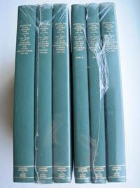
1995018762Storrs-Mansfield CT / Parsippany New Jersey: Martino Fine Books / About Books 1995. 6 separate volumes complete 5 volumes bound in 6 books WITH LARGE FOLD-OUT MAPS -- just like the first edition. SEE PHOTOS. Each of the 6 books in this 1995 large format edition measures 9.25" wide by 12.25" tall. This is NOT the later smaller format 3-volume reprint in which the maps are reduced in size. Unlike later reduced-size editions the maps in this 1995 six-volume edition measure as large as 21" by 33" when unfolded. SEE PHOTOS. As original co-publisher we are pleased to offer the few remaining sets of the 1995 large-format 6-volume edition recently rediscovered in our warehouse. They are BRAND NEW in perfect condition. STILL SEALED in the publisher's clear plastic SHRINKWRAP and the PUBLISHER'S CARDBOARD SHIPPING BOX. NO rubbing. NO fading. Bright clean square and tight. NO owner's name or bookplate. NOT a remainder. Fresh and crisp -- obviously never read. No date but 1995 First Martino/About Books printing "strictly limited to 350". Reprint of the original 1957-1963 six separate volumes: xiv 264; xiii 281; xiii 349; xiii 260; xix 222; iv 223-487pp. MAPPING THE TRANSMISSISSIPPI WEST is a monumental and exceptionally thorough work that is unlikely to be surpassed. The set is illustrated with a total of 376 maps including several that fold out. In this standard carto-bibliography are full descriptions of some 1300 maps from the year 1540 to about 1880. Wheat discusses each map showing the origins of its date and weighing its significance and accuracy. He also identifies the atlases and books in which the maps can be found. Norman Thrower: "Scholars and others who are interested in the American west have found Wheat's work indispensable." Ristow 382: "A comprehensive cartobibliography with many fine reproductions." The 6 volumes are uniformly bound in the original gilt-stamped green cloth. SEE PHOTOS. Oversize Hardcover. All 6 volumes measure 9.25" wide by 12.25" tall. This heavy set will require extra postage for Priority and International shipments. But for media mail you pay only our standard charge for 1 volume and we ship the other 5 volumes at no extra cost. First Martino/About Books printing. Oversize Hardcover. New/in publisher's shrinkwrap. Illus. by We ship all 6 volumes for cost of 1. 6 volumes: 9.25" wide by 12.25" tall. Great Packaging Fast Shipping. Martino Fine Books / About Books Hardcover
1995018771Storrs-Mansfield CT / Parsippany New Jersey: Martino Fine Books / About Books 1995. Vol. 5 Part I only of 6 separate books. As original co-publisher we are pleased to offer the few remaining individual volumes from our 1995 large-format 6-volume edition that were recently rediscovered in our warehouse. Oversize Hardcover. 9.25" wide by 12.25" tall. This volume is NOT from the later smaller format 3-volume reprint in which the maps are reduced in size. Offered here is Vol. 5 Part I only Vol. 5 was issued in 2 separate books. It is BRAND NEW in perfect condition. NO rubbing. NO fading. Bright clean square and tight. NO owner's name or bookplate. NOT a remainder. Fresh and crisp -- obviously never read. No date but 1995 First Martino/About Books printing "strictly limited to 350". Vol. 5 Part I only. Reprint of the 1963 Institute of Historical Cartography original. MAPPING THE TRANSMISSISSIPPI WEST is a monumental and exceptionally thorough work that is unlikely to be surpassed. In this standard carto-bibliography are full descriptions for hundreds of important maps 1861-1867. Many are illustrated on full page plates 9.25" wide by 12.25" tall. Wheat discusses each map showing the origins of its date and weighing its significance and accuracy. He also identifies the atlases and books in which the maps can be found. Norman Thrower: "Scholars and others who are interested in the American west have found Wheat's work indispensable." Ristow 382: "A comprehensive cartobibliography with many fine reproductions." Bound in the original gilt-stamped green cloth. This large heavy book will require extra postage for Priority and International shipments but only the standard charge for media mail. First Martino/About Books printing. Oversize Hardcover. New/No jacket as issued. xix 222pp. Great Packaging Fast Shipping. Martino Fine Books / About Books Hardcover
1995018772Storrs-Mansfield CT / Parsippany New Jersey: Martino Fine Books / About Books 1995. Vol. 5 Part 2 only of 6 separate books. As original co-publisher we are pleased to offer the few remaining individual volumes from our 1995 large-format 6-volume edition that were recently rediscovered in our warehouse. Oversize Hardcover. 9.25" wide by 12.25" tall. This volume is NOT from the later smaller format 3-volume reprint in which the maps are reduced in size. Offered here is Vol. 5 Part 2 only Vol. 5 was issued in 2 separate books. It is BRAND NEW in perfect condition. NO rubbing. NO fading. Bright clean square and tight. NO owner's name or bookplate. NOT a remainder. Fresh and crisp -- obviously never read. No date but 1995 First Martino/About Books printing "strictly limited to 350". Vol. 5 Part 2 only. Reprint of the 1963 Institute of Historical Cartography original. MAPPING THE TRANSMISSISSIPPI WEST is a monumental and exceptionally thorough work that is unlikely to be surpassed. In this standard carto-bibliography are full descriptions for hundreds of important maps from 1868 to the 1870s. Many are illustrated on full page plates 9.25" wide by 12.25" tall. Wheat discusses each map showing the origins of its date and weighing its significance and accuracy. He also identifies the atlases and books in which the maps can be found. As this is the final volume it contains a comprehensive index for all 6 books in the set. Norman Thrower: "Scholars and others who are interested in the American west have found Wheat's work indispensable." Ristow 382: "A comprehensive cartobibliography with many fine reproductions." Bound in the original gilt-stamped green cloth. This large heavy book will require extra postage for Priority and International shipments but only the standard charge for media mail. . First Martino/About Books printing. Oversize Hardcover. New/No jacket as issued. iv pp. 223-487. Great Packaging Fast Shipping. Martino Fine Books / About Books Hardcover
1995018317Storrs-Mansfield Connecticut: Maurizio Martino Publisher 1995. 1995 Enlarged edition. BRAND NEW in perfect condition. NO rubbing. NO fading. Bright clean square and tight. Sharp corners. NO owner's name or bookplate. NOT a remainder. Fresh and crisp -- obviously never read. No date but 1995 First Martino printing "strictly limited to 350". This 1995 edition has all the content of the 1942 original plus is updated and enlarged. There is a new introduction by Gary Kurutz that places Wheat's work in historical context and offers information on the book's production and initial reception. Also new are descriptions by Warren Heckrotte of 27 Gold Rush maps or variants that Wheat missed. Another plus is the frontispiece Map of the Southern Mines 1852 which did not appear in the 1942 trade edition but only in 22 deluxe presentation copies. Including the frontispiece there are a total of 27 full-page and double-page map facsimiles. This is an attractively produced book handsomely bound in the original tan cloth stamped in bright red and black over a cream color spine label. Oversize Hardcover. 9.25" wide by 12.25" tall. This large heavy book will require SUBSTANTIAL extra postage for international shipments but only the standard charge for priority or media mail. Updated and Expanded Edition. Oversize Hardcover. New/No jacket as issued. xlii 153pp. plates 262 total pages. Great Packaging Fast Shipping. Maurizio Martino Publisher Hardcover
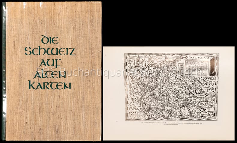
19694008CB2. Auflage. Zürich, NZZ, 1969. 4°. 247 S. Mit zahlr. (dv. viele gef.) Karten u. Textillustr. nach alten Vorlagen. Orig.-Halblederband.
19694008CBZürich, NZZ, 1969. 4°. 247 S. Mit zahlr. (dv. viele gef.) Karten u. Textillustr. nach alten Vorlagen. Orig.-Halblederband. + Wichtig: Für unsere Kunden in der EU erfolgt der Versand alle 14 Tage verzollt ab Deutschland / Postbank-Konto in Deutschland vorhanden +, A 2. Auflage.
19241802AGWinterthur, 1924. Farbige Karte auf Leinen aufgezogen. 59 x 87 cm. + Wichtig: Für unsere Kunden in der EU erfolgt der Versand alle 14 Tage verzollt ab Deutschland / Postbank-Konto in Deutschland vorhanden +, A|B [2 Warenabbildungen]
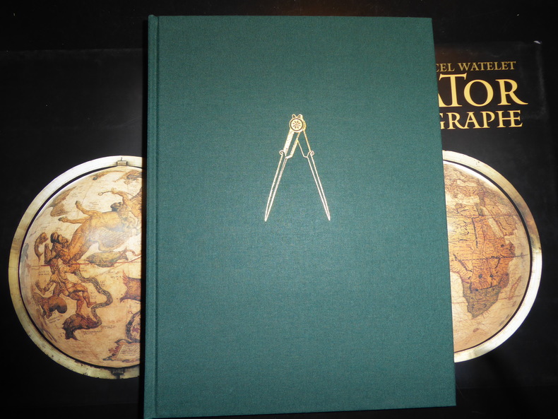
199457473Anvers, Fond Mercator, Paribas 1994 Grand in-4 25 x 34 cm. Reliure de l’éditeur pleine toile verte sous jaquette rempliée illustrée en couleurs et étui, 445 pp. Très nombreuses illustrations en noir et en couleurs dans le texte et à pleine page. Exemplaire en excellent état. Très bel ouvrage publié à l’occasion du 400e anniversaire de la mort de Gérard Mercator 1512-1594 humaniste, mathématicien, géographe des Pays-Bas espagnols, inventeur de la projection qui porte son nom.
199480197[Anvers], Fonds Mercator et la Banque BNP Paribas Belgique, 1994. Grand in-4, 445[dont faux-titre et titre]-(1) pp. – (1) f.[Colophon/registre- ancien- de caractères], bradel toile verte, titre doré au dos, compas doré sur le plat supérieur, jaquette rempliée et étui illustrés en couleurs (reliure de l’Éditeur ; infimes défauts sur l’étui, sinon exemplaire quasi-parfait).
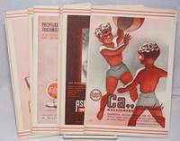
1940250450no city Spain: Wassermann 1940. Nineteen quarto leaves of alkaline paperstock each folded vertically in half to make nineteen separate advertising brochures of 8.5x5.5 inches all four faces of each brochure printed in colors with a come-on cover; pages within pp.2 & 3 print a detailed doublespread color map back cover mostly text with spot-color touches. Partial set 19 of an original total of 42. Each map features a different region or province in Spain including the Islands and North Africa while exterior covers boast a different medicine medications for the blood or bone for young and old: Take Aspasmol a sedative for spaamodic attacks &c &c. Please note that nos.13 and 37 use the same cover image but deal different meds and differing parts of Spain. All in nice condition clean and sound. Wassermann unknown books
196831223ABGattikon, Verlag Dorfpresse, 1968. Folio. 2 Bl. Mit 20 kol. faks. Karten. Lose in Pappmappe. + Wichtig: Für unsere Kunden in der EU erfolgt der Versand alle 14 Tage verzollt ab Deutschland / Postbank-Konto in Deutschland vorhanden +, A|B [2 Warenabbildungen]
1999018413Mansfield Centre Connecticut: Martino Publishing 1999. 2 volumes bound as 1 complete. BRAND NEW HARDCOVER in perfect condition. STILL SEALED in the publisher's clear plastic SHRINKWRAP. NO rubbing. NO fading. Bright clean square and tight. Sharp corners. NOT a library discard. NO owner's name or bookplate. NOT a remainder. Fresh and crisp -- obviously never read. No date but 1999 First Martino printing "Limited Edition Facsimile". Reprint of the 1937 two volume set. 2 vols. in 1: xii pp. 1-270; iv pp. 271-543 13 maps not included in the pagination. Well illustrated with 41 map reproductions including 13 that fold-out. Bound in the original pale yellow cloth stamped in bright gold over a handsome dark green spine panel. "Although emphasis is on the Northwest Coast of America this is a useful reference work for the student of the cartographic history of America. It contains an extensive index bibliography and list of place names as well as a list of maps. An exhaustive and scholarly publication which includes a note on practically every important map. 1507-1794." -- Ristow GUIDE TO THE HISTORY OF CARTOGRAPHY #377. Howes USIANA W7. Oversize Hardcover. 8.75" wide by 11" tall. This large heavy book will require extra postage for international shipments but only the standard charge for priority or media mail. First Martino printing. Oversize Hardcover. New/in publisher's shrinkwrap. 2 vols. in 1: xii pp. 1-270; iv pp. 271-543. Great Packaging Fast Shipping. Martino Publishing Hardcover
1939153988Freiburg, Herder, (1939). M. Portr., Ktn. u. Abb. 15 S. OBr. Umschl. angeschmutzt.
196451655BB[Amsterdam], [N. Israel], 1964. Folio. 41 cm. Nicht durchgehend paginiert. [4] Blatt, 36 Seiten. XXX gefaltete Karten mit Beschreibung, [4] Blatt. Original-Leinenband mit Original-Pappschuber.