93 résultats
1970Map 787London: Director General of the Ordnance Survey 1970. revised edition . No Binding. Fine. Double unfolded sheet. 25 inches to the mile. 89 x 58.5cms. College stamp to lower margin not affecting the plate. LEITH with the docks to the top of the large double sheet. PLEASE EMAIL FOR PHOTO. <br/> <br/> Director General of the Ordnance Survey unknown
1969Map 790London: Director General of the Ordnance Survey 1969. revised edition . No Binding. Fine. Double unfolded sheet. 25 inches to the mile. 89 x 58.5cms. College stamp to lower margin not affecting the plate. HOLYROOD PARK/ST LEONARDS on a large double sheet. PLEASE EMAIL FOR PHOTO. <br/> <br/> Director General of the Ordnance Survey unknown
1964Map 792London: Director General of the Ordnance Survey 1964. revised edition . No Binding. Fine. Double unfolded sheet. 25 inches to the mile. 89 x 58.5cms. College stamp to lower margin not affecting the plate. TRINITY Edinburgh on a large double sheet. PLEASE EMAIL FOR PHOTO. <br/> <br/> Director General of the Ordnance Survey unknown
1968Map 791London: Director General of the Ordnance Survey 1968. revised edition . No Binding. Fine. Double unfolded sheet. 25 inches to the mile. 89 x 58.5cms. College stamp to lower margin not affecting the plate. NEWINGTON Edinburgh on a large double sheet. PLEASE EMAIL FOR PHOTO. <br/> <br/> Director General of the Ordnance Survey unknown
1969Map789London: Director General of the Ordnance Survey 1969. revised edition . No Binding. Fine. Double unfolded sheet. 25 inches to the mile. 89 x 58.5cms. College stamp to lower margin not affecting the plate. Quarryhills Edinburgh on a large double sheet. Leith links to the east and Pilrig ot the west. PLEASE EMAIL FOR PHOTO. <br/> <br/> Director General of the Ordnance Survey unknown
1970Map788London: Director General of the Ordnance Survey 1970. revised edition . No Binding. Fine. Double unfolded sheet. 25 inches to the mile. 89 x 58.5cms. College stamp to lower margin not affecting the plate. PORTOBELLO PROMONADE AND Shore on a large double sheet. PLEASE EMAIL FOR PHOTO. <br/> <br/> Director General of the Ordnance Survey unknown
1991022980Chapel Hill: University of North Carolina Press 1991. BRAND NEW in a BRAND NEW dust jacket. Perfect condition. Still sealed in the publisher's clear plastic shrink wrap. NO chips. NO tears. NO creases. NO rubbing. NO fading. Sharp corners. Bright and shiny. Fresh crisp clean and unmarked. 1991. First Printing of the First Edition with complete number row 54321 on the copyright page. Illustrated with more than 100 maps bird's-eye views engravings etchings collotypes aquatints mezzotints steel engravings wood engravings and lithographs. Most are in full color. Includes notes on the artists printers publishers and history of the city. Views are accompanied by 97 excerpts from contemporary published works of visitors and residents e. g. Charles Dickens Frederick Marryat Harriet Martineau Benjamin Perley Poore Anthony Trollope Francis Trollope Mark Twain Walt Whitman. Bound in the original light gray cloth stamped in bright gold over a black panel on the spine. Complete with pristine dust jacket. Oversize Hardcover. Oblong. 15" wide by 11.5" tall. This VERY large VERY heavy book will require SUBSTANTIAL extra postage for Priority and International shipments but only the standard charge for media mail. . First Printing of the First Edition. Oversize Hardcover. New/New in publisher's shrinkwrap. xiv 297pp. Great Packaging Fast Shipping. University of North Carolina Press Hardcover
1967Map 798London: Director General of the Ordnance Survey 1967. revised edition . No Binding. Fine. Double unfolded sheet. 25 inches to the mile. 89 x 58.5cms. N.W. Ross-On-Wye and Wilton with the A449 crossing the area with surrounding countryside on a large double sheet. Centre fold crease. PLEASE EMAIL FOR PHOTO. <br/> <br/> Director General of the Ordnance Survey unknown
1969Map 797London: Director General of the Ordnance Survey 1969. revised edition . No Binding. Fine. Double unfolded sheet. 25 inches to the mile. 89 x 58.5cms. Ross-On-Wye and surrounding countryside to the west on a large double sheet. Centre fold crease. PLEASE EMAIL FOR PHOTO. <br/> <br/> Director General of the Ordnance Survey unknown
1991018014London: Studio Editions 1991. Fine condition in a Near Fine dust jacket. NO chips. NO tears. Bright clean square and tight. Sharp corners. NO owner's name or bookplate. Not a remainder. Pages are crisp and unmarked. 1991 First Studio edition. For this production the most decorative plates were selected from Braun & Hogenberg's CIVITATES ORBIS TERRARUM which was first published in 6 volumes between 1572 and 1617. Sixty gorgeous full-color maps are reproduced each spread across two folio pages. Full annotations provide facts about the maps their makers and history of the various cities. Bound in the original gilt-stamped green boards. Complete with dust jacket. Oversize Hardcover. 11.25" wide by 15.25" tall 285mm x 380mm. This large heavy book will require extra postage for Priority and International shipments but only the standard charge for media mail. First Edition Thus. Oversize Hardcover. Fine condition/Near Fine dust jacket. 128pp. Great Packaging Fast Shipping. Studio Editions Hardcover
1974019878Washington D. C.: Library of Congress / U. S. Government Printing Office 1974. Very Good EX-LIBRARY. Hinges are perfect. Pages are clean and crisp. NO underlining. NO highlighting. NO margin notes. 1974. First Edition. Volume 8 comprising the Index to Volume 7 titles 10255-18435. From the preface: "Indexed in this volume are areas subjects map authors engravers lithographers publishers etc. and atlas titles with distinctive words." Subtitle: "A Continuation of Four Volumes by Philip Lee Phillips." Bound in the original blue cloth gilt-stamped over a red spine panel. This First Edition measures 7" wide by 10" tall which is a larger format than the 1996 Martino reprint. BIBLIOGRAPHICAL NOTE: Volume 8's ISBN listed here was mistakenly duplicated for Volume 9 The Comprehensive Author List when it was published in 1992. First Edition. Hardcover. Very Good EX-LIBRARY/No jacket as issued. v 190pp. Great Packaging Fast Shipping. Library of Congress / U. S. Government Printing Office Hardcover
1991018856Spokane Washington: The Arthur H. Clark Company 1991. Brand New HARDCOVER in a Brand New dust jacket. Perfect condition. NO chips. NO tears. NO creases. NO rubbing. NO fading. Bright shiny clean square and tight. Sharp corners. NOT a library discard. NO owner's name or bookplate. NO remainder mark. Fresh and crisp - obviously never read. 1991. First Edition. A fascinating look at a geographic misconception that persisted for two centuries. Extensively illustrated with 57 historic maps. Has a 23 page bibliography of sources for additional reading. List of chapter notes. Index. Bound in the original gilt-stamped maroon cloth. From the dust jacket: "The Island of California -- this misconception flourished on and off for almost two centuries following the Spanish discovery early in the 16th century. This book traces the origin of this strange notion -- how it evolved how it kept recurring and how it was finally put to rest." Volume XIII in the Spain in the West series. First Edition. Hardcover. New/New. 8vo. 398pp. Great Packaging Fast Shipping. The Arthur H. Clark Company Hardcover
1951020965New York: The Bibliographical Society of America 1951. Very Good condition. The spine is square and flat with NO creases. NO owner's name or bookplate. NOT a library discard. Pages are clean and unmarked. NO foxing. THE PAPERS OF THE BIBLIOGRAPHICAL SOCIETY OF AMERICA Volume Forty-Five Vol. 45 XLV Third 3rd Quarter 1951. 1300 copies printed. Contains: THE RUYSCH MAP OF THE WORLD 1507-1508 by Bradford F. Swan; EARLY WEST VIRGINIA IMPRINTS by Boyd B. Stutler; a contribution by Lawrence C. Wroth; etc. Composed and printed by the Anthoensen Press Portland Maine. Bound in the original wraps. 6.25" wide by 9.5" tall. First Edition. Softcover. Very Good condition. iv pp. 191-272. Great Packaging Fast Shipping. The Bibliographical Society of America Paperback
1970TS343Amsterdam: N. Israel 1970. reprint . paper wrappers. Fine. large 4to. 125pp. Pale blue heavy paper cover. Trifle toned to the spine but a fine copy with no annotations or marks. From the fine reprint series 1960-. Imago Mundi is the only English language periodical dedicated to fine and rare maps and the history of cartography. MORE COPIES ARE AVAILABLE FROM THIS SERIES. Please email. <br/> <br/> N. Israel unknown
1990Map891London: Imago Mundi King's College 1990. Original issue . Hardback. Fine/No d.j. 4to. 180pp.Pub. blue cloth gilt. A fine copy in the original blue cloth. Trifle shelf rubbed. No inscriptions or stamps. Medieval manuscript maps; The map of Bahamas; Maps in 16th century bibles; Land Company mapping in North America in the 'new republic'. etc etc. Imago Mundi is a scholarly journal on the history of maps and was first pub. in 1935. <br/> <br/> Imago Mundi King's College hardcover
1990S266London: Times Books 1990. 1st ediiton . Hardback. Fine/V G rubbed. Folio. 168pp. 50 plates each with a text description. D.j. a little torn to the edges on the rear cover. Pictorial wrapper. A nice copy. 37.5 x 29 cms <br/> <br/> Times Books hardcover
1995S245New York: Abbeville Press Inc. 1995. 1st Edition . Hardback. Fine/Fine. Folio. 164pp. . Maps in colour & b/w. 4 fold-out map illustrations. A fine clean copy. Uncommon in the UK. <br/> <br/> Abbeville Press Inc. hardcover
1939P278London: Alexander Duckham 1939. facsimile reprint . Hardback. Vg./No Jacket. Oblong 4to. 108 pp including 100 pp of facsimile road maps plus a general map of England and Wales Facsimile edition of the 1675 edition. Red cloth labels. Internally clean and tight. Trifle foxing to the fore-edge. A nice copy. or an Illustration of the Kingdom of England and Dominion of Wales. a. Description of the Principal Roads <br/> <br/> Alexander Duckham hardcover
1964Map 793London: Director General of the Ordnance Survey 1964. revised edition . No Binding. Fine. Double unfolded sheet. 25 inches to the mile. 89 x 58.5cms. College stamp to lower margin not affecting the plate. ROYAL BOTANIC GARDENS/ BROUGHTON Edinburgh on a large double sheet. PLEASE EMAIL FOR PHOTO. <br/> <br/> Director General of the Ordnance Survey unknown
1974012035New York: Macmillan 1974. 8.75" wide by 11" tall. Previous owner's blindstamp. Otherwise a bright clean square tight unmarked copy. Not a book club edition. Not price clipped 15.00. No remainder mark. Illustrated with photos drawings and 65 maps. From the Dust Jacket: "Here is the most extensive historical atlas of religion ever published." Essays photos and maps illuminate the origins and distribution of religions; their movement; locations of sacred cities sites and temples; growth; the relation of one religion with another; places associated with leading rabbis theologians and writers; Jewish emigration; Muslim rule; religious use of narcotics; Chinese religions; 18th century Christianity; Islamic schools of law sects and reform movements; spread of Orthodox law schools; etc. Appendix 38 pages long gives detailed chronologies of the religions of the past. Subject Index. Name Index. First Printing of the First Edition. Oversize Hardcover. Near Fine condition/VG DJ tiny closed tears. xviii 346pp . Macmillan Hardcover
198713336Norman OK USA: University of Oklahoma Press 1987. First Edition Second Printing. Paperback. Very Good/No Dust Jacket. Large paperback no marks many maps and illustrations with 224 pages. <br/><br/> University of Oklahoma Press paperback
1997018405Mansfield Centre Connecticut: Martino Fine Books 1997. Brand New in perfect condition just removed from the publisher's shrinkwrap so we could write this description. NO rubbing. NO fading. Bright clean square and tight. Sharp corners. NO owner's name or bookplate. NO remainder mark. Fresh and crisp -- obviously never read. Limited to 100 copies. n. d. but 1997. Reprint of the expanded 1964 edition. The best edition of the best cartography of Texas maps. Describes and comments on some 1000 Texas maps from 1527 to 1900. Entries identify full title publisher map maker date content scale color dimensions etc. Illustrated. Bound in the original gilt-stamped bluish-green cloth. Moeb's U. S. REFERENCE-IANA 748: "A basic reference in the field. This 1964 issue contains 88 maps not in the prior printing." See Ristow 325. From the publisher: "This important work is the most extensive cartography devoted exclusively to Texas maps. It comprises the map collection of the Texas State Archives. In all approximately 1000 maps are meticulously described. There are excellent annotations describing coloring rivers mountains towns forts Indian tribes trails trading posts and a host of other subjects depicted in the maps. There is also interesting background information about the history of the territory or the map described. And of course dimensions and scales are given.". Reprint of the expanded 1964 edition. Hardcover. New/No jacket as issued. iv 178pp. Great Packaging Fast Shipping. Martino Fine Books Hardcover
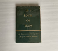
1952018855Madison: The University of Wisconsin Press 1952. SCARCE FIRST EDITION. Very Good condition in a Very Good dust jacket. SEE OUR PHOTOS. The jacket has small chips at the spine ends and corners. NOT price clipped $2.75. Protected by a removable Brodart clear-plastic sleeve. NOT a library discard. NO owner's name or bookplate. NO underlining. NO highlighting. NO margin notes. A few tiny brown speckles light foxing on the endpapers and one plate only. 1952. First Edition. A study of maps as art the importance of lettering calligraphy and type styles principles of design use of color hue intensity contrast projection etc. Figures. Tables. Bibliographical references. Bound in the original gilt-stamped green cloth. Complete with dust jacket. First Edition. Hardcover. Very Good condition/Very Good dust jacket. Illus. by NOT a library discard. 8vo. xi 105pp. Great Packaging Fast Shipping. The University of Wisconsin Press Hardcover
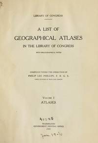
1997017766Mansfield Centre Connecticut: Martino Fine Books 1997. Brand New in perfect condition. 2 vols in 1. STILL SEALED in the publisher's clear plastic SHRINKWRAP. NO rubbing. NO fading. Bright clean square and tight. Sharp corners. NO owner's name or bookplate. NOT a remainder. Fresh and crisp -- obviously never read. n. d. but 1997. HARDCOVER reprint limited to 150 copies of the 1950 and 1953 Library of Congress originals. 2 volumes bound as 1 with a total of 767 pages. Because this edition is bound in sturdy cloth it is much better suited to heavy use than the paper bindings of the original editions. A welcome reprint of an important and scarce reference. Described here are 6696 atlases. Entries are first arranged geographically and by subject national; state; and within the various states by county/parish city and region; special subject atlases include agriculture aviation canals climate coal geology history languages railroads etc. Then the atlases are re-listed by author/publisher in the index. A typical entry includes the atlas title; cartographer; publisher; city and date of first publication; dimensions in centimeters; number of pages plates and maps; the number that are colored etc. Occasional notes on contents. In the second part copies of the atlases held by some 180 libraries are located. Hodgkiss/Tatham KEYGUIDE TO INFORMATION SOURCES IN CARTOGRAPHY: "An indispensable reference for students of American history or of the development of American cartography." Bound in the original gilt-stamped blue cloth. Besterman 6267. Sheehy CL288. KEYGUIDE 94. 1997 reprint of 1950/53 originals. Hardcover. New/in publisher's shrinkwrap. 2 vols in 1: viii445pp. xiii301pp. 767 total. Great Packaging Fast Shipping. Martino Fine Books Hardcover
1997017659Mansfield Centre Connecticut: Martino Fine Books 1997. Brand New in perfect condition. STILL SEALED in the publisher's clear plastic SHRINKWRAP. NO rubbing. NO fading. Bright clean square and tight. Sharp corners. NO owner's name or bookplate. NO remainder mark. Fresh and crisp -- obviously never read. Limited to 100 copies. n. d. but 1997. Reprint of the expanded 1964 edition. The best edition of the best cartography of Texas maps. Describes and comments on some 1000 Texas maps from 1527 to 1900. Entries identify full title publisher map maker date content scale color dimensions etc. Illustrated. Bound in the original gilt-stamped bluish-green cloth. Moeb's U. S. REFERENCE-IANA 748: "A basic reference in the field. This 1964 issue contains 88 maps not in the prior printing." See Ristow 325. From the publisher: "This important work is the most extensive cartography devoted exclusively to Texas maps. It comprises the map collection of the Texas State Archives. In all approximately 1000 maps are meticulously described. There are excellent annotations describing coloring rivers mountains towns forts Indian tribes trails trading posts and a host of other subjects depicted in the maps. There is also interesting background information about the history of the territory or the map described. And of course dimensions and scales are given.". Reprint of the expanded 1964 edition. Hardcover. New/in publisher's shrinkwrap. iv 178pp. Great Packaging Fast Shipping. Martino Fine Books Hardcover