BAEDEKER, Karl [Cartography - Germany]Biblio.com
333 résultats
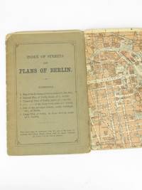
18935233Leipsic: Karl Baedeker 1893. Stiff Printed Wraps. Good. Wagner & Debes. 16mo. Pp. 11 street index 6 fold-out color maps. Saddle stapled green-gray printed wrap. Wrap fold split effaced pencil notes edges rubbed and soiled. Map corners creased. Pocket-size visitor's street guide in English with superb cartography by the firm of Eduard Wagner & Ernst Debes from the publisher's golden age under Fritz Baedeker. Preserved in a clear archival sleeve. Karl Baedeker unknown
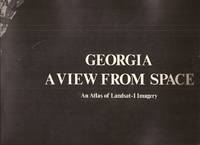
20587<p>Atlanta: Georgia Dept. of Natural Resources. 1976. 33pp. illus. paperback oblong folio: Very Good. An unusual study in black and white photos and maps.</p> Atlanta: Georgia Dept. of Natural Resources paperback
1807Map960Paternoster Row London: Longman Hurst Rees & Orme 1807. 1st Edition 1st Printing. No Binding. Fine. Original early 19th century MAP of ALPINE COUNTRY from The North Sea to the border of AUSTRIA On MERCATORS PROJECTION BY AARON ARROWSMITH. A FINE AND DARK IMPRESSION. Original folding plate printed on heavy paper dated 1804. A scarce example and in fine un-coloured original condition. SOME FOXING. 41x27cms. Double-page folding map. <br/> <br/> Longman, Hurst, Rees & Orme unknown
1807Map959Paternoster Row London: Longman Hurst Rees & Orme 1807. 1st Edition 1st Printing. No Binding. Good. Original early 19th century MAP of ALPINE COUNTRY from The North Sea to the border of Switzerland On MERCATORS PROJECTION BY AARON ARROWSMITH. A FINE AND DARK IMPRESSION. Original folding plate printed on heavy paper dated 1804. A scarce example and in fine un-coloured original condition. SOME FOXING. 41x27cms. Double-page folding map. <br/> <br/> Longman, Hurst, Rees & Orme unknown
1848Map 474London: George Virtue 1848. No Binding. Vg. 10.75"x 8.25" Later hand-colour. Original steel engraving <br/> <br/> George Virtue unknown
1970Map 787London: Director General of the Ordnance Survey 1970. revised edition . No Binding. Fine. Double unfolded sheet. 25 inches to the mile. 89 x 58.5cms. College stamp to lower margin not affecting the plate. LEITH with the docks to the top of the large double sheet. PLEASE EMAIL FOR PHOTO. <br/> <br/> Director General of the Ordnance Survey unknown
1969Map 790London: Director General of the Ordnance Survey 1969. revised edition . No Binding. Fine. Double unfolded sheet. 25 inches to the mile. 89 x 58.5cms. College stamp to lower margin not affecting the plate. HOLYROOD PARK/ST LEONARDS on a large double sheet. PLEASE EMAIL FOR PHOTO. <br/> <br/> Director General of the Ordnance Survey unknown
1964Map 792London: Director General of the Ordnance Survey 1964. revised edition . No Binding. Fine. Double unfolded sheet. 25 inches to the mile. 89 x 58.5cms. College stamp to lower margin not affecting the plate. TRINITY Edinburgh on a large double sheet. PLEASE EMAIL FOR PHOTO. <br/> <br/> Director General of the Ordnance Survey unknown
1968Map 791London: Director General of the Ordnance Survey 1968. revised edition . No Binding. Fine. Double unfolded sheet. 25 inches to the mile. 89 x 58.5cms. College stamp to lower margin not affecting the plate. NEWINGTON Edinburgh on a large double sheet. PLEASE EMAIL FOR PHOTO. <br/> <br/> Director General of the Ordnance Survey unknown
1969Map789London: Director General of the Ordnance Survey 1969. revised edition . No Binding. Fine. Double unfolded sheet. 25 inches to the mile. 89 x 58.5cms. College stamp to lower margin not affecting the plate. Quarryhills Edinburgh on a large double sheet. Leith links to the east and Pilrig ot the west. PLEASE EMAIL FOR PHOTO. <br/> <br/> Director General of the Ordnance Survey unknown
1970Map788London: Director General of the Ordnance Survey 1970. revised edition . No Binding. Fine. Double unfolded sheet. 25 inches to the mile. 89 x 58.5cms. College stamp to lower margin not affecting the plate. PORTOBELLO PROMONADE AND Shore on a large double sheet. PLEASE EMAIL FOR PHOTO. <br/> <br/> Director General of the Ordnance Survey unknown
1769Map1003London: Russell and Price 1769. Original Map . No Binding. Fine. 4to. Single page map of the County of SUFFOLK John Roque.Published in ENGLAND DISLAYED Being a New Complete and Accurate Survey and Description of the Kingdom of England and Principality of Wales. Plate 16 x20cm on sheet 160 x 243mm. Fine original map printed on laid paper. Uncoloured. 2ND EDITION DATED 1769. OTHER COUNTIES ARE AVAILABLE FROM THIS ISSUE. <br/> <br/> Russell and Price unknown
1991022980Chapel Hill: University of North Carolina Press 1991. BRAND NEW in a BRAND NEW dust jacket. Perfect condition. Still sealed in the publisher's clear plastic shrink wrap. NO chips. NO tears. NO creases. NO rubbing. NO fading. Sharp corners. Bright and shiny. Fresh crisp clean and unmarked. 1991. First Printing of the First Edition with complete number row 54321 on the copyright page. Illustrated with more than 100 maps bird's-eye views engravings etchings collotypes aquatints mezzotints steel engravings wood engravings and lithographs. Most are in full color. Includes notes on the artists printers publishers and history of the city. Views are accompanied by 97 excerpts from contemporary published works of visitors and residents e. g. Charles Dickens Frederick Marryat Harriet Martineau Benjamin Perley Poore Anthony Trollope Francis Trollope Mark Twain Walt Whitman. Bound in the original light gray cloth stamped in bright gold over a black panel on the spine. Complete with pristine dust jacket. Oversize Hardcover. Oblong. 15" wide by 11.5" tall. This VERY large VERY heavy book will require SUBSTANTIAL extra postage for Priority and International shipments but only the standard charge for media mail. . First Printing of the First Edition. Oversize Hardcover. New/New in publisher's shrinkwrap. xiv 297pp. Great Packaging Fast Shipping. University of North Carolina Press Hardcover
8424141210.Gpaperback. Good. Access codes and supplements are not guaranteed with used items. May be an ex-library book. paperback
1807Map951Paternoster Row London: Longman Hurst Rees & Orme 1807. 1st Edition 1st Printing. No Binding. Fine. Folio - over 12 - 15" tall. Original early 19th century uncoloured MAP OF THE SEVEN UNITED PROVINCES BY AARON ARROWSMITH. A DARK IMPRESSION. BUT DAMP EVIDENCE TO THE PAPER. Original folding plate covering SPAIN AND PORTUGAL printed on heavy paper dated 1807. A scarce example and in fine un-coloured original condition. An occasional light foxing mark. 41x27cms. Double-page folding map. engraved by COOPER.A LOVELY COPY. paper watermark dated 1808 <br/> <br/> Longman, Hurst, Rees & Orme unknown
1842Map 818Edinburgh: A&C Black 1842. No Binding. Fine/uncoloured. Beautiful steel engravings from Encyclopaedia Britanica Seventh edition dated 1842. Plates CCCXVIII and CCXIX 1-2 . Fine examples with no wear. Trifle foxing. 270x380mm. Engraved by Sidney Hall Bloomsbury. Published by A. & C. Black. <br/> <br/> A&C Black unknown
1842Map 816Edinburgh: A&C Black 1842. No Binding. Fine/uncoloured. Beautiful steel engravings from Encyclopaedia Britanica Seventh edition dated 1842. Plates CCCXVIII and CCLXIV-V .Fine examples with no wear. 270x380mm. Engraved by Sidney Hall Bloomsbury. Published by A. & C. Black. <br/> <br/> A&C Black unknown
1842Map 809Edinburgh: A&C Black 1842. No Binding. Fine/uncoloured. Beautiful steel engravings from Encyclopaedia Britanica Seventh edition dated 1842. Plates CCLXXVIII -1 and 2 .Fine example with no wear. 410x260mm. Engraved by Sidney Hall Bloomsbury. Published by A. & C. Black. <br/> <br/> A&C Black unknown
1842mAP 813Edinburgh: A&C Black 1842. No Binding. Fine/uncoloured. Beautiful steel engravings from Encyclopaedia Britanica Seventh edition dated 1842. Plates CCCXVIII and CCCXIX .Fine example with no wear. 270x380mm. Engraved by Sidney Hall Bloomsbury. Published by A. & C. Black. <br/> <br/> A&C Black unknown
1848Map 303London: George Virtue 1848. No Binding. Vg. 10.75"x 8.25" Later hand-colour. Original steel engraving <br/> <br/> George Virtue unknown
1967Map 798London: Director General of the Ordnance Survey 1967. revised edition . No Binding. Fine. Double unfolded sheet. 25 inches to the mile. 89 x 58.5cms. N.W. Ross-On-Wye and Wilton with the A449 crossing the area with surrounding countryside on a large double sheet. Centre fold crease. PLEASE EMAIL FOR PHOTO. <br/> <br/> Director General of the Ordnance Survey unknown
1969Map 797London: Director General of the Ordnance Survey 1969. revised edition . No Binding. Fine. Double unfolded sheet. 25 inches to the mile. 89 x 58.5cms. Ross-On-Wye and surrounding countryside to the west on a large double sheet. Centre fold crease. PLEASE EMAIL FOR PHOTO. <br/> <br/> Director General of the Ordnance Survey unknown
1869Map 725Ordnance Survey Office 1869. 1st Edition . Hardback. Vg. Folding map. Folding dissected map in 18 sections the rare first series edition laid on linen and cased in the original green cloth boards 6.75 x 4.5 inches with a hand-written paper label. Surveyed 1860-1871 and published in1869. Small grid of adjoining maps for the one inch and six inch series pasted to inside cover. 25x19 inches with hand-coloured roads. A nice copy a couple of small red ink marks otherwise clean with no wear or loss. There were 132 sheets for the complete Scottish ordnance maps and a second edition appeared in in 1898-1904 with coloured parishes. The one inch maps were based on larger scale surveys of 1843-1878 and published between 1856 and 1895. <br/> <br/> Ordnance Survey Office hardcover
1991018014London: Studio Editions 1991. Fine condition in a Near Fine dust jacket. NO chips. NO tears. Bright clean square and tight. Sharp corners. NO owner's name or bookplate. Not a remainder. Pages are crisp and unmarked. 1991 First Studio edition. For this production the most decorative plates were selected from Braun & Hogenberg's CIVITATES ORBIS TERRARUM which was first published in 6 volumes between 1572 and 1617. Sixty gorgeous full-color maps are reproduced each spread across two folio pages. Full annotations provide facts about the maps their makers and history of the various cities. Bound in the original gilt-stamped green boards. Complete with dust jacket. Oversize Hardcover. 11.25" wide by 15.25" tall 285mm x 380mm. This large heavy book will require extra postage for Priority and International shipments but only the standard charge for media mail. First Edition Thus. Oversize Hardcover. Fine condition/Near Fine dust jacket. 128pp. Great Packaging Fast Shipping. Studio Editions Hardcover
8424139070.Gpaperback. Good. Access codes and supplements are not guaranteed with used items. May be an ex-library book. paperback