[MANUSCRIPT - CARTOGRAPHY].Biblio.com
60 résultats
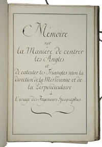
1750ABC_46337France 1750. Folio. Sewn in quires and stored loose in a portfolio covered with grey paper grey cloth ties paper label on the front board. Manuscript in French on thick paper written in a neat 18th-century cursive hand. With 5 manuscript plates showing 14 geometrical figures. 2 blank 1 1 blank 61 3 blank pp. Cartographic manuscript intended to teach engineer-geographers how to in the authors words centrer les angles bisect angles and to triangulate to calculate locations on a map as precisely as possible. The author remains unidentified but probably taught cartography. He the field was hardly open to women gives many examples to explain his methods all richly illustrated in the manuscripts geometric figures and with tables. He quotes the methods of the important French mathematician physician and hydrographer Pierre Bouguer 1698-1758 who was also geometer at the Académie des Sciences in Paris for the means to centrer les angles though we have not found Bouguer using that phrase and those of the French astronomer and cartographer César-François Cassini de Thury 1714-1784 also member of the Académie for triangulation. Altogether the work is a practical guideline for engineer-geographers in which the author not only describes methods for bisecting angles and for triangulation but for example also how to use his own tables on pp. 29-44. A highly interesting cartographic manuscript with a strong geometrical focus quoting two of the foremost French cartographers of the 18th century.With the library stamp of the Danish national library Det Kongelige Bibliothek in Copenhagen. Portfolio a little worn dust-soiled and somewhat stained but the leaves are still in good condition.l Katalog der Bibliothek und Kartensammlung der Königlichen Allgemeinen Kriegsschule 1851 56. hardcover
1780Map724Bassano Del Grappa: Giovanni Remondini 1780. 1st ediiton . No Binding. Fine. Folio. ND c1780. 36 x 50cms. Original hand-colour. Dusty condition. Very rare town view of Marseille engraved by the Venitian Francesco Ambrosi 1713-173. A numbered key in French to the lower margin of places of interest in the city 1-19. A dark impression printed on heavy paper with a strong plate mark and clear chain lines but no watermarks. <br/> <br/> Giovanni Remondini unknown
1799TS431Paris: De L'imprimerie De La Republique 1799. 1st Edition . Hardback. Fine. quarto. Pendant Les Annees 17901791et 1792 par Etienne MARCHAND; precede d'une introduction historique auquel on a joint des recherches sur les terres Australes de DRAKE et un examen critique du .ii viii 158pp Tables 141-158pp. 15 fine condition plates complete. 30cm The title-page has a contemporary printed slip pasted over the volume number reading 'Tome Sixieme'. This is because the 4 volume quarto issue and the six volume octavo edition were published at the same time and both used the same quarto last volume offered here. The 15 plates are all as called for and in printed on thick paper and all in fine condition The World map is particularily attractive. PLEASE EMAIL FOR PHOTOS. NB An VIII was the result of the date changing to Year 0 in post-revolution France and spans the old years of 1799-1780. Original half calf binding with the distinctive brown 'marbled' boads and gilt decorative spine similar to the copy in the National Library of France. Rather worn and splits but the contents fine. LISTE DES CARTES. No I. Carte générale. World map No 2 . Fragmeiu de la Carie rcduiie d'une partie de I'Ameriqu Septentrionale par le Capitaine John AIeares. No 3. Carie Systéinaiique d'une partie de I'Amerique du nord-Ouest pour l'intelligence des Découvertes de l'Amiral de Fuente par J. N. De L'Isle 1752. N0 4. Deux Cartes sur la même feuille des Marques as de Mendoça déco-'vertes en 1595 par Mendana et des îles de la Révolution découver en 1791 par le Capitaine Marchand. No 5. Échasses de WahÎtahô ou Santa-Christin a une des Mar- quesas de Mendoça vues de face et de profil grandeur de moitié. No 6. Carte des îles de la Révolution situées dans le Nord-Ouest des Marquesas de Mendoça. Levée ar le Capitaine Prosper Chanel en 1791. No.6b Copie de la Carte du Groupe DU Nord-Ouest des Mar- quesas De Mendoça nommé par les Anglais en 1792 Mergest's Islands telle qu'elle a été publiée par Vancou v ER en 1798 dans la Relation de son Voyage. No 7. Partie Orientale de la Carte de Tupia. N.B. La Carte de cet Insulaire de l'Archipel de LA SOCIÉTÉ présente les Iles Équinoxiales du Grand Océan. No 8. Plan de la Baie de Tchinkitane la Baya de Guadalupa des Espagnols en 1775 et Norfolk-Bav des Anglais en 17S7 située à la Côte du NoRD-OuEST de I'Amerique par 57 4.' de Latit. N. Levée en 1791 par le Capitaine Prosper Chanal. No9. Esquisse de Cloak-Bay et du Détroit de Cox à 54 10' de Latit. N. Iles de ueen-Charlotte Côte du Nord-Ouest de I'Amerique. Par le Capitaine Prosper Chanal en 1791. No 10. Carte réduite d'une partie de la Côte Occidentale d'une des îles de Queen-Charlotte. Levée en 1791 par le Capitaine Prosper Chanal. No 11 Carte comparative des Iles Sandwich et du Groupe de la Mesa qui se voit sur la Carte du Galion de Manille. No 12 Carte gtiicrale du Détroit d'entre Banca et Bil'.iton comprenant les Detroit de Gaspar et de Cléments depuis la Pointe Pesant de Banca au Nord jusqu'aux îles de la. Reconnoissance au Sud. No13 Carte particulicre des mêmes dtroits sur une Échelle plus gr.mde. No 14 Carte du Détroit de Magellan Magalhaens et de la Tierra Del Fuego pour l'intelligence sur les Recherches des Terres Australes de Drake. No15. Carte d'une partie du Grand-Océan Équinoxial pour l'intelligence de YLxamen critique des Relations du Voyage. The Atlas volume of the account of the second French circumnavigation and the first French commercial voyage to the PacificNorth West. <br/> <br/> De L'imprimerie De La Republique hardcover
1744Map918London: Eman. Bowen 1744. 1st Edition . Hardcover. Fine. Double hemisphere map of the world with four seated allogorical women in each corner of the plate. Uncoloured state with a trimmed right hand side but no loss to the map. Plate impress 31.5 x 53.5 cms with sheet size 36.5 x 54 cms. Centre fold. Pre-Cook outlines of Australia and New Zealand. PLEASE EMAIL FOR PHOTOS. <br/> <br/> Eman. Bowen hardcover
1713Map868London: Henry Overton 1713. Original printed issues 1st Editions . No Binding. Fine. Folio. 1603-1713 The rare re-issue with amendments by Henry Overton of Smiths original plate of 1603. Based on the map by Saxton in 1573. Un-coloured example in fine condition of the copperplate engraving. Paper size 55 x 46 cms. Plate size 48 x 33 cms. No splits or holes. Plain verso and part of the original hinge still present. Table with a list of the hundreds. One of the original 'anonymous' maps that were identified as being by Smith in recent times.PLEASE EAMIL FOR PHOTOS. <br/> <br/> Henry Overton unknown
1740TH228London: Printed for Thomas Wright Mathematical Instrument-Maker. And E. Cushee Globe-Make 1740. fifth Edition . Hardback. Vg. 8vo. THE DESCRIPTION AND USE OF THE GLOBES AND THE ORRERY To which is prefixed by way of introduction a brief Account of the Solar System.viii 190pp. 6 folding plates. Pub. advert to the reverse of the title-page. Index of the astronomical terms. Original full calf polished calf binding with gilt dbl. ruled border to the boards. Five raised band and neat owners to the top edge of the title-page. A tight clean and fresh copy with a plain but period binding Near fine Nicholson Calvert 1816 an English Whig politicain who fought at the Battle of Waterloo. <br/> <br/> Printed for Thomas Wright, Mathematical Instrument-Maker. And E. Cushee, Globe-Make hardcover
1745TH352London: Printed for Thomas Wright Mathematical Instrument-Maker. And E. Cushee Globe-Make 1745. sixth edition . Hardback. Vg. 8vo. To which is prefixed by way of introduction a brief Account of the Solar System.viii 190pp. 6 folding plates. Pub. advert to the reverse of the title-page. Index of the astronomical terms. Original full calf calf binding. Five raised bands. A tight clean and fresh copy with a plain but period bindng/ Original binding intact but worn to the extremities and joints cracked but the boards attached. A tight and clean text with beautiful crisp plates. <br/> <br/> Printed for Thomas Wright, Mathematical Instrument-Maker. And E. Cushee, Globe-Make hardcover
1788GT789London: Charles Dilly in the Poultry et al 1788. eleventh edition . Hardback. Vg. 8vo. x 2 928pp. 20 map plates : 2 engeaved illustrations charts maps ; Damp staining to the plates and map in some but compete and tight copy in the original binding. A New System of Modern Geography: or A geographical historical and commercial grammar; and present state of the several kingdoms of the world. : Containing I. the figures motions and distances of the planets according to the Newtonian system and the latest observations. II. A general view of the Earth considered as a planet; with several useful geographical definitions and problems. III. The grand divisions of the globe into land and water continents and islands. IV. The situation and extent of empires kingdoms states provinces and colonies. V. Their climates air soil vegetable productions metals minerals natural curiosities seas rivers bays capes promontories and lakes. VI. The birds and beasts peculiar to each country . XII. The longitude latitude bearings and distances of principal places from London. To which are added I. A geographical index with the names and places alphabetically arranged. II. A table of the coins of all nations and their value in English money. III. A chronological table of remarkable events from the Creation to the present time. Original full calf with red morocco label to the spine. <br/> <br/> Charles Dilly in the Poultry et al hardcover
1773Map922London: H. Turpin 1773. 3rd Edition . No Binding. Fine. Single map of Lincolnshire. A fine uncoloured copy of the last issue of Robert Moderns playing card maps. Approx 55x90mms. Title to the head wth Roman numeral VIII and the uncoloured map to the main section enclosed with double ruled lines above and below with county dimensions and distances at the foot. Harry Turpin published a 52 sheet set of these maps between 1764 and 1787 but no exact date is known for publication. RARE. Please email for photos. <br/> <br/> H. Turpin unknown
1758T371Dublin: John Exshaw Dame Street 1758. 1st Edition . No Binding. Fine. 8vo. 481-536pp. A disbound copy of the Dublin version of the Gentleman's Magazine for the month of Sept 1758. Fine fresh paper with no foxing wear or marks. The title-page lists 25 articles on the title-page and includes a fine copy of the rare 'Plan of the Country from the LANDING PLACE with the Encampments and Marches of the Troops under Major General ABERCROMBIE to the Attack of TICONDEROGA . 19 x11 cms. Together with an account from the action. Also a fine plan of St Malo with map of part of French Coast inset 19 x 11cms together with an account of shipping lost in recent action. Also a PLAN of Cherburg with Channel map inset 19 x 11cms with an account. All 3 plans engraved by Ridge. Please email for photos. <br/> <br/> John Exshaw, Dame Street unknown
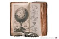
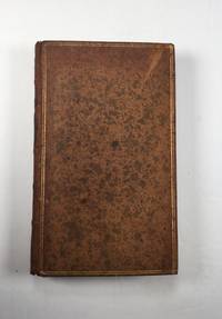
178078258Bruxelles: Benoît Le Francq 1780. Full leather hardcover. xx240 pp. illustrated with a black-and-white frontispiece showing Atlas as a child holding up the celestial sphere and 24 old hand-colored folding maps/plates after G. Dellisle. Rare Brussels pocket atlas based on the 5th Amsterdam edition published by B. Vlam in the same year 1780. Includes B. Vlam's bookseller's list at the end. One map has a repaired taped tear and some maps have frayed edges. Bound in a leather cover with various damages. The book is complete and the maps remain visually attractive. Text in French / Français. See pictures. Benoît Le Francq hardcover
1705Map902London: Richard Blome 1705. re-issue . No Binding. Vg. Folio. 50x42cms. Nice dark impression printed on thick paper. Single original plain red ink hand drawn crossing borders to the image edges and repeated in the blank verso. Uncoloured map. Originally engraved by Joseph Moxon in 1660 this later issue of 1705 by Richard Blome has the cartouche and corner engraving removed and rplaced by a compass and pair of dividers. Very wide margins. Joseph Moxn 1627-1699. The map was first designed by Nicolas Visscher. <br/> <br/> Richard Blome unknown
1704TH254London: printed for John Nicholson and Samuel Ballard 1704. The Seventh Edition . Hardback. Fine. 12mo. Being a geographical index. Of all the considerable cities patriachships. in Europe. The seventh edition corrected and very much enlarged with the addition of a table of births marriages &c. of.Unpaginated.256pp. Both parts present. The second part being The Births marriages etc of all the Kings Princes and Potentates of Europe. Original full calf binding with panelled polished calf boards and attractive decoration to the corners of the outer panel. Robbed to the extremities but a nice copy. PLEASE EMAIL FOR PHOTOS. <br/> <br/> printed for John Nicholson, and Samuel Ballard hardcover
1716Pa888London: John Nicholson and Samuel Ballad 1716. eleventh edition . Hardback. Vg. 12mo. ii pubs. ad. including maps and atlases by Herman Moll. i pp ad Preface incl. The Clavis i pp vi Gazetteer a5-Ll5; iii pub. book lists.; bound with the Second Part THE GAZETTEER'S OR NEWMAN'S INTERPRETER Being a Geographical Index .in Asia Africa and America pub. by George Sawbridgeand Maurice Atkins London the third edition Corrected and Enlarged 1710 Preface iv Or Divers Measures iii The Clavis i pp The Gazeteer A6- M5 pub. ads iii pp. Original full calf with raised bands. Single gilt ruled borders to the boards. <br/> <br/> John Nicholson and Samuel Ballad hardcover
1758T370Dublin: John Exshaw Dame Street 1758. No Binding. Fine. 8vo. 427-480pp. A disbound copy of the Dublin version of the Gentleman's Magazine for the month of August 1758. Fine fresh paper with no foxing wear or marks. The title-page lists 24 articles on the title-page and includes a fine copy of the rare 'A PLAN of the Harbour and TOWN of LOUISBOURG in the Island of CAPE BRETON Drawn on the Spot. Folding page 28 x 20 cms with a plate impression 24 x 18 cms.4 page description of the plan and town. Other articles include an estimate of the Naval Debt; Part of the trial of William Barnard; Journal of the Seige of Louisbourg; General Abercromby's Account of the Exped. to Crown Point. Single page map of 'The Country between CROWN POINT and ALBANY being the Great Pass from the English to the French Settlements in North America'.11.5 x 19.1 cms. Please email for photos. <br/> <br/> John Exshaw, Dame Street unknown
1705Map901London: Richard Blome 1705. re-issue . No Binding. Vg. Folio. 50x42cms. Nice dark impression printed on thick paper. Single original plain red ink hand drawn crossing borders to the image edges and repeated in the blank verso. Uncoloured map. Originally engraved by Joseph Moxon in 1671 this later issue of 1705 by Richard Blome has the cartouche and coats of arms and lower engraving re-engraved and the lower part of the plate removed and replaced with a irnage of small hills! The Jonas and his whale engraving has also been re-engraved at the centre top of the image. Now measuring 27x45cms. Very wide margins. Joseph Moxn 1627-1699. The map was first designed by Nicolas Visscher. <br/> <br/> Richard Blome unknown
1799Map913London: G.G.& J. Robinson Paternoster Row 1799. Original Map . No Binding. Fine. Folio. Folding folio map of Asia with outline hand-colour. An attractive map of Asia at the end of the eighteenth century probably engraved by Thomas Kitchen. Nice hand-coloured to the boundaries of the countries stretching from Arabia to Japan and down to Java and New Guinea Nice wide margins 38 x 47.5 cms. image 34 x39 cms. This large scarce map appeared in several publicatons including Clement Cruttwells 1799 Atlas. see House of Commons Map Collection. PLEASE EMAIL FOR PHOTOS <br/> <br/> G.G.& J. Robinson, Paternoster Row unknown
1794025454Hartford Connecticut: Elisha Babcock 1794. Good - Very Good condition. SEE PHOTOS. Hinges are sound with only a single half inch hairline crack. NOT a library discard. NO owner's name or bookplate. Foxing mostly light to moderate to several pages. Slight age toning. Bound in full leather sprinkled calf with 5 raised spine bands. Brown leather spine label mostly chipped away. Gilt spine decorations and gilt double ruled borders on the front and rear covers. Handsome gilt inside dentelles i.e. borders decorated with gilt lacy pattern at inner edges. SEE PHOTOS. Frontispiece portrait of the author engraved by Amos Doolittle. This copy includes plates 1 2 4 5 6 8 also engraved Amos Doolittle. Of these 6 plates 5 are folding some copies have only 3 plates that are folding. Plate 1 is a map of New Haven and Its Environs Wheat 281. Plate 4 shows 3 maps one of which shows Hadley Mass Wheat 276 278 280. Plate 5 is a map of the City of New Haven Wheat 275. Plate 8 is another map of Hadley Massachusetts Wheat 279. Lacks pages 145-156 plates 3 and 9 which apparently were not bound in. Plate 7 does not exist in any copy per Howes and Sabin: "there is no plate 7 in any of the copies seen and it is probable none was made." This is a history of three members of the tribunal which had Charles I beheaded in 1649. The author Ezra Stiles was president of Yale College from 1778 until his death in 1795. No errata slip is present in this copy so presumably it is Howes' second issue. Includes the "Advertisement" at the end on an unnumbered page that offers subscribers the option to cancel if dissatisfied with the change in the dimensions of this book from what was described in the prospectus not present. Full title: "A history of three of the judges of King Charles I. Major-General Whalley Major-General Goffe and Colonel Dixwell: Who at the Restoration 1660 fled to America; and were secreted and concealed in Massachusetts and Connecticut for near thirty years. With an account of Mr. Theophilus Whale of Narragansett supposed to have been also one of the judges." Howes S-999. Evans 27743. Sabin 91742. Trumbull Connecticut 1425. ESTC W20469. Church 1264. Wheat and Brun 275-283. First Edition Second Issue. Hardcover. Good - Very Good condition. Illus. by NOT a library discard. 12mo. 358pp. "Advertisement". Great Packaging Fast Shipping. Elisha Babcock Hardcover
1747Map882London: E. Bowen 1747. 1st Edition . printed Map. Fine. . Drawn from the Most approv'd Foreigners Mpas and Charts and Regulated By Astron'l Observations. An original printed map with outline hand-colour to the coast-line and cartouche in the lower right corner. A lovely plate impressed map with sharp clear engraving and title cartouche to the lower right-hand corner. Emanuel Bowen 1694- 1767. Plate 31.7x22.0 paper 38.5 x 26.5 cms. Nice margins. From the 1747 'A Complete System of Geography'. <br/> <br/> E. Bowen unknown
1760Map1001London: T. Bowen 1760. Original First Edition . No Binding. Fine. c1760 A fine example of Bowens map of Portugall. Title within an oval frame. An uncoloured example and printed of thick paper. 2 vertical folds to the page but nice clean margins and a dark impression. Some minor foxing reflecting its age but a nice example. 'Prepared for Barlow's General History of Europe'. Blank reverse. 33x34cms Barlows volume is often very damp stained and foxed. This map is however a fine example. Thomas Bowen 1714-1767 <br/> <br/> T. Bowen unknown
1781Map904London: W. Strachen and T. Cadell 1781. printed Map. Fine. 41.5 x 48.5 cms. Nice wide margins. Folding map uncoloured and printed on heavy paper. One small hole on a fold. PLEASE EMAIL FOR PHOTOS. <br/> <br/> W. Strachen and T. Cadell unknown
1790Map924London: Thomas Bowen 1790. 1st Edition . printed Map. Fine. Folio. ND 1790. Engraved by Thomas Bowen for Barlow's General Hostory of Europe. A fine copy printed on thick paper with two folds. Nice strong impression with strong plate mark and good margins. No wear or splits. A lovely example. One small fox mark. 36x47cms. Interesting map in that Portugal is not mapped in this cartographic original merely the ' Portugal' where the country should be.ESCT 97895 Barlows History c1790. <br/> <br/> Thomas Bowen unknown
1758T374Dublin: John Exshaw Dame Street 1758. 1st Edition . No Binding. Fine. 8vo. 369-425pp. A disbound copy of the Dublin version of the Gentleman's Magazine for the month of July 1758. Fine fresh paper with no foxing wear or marks. The title-page lists 19 articles on the title-page and includes a fine copy of the rare folding sheet map 'A New and Accurate Map of Germany Drawn from the latest surveys Discribing the Port Roads & Distances from Town to Town according to the original Map of the Prussion Routs Published at berlin By Richd Bennet Engineer'. Engraved by S. Wheatley.33x26 cms. Trifle margin crop lower corner. Title-page call for a map of the Channel Islands but Germany map present. Please email for photos. <br/> <br/> John Exshaw, Dame Street unknown
1758T372Dublin: John Exshaw Dame Street 1758. 1st Edition . No Binding. Fine. 8vo. 313-368pp. A disbound copy of the Dublin version of the Gentleman's Magazine for the month of June 1758. Fine fresh paper with no foxing wear or marks. The title-page lists 24 articles on the title-page and includes a fine copy of the rare folding map 'A NEW MAP OF THE ENGLISH CHANNEL' engraved by Ridge 25 x 17 cms. Map engraved by Ridge. Title contents calls for a Sheet map of Germany and not the English Channel. Please email for photos. <br/> <br/> John Exshaw, Dame Street unknown
1758T373Dublin: John Exshaw Dame Street 1758. 1st Edition . No Binding. Fine. 8vo. 3-64pp. A disbound copy of the Dublin version of the Gentleman's Magazine for the month of January 1758. Fine fresh paper with no foxing wear or marks. The title-page lists 21 articles on the title-page and includes a fine copy of the rare folding map 'Island Rathlin showing the Ballycastle Colleries 21x18 cms. Also A PLAN OF THE CITY OF BRESLAU Capital of Silesia 18x12 CMS.Please email for photos. <br/> <br/> John Exshaw, Dame Street unknown