125 résultats
1839W043Eton: E. Williams 1839. New and improved edition . Hardback. Fair. large 8vo. xviii 847 i adpp. Folding frontis. plate of the Solar system.; astronomical folding plate; folding plate of Athens. Lacks Rome and Syracuse plates. Title-page and frontis. loose and binding worn. READING/ REFERENCE COPY ONLY. <br/> <br/> E. Williams hardcover
1830Le601London: G.G. and J. Robinson 1830. 3rd Edition . Hardback. Vg. 8vo. :Containing a Comprehensive System of Modern Geography After a New and Curious Methodlxiii 567 viii pp appendix. Original full plain calf gilt ruled compartments. 5 engraved plates in the Introduction A double hemisphere world map worn but complete as a frontis. and 6 folding maps Europe creased in the main section. "Corrected and considerably enlarged". New descriptions of America and Cook's Voyages I. A General View of the Terraqueous Globe: Being a Description of the Figure Motion and Magnitude of the Earth; The Theory of the Air Winds and Tides; the Doctrine of the Sphere; the Use of the Globes etc etc. II. A particular View of the Terraqueous Globe: Being an accurate Description of all the Empires Kingdoms States Provinces and Colonies in the known World; shewing the Extent of their Situation Extent Climate Air Soil Animal Vegetable and Mineral Productions . To which is added An Appendix: Containing a Geographical Table with the Names and Situations of the Chief Cities Towns &c. etc etc.The first edition of this educational book was <br/> <br/> G.G. and J. Robinson hardcover
1839TH225London: Aldam and Co. Et al. 1839. 1st Edition . Hardback. Fine. 8vo. 100pp. Large folding table of distances frontis. A wonderful early Victorian geography in the orginal stiff card cover with fine buckram cloth cover and a lozenge label pasted to the front cover. A RARE ITEM. Copac 1 copy only 1839. A second edition was published in 1850. <br/> <br/> Aldam and Co. Et al. hardcover
1839TH327London: Longman Orme Brown Green & Longmans 1839. a new Edition Considerably Improved . Hardback. Vg. 8vo. ND but preface dated Walworth 1839. xxiv 364pp 7 folding plates at the rear.12pp pub. cat. dated August 1841 London. Bound in the pub. green fine pebble gren cloth with gilt titles to the spine. Pasted -down end-papers list Longmans 'New School Books'/ Neat owners sig. dated 1842. Thomas Keith 1759-1824. The first edition was pub. in 1805 <br/> <br/> Longman, Orme, Brown, Green & Longmans hardcover
1809Map953Paternoster Row London: Longman Hurst Rees & Orme 1809. 1st Edition 1st Printing. No Binding. Fine. Original early 19th century map MAP OF AEGYPTUS BY AARON ARROWSMITH. Inset detailed map of Aegypti pars Meridionalis.A FINE CLEAN AND DARK IMPRESSION. Original folding plate printed on heavy paper A scarce example and in fine un-coloured original condition. An occasional light foxing mark. 41x27cms. Double-page folding map. Engraved by Cooper.A LOVELY COPY. Imprint date June 1 1809. <br/> <br/> Longman, Hurst, Rees & Orme unknown
1807Map945Paternoster Row London: Longman Hurst Rees & Orme 1807. 1st Edition 1st Printing. No Binding. Fine. Original early 19th century map MAP OF AFRICA BY AARON ARROWSMITH. A FINE CLEAN AND DARK IMPRESSION. Original folding plate covering THE WHOLE OF AFRICA printed on heavy paper dated 1807. A scarce example and in fine un-coloured original condition. An occasional light foxing mark. 41x27cms. Double-page folding map.Engraved by Cooper.A LOVELY COPY <br/> <br/> Longman, Hurst, Rees & Orme unknown
1805Map958Paternoster Row London: Longman Hurst Rees & Orme 1805. 1st Edition 1st Printing. No Binding. Fine. Original early 19th century MAP of ALPINE COUNTRY from Barvaria to N. Italy. On MERCATORS PROJECTION BY AARON ARROWSMITH. A FINE AND DARK IMPRESSION. Original folding plate printed on heavy paper dated 1804. A scarce example and in fine un-coloured original condition. SOME MARGINAL FOXING. 41x27cms. Double-page folding map.A NICE COPY <br/> <br/> Longman, Hurst, Rees & Orme unknown
1832Pa402London: A. Arrowsmith and B. Fellowes 1832. 1st Edition . Hardback. Vg. 12mo. Engraved title engraved index and 19 engraved maps with outline colour lower half of Italy lacking. Double page and folding maps. Some edges of folds split. Original binding with detached front board. The ancient world by Arrowsmith 'Hydrographer to the King' William IV <br/> <br/> A. Arrowsmith and B. Fellowes hardcover
1837TS145London: Longman & Co. 1837. 1st Edition . original half red morocco. Grubby. octavo. 23 attractive double page maps of the ancient world with outline hand-colouring. Index. A scruffy original binding but with clean maps. <br/> <br/> Longman & Co. unknown
1808Map941Paternoster Row London: Longman Hurst Rees & Orme 1808. 1st Edition 1st Printing. No Binding. Fine. Original early 19th century map MAP OF ARABIA BY AARON ARROWSMITH. A FINE CLEAN AND DARK IMPRESSION. Original folding plate covering THE WHOLE OF ARABIA printed on heavy paper dated 1808. A scarce example and in fine un-coloured original condition. An occasional light foxing mark. 41x27cms. Double-page folding map.Engraved by Cooper.A LOVELY COPY <br/> <br/> Longman, Hurst, Rees & Orme unknown
1806Map954Paternoster Row London: Longman Hurst Rees & Orme 1806. 1st Edition 1st Printing. No Binding. Fine. Original early 19th century map MAP OF ASIA BY AARON ARROWSMITH.A FINE CLEAN AND DARK IMPRESSION. Original folding plate printed on heavy paper A scarce example and in fine un-coloured original condition. An occasional light foxing mark. 41x27cms. Double-page folding map. Engraved by Edw. Jones.A LOVELY COPY. Imprint date May 6th 1806. <br/> <br/> Longman, Hurst, Rees & Orme unknown
1868016331New York: F. W. Beers; A.D. Ellis; G.G. Soule 1868. Near Fine condition. NO chips. NO tears. A bright clean tight copy. The spine is square and flat with NO creases. NO owner's name or bookplate. Pages are bright white clean and crisp. This is an undated modern facsimile of the 1868 original. Oversize Softcover with black cloth spine. 10.75" wide by 14" tall. This atlas consists of a printed title-page; an outline map of Morris County; 31 single and double-page maps; a Table of Distances for Morris County; and 2 pages of lithographic views of 6 buildings George Washington's Headquarters in 1779/80; Boonton Academy; Schooley's Mountain Seminary; etc. Included are maps of: Washington; Chester; Mendham; Brookside; Stephensburg; Whippany; Morris; Morristown; Passaic; Green Village; New Vernon; Chatham; Madison; Troy; Hanover; Chatham Long Hill; Parsippany; Roxbury; Drakesville; Randolph; Dover; Oram; Jefferson; Flanders; Milton; German Valley; Schooley's Mountain; Rockaway; McCainsville; Succasunny; Hanover; Boonton; Montville; Boonton Borough; and Pequannock. Laid in is a facsimile of an old map of Morristown scale: 20 rods to the inch that unfolds to 22" wide by 25" tall. The map is keyed to the locations of Morristown businesses such as livery stables markets boot and shoe sellers manufactures physicians hotels editors merchants etc. This large book will require extra postage for Priority and International shipments but only the standard charge for media mail. Facsimile Edition. Oversize Softcover. Near Fine condition. Unpaged but 64 pages. F. W. Beers; A.D. Ellis; G.G. Soule Paperback
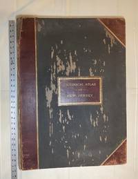
1889028277New York: Julius Bien & Co 1889. Condition of the binding is only Fair with pest damage. Leather over the spine has perished. Front and rear outer hinges cracks have been neatly reinforced with high quality clear flexible glue. Inner hinges are OK having been reinforced by the publisher/bookbinder with sturdy maroon cloth. SEE PHOTOS. Condition of all maps is NEAR FINE - FINE. NO foxing or toning. Pages are clean and unmarked. SEE PHOTOS. Includes a title page map of New Jersey Key to the System of Mapping and 19 linen-backed double page maps. Collated and complete per table of contents -- SEE PHOTOS. The maps are lithographically printed in blue red yellow and black. The double page maps open to an impressive 26.50" across by 36.50" tall. No year of publication is stated but Phillips 2149 in A LIST OF GEOGRAPHIC ATLASES Vol. 1 says 1889. The maps themselves are variously dated up to 1888. Titles of Sheets: No. 0. New Jersey State Map Geographic; No. 1. Kittatinny Valley and Mountain No. 2. Southwestern Highlands; No. 3. Central Highlands; No. 4. Northeastern Highlands; No. 5.Vicinity of Flemington; No. 6. Valley of the Passaic; No. 7. The Counties of Bergen Hudson Essex No. 8. Vicinity of Trenton; No. 9. Monmouth Shore; No. 10. Vicinity of Salem No. 11. Vicinity of Camden; No. 12. Vicinity of Mount Holly; No. 13. Vicinity of Barnegat Bay; No. 14. Vicinity of Bridgeton; No. 15. Southern Interior; No. 16. Egg Harbor and Vicinity; No. 17. Peninsula of Cape May; Unnumbered map. "New Jersey from Original Surveys based on the Triangulation of the U.S. Coast and Geodetic Survey Relief Map." Scale of first and last doublepage maps: 5 miles to an Inch. Scale of maps No. 1 to No. 17: 1 mile to an Inch. Bound in black pebble-grain cloth with gilt-stamped brown leather title label leather spine and corners leather backstrip has perished. SEE PHOTOS. The textblock could be easily rebacked or recased with no re-sewing required since all pages/maps are still securely bound together. Oversize Hardcover. 19.50" wide by 27" tall. This massive extremely heavy book will require SUBSTANTIAL extra postage at our cost based on your location. LeGear ATLASES OF THE UNITED STATES L5609. See also Schwartz and Ehrenerg's THE MAPPING OF AMERICA pp. 310-311. Phillips 2149. This massive extremely heavy book will require SUBSTANTIAL extra postage at our cost based on your location. Second Edition. Oversize Hardcover. Fair - FINE condition. Illus. by NOT a library discard. Atlas folio. Great Packaging Fast Shipping. Julius Bien & Co Hardcover
1834Map893London: Greenwood 13 Regent Street Pall Mall 1834. 1st Edition . Hardback. Fine. Elephant Folio - over 15" - 23" tall. A fine large ATLAS with 44 of 46 lacking Suffolk and lacking Norfolk double page maps bound with central hinges. Clean paper with little off-setting foxing tanning or marks. Decorative double page engraved maps of the counties with an uncoloured vignette views. Fine elegant engraved titles Original hand-colour block and outline. 65 x 80.5 cms 25 1/2 x 31 3/4 inches printed on thick paper with wide clean and fine margins. Printed July 4th 1829 and published in the C& J Greenwoods "Atlas of The Counties of England" dated 1834. SPINE LACKING AND THE BOARDS DETACHED. PLEASE EMAIL FOR PHOTOS. <br/> <br/> Greenwood, 13 Regent Street, Pall Mall hardcover
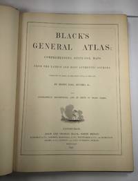
1844026815Edinburgh / London / Dublin: Adam and Charles Black / Longman / Simpkin / Whittaker / Hamilton / Cumming 1844. Good - Very Good condition. Bound in green cloth with black leather spine and corners elaborately gilt decorated. The leather is surprisingly well preserved. The cloth is faded and soiled with frayed edges. SEE PHOTOS. NO owner's name or bookplate. NOT a library discard. Imprinted "MDCCCXLIV" at the foot of the title page with "1844" hand inked beneath. All other pages are crisp clean and umarked with almost no foxing. Full title; "Black's General Atlas: Comprehending Sixty-One Maps from the Latest and Most Authentic Sources Engraved on Steel in the First Style of the Art by Sidney Hall Hughes etc. with Geographic Descriptions and an Index of 56000 Names." The maps several double page are tissue guarded and most are handcolored in red yellow and green. SEE PHOTOS. With the binder's ticket of Smith & Son 306 Lawnmarket Edinburgh. All edges gilt. Oversize hardcover. 13.25" wide by 17.75" tall. This large heavy book will require SUBSTANTIAL extra postage depending on destination that will be charged at our cost. 1844 edition. Oversize Hardcover. Good - Very Good condition. Illus. by NOT a library discard. 12pp. 61 maps 57 page Index. Great Packaging Fast Shipping. Adam and Charles Black / Longman / Simpkin / Whittaker / Hamilton / Cumming Hardcover
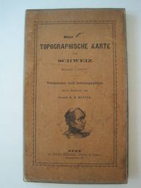
1861016428Bern Switzerland: Hans Körber Koerber Huber & Comp. 1861. Very Good condition. SEE PHOTOS. Karten etwas fleckig maps somewhat spotted. This is Blatt VIII Aarau - Luzern Zug - Zürich Zurich. The map is dated 1861 and has 21 sections. It is printed on paper then mounted on cloth i.e. backed with linen. When folded the map measures 19 cm tall x 11 cm wide. When unfolded 57 cm tall x 79 cm wide. SEE PHOTOS. Linen-backed steel-engraved folding map in 21 segments. Scale 1:100000. 1861 edition. Hardcover. Very Good somewhat spotted. Hans Körber [Koerber] (Huber & Comp.) Hardcover
1851Map920London: The London Printing And Publishing Co Ltd 1851. Original printed issues 1st Editions . No Binding. Fine. quarto. An original map of BRITISH INDIA originally pub. by John Tallis in this issue by The London Printing Company. Original out-line hand colour showing the borders and boundaries and with fine vignette scenes of cities and an Indian Procession. Enclosed within a highly decorative border with nice wide margins. A fine copy printed on thick paper folded to the centre with no wear. PLEASE EMAIL FOR PHOTOS <br/> <br/> The London Printing And Publishing Co Ltd unknown
1808Map932Paternoster Row London: Longman Hurst Rees & Orme 1808. 1st Edition 1st Printing. No Binding. Fine. Original early 19th century map of the BRITISH ISLES BY AARON ARROWSMITH. A FINE CLEAN AND DARK IMPRESSION. Original folding map. A scarce example and in fine un-coloured original condition.41x27cms. Double-page. <br/> <br/> Longman, Hurst, Rees & Orme unknown
1809Map931Paternoster Row London: Longman Hurst Rees & Orme 1809. 1st Edition 1st Printing. No Binding. Fine. Original early 19th century uncoloured MAP OF BRITISH POSSESSIONS IN NORTH AMERICA BY AARON ARROWSMITH. A FINE CLEAN AND DARK IMPRESSION. Original folding plate including Northern United States and gREENELAND DOWN TO WASHINGTON IN THE SOUTH. A scarce example and in fine un-coloured original condition.41x27cms. Double-page. <br/> <br/> Longman, Hurst, Rees & Orme unknown
1848Map 822London: George Virtue 1848. re-issue . No Binding. Vg. 21 x 27 cms. Original un-coloured state first issue in 1832. Finely engraved views of Cambridge. A nice original dark impression steel engraving. Arms of the colleges and vignette of Trinity College <br/> <br/> George Virtue unknown
1818Map912London: Longman Hurst Rees Orme and Brown 1818. 1st Edition . No Binding. Fine. 4to. DOUBLE-PAGE FOLDING MAP engraved by Alexander Hindlay. Published as the Act directs May 1st 1818 by Longman Hurst Rees Orme and Brown. Clean folding plate with no toning to the fold 395x250mm. Cover the whole mainland of Britain with details of routes of rivers and canals. Bold margin border. PLEASE EMAIL FOR PHOTOS. Published in Abraham Ree's 'Cyclopedia or Universal Dictionary'. <br/> <br/> Longman, Hurst, Rees, Orme and Brown unknown
1807Map937Paternoster Row London: Longman Hurst Rees & Orme 1807. 1st Edition 1st Printing. No Binding. Fine. Original early 19th century MAP OF THECAPE OF GOOD HOPE BY AARON ARROWSMITH. A FINE CLEAN AND DARK IMPRESSION. Original folding plate. A scarce example and in fine un-coloured original condition.41x27cms. Double-page. Please email for photos <br/> <br/> Longman, Hurst, Rees & Orme, unknown
1808Map946Paternoster Row London: Longman Hurst Rees & Orme 1808. 1st Edition 1st Printing. No Binding. Fine. Original early 19th century map MAP OF AFRICA BY AARON ARROWSMITH. A FINE CLEAN AND DARK IMPRESSION. Original folding plate covering THE WHOLE OF AFRICA printed on heavy paper dated 1808. A scarce example and in fine un-coloured original condition. An occasional light foxing mark. 41x27cms. Double-page folding map. SUMATRA CELEBES.PAPUA NEW GUINEA MALAYA TIMORE etc etc.engraved by Cooper.A LOVELY COPY <br/> <br/> Longman, Hurst, Rees & Orme unknown
1808Map930Paternoster Row London: Longman Hurst Rees & Orme 1808. 1st Edition 1st Printing. No Binding. Fine. Original early 19th century map CHART OF THE PACIFIC OCEAN BY AARON ARROWSMITH. A FINE CLEAN AND DARK IMPRESSION. Original folding plate including New Holland Australia with an incomplete southern coastline with a complete New Zealand. Watermarked paper 1811. A scarce example and in fine un-coloured original condition.41x27cms. Double-page. <br/> <br/> Longman, Hurst, Rees & Orme unknown
1847GT028London: Charles F. Cheffins 1847. fifth Edition . No Binding. Vg. FOLDING MAP c1847. Lithographic folding map mounted on linen with 20 dissected sections with an additional section for Cornwall attached at the lower left corner. An inset map at the top of Scottish lines.Outline blue colour to the coast-line and colouring to the railways in black and red with additional hand-coloured marks and amendments to the details by a previous owner please email for photos. Encased in simple green cloth card covers with a pasted title and an engraved inside cover. 71x57cms. A grubby map but scarce in all editions. <br/> <br/> Charles F. Cheffins unknown