93 résultats
19984973<p>The Nautical & Aviation Publishing Company of America 1998. 6110 pages. New Hardcover New DJ. 10.1"x7.0". be5</p> The Nautical & Aviation Publishing Company of America hardcover
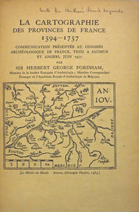
190827846Various places.: Various publishers 1908 to 1923. 10 volumes bound together in one volume. First Editions and all but one are inscribed by the author. Illustrated with cartographic cover art re-impressions of important works cartographic decorations and a number of maps including a number that are folding. 8vo the original printed wraps to each pamphlet are present and all are bound into the one cloth covered volume brown morocco label gilt. Each pamphlet can be considered fine and in exemplary condition some evidence of use and a bit of age to the cloth covers. A fine collection. A FINE COLLECTION OF INSCRIBED FIRST EDITIONS. Ranging from the cartography of the provinces of France 1594 to British and Irish Itineraries and Road-Books English Counties Welsh a pamphlet on the Evolution of the Maps of the Bristish Isles on the great engraver and mapmaker John Cary and two on France cartography and routes from the mid-1500's until the middle of the 19th century. ALL BOOKS ARE INSCRIBED BY THE AUTHOR. Various publishers paperback
1978021557La Crosse Wisconsin: Sumac Press 1978. NEW in a NEW dust jacket. The jacket is protected by a removable Brodart clear-plastic sleeve. Sharp corners. First Edition Limited to 300 copies. Includes a hand-mounted genuine 13 cent Ben Franklin The Theatre of War USA bicenntenial stamp from 1976. Illustrated with numerous facsimiles of stamps showing maps. Tells their stories. Published by Emerson Wulling at the Sumac Press. Bound in the original red cloth stamped in bright gold. Complete with errata page and dust jacket. First Edition 1/300 copies. Hardcover. New/New. 8vo. 67pp. Great Packaging Fast Shipping. Sumac Press Hardcover
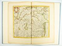
1985ST20505-12Fullerton California: Stone & Lorson 1985. ONE OF 89 COPIES in quarter vellum of a total edition of 115. 490 x 325 mm. 19 1/4 x 13". viii 23 1 pp. 1 leaf. <br/> Publisher's quarter vellum over gray paper boards covers with device in gilt smooth spine lettered in gilt. In just slightly chafed black buckram slipcase. WITH A MAP FROM THE ORIGINAL 1619 ATLAS bound in with period hand coloring. Map 293 "Tarvisina Marchia Et Tirolis Comitatus". De Hamel & Silver "Disbound and Dispersed" 186. One corner a bit bumped otherwise the main volume flawless; the map edges a bit browned and just slightly frayed a few light spots but still excellent with good color and strong general appeal.<br/> <br/> This attractive oversized production includes an original map of an important region of northeastern Italy taken from the 1619 edition of the Mercator-Hondius atlas. A pioneer in commercial cartography and a founder of the Netherlandish school of cartography and geography Mercator 1512-94 produced maps used around the world that were informed by his brilliant "Mercator Projection" which allowed the round Earth to be accurately depicted on a flat map. Near the end of his life he began work on an ambitious cosmography that would contain an account of the creation of the world a description of the universe descriptions of the countries and oceans of the world genealogies and political histories of the several countries and a chronology of the cosmos. Only the account of creation the chronology and maps of the known regions of the world came to fruition. Mercator having died before the work came to press it was completed by his heirs and published in 1595 with 107 maps. Leading Amsterdam map publisher Jodocus Hondius 1563-1612 acquired the plates in 1604 and issued the first Mercator-Hondius "Atlas" in 1606 with 37 maps he had engraved added to the original 107. Teacher and Hondius' brother-in-law Pieter van den Berg wrote the introduction and the descriptive text that appears on the versos of the maps. A 1611 edition increased the number of maps to 150 and another six were added in 1619. The hand-colored map included in our copy depicts the South Tyrol and Veneto regions including Lake Garda Verona Padua and Venice. It is accompanied with an essay by Norman J. W. Thrower 1919-2020 UCLA geography professor and cartographer describing the historical background of the atlas. Joel Silver in "Disbound and Dispersed" tells us that "the physical production of this leaf book is superb from the design by Vance Gerry to the presswork of Patrick Reagh.". Stone & Lorson unknown
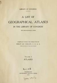
1958018590Washington D. C.: Library of Congress 1958. 1958. First Edition. Volume 5. Very Good condition. Clean square and tight. Hinges are perfect. Previous owner's small armorial bookplate on the pastedown endpaper. All other pages are crisp and unmarked. NO underlining. NO highlighting. NO margin notes. Preface. Author List. List of Geographical Atlases Titles 5325-7623. Comprehensive Index pp. 487-666. Subtitle: "With Bibliographical Notes A Continuation of Four Volumes by Philip Lee Phillips." Bound in the original blue cloth stamped in bright gold over a maroon panel on the spine. 7" wide by 10" tall by 1.75" thick. First Edition. Hardcover. Very Good condition/No jacket as issued. xlvii 666pp. Great Packaging Fast Shipping. Library of Congress Hardcover
1974019878Washington D. C.: Library of Congress / U. S. Government Printing Office 1974. Very Good EX-LIBRARY. Hinges are perfect. Pages are clean and crisp. NO underlining. NO highlighting. NO margin notes. 1974. First Edition. Volume 8 comprising the Index to Volume 7 titles 10255-18435. From the preface: "Indexed in this volume are areas subjects map authors engravers lithographers publishers etc. and atlas titles with distinctive words." Subtitle: "A Continuation of Four Volumes by Philip Lee Phillips." Bound in the original blue cloth gilt-stamped over a red spine panel. This First Edition measures 7" wide by 10" tall which is a larger format than the 1996 Martino reprint. BIBLIOGRAPHICAL NOTE: Volume 8's ISBN listed here was mistakenly duplicated for Volume 9 The Comprehensive Author List when it was published in 1992. First Edition. Hardcover. Very Good EX-LIBRARY/No jacket as issued. v 190pp. Great Packaging Fast Shipping. Library of Congress / U. S. Government Printing Office Hardcover
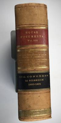
1901025183Washington: Government Printing Office 1901. SEE PHOTOS. A handsome example of the 1901 first edition in quite scarce original leather binding with 3 titles bound together as sometimes seen -- NOT print on demand edition or modern reprint. Very Good condition. NOT a library discard. NO owner's name or bookplate. Hinges are perfect. Minor offset as usual from the leather binding to edges of the endpapers. Front free endpaper has light soil and 4 small edge chips. Pages are otherwise clean and unmarked. NO foxing. 1901. First Edition. 1137pp. Bound in the original full leather calf binding we say "original" because we have seen other first editions in an identical leather binding including its 3 attractive leather spine labels -- in red black and brown -- although none of them were in condition as nice as this one. Leather is only moderately rubbed. SEE PHOTOS. All gilt stamping is still bright and shiny. This is House of Representatives Document No. 516 1901. Also bound in are: A LIST OF BOOKS WITH REFERENCES TO PERIODICALS ON PORTO RICO by A. P. C. Griffin. Senate Document No. 222. 55pp. 1901.; and A LIST OF BOOKS WITH REFERENCES TO PERIODICALS ON THE DANISH WEST INDIES by A. P. C. Griffin. Senate Document No. 223. 18 pp. 1901. Oversize Hardcover. 7.25" wide by 10.25" tall by 3" thick. This large heavy book will require extra postage for Priority and International shipments but only the standard charge for media mail. Sheehy 1986 CL287: "Lists maps to be found in books and atlases as well as those separately issued. Describes many old state and country maps and city plans.". First Edition. Oversize Hardcover. Very Good condition. Illus. by NOT a library discard. 1137pp. 55pp. 18pp. Great Packaging Fast Shipping. Government Printing Office Hardcover
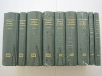
1995018557Staten Island New York: Maurizio Martino Publisher 1995. SEE PHOTO. 9 volumes complete. BRAND NEW HARDCOVERS in perfect condition. STILL SEALED in the publisher's clear plastic SHRINKWRAP. NO rubbing. NO fading. Bright clean square and tight. Sharp corners. NO owner's name or bookplate. NOT a remainder. Fresh and crisp -- obviously never read. The standard reference complete in 9 volumes. Vols. 1-4 by Philip Lee Phillips. No date but 1995 First Martino printing "strictly limited to 100". Reprint of the 1909-1920 Library of Congress originals. Vols 5-9 by Clara Egli Le Gear. No date but 1996 First Martino printing "strictly limited to 150". Reprint of the 1958-1992 Library of Congress originals in continuation of volumes 1-4 by Philip Lee Phillips. These 9 volumes fully describe thousands of atlases including imprint collation details of publication measurements content typographical and numbering errors comparisons with foreign and later editions reference citations reviews etc. There are also useful biographical sketches of explorers mapmakers engravers and lithographers. For most atlases before 1870 complete tables of contents are listed. Volume 9 is the comprehensive author index to both Phillips and LeGear with listings for 18435 atlases. The nine volumes are uniformly bound in the original gilt-stamped green cloth. SEE PHOTO. Sheehy CL286: "An important catalog of an outstanding collection." Hodgkiss/Tatham KEYGUIDE 11: "The most comprehensive work on historical atlases." This heavy 9 volume set will require extra postage for Priority and International shipments. But for media mail you pay only our standard charge for 1 volume and we ship the other 8 volumes at no extra cost. First Martino printing. Hardcover. New/in publisher's shrinkwrap. Illus. by We ship all 9 volumes for cost of 1. 9 volumes complete. Great Packaging Fast Shipping. Maurizio Martino Publisher Hardcover
1995018560Staten Island New York: Maurizio Martino Publisher 1995. 9 volumes complete. BRAND NEW HARDCOVER in perfect condition just removed from the publisher's shrinkwrap so we could write this description. NO rubbing. NO fading. Bright clean square and tight. Sharp corners. NO owner's name or bookplate. NOT a remainder. Fresh and crisp -- obviously never read. The standard reference complete in 9 volumes. Vols. 1-4 by Philip Lee Phillips. No date but 1995 First Martino printing "strictly limited to 100". Reprint of the 1909-1920 Library of Congress originals. Vols 5-9 by Clara Egli Le Gear. No date but 1996 First Martino printing "strictly limited to 150". Reprint of the 1958-1992 Library of Congress originals in continuation of volumes 1-4 by Philip Lee Phillips. These 9 volumes fully describe thousands of atlases including imprint collation details of publication measurements content typographical and numbering errors comparisons with foreign and later editions reference citations reviews etc. There are also useful biographical sketches of explorers mapmakers engravers and lithographers. For most atlases before 1870 complete tables of contents are listed. Volume 9 is the comprehensive author index to both Phillips and LeGear with listings for 18435 atlases. The nine volumes are uniformly bound in the original gilt-stamped green cloth. Sheehy CL286: "An important catalog of an outstanding collection." Hodgkiss/Tatham KEYGUIDE 11: "The most comprehensive work on historical atlases." This heavy 9 volume set will require extra postage for Priority and International shipments. But for media mail you pay only our standard charge for 1 volume and we ship the other 8 volumes at no extra cost. . First Martino printing. Hardcover. New/No jackets as issued. Illus. by We ship all 9 volumes for cost of 1. 9 volumes complete. Great Packaging Fast Shipping. Maurizio Martino Publisher Hardcover
1995018575Staten Island New York: Maurizio Martino Publisher 1995. Volumes 1-4. BRAND NEW HARDCOVERS. Three of the four volumes are STILL SEALED in the publisher's clear plastic SHRINKWRAP. Volume 1 has a small spot on its rear cover. Volume 2 has a mild bump at the head of its spine NO pages are affected. Bright clean square and tight. Sharp corners. NO owner's name or bookplate. NOT a remainder. Fresh and crisp -- obviously never read. The standard reference. No date but 1995 First Martino printing "strictly limited to 100". Reprint of the 1909-1920 Library of Congress originals. The four volumes are uniformly bound in the original gilt-stamped green cloth. Sheehy CL286: "An important catalog of an outstanding collection." Hodgkiss/Tatham KEYGUIDE 11: "The most comprehensive work on historical atlases." This heavy 4 volume set will require extra postage for Priority and International shipments. But for media mail you pay only our standard charge for 1 volume and we ship the other 3 volumes at no extra cost. First Martino printing. Hardcover. New/in publisher's shrinkwrap. Illus. by We ship all 4 volumes for cost of 1. 4 volumes. Great Packaging Fast Shipping. Maurizio Martino Publisher Hardcover
1995018565Staten Island New York: Maurizio Martino Publisher 1995. Volumes 1-4. BRAND NEW HARDCOVERS in perfect condition. STILL SEALED in the publisher's clear plastic SHRINKWRAP. NO rubbing. NO fading. Bright clean square and tight. Sharp corners. NO owner's name or bookplate. NOT a remainder. Fresh and crisp -- obviously never read. The standard reference. No date but 1995 First Martino printing "strictly limited to 100". Reprint of the 1909-1920 Library of Congress originals. The four volumes are uniformly bound in the original gilt-stamped green cloth. Sheehy CL286: "An important catalog of an outstanding collection." Hodgkiss/Tatham KEYGUIDE 11: "The most comprehensive work on historical atlases." This heavy 4 volume set will require extra postage for Priority and International shipments. But for media mail you pay only our standard charge for 1 volume and we ship the other 3 volumes at no extra cost. First Martino printing. Hardcover. New/in publisher's shrinkwrap. Illus. by We ship all 4 volumes for cost of 1. 4 volumes. Great Packaging Fast Shipping. Maurizio Martino Publisher Hardcover
1962021562Iowa City: The Prairie Press 1962. A beautiful copy. Fine condition in a Fine dust jacket. The jacket is protected by a removable Brodart clear-plastic sleeve. NOT price clipped $4.00. NO rubbing. NO fading. NO chips. NO tears. NO creases. NO owner's name or bookplate. Sharp corners. First Edition Limited to 550 copies. Frontispiece features a hand-mounted genuine 3 cent stamp from 1955 showing a diagram of Fort Ticonderoga. Illustrated with numerous facsimiles of stamps showing maps or plans. Tells their stories. Printed by Carroll Coleman at The Prairie Press in Iowa City Iowa. Bound in the original blue patterned paper-covered boards with a black cloth spine and printed paper spine label. Complete with dust jacket. First Edition 1/550 copies. Hardcover. Fine condition/Fine dust jacket. 83pp. Great Packaging Fast Shipping. The Prairie Press Hardcover
1960508064Praeger 1960. First Edition. Hardcover with Dust Jacket. NEAR FINE/NEAR FINE. 10 11-126pp. 12mo sewn binding in black cloth gilt spine lettering. Illustrated throughout with Horrabin's hand-drawn maps and pithy political and historical commentary on facing pages. Owner's name to FFEP and some very faint toning to the endpapers exceedingly clean and sharp otherwise; DJ with a short tear and creasing to rear head clean and bright otherwise and now wrapped in mylar. A lovely book by the famed Socialist Cartographer and illustrator showing aspects of ancient and colonial eras with a particular interest in the African Nationalist movement then hotly active; final publication before his death in 1962. Praeger hardcover
198713336Norman OK USA: University of Oklahoma Press 1987. First Edition Second Printing. Paperback. Very Good/No Dust Jacket. Large paperback no marks many maps and illustrations with 224 pages. <br/><br/> University of Oklahoma Press paperback
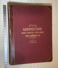
1910028278Philadelphia Pennsylvania: A. H. Muller Publisher 1910. Condition of the binding is Good but for rubbing at the corners and outer hinges cracked. SEE PHOTOS. Inner hinges are PERFECT having been reinforced by the publisher/bookbinder with sturdy maroon cloth. Housed in a Fine custom-made maroon cloth-covered clamshell case. SEE 2 PHOTOS its outside and both inner halves when opened. Condition of all maps is NEAR FINE - FINE. Pages are clean and unmarked. NO tears or foxing. SEE PHOTOS. This atlas consists of 25 i. e. 26 counting the Index map hand-colored lithographic linen-backed double page maps. The maps are color-keyed to the locations of each of the following: stone buildings brick buildings frame or half frame buildings stables or barns green houses steam railroads electric railroads water pipes sewers improved roads and fire hydrants. SEE PHOTOS. The double page maps open to an impressive 31.50" across by 22.25" tall. Each map did have a maroon leather numbered tab i. e. Index and 1-25 however the numbers for tabs 15-19 are broken/missing. SEE PHOTOS. Full title: "Atlas of Part of Morris Co. N. J. Embracing Town of Morristown The Boroughs of Madison Florham Park Chatham and Mendham: Morris Township and Parts of Chatham Hanover Mendham and Passaic Townships compiled from actual surveys official records and private plans by J. M. Lathrop and Thomas Flynn Civil engineers. Under the direct management and supervision of A. H. Muller Publisher 530 Locust Street Philadalphia PA. 1910." Collated and complete per table of contents. Includes a STREET INDEX. Bound in the original maroon cloth with maroon leather spine and corners. Gilt-stamping is still bright. SEE PHOTOS. The textblock could be easily rebacked with no re-sewing required since all pages/maps are still securely bound together. Oversize Hardcover. 17" wide by 22.50" tall. This massive extremely heavy book will require SUBSTANTIAL extra postage at our cost based on your location. LeGear ATLASES OF THE UNITED STATES L2343. Phillips A LIST OF GEOGRAPHIC ATLASES 3834. First Edition. Oversize Hardcover. Good - Fine condition/Fine clamshell case. Illus. by NOT a library discard. Atlas folio. Great Packaging Fast Shipping. A. H. Muller, Publisher Hardcover
19466825Washington DC: U.S. Department of State 1946-1947. fair. 47 maps cardboard covers 47 fold-out maps stain on fore-edge covers worn & scuffed: small tears creases ink name on front cover. Oversized volume measuring approximately 14.25" 36 cm by 20.5" 52.5 cm. This volume was an appendix to "Administrative Subdivisions of Japan " Department of State Publications 2749 Far Eastern Series 19. There is one map for each of the 47 subdivisions on Hokkaido Honshu Shikoku and Kyushu. U.S. Department of State unknown
1973018834Ottawa: National Map Collection Public Archives of Canada 1973. Very Good condition. Covers lightly rubbed. NOT a library discard. NO owner's name or bookplate. Pages are clean and unmarked. NO underlining. NO highlighting. NO margin notes. A descriptive carto-bibliography with full collations contents notes lists of maps map measurements etc. Foreword by Theodore E. Layng Keeper of Maps in French and English. Subtitle: "No. 1 in a provisional series describing the atlases in the National Map Collection by country of origin." Bound in the original dark pink wraps stamped in white. 8.5" wide by 11" tall. . First Edition. Softcover. Very Good condition. xvii 132pp. Great Packaging Fast Shipping. National Map Collection, Public Archives of Canada Paperback
1963153757London: Geographical Section General Staff 1963. Scarce charts of Bahrain and the Straits of Hormuz A rare and historically interesting pair of adjacent maps of the Arabian Gulf covering six degrees of longitude each the geographical area encompassing the whole of Qatar Bahrain and part of what was to become the United Arab Emirates Al-Hofuf being the major city in the Al-Ahsa Oasis Eastern Province Saudi Arabia; sixth and fifth editions respectively. Maps of the period issued by the GSGS Geographical Section General Staff use a 7-colour tint scale to distinguish altitude and a glossary that highlights towns of significance and other standout features which provided steady references for army personnel to aid navigation in the challenging conditions of the region. The Bander Abbas map was compiled by the US Army Map Service Corps of Engineers from a number of sources including USAF Aeronautical Approach Charts of 1951-55 and the US Geological Survey of the Arabian Peninsula 1958. The Hofuf chart is based inter alia on 512 Field Survey Royal Engineers charts 1942-4. WorldCat lists just three individual copies for Hofuf NG39 SUNY at Buffalo University of Notre Dame and Eastern Illinois University alongside four copies of Bandar Abbas NG40 University of Exeter University of Notre Dame Eastern Illinois University and University of South Florida. It should be noted that major national institutions - BL for example - will have holdings of these maps within the complete GSGS series. Most copies would be discarded on supersession making these an important record of cartographic progress in the region. Two two-colour printed maps 1:1000000 scale 690 x 610 & 750 x 610 mm respectively. Ex- libris stamp of Arizona State Library both stamped "superseded" in blank margin and "withdrawn" on verso some pencilled marginalia; both in excellent condition. unknown
1991018014London: Studio Editions 1991. Fine condition in a Near Fine dust jacket. NO chips. NO tears. Bright clean square and tight. Sharp corners. NO owner's name or bookplate. Not a remainder. Pages are crisp and unmarked. 1991 First Studio edition. For this production the most decorative plates were selected from Braun & Hogenberg's CIVITATES ORBIS TERRARUM which was first published in 6 volumes between 1572 and 1617. Sixty gorgeous full-color maps are reproduced each spread across two folio pages. Full annotations provide facts about the maps their makers and history of the various cities. Bound in the original gilt-stamped green boards. Complete with dust jacket. Oversize Hardcover. 11.25" wide by 15.25" tall 285mm x 380mm. This large heavy book will require extra postage for Priority and International shipments but only the standard charge for media mail. First Edition Thus. Oversize Hardcover. Fine condition/Near Fine dust jacket. 128pp. Great Packaging Fast Shipping. Studio Editions Hardcover
1939P278London: Alexander Duckham 1939. facsimile reprint . Hardback. Vg./No Jacket. Oblong 4to. 108 pp including 100 pp of facsimile road maps plus a general map of England and Wales Facsimile edition of the 1675 edition. Red cloth labels. Internally clean and tight. Trifle foxing to the fore-edge. A nice copy. or an Illustration of the Kingdom of England and Dominion of Wales. a. Description of the Principal Roads <br/> <br/> Alexander Duckham hardcover
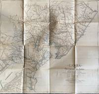
1928List1922Bahia 1928. Folded map. Fine condition. Fine. Teodoro Sampaio was an Afro-Brazilian cartographer engineer politician and historian who was very active in Brazil particularly in Bahia during the late nineteenth and early twentieth century. Offered here is Sampaio’s map of Bahia from 1928 which updates a map he produced in 1899 of the same region with updates of the settlement of the region including a detailed inset of the city of BBahio de Todos os Santos on the lower right corner. At the time of the map’s production Sampaio was an authority on Brazilian geography being a member of the Instituto Geográfico e Histórico da Bahia serving as president in 1922 and a member of the Instituto Histórico e Geográfico Brasileiro and the Instituto Geográfico e Histórico da Bahia and publishing several books on Brazilian geography. The period between 1899 when the first edition of this map was published and 1928 saw the development of rubber plantations in Bahia and the map provides detail on the region’s roads and population centers. We find no publicly held examples of this edition and one copy of the 1899 edition at Princeton though we do find a reference to this edition at the Brazilian National Archives. unknown
197240342Chicago: Rand McNally & Company 1972. Collection of 14 company Christmas cards one each for the years 1972 through 1985 plus year three undated. Near fine overall. Printed in modest quantities and intended for distribution only to top vendors suppliers and distributors this delightful collection ranges in size from narrow 4to to wide 8vo some bigger and some smaller. All are handsomely and colorfully printed on fine heavy stock. Most are at least three panels and many are more and all open up to reveal superb reproductions of famed antiquarian maps from around the world. Some open up to small poster size and two contain separate folded maps that open to full poster size. Several have been signed by various company executives. Most unusual and attractive -- a collection that would be near-impossible to duplicate. Rand McNally & Company unknown
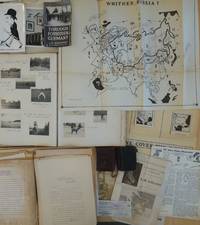
1950List2425Europe and California 1950. Includes two small diaries from 1901 and 1917 with sporadic entries a large photo album measuring 14 x 11 with appx. 400 small photographs from 1906-1909 attached to album pages most measuring 3 x 2 as well as a few larger format images laid in. With 100 plus pages of typed pages including retained correspondence story ideas and various other manuscripts. With eleven maps produced for his “Of Men and Maps†series including five copies of a large map entitled “Whither Russia†in varied states and in large sizes up to 30 by 36 inches and a handful of small ephemeral pieces. Generally near fine condition with the exception of the album which is missing its rear board and has some pages loose and torn. Very Good. J.M. de Beaufort a war correspondent for the London Daily Telegraph and New York American during World War I recounted his wartime adventures in the 1917 book "Behind the German Veil: A Record of a Journalistic War Pilgrimage." Originally arriving in Chicago in 1909 he married a steel magnate's daughter and pursued a career in show business. However by 1912 he had gone through a divorce and transitioned to newspaper work earning the moniker of the "Dude Reporter." Originally born in the Netherlands as Jacques Albert Uilenbroek he was thought to be a deserter. He spent the latter part of his life in the United States apparently jailed in San Francisco for a stint in the 1920s and eventually settled in Los Angeles. <br /> Offered here is an interesting smattering of material from the life of the mysterious De Beaufort which bookends his most unusual career and life with a large visual photographic record of his life in Europe as a young man and over a hundred pages of manuscript material from late in his life with a highlight being several maps in draft form for an apparently unpublished project called “Of Men and Maps.†As a group the material shows the work of an ex-con artist and war correspondent trying to regain his form while living in Los Angeles. He was still writing as a “Special Correspondent†at this point though the title seems to have been fully honorary. Also included are two small pocket journals with sporadic notations from his life in Europe in 1900 and in 1917. In its entirety the group gives an interesting visual and manuscript record of a literary fraudulent and imaginative transatlantic life and intellect. <br /> The cartographic highlight of the group is several iterations of a large map called “Whither Russia†in varied forms which show an interesting interpretation of the sphere of influence of the USSR and its growth from 1939 to 1946. Also included are two drafts of a map of Operation Market-Garden in the Netherlands in 1944 an unidentifed tactical map of a military battlefield a map called “Middle East Jackpot†showing the division of territory between the Allied and Axis powers a map called “Dawn’s Early Light some reproduced small format maps from the De Beaufort’s and a small map called “Gifts from Yalta.†De Beaufort was working on these maps for a column called “Of Men Maps and Memories†that was published in the East Los Angeles Tribune. He also sent the columns out in newsletter form from his address at 1635 N. Ogden Drive in Los Angeles. <br /> The collection of manuscripts drafts and retained correspondence tackle a range of subjects perhaps most interestingly those detailing De Beaufort’s creative process - drafts of stories lists of ideas for stories and letters. His over the top style is on display in a lot of the writings some of which are of unknown origin and purpose. The documents contain correspondence between De Beaufort and Edwin Pauley the oil man and presidential advisor. In one untitled essay he asks himself the question “What has been your most thrilling experience†and his reply is “ Silly questions. Who or at least what newspaperman of some 25 turbulent years standing - and falling - could answer such a question. A reporter’s life has a thousand thrills. There was that rainy day in Marcy 1915 in the fortress of Loetzen when I stood face to face with Hindenburg. Hm yes that was quite a thrill…†De Beaufort was entrenched in the Los Angeles journalistic scene at this point and the documents show the degree to which he relied on his former glories to attempt various career revitalizations endeavors. <br /> The album of photographs from 1906-1909 over 400 in total give a visual record of the young Uilenbroek’s life in Europe. The star of the collection is his bulldog Bob who travels throughout Europe with him and eventually comes to America by 1907. Mary who we presume to be his future wife is featured heavily in the images. It is unclear whether he was working at this point the images show affluent young people and their dog in varied cities and are purely of a personal nature. Other photographs laid in are relics from his war correspondent period. The loose photographs and ephemera are a mix of portraits from different periods from his life including two pictures of Sydney Turing Barlow Lawson one signed by his widow. The journals are sporadically filled and hard to decipher though one legible passage says “drinking all day.â€<br /> Overall the group gives evidence of this intriguing life and is the only extant group of material relating to Beaufort to our knowledge with the exception of a single journal from his time in Belgium during WWI that was sold at Bonhams and is still available in the trade as of this writing. unknown
1920Map889London: Geographia Ltd 1920. 1st Edition . paperback. Fine. Folding map. FOLDING MAP: Lithographic colour map MOUNTED ON LINEN c1920 measuring 1460x950 mm 37.5 x 57.25 inches. A fine copy of a scarce map. Green board covers gilt spine worn but complete. A very attractive map of the world and British Empire just after the first world war. <br/> <br/> Geographia Ltd paperback
1980017928London: Holland Press 1980. Brand New in perfect condition. NO rubbing. NO fading. Bright clean square and tight. Sharp corners. NO owner's name or bookplate. NO remainder mark. Fresh and crisp -- obviously never read. Revised Edition. 1980. 88 plates. In 1973 a preliminary version of this work appeared in 5 issues of the periodical MAP COLLECTORS' CIRCLE. For this 1980 revision an index has been added as well as 97 new or corrected entries. Described and commented on are over 700 maps of the period. A final chronological listing identifies the cartographer date of publication and gives an estimate of rarity for each map's principal edition or first state. Volume #5 in The Holland Press Cartographica series. Bound in the original gilt-stamped dark green boards. 7.5" wide by 10" tall. 1980 Revised Edition. Hardcover. New/No jacket. xxv 188pp. Great Packaging Fast Shipping. Holland Press Hardcover