Brod, Walter MAntiquariat.de

574 résultats
196441671ABWürzburg, Deutsche Gesellschaft für Geschichte der Medizin, Naturwissenschaft und Technik / [Volkach, Karl Hart (Druck)], 1964. 8° (21x15), 22 S., mit 1 TextAbb., 2 Tafeln, Kartentasche mit mehrfach gefalteter Karte, ill OKart (Brosch), fest sauber und gepflegt,
19971247024(Norwich), Terra Nova Press, (1997). 4to. 37, (1) S., 408 S. m. zahlr., teils farbigen Abb., 1 Bl. OLwd m. OUmschlag (Umschlag minimal gebrauchsspurig).
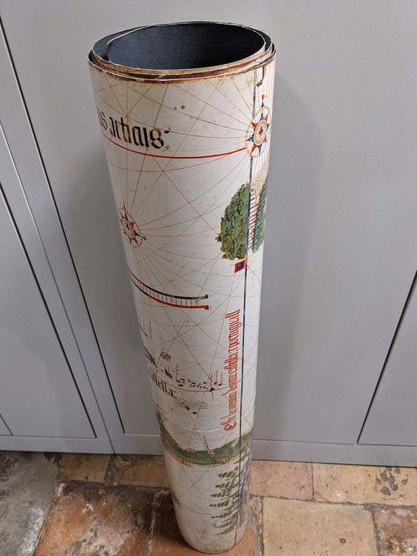
19941002CGModena, Biblioteca Estense, 1994. 103 x 220 cm. 2 Kommentarbändchen in Schuber.
19941002CGModena, Biblioteca Estense, 1994. 103 x 220 cm. 2 Kommentarbändchen in Schuber. + Wichtig: Für unsere Kunden in der EU erfolgt der Versand alle 14 Tage verzollt ab Deutschland / Postbank-Konto in Deutschland vorhanden +, A
198424561New York New York: Photo By Bill Ray 1984. Black and white photograph 8" x 10" on heavy photographic paper; on back is handwritten "For my old and valued friend Bob Greene" and with Harrison's name and the date of April 1984 at the lower border; with the studio stamp of Photo by Bill Ray 350 Central Park West New York. with A group of copy-pages of drawings from the New Yorker by Harrison and presented "for Bob Greene Richard Edes Harrison on his 66th Birthday" with the black and white illustrated memorial service pamphlet for R. E. Harrison 1901 - 1994 Cartographer-Artisan-Birder-Raconteur on the 93rd Anniversary of his Birth March 11 1994. in good condition. Robert S. Greene 1922 - 2013 American writer jazz musician documentarian and historian friend of the artist who innovated U.S. cartography in the 20th century. see Timothy Barney "Richard Edes Harrision and the Cartographic Perspective of Modern Internationalism" U. of Richmond 2012 for his more on his contributions to cartography. Photograph. Soft Cover. Very Good. Photo By Bill Ray Paperback books
19984973<p>The Nautical & Aviation Publishing Company of America 1998. 6110 pages. New Hardcover New DJ. 10.1"x7.0". be5</p> The Nautical & Aviation Publishing Company of America hardcover
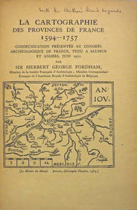
190827846Various places.: Various publishers 1908 to 1923. 10 volumes bound together in one volume. First Editions and all but one are inscribed by the author. Illustrated with cartographic cover art re-impressions of important works cartographic decorations and a number of maps including a number that are folding. 8vo the original printed wraps to each pamphlet are present and all are bound into the one cloth covered volume brown morocco label gilt. Each pamphlet can be considered fine and in exemplary condition some evidence of use and a bit of age to the cloth covers. A fine collection. A FINE COLLECTION OF INSCRIBED FIRST EDITIONS. Ranging from the cartography of the provinces of France 1594 to British and Irish Itineraries and Road-Books English Counties Welsh a pamphlet on the Evolution of the Maps of the Bristish Isles on the great engraver and mapmaker John Cary and two on France cartography and routes from the mid-1500's until the middle of the 19th century. ALL BOOKS ARE INSCRIBED BY THE AUTHOR. Various publishers paperback
1978021557La Crosse Wisconsin: Sumac Press 1978. NEW in a NEW dust jacket. The jacket is protected by a removable Brodart clear-plastic sleeve. Sharp corners. First Edition Limited to 300 copies. Includes a hand-mounted genuine 13 cent Ben Franklin The Theatre of War USA bicenntenial stamp from 1976. Illustrated with numerous facsimiles of stamps showing maps. Tells their stories. Published by Emerson Wulling at the Sumac Press. Bound in the original red cloth stamped in bright gold. Complete with errata page and dust jacket. First Edition 1/300 copies. Hardcover. New/New. 8vo. 67pp. Great Packaging Fast Shipping. Sumac Press Hardcover
197660413Tucson: Southwestern Mission Research Center 1976. 50p. 8.5x11 inches illustrations photos maps reading guide very good later revised printing booklet in stapled pictorial wraps. Southwestern Mission Research Center unknown books
1942WOC-1675Dessin de A. Boekholt, P. Joubert et D. Ragonneau. Hors-texte gravés par l'Institut National de Géographie. 2 ème édition revue. Cahors, A. Coueslant, «Éclaireurs Unionistes de France», 1942. In-8 (21,7x14cm) broché, couverture illustré d'un paysage. 83pp.
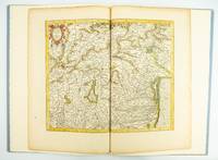
1985ST20505-12Fullerton California: Stone & Lorson 1985. ONE OF 89 COPIES in quarter vellum of a total edition of 115. 490 x 325 mm. 19 1/4 x 13". viii 23 1 pp. 1 leaf. <br/> Publisher's quarter vellum over gray paper boards covers with device in gilt smooth spine lettered in gilt. In just slightly chafed black buckram slipcase. WITH A MAP FROM THE ORIGINAL 1619 ATLAS bound in with period hand coloring. Map 293 "Tarvisina Marchia Et Tirolis Comitatus". De Hamel & Silver "Disbound and Dispersed" 186. One corner a bit bumped otherwise the main volume flawless; the map edges a bit browned and just slightly frayed a few light spots but still excellent with good color and strong general appeal.<br/> <br/> This attractive oversized production includes an original map of an important region of northeastern Italy taken from the 1619 edition of the Mercator-Hondius atlas. A pioneer in commercial cartography and a founder of the Netherlandish school of cartography and geography Mercator 1512-94 produced maps used around the world that were informed by his brilliant "Mercator Projection" which allowed the round Earth to be accurately depicted on a flat map. Near the end of his life he began work on an ambitious cosmography that would contain an account of the creation of the world a description of the universe descriptions of the countries and oceans of the world genealogies and political histories of the several countries and a chronology of the cosmos. Only the account of creation the chronology and maps of the known regions of the world came to fruition. Mercator having died before the work came to press it was completed by his heirs and published in 1595 with 107 maps. Leading Amsterdam map publisher Jodocus Hondius 1563-1612 acquired the plates in 1604 and issued the first Mercator-Hondius "Atlas" in 1606 with 37 maps he had engraved added to the original 107. Teacher and Hondius' brother-in-law Pieter van den Berg wrote the introduction and the descriptive text that appears on the versos of the maps. A 1611 edition increased the number of maps to 150 and another six were added in 1619. The hand-colored map included in our copy depicts the South Tyrol and Veneto regions including Lake Garda Verona Padua and Venice. It is accompanied with an essay by Norman J. W. Thrower 1919-2020 UCLA geography professor and cartographer describing the historical background of the atlas. Joel Silver in "Disbound and Dispersed" tells us that "the physical production of this leaf book is superb from the design by Vance Gerry to the presswork of Patrick Reagh.". Stone & Lorson unknown
1958018590Washington D. C.: Library of Congress 1958. 1958. First Edition. Volume 5. Very Good condition. Clean square and tight. Hinges are perfect. Previous owner's small armorial bookplate on the pastedown endpaper. All other pages are crisp and unmarked. NO underlining. NO highlighting. NO margin notes. Preface. Author List. List of Geographical Atlases Titles 5325-7623. Comprehensive Index pp. 487-666. Subtitle: "With Bibliographical Notes A Continuation of Four Volumes by Philip Lee Phillips." Bound in the original blue cloth stamped in bright gold over a maroon panel on the spine. 7" wide by 10" tall by 1.75" thick. First Edition. Hardcover. Very Good condition/No jacket as issued. xlvii 666pp. Great Packaging Fast Shipping. Library of Congress Hardcover
1974019878Washington D. C.: Library of Congress / U. S. Government Printing Office 1974. Very Good EX-LIBRARY. Hinges are perfect. Pages are clean and crisp. NO underlining. NO highlighting. NO margin notes. 1974. First Edition. Volume 8 comprising the Index to Volume 7 titles 10255-18435. From the preface: "Indexed in this volume are areas subjects map authors engravers lithographers publishers etc. and atlas titles with distinctive words." Subtitle: "A Continuation of Four Volumes by Philip Lee Phillips." Bound in the original blue cloth gilt-stamped over a red spine panel. This First Edition measures 7" wide by 10" tall which is a larger format than the 1996 Martino reprint. BIBLIOGRAPHICAL NOTE: Volume 8's ISBN listed here was mistakenly duplicated for Volume 9 The Comprehensive Author List when it was published in 1992. First Edition. Hardcover. Very Good EX-LIBRARY/No jacket as issued. v 190pp. Great Packaging Fast Shipping. Library of Congress / U. S. Government Printing Office Hardcover
1901025183Washington: Government Printing Office 1901. SEE PHOTOS. A handsome example of the 1901 first edition in quite scarce original leather binding with 3 titles bound together as sometimes seen -- NOT print on demand edition or modern reprint. Very Good condition. NOT a library discard. NO owner's name or bookplate. Hinges are perfect. Minor offset as usual from the leather binding to edges of the endpapers. Front free endpaper has light soil and 4 small edge chips. Pages are otherwise clean and unmarked. NO foxing. 1901. First Edition. 1137pp. Bound in the original full leather calf binding we say "original" because we have seen other first editions in an identical leather binding including its 3 attractive leather spine labels -- in red black and brown -- although none of them were in condition as nice as this one. Leather is only moderately rubbed. SEE PHOTOS. All gilt stamping is still bright and shiny. This is House of Representatives Document No. 516 1901. Also bound in are: A LIST OF BOOKS WITH REFERENCES TO PERIODICALS ON PORTO RICO by A. P. C. Griffin. Senate Document No. 222. 55pp. 1901.; and A LIST OF BOOKS WITH REFERENCES TO PERIODICALS ON THE DANISH WEST INDIES by A. P. C. Griffin. Senate Document No. 223. 18 pp. 1901. Oversize Hardcover. 7.25" wide by 10.25" tall by 3" thick. This large heavy book will require extra postage for Priority and International shipments but only the standard charge for media mail. Sheehy 1986 CL287: "Lists maps to be found in books and atlases as well as those separately issued. Describes many old state and country maps and city plans.". First Edition. Oversize Hardcover. Very Good condition. Illus. by NOT a library discard. 1137pp. 55pp. 18pp. Great Packaging Fast Shipping. Government Printing Office Hardcover
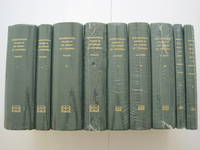
1995018557Staten Island New York: Maurizio Martino Publisher 1995. SEE PHOTO. 9 volumes complete. BRAND NEW HARDCOVERS in perfect condition. STILL SEALED in the publisher's clear plastic SHRINKWRAP. NO rubbing. NO fading. Bright clean square and tight. Sharp corners. NO owner's name or bookplate. NOT a remainder. Fresh and crisp -- obviously never read. The standard reference complete in 9 volumes. Vols. 1-4 by Philip Lee Phillips. No date but 1995 First Martino printing "strictly limited to 100". Reprint of the 1909-1920 Library of Congress originals. Vols 5-9 by Clara Egli Le Gear. No date but 1996 First Martino printing "strictly limited to 150". Reprint of the 1958-1992 Library of Congress originals in continuation of volumes 1-4 by Philip Lee Phillips. These 9 volumes fully describe thousands of atlases including imprint collation details of publication measurements content typographical and numbering errors comparisons with foreign and later editions reference citations reviews etc. There are also useful biographical sketches of explorers mapmakers engravers and lithographers. For most atlases before 1870 complete tables of contents are listed. Volume 9 is the comprehensive author index to both Phillips and LeGear with listings for 18435 atlases. The nine volumes are uniformly bound in the original gilt-stamped green cloth. SEE PHOTO. Sheehy CL286: "An important catalog of an outstanding collection." Hodgkiss/Tatham KEYGUIDE 11: "The most comprehensive work on historical atlases." This heavy 9 volume set will require extra postage for Priority and International shipments. But for media mail you pay only our standard charge for 1 volume and we ship the other 8 volumes at no extra cost. First Martino printing. Hardcover. New/in publisher's shrinkwrap. Illus. by We ship all 9 volumes for cost of 1. 9 volumes complete. Great Packaging Fast Shipping. Maurizio Martino Publisher Hardcover
1995018560Staten Island New York: Maurizio Martino Publisher 1995. 9 volumes complete. BRAND NEW HARDCOVER in perfect condition just removed from the publisher's shrinkwrap so we could write this description. NO rubbing. NO fading. Bright clean square and tight. Sharp corners. NO owner's name or bookplate. NOT a remainder. Fresh and crisp -- obviously never read. The standard reference complete in 9 volumes. Vols. 1-4 by Philip Lee Phillips. No date but 1995 First Martino printing "strictly limited to 100". Reprint of the 1909-1920 Library of Congress originals. Vols 5-9 by Clara Egli Le Gear. No date but 1996 First Martino printing "strictly limited to 150". Reprint of the 1958-1992 Library of Congress originals in continuation of volumes 1-4 by Philip Lee Phillips. These 9 volumes fully describe thousands of atlases including imprint collation details of publication measurements content typographical and numbering errors comparisons with foreign and later editions reference citations reviews etc. There are also useful biographical sketches of explorers mapmakers engravers and lithographers. For most atlases before 1870 complete tables of contents are listed. Volume 9 is the comprehensive author index to both Phillips and LeGear with listings for 18435 atlases. The nine volumes are uniformly bound in the original gilt-stamped green cloth. Sheehy CL286: "An important catalog of an outstanding collection." Hodgkiss/Tatham KEYGUIDE 11: "The most comprehensive work on historical atlases." This heavy 9 volume set will require extra postage for Priority and International shipments. But for media mail you pay only our standard charge for 1 volume and we ship the other 8 volumes at no extra cost. . First Martino printing. Hardcover. New/No jackets as issued. Illus. by We ship all 9 volumes for cost of 1. 9 volumes complete. Great Packaging Fast Shipping. Maurizio Martino Publisher Hardcover
1995018575Staten Island New York: Maurizio Martino Publisher 1995. Volumes 1-4. BRAND NEW HARDCOVERS. Three of the four volumes are STILL SEALED in the publisher's clear plastic SHRINKWRAP. Volume 1 has a small spot on its rear cover. Volume 2 has a mild bump at the head of its spine NO pages are affected. Bright clean square and tight. Sharp corners. NO owner's name or bookplate. NOT a remainder. Fresh and crisp -- obviously never read. The standard reference. No date but 1995 First Martino printing "strictly limited to 100". Reprint of the 1909-1920 Library of Congress originals. The four volumes are uniformly bound in the original gilt-stamped green cloth. Sheehy CL286: "An important catalog of an outstanding collection." Hodgkiss/Tatham KEYGUIDE 11: "The most comprehensive work on historical atlases." This heavy 4 volume set will require extra postage for Priority and International shipments. But for media mail you pay only our standard charge for 1 volume and we ship the other 3 volumes at no extra cost. First Martino printing. Hardcover. New/in publisher's shrinkwrap. Illus. by We ship all 4 volumes for cost of 1. 4 volumes. Great Packaging Fast Shipping. Maurizio Martino Publisher Hardcover
1995018565Staten Island New York: Maurizio Martino Publisher 1995. Volumes 1-4. BRAND NEW HARDCOVERS in perfect condition. STILL SEALED in the publisher's clear plastic SHRINKWRAP. NO rubbing. NO fading. Bright clean square and tight. Sharp corners. NO owner's name or bookplate. NOT a remainder. Fresh and crisp -- obviously never read. The standard reference. No date but 1995 First Martino printing "strictly limited to 100". Reprint of the 1909-1920 Library of Congress originals. The four volumes are uniformly bound in the original gilt-stamped green cloth. Sheehy CL286: "An important catalog of an outstanding collection." Hodgkiss/Tatham KEYGUIDE 11: "The most comprehensive work on historical atlases." This heavy 4 volume set will require extra postage for Priority and International shipments. But for media mail you pay only our standard charge for 1 volume and we ship the other 3 volumes at no extra cost. First Martino printing. Hardcover. New/in publisher's shrinkwrap. Illus. by We ship all 4 volumes for cost of 1. 4 volumes. Great Packaging Fast Shipping. Maurizio Martino Publisher Hardcover
19711247911Amsterdam, Theatrum Orbis Terrarum, 1971. 13, 1659 S. u. 1 Bl., 137, 1030; 163, 639 S. OLwdbd (Kanten u. Gelenke teils stärker bestoßen, erste u. letzte Blätter etwas knickfaltig).
1962021562Iowa City: The Prairie Press 1962. A beautiful copy. Fine condition in a Fine dust jacket. The jacket is protected by a removable Brodart clear-plastic sleeve. NOT price clipped $4.00. NO rubbing. NO fading. NO chips. NO tears. NO creases. NO owner's name or bookplate. Sharp corners. First Edition Limited to 550 copies. Frontispiece features a hand-mounted genuine 3 cent stamp from 1955 showing a diagram of Fort Ticonderoga. Illustrated with numerous facsimiles of stamps showing maps or plans. Tells their stories. Printed by Carroll Coleman at The Prairie Press in Iowa City Iowa. Bound in the original blue patterned paper-covered boards with a black cloth spine and printed paper spine label. Complete with dust jacket. First Edition 1/550 copies. Hardcover. Fine condition/Fine dust jacket. 83pp. Great Packaging Fast Shipping. The Prairie Press Hardcover
1998B55774Turnhout, Brepols 1998 208pp.richement ill.en couleurs et en bl/n, 28cm., bel état
196853265BBLeipzig, Edition Leipzig, 1968. 2°. 53 cm. 77 Doppelblatt. Original-Leinenband und 61-seitiges kartoniertes Begleitheft.
1985B119087Bruxelles, Crédit Communal de Belgique 1985-1991 La partie "Comté d'Artois" complet en 7 volumes, reliures cart. d'éditeur, jaquettes illustrées, 34cm., bel état, poids: 17.3 kg., [CONTENU: Tome I: Généralités, abbayes et villes (287pp., avec 122 planches en couleurs), II-III: Gouvernance d'Arras, première et deuxième partie (216 + 214pp., avec 180 pl.), IV-V: Comté de Saint-Pol, première & deuxième partie (253 + 251pp., avec 210 pl.), VI: Bailliages de Béthune et de Lens (279pp., avec 110 pl.), VII: Bailliages d'Aire, Bapaume, Béthune, Hesdin, Lens, Lillers et Saint-Omer, villes fortes (360pp., avec 134 planches], B119087
1996B119086Bruxelles, Crédit Communal de Belgique 1996 461pp., avec de nombreuses illustrations en couleurs, reliure cart. d'éditeur, jaquette illustrée (dos décolorié), 34cm., texte et intérieur sont frais et en très bon état, poids: 4.7kg., B119086