93 résultats
1991022980Chapel Hill: University of North Carolina Press 1991. BRAND NEW in a BRAND NEW dust jacket. Perfect condition. Still sealed in the publisher's clear plastic shrink wrap. NO chips. NO tears. NO creases. NO rubbing. NO fading. Sharp corners. Bright and shiny. Fresh crisp clean and unmarked. 1991. First Printing of the First Edition with complete number row 54321 on the copyright page. Illustrated with more than 100 maps bird's-eye views engravings etchings collotypes aquatints mezzotints steel engravings wood engravings and lithographs. Most are in full color. Includes notes on the artists printers publishers and history of the city. Views are accompanied by 97 excerpts from contemporary published works of visitors and residents e. g. Charles Dickens Frederick Marryat Harriet Martineau Benjamin Perley Poore Anthony Trollope Francis Trollope Mark Twain Walt Whitman. Bound in the original light gray cloth stamped in bright gold over a black panel on the spine. Complete with pristine dust jacket. Oversize Hardcover. Oblong. 15" wide by 11.5" tall. This VERY large VERY heavy book will require SUBSTANTIAL extra postage for Priority and International shipments but only the standard charge for media mail. . First Printing of the First Edition. Oversize Hardcover. New/New in publisher's shrinkwrap. xiv 297pp. Great Packaging Fast Shipping. University of North Carolina Press Hardcover
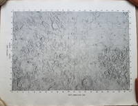
19693792<p>A very uncommon map of the Sea of Tranquility area that would be the site of the first moon landing in 1969. According to a description of a related larger-scale map in a 2020 Bonham's auction "NASA mission planners created this internal Manned Spacecraft Center chart a few months before the flight in 1969."</p><p>The map encompasses the area from 14 degrees South to 14 degrees North Latitude and from 0 degrees to 42 degrees East Longitude. The coordinates of the Eagle's landing site were 0.675 degrees Latitude North and 23.47 degrees Longitude East – very near the center of the mapped area.</p><p>The map is numbered "MSC – 6238 – 69" in the lower right margin. As it was meant for internal use only the map appears to be significantly less common than the LAC Lunar Chart series and the USGS geologic chart series. We were unable to locate an online reference to the map on the Lunar and Planetary Institute website.</p><p><strong>Condition: </strong>Rolled never folded. Some crinkling in the lower margin. Tear at extreme lower right corner with map number has been closed with archival tape on the reverse. Good.</p><p>ICN 7706.1.</p> NASA Manned Spacecraft Center
193560001New York: John Day Reynal & Hitchcock 1935. 4to. xiv 351 1 pp. With 56 maps most full-page numerous text illustrations. Blue publisher’s cloth silver lettering front cover & spine minor shelfwear light rubbing at head & foot of spine corners w/ d.j. striking Art Deco cover art of ships voyaging minor creasing edgewear couple closed tears on back cover wear to corners still NF/VG- copy inscribed by author on half-title. First edition inscribed of this unashamedly Eurocentric voyages and exploration history detailing “all the great adventurers by land and sea from Hannu 2750 B.C. to Piccard 1935.†The specially prepared maps specifically show the ground and oceans covered by each explorer with the contemporary “Known World†starkly defined. The maps and histories sequentially “unroll†from the very small area around the Mediterranean to the World. Outhwaite 1892-1979 was an anthropologist who worked on American race relations at the Laura Spelman Rockefeller Memorial from 1923-1028 worked for the Rockefeller Foundation through the 1930’s and organized “Outhwaite Exhibits†for museums World’s Fairs and window displays. He also was an adventurer who sailed 14000 miles on the Atlantic Ocean from 1929-1930 onboard the yacht “Kinkajou†visiting Mt. Pelee Martinique. John Day, Reynal & Hitchcock, hardcover
1997017766Mansfield Centre Connecticut: Martino Fine Books 1997. Brand New in perfect condition. 2 vols in 1. STILL SEALED in the publisher's clear plastic SHRINKWRAP. NO rubbing. NO fading. Bright clean square and tight. Sharp corners. NO owner's name or bookplate. NOT a remainder. Fresh and crisp -- obviously never read. n. d. but 1997. HARDCOVER reprint limited to 150 copies of the 1950 and 1953 Library of Congress originals. 2 volumes bound as 1 with a total of 767 pages. Because this edition is bound in sturdy cloth it is much better suited to heavy use than the paper bindings of the original editions. A welcome reprint of an important and scarce reference. Described here are 6696 atlases. Entries are first arranged geographically and by subject national; state; and within the various states by county/parish city and region; special subject atlases include agriculture aviation canals climate coal geology history languages railroads etc. Then the atlases are re-listed by author/publisher in the index. A typical entry includes the atlas title; cartographer; publisher; city and date of first publication; dimensions in centimeters; number of pages plates and maps; the number that are colored etc. Occasional notes on contents. In the second part copies of the atlases held by some 180 libraries are located. Hodgkiss/Tatham KEYGUIDE TO INFORMATION SOURCES IN CARTOGRAPHY: "An indispensable reference for students of American history or of the development of American cartography." Bound in the original gilt-stamped blue cloth. Besterman 6267. Sheehy CL288. KEYGUIDE 94. 1997 reprint of 1950/53 originals. Hardcover. New/in publisher's shrinkwrap. 2 vols in 1: viii445pp. xiii301pp. 767 total. Great Packaging Fast Shipping. Martino Fine Books Hardcover
1953003010New York: American Society of Civil Engineers 1953. Fine condition. Bright clean square and tight. Sharp corners. Gilt on cover is still bright and shiny. No owner's name or bookplate. Pages are fresh and crisp. No underlining. No highlighting. No margin notes. Illustrations throughout. Author Index. Subject Index. Includes: A HUNDRED YEARS OF AMERICAN CIVIL ENGINEERING 1852-1952 by J. K. Finch pp. 28-96; AN ENGINEERING CENTURY IN CALIFORNIA by Walter L. Huber pp. 97-111; SURVEYING AND MAPPING IN CANADA 1852-1952 by F. H. Peters pp. 857- 871; WATERWAY GROWTH IN THE UNITED STATES by William L. Hartley pp. 976-1041; HISTORY AND FUTURE OF FLOOD CONTROL by George R. Schneider pp. 1042- 1099; etc. There are also papers on Civil Engineering - History and Practice; Engineering Education; City Planning; Construction; Irrigation; Power Sanitary Engineering; Soil Mechanics; Structural; Surveying; Transportation; Waterways; Allied Interests Metals in the Economy; Synergism between Engineering and Petroleum; Iron and Steel Production 1851-1951. Bound in the original black cloth. . First Edition. Hardcover. Fine condition/No dust jacket. 8vo. xii 1330pp. American Society of Civil Engineers Hardcover
1964P266Amsterdam: Meridian Publishing Company 1964. facimile reprint . Hardback. Fine/V G Chipped. small folio. 192pp including 19 double page maps in black and white and an introduction by R.A. Skelton. A facsimile edition of the first atlas entirely devoted separately to the Americas. Originally published in 1597. A series of atlases in Facsimile. First series volume V. Original d.j. now proected by a clear mylar wrapper <br/> <br/> Meridian Publishing Company hardcover
195282192Minneapolis:: Printed for the Author by the Voyageur Press 1952. First edition; one of Sixty Copies Printed. Two looseleaf albums . Generally fine. 8vo. A comprehensive album for collecting postage stamps featuring maps from around the world with spaces to affix specimens and information about each stamp. In this example there are approximately 150 affixed stamps and 133 blank spaces for stamps. Printed for the Author by the Voyageur Press, unknown
1959031767New York: Frederick A. Praeger 1959. Two volumes complete with original slipcase published in 1959 at $47.50. Both volumes are first printings of the first edition with "First published. in 1959" so stated on the copyright pages and no indication of any other printings. Volume I: 1689-1900 Volume II: 1900-1953." Both books are in Fine condition and appear seldom if ever read. They are square and tight with sharp corners. NO owner's name or bookplate. NOT a library discard. NO dust jackets as issued. The original slipcase is in only Good condition entirely intact with minor soil and several edge cracks that have been securely and neatly glue reinforced. PHOTOS UPON REQUEST. With an introductory letter by Dwight D. Eisenhower. Pages are crisp clean and unmarked. There are approximately 600 total pages nearly half consisting of mostly full page maps printed in multiple colors. The maps cover the battles of American Colonial wars Revolutionary war War of 1812 Mexican war American civil war Spanish American war WW1 WW2 and Korean war. The two volumes are uniformly bound in the original gilt-stamped black cloth with oatmeal cloth spines with gilt-stamping over black spine panels. Oversize Oblong Hardcover. Altogether the measurements are 14.5" wide by 11" tall by 3" thick This large very heavy set will require SUBSTANTIAL extra postage for International shipments but only the standard one book charge for priority or media mail. We ship 2 volumes for cost of 1 via priority or media mail. First printings of the first edition. Oversize Hardcover. Fine condition/Good original slipcase. Illus. by NOT a library discard. 2 vols: irregular pagination but about 600 pages. Great Packaging Fast Shipping. Frederick A. Praeger Hardcover
1961020975New York: The Bibliographical Society of America 1961. Fine condition. The spine is square and flat with NO creases. NO owner's name or bookplate. NOT a library discard. Pages are clean and unmarked. NO foxing. THE PAPERS OF THE BIBLIOGRAPHICAL SOCIETY OF AMERICA Volume Fifty-Five Vol. 55 LV Fourth 4th Quarter 1961. 1300 copies printed. Contains: A STONE THROWN AT THE MAP MAKER by Kenneth Nebenzahl; plus contributions by G. Thomas Tanselle; George N. Belknap; etc. Includes the title-page laid-in and index bound-in for the whole of Volume 55. Composed and printed by the Anthoensen Press Portland Maine. Bound in the original wraps. 6.25" wide by 9.5" tall. First Edition. Softcover. Fine condition. xiv pp. 283-426. Great Packaging Fast Shipping. The Bibliographical Society of America Paperback
1951020965New York: The Bibliographical Society of America 1951. Very Good condition. The spine is square and flat with NO creases. NO owner's name or bookplate. NOT a library discard. Pages are clean and unmarked. NO foxing. THE PAPERS OF THE BIBLIOGRAPHICAL SOCIETY OF AMERICA Volume Forty-Five Vol. 45 XLV Third 3rd Quarter 1951. 1300 copies printed. Contains: THE RUYSCH MAP OF THE WORLD 1507-1508 by Bradford F. Swan; EARLY WEST VIRGINIA IMPRINTS by Boyd B. Stutler; a contribution by Lawrence C. Wroth; etc. Composed and printed by the Anthoensen Press Portland Maine. Bound in the original wraps. 6.25" wide by 9.5" tall. First Edition. Softcover. Very Good condition. iv pp. 191-272. Great Packaging Fast Shipping. The Bibliographical Society of America Paperback
1997018214Staten Island New York: Maurizio Martino 1997. BRAND NEW in perfect condition. NO rubbing. NO fading. Bright clean square and tight. Sharp corners. NO owner's name or bookplate. NOT a remainder. Fresh and crisp -- obviously never read. No date but 1997 First Martino printing "strictly limited to 300 copies". This is a facsimile edition with significant additions of Neal Harlow's work that was first published by the Book Club of California in 1950. To this edition Harlow has added a new preamble as well as expert descriptions historical notes and full page reproductions of two new maps that came to light after the 1950 edition was published. Also added here is a new introduction with useful historical and biographical details by Alfred Newman President of California Maps Society. Illustrated with 41 full page maps several that spread over two pages or foldout. Reproduced are 31 maps of the Bay and 10 maps of the Town of San Francisco from 1769-1847. Bound in the original gilt-stamped red cloth. Oversize Hardcover. 9" wide by 12.25" tall. This large heavy book will require extra postage for Priority and International shipments but only the standard charge for media mail. Reprint with additions; Limited 300 . Oversize Hardcover. New/No jacket as issued. xviii 144pp. 41 maps 203 total pages. Great Packaging Fast Shipping. Maurizio Martino Hardcover
1995018317Storrs-Mansfield Connecticut: Maurizio Martino Publisher 1995. 1995 Enlarged edition. BRAND NEW in perfect condition. NO rubbing. NO fading. Bright clean square and tight. Sharp corners. NO owner's name or bookplate. NOT a remainder. Fresh and crisp -- obviously never read. No date but 1995 First Martino printing "strictly limited to 350". This 1995 edition has all the content of the 1942 original plus is updated and enlarged. There is a new introduction by Gary Kurutz that places Wheat's work in historical context and offers information on the book's production and initial reception. Also new are descriptions by Warren Heckrotte of 27 Gold Rush maps or variants that Wheat missed. Another plus is the frontispiece Map of the Southern Mines 1852 which did not appear in the 1942 trade edition but only in 22 deluxe presentation copies. Including the frontispiece there are a total of 27 full-page and double-page map facsimiles. This is an attractively produced book handsomely bound in the original tan cloth stamped in bright red and black over a cream color spine label. Oversize Hardcover. 9.25" wide by 12.25" tall. This large heavy book will require SUBSTANTIAL extra postage for international shipments but only the standard charge for priority or media mail. Updated and Expanded Edition. Oversize Hardcover. New/No jacket as issued. xlii 153pp. plates 262 total pages. Great Packaging Fast Shipping. Maurizio Martino Publisher Hardcover
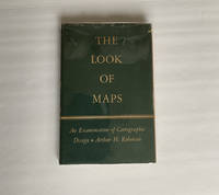
1952018855Madison: The University of Wisconsin Press 1952. SCARCE FIRST EDITION. Very Good condition in a Very Good dust jacket. SEE OUR PHOTOS. The jacket has small chips at the spine ends and corners. NOT price clipped $2.75. Protected by a removable Brodart clear-plastic sleeve. NOT a library discard. NO owner's name or bookplate. NO underlining. NO highlighting. NO margin notes. A few tiny brown speckles light foxing on the endpapers and one plate only. 1952. First Edition. A study of maps as art the importance of lettering calligraphy and type styles principles of design use of color hue intensity contrast projection etc. Figures. Tables. Bibliographical references. Bound in the original gilt-stamped green cloth. Complete with dust jacket. First Edition. Hardcover. Very Good condition/Very Good dust jacket. Illus. by NOT a library discard. 8vo. xi 105pp. Great Packaging Fast Shipping. The University of Wisconsin Press Hardcover
1964P268Amsterdam: Theatrum Orbis Terrarum Ltd 1964. facimile reprint . Hardback. Fine/Fine. Oblong 4to. xiii 60 114 118 s. : illus maps 41 fold. port. Fascimile of the first edition printed in English. Theatrum Orbis Terrarum. Series of Atlases in Facsimile. First Series Volume VI <br/> <br/> Theatrum Orbis Terrarum Ltd hardcover
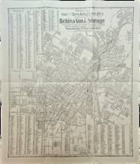
1910List3117Los Angeles California: Bekins Van & Storage 1910. Map measuring 15 ¼ x 13 ¼ inches. Folded with some wrinkling; Near Fine. A map of Los Angeles between Aldama Street South Indiana Street Slauson Ave and Arlington Street published by Bekins Van & Storage. The map is undated but based on the city’s population listed on the map—a mere 125000—it was created some time between 1900 when the population was about 103000 and 1910 when it had ballooned to over 319000. Bekins Van & Storage unknown
1991018856Spokane Washington: The Arthur H. Clark Company 1991. Brand New HARDCOVER in a Brand New dust jacket. Perfect condition. NO chips. NO tears. NO creases. NO rubbing. NO fading. Bright shiny clean square and tight. Sharp corners. NOT a library discard. NO owner's name or bookplate. NO remainder mark. Fresh and crisp - obviously never read. 1991. First Edition. A fascinating look at a geographic misconception that persisted for two centuries. Extensively illustrated with 57 historic maps. Has a 23 page bibliography of sources for additional reading. List of chapter notes. Index. Bound in the original gilt-stamped maroon cloth. From the dust jacket: "The Island of California -- this misconception flourished on and off for almost two centuries following the Spanish discovery early in the 16th century. This book traces the origin of this strange notion -- how it evolved how it kept recurring and how it was finally put to rest." Volume XIII in the Spain in the West series. First Edition. Hardcover. New/New. 8vo. 398pp. Great Packaging Fast Shipping. The Arthur H. Clark Company Hardcover
1908013882Washington D. C.: Government Printing Office GPO 1908. Very Good condition. Bound in sturdy green cloth with a gilt lettered spine. All text pages maps and plates are clean and unmarked. NO foxing. 9.5" wide by 11.5" tall. "United States Geological Survey Professional Paper 60." 84pp 170 leaves 340 pages of maps and plates mostly in full-color many double-page one fold-out. All 170 plates are printed on the rectos only right-hand side of each page with the versos being blank. There are also 34 maps and figures in the text. This volume includes well over 100 beautiful full-color maps with examples from nearly every State and Territory of the United States Geology Survey. The maps also cover topics such as glaciation coast lines volcanism faulting lakes stream piracy alluviation wind and river erosion cycles etc. This copy is from the library of geologist and author Robert B. Sosman with his small ink-stamp on the front endpaper. Keywords: Cartography. Geology. First Edition. Oversize Hardcover heavy. Very Good condition. 84pp 170 leaves 340 pages . Government Printing Office (GPO) Hardcover
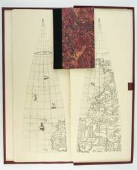
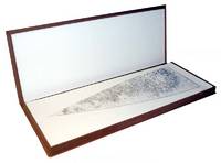
1987ST20505-11Madison Wisconsin: The Juniper Press 1987. No. 116 OF 150 COPIES. 632 x 250 mm. 25 x 9 3/4". 2p.l. 19 1 pp. <br/> Black quarter buckram over maroon marbled paper boards spine lettered in gilt. In a custom maroon buckram clamshell box. WITH 24 FACSIMILE GLOBE GORES. Signed by Woodward on the limitation page. Just a hint of use to the box booklet corners just a touch rubbed otherwise as new.<br/> <br/> This sizable attractive publication reproduces one of the largest complete sets of 16th century globe gores. Dating from around 1574 the original gores which when assembled would make a globe measuring just under 70 centimeters in diameter have been attributed to brothers Livio and Giulio Sanuto Venetian cartographers and engravers. Little is known about the gores' origin; the accompanying essay suggests they may have never made it to the final stages of publication and production possibly stopped by an outbreak of plague. This facsimile was created from the only extant set in the collection of Arthur Holzheimer 1932-2025 and was produced by his research foundation along with the Newberry Library. The gores are accompanied by a booklet by noted cartography scholar David Woodward 1942-2004 which provides background and the evidence supporting the attribution of the gores to the Sanuto brothers. The Juniper Press unknown
19871201030076Madison Wisc. : Juniper Press 1987. Hardcover. Like New. Signed. Maroon cloth portfolio clamshell case that contains 24 facsimiles sheets 24" x 9" unbound. Case is in near fine condition with very minor scuffing. Facsimiles in fine condition. Also includes descriptive booklet Cloth 8vo hardcover with marbled boards. Cover and binding are in fine condition text has clear/unmarked pages. Booklet is signed by David Woodward on its limitation leaf. - Published in a limited edition of 150 copies no. 64.This is an oversized or heavy book that requires additional postage for international delivery outside of Canada and the US. <br><br> Madison [Wisc.] : Juniper Press hardcover
198283789Baltimore: Johns Hopkins University Press 1982. First Edition. First printing. Oblong quarto 11" x 14-1/2"; cloth-backed boards hardcover in pictorial dustjacket; 128pp; illus. Mild soil to board edges else tight and clean; internally free of markings or soil; Very Good or better in the original dustwrapper. Johns Hopkins University Press unknown
198120395University of Glasgow 1981. Scale 1:63360. V.g. Folded map and cross-section sheet Two sheets the first showing a plan of the geology the second showing cross-sections at the same scale. University of Glasgow unknown
1928008291Paterson New Jersey:: The Benjamin Franklin Press 1928. 8" wide by 11" tall. A square reasonably tight copy. Inner hinges are perfect. Bound in the original blue cloth -- moderately rubbed. The front cover is stamped in black with a surveyor's tripod. Gilt lettering on the spine and front cover is still quite bright and shiny. Pages are clean and free of markings except for previous owner's ink name and a thin stain 1/4 inch by 3 inch at the edge of 7 leaves in the margin only NO text is affected. Illustrated with 28 plates -- maps portraits photographs and document facsimiles. Attractive decorative endpapers. For his inventions in the hydraulic engineering field Erskine was elected a fellow of the Royal Society. He left Britain for New Jersey in 1771 where he worked for the American Iron Company whose extensive mines were located in what is now upper Passaic County. In 1775 he organized the men in his employ and was commissioned a captain in the Bergen County militia. Soon afterward General Washington offered him the position of geographer and surveyor-general to the Continental Army. According to the DICTIONARY OF AMERICAN BIOGRAPHY "Erskine worked zealously for the colonial cause and his maps. were important factors in the ultimate victory." Reprinted here are the letters between Erskine and Washington. There is also an appendix that lists 129 of his maps. The DAB cites this book as a primary source for its article on Erskine. Contains chapters on: Erskine the Inventor; Romance of the Ringwood Mines; The Iron Master in the Making; The Hudson River Obstructions and Campaigns against the Indians; and others treating the history of the American Iron Co. New York City Bergen County militia; surveying for Washington Washington at Pompton N.J.; Washington at Morristown for the winter of 1779-1780 etc. From the intro: "Robert Erskine F.R.S. the Surveyor-General of the Continental Army and the trusted friend of the Commander-in-chief was the silent man behind the scenes who mapped out the by-ways and back-roads over the mountains and -- by his familiarity with the great 'middle-ground' between the Hudson Highlands and the Delaware -- provided Washington with that thorough knowledge of the topography of the country which enabled him repeatedly to out-maneuver the enemy.". First Edition. Hard Cover. Very Good condition./No jacket. xii 216pp. 28 plates. . The Benjamin Franklin Press Hardcover
1999017926Mansfield Centre Connecticut: Martino Publishing 1999. Brand New HARDCOVER in perfect condition. STILL SEALED in the publisher's clear plastic SHRINKWRAP. NO rubbing. NO fading. Bright clean square and tight. Sharp corners. NO owner's name or bookplate. NOT a remainder. Fresh and crisp -- obviously never read. 1999 reprint of the 1944 original. A standard work. Illustrated with 22 FOLD-OUT maps. "An excellent study of those maps from Ptolemy to 1798 important in the development of the cartography of the Pacific area with facsimiles of 22 of the 104 maps described." -- Ristow 393 in GUIDE TO THE HISTORY OF CARTOGRAPHY. Hodgkiss/Tatham 137 in KEYGUIDE TO INFORMATION SOURCES IN CARTOGRAPHY. Bound in the original gilt-stamped brown cloth. Because this edition is bound in sturdy cloth it is much better suited to repeated use than the paper binding of the original edition. 1999 reprint of the 1944 original. Hardcover. New/in publisher's shrinkwrap. 8vo. vi pp. 87-268 22 folding plates. Great Packaging Fast Shipping. Martino Publishing Hardcover
1999018413Mansfield Centre Connecticut: Martino Publishing 1999. 2 volumes bound as 1 complete. BRAND NEW HARDCOVER in perfect condition. STILL SEALED in the publisher's clear plastic SHRINKWRAP. NO rubbing. NO fading. Bright clean square and tight. Sharp corners. NOT a library discard. NO owner's name or bookplate. NOT a remainder. Fresh and crisp -- obviously never read. No date but 1999 First Martino printing "Limited Edition Facsimile". Reprint of the 1937 two volume set. 2 vols. in 1: xii pp. 1-270; iv pp. 271-543 13 maps not included in the pagination. Well illustrated with 41 map reproductions including 13 that fold-out. Bound in the original pale yellow cloth stamped in bright gold over a handsome dark green spine panel. "Although emphasis is on the Northwest Coast of America this is a useful reference work for the student of the cartographic history of America. It contains an extensive index bibliography and list of place names as well as a list of maps. An exhaustive and scholarly publication which includes a note on practically every important map. 1507-1794." -- Ristow GUIDE TO THE HISTORY OF CARTOGRAPHY #377. Howes USIANA W7. Oversize Hardcover. 8.75" wide by 11" tall. This large heavy book will require extra postage for international shipments but only the standard charge for priority or media mail. First Martino printing. Oversize Hardcover. New/in publisher's shrinkwrap. 2 vols. in 1: xii pp. 1-270; iv pp. 271-543. Great Packaging Fast Shipping. Martino Publishing Hardcover
1906Map 753Sampson Low Marston & Co. Ltd. 1906. 2nd Edition . No Binding. Fine. 67x106 cms. 42 x 26 inches. A large folding map laid on linen. The first issue of the map was 1902 and this is the second edition. The Franco-British Exhibition site is included on what became White City and covered 140 acres. The tube lines are updated and include approved and those under construction. A beautifully coloured map in green red and blue. The tube lines are inserted onto a geographical map. It covers a wide area of London and the Home Counties. Unfaded colour and in fine condition. Some folds a trifle split but not worn. The map folds to be enclosed in the original pictorial boardswhich is complete and sound but a trifle foxed and faded. PLEASE EMAIL FOR PHOTOS. <br/> <br/> Sampson Low, Marston & Co. Ltd. unknown