(ATLAS)Biblio.com
112 résultats
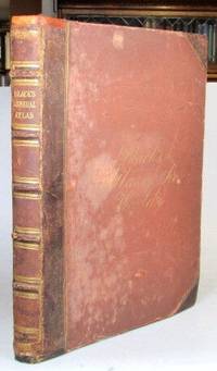
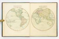
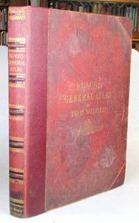
187652192Edinburgh: Adam and Charles Black 1876. Folio. 32 70 pp. Publisher's gilt lettered cloth boards rebacked preserving much of the original leather spine. Illustrations numbered 1-56; a frontispiece of "The Flags of All Nations" plus 29 double page and 23 full page colour maps - complete despite the curious numbering system some double maps feature two numbers and others one collation also includes two bis maps. Covers very worn and faded but solid due to the reback the frontispiece with some wear and tear consolidated by being laid down at some point a few of the early maps with repaired marginal tears map 13 Ireland with a longer repaired tear across one half dampstaining to the lower edge throughout. Edinburgh: Adam and Charles Black unknown
186552198Edinburgh: Adam and Charles Black 1865. Folio. 32 70 pp. Publisher's brown half morocco over cloth boards spine with raised bands gilt lettered direct to one panel cursive gilt lettering to the upper cover early owner's inscription to the front pastedown. Frontispiece of "The Flags of All Nations" plus 57 maps - 31 double page and 26 full page including a supplementary map of the borders of central Europe. Covers worn but sound some rudimentary repairs to the spine ends and the hinges similarly reinforced a number of maps with lightly pencilled 19th century annotations to the margins and/or their versos the contents mostly in decent shape. Edinburgh: Adam and Charles Black unknown
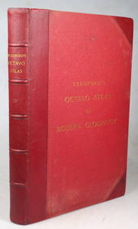
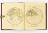
189643355London: Edward Stanford 1896. Second edition small folio iii leaves followed by 38 double page coloured maps plus a 104 pp index at the end. Marbled endpapers. Original red half morocco a.e.g. some faint rubbing otherwise very good. London: Edward Stanford unknown
189776793Washington DC: Department of Agriculture Weather Bureau 1897. First edition thus Oblong octavo 6 1/2 x 4 5/8 inches. 3 pp. of text printed in orange 12 full page Prang chromolithographs after Rudolf Cronau. Descriptive text on the opposing versos. Publisher's flexible brown cloth with black lettering. An excellent copy.These Prang lithos of clouds were used in a variety of government publications but all are hard to come by. Department of Agriculture Weather Bureau hardcover
187477074Chicago IL: Everts Stewart& Co. Very Good. 1874. 1/2 Maroon Leather & Black Cloth Boards. COMBINATION ATLAS MAP OF SANDUSKY COUNTY OHIO Compiled Drawn and Published from Personal Examinations and Surveys By Everts Stewart & Co. Chicago IL. 1874. This atlas is has been re-bound hard-bound in 1/2 maroon leather with black cloth covers with gilt stamping on the upper cover and spine. The binding is solid with new end-pages and with the original cloth from the upper cover pasted-down onto the verso of the upper cover. The contents are bright and generally clean with hand colored maps views and portraits but also with some light scattered soiling. A lovely example of this original Atlas published in Chicago IL. in 1874 which is scarce in the trade . Everts, Stewart,& Co. hardcover
188976491Uten sted. New York. Uten år. 1889. Oblong 8vo. Samtidig skinnryggbind med marmorerte dekler og tittelfelt i svart skinn på fordekkelen. Upaginert. 28 s. Med 50 kromolitograferte kart av U. S. A.’s stater. Med kartene er også andre motiver.8vo oblong. Contemporary half calf marbled boards title in blck on front cover. Not paginated. 28 pp. With 50 chromolithographed plates - maps and other motives . Engelsk. <br/><br/><em>Uvanlig i så god tilstand. A very good copy. </em> hardcover
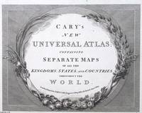
1813373400John Cary London 1813. Unframed Print. Very Good Condition. ENGRAVED TITLE ONLY. Framed with botanical motifs of grapevines lilies and acanthus leaves it evokes a classical aesthetic that elevates the atlas from mere utility to an object of refinement. These flourishes suggest the Enlightenments reverence for nature and knowledge uniting visual beauty with intellectual pursuit. Printed in a crisp serif typeface and etched with meticulous lines the engraving embodies the precision of pre-industrial printing. Carys reputation for clarity and accuracy meant that his atlases werent only elegant they were dependable reference tools. Engraving 21 x 26 cms sheet 26 x 32 cms. An attractive and bright sheet. A very attractive engraved page. Category: PRINTS : Antiquarian Interest; PRINTS : Historic Interest; Special Interest. This item may require more postage than the rates shown for delivery outside the UK. If extra postage is required we will contact you before processing your order and you will be given the details and option to decline the extra cost. John Cary unknown
1820373401William Darton London 1820. Unframed Print. Very Good Condition. ENGRAVED TITLE ONLY. William Dartons engraved title page blends Quaker ideals with visual grandeur. Centred on Penns Treaty it promotes peace and mutual respect within a global context. Darton's commitment to moral education and artisanal clarity made this atlas both a didactic tool and a quiet testament to conscientious publishing. Engraving 25 x 34 cms sheet 30 x 39 cms. An attractive and bright sheet with only minor surface creasing just a touch more so to the bottom right corner. A very attractive engraved page. Category: PRINTS : Antiquarian Interest; PRINTS : Historic Interest; Special Interest. This item may require more postage than the rates shown for delivery outside the UK. If extra postage is required we will contact you before processing your order and you will be given the details and option to decline the extra cost. William Darton unknown
183553619New York: Published by Huntington and Savage 216 Pearl St. 1835. Imperial 4to. 16 x 14 in. 10 leaves 8 engraved plates 2 double-page 7 hand-coloured minor foxing edgewear faint tidemark to lower margin of first few leaves. Original printed yellow softcovers mounted on thicker paper stock cover art woodcut of astronomer gazing at the stars w/ telescope testimonials printed on back cover soiling edgewear rubbing tide-mark to lower margin bumping to corners pencil drawings by child on verso of some plates trying to reproduce some of the figures still G copy. First edition thus stated “New Edition†which in actuality was an updated and revised edition with new engraved plates executed by W.G. Evans of New York fl. 1830-1845 who also engraved the famed Map of Lewis & Clark’s Track Across the Western Portion of North America in 1842 revised by Archibald M’Vickar. Burritt 1794-1838 an American astronomer and mathematician created his textbook and the later atlas as a low-cost alternative to celestial globes which were often too expensive for many schools in Jacksonian America. The atlas could be purchased for $ 1.25 at the time and the Geography of the Heavens textbooks and Atlases would prove immensely popular in classrooms up until 1876. Adapting most of his constellation figures from Alexander Jamieson’s A Celestial Atlas 1822 Burritt included a plan of the Solar System Celestial maps of the skies in January-March October-December April-June July-September South Pole North Pole and Planisphere of the Whole Heavens on Mercator’s Projection. This was the last decorative celestial reference in the 19th century and even served as inspiration of H.P. Lovecraft who notes it as prized possession in letter to Maurice Moe in 1915. See: Kidwell Elijah Burritt and the Geography of the Heavens Sky & Telescope Vol. 69 January 1985 pp. 26-28; Boston University Art Gallery Celestial Images: Antiquarian Astronomical Charts and Maps from the Mendillo Collection 2005 75. Published by Huntington and Savage, 216 Pearl St., paperback
1851D6GE1B01U79OMontpellier 1851. Contemporary bindings: vol. 1 red half goatskin with binder's/stationer's ticket of "Papeterie Sijas Montpellier" red textured paper sides "E.M." in gold on front board marbled endpapers Wolfe 159; vol. 2 black half goatskin black embossed paper sides "C. du M." in gold on front board marbled endpapers Wolfe 112; vol. 3 black sheepskin "C. du M." in gold on front board white watered-silk endleaves. Folio vol. 1 and large 4to 32 x 25.5. cm. vols. 2-3. Neatly written manuscripts on paper with 23 graphically vibrant maps coloured in outline with subtly shaded washes in grey for the coasts and numerous bright colours for political boundaries and with calligraphic headings. 3 volumes. A 3-volume historical manuscript atlas with beautiful manuscript maps the volumes titled: Atlas historique Souvenirs historiques and Tableaux et cartes. The Atlas historique contains finely calligraphed chronological tables displaying events in ecclesiastical history the history of the Roman Empire and France from the first century to 1850 followed by coloured double-page maps of France the Ottoman Empire Europe and the Roman Empire. The Souvenir historiques has the same structure but is solely devoted to the history of England Spain Germany and Italy covering the period from the fifth century to 1850 with coloured double-page maps of the British Isles the Iberian Peninsula the German states and Italy. The Cartes et tableaux is the most ambitious volume containing no fewer than 14 coloured double-page maps including two world maps maps of Africa Asia America Oceania Europe etc. and numerous chronological tables.The ink has sometimes left a browned shadow on the back of the leaves or facing leaves and occasionally eaten a small hole in the paper but the atlas is otherwise in very good condition. Bindings slightly chafed. A graphically vibrant French historical manuscript atlas. unknown
189255835Chicago & New York: Rand McNally & Co. 1892. Thick elephant folio. 16.5 x 23 x 3 in. 597 1 pp. plus 4 pp. Classified List of Subscribers in Portland Oregon. With over 150 wax engraved colour maps colour diagrams and charts many double-page numerous black & white text maps for cities streets and townships. Full embossed brown morocco over beveled boards gilt lettering & embossed borders on front cover gilt decoration & lettering on spine gilt inner dentelles marbled endpapers spine rebacked w/ original laid back down minor repairs to leather on back cover some scuffing edgewear wear to corners still a VG copy with superb clean interior. First edition thus of the subscriber’s edition of Rand McNally & Co.’s famed Indexed Atlas which encompasses both Western and Eastern Hemispheres offering an essential cartographic and historic reference for the world at the height of the Victorian era on the eve of the 1893 Columbian Exposition in Chicago Illinois. The detailed maps for the United States drew upon the 1890 census results and presented the population of every city town village and settlement in America at the time including Alaska the Indian Territory and Oklahoma all with maps present as well as many large maps of major cities such as Chicago including the site of the forthcoming Columbian Exposition a Chicago Railway Terminal map as well as such cities as Baltimore Cincinnati Louisville San Francisco and many others. Rand McNally & Co. were famed for their relief plate engraving process was engraving which produced fine detailed maps with exceptional detail and colour in competition with such companies as Colton Asher & Adams of New York Matthews-Northrup Co. and George Cram. The atlas also encompasses large detailed maps of Africa India China Asia Europe the Russian Empire and more along with detailed economic and statistical charts across the World. This Indexed Atlas was also released in other variations such as two volumes for Eastern and Western Hemispheres as well as a more compact version with less maps and descriptive text and without the subscriber’s list although all were issued with the same title page. The subscriber’s list for Portland reads as a Who’s Who of the most important firms in the business at the time including the Weinhard Brewery Stranahan & Du Puy architects the Portland Bottline Works owned by Cordes & Johannsen Max Smith’s Vienna Cafe Edison General Electric the Portland Cracker Company and many more. Worldcat locates 7 copies California State Notre Dame & Toronto Complete w/ varying paginations; Univ. of Illinois & Rutgers Vol. I only Rutgers substantially incomplete; Case Western Reserve copy not listed as present in their catalogue LOC; See: Phillips & Le Gear A List of Geographical Atlases in the Library of Congress Vol. I 975. Rand, McNally & Co., hardcover
1899867341899. ATLAS. ATLAS OF DORCHESTER WEST ROXBURY AND BRIGHTON CITY OF BOSTON in one volume. Boston: L. J. Richards 1899. Folio. 22" Street index plus 40 double page maps measuring 32" x 22". Bound in 1/2 leather which is largely absent. Front board is detached. Interiors are clean and free from staining with the exception of some light red or graphite pencil annotations on a few plates and soiled end-papers. Plates with pencil annotations: 28 29 30 37 39. Maps printed in as many as seven colors. A good copy. unknown
1896867391896. ATLAS. ATLAS OF THE CITY OF BOSTON VOLUME 6 WEST ROXBURY. Philadelphia: G. W. Bromley and Co. 1896. Second edition. Folio 22.5". Contains street index outline and index map and 30 double-page maps measuring 22.5" by 32". Maps have only minor soiling to margins and occasional pencil annotations plates 1 and 27. FFEP and title page have large chips. Bound in half leather now mostly chipping or absent. In need of rebacking front board detatched. unknown
1890867351890. ATLAS. ATLAS OF THE CITY OF BOSTON Vol. 7 BRIGHTON MASS. Philadelphia: G. W. Bromley & Co. 1890. Folio. 22" Contains 30 double page maps - outline and index map and 29 plates - measuring 32" x 22" with only slight marginal staining near spine at head. Maps are drawn at scale of either 600 100 or 150 ft/inch. Bound in 1/2 leather missing much of leather covering and has detached and chipped FFEP. Front hinge very weak. unknown
1899867361899. ATLAS. ATLAS OF THE CITY OF BOSTON: SOUTH BOSTON. Philadelphia: G. W. Bromley Co. 1899. Folio 23". Street index and 33 double-page maps - outline and index map and 32 plates - measuring 32.5" x 22.5". Ffep missing. Outline and index map has tear near bottom where sheet folds. Plate 1 partly detached. Plates 29 30 31 are detached. Plates 2 and 32 have pencil annotations. Bound in 1/2 leather which is flaking. Interiors are bright some soil. Good. unknown
1896867401896. ATLAS. ATLAS OF THE CITY OF CHELSEA AND THE TOWNS OF REVERE & WINTHROP MASS. Philadelphia: G. W. Bromley and Co. 1896. Folio 22.5". Contains street index outline and index map and 22 double-page maps measuring 22.5" by 32". Maps have only minor soiling to margins and occasional pencil annotations plates 12 17 18 21 and 22. Bound in half leather now mostly chipping or absent. In need of rebacking front board detached. As is. unknown
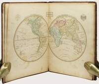
1809127861London: Printed for C. Smith Mapseller Extraordinary to his Royal Highness the Prince of Wales 1809. First Edition. Hardcover. Very Good. London Printed for C. Smith Mapseller Extraordinary to his Royal Highness the Prince of Wales 1809. Folio 404 × 330 mm engraved title leaf letterpress contents leaf and 43 hand-coloured copper-engraved maps numbered as 45 the map of Germany comprises two double-page sheets numbered 19-20 and 21-22. All leaves are printed one side only; all maps are dated 1808. Modern half calf and cloth with a gilt-lettered contrasting leather title-label on the spine; short scratch to the leather on the rear cover; title page a little tanned and discoloured around the margins by the leather corners of an earlier binding; scattered light foxing; insignificant short tears to some margins now sealed; trifling signs of age and use; overall in excellent condition. An attractive Georgian atlas 'on a Scale sufficiently large for the Purposes of general Reading and yet not too inconvenient for the Study or the Table' advertisement at the foot of the contents page. The three maps showing Australia 'Eastern Hemisphere' 'The World on Mercator's Projection' and 'Asia' all show the southern coast of the continent as uncharted. The expeditions of Flinders and Baudin had both charted this coast in 1802 but their maps were not published until 1814 and 1811 respectively. Printed for C. Smith, Mapseller Extraordinary to his Royal Highness the Prince of Wales hardcover
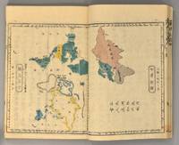
1871894281871. ATLAS Bridgeman E.C. translated by Mitsukuri Genpo. RENPO SHIRYAKU 2 vols. Tokyo Zodiacal date of Meiji 4 1871. String-bound Japanese-style fukuro-toji. An interesting work by Bridgeman the Chinese missionary originally published in Chinese but here marked for reading as Japanese kanbun. Thus not a translation as we might understand the term but a long standing aid for literate Japanese to understand the original classical Chinese. With a number of bw and some color maps of the USA along with a text describing US history culture economics etc. A bit of cover soiling outside and the scattered signs of insect damage internally but overall a very good copy. Upon comparison to the original Japanese edition of 1861 there is not much to choose between them. unknown
1805D19536Boston: J. T. Buckingham for Thomas & Andrews 1805. Hardcover. Good. Two volumes. A matched set: volume one is a fifth edition with old stamps and bookplates from Meadville Theological School; volume two is a fourth edition bookplate of Anne and Clarence Kilburn. Both in contemporary calf spine labels; volume two with front board detached. Engraved maps throughout. Contents with occasional spotting and toning a few of the maps with creases and short edge tears but quite respectable relative to other sets. <br/><br/> J. T. Buckingham, for Thomas & Andrews hardcover
1828142642London: The Author 1828. First Edition. Hardcover. Very Good. London The Author 1828. Large quarto 358 × 295 mm vi pages engraved title dedication and index printed rectos only plus 53 extensively hand-coloured maps all printed recto or verso only with all but the last one - the Western Hemisphere - presented as facing pairs modern followed by ancient. Later quarter red morocco and cloth spine lettered in gilt; top corners slightly bumped; all edges speckled red; a few small inkspots to the top edge with minimal bleeding into a few top margins; all maps offset; blotted ink marks to the top corner of the map of 'Terra Sancta' map 20; trifling signs of age and use; overall in excellent condition. The extensive hand-colouring would appear to be the exception rather than the rule hand-coloured in outline only. The Author hardcover
183533158Edinburgh: Oliver & Boyd ca. 1835. Early printing undated. Fully illustrated with 27 maps the map of the world double-page all hand-coloured. Two additional maps are affixed to the endpapers and are extra to those included in the book. These were sometime added by an owner of the volume. 4to publisher's original brown calf over brown cloth covered boards the spine lettered in gilt the upper cover with hand-printed titling label. vi 27 maps on 28 pages A very well preserved copy. The binding with some wear from time and use still strong and showing minor separation at the free-flies and pastedowns the maps all in good order clean and well coloured. EARLY PRINTING OF EWING'S GENERAL ATLAS. Now scarce as a complete book many copies have been broken up with the maps sold separately. The maps have been handcoloured and are preserved very well. A double-page world map is presented first and then the maps of the countries of European countries and Russia Asia Africa North America and South America. The U.S. map is quite interesting in that it includes only the states and territories recognized at the time of publication. The country is show bordering the Atlantic on the East but extending only into the Missouri Territory and Arkansas in the west. Oliver & Boyd hardcover
1830D19538Boston: Crocker & Brewster 1830. Hardcover. Very Good. Publisher's cloth boards gilt modern cloth over spine. 26 hand-colored engraved maps some folded. Contents lightly toned some offsetting as typical; generally speaking a nice copy. <br/><br/> Crocker & Brewster hardcover
187551587Montreal Toronto & London: George N. Tackabury Printed by the Burland-Desbarats Lithographic Co. 1875. Folio. 14.25 x 17.75 in. 251 1 pp. Colour lithograph illustrated title page showing the Parliament Building in Ottawa Canada from photograph by W. Notman 53 colour lithograph maps many double-page many tables. Publisher’s plum-coloured embossed cloth gilt decorative lettering on front cover marbled endpapers nicely rebacked in simulated black calf corners renewed some wear & rubbing to corners 1 leaf w/ repairs to creases minor tidemark to upper right corner not affecting maps still G copy. First edition of this fine atlas of Victorian-era Canada including maps of climatology possessions provinces prior to Alberta Saskatchewan & Newfoundland becoming provinces plat maps of counties Railways as well as maps of the United States and Europe. Of particular interest are the city maps of Quebec Ottawa London Hamilton Kingston Toronto and Montreal. This excellent reference work also provides a comprehensive list of railways in Canada steamships in use lists post offices railway stations cities and populations as well as business cards located by city and town. George N. Tackabury, [Printed by the Burland-Desbarats Lithographic Co.], hardcover
1865291807New York: J. H. Colton 1865. Second Edition. Colored engraved map with a bit of creasing at the fold. 11 3/4 x 9 1/2â€. From the second edition of Colton’s Condensed Octavo Atlas of the Union. J. H. Colton unknown
1865291848New York: J. H. Colton 1865. Second Edition. Colored engraved map with a bit of creasing at the fold. 11 3/4 x 9 1/2â€. From the second edition of Colton’s Condensed Octavo Atlas of the Union. J. H. Colton unknown