(ATLAS)Biblio.com
990 résultats
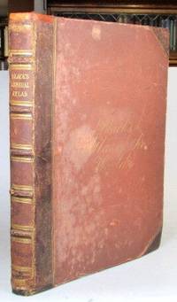
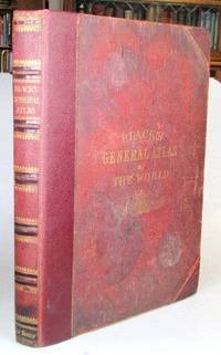
187652192Edinburgh: Adam and Charles Black 1876. Folio. 32 70 pp. Publisher's gilt lettered cloth boards rebacked preserving much of the original leather spine. Illustrations numbered 1-56; a frontispiece of "The Flags of All Nations" plus 29 double page and 23 full page colour maps - complete despite the curious numbering system some double maps feature two numbers and others one collation also includes two bis maps. Covers very worn and faded but solid due to the reback the frontispiece with some wear and tear consolidated by being laid down at some point a few of the early maps with repaired marginal tears map 13 Ireland with a longer repaired tear across one half dampstaining to the lower edge throughout. Edinburgh: Adam and Charles Black unknown
186552198Edinburgh: Adam and Charles Black 1865. Folio. 32 70 pp. Publisher's brown half morocco over cloth boards spine with raised bands gilt lettered direct to one panel cursive gilt lettering to the upper cover early owner's inscription to the front pastedown. Frontispiece of "The Flags of All Nations" plus 57 maps - 31 double page and 26 full page including a supplementary map of the borders of central Europe. Covers worn but sound some rudimentary repairs to the spine ends and the hinges similarly reinforced a number of maps with lightly pencilled 19th century annotations to the margins and/or their versos the contents mostly in decent shape. Edinburgh: Adam and Charles Black unknown
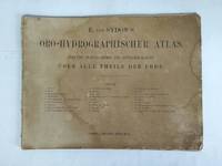
5f4764Justus Perthes Gotha 1856. 1 Titelblatt 2 S. Vorwort und 23 Kartenseiten mit 25 Karten quart-quer Einband fehlt/fleckig/gebräunt/Titelblatt mit kleinen Eckeinrissen/. unknown
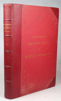
189643355London: Edward Stanford 1896. Second edition small folio iii leaves followed by 38 double page coloured maps plus a 104 pp index at the end. Marbled endpapers. Original red half morocco a.e.g. some faint rubbing otherwise very good. London: Edward Stanford unknown
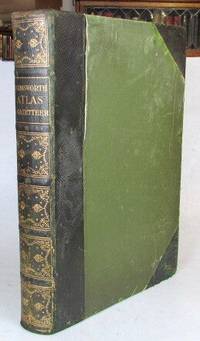
190752208London: The Amalgamated Press c. 1907. 4to. viii 32 284 pp. Contemporary possibly publisher's green half morocco over green cloth sides spine gilt top edge gilt. 3 colour plates of flags 210 map colour sheets mostly comprising double page maps but including single page maps and plans the 32 pages towards the rear also featuring numerous colour maps and diagrams. Covers worn but sound the front hinge weakened though it is still holding contents generally pretty good. London: [The Amalgamated Press] unknown
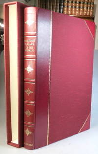
199937957London: Times Books; The Folio Society 1999. Limited edition no. 810 of 1000 copies folio 67 249 220 4 pp. 123 double page and one single page coloured map. Maroon half goatskin slipcase a couple of minor marks to the spine ends otherwise a lovely copy. (London: Times Books; The Folio Society unknown
318424Edinburgh: W. & A.K. Johnston nd. 24th Edition 240000th. With a tipped in 1842 Map of South America as Frontispiece. Folio. Bound in three quarters modern half brown mottled calf. Fine. 24th Edition 240000th. With a tipped in 1842 Map of South America as Frontispiece. Folio. W. & A.K. Johnston unknown
189776793Washington DC: Department of Agriculture Weather Bureau 1897. First edition thus Oblong octavo 6 1/2 x 4 5/8 inches. 3 pp. of text printed in orange 12 full page Prang chromolithographs after Rudolf Cronau. Descriptive text on the opposing versos. Publisher's flexible brown cloth with black lettering. An excellent copy.These Prang lithos of clouds were used in a variety of government publications but all are hard to come by. Department of Agriculture Weather Bureau hardcover
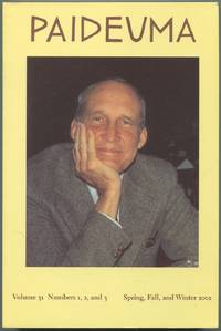
2002531791Orono Maine: University of Maine 2002. Softcover. Near Fine. Magazine. Illustrated from black and white photographs. Pictorial wrappers. 398pp. Light foxing on page edges else fine. Paper tipped in "In Memoriam sic Carroll F. Terrell February 21 1917 - November 29 2003 Founding Editor of Paideuma Founding Director of the National Poetry Foundation"; Hugh Kenner January 7 1923 - November 24 2003 Senior Editor of Paideuma Lifelong Friend and Supporter of NPF." This special volume is dedicated to James Laughlin 1914 - 1997 & Guest-Edited by Emily Mitchell Wallace. Contributions by Rodney Grove Dennis Tom Vitale James Atlas Joel Conarroe Anne Conover William Eric Williams Hught Witemeyer Hayden Carruth Penelope Laurans Fitzgerald Samuel A. Streit Emily Mitchell Wallace Terry Halladay Leslie A. Morris Patricia C. Willis John A. Harrison Ezra Pound Zhaoming Qian Richard Taylor Demetres Tryphonopoulos William McNaughton Patrizia De Rachewiltz and fourteen poems by James Laughlin. University of Maine unknown
2F10292Atlas Verlag Cheseaux-sur-Lausanne/Schweiz um 1990. Maßstab 1:48 in original Verpackung Verpackungen teils gering berieben. - sonst gute Exemplare / Enthalten: T19 - 105 MM Howitzer Motor Carriage USA 1943 / Halftrack M21 - 81 MM Mortar Carrier USA 1945 / Light Armored Vehicle-25 LAV-25 USA 1991 / TPZ 1 Fuchs Germany 1998 / Sd. Kfz. 251/1 "Stuka zu Fuss" Germany 1944 - unknown
5f2594Atlas Verlag Cheseaux-sur-Lausanne/Schweiz 2000. Insgesamt ca. 170 Falttafeln mit zahlreichen Abbildungen in 2 original Ringordnern quart geringe Gebrauchsspuren. - sonst gute Exemplare / Inhalt: Vögel in Garten und Stadt / Vögel des Waldes / Vögel der Felder Wiesen und Moore / Vögel der Binnengewässer / Vögel der Berge / Vögel an Meer und Küste / Biologie der Vögel / Klassifikation und Entwicklung / Beobachten forschen und schützen - unknown
2F10290Atlas Verlag Cheseaux-sur-Lausanne/Schweiz um 1990. Maßstab 1:72 in original Verpackung meist noch verschweißt. - neuwertig / Enthalten: Pz. Kpfw. V Panther Ausf. A Sd. Kfz. 171 1944 / Leopard 2 A5 - 2000 / Pz. Kpfw. IV Ausf. H Sd. Kfz. 161/2 - 1943 / M60A3 - 1983 / Leclerc T5 - 1997 / M1A1 HA Abrams - 1991 / M26 Pershing - 1945 / T-34/76 - 1942 / Pz. Kpfw. III Ausf. G Sd. Kfz 141 - 1941 / Challenger 1 - 1984 / Panzerjäger SU-85 - 1945 / Panzerjäger Jagdpanther Sd. Kfz. 173 - 1944 / Crusader Mk. II- 1942 / M4A3 Sherman - 1945 / Pz. Kpfw. VI Tiger Ausf. E Sd. Kfz. 181 - 1943 / Pz. Kpfw. VI Königstiger Ausf. B Sd Kfz. 182 - 1944 / Dazu ein Buch: Panzer. Die wichtigsten Kampffahrzeuge der Welt vom Ersten Weltkrieg bis heute; Philip Trewhitt Wissenwertes - Technik - unknown
193872459Chicago: Rand McNally & American Hotel Register Co. 1938. First edition of this merging of two American atlases. Folio 10 1/2 x 16 inches. The Rand McNally section is pp. 1-52 at the beginning and pp. 52-105 at the end. All maps printed in blue and red. The Leahy section starts in the middle and runs from p. 1 to p. 112 and with two more pages. These maps are entirely printed in black and much of the section is take up with listing for hotels in various states. Publisher's green cloth with gilt cover lettering Leahy's. The text block was originally stapled into the covers but has since come loose from the staples but the text block is entirely secure. A very good copy of an unusual publication.As both companies were headquartered in Chicago it is easy to imagine a friendly lunch at which this was discussed. Rand McNally & American Hotel Register Co. hardcover
187477074Chicago IL: Everts Stewart& Co. Very Good. 1874. 1/2 Maroon Leather & Black Cloth Boards. COMBINATION ATLAS MAP OF SANDUSKY COUNTY OHIO Compiled Drawn and Published from Personal Examinations and Surveys By Everts Stewart & Co. Chicago IL. 1874. This atlas is has been re-bound hard-bound in 1/2 maroon leather with black cloth covers with gilt stamping on the upper cover and spine. The binding is solid with new end-pages and with the original cloth from the upper cover pasted-down onto the verso of the upper cover. The contents are bright and generally clean with hand colored maps views and portraits but also with some light scattered soiling. A lovely example of this original Atlas published in Chicago IL. in 1874 which is scarce in the trade . Everts, Stewart,& Co. hardcover
188976491Uten sted. New York. Uten år. 1889. Oblong 8vo. Samtidig skinnryggbind med marmorerte dekler og tittelfelt i svart skinn på fordekkelen. Upaginert. 28 s. Med 50 kromolitograferte kart av U. S. A.’s stater. Med kartene er også andre motiver.8vo oblong. Contemporary half calf marbled boards title in blck on front cover. Not paginated. 28 pp. With 50 chromolithographed plates - maps and other motives . Engelsk. <br/><br/><em>Uvanlig i så god tilstand. A very good copy. </em> hardcover
a74346Washington 1974 U. S. Department of Commerce. Oblong folio about 80pp. maps original printed wraps. A few Depository Library marks on covers maps clean. VG light vertical crease. . paperback
a74345Washington 1974 U. S. Department of Commerce. Oblong folio about 30pp. maps original printed wraps. A few Depository Library marks on covers maps clean. VG light vertical crease. . paperback
a74344Washington 1974 U. S. Department of Commerce. Oblong folio about 30pp. maps original printed wraps. A few Depository Library marks on covers maps clean. VG light vertical crease. . paperback
1988199800Lond. John Bartholomew & Times Bks. 1988. Elephant folio. Or.bds. Dustjacket. xlvii123 colour plates 228pp. Index-gazatteer. Fine copy. A splendid reference atlas. Lond. John Bartholomew & Times Bks. unknown
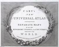
1813373400John Cary London 1813. Unframed Print. Very Good Condition. ENGRAVED TITLE ONLY. Framed with botanical motifs of grapevines lilies and acanthus leaves it evokes a classical aesthetic that elevates the atlas from mere utility to an object of refinement. These flourishes suggest the Enlightenments reverence for nature and knowledge uniting visual beauty with intellectual pursuit. Printed in a crisp serif typeface and etched with meticulous lines the engraving embodies the precision of pre-industrial printing. Carys reputation for clarity and accuracy meant that his atlases werent only elegant they were dependable reference tools. Engraving 21 x 26 cms sheet 26 x 32 cms. An attractive and bright sheet. A very attractive engraved page. Category: PRINTS : Antiquarian Interest; PRINTS : Historic Interest; Special Interest. This item may require more postage than the rates shown for delivery outside the UK. If extra postage is required we will contact you before processing your order and you will be given the details and option to decline the extra cost. John Cary unknown
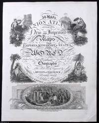
1820373401William Darton London 1820. Unframed Print. Very Good Condition. ENGRAVED TITLE ONLY. William Dartons engraved title page blends Quaker ideals with visual grandeur. Centred on Penns Treaty it promotes peace and mutual respect within a global context. Darton's commitment to moral education and artisanal clarity made this atlas both a didactic tool and a quiet testament to conscientious publishing. Engraving 25 x 34 cms sheet 30 x 39 cms. An attractive and bright sheet with only minor surface creasing just a touch more so to the bottom right corner. A very attractive engraved page. Category: PRINTS : Antiquarian Interest; PRINTS : Historic Interest; Special Interest. This item may require more postage than the rates shown for delivery outside the UK. If extra postage is required we will contact you before processing your order and you will be given the details and option to decline the extra cost. William Darton unknown
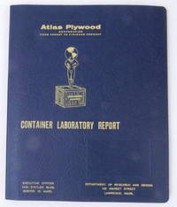
195627405Boston 16 Mass: Atlas Plywood Corporation 1956. Boards. Near Fine. 9 1/2 x 11 3/8 inches dimensions of tabbed loose leaf binder. Fourteen 8 x 10 inch approximate photographs plus "title page" photograph. Boards. A loose leaf binder with photographs depicting testing of crates and the attendant necessary equipment. Photos show a "large revolving drum" construction shop a compression machine what looks like a drop test chassis with crate affixed two photos of several men in a laboratory using a microscope and several other instruments a blueprint in progress two closeup images of instruments including a mullen tester a very large press used to compress pieces of plywood together testing in action and several other images. No doubt used as a sales tool demonstrating how thoroughly the company could build and test crates for reliable performance.<br /> <br /> The tenth edition of Industrial Research Laboratories of the United States 1956 locates the Atlas Plywood Corporation's Department of Research and Design at 431 Market Street Lawrence Mass. the same address as on the card cover of this folder hence our approximate dating. Atlas Plywood Corporation unknown
191656549Washington D.C. & Juneau A.T.: Superintendent of Documents U.S. Surveyor General’s Office 1916. Oblong Atlas Folio. 24 x 19 in. 14 colour maps 1 large folding 17.25 x 41.5 in. Printed softcovers stapled and paper reinforcement at gutter margin some minor toning & soiling to fore-edges edgewear to spine minor scuffing and a couple removed label ghosting still VG- bright copy. First edition of this remarkably scarce plat map atlas for the Matanuska coal fields and township sites surveyed by Walker & McDaniel during their surveys following those on the Kenai Peninsula. By 1912 with the act establishing Alaska as a U.S. Territory and in 1914 the authorization to construct an Alaska Railroad there became an increased need and demand for coal. The Matanuska mines located about 45 miles northeast of Anchorage first began production in 1916 and would stay in continuous production through both World War I and World War II and well into the 20th Century re-opening again in the 21st Century. Not only do these maps show available government lease sites for coal mines but also available Township sites for homesteaders as required by the original Homestead Acts of 1866 and the 1916 Act for Alaska requiring surveys and resurveys to accurately determine boundaries of unsold railroad lands and identify their boundaries. Worldcat locates 2 copies Anchorage Museum & Univ. of Calgary; See: Catalogue of the Public Documents of the Sixty-Fourth Congress Index Vol. 13 1922 p. 74; C. Albert White A History of the Rectangular Survey System 1983 p. 189. Superintendent of Documents, U.S. Surveyor General’s Office, paperback
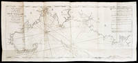
17945887<p>THE FIRST ENGLISH SEA ATLAS OF AMERICA</p><p>Folio 47.7 x 31 cm 66 pp. with pagination errors with 26 engraved maps 21 of which are double-page or folding the first chart with letterpress text attached as called for numerous woodcuts in the text. Bound in contemporary sheep rebacked blind-tooled borders to upper and lower covers. Minor rubbing to covers. Some spotting to the fourth map Verner no. 62 and adjacent letterpress pages small tear to fold of map 10 Verner no. 60 two small circular mends to title page not affecting text otherwise remarkably well preserved.</p><p>A spectacular copy of the final edition of the <em>English Pilot</em> <em>The Fourth Book</em> the first wholly English sea atlas of American waters. The work was sufficiently in demand to justify 37 legitimate editions from 1689 to 1794 and three pirated editions. All editions are rare. During the history of this title its charts underwent numerous changes. The first edition contained only 18 maps whereas this 1794 final edition contained 26.</p><p>"<em>The English Pilot</em> was the first major sea-atlas produced in England. In its final form it consisted of five separate books and <em>The Fourth Book</em> was the first wholly English sea-atlas of American waters. Although the idea originated with John Seller he was involved in producing only the first two books. William Fisher and John Thornton produced <em>The Fourth Book</em> in 1689 and their successors Mount and Page continued to print it for over 100 years Seller's proposal for a 'Sea Waggoner' resulted in the production of <em>The English Pilot</em> which consisted of five separate volumes with a common generic title. Book One included the southern navigation and Book Two the northern. Book Three was concerned with the Orient Book Four with America and Book Five contained Africa. Each book or volume has its own independent publishing history and appeared in numerous editions. The five separate books constitute a set only by virtue of the general title and under that title <em>The English Pilot</em> is the first great sea-atlas produced in England. Of the five books the fourth has the longest publication history and is the best known" Verner p. v.</p><p>Throughout its history <em>The Fourth Book</em> showed very few changes in textual matter and the content of the volume was established between the editions of 1706 and 1721.</p><p>The present example of the 1794 edition is complete and contains the following maps see Verner pp. xv-xx for full list of editions and charts from 1689 to 1794:</p><p>1. A New and Correct Chart of the Western and Southern Oceans Showing the Variations of the Compass with letterpress text attached</p><p>2. A New and Correct Chart of the North Part of America from New Found Land to Hudson's Bay</p><p>3. A New Generall Chart for the West Indies of E. Wright's Projection</p><p>4. A New and Accurate Chart of the Vast Atlantic or Western Ocean by Eman. Bowen</p><p>5. Harbour of Casco Bay Capt. Cyprian Southicke 1720 Em. Bowen</p><p>6. A New and Correct Chart of the Coast Line of Newfoundland from Cape Raze to Cape Bionavista</p><p>7. Island of St. Peters </p><p>8. Chart of the South East Coast of Newfoundland</p><p>9. New and Correct Chart of the Sea Coast of New-England from Cape Cod to Casco Bay Henry Barnsley</p><p>10. A Map of the Coast of New England from Staten Island to the Island of Breton Capt. Cyprian Southack</p><p>11. A Chart of New York Harbour with the Banks </p><p>12. Virginia Maryland Pennsylvania East & West New Jersey </p><p>13. A Draught of Virginia by Mark Tiddeman</p><p>14. Barbados copperplate in text</p><p>15. A New Mapp of the Island of St. Christophers Survey taken by Mr. Andrew Norwood</p><p>16. A Large Draft of the Island of Antegua copperplate in the text</p><p>17. A Draught of South Carolina and Georgia from Sewee to St. Estaca by Andrew Hughes</p><p>18. A Correct Chart of the Caribee Islands</p><p>19. A Correct Chart of Hispaniola with the Windward Passage by C. Price</p><p>20. A Draught of the West End of the Island of Porto Rico </p><p>21. A New & Correct Chart of Cuba Streights of Bahama Windward Passage </p><p>22. A New and Correct Draught of the Bay of Matanzas by Rob.t Pearson</p><p>23. Bermudas copperplate in text</p><p>24. A New and Correct Chart of the Island of Jamaica</p><p>25. A Chart of the Coast of Guayana By R. Waddington</p><p>26. A New and Correct Chart of the Trading Part of the West Indies</p><p> <em>The English Pilot: The Fourth Book</em> Amsterdam 1967 with an introduction by Coolie Verner.</p> Printed for Mount and Davidson hardcover
183553619New York: Published by Huntington and Savage 216 Pearl St. 1835. Imperial 4to. 16 x 14 in. 10 leaves 8 engraved plates 2 double-page 7 hand-coloured minor foxing edgewear faint tidemark to lower margin of first few leaves. Original printed yellow softcovers mounted on thicker paper stock cover art woodcut of astronomer gazing at the stars w/ telescope testimonials printed on back cover soiling edgewear rubbing tide-mark to lower margin bumping to corners pencil drawings by child on verso of some plates trying to reproduce some of the figures still G copy. First edition thus stated “New Edition†which in actuality was an updated and revised edition with new engraved plates executed by W.G. Evans of New York fl. 1830-1845 who also engraved the famed Map of Lewis & Clark’s Track Across the Western Portion of North America in 1842 revised by Archibald M’Vickar. Burritt 1794-1838 an American astronomer and mathematician created his textbook and the later atlas as a low-cost alternative to celestial globes which were often too expensive for many schools in Jacksonian America. The atlas could be purchased for $ 1.25 at the time and the Geography of the Heavens textbooks and Atlases would prove immensely popular in classrooms up until 1876. Adapting most of his constellation figures from Alexander Jamieson’s A Celestial Atlas 1822 Burritt included a plan of the Solar System Celestial maps of the skies in January-March October-December April-June July-September South Pole North Pole and Planisphere of the Whole Heavens on Mercator’s Projection. This was the last decorative celestial reference in the 19th century and even served as inspiration of H.P. Lovecraft who notes it as prized possession in letter to Maurice Moe in 1915. See: Kidwell Elijah Burritt and the Geography of the Heavens Sky & Telescope Vol. 69 January 1985 pp. 26-28; Boston University Art Gallery Celestial Images: Antiquarian Astronomical Charts and Maps from the Mendillo Collection 2005 75. Published by Huntington and Savage, 216 Pearl St., paperback