[Zweisimmen - Gemmi]Antiquariat.de

430 résultats
189250084Bern, Eidgenössisches topographisches Bureau, 1892. Farb. Karte (56 x 78 cm) mit Titelschild, in 18 Segmenten auf Lwd. aufgezogen.
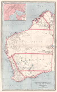
18876001887. Chromolithograph. 645mm by 425mm sheet. Detailed map of Western Australia with inset map of 'Perth'. From 'Picturesque Atlas of Australasia'.<br /> Central horizontal fold as issued. Key on reverse. unknown
189035302Luzern, Verlag E.Wagner, 1890. 12 Karten (Leporello), 1 Übersichtskarte, VI, 80 S. + Werbung (25 S.) Kl.-8°, OLn. mit goldgeprägemt Titel
1853176101-1Glogau, C. Flemming 1853. 4°. Mit 114 grenzkolor. lithographischen doppelblattgr. Karten. Halblederband der Zeit
1855KART0172Glogau, Flemming 1855. quer-folio (37 x 46 cm). 2 Bll. Mit 113 (von 114) lithographierten, meist grenzkolorierten Kartenblättern. Neuerer, restaur. Halblederband mit den originalen Leinern-Deckelbezügen, darauf goldgepr. Titel, Lederecken. Einige Karten stockfleckig bzw. gebräunt. - Die Karte 29 (Westfalen) fehlt. Espenhorst 5.3c.
183659541Darmstadt Litho. Anst. Fromann 1836-38 40. Folio-oblong. 395 x 51 cm. Contemp. hcalf. Spine worn. Corners weared down. With 37 outlinecoloured lithographed maps. Numbered II-XXXVI Titlepage numb. I lacks and 2 extra maps numbered XXVIII b and XXXI b present XXXI b dated 1840 most of the other maps dated 1836 1837 a. 1840. The maps having sometimes rather heavely dampstaining throughout. 2 maps with closed tears. A map added not belonging to the atlas "Charte und Meilenzeiger Daenemark mit Schleswig. Holstein. Lauenburg. Entworfen von Euard v. Grubl. Flensburg 1837". Some brownspots and a bit of lower right corner gone. <br/><br/><em>First edition of Glaser's world-atlas where the lacking title-page should be dated 1839. "The map sheets were to a large extent modeled on Stieler's handatlas. The maps were not simple copies however. They were newly drawn as can be seen for example in fact that some sheets were rotated 90 degrees. Glaser also chose to use a map sheet measuring 406 x 495 cm. a larger format than that of the Stieler whose sheets at that time were 363 x 442 cm. This enabled him to use a somewhat larger scale than that found in the STIELER."Jürgen Espenhorst Petermann's Planet p. 1013. </em> unknown
184927973Kjöbenhavn Chr. Steen & Søn 1849-61. Titelbladet uden år. Stor folio. Samt. hldrbd. Forperm med orig. bogtrykt omslag påsat. Udvendig noget slidt og med brugsspor. Litograferet titelblad med trykt indholdsfortegnelse over atlassets 20 dobbeltsidede foliokort alle litograferede og håndkoloreret hvert målende ca 52x64 cm. Her og der med lidt brunpletter særligt marginer men indvendigt iøvrigt i god stand. Kortene er litograferede hos Emil Bærentzen & Co. Lith. Institut og alle daterede mellem 1849 og 1861 opsat på false. <br/><br/><em>Prægtigt stort atlas af dansk oprindelse. Ikke anført i Dansk Bogfortegnelse - ikke hos Phillips. Indeholder: 1. Den östlige og vestlige Halvkugle. 2. Europa. 3. Asien. 4. Afrika. 5. Nordamerika. 6. Sydamerika. 7. Australien. 8. Danmark. 9. Norge og Sverrig. 10. Storbrittanien og Irland. 11. Frankrig. 12. Spanien og Portugal. 13. Schweitz. 14. Tyskland. 15. Preussen. 16. Nederlandene og belgien. 17. Italien. 18. österrig. 19. Rusland. 20. Tyrkiet og Grækenland. </em> unknown
190059477Amsterdam, Van Houten ca. 1900. 8,5 x 10 cm - 18 Karten Karten gestempel mit W. Brokelmann ( wohl Cafe oder Vertrieb) Mappe mit losen farbigen Karten, Mappe beschrieben
19006200167Amsterdam: Van Houten ca. 1900. 20 farb. ill. Kt., 9cm x 10cm Karten
1845SB-17177Gotha, Justus Perthes, 1845. Brauner Halbleinenband der Zeit im Querformat 38 x 46 cm; Buchdeckel mit braun-beigen Marmorbezügen und Leinenecken. Großformatiges Tabellenwerk des Kartographen und Historikers Karl von Spruner (1803 - 1892) und des Regionalhistorikers und Juristen Siegfried Haenle (1814 - 1889) zur deutschen Geschichte. Mit XIX doppelseitigen chronologisch geordneten, nach Stämmen unterteilten Haupttabellen sowie XII Nebentabellen, die Texte zur Geographie und Genealogie sowie Stammtafeln enthalten, ferner mit einer grenzkolorierten Deutschlandkarte. Der vorliegende Band reicht von den "ältesten Zeiten" bis zum Vertrag von Verdun im Jahre 843.
1900202748Kieler Nachrichten, Unabhängige Landeszeitung für Schleswig - Holstein, Jahr o.A. ca Mitte 1900. Zahlreiche Farbige Abbildungen und Karten, 200 Seiten Kartoniert
1865291807New York: J. H. Colton 1865. Second Edition. Colored engraved map with a bit of creasing at the fold. 11 3/4 x 9 1/2â€. From the second edition of Colton’s Condensed Octavo Atlas of the Union. J. H. Colton unknown
1865291848New York: J. H. Colton 1865. Second Edition. Colored engraved map with a bit of creasing at the fold. 11 3/4 x 9 1/2â€. From the second edition of Colton’s Condensed Octavo Atlas of the Union. J. H. Colton unknown
180756070Weimar Geographischen Institute 1807-13. Folio-oblong. Loose sheets in a box. Containg 128 engraved maps each measuring ca. 30 x 45 cm. Mostly clean and fine but some with annotations some with browning and some with traces of use. <br/><br/><em>Present are the following maps Sections: 3-12 17-24 29-36 42-48 53-60 64-66 71-74 80-81 86-90 97-98 103-108 114-126 135-142 151-159 167-173 180-186 193-197 204-208 216-219 227-231 239-243 and 248-254. </em> unknown
182054816Weimar 1820. Folio. Image of maps: ca. 35 x 44 cm. Paper size: ca. 46 x 56 cm. Engraved title with outline of the maps title-page in French numbered as Section I. Comprising the Sections I-XXXVI XXIX and XXXII with a and b all but the General map in 2 parts not present. Some maps with markings in red and blue. One with dampstain in lower margin a few with minor traces of use but all intact. In all 38 engraved sheets. unknown
188002138Edinburgh, Johnston, ca1880. Ln, 23 kolorierte Karten, gutes Exemplar
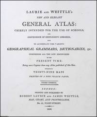
1806373392Laurie and Whittle London 1806. Unframed Print. Very Good Condition. Robert Laurie and James Whittle were prominent London map and print sellers operating from 53 Fleet Street. Their firm which evolved from Robert Sayers earlier business was a cornerstone of British cartographic publishing in the late 18th and early 19th centuries. Letterpress 21 x 18 cms sheet 26 x 33 cms. Category: PRINTS : Antiquarian Interest; PRINTS : Historic Interest; Special Interest. This item may require more postage than the rates shown for delivery outside the UK. If extra postage is required we will contact you before processing your order and you will be given the details and option to decline the extra cost. Laurie and Whittle unknown
1830D19538Boston: Crocker & Brewster 1830. Hardcover. Very Good. Publisher's cloth boards gilt modern cloth over spine. 26 hand-colored engraved maps some folded. Contents lightly toned some offsetting as typical; generally speaking a nice copy. <br/><br/> Crocker & Brewster hardcover
1805D19536Boston: J. T. Buckingham for Thomas & Andrews 1805. Hardcover. Good. Two volumes. A matched set: volume one is a fifth edition with old stamps and bookplates from Meadville Theological School; volume two is a fourth edition bookplate of Anne and Clarence Kilburn. Both in contemporary calf spine labels; volume two with front board detached. Engraved maps throughout. Contents with occasional spotting and toning a few of the maps with creases and short edge tears but quite respectable relative to other sets. <br/><br/> J. T. Buckingham, for Thomas & Andrews hardcover