Picturesque Atlas Publishing CompanyBiblio.com
112 résultats
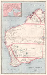
18876001887. Chromolithograph. 645mm by 425mm sheet. Detailed map of Western Australia with inset map of 'Perth'. From 'Picturesque Atlas of Australasia'.<br /> Central horizontal fold as issued. Key on reverse. unknown
183659541Darmstadt Litho. Anst. Fromann 1836-38 40. Folio-oblong. 395 x 51 cm. Contemp. hcalf. Spine worn. Corners weared down. With 37 outlinecoloured lithographed maps. Numbered II-XXXVI Titlepage numb. I lacks and 2 extra maps numbered XXVIII b and XXXI b present XXXI b dated 1840 most of the other maps dated 1836 1837 a. 1840. The maps having sometimes rather heavely dampstaining throughout. 2 maps with closed tears. A map added not belonging to the atlas "Charte und Meilenzeiger Daenemark mit Schleswig. Holstein. Lauenburg. Entworfen von Euard v. Grubl. Flensburg 1837". Some brownspots and a bit of lower right corner gone. <br/><br/><em>First edition of Glaser's world-atlas where the lacking title-page should be dated 1839. "The map sheets were to a large extent modeled on Stieler's handatlas. The maps were not simple copies however. They were newly drawn as can be seen for example in fact that some sheets were rotated 90 degrees. Glaser also chose to use a map sheet measuring 406 x 495 cm. a larger format than that of the Stieler whose sheets at that time were 363 x 442 cm. This enabled him to use a somewhat larger scale than that found in the STIELER."Jürgen Espenhorst Petermann's Planet p. 1013. </em> unknown
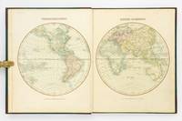
184927973Kjöbenhavn Chr. Steen & Søn 1849-61. Titelbladet uden år. Stor folio. Samt. hldrbd. Forperm med orig. bogtrykt omslag påsat. Udvendig noget slidt og med brugsspor. Litograferet titelblad med trykt indholdsfortegnelse over atlassets 20 dobbeltsidede foliokort alle litograferede og håndkoloreret hvert målende ca 52x64 cm. Her og der med lidt brunpletter særligt marginer men indvendigt iøvrigt i god stand. Kortene er litograferede hos Emil Bærentzen & Co. Lith. Institut og alle daterede mellem 1849 og 1861 opsat på false. <br/><br/><em>Prægtigt stort atlas af dansk oprindelse. Ikke anført i Dansk Bogfortegnelse - ikke hos Phillips. Indeholder: 1. Den östlige og vestlige Halvkugle. 2. Europa. 3. Asien. 4. Afrika. 5. Nordamerika. 6. Sydamerika. 7. Australien. 8. Danmark. 9. Norge og Sverrig. 10. Storbrittanien og Irland. 11. Frankrig. 12. Spanien og Portugal. 13. Schweitz. 14. Tyskland. 15. Preussen. 16. Nederlandene og belgien. 17. Italien. 18. österrig. 19. Rusland. 20. Tyrkiet og Grækenland. </em> unknown
1865291807New York: J. H. Colton 1865. Second Edition. Colored engraved map with a bit of creasing at the fold. 11 3/4 x 9 1/2â€. From the second edition of Colton’s Condensed Octavo Atlas of the Union. J. H. Colton unknown
1865291848New York: J. H. Colton 1865. Second Edition. Colored engraved map with a bit of creasing at the fold. 11 3/4 x 9 1/2â€. From the second edition of Colton’s Condensed Octavo Atlas of the Union. J. H. Colton unknown
180756070Weimar Geographischen Institute 1807-13. Folio-oblong. Loose sheets in a box. Containg 128 engraved maps each measuring ca. 30 x 45 cm. Mostly clean and fine but some with annotations some with browning and some with traces of use. <br/><br/><em>Present are the following maps Sections: 3-12 17-24 29-36 42-48 53-60 64-66 71-74 80-81 86-90 97-98 103-108 114-126 135-142 151-159 167-173 180-186 193-197 204-208 216-219 227-231 239-243 and 248-254. </em> unknown
182054816Weimar 1820. Folio. Image of maps: ca. 35 x 44 cm. Paper size: ca. 46 x 56 cm. Engraved title with outline of the maps title-page in French numbered as Section I. Comprising the Sections I-XXXVI XXIX and XXXII with a and b all but the General map in 2 parts not present. Some maps with markings in red and blue. One with dampstain in lower margin a few with minor traces of use but all intact. In all 38 engraved sheets. unknown
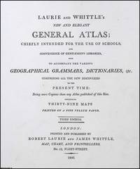
1806373392Laurie and Whittle London 1806. Unframed Print. Very Good Condition. Robert Laurie and James Whittle were prominent London map and print sellers operating from 53 Fleet Street. Their firm which evolved from Robert Sayers earlier business was a cornerstone of British cartographic publishing in the late 18th and early 19th centuries. Letterpress 21 x 18 cms sheet 26 x 33 cms. Category: PRINTS : Antiquarian Interest; PRINTS : Historic Interest; Special Interest. This item may require more postage than the rates shown for delivery outside the UK. If extra postage is required we will contact you before processing your order and you will be given the details and option to decline the extra cost. Laurie and Whittle unknown
1830D19538Boston: Crocker & Brewster 1830. Hardcover. Very Good. Publisher's cloth boards gilt modern cloth over spine. 26 hand-colored engraved maps some folded. Contents lightly toned some offsetting as typical; generally speaking a nice copy. <br/><br/> Crocker & Brewster hardcover
1805D19536Boston: J. T. Buckingham for Thomas & Andrews 1805. Hardcover. Good. Two volumes. A matched set: volume one is a fifth edition with old stamps and bookplates from Meadville Theological School; volume two is a fourth edition bookplate of Anne and Clarence Kilburn. Both in contemporary calf spine labels; volume two with front board detached. Engraved maps throughout. Contents with occasional spotting and toning a few of the maps with creases and short edge tears but quite respectable relative to other sets. <br/><br/> J. T. Buckingham, for Thomas & Andrews hardcover
187551587Montreal Toronto & London: George N. Tackabury Printed by the Burland-Desbarats Lithographic Co. 1875. Folio. 14.25 x 17.75 in. 251 1 pp. Colour lithograph illustrated title page showing the Parliament Building in Ottawa Canada from photograph by W. Notman 53 colour lithograph maps many double-page many tables. Publisher’s plum-coloured embossed cloth gilt decorative lettering on front cover marbled endpapers nicely rebacked in simulated black calf corners renewed some wear & rubbing to corners 1 leaf w/ repairs to creases minor tidemark to upper right corner not affecting maps still G copy. First edition of this fine atlas of Victorian-era Canada including maps of climatology possessions provinces prior to Alberta Saskatchewan & Newfoundland becoming provinces plat maps of counties Railways as well as maps of the United States and Europe. Of particular interest are the city maps of Quebec Ottawa London Hamilton Kingston Toronto and Montreal. This excellent reference work also provides a comprehensive list of railways in Canada steamships in use lists post offices railway stations cities and populations as well as business cards located by city and town. George N. Tackabury, [Printed by the Burland-Desbarats Lithographic Co.], hardcover
1850137729Leipzig and Glogau: C. Flemming 1850. The 1850 supplement to the Sohr-Berghaus Hand-Atlas comprising in total 40 maps including Texas and a world map. The atlas and its supplements were published in various editions from 1847 to 1906. Sohr is a pseudonym probably of Friedrich Handtke the editor and main cartopgrapher; from 1848 onwards the inclusion of three maps contributed by the geographer Heinrich Berghaus led to the atlas being published as the Sohr-Berghaus atlas. The atlas and supplement was issued in series and are often found with maps in variant orders; this volume does not include the map of Morocco. Folio 370 x 233 mm. 38 double-page lithographic maps with hand colouring 2 large folding maps bound at rear from different atlas series. Contemporary quarter sheep spine lettered in gilt brown cloth sides. Binding somewhat soiled and worn at extremities contents foxed the two folding maps substantially torn but others all intact contemporary manuscript title to most maps on recto. A good copy. hardcover
188518330Lille folio. Samt. hldrbd. 8 pp. samt 22 dobbeltsidede farvelitograferede kort hel verden. unknown
187743308Gotha Justus Perthes n.d. 1877-78 Folio. Orig. full blindstamped cloth. Frontcover with gilt title. Lower part of spine ca. 8 cm. lacks and top of spine with some wear otherwise fine. With 31 double-page 37x435 steel-engraved maps with outline colouring. All maps clean and fine. Maps dated 1877 a. the last 1878. hardcover
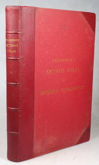
189643355London: Edward Stanford 1896. Second edition small folio iii leaves followed by 38 double page coloured maps plus a 104 pp index at the end. Marbled endpapers. Original red half morocco a.e.g. some faint rubbing otherwise very good. London: Edward Stanford unknown
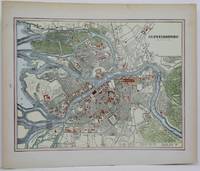
1888M5514Toronto: Home Knowledge Association 1888. Very good. Notes: Late 19th century city map of St. Petersburg in Russia. Size : 230x300 mm 9x11.75 Inches Coloring: Printed in Color with some hand colouring Category: Maps City Maps; Maps Russia Home Knowledge Association unknown
1877260751877. F.W. BEERS ATLAS OF MONMOUTH COUNTY. SPRING LAKE 1877: REIDS VILLA PARK. Upper picture frontal view of Reids Villa Park lower picture frontal view of the residence of Rev. A.A. Willits Spring Lake. Hand-colored. $125.00. unknown
1878260871878. WOOLMAN AND ROSE ATLAS OF THE NEW JERSEY COAST. SPRING LAKE HEIGHTS 1878 MAP. A 14-inch by 22-inch map showing Rodger's Park adjoining Spring Lake. $60.00. unknown
1878260991878. WOOLMAN AND ROSE ATLAS OF THE NEW JERSEY COAST. SPRING LAKE 1878 MAP. A 14-inch by 22-inch hand-colored map showing the Spring Lake Beach Tract Reid's Villa Park adjoining Sea Girt. $65.00. unknown
1809127861London: Printed for C. Smith Mapseller Extraordinary to his Royal Highness the Prince of Wales 1809. First Edition. Hardcover. Very Good. London Printed for C. Smith Mapseller Extraordinary to his Royal Highness the Prince of Wales 1809. Folio 404 × 330 mm engraved title leaf letterpress contents leaf and 43 hand-coloured copper-engraved maps numbered as 45 the map of Germany comprises two double-page sheets numbered 19-20 and 21-22. All leaves are printed one side only; all maps are dated 1808. Modern half calf and cloth with a gilt-lettered contrasting leather title-label on the spine; short scratch to the leather on the rear cover; title page a little tanned and discoloured around the margins by the leather corners of an earlier binding; scattered light foxing; insignificant short tears to some margins now sealed; trifling signs of age and use; overall in excellent condition. An attractive Georgian atlas 'on a Scale sufficiently large for the Purposes of general Reading and yet not too inconvenient for the Study or the Table' advertisement at the foot of the contents page. The three maps showing Australia 'Eastern Hemisphere' 'The World on Mercator's Projection' and 'Asia' all show the southern coast of the continent as uncharted. The expeditions of Flinders and Baudin had both charted this coast in 1802 but their maps were not published until 1814 and 1811 respectively. Printed for C. Smith, Mapseller Extraordinary to his Royal Highness the Prince of Wales hardcover
181832926Uden Sted ca. 1818-30. Lille 4to. 195x17 cm. Beskedent hshirtbd. Indre false itu men blokken som består af kortbladene intakt. Indeholder 44 af Holms kortblade skårne i træ og herefter grænsekolorerede i hånden. Her og der med lidt brunpletter og brugsspor. Et kort med rift repareret uden tab. Et kort med lidt tab i øverste venstre hjørne. <br/><br/><em>Det lidt naive men charmerende atlas er selvom det er produceret til skolebrug det første danske atlas. Det udkom med et varierende antal kort og sammensætning men ialt er der registreret 50 udgivne blade. Omfatter Danmark Slesvig og Holsten herefter kort over "Norge og Sverrig" "Rusland" "Tydskland" "Preussen" "Österrige Ungern og Gallicien" "Tÿrkiet" "Italien" "Spanien og Portugal" "Frankrige" "Nederlandene" "Storbrittanien" "Asien" "Afrika" "America" og "Australien". - Bibliotheca Danica II:391. </em> unknown
181956069København 1819. Folio. 44 x 27 cm. Original blue wrappers with some dampstains and rear somewhat soiled. With the engraved oval title on upper wrapper. In a later hcloth portfolio. With 19 all engraved maps charts plans coastal profiles of which 7 are double-page. Maps numbered in letters A-K profiles numbered I-IX.The maps depicting the main harbours with townplans and anchorages. Maps with a few small marginal closed tears. <br/><br/><em>Extremely scarce Danish edition a compilation from Vicente Tofino's "Atlas Maritimo" where the sheets have Danish text. This maritime-atlas was probably intended to accompagny Løvenørn's "Beskrivelse til det voxende Kaart over Kysterne af Spanien og Portugal." 1818.Bibl. Danica II 362 a. 367. - Luisa Martín-Merás: Catálogo analítico de los Atlas del Museo Naval de Madrid 2007". No 232. </em> hardcover
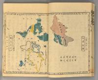
1871894281871. ATLAS Bridgeman E.C. translated by Mitsukuri Genpo. RENPO SHIRYAKU 2 vols. Tokyo Zodiacal date of Meiji 4 1871. String-bound Japanese-style fukuro-toji. An interesting work by Bridgeman the Chinese missionary originally published in Chinese but here marked for reading as Japanese kanbun. Thus not a translation as we might understand the term but a long standing aid for literate Japanese to understand the original classical Chinese. With a number of bw and some color maps of the USA along with a text describing US history culture economics etc. A bit of cover soiling outside and the scattered signs of insect damage internally but overall a very good copy. Upon comparison to the original Japanese edition of 1861 there is not much to choose between them. unknown
1889262481889. WOLVERTON'S ATLAS OF MONMOUTH COUNTY. RARITAN MAP 1889. A 15-inch by 18-inch hand-colored map of Raritan showing the Union Keyport Bethany Centerville and Granville school districts. $50.00. unknown
189255835Chicago & New York: Rand McNally & Co. 1892. Thick elephant folio. 16.5 x 23 x 3 in. 597 1 pp. plus 4 pp. Classified List of Subscribers in Portland Oregon. With over 150 wax engraved colour maps colour diagrams and charts many double-page numerous black & white text maps for cities streets and townships. Full embossed brown morocco over beveled boards gilt lettering & embossed borders on front cover gilt decoration & lettering on spine gilt inner dentelles marbled endpapers spine rebacked w/ original laid back down minor repairs to leather on back cover some scuffing edgewear wear to corners still a VG copy with superb clean interior. First edition thus of the subscriber’s edition of Rand McNally & Co.’s famed Indexed Atlas which encompasses both Western and Eastern Hemispheres offering an essential cartographic and historic reference for the world at the height of the Victorian era on the eve of the 1893 Columbian Exposition in Chicago Illinois. The detailed maps for the United States drew upon the 1890 census results and presented the population of every city town village and settlement in America at the time including Alaska the Indian Territory and Oklahoma all with maps present as well as many large maps of major cities such as Chicago including the site of the forthcoming Columbian Exposition a Chicago Railway Terminal map as well as such cities as Baltimore Cincinnati Louisville San Francisco and many others. Rand McNally & Co. were famed for their relief plate engraving process was engraving which produced fine detailed maps with exceptional detail and colour in competition with such companies as Colton Asher & Adams of New York Matthews-Northrup Co. and George Cram. The atlas also encompasses large detailed maps of Africa India China Asia Europe the Russian Empire and more along with detailed economic and statistical charts across the World. This Indexed Atlas was also released in other variations such as two volumes for Eastern and Western Hemispheres as well as a more compact version with less maps and descriptive text and without the subscriber’s list although all were issued with the same title page. The subscriber’s list for Portland reads as a Who’s Who of the most important firms in the business at the time including the Weinhard Brewery Stranahan & Du Puy architects the Portland Bottline Works owned by Cordes & Johannsen Max Smith’s Vienna Cafe Edison General Electric the Portland Cracker Company and many more. Worldcat locates 7 copies California State Notre Dame & Toronto Complete w/ varying paginations; Univ. of Illinois & Rutgers Vol. I only Rutgers substantially incomplete; Case Western Reserve copy not listed as present in their catalogue LOC; See: Phillips & Le Gear A List of Geographical Atlases in the Library of Congress Vol. I 975. Rand, McNally & Co., hardcover