MaineABAA
165 résultats
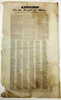
183234328Portland 1832. Broadside 11-3/4" x 19". Lightly foxed generously margined and untrimmed with lower blank margins chipped some old folds. Else Very Good. Matted. Dated in type at the end: Portland Oct. 25th 1832."<br/><br/> The text of this rare broadside urging the defeat of President Jackson in the upcoming presidential election is printed in three columns. It is followed by six columns consisting of hundreds of printed names of Portland citizens endorsing its sentiments. Despite promises to the contrary Jackson has expanded the power of the presidency reneging on his promise to serve only one term; enthusiastically practiced the Spoils System; and "the expenses of his administration have largely exceeded those of any of his six predecessors." He has claimed the power of "interpreting for himself" the Constitution although contradicted by "the Supreme Judiciary." <br/>AI 10824 1- Harvard. OCLC 58786948 3- AAS NYHS Harvard as of October 2017. unknown books
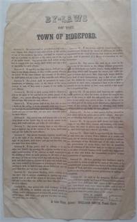
1850299Biddeford: N.p. 1850. Broadside 14" x 8" double column signed in type by three selectmen with attestation by town clerk at end. Folded in quarters with several tiny holes no loss a number of creases minor stains one short marginal tear etc. but overall quite sound. Comprised of 19 Articles proscribing certain types of behavior the unique broadside specifies fines or other punishments for lawbreakers. Most interesting is Article 4: "No boy or other person shall be allowed to play at the game of bat and ball in the public streets of the village. Any person offending against this article shall forfeit and pay fifty cents for each offence." In addition to the obvious like public drunkenness these include: riding horses at a gallop in town or more than a walk on the covered bridge; "any boy or other person" who hangs onto a sleigh or carriage; anyone "causing dogs or any other animals to fight" in the streets; "Any person wantonly exposing himself sic naked in sight of any dwelling house"; a person injuring an ornamental tree on any street; anyone mutilating or pulling down signs or public notices or throwing dirt or setting off firecrackers or sliding down hills in the public streets &c. &c. According to internet resources Biddeford Maine passed a city charter and adopted a mayoral form of government in 1855. Not recorded in OCLC. 299. N.p. unknown books
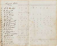
1862WRCAM55597Various locations mostly Louisiana 1862. 120pp. Contemporary sheep later leatherette backstrip title stamped in dark brown on front board reading "GUARD BOOK D. CO. 12TH. REG. MAINE." Some edge wear mild chipping and light scuffing to boards. Front hinge detached spine cracked. Occasional thumb-soiling to text. Still very good. A manuscript record book documenting an entire year of guard duty worked by various members of Company D 12th Maine Infantry Regiment Volunteers during the early part of the Civil War. The majority of time recorded in this book emanates from Louisiana while the 12th Maine Regiment was attached to Butler's Expeditionary Corps from January to March 1862. On their way to Louisiana the regiment travelled on the Steamship Constitution to Ship Island Mississippi serving there until May 4 1862. The Regiment then traveled to New Orleans for guard duty at the U.S. Mint until October 1862. While in New Orleans the Regiment took part in the expedition to Pass Manchaca from June 16 to 20 and the expedition to Ponchatoula from September 13 to 18. In October the Regiment moved slightly north to Camp Parapet in Shrewsbury Louisiana and served there until November 19 1862; the record book ends here. <br> <br> Each two-page opening of the ledger is pre- printed with a large column on the left for names and thirty-one numbered smaller columns for marking days served on guard duty. Most days have just one or two tick marks for any particular soldier indicating just one or two men were on active patrol mostly privates but also sergeants corporals musicians wagoners and others. The number of guard shifts worked by the regiment increased dramatically in May 1862 when they arrived at the U.S. Mint in New Orleans before falling off again the next month presumably after some relief arrived. In addition to guard duty service notations indicate reasons for absences such as "died at" "sick" "in confinement" "permanent detail" "enlisted for cook" "light duty" "in the woods" and "hospital." Notations from February 1862 indicate that James H. Andrews died onboard the Constitution on February 14 and two other soldiers caught sickness at Fortress Monroe. Another entry shows that S.G. Tracy "Died at Ship Island 12 of April 1862." Later in July Capt. H.W. Dunn is detailed for daily duty at the "Reding Press" in New Orleans. In August G.F. Drown is "Detailed as Nurse in General Hospital St. James Hotel N.O." <br> <br> Material from the Trans-Mississippi West is rare this early in the Civil War and also usually not as thorough as the present record book documents an entire year of service. A unique record of Civil War service for a peripatetic Maine volunteer infantry regiment serving in the Bayou State. hardcover books
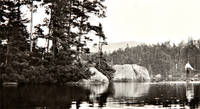
1920WRCAM45906Maine and various places in Europe 1920. A total of 248 original photographic prints. Oblong octavo albums. Original black morocco spines gilt titles as transcribed below. Albums with some shelf wear; European album slightly cocked lower portion of front joint splitting. The photographs are clean and in excellent condition. An outstanding collection of photographic images of scenes in Maine coastal France and the Channel Islands. The photographs were taken by an MIT Professor who apparently vacationed in Maine on a regular basis and who also visited England and France in the year before the outbreak of World War I. The albums of Maine images ably show the natural beauty of far western Maine while the album of scenes in France and England captures life in small villages and towns in Normandy Brittany and the Channel Islands before the peace of the region was shattered by the Great War. Two of the albums feature silver gelatin prints that have been printed directly onto the album sheets with accompanying handwritten captions. The third album consists of photographic prints affixed to sheets of the album. <br> <br> Though without ownership signatures we attribute these albums to Ralph Restieaux Lawrence a Professor of Electrical Engineering at MIT. These albums came with other photographic albums made by Lawrence on trips to the American West and Canada featuring photographs done in a similar style captioned and bound as these albums. Ralph Restieaux Lawrence b. 1873 was born in Cambridge Massachusetts and graduated from MIT in 1895. He taught electrical engineering at MIT from 1896 to 1941 and apparently enjoyed photography and traveling as the present albums would indicate. <br> <br> The three albums are: <br> <br> 1 HEALD POND MAINE 1907. Thirty-nine original photographic prints most approximately 3 3/4 x 4 3/4 inches each print affixed to a sheet in the album the sheets measuring 8 x 10 inches. Original oblong octavo album. This album contains a series of lovely photographs of the area around Heald Pond in west-central Maine not far from the Canadian border. Heald Pond is known for its natural beauty - ably captured in these photographs - and for its hiking trails. The photographs in this album are uncaptioned but show a number of images of the large pond and surrounding area as well as cabins and campsites. <br> <br> 2 PHOTOGRAPHS EUROPE 1913. 162 original silver gelatin prints approximately 3 1/4 x 5 1/4 inches each printed directly onto a sheet in the album the sheets measuring 6 3/4 x 9 1/4 inches. Each image is identified by a manuscript caption on the facing sheet. Original oblong octavo album. The pictures show scenes in France and England mostly in the regions of Brittany and Normandy the Channel Islands of Jersey Guernsey and Sark and the towns of Warwick and Stratford- upon-Avon. Many of the photographs show life in villages or larger towns such as Caen in Normandy. There are a number of photographs of scenes in and around the Brittany village of Concarneau including market scenes fetes and scenes along the port but other villages such as Pont-Aven and Vitre are included as well. Many of the photographs in the British islands show castles ruins towns and coastal scenes. In all a magnificent series of photographs of this region on the verge of World War I. <br> <br> 3 PHOTOGRAPHS ATTEAN MAINE 1920. Forty- seven original silver gelatin prints on average 3 x 5 inches one of them a panoramic photo 3 x 13 1/2 inches on a folded sheet each printed directly onto a sheet in the album the sheets 7 x 9 1/2 inches. Each image is identified by a manuscript caption on the facing sheet. Original oblong octavo album. Attean Lake is a resort area located in west- central Maine and this album of attractive silver gelatin prints shows scenes from a vacation taken there by Lawrence in 1920. The panoramic photograph is a lovely view of Attean Lake from a high perspective on nearby Mount Sally. There are several other pictures from Mount Sally as well as images of camps vistas from lake level nearby woods other ponds etc. unknown books
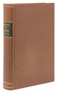
1795101339Boston: Printed by I Thomas and E.T. Thomas 1795. First edition. Engraved frontispiece foldng map drawn by Osgood Carleton. 8vo. Rebound in modern buckram with brown leather spine label with "Index of Names and Places in Sullivan's History of Maine" bound in at rear separately pubished by A.J. Huston Portland Maine. n.d. Map with 2-inch tear into image from inner margin uniform toning to text and map. Overall though very good. First edition. Engraved frontispiece foldng map drawn by Osgood Carleton. 8vo. The First General History of the State with Map. Howes S- 1122 "First general history of this state"; Evans 29589 Printed by I Thomas and E.T. Thomas unknown books
535894to. 10 pages rectos only though Gould has sketched a map with troop placements and annotations on the verso of one leaf approximately 1200 words. Folded corners of two leaves chipped some edgewear. Some browning but quite legible throughout. After a quarter century during which time he published a history of his regiment John M. Gould. History of the First-Tenth-Twenty Ninth Maine Regiment; Portland 1871 Gould is still searching for the identity of the Confederate regiment that faced his near the East Woods at Antietam. Reporting to Law the commander of the 4th Alabama Infantry in that bloody battle Gould relates his findings in excruciating detail quoting correspondents from a dozen regiments commanders junior officers and non-commissioned officers from both sides who have given him conflicting reports almost all of which stand at odds with official published reports as to the deployment of their units in the chaos of Hood's counter attack against Hooker's corps that blunted the initial Union assault early on the morning of 17 September 1862. _"It is quite clear that Hooker's fragments did not offer very serious resistance to Hood's advance. As far as the East Wood is concerned the 10th Maine was their first real obstacle . Judge Smith of the 5th Texas writes of the exceedingly severe fight the 1st was having with some Union forces & that both parties were showing their best 'staying qualities.' Then Gen. Hood noticing a force coming out of the East Wood said to Capt. Turner 'You may attend to those people!' I can't understand who this Union force was . this succession of events is extremely puzzling." Gould closes by asking Law not to refer to printed sources all of which he was familiar with but asked for any personal comments on his long commentary. "At present it appears to me that Gordon's Brigade did not follow up Hood sharply or at all & that Ripley & Colquitt replaced Hood but the latter line was considerably south of yours. How does that accord with your idea" In addition to his history of the regiments he served in during the Civil War Gould contributed a number of articles to the "National Tribune" relating to Antietam and corresponded with veterans from both sides as referred to often in this letter seeking information on various controversies surrounding the battle. He later donated hundreds of these letters to the Antietan Battlefield Board. Detailed letters on major Civil War battles by participants even those fueled by recollections shaded by decades of discussion and dispute are uncommon in trade. <br/><br/> unknown books
1919307722Boston 1919. 291 photographs usually four to a page on 75 black album leaves captioned throughout in white ink. 1 vols. Oblong folio. Post bound album in black leather over limp boards edges rubbed front joint tender. A few photographs loosened but all present and complete one photo folded at left edge long ago. Black cloth folding box. 291 photographs usually four to a page on 75 black album leaves captioned throughout in white ink. 1 vols. Oblong folio. An excellent and fully captioned photograph album of summer trout fishing and camping in the Rangeley district at Loon Lake Maine and other places of interest. The photographer is unnamed but evidently from Boston or the north shore with some connections further south on Long Island.<br/><br/>The album records two trips to Maine: the first to Loon Lake in 1915 and the J. Lewis York family fishing camp including several fine images of York often with a bear cub on a lead 66 photographs on 17 leaves ; and the second undated to Green Lake Mike Marr's camp at Indian Pond to Squaw Mountain Pond with Fred Lessor guide and to Moosehead Lake and the Kennebec 36 photographs on 9 leaves. <br/><br/>Three trips to Nova Scotia in 1914 1919 and 1923 to the Kedgemakoogee Rod and Gun Club on Kedgemakoogee Lake the Shelburne River and other trout fishing excursions 139 photographs on 37 leaves. In the June 1923 trip Irving Lake Dam on the Shelburne is described as the best fishing water of the trip. A few participants are identified: E.L. Matlack O.H. Muir and Wilson Forrest and the unidentified grinning angler with a large string of trout may well be the compiler. <br/><br/>As well as scenes from the Piping Rock Horse Show Long Island noting Miss Lansdale up in several snapshots 22 photographs on 5 leaves; and a trip to Atlantic City at the end with the Shriners parade and seaside scenes 27 photographs on 7 leaves. Cf. Bibliotheca Salmo Salar 186 for a similar album unknown books
18900000807Rochester 1890. Original Dark Blue Cloth. Very good. Oblong 8vo. Original dark blue cloth gild border tooling on front cover; tooling only on rear cover. Collation: Title page for Specimen Book followed by around 90 chromolithograph or pochoir color plates of various fruits and trees for clients. <br/><br/>This specimen book was presented interested parties who would purchase from plants from the nursery. The plates were prepared by Brunswick & Co. Rochester. Some offsetting present from fruit image to verso of preceding plate. hardcover books
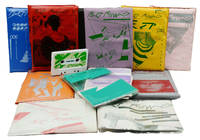
1982140940258Melbourne Australia: Fast Forward 1982. Complete run of 13 issues in 12 #008/009 is a double issue. Magazines often folded and sometimes staple bound with a variety of folded inserts with cassettes housed in silk-screened colored plastic wallets. Near Fine condition overall appearing to contain all inserts etc.; slightly rubbed and soiled occasional slight creasing to inserts or oxidation to staples. Small tear to rear wallet of #005. Issue 008/009 wallet gilt lettering well-rubbed. Offsetting to wallet of #011. Rare as a set. One of the very first cassette magazines which was popular financially successful and proved to be influential in the burgeoning global "cassette culture" of '80s independent music directly spawning such other projects as Sub Pop editor/ label head Bruce Pavitt was a contributor to the double-issue and the UK's Mix. The audio portion was structured somewhat like an old-timey news broadcast featuring new music as well as interviews with musicians. In addition to featuring the sounds of Aussies The Birthday Party Primitive Calculators Dead Can Dance Scientists and the Go-Betweens et al many prominent cutting-edge British and American musicians such as Pere Ubu The Clash The Fall The Residents Adam and the Ants and Gang of Four were interviewed and sometimes provided songs. Being Australian the magazine was bound to have a sense of humor. Robert Smith of The Cure got in on the act and provided "A Few Stylish Tips" in #013 about how he obtained that perfect lift for his '80s hair: soap and water. Crossword puzzles became a feature early on. Also Michael Trudgeon's design of the magazine was inspired growing in sophistication throughout the run adding inserts steadily stylishly utilizing only one or two colors in the printing process. A real acme of early '80s independent music print and design cultures. Its run lends credence to the idea that post-punk truly went beyond punk in many ways. Fast Forward unknown books
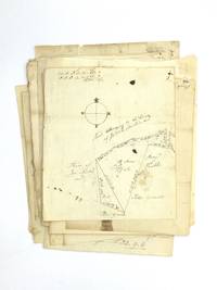
72615Very good. A collection of 28 original manuscript land surveys recording the boundaries of property in Kittery York County Maine during the mid to late 1700s. Then located in Massachusetts York County was established in 1652 when the Massachusetts Bay Colony first asserted territorial claims over the settlements of present-day southern Maine.<br/> <br/>Together this collection of property surveys helps to paint a picture of the history development and inhabitants of Kittery between 1772 and 1799. The coastal town with a current estimated population of about 10000 residents is the southernmost city in Maine and was originally settled as a fishing village. During the Revolutionary War the first vessels of the U.S. Navy were constructed in Kittery. In addition to the shape of property and ownership of homesteads the surveys reveal who occupied adjoining lands locations of roadways and occasionally the site of buildings and other improvements.<br/> <br/>One of the earliest surveys in this collection is pre-Independence dated November 6 1772 and provides the boundaries of land owned by John Bradbury. A February 1780 survey shows that a country road adjoined the property of Tim Fergusson and Stephen Paul while another updated survey is labeled "Plan Goodwin's Marsh" which is bounded along one edge by the York River. A portion of the property drawn for an undated survey of Stephen Remick's land is labeled "widows thirds" a reference to the common law tradition of dower which originated in England and carried on in the American colonies providing widows the right to one-third of the land and property of her husband. This practice persisted in Maine until 1896 when a new concept of a spousal share was enacted.<br/> <br/>A survey dated May 1790 contains the handwritten note: "Plan land taken by execution in favour of selectmen of York from Dan Braydon." Land taken by execution refers to the seizure of property generally in payment of a debt. However during this period property was routinely confiscated from landowners who were loyal to the King during the war for independence. Little is known about Braydon so the reasons for this forfeiture are unknown.<br/> <br/>Four of the surveys in this collection are connected to properties owned by the Jeremiah Moulton family who were among the earliest and most prominent settlers in the region. A survey dated May 13 1793 shows a portion of land "taken by execution in favour" of Abigail Lyman from her presumed brother Jeremiah Moulton. Both her father who died in 1777 and her brother were named Jeremiah Moulton. Two more surveys both dated July 7 1783 note Joseph Bragdon's land was "taken by execution from Jeremiah Moulton." Bragdon who died in 1766 was married to Mary Moulton the sister of the elder Jeremiah Moulton. The land had been mortgaged to Jonathan Sayward. Another plan is labeled "Col. Moulton's land bot of Peter Grant April 1785."<br/> <br/>Another group of land surveys in this collection is connected to the family of Abraham Preble who settled in York County in 1642 by way of County Kent England. He was a councilor county treasurer and judge. These five surveys show lands owned by Caleb Paul Esaias and Benjamin Preble two generations removed from Abraham. Esaias was captain of a company of minutemen at Cambridge later rising to the rank of Colonel during the Revolutionary War.<br/> <br/>The surveys each measure about 7 ½" x 8" and are hand drawn often containing holographic notations boundaries with longitude and latitude markings and various other notations including figures. They are generally toned several are soiled and a few have silk tape repairs. Overall they are in very good condition. unknown books
18901146c. 1890. Pencil chalk and watercolor. Margins: 21 ¼ x 14 ½. Roosevelt-Richards is just recently being recognized for her place in American artBorn: <br /><br />Known for: Juvenile book and magazine illustration<br />1905 was the year she came to Wilmington.Delaware and studied with Howard Pyle remaining there for 7 years.By the time Richards had begun her studies under Pyle she was a published illustrator with works appearing in juvenile literature books.In a 1927 interview she recalled Pyle's attitude toward his teaching: "Twice a week we would come together and Mr. Pyle would criticize our efforts and offer suggestions. He always acted as if it were a privilege we gave him." After her stay in Wilmington Richards settled permanently in New Haven actively participating in the art community there.<br /> books
188130409Ellworth Maine: S. F. Colby & Co engraved by William Bracher printed by F. Bourquin Philadelphia 1881. Folio. 16 3/4 x 14 1/4 inches. 96pp including 5pp ads in rear. 39 hand coloured lithographed maps 17 double-page some printed recto and verso of same sheets numerous insets complete. Contemporary black morocco upper cover lettered in gilt marbled endpapers gilt edges.<br/> <br/>Provenance: Edward C. Burleigh name in gilt on upper cover<br/> <br/>The first atlas devoted to Hancock County Maine.<br/> <br/>In 1881 cartographer/surveyor George N. Colby assisted by J.H. Stuart and others published the first atlas of Hancock County towns villages plantations and timber lots. The maps identify many property owners by name and show the locations of homesteads businesses roads schools churches mills and cemeteries in those plantations towns and villages. Including all the insets 87 maps were produced by Colby Halfpenny and Stuart drawn on stone by William Bracher and printed by F. Bourquin of Philadelphia. The detailed town plans include Mount Desert Island Bar Harbor Ellsworth Bluehill Southwest Harbor and numerous others. As with most 19th century county atlases the work was published strictly by subscription. Given the relatively small size of the county in terms of population the atlas would not have been published in a large print run resulting in its rarity today. "Despite their limitations and inaccuracies nineteenth-century county atlases nonetheless preserve a detailed cartographical biographical and pictorial record of a large segment of rural America in the Victorian age" Ristow American Maps and Mapmakers p. 424. This copy with provenance to Edward C. Burleigh the Governor of Maine from 1889-1893.<br/> <br/>LeGear 14311. S. F. Colby & Co [engraved by William Bracher, printed by F. Bourquin, Philadelphia] unknown books
1912312798np 1912. 2 60 pp of typewritten text with a hand-drawn map of the Club property on the Dobsis Stream between "Dobsis" and "Pocumsas" lakes a folding cyanotype map of the region and 23 photographs of the Club and members. 1 vols. 8vo 8-1/2 x 6 inches. Reverse buckskin with title stamped in blind Dobsis Club 1872-1912 with metal ring binding. Signature "January 1 1912 Lillian W. Larrabbee" on title leaf. Typescript addendum of fishing catches 1919-1920 by H.S. Dennison loosely inserted. Green cloth folding box. 2 60 pp of typewritten text with a hand-drawn map of the Club property on the Dobsis Stream between "Dobsis" and "Pocumsas" lakes a folding cyanotype map of the region and 23 photographs of the Club and members. 1 vols. 8vo 8-1/2 x 6 inches. UNRECORDED. History of the Dobsis Club in the Grand Lake watershed formed in 1872 by Harvey Jewell Lyman B. Jewell E.W. Dennison Cutler Downer V.H. Blackston and F.A. Kennedy with famous Rangeley guide G. L. F. Ball as Manager. In 1879 club buildings were built by Ball on the spit of land between Sysladobsis or Dobsis and Pocumcus lakes. <br/>The first portion of the book transcribes Ball's letters 1872-1894 discussing his marriage money woes and fish hatchery business. Ball who had been a guide in the Rangeley region since the early 1860s worked for the club until 1898 and died the following year. The history includes a calendar of notable dates including construction poker hands an earthquake persons falling into the rivers and the disappearance of N.O. Shaw on 19 December 1907; his body was found the next June. Weather records include Ice Out dates earliest 22 April 1878 latest 16 May 1888 extremes of temperature in summer and winter. There is a long register of fishermen and visitors and logs of fishing catches and game bags. Many names from the Dennison clan appear over the years. The work is illustrated throughout with high quality photographs: portraits of members and views of the club sometimes two to a plate. The last entries for seven members visiting in Spring 1912 are in manuscript.<br/>The club appears to have continued in existence through the early 1940s. unknown books
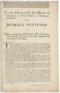
1715WRCAM39807London 1715. 1p. with printed docket title on verso. Small folio. Antique-style three-quarter calf and marbled boards spine gilt leather label. Ornamental upper border. Minor foxing. Very good. A rare and early petition relating to British settlement in the eastern part of present-day Maine. The authors refer to petitioning "his Majesty in Council on the 6th Day of December last for having a Colony settled between New England and Nova Scotia" with "over one thousand disbanded men" and to be funded with the proceeds of a proposed coinage operation. The only copy of this document listed by OCLC and ESTC is at the New-York Historical Society which estimates merely that the document was printed during the 1700s. The historical context the text cited above and discovery of this broadsheet among similar petitions dating almost exclusively to 1714 and 1715 however make 1715 an extremely likely date of printing. In the Treaty of Utrecht 1713 the French ceded the land east of the Kennebec River presumably the area in question here to the British; this event and the reference to "disbanded soldiers" suggest that the War of the Spanish Succession had recently ended which it finally did in 1714. George I succeeded Queen Anne in late 1714 which means the petitioning of "December last" could not have been earlier than that year. With the new monarchy and a major upheaval in the House of Commons following the general election of 1715 petitionary literature distributed in the lobby of Parliament surged with this document almost certainly among the examples from that year. <br> <br> The petitioners evidently officers who had served in the recent war call attention to the fact that the lands they hope to settle "were formally survey'd and given by King Charles the Second to the Duke of York" and that the area has been confirmed as rich for farming. They ask that Parliament allow them to present their formal proposals for the settlement or "if not thought proper to have a Colony settled in that part of North- America" at least still to grant them a contract to coin 1000 tons worth of half- pence and farthings. <br> <br> A very important Maine document one of only two surviving copies. hardcover books
176726308Newport R.I. 1767. Manuscript map in ink and wash on a single folio sheet 15 1/4 x 19 inches. Docketed in manuscript on verso "Map of Leveretts Patent alias Muscongus." With two manuscript documents one being 3pp. on folio sheets dated at Boston May 19 1787; the other being 3pp. on folio sheets dated at Providence R.I. on May 30 1787. Also with a half-page of manuscript dated Boston March 28 1768. All three documents relating to the lands depicted on the map. Map with minor separations along horizontal fold. The half-page document being only the beginning portion of a longer letter otherwise the manuscripts in near fine condition. A highly important manuscript map of Colonial Maine: heavily annotated by William Ellery a signer of the Declaration of Independence from Rhode Island.<br/> <br/>An attractive eighteenth century manuscript map of Penobscot Bay Maine heavily annotated by William Ellery a signer of the Declaration of Independence from Rhode Island who made claims to some of the lands depicted on the map. The map was drawn by British Rear-Admiral Jahleel Brenton who commanded the HMS Queen during the Revolution and whose family lost much of its property as a result of the Revolution. The map is skillfully rendered as would be expected of a British naval officer and is done on a scale of about three miles to the inch. The map depicts the coastline from the Damariscotta River in the southwest to the Penobscot River in the northeast and shows and names the many islands of the Bay as well as many inlets harbors rivers ponds etc. The location of a fort and settlements have also been added. This information was all added by William Ellery 1727-1820 a signer of the Declaration of Independence from Rhode Island. Ellery explains in a manuscript note in the lower right corner of the map dated at Newport Rhode Island in 1767: "This map of Leverett's Patent &c was copied from a copy by Jahleel Brenton Esq. one of the Proprietors; and presented by his son Samuel Brenton to William Ellery who wrote the References Names of Places &c. William Ellery." In the upper left corner of the sheet Ellery has added a long manuscript note explaining the survey and the boundaries of Leverett's Patent as depicted on the map. This map and the accompanying manuscript documents were found among William Ellery's papers and were part of Ellery and his brother Benjamin's attempts to claim lands in Maine that they believed belonged to their family. "Leverett's Patent" also known as the Waldo Patent or the Muscongus Patent was issued in 1629 to Thomas Leverett and John Beauchamp. It granted land and trading rights for a thirty-six square mile area along the Penobscot Bay in present-day Maine between the Muscongus River and Penobscot River. According to the documents present here Leverett inherited the full patent upon Beauchamp's death and at his own death divided the grant among his ten children who then divided the land again amongst the next generation. Around 1720 Gen. Samuel Waldo of Boston acquired a large portion of the patent and began recruiting immigrants from Germany to settle the area. The letter fragment present here dated March 28 1768 and addressed to Benjamin and William Ellery asserts that the Ellerys have an "undoubted right to a half share" of the Muscongus lands as a result of a purchase made by their grandfather. The unidentified author of the letter goes on to describe the Waldo heirs as "exceeding difficult to deal with." Also present are two manuscripts one being a 1787 copy of the original 1629 grant of the Muscongus Patent from the Council of Plymouth the other being a manuscript deed of sale signed by James Green for a portion of the original patent. A handsome colonial era manuscript map of the coast of Maine drawn by a British Rear-Admiral and used by a signer of the Declaration of Independence to defend his family's claims to the land. Significant manuscript maps of this early date are virtually unknown in the market. unknown books