98 résultats
178466690S. n. | à Amsterdam 1784 | 9 x 14.7 cm | relié
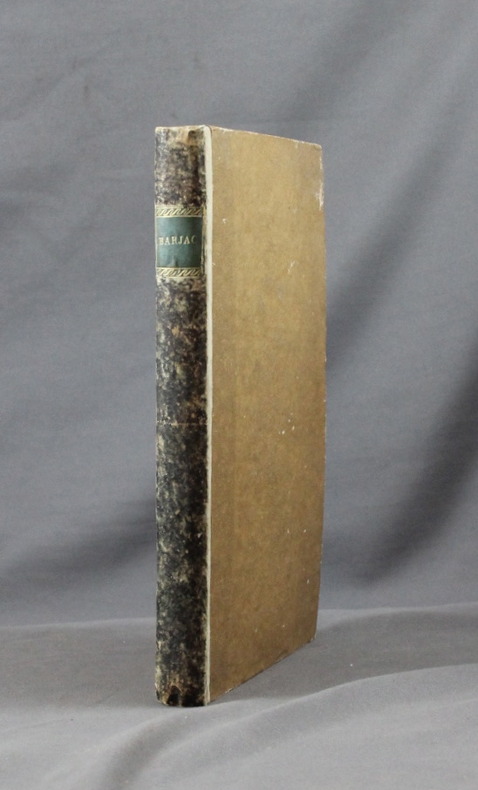
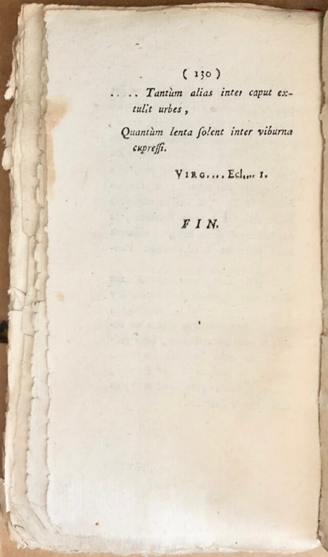
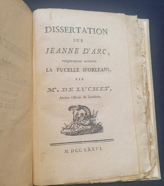
1776319Ff1776 Sans lieu - 1776 - In8 - reliure demi veau moderne couverture d'attente de papier gris conservée - Rare édition originale de cette biographie de Jeanne d'Arc par le marquis de Luchet de La Roche du Maine. Cet ouvrage était déjà considéré comme rare en 1852 comme en témoigne Charles Brainne dans Les Hommes illustres de l'Orléanais. (T. 1, pp. 251-252) : "En 1776, M. de Luchet fit imprimer un in-8 de cent trente et une pages, très rare maintenant, et intitulé « Dissertation sur Jeanne d'Arc », il est sans nom d'imprimeur et sans permis d'imprimer. Plusieurs historiens de Jeanne d'Arc, et notamment M. Lebrun des Charmettes, le plus complet et le plus exact de tous, en ont eu connaissance". Ouvrage très rare donc -
178466690à Amsterdam: S. n. 1784. Fine. S. n. à Amsterdam 1784 9 x 14.7 cm relié Several editions appeared the same year in Paris London Berlin. Full brown flamed sheep binding late 19th century. Smooth spine richly decorated in Restoration style. Red morocco title label. Fine copy. Armorial bookplate engraved from a private library. Satirical and cynical description of Parisian life and customs. The author discusses theaters prisons fashions promenades the Tuileries. S. n. unknown
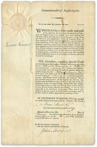
1799707161799. 1799 Document Appointed a Judge to the Kennebeck County Maine Court of Common Pleas Judges. Maine. Dummer Nathaniel 1755-1815. To All Unto Whom These Presents Shall Come Greeting. Boston February 28 1799. 17" x 11" part-printed document inscribed in neat hand docketed on verso large embossed Massachusetts seal to upper-left corner signed by Governor Increase Sumner countersigned by John Avery first Massachusetts Secretary of the Commonwealth. Light browning and edgewear light soiling and a few minor spots vertical and horizontal fold lines a few minor years along folds with no loss to text. An interesting item. $350. Dummer resided in Hallowell Maine and was judge of the Kennebeck County Court from 1799 until his death in 1815. He was also Hallowell's postmaster from 1792 to 1802. The docket note witnessed by Joseph North and William Howard attests that Dummer took his oath of office on April 2 1799. unknown books
178446404421À Dublin, de l’Imprimerie de Wilson, et se trouve à Paris, chez les libraires qui vendent des nouveautés, 1784 ; in-8, broché, couverture bleue muette, non rogné. (brochage de l’époque) VIII pp., 216 pp.Une des éditions à la date de l’originale. Sur le titre, ce roman est attribué à Choderlos de Laclos. Le véritable auteur est le marquis de Luchet (Saintes 1740 - Paris 1792). D’abord officier de cavalerie, il quitte l’armée pour faire des affaires qui échouent et l’obligeront à se réfugier à Lausanne pour fuir ses créanciers. Grâce à Voltaire il devint bibliothécaire du landgrave de Hesse. En 1786, il passa au service du prince Henri de Prusse et ne revint en France qu’en 1788. Luchet a beaucoup produit. Ses livres qui se voulaient des mémoires de son temps étaient en réalité des romans satiriques. Drujon. Les livres à clefs II, 965 donne les clefs de celui-ci. On y trouve la ctesse et le cte de La Noue, le mis de Culan, Melle Arnould, Melle Dubois la première femme de Beaumarchais, le Mis de Villette, Beaumarchais, Linguet, Fréron, Boufflers, Vergennes... Lorsqu’on connaît cette clef, le roman devient assez piquant. “Les mémoires que nous publions aujourd’hui sont une fiction, si l’on veut : il n’y a cependant pas un fait dont le fonds ne soit vrai, pas un personnage qui n’existe ou n’ait existé. Tout ce que j’ai supprimé, c’est le merveilleux ; ce qui se passe est beaucoup plus incroyable que ce qu’on invente.”Mylne Martin 84,39. - Exemplaire à toutes marges, bel état intérieur, le brochage est un peu défraîchi.
178149841781 Paris Lattré 1781-1791 5 cartes anciennes. Env. 30 x 41,5 cm hors marges, 36,5 x 51 cm toutes marges comprises. Frontières rehaussées. Bonnes conditions. Quelques menues déchirures marginales à certaines cartes. Pliure partiellement fendue à la carte du Dauphiné et de la Provence.
17864185Hambourg, Paris, Strasbourg, chez François FAUCHE, Imprimerie L. Cellot, 1786 5 vol. in-8 (210 x 135 mm.), vol. 1 : [J.-P.-L. de La Roche du Maine], Hambourg, chez François Fauche, 1786, 74 pp., vol. 2 : (Me Doillot, Avocat), Paris, L. Cellot, 1786, 109 pp., vol. 3 : Strasbourg, 1786, 83 pp., vol. 4 : (Me Doillot, Avocat), Paris, L. Cellot, 1786, 93 pp., vol. 5 : ( Me Doillot, Avocat), Paris, Cellot, 1786, 96 pp.Brochure d'attente sous papier bleu, non-rognée, vol. 1 : petite auréole en marge inf., vol. 2 : page de titre tachée (mouillure), vol. 3 : un feuillet déchiré et froissé en marge, vol. 4 : auréole de mouillure sur quelques feuillets, papiers d'attente défraîchis, dos absents.
17841664A Dublin, De l’imprimerie de Wilson, 1784. In-8 de VIII, 216 pages, demi-vélin, dos teinté en noir, étiquette de titre verte ornée. Non-rogné.
17895941Sans lieu, , 1789. 2 tomes de VIII-130-(2) pp. (2)-172-(4) pp.La Galerie des Dames françaises, pour servir de suite à la Galerie des Etats-Généraux, par le même auteur. A Londres, 1790. 207-(2) pp.Ensemble 3 tomes en 2 vol. in-8, demi-basane havane à coins, dos orné à nerfs, tranches rouges (reliure de l'époque).
17983706Paris, Jansen, 1798. 12 pièces reliées en 1 vol. in-8, basane havane, dos lisse orné d'une treille dorée, pièce de titre en maroquin rouge, frise dorée d'encadrement sur les plats (reliure de l'époque).
17898436Imprimerie Impériale / Chez Pillet / Delaunay / J.C. Cotta / Poussielgue / Asselin / Gaultier - Laguionie 13 x 20,5 1789 Petit in-8, reliure à la bradel pleine toile bleue moderne, titre "France 1789-1815" doré au dos, réunissant 8 pièces rares, parues entre 1789 et 1840, concernant l'histoire de la période qui s'étend de 1789 à 1815. I./ La galerie des Etats-Généraux, 1789, 204-[1] pp. Ecrit à plusieurs mains (Luchet, Mirabeau ?), la "Galerie" est une succession de portraits (31) satiriques des hommes de 1789, de Narsès (Necker) à (Francus l'archevêque de Vienne/Lefranc de Pompignan, affublé chacun d'un nom codé, dont la clé figure sur la dernière page. L'ensemble compte 3 volumes, il s'agit ici du seul premier volume. II. Notice abrégée sur la vie, le caractère et les crimes des principaux assassins aux gages de l'Angleterre qui sont aujourd'hui traduit devant le Tribunal de la Seine, Paris, Imprimerie Impériale, An XII, 1804, 72 pp. Notice à charge, attribuée à l'agent de Napoléon Roques de Montgaillard, qui dresse la biographie des hommes autour de Cadoudal qui fomentèrent le complot de 1804. III. Procès de M. Marie Chamans de Lavalette, accusé de complicité dans l'attentat qui a ramené l'usurpateur en France et condamné à mort le 21 novembre à la peine de mort, précédé d'une notice historique sur la carrière civile et militaire de M. de Lavalette, Paris, chez Pillet, 1815, 50 p. IV. Mémoire de M. le Maréchal Masséna duc de Rivoli, prince d'Essling, sur les événements qui ont eu lieu en Provence, pendant les mois de mars et d'avril 1815, suivi de pièce justificatives et d'une carte géographique, Deuxième édition; Paris, Delaunay, 1816, 89 pp. Réponse du maréchal d'Empire (1758-1817) aux accusations des Ultras de ne pas avoir voulu arrêter Bonaparte à son retour lors de sa traversée de la Provence en mars 1815. V. Projet de pétition au Parlement d'Angleterre par le comte de Las Cases, Stuttgart, dans la librairie de J.G. Cotta, 1818, 51 pp. Page de titre en allemand également (Entwurf einer Bittschrift an das brittische Parlament vom Grafen de Las Cases) et texte allemand et traduction française page à page. Après Waterloo, Las Cases (1766-1842) accompagne Napoléon à Sainte-Hélène. Pétition que Las Cases aurait transmise lors de son arrivée au Cap de Bonne Espérance, après avoir laissé Napoléon à Longwood. VI. Appel à tous les Français contre les calomnies par lesquelles on a cherché à flétrir la conduite du comte de Bourmont en 1815, Paris, Imprimerie de Poussielgue, 1840, 40 pp. Plaidoyer de Charles de Bourmont lors du retour d'exil de son père le maréchal d'Empire. VII. Documents inédits sur la campagne de 1815 publiés par le duc d'Elchingen, Paris, 1840, Asselin - Laguionie, 87 pp. Défense de la mémoire de Ney maréchal d'Empire, par son fils Michel Ney (1804-1854), duc d'Elchingen, qui avait réuni d'importants documents sur la bataille de Waterloo et sur le rôle joué par son père. Mais carte dépliante absente. Ce texte est suivi par une note du général Jomini (pp. 265-280), adressée à Michel Ney en septembre 1841. VIII. Relation de la campagne de 1815, dite de Waterloo, pour servir à l'histoire du maréchal Ney, par le colonel Heymès, son premier aide de camp, témoin oculaire, Paris, imprimerie de Gaultier-Laguionie, Paris 1829. Exemplaire de bibliothèque avec ses cotes au dos, très bon état de cet ensemble de pièces peu fréquentes. Ex-libris gravé sur le premier contre plat du collectionneur et prêtre californien Joseph M. Gleason (1869-1942) et petit ex-libris récent.(B56). PHOTOS NUMERIQUES DISPONIBLES PAR EMAIL SUR SIMPLE DEMANDE-DIGITAL PHOTOGRAPS MAY BE AVAILABLE ON REQUEST
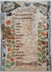
18003722<b><i>Family Register of Seward Porter circa 1800</i></b><br /><br /><br />A nicely accomplished though primitive family register of the Seward and Eleanor Porter family. Two colorful plants with birds in their top branches fill the sides of the register. At the top hover two angel-like figures one bearing an hour glass the other blowing a horn. <p>Seward and Eleanor Porter were from Weymouth Massachusetts but relocated to Falmouth in the District of Maine in about 1777 and then to Freeport in about 1782. This family register lists the names birth places and birth dates of the Porter's 13 children from 1778 to 1797. </p>Their fourth son on the list -- also named Seward Porter -- would become a prominent Maine mariner and entrepreneur. He brought the first steamboat to Maine in 1823. In 1837 he published a now-highly-prized set of charts of the Maine coast. For Seward Porter the son see:<i>Tooley's Dictionary of Mapmakers</i>: Vol 3 p. 453 and Guthorn <i>United States Coastal Charts 1783-1861</i>: p. 29. <br /><br /><b>Condition:</b> Approximately 14 x 10." Iron gall ink on wove sheet with colored decorations. The sheet is mounted on a ca. 1815 newspaper and strips of wallpaper about 1" wide have been applied along the left and right sides. The piece is in fair condition with overall cockling and some water damage. There is a small puncture on the left edge. The ink notations of the birth dates and locations are faded but legible.<br /><br />ICN 3198.
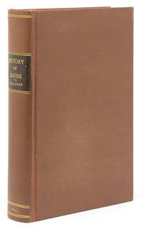
1795101339Boston: Printed by I Thomas and E.T. Thomas 1795. First edition. Engraved frontispiece foldng map drawn by Osgood Carleton. 8vo. Rebound in modern buckram with brown leather spine label with "Index of Names and Places in Sullivan's History of Maine" bound in at rear separately pubished by A.J. Huston Portland Maine. n.d. Map with 2-inch tear into image from inner margin uniform toning to text and map. Overall though very good. First edition. Engraved frontispiece foldng map drawn by Osgood Carleton. 8vo. The First General History of the State with Map. Howes S- 1122 "First general history of this state"; Evans 29589 Printed by I Thomas and E.T. Thomas unknown books
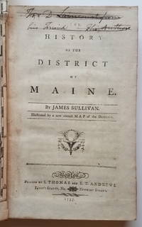
17953732This is the first general history of Maine written in the post-Revolutionary War time period that saw several state histories published including those by Belknap Jefferson and Ramsay. Despite its distinctly chilly initial reception and the less than impressive editorial standards Sullivan's <i>History</i>is a cornerstone work in any collection of Maine material. <p>The <i>History</i>includes as the frontispiece Osgood Carleton's <i>A Map of the District of Maine Drawn from the latest Surveys and other best Authorities by Osgood Carleton</i>. The map measuring 20 5/16 x 16 3/8" includes an inset titled <i>A Map of those parts of the Country most famous for being harassed sic by the Indians</i>. Carleton's map was the most detailed done of Maine to that time. </p><p>At the head of the title page is an inscription which has been lined out: "For D. Laincourt from his Friend the Author."</p><p><b>References:</b> Evans: 29589. Howes <i>USiana:</i> S-1122. Sabin: 93499. Williamson <i>A Bibliography of the State of Maine</i>: 9608. Thompson: <i>Important Maine Maps Books Prints and Ephemera</i>: 18A. For the map: Wheat & Brun <i>Maps and Charts Published in America before 1800</i>: 171. McCorkle <i>New England in Early Printed Maps 1513-1800</i>: Me795.1. </p><p><b>Condition: </b>vii iv 421 pp. With folding map frontispiece.Original full calf with worn red title label. Boards scuffed and bumped with areas of abrasion; joints cracked. Text block is very tight. Occasional light foxing and staining throughout. The map is in remarkably good condition especially in comparison to the usual state in which it is found. Trimmed close as usual along the binding edge. A sharp dark impression with minimal foxing or offsetting. <br /></p><p>ICN 7660.3.</p> Printed by I. Thomas and E.T. Andrews hardcover
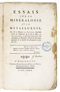
1779K89BNAR73VU7Maastricht 1779. 8vo 22.5 x 13.5 cm. J.E. Dufour & P. Roux Contemporary decorated paper wrappers. 3 parts in 1 volume. 4 XXVII 1 232 pp. Very rare first edition printed in Maastricht of a mining manual by a French enlightened marquis who worked as chief librarian at the Hessen-Kassel court of Friedrich II 1720-1785. Although mentioned reference literature the book is very rare on the market and we found no copy in auction records. Luchet was an acquaintance of Voltaire and in fact had a letter of recommendation from him that helped him obtain his position at the Hessen-Kassel court. Luchet's other writings concerned literature and theatre which makes this mining manual a curious standout. It is unclear why this work was printed in Maastricht except that the Maastricht south Limburg region does have a long history of mining. In a lengthy discourse on mining in the preliminaries Luchet makes a strong pro-mining statement. This is followed by reflections on several aspects of mining often in a question and answer form. He goes into the medical consequences of mining and names several minerals and metals such as coal quartz lead tin gold silver copper and more.A second edition appeared in 1797 often bound with H. Struve Methode analytique des fossils Lausanne 1797.Bookplate on front paste-down owner's name on title-page small stamp on title-page and pages 9 99 199 and 232. First few pages with marginal stains. Binding worn. Otherwise in good condition and wholly untrimmed.l Geology emerging 1404; Hoover 549; Wellcome III p. 451; Worldcat 3 copies; not in Margerie. unknown
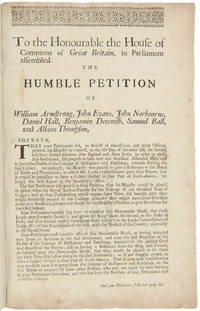
171521151London 1715. Broadsheet. 1p. plus printed docket title on verso. Small folio. Bound to style in half calf over marbled paper-covered boards. Ornamental border. Minor foxing. Very good. A project for colonizing Maine in 1715. One of only two surviving copies.<br/> <br/> A rare early petition relating to British settlement in the eastern part of present-day Maine. The authors refer to petitioning "his Majesty in Council on the 6th Day of December last for having a Colony settled between New England and Nova Scotia" with "over one thousand disbanded men" and to be funded with the proceeds of a proposed coinage operation. The only copy of this document listed by OCLC and ESTC is at the New-York Historical Society which estimates merely that the document was printed during the 1700s. The historical context the text cited above and discovery of this broadsheet among similar petitions dating almost exclusively to 1714 and 1715 however make 1715 an extremely likely date of printing. In the Treaty of Utrecht 1713 the French ceded the land east of the Kennebec River presumably the area in question here to the British; this event and the reference to "disbanded soldiers" suggest that the War of the Spanish Succession had recently ended which it finally did in 1714. George I succeeded Queen Anne in late 1714 meaning that the petitioning of "December last" could not have been earlier than that year. With the new monarchy and a major upheaval in the House of Commons following the general election of 1715 petitionary literature distributed in the lobby of Parliament surged with this document almost certainly among the examples from that year. The petitioners evidently officers who had served in the recent war call attention to the fact that the lands they hope to settle "were formally survey'd and given by King Charles the Second to the Duke of York" and that the area has been confirmed as rich for farming. They ask that Parliament allow them to present their formal proposals for the settlement or "if not thought proper to have a Colony settled in that part of North-America" at least still to grant them a contract to coin 1000 tons' worth of half-pence and farthings. A very important Maine document one of only two surviving copies. unknown
176611625Amsterdam and Paris: P.-F. Gueffier 1766. Contemporary cat’s paw sheep neatly restored slightly defective gilt spine and label red edges pink silk marker; interleaved throughout — a vertical crease divides the interleaves in two columns. <p>With: Jousse Daniel-Charles.       1742-1769.<br />        Lettre D’Un Orléanois…Sur La Nouvelle Histoire De L’Orléanois. Bruxelles and Paris E. Flon and J. Debure 1766. 12mo 173 x 110 mm. inlaid in blank quarto sheets for binding. 40p.</p> <br /> <p>      Ad I-II: This volume belonged to the local historian and Orléans Cathedral canon Louis-Eusèbe Loiseau 1721-95.<br />       Ad I: ALL PUBLISHED SUPPRESSED. Only Edition. Luchet believed “Good history is a long fable†p. iv tr. Immediately upon publication of this first volume of a projected five Luchet’s fanciful account of the history of Orléans and environs 52 B.C.E. to 1428 C.E. came under fire. He had manufactured personal information abandoned the facts cloven to the marvelous and doubted Jeanne d’Arc’s divine mission pp. 307-419. This last angered the clergy and THE DUC D’ORLÉANS FORCED THE AUTHOR TO BUY UP AND DESTROY THE EDITION.<br />       COUNTERING LUCHET’S FANTASIES LOISEAU COMPILED HIS OWN THIRTY THOUSAND WORD DOUBLE-COLUMN CHRONOLOGY filling 115 interleaf pages. Its preface summarizes Luchet’s History — “detestable in substance and form†tr. lists errors and sketches a damning biography of Luchet. One column of the manuscript chronology draws on Polluche’s Essais historiques sur Orléans 1778 and the other on articles in Calendrier historique d’Orléanois by the Orléans Maurist librarian Louis Fabre 1710-98.<br />       The longest and earliest inserted manuscript is A FIFTEEN-PAGE ESSAY UNFAVORABLE TO LUCHET’S HISTORY identifying still more inaccuracies nine concern Jeanne d’Arc. The Mémoire takes a statistical and economic perspective on Orléans its architecture and exports. Signed by Loiseau the Observations treats the by-laws of the new Orléans learned society born of the 1786 merger of two earlier groups. Loiseau was secretary of one for 25 years 1761-85.<br /> ¶Lanéry d’Arc Le Livre d’or de Jeanne d’Arc. Bibliographie 700; Lelong Bibliothèque historique de la France III: 35603-4; Brainne et al. Les Hommes illustres de l’Orléanais I: 250-2.<br />       Ad II: Only Edition the author’s sole book and the first published attack on Luchet’s History. Exposing 108 blunders with context and secondary source proof Jousse used material gathered by his father 1710-81 who supplied all the entries related to Orléans in Lelong’s Bibliothèque historique 1768-78.<br /> ¶Lanéry d’Arc 700; Lelong III: 35604; Conlon Le Siècle des Lumières 66:976.<br />       All items are in good condition.</p> P.-F. Gueffier unknown
17763748<b>Striking Casco Bay Chart from the Atlantic Neptune 1776</b><br /><br />This is an exceptional chart of the coast of Maine between Cape Elizabeth and Popham from the early Revolutionary War period. It is from Des Barres' monumental <i>Atlantic Neptune</i> a sea atlas published by the British Admiralty during the last quarter of the 18th century. The <i>Atlantic Neptune</i> has been called "the most splendid collection of charts plans and views ever published." <br /><br />The present chart includes all of Casco Bay naming the larger islands and extends east to include Seguin "Segevin Island" and Georgetown Islands. Among the numerous geographic features named are Great Jebieg Chebeague Merrymeeting Bay Segadahock River Arrowsick Island and Halfway Road i.e. Rock. Roads are shown on the chart as are individual buildings. <br /><br />The chart is dated July___ 1776 i.e. with a prominent space after the month as if a date were going to be inserted. There is no type-stamped "15" at the upper right as called for in some copies of state "b" of the Stevens Catalogue. <br /><br />The chart was folded into four vertical panels about 30 1/4 x 12" to accommodate being "bound up in tall narrow form" Stevens' Catalogue p. vii. The chart paper has the LVG watermark consistent with the earlier issues of the chart. <br />A scarce early state of a desirable chart. <br /><br /><b>References:</b> Stevens <i>Catalogue of the Atlantic Neptune</i>: 105 State: b. Sellers & Van Ee <i>Maps and Charts of North America and the West Indies</i> 1750-1789: 855. <br /><br /><b>Condition: </b>A wonderfully clean example of a striking chart of Casco Bay.<br /><br />ICN 3763. From The Atlantic Neptune.
1715WRCAM39807London 1715. 1p. with printed docket title on verso. Small folio. Antique-style three-quarter calf and marbled boards spine gilt leather label. Ornamental upper border. Minor foxing. Very good. A rare and early petition relating to British settlement in the eastern part of present-day Maine. The authors refer to petitioning "his Majesty in Council on the 6th Day of December last for having a Colony settled between New England and Nova Scotia" with "over one thousand disbanded men" and to be funded with the proceeds of a proposed coinage operation. The only copy of this document listed by OCLC and ESTC is at the New-York Historical Society which estimates merely that the document was printed during the 1700s. The historical context the text cited above and discovery of this broadsheet among similar petitions dating almost exclusively to 1714 and 1715 however make 1715 an extremely likely date of printing. In the Treaty of Utrecht 1713 the French ceded the land east of the Kennebec River presumably the area in question here to the British; this event and the reference to "disbanded soldiers" suggest that the War of the Spanish Succession had recently ended which it finally did in 1714. George I succeeded Queen Anne in late 1714 which means the petitioning of "December last" could not have been earlier than that year. With the new monarchy and a major upheaval in the House of Commons following the general election of 1715 petitionary literature distributed in the lobby of Parliament surged with this document almost certainly among the examples from that year. <br> <br> The petitioners evidently officers who had served in the recent war call attention to the fact that the lands they hope to settle "were formally survey'd and given by King Charles the Second to the Duke of York" and that the area has been confirmed as rich for farming. They ask that Parliament allow them to present their formal proposals for the settlement or "if not thought proper to have a Colony settled in that part of North- America" at least still to grant them a contract to coin 1000 tons worth of half- pence and farthings. <br> <br> A very important Maine document one of only two surviving copies. hardcover books
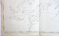
176726308Newport R.I. 1767. Manuscript map in ink and wash on a single folio sheet 15 1/4 x 19 inches. Docketed in manuscript on verso "Map of Leveretts Patent alias Muscongus." With two manuscript documents one being 3pp. on folio sheets dated at Boston May 19 1787; the other being 3pp. on folio sheets dated at Providence R.I. on May 30 1787. Also with a half-page of manuscript dated Boston March 28 1768. All three documents relating to the lands depicted on the map. Map with minor separations along horizontal fold. The half-page document being only the beginning portion of a longer letter otherwise the manuscripts in near fine condition. A highly important manuscript map of Colonial Maine: heavily annotated by William Ellery a signer of the Declaration of Independence from Rhode Island.<br/> <br/>An attractive eighteenth century manuscript map of Penobscot Bay Maine heavily annotated by William Ellery a signer of the Declaration of Independence from Rhode Island who made claims to some of the lands depicted on the map. The map was drawn by British Rear-Admiral Jahleel Brenton who commanded the HMS Queen during the Revolution and whose family lost much of its property as a result of the Revolution. The map is skillfully rendered as would be expected of a British naval officer and is done on a scale of about three miles to the inch. The map depicts the coastline from the Damariscotta River in the southwest to the Penobscot River in the northeast and shows and names the many islands of the Bay as well as many inlets harbors rivers ponds etc. The location of a fort and settlements have also been added. This information was all added by William Ellery 1727-1820 a signer of the Declaration of Independence from Rhode Island. Ellery explains in a manuscript note in the lower right corner of the map dated at Newport Rhode Island in 1767: "This map of Leverett's Patent &c was copied from a copy by Jahleel Brenton Esq. one of the Proprietors; and presented by his son Samuel Brenton to William Ellery who wrote the References Names of Places &c. William Ellery." In the upper left corner of the sheet Ellery has added a long manuscript note explaining the survey and the boundaries of Leverett's Patent as depicted on the map. This map and the accompanying manuscript documents were found among William Ellery's papers and were part of Ellery and his brother Benjamin's attempts to claim lands in Maine that they believed belonged to their family. "Leverett's Patent" also known as the Waldo Patent or the Muscongus Patent was issued in 1629 to Thomas Leverett and John Beauchamp. It granted land and trading rights for a thirty-six square mile area along the Penobscot Bay in present-day Maine between the Muscongus River and Penobscot River. According to the documents present here Leverett inherited the full patent upon Beauchamp's death and at his own death divided the grant among his ten children who then divided the land again amongst the next generation. Around 1720 Gen. Samuel Waldo of Boston acquired a large portion of the patent and began recruiting immigrants from Germany to settle the area. The letter fragment present here dated March 28 1768 and addressed to Benjamin and William Ellery asserts that the Ellerys have an "undoubted right to a half share" of the Muscongus lands as a result of a purchase made by their grandfather. The unidentified author of the letter goes on to describe the Waldo heirs as "exceeding difficult to deal with." Also present are two manuscripts one being a 1787 copy of the original 1629 grant of the Muscongus Patent from the Council of Plymouth the other being a manuscript deed of sale signed by James Green for a portion of the original patent. A handsome colonial era manuscript map of the coast of Maine drawn by a British Rear-Admiral and used by a signer of the Declaration of Independence to defend his family's claims to the land. Significant manuscript maps of this early date are virtually unknown in the market. unknown books