4 981 résultats
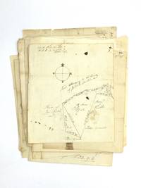
176726308Newport R.I. 1767. Manuscript map in ink and wash on a single folio sheet 15 1/4 x 19 inches. Docketed in manuscript on verso "Map of Leveretts Patent alias Muscongus." With two manuscript documents one being 3pp. on folio sheets dated at Boston May 19 1787; the other being 3pp. on folio sheets dated at Providence R.I. on May 30 1787. Also with a half-page of manuscript dated Boston March 28 1768. All three documents relating to the lands depicted on the map. Map with minor separations along horizontal fold. The half-page document being only the beginning portion of a longer letter otherwise the manuscripts in near fine condition. A highly important manuscript map of Colonial Maine: heavily annotated by William Ellery a signer of the Declaration of Independence from Rhode Island.<br/> <br/>An attractive eighteenth century manuscript map of Penobscot Bay Maine heavily annotated by William Ellery a signer of the Declaration of Independence from Rhode Island who made claims to some of the lands depicted on the map. The map was drawn by British Rear-Admiral Jahleel Brenton who commanded the HMS Queen during the Revolution and whose family lost much of its property as a result of the Revolution. The map is skillfully rendered as would be expected of a British naval officer and is done on a scale of about three miles to the inch. The map depicts the coastline from the Damariscotta River in the southwest to the Penobscot River in the northeast and shows and names the many islands of the Bay as well as many inlets harbors rivers ponds etc. The location of a fort and settlements have also been added. This information was all added by William Ellery 1727-1820 a signer of the Declaration of Independence from Rhode Island. Ellery explains in a manuscript note in the lower right corner of the map dated at Newport Rhode Island in 1767: "This map of Leverett's Patent &c was copied from a copy by Jahleel Brenton Esq. one of the Proprietors; and presented by his son Samuel Brenton to William Ellery who wrote the References Names of Places &c. William Ellery." In the upper left corner of the sheet Ellery has added a long manuscript note explaining the survey and the boundaries of Leverett's Patent as depicted on the map. This map and the accompanying manuscript documents were found among William Ellery's papers and were part of Ellery and his brother Benjamin's attempts to claim lands in Maine that they believed belonged to their family. "Leverett's Patent" also known as the Waldo Patent or the Muscongus Patent was issued in 1629 to Thomas Leverett and John Beauchamp. It granted land and trading rights for a thirty-six square mile area along the Penobscot Bay in present-day Maine between the Muscongus River and Penobscot River. According to the documents present here Leverett inherited the full patent upon Beauchamp's death and at his own death divided the grant among his ten children who then divided the land again amongst the next generation. Around 1720 Gen. Samuel Waldo of Boston acquired a large portion of the patent and began recruiting immigrants from Germany to settle the area. The letter fragment present here dated March 28 1768 and addressed to Benjamin and William Ellery asserts that the Ellerys have an "undoubted right to a half share" of the Muscongus lands as a result of a purchase made by their grandfather. The unidentified author of the letter goes on to describe the Waldo heirs as "exceeding difficult to deal with." Also present are two manuscripts one being a 1787 copy of the original 1629 grant of the Muscongus Patent from the Council of Plymouth the other being a manuscript deed of sale signed by James Green for a portion of the original patent. A handsome colonial era manuscript map of the coast of Maine drawn by a British Rear-Admiral and used by a signer of the Declaration of Independence to defend his family's claims to the land. Significant manuscript maps of this early date are virtually unknown in the market. unknown books
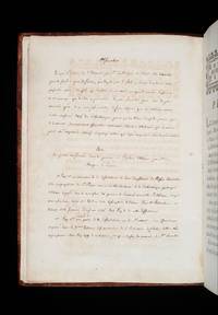
182841555, , 1828-1877. Manuscrit in-folio à l’encre brune (42 x 27 cm) de (1)-160-(8) ff. en belle page, 187 grandes miniatures dans le texte finement coloriées à l'époque, demi-vélin à coins, dos lisse muet (reliure de l'époque).
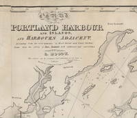
18283754<p><b>Important Early Chart of Portland Maine Harbor</b></p><p>Lemuel Moody 1767-1846 was an enterprising sea captain and nautical entrepreneur in Portland Maine. Realizing "the great necessity of a correct Chart of Portland Harbour and the dangerous Rocks near Cape Elizabeth also of Winter Harbour and the numerous islands in Casco Bay" Moody decided to produce such a chart. By 1825 the <i>Atlantic Neptune</i> charts that included this area were more than 50 years old and in need of updating. Moody took advantage of the opportunity and produced this chart using the <i>Atlantic Neptune</i> charts as the foundation. In a notation on the original agreement for producing the chart Moody states that "I did the whole of the survey." This impressive chart of Casco Bay was his sole cartographic undertaking. </p><p>The chart covers the area from Saco Bay to Seguin Island. A large inset at the upper left focuses on the immediate area around Portland harbor including a detailed layout of streets and wharves. Small drawings of several sailing ships decorate the chart. Of particular interest is one sailing vessel being towed by a steam-belching vessel southeast of Small Point an early record of steam-powered ships in Maine waters.</p><p>One of the prominent landmarks that Moody included on the chart is the Portland Observatory an 86' high tower that still stands atop Portland's Munjoy Hill. The Observatory one of Moody's entrepreneurial undertakings was built in 1807 and served as a marine signaling tower. Using a telescope from the tower and a flag-based signaling system Moody would – for an annual fee – alert ship owners of the arrival of their vessels well in advance of their arrival in the harbor.</p><p>The chart went through at least five states of which this is the second. The fortuitous survival of Moody's business records and the known construction dates of certain marine landmarks make it possible to identify the dates and production run of the various states of the chart with a fair degree of specificity. While all the charts produced include the initial publication date of 1825 in the title later states were known to have been printed in 1828 1832 1838 and 1857. The initial 1825/6 printing was 191 charts. For this second state only 49 charts were struck from the plates.</p><p>The second state is distinguished by the addition of two light towers that were constructed in Cape Elizabeth in 1828. Known now appropriately enough as "Two Lights" the two structures still stand though one has been decommissioned as a navigation aid. The updates to the copperplate and printing of this state were by Andrew Allen of Boston.</p><p>Moody's chart is very uncommon in any of its states. OCLC identifies three institutional holders as of September 2021: State Library of Massachusetts Osher Map Library and Boston Public Library. Additional examples are held at the Maine Historical Society Library of Congress Yale and at least one private collector. No examples of the chart were identified in the <i>Antique Map Price Record</i> during its run from 1983 to 2011.</p><p>A very attractive example of an important and scarce early Maine chart.</p><p><b>Reference</b>: Phillips <i>A List of Maps of the United States</i>: p. 717 Mistakenly titled as Map of Portland Harbour and Islands…</p><p><b>Acknowledgment:</b> I am indebted to Ms. Frances Pollitt formerly of the Maine Historical Society for sharing her research on the dating and production of Moody's chart.</p><b>Condition: </b>Lined on reverse mending several tears. Very minor recreation of image loss and restoration of blank margin areas.<p>ICN 7690.3.</p> [Lemuel Moody.] .] Engd by D. G. Johnson. Entered According to Act of Congress July 13th, 1825. [but 1828.]
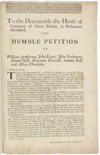
1715WRCAM39807London 1715. 1p. with printed docket title on verso. Small folio. Antique-style three-quarter calf and marbled boards spine gilt leather label. Ornamental upper border. Minor foxing. Very good. A rare and early petition relating to British settlement in the eastern part of present-day Maine. The authors refer to petitioning "his Majesty in Council on the 6th Day of December last for having a Colony settled between New England and Nova Scotia" with "over one thousand disbanded men" and to be funded with the proceeds of a proposed coinage operation. The only copy of this document listed by OCLC and ESTC is at the New-York Historical Society which estimates merely that the document was printed during the 1700s. The historical context the text cited above and discovery of this broadsheet among similar petitions dating almost exclusively to 1714 and 1715 however make 1715 an extremely likely date of printing. In the Treaty of Utrecht 1713 the French ceded the land east of the Kennebec River presumably the area in question here to the British; this event and the reference to "disbanded soldiers" suggest that the War of the Spanish Succession had recently ended which it finally did in 1714. George I succeeded Queen Anne in late 1714 which means the petitioning of "December last" could not have been earlier than that year. With the new monarchy and a major upheaval in the House of Commons following the general election of 1715 petitionary literature distributed in the lobby of Parliament surged with this document almost certainly among the examples from that year. <br> <br> The petitioners evidently officers who had served in the recent war call attention to the fact that the lands they hope to settle "were formally survey'd and given by King Charles the Second to the Duke of York" and that the area has been confirmed as rich for farming. They ask that Parliament allow them to present their formal proposals for the settlement or "if not thought proper to have a Colony settled in that part of North- America" at least still to grant them a contract to coin 1000 tons worth of half- pence and farthings. <br> <br> A very important Maine document one of only two surviving copies. hardcover books
17763748<b>Striking Casco Bay Chart from the Atlantic Neptune 1776</b><br /><br />This is an exceptional chart of the coast of Maine between Cape Elizabeth and Popham from the early Revolutionary War period. It is from Des Barres' monumental <i>Atlantic Neptune</i> a sea atlas published by the British Admiralty during the last quarter of the 18th century. The <i>Atlantic Neptune</i> has been called "the most splendid collection of charts plans and views ever published." <br /><br />The present chart includes all of Casco Bay naming the larger islands and extends east to include Seguin "Segevin Island" and Georgetown Islands. Among the numerous geographic features named are Great Jebieg Chebeague Merrymeeting Bay Segadahock River Arrowsick Island and Halfway Road i.e. Rock. Roads are shown on the chart as are individual buildings. <br /><br />The chart is dated July___ 1776 i.e. with a prominent space after the month as if a date were going to be inserted. There is no type-stamped "15" at the upper right as called for in some copies of state "b" of the Stevens Catalogue. <br /><br />The chart was folded into four vertical panels about 30 1/4 x 12" to accommodate being "bound up in tall narrow form" Stevens' Catalogue p. vii. The chart paper has the LVG watermark consistent with the earlier issues of the chart. <br />A scarce early state of a desirable chart. <br /><br /><b>References:</b> Stevens <i>Catalogue of the Atlantic Neptune</i>: 105 State: b. Sellers & Van Ee <i>Maps and Charts of North America and the West Indies</i> 1750-1789: 855. <br /><br /><b>Condition: </b>A wonderfully clean example of a striking chart of Casco Bay.<br /><br />ICN 3763. From The Atlantic Neptune.
176611625Amsterdam and Paris: P.-F. Gueffier 1766. Contemporary cat’s paw sheep neatly restored slightly defective gilt spine and label red edges pink silk marker; interleaved throughout — a vertical crease divides the interleaves in two columns. <p>With: Jousse Daniel-Charles.       1742-1769.<br />        Lettre D’Un Orléanois…Sur La Nouvelle Histoire De L’Orléanois. Bruxelles and Paris E. Flon and J. Debure 1766. 12mo 173 x 110 mm. inlaid in blank quarto sheets for binding. 40p.</p> <br /> <p>      Ad I-II: This volume belonged to the local historian and Orléans Cathedral canon Louis-Eusèbe Loiseau 1721-95.<br />       Ad I: ALL PUBLISHED SUPPRESSED. Only Edition. Luchet believed “Good history is a long fable†p. iv tr. Immediately upon publication of this first volume of a projected five Luchet’s fanciful account of the history of Orléans and environs 52 B.C.E. to 1428 C.E. came under fire. He had manufactured personal information abandoned the facts cloven to the marvelous and doubted Jeanne d’Arc’s divine mission pp. 307-419. This last angered the clergy and THE DUC D’ORLÉANS FORCED THE AUTHOR TO BUY UP AND DESTROY THE EDITION.<br />       COUNTERING LUCHET’S FANTASIES LOISEAU COMPILED HIS OWN THIRTY THOUSAND WORD DOUBLE-COLUMN CHRONOLOGY filling 115 interleaf pages. Its preface summarizes Luchet’s History — “detestable in substance and form†tr. lists errors and sketches a damning biography of Luchet. One column of the manuscript chronology draws on Polluche’s Essais historiques sur Orléans 1778 and the other on articles in Calendrier historique d’Orléanois by the Orléans Maurist librarian Louis Fabre 1710-98.<br />       The longest and earliest inserted manuscript is A FIFTEEN-PAGE ESSAY UNFAVORABLE TO LUCHET’S HISTORY identifying still more inaccuracies nine concern Jeanne d’Arc. The Mémoire takes a statistical and economic perspective on Orléans its architecture and exports. Signed by Loiseau the Observations treats the by-laws of the new Orléans learned society born of the 1786 merger of two earlier groups. Loiseau was secretary of one for 25 years 1761-85.<br /> ¶Lanéry d’Arc Le Livre d’or de Jeanne d’Arc. Bibliographie 700; Lelong Bibliothèque historique de la France III: 35603-4; Brainne et al. Les Hommes illustres de l’Orléanais I: 250-2.<br />       Ad II: Only Edition the author’s sole book and the first published attack on Luchet’s History. Exposing 108 blunders with context and secondary source proof Jousse used material gathered by his father 1710-81 who supplied all the entries related to Orléans in Lelong’s Bibliothèque historique 1768-78.<br /> ¶Lanéry d’Arc 700; Lelong III: 35604; Conlon Le Siècle des Lumières 66:976.<br />       All items are in good condition.</p> P.-F. Gueffier unknown
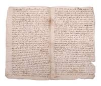
1680353098Likely Boston 1680. 4pp. Clerically signed Robert Warwick and Edward Gorges above an additional reaffirmation of grant dated June 1631 clerically countersigned by Thomas Wiggin James Parker James Watts and George Donglan. Docketed "Patent Saco: east of the river". Bifolium. Usual folds minor separations two repaired. 4pp. Clerically signed Robert Warwick and Edward Gorges above an additional reaffirmation of grant dated June 1631 clerically countersigned by Thomas Wiggin James Parker James Watts and George Donglan. Docketed "Patent Saco: east of the river". Bifolium. In 1629 less than a decade after the Pilgrims landed at Plymouth Rock the Council of New England an English joint stock company founded to establish colonial settlements in America issued a series of grants subdividing their royal charter that had ceded to them all land between "degrees 34 and 44" from sea to sea. These grants were important being among the earliest grants independently issued within the colonies. <br /> <br /> The present grant is of particular note for the history of Maine being the grant made to Thomas Lewis and Captain Richard Bonython for the land north of the Swanckadocke River i.e. the Saco River. The text of the grant reads in part:<br /> ".Whereas King James of famous memory late King of England Scotland France and Ireland by his Highness' letters patent and royal grant under the great seal of England bearing date the third day of November in the eighteenth year of his reign of England France and Ireland etc. for the causes therein expressed did absolutely give grant and confirm to the said Council for the affairs of New England in America and their successors forever all the land of New England lying and being from forty to forty-eight degrees of northerly latitude and in length by all that breadth aforesaid from sea to sea throughout the main land . that the said council for the affairs of New England in America as well for and in consideration that Thomas Lewis Gentleman has already been at the charge to transport himself and others to take a view of New England in America aforesaid for the bettering of his experience in advancing of a plantation and does now wholly intend by God's assistance with his associates to plant there both for the good of his Majesty's realms and dominions and for the propagation of Christian religion among those infidels and in consideration also that the said Thomas Lewis together with Captain Richard Bonighton and also with their associates and company have undertaken at their own proper costs and charges to transport fifty persons there within seven years next ensuing to plant and inhabit there to the advancement of the general plantation of that country and the strength and safety thereof among the natives or any other invaders also for the encouragement of the said Thomas Lewis and Captain Richard Bonighton and other considerations the said council thereunto moving have given granted enfeoffed and confirmed and by this present writing do fully clearly and absolutely give grant enfeof and confirm to the said Thomas Lewis and Captain Richard Bonighton their heirs and assigns for ever all that part of the main land in New England in America aforesaid commonly called or known by the name of Swanckadocke or by whatsoever other name or names the same is or shall be hereafter called or known by situated lying and being between the cape or bay commonly called Cape Elizabeth and the cape or bay commonly called Cape Porpoise containing in breadth from northeast to southwest along by the sea four miles in a straight line or accounting seventeen hundred and three score yards according to the standard of England to every mile and eight English miles upon the main land on the north side of the river Swanckadock after the same rate from the sea through all the breadth aforesaid ."<br /> <br /> The original vellum grant with seals is located in the archives of the Maine Historical Society. The present example is one of several extant early manuscript copies made during the subsequent conflicts and competing claims between the crown Massachusetts and Maine. In 1652 commissioners were appointed to determine the correct boundary between Massachusetts and several of the early patents with the former gradually extending their claim northward. In 1653 the settlers of Saco and other parts of Maine yielded to Massachusetts and the region was renamed Yorkshire or County of York. In 1664 after the Restoration the region was restored as an independent province but much of the region sold back to Massachusetts in 1678. After the charter of Massachusetts was annulled in 1684 and James II ascended to the crown in 1685 the region was once again assigned as part of the Province of Massachusetts Bay. Maine would remain part of Massachusetts until the final separation in 1820. <br /> <br /> The present undated copy likely dates from the period circa 1664 when a royal commission consisting of Richard Nicolls Sir Robert Carre George Cartwright and Samuel Maverick was sent to oversee the government of the colonies in New England. However it could also date as late as the period from the 1680s when Sir Edmund Andros became the Commissioner for the Dominion of New England. Documentary History of the State of Maine vol. 7 p. 117 unknown
1912312798np 1912. 2 60 pp of typewritten text with a hand-drawn map of the Club property on the Dobsis Stream between "Dobsis" and "Pocumsas" lakes a folding cyanotype map of the region and 23 photographs of the Club and members. 1 vols. 8vo 8-1/2 x 6 inches. Reverse buckskin with title stamped in blind Dobsis Club 1872-1912 with metal ring binding. Signature "January 1 1912 Lillian W. Larrabbee" on title leaf. Typescript addendum of fishing catches 1919-1920 by H.S. Dennison loosely inserted. Green cloth folding box. 2 60 pp of typewritten text with a hand-drawn map of the Club property on the Dobsis Stream between "Dobsis" and "Pocumsas" lakes a folding cyanotype map of the region and 23 photographs of the Club and members. 1 vols. 8vo 8-1/2 x 6 inches. UNRECORDED. History of the Dobsis Club in the Grand Lake watershed formed in 1872 by Harvey Jewell Lyman B. Jewell E.W. Dennison Cutler Downer V.H. Blackston and F.A. Kennedy with famous Rangeley guide G. L. F. Ball as Manager. In 1879 club buildings were built by Ball on the spit of land between Sysladobsis or Dobsis and Pocumcus lakes. <br/>The first portion of the book transcribes Ball's letters 1872-1894 discussing his marriage money woes and fish hatchery business. Ball who had been a guide in the Rangeley region since the early 1860s worked for the club until 1898 and died the following year. The history includes a calendar of notable dates including construction poker hands an earthquake persons falling into the rivers and the disappearance of N.O. Shaw on 19 December 1907; his body was found the next June. Weather records include Ice Out dates earliest 22 April 1878 latest 16 May 1888 extremes of temperature in summer and winter. There is a long register of fishermen and visitors and logs of fishing catches and game bags. Many names from the Dennison clan appear over the years. The work is illustrated throughout with high quality photographs: portraits of members and views of the club sometimes two to a plate. The last entries for seven members visiting in Spring 1912 are in manuscript.<br/>The club appears to have continued in existence through the early 1940s. unknown books
1893160511893 PARIS, Alphonse Picard, CAEN,Henri Delesques, 1893, N° 1, 3, 5 & 6 - Broché - In-8 - Couverture imprimée avec médaille au nom d'Arcisse de CAUMONT - Importante iconographie : nombreuses planches PP Ht & illustrations en texte - 85 pages & Pagination 191 à 589 - Bon exemplaire, Intérieur très frais.
PARIS, Alphonse Picard, CAEN,Henri Delesques, 1893, N° 1, 3, 5 & 6 - Broché - In-8 - Couverture imprimée avec médaille au nom d'Arcisse de CAUMONT - Importante iconographie : nombreuses planches PP Ht & illustrations en texte - 85 pages & Pagination 191 à 589 - Bon exemplaire, Intérieur très frais. chaque fascicule peut-être vendu individuellement au prix de 20 € pièce
171521151London 1715. Broadsheet. 1p. plus printed docket title on verso. Small folio. Bound to style in half calf over marbled paper-covered boards. Ornamental border. Minor foxing. Very good. A project for colonizing Maine in 1715. One of only two surviving copies.<br/> <br/> A rare early petition relating to British settlement in the eastern part of present-day Maine. The authors refer to petitioning "his Majesty in Council on the 6th Day of December last for having a Colony settled between New England and Nova Scotia" with "over one thousand disbanded men" and to be funded with the proceeds of a proposed coinage operation. The only copy of this document listed by OCLC and ESTC is at the New-York Historical Society which estimates merely that the document was printed during the 1700s. The historical context the text cited above and discovery of this broadsheet among similar petitions dating almost exclusively to 1714 and 1715 however make 1715 an extremely likely date of printing. In the Treaty of Utrecht 1713 the French ceded the land east of the Kennebec River presumably the area in question here to the British; this event and the reference to "disbanded soldiers" suggest that the War of the Spanish Succession had recently ended which it finally did in 1714. George I succeeded Queen Anne in late 1714 meaning that the petitioning of "December last" could not have been earlier than that year. With the new monarchy and a major upheaval in the House of Commons following the general election of 1715 petitionary literature distributed in the lobby of Parliament surged with this document almost certainly among the examples from that year. The petitioners evidently officers who had served in the recent war call attention to the fact that the lands they hope to settle "were formally survey'd and given by King Charles the Second to the Duke of York" and that the area has been confirmed as rich for farming. They ask that Parliament allow them to present their formal proposals for the settlement or "if not thought proper to have a Colony settled in that part of North-America" at least still to grant them a contract to coin 1000 tons' worth of half-pence and farthings. A very important Maine document one of only two surviving copies. unknown
1691002926A Paris, Galerie-Neuve du Palais, G.de Luyne, T. Girard, Veuve M. Guérout, avec Privilège du Roy, 1691
193812984COLLECTION OF EARLY BRITISH FANZINES: THE SATELLITE FANTAST NEW WORLDS GARGOYLE & ZENITH Various places 1938 to 1942 first editions mostly vg copies. 17 SATELLITES being volume 1 #1 thru volume 3 #5 the complete run; 14 FANTASTS being volume 1 #1 thru volume 3 #2 the complete run; 4 NEW WORLDS the complete run of the first incarnation; 5 ZENITHS & 3 GARGOYLES. All sets contain issue 1 #1 with original and no where else reprinted contributions by: Arthur C. Clarke C. S. Youd John Burke Ted Carnell John Russell Fearn Eric Maine William Temple et.al. A literal Who's Who of early British Fandom. All from the library of author and publisher of The Satellite John Burke. Rare! 43 different issues. Various unknown
188130409Ellworth Maine: S. F. Colby & Co engraved by William Bracher printed by F. Bourquin Philadelphia 1881. Folio. 16 3/4 x 14 1/4 inches. 96pp including 5pp ads in rear. 39 hand coloured lithographed maps 17 double-page some printed recto and verso of same sheets numerous insets complete. Contemporary black morocco upper cover lettered in gilt marbled endpapers gilt edges.<br/> <br/>Provenance: Edward C. Burleigh name in gilt on upper cover<br/> <br/>The first atlas devoted to Hancock County Maine.<br/> <br/>In 1881 cartographer/surveyor George N. Colby assisted by J.H. Stuart and others published the first atlas of Hancock County towns villages plantations and timber lots. The maps identify many property owners by name and show the locations of homesteads businesses roads schools churches mills and cemeteries in those plantations towns and villages. Including all the insets 87 maps were produced by Colby Halfpenny and Stuart drawn on stone by William Bracher and printed by F. Bourquin of Philadelphia. The detailed town plans include Mount Desert Island Bar Harbor Ellsworth Bluehill Southwest Harbor and numerous others. As with most 19th century county atlases the work was published strictly by subscription. Given the relatively small size of the county in terms of population the atlas would not have been published in a large print run resulting in its rarity today. "Despite their limitations and inaccuracies nineteenth-century county atlases nonetheless preserve a detailed cartographical biographical and pictorial record of a large segment of rural America in the Victorian age" Ristow American Maps and Mapmakers p. 424. This copy with provenance to Edward C. Burleigh the Governor of Maine from 1889-1893.<br/> <br/>LeGear 14311. S. F. Colby & Co [engraved by William Bracher, printed by F. Bourquin, Philadelphia] unknown books
18901146c. 1890. Pencil chalk and watercolor. Margins: 21 ¼ x 14 ½. Roosevelt-Richards is just recently being recognized for her place in American artBorn: <br /><br />Known for: Juvenile book and magazine illustration<br />1905 was the year she came to Wilmington.Delaware and studied with Howard Pyle remaining there for 7 years.By the time Richards had begun her studies under Pyle she was a published illustrator with works appearing in juvenile literature books.In a 1927 interview she recalled Pyle's attitude toward his teaching: "Twice a week we would come together and Mr. Pyle would criticize our efforts and offer suggestions. He always acted as if it were a privilege we gave him." After her stay in Wilmington Richards settled permanently in New Haven actively participating in the art community there.<br /> books
18901146c. 1890. Pencil chalk and watercolor. Margins: 21 ¼ x 14 ½. Roosevelt-Richards is just recently being recognized for her place in American artBorn: <br /><br />Known for: Juvenile book and magazine illustration<br />1905 was the year she came to Wilmington.Delaware and studied with Howard Pyle remaining there for 7 years.By the time Richards had begun her studies under Pyle she was a published illustrator with works appearing in juvenile literature books.In a 1927 interview she recalled Pyle's attitude toward his teaching: "Twice a week we would come together and Mr. Pyle would criticize our efforts and offer suggestions. He always acted as if it were a privilege we gave him." After her stay in Wilmington Richards settled permanently in New Haven actively participating in the art community there.<br />
72615Very good. A collection of 28 original manuscript land surveys recording the boundaries of property in Kittery York County Maine during the mid to late 1700s. Then located in Massachusetts York County was established in 1652 when the Massachusetts Bay Colony first asserted territorial claims over the settlements of present-day southern Maine.<br/> <br/>Together this collection of property surveys helps to paint a picture of the history development and inhabitants of Kittery between 1772 and 1799. The coastal town with a current estimated population of about 10000 residents is the southernmost city in Maine and was originally settled as a fishing village. During the Revolutionary War the first vessels of the U.S. Navy were constructed in Kittery. In addition to the shape of property and ownership of homesteads the surveys reveal who occupied adjoining lands locations of roadways and occasionally the site of buildings and other improvements.<br/> <br/>One of the earliest surveys in this collection is pre-Independence dated November 6 1772 and provides the boundaries of land owned by John Bradbury. A February 1780 survey shows that a country road adjoined the property of Tim Fergusson and Stephen Paul while another updated survey is labeled "Plan Goodwin's Marsh" which is bounded along one edge by the York River. A portion of the property drawn for an undated survey of Stephen Remick's land is labeled "widows thirds" a reference to the common law tradition of dower which originated in England and carried on in the American colonies providing widows the right to one-third of the land and property of her husband. This practice persisted in Maine until 1896 when a new concept of a spousal share was enacted.<br/> <br/>A survey dated May 1790 contains the handwritten note: "Plan land taken by execution in favour of selectmen of York from Dan Braydon." Land taken by execution refers to the seizure of property generally in payment of a debt. However during this period property was routinely confiscated from landowners who were loyal to the King during the war for independence. Little is known about Braydon so the reasons for this forfeiture are unknown.<br/> <br/>Four of the surveys in this collection are connected to properties owned by the Jeremiah Moulton family who were among the earliest and most prominent settlers in the region. A survey dated May 13 1793 shows a portion of land "taken by execution in favour" of Abigail Lyman from her presumed brother Jeremiah Moulton. Both her father who died in 1777 and her brother were named Jeremiah Moulton. Two more surveys both dated July 7 1783 note Joseph Bragdon's land was "taken by execution from Jeremiah Moulton." Bragdon who died in 1766 was married to Mary Moulton the sister of the elder Jeremiah Moulton. The land had been mortgaged to Jonathan Sayward. Another plan is labeled "Col. Moulton's land bot of Peter Grant April 1785."<br/> <br/>Another group of land surveys in this collection is connected to the family of Abraham Preble who settled in York County in 1642 by way of County Kent England. He was a councilor county treasurer and judge. These five surveys show lands owned by Caleb Paul Esaias and Benjamin Preble two generations removed from Abraham. Esaias was captain of a company of minutemen at Cambridge later rising to the rank of Colonel during the Revolutionary War.<br/> <br/>The surveys each measure about 7 ½" x 8" and are hand drawn often containing holographic notations boundaries with longitude and latitude markings and various other notations including figures. They are generally toned several are soiled and a few have silk tape repairs. Overall they are in very good condition. unknown books
156542526Poitiers, Enguilbert de Marnef et les Bouchetz frères, 1565. In-12 de de (24)-255-(1)-(16)-(8) pp., table, vélin rigide (reliure de l'époque).
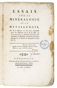
1779K89BNAR73VU7Maastricht 1779. 8vo 22.5 x 13.5 cm. J.E. Dufour & P. Roux Contemporary decorated paper wrappers. 3 parts in 1 volume. 4 XXVII 1 232 pp. Very rare first edition printed in Maastricht of a mining manual by a French enlightened marquis who worked as chief librarian at the Hessen-Kassel court of Friedrich II 1720-1785. Although mentioned reference literature the book is very rare on the market and we found no copy in auction records. Luchet was an acquaintance of Voltaire and in fact had a letter of recommendation from him that helped him obtain his position at the Hessen-Kassel court. Luchet's other writings concerned literature and theatre which makes this mining manual a curious standout. It is unclear why this work was printed in Maastricht except that the Maastricht south Limburg region does have a long history of mining. In a lengthy discourse on mining in the preliminaries Luchet makes a strong pro-mining statement. This is followed by reflections on several aspects of mining often in a question and answer form. He goes into the medical consequences of mining and names several minerals and metals such as coal quartz lead tin gold silver copper and more.A second edition appeared in 1797 often bound with H. Struve Methode analytique des fossils Lausanne 1797.Bookplate on front paste-down owner's name on title-page small stamp on title-page and pages 9 99 199 and 232. First few pages with marginal stains. Binding worn. Otherwise in good condition and wholly untrimmed.l Geology emerging 1404; Hoover 549; Wellcome III p. 451; Worldcat 3 copies; not in Margerie. unknown
186223052301021st Maine Light Artillery; Union Army 1862. First Edition. Hardcover. Good. Union Army Order Book Large folio. 75 pages. Written by a fine hand 1862-1864. Also includes original typed orders from General Butler etc. Includes orders received by the unit from January 16 1862 through July 14 1864. Much of this period the battery was assigned to Louisiana Mississippi the Gulf of Mexico. <br> The battery was attached to 3rd Brigade Department of the Gulf until September 1862. It was attached to Weitzel's Reserve Brigade Department of the Gulf until January 1863. It was attached to Artillery 1st Division XIX Corps Department of the Gulf until January 1864 and the 2nd Division until April 1864. It then served at Camp Barry Defenses of Washington XXII Corps until July 1864. <br> The Battery notably served in the following engagements: Siege of Port Hudson; Battle of Fort Stevens; Third Battle of Winchester; Battle of Fisher's Hill; Battle of Cedar Creek. 1st Maine Light Artillery; Union Army hardcover
1898List2965United States and Caribbean 1898. Approximately twenty-nine pieces: logbook of eighty-four double-sided pages measuring 13 x 20 inches; eight letters seventeen documents and forms and three pieces of miscellany. Much wear and significant damage to logbook including water damage mildew and tearing; log book overall fair to good minus. Other materials good to very good. Overall good. William Higgins 1791–1872 was a farmer sea captain and owner of and investor in ships from Bowdoinham Maine. According to the Maine Maritime Museum which holds his family papers Higgins’ ships traded mainly in lumber which they took from Wilmington North Carolina to the Caribbean.<br /> <br /> Offered here is a logbook recording the travels of several of Higgins’ ships particularly the brigs Mary Jane and Llewellyn alongside related documents and personal letters. The logbook dating between 1832 and 1836 extensively documents the course wind data and weather remarks for travels of the ships between east coast US port cities and various locations in the Caribbean including Barbados St. Thomas and Martinique. The logbook also contains a copy of astronomer and mathematician Elijah Burritt’s illustration “A Plan of the Solar System Exhibiting its Relative Magnitudes and Distances†engraved by W. G Evans and printed in 1835 by F.J. Huntington.<br /> <br /> The letters and documents date from 1830 to 1867 and are also mostly business-related including an insurance document for the brig William Parrington a roll of sailors enlisted to work on a six-month journey between the Caribbean and the US in 1845 a bill of sale for ¼ stake in the brig Mary Jane and receipts and logs for items including various liquors sugar molasses casks and so on. One letter from a young man in Wilmington requests advice on how to start his own business in the style of Higgins’; other letters concern family matters. One interesting undated document is a writ addressed to the Marshal of the District of Maine concerning a lawsuit filed against Higgins and Rufus Carr master of the William Parrington by Zachrisson Nelson Co. The suit alleged that Carr acting as an agent for the ship’s owners that is Higgins had agreed to an affreightment involving shipping from Jamaica to Spain to New York but had then “wholly neglected and refused to do soâ€.<br /> <br /> Of interest to scholars of maritime history and trade in the mid-19th century. unknown
18900000807Rochester 1890. Original Dark Blue Cloth. Very good. Oblong 8vo. Original dark blue cloth gild border tooling on front cover; tooling only on rear cover. Collation: Title page for Specimen Book followed by around 90 chromolithograph or pochoir color plates of various fruits and trees for clients. <br/><br/>This specimen book was presented interested parties who would purchase from plants from the nursery. The plates were prepared by Brunswick & Co. Rochester. Some offsetting present from fruit image to verso of preceding plate. hardcover books
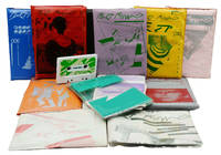
1982140940258Melbourne Australia: Fast Forward 1982. Complete run of 13 issues in 12 #008/009 is a double issue. Magazines often folded and sometimes staple bound with a variety of folded inserts with cassettes housed in silk-screened colored plastic wallets. Near Fine condition overall appearing to contain all inserts etc.; slightly rubbed and soiled occasional slight creasing to inserts or oxidation to staples. Small tear to rear wallet of #005. Issue 008/009 wallet gilt lettering well-rubbed. Offsetting to wallet of #011. Rare as a set. One of the very first cassette magazines which was popular financially successful and proved to be influential in the burgeoning global "cassette culture" of '80s independent music directly spawning such other projects as Sub Pop editor/ label head Bruce Pavitt was a contributor to the double-issue and the UK's Mix. The audio portion was structured somewhat like an old-timey news broadcast featuring new music as well as interviews with musicians. In addition to featuring the sounds of Aussies The Birthday Party Primitive Calculators Dead Can Dance Scientists and the Go-Betweens et al many prominent cutting-edge British and American musicians such as Pere Ubu The Clash The Fall The Residents Adam and the Ants and Gang of Four were interviewed and sometimes provided songs. Being Australian the magazine was bound to have a sense of humor. Robert Smith of The Cure got in on the act and provided "A Few Stylish Tips" in #013 about how he obtained that perfect lift for his '80s hair: soap and water. Crossword puzzles became a feature early on. Also Michael Trudgeon's design of the magazine was inspired growing in sophistication throughout the run adding inserts steadily stylishly utilizing only one or two colors in the printing process. A real acme of early '80s independent music print and design cultures. Its run lends credence to the idea that post-punk truly went beyond punk in many ways. Fast Forward unknown books
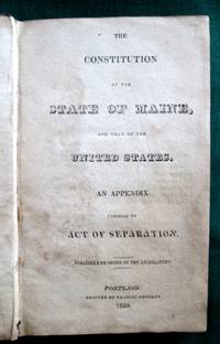
18203763<b>First Official Printing of Maine's Constitution</b><br /><br />A very scarce example of the first printing of the Maine Constitution. As noted on the verso of the title leaf 200 copies were ordered "printed for the use of the Legislature." In contrast the next printing ordered by the Legislature -- in 1825 -- was for 10000 copies. OCLC locates examples at six institutions. <br /><br /><br /><b>References:</b> Noyes <i>Maine Imprints to 1820</i>: 931. Skillin <i>A Bibliography of Maine Imprints 1785-1820</i>: 20-70. Not in Williamson A <i>Bibliography of the State of Maine</i>. Thompson:<i> Important Maine Maps Books Prints and Ephemera</i>: 28A. The Thompson copy sold for $1840 in 2003. Sprague <i>The Mirror of Maine</i>: see 11 for the 1825 edition. Shoemaker <i>A Checklist of American Imprints for 1820</i>: 2075.<br /><br /><b>Condition:</b> Contemporary calf. Boards well-scuffed and with small gouged area. Significant chipping of spine leather; hinges and joints cracked. Age-toned and areas of staining throughout. An unsophisticated but appealing example of a very scarce book. Published by Order of the Legislature. Printed by Francis Douglas. hardcover
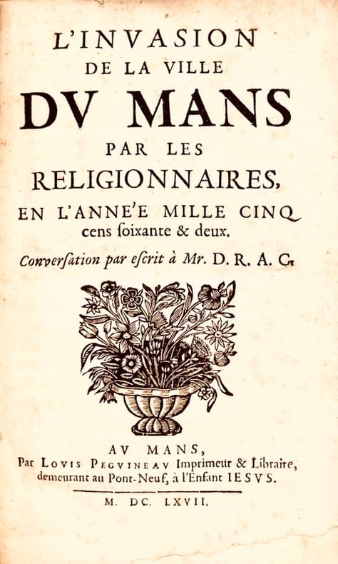
166743610Au Mans, par Louis Peguineau, imprimeur & libraire, demeurant au Pont-Neuf, à l'Enfant Jesus, 1667. In-12 de 124-(1) pp., vélin souple à petits rabats (reliure de l'époque).