175 résultats
1969stela1096Burnswick: 1969. 1969. oblong 8vo. unpaginated. 60 b/w illus. text by Rockwell Kent Carl Zigrosser & Richard V. West. chronology. wrs. couple stains to front cover spine sunned with wear bit scuffed half title had a Bowdoin College Museum of Art label addressed to Mr. & Mrs. Eris Wesselow. Soft cover. Very Good. [Burnswick]: 1969. Paperback
1919307722Boston 1919. 291 photographs usually four to a page on 75 black album leaves captioned throughout in white ink. 1 vols. Oblong folio. Post bound album in black leather over limp boards edges rubbed front joint tender. A few photographs loosened but all present and complete one photo folded at left edge long ago. Black cloth folding box red morocco spine label. 291 photographs usually four to a page on 75 black album leaves captioned throughout in white ink. 1 vols. Oblong folio. An excellent and fully captioned photograph album of summer trout fishing and camping in the Rangeley district at Loon Lake Maine and other places of interest. The photographer is unnamed but evidently from Boston or the north shore with some connections further south on Long Island.<br /> <br /> The album records two trips to Maine: the first to Loon Lake in 1915 and the J. Lewis York family fishing camp including several fine images of York often with a bear cub on a lead 66 photographs on 17 leaves ; and the second undated to Green Lake Mike Marr's camp at Indian Pond to Squaw Mountain Pond with Fred Lessor guide and to Moosehead Lake and the Kennebec 36 photographs on 9 leaves. <br /> <br /> Three trips to Nova Scotia in 1914 1919 and 1923 to the Kedgemakoogee Rod and Gun Club on Kedgemakoogee Lake the Shelburne River and other trout fishing excursions 139 photographs on 37 leaves. In the June 1923 trip Irving Lake Dam on the Shelburne is described as the best fishing water of the trip. A few participants are identified: E.L. Matlack O.H. Muir and Wilson Forrest and the unidentified grinning angler with a large string of trout may well be the compiler. <br /> <br /> As well as scenes from the Piping Rock Horse Show Long Island noting Miss Lansdale up in several snapshots 22 photographs on 5 leaves; and a trip to Atlantic City at the end with the Shriners parade and seaside scenes 27 photographs on 7 leaves. Cf. Bibliotheca Salmo Salar 186 for a similar album unknown
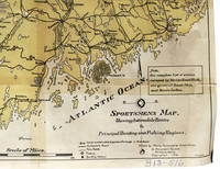
1916339615Portland Maine: maine Automobile Association 12 Monument Square 1916. Printed in yellow and black. Sporting camps marked with black dot. 22 x 16-1/2 inches. Tape repairs omn back else Very Good. Printed in yellow and black. Sporting camps marked with black dot. 22 x 16-1/2 inches. <br/><br/> maine Automobile Association, 12 Monument Square unknown
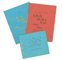
190263105Byerly Printing Co 1902. First and only edition. Illustrated by F. P. Byerly. 3 vols. 32mo. Blue red and green printed sewn wrappers. Fine. First and only edition. Illustrated by F. P. Byerly. 3 vols. 32mo. Amateur printing. Byerly Printing Co unknown
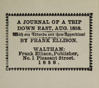
1981316097Dallas: The Somesuch Press 1981. Limited edition no. 56 of 200 copies signed by the printer and the publisher. vii 10 33 9 pp. 1 vols. Miniature 2-5/8 x 3 inches. Printed wrappers. As new. Limited edition no. 56 of 200 copies signed by the printer and the publisher. vii 10 33 9 pp. 1 vols. Miniature 2-5/8 x 3 inches. Facsimile of a rare and curious miniature book printed in 1858 reporting on a hunting trip to Maine. The Somesuch Press unknown
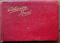
192036670Maine: n.p. 1920. Leather bound. Good. Oblong soft red leather ledger. Approximately 6.5" x 4.5." 64 leaves. Printed title page and explanation page. 60 pages used for writing down records. Several blank pages. Front cover shows light scratches a small stain and light creases. Small ink stain on a couple of blank pages towards the back else contents are clean. <br /> <br /> Records are written in columns for the first 56 pages. Column heading include date start time cyclo arrival time cyclo distance delays net running time average miles per hour roads party and remarks. Several empty pages until 4 pages of manuscript written in the memoranda section. The last note in this section is dated 1927. Alphabetical thumb index for expense records towards the back was not used. Title page does not have the name of the driver. However written at the bottom of the page is "1917 Ford #1750755 1921 Reg # 49290 Maine."Early trips recorded to Plymouth New Bedford Concord Boston Harvard Boothbay Harbor etc. Last driving record recorded August 1926. Although a date of 1927 recorded in the Memoranda section. A presentation card to "Uncle Charlie" enclosed with the inscription "may the roads be good the pleasure great and the blowouts few. n.p. unknown
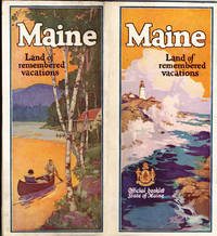
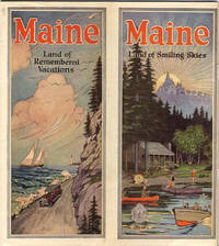
193641294Augusta: Maine Development Commission n.d. ca 1936. 1936. First edition. 9" x 8" with vertical fold at center and with bright colorful cover showing a coastal scene on 1/2 and a cabin scene on the other. 70 pp. including wrappers. Illustrations. Foreword. Maps. Map Index. General Index. Information and black and white photographs of the Maine seacoast to include the Yorks the Scarboro Beaches Portland and Casco Bay Bowdoin College Boothbay Harbor Bar Harbor Bangor Camden and Prescott Bay Narraguagus Bay Passamaquoddy Bay Eastport etc.; Inland Maine to include Sebago country Bridgton Harrison the Saco Valley the Oxford County Hills the Poland County etc.; Northwestern Maine to include the Rangeley region the Kennebago country the Dead River region etc.; Central Maine to include Moosehead Lake and Mount Kineo Kennebec Belgrade Lake Parlin etc.; and Eastern and Northern Maine to include the Grand Lakes country in Washington County Northern Aroostook County Patten Norcross Mount Katahdin etc. Information on various camping opportunities winter sports Maine's industry and agriculture as well as a history of Maine and its colonization. At center is a two-page map of the state of Maine showing the location of all cities towns and seacoast and inland resorts. Much valuable information. Light soiling to wrappers and with wear to the extremities. Maine Development Commission, n.d. [ca 1936]. unknown
192041289Washington D.C.: Published by the United States Coast and Geodetic Survey 1920. Large folding nautical chart printed on heavy paper stock. Colored. A rare original coastal survey of Maine and New Hampshire including Portsmouth York Ogunquit Kennebunkport Biddeford and Cape Elizabeth.<br/> <br/> Established by President Thomas Jefferson in 1807 as the Survey of the Coast the U.S. Coast and Geodetic Survey was the United States' first civilian scientific agency. This agency has followed its mission to survey the U.S. coastline create nautical charts of the coast and help increase maritime safety since its founding and has often played fascinating roles in significant chapters of U.S. history. It served in all theaters of the Civil War in the service of the Union Army and Navy pioneered acoustic exploration in the wake of the sinking of the Titanic and during WWI it worked to detect enemy submarines. In addition this agency worked to survey and produce detailed maps and renderings of the U.S. coast. These nautical survey maps commonly referred to as "T-sheets" provide fascinating insights into the history of the United States coastline which has and will continue to shift. These maps are the most important data source for understanding the physical and ecological characteristics of the U.S. shoreline. The present map is a highly detailed and accurate sea chart of the coasts of Maine and New Hampshire and an important historical view of the developing states. Published by the United States Coast and Geodetic Survey unknown
192041283Washington D.C.: Published by the United States Coast and Geodetic Survey 1920. Large folding nautical chart printed on heavy paper stock. Uncolored. A rare original coastal survey of New Hampshire and Maine including Portsmouth Exeter Dover and the Piscataqua River.<br/> <br/> Established by President Thomas Jefferson in 1807 as the Survey of the Coast the U.S. Coast and Geodetic Survey was the United States' first civilian scientific agency. This agency has followed its mission to survey the U.S. coastline create nautical charts of the coast and help increase maritime safety since its founding and has often played fascinating roles in significant chapters of U.S. history. It served in all theaters of the Civil War in the service of the Union Army and Navy pioneered acoustic exploration in the wake of the sinking of the Titanic and during WWI it worked to detect enemy submarines. In addition this agency worked to survey and produce detailed maps and renderings of the U.S. coast. These nautical survey maps commonly referred to as "T-sheets" provide fascinating insights into the history of the United States coastline which has and will continue to shift. These maps are the most important data source for understanding the physical and ecological characteristics of the U.S. shoreline. The present map is a highly detailed and accurate sea chart of coastal New Hampshire and Maine and an important historical view of the developing states. Published by the United States Coast and Geodetic Survey unknown
192041288Washington D.C.: Published by the United States Coast and Geodetic Survey 1920. Large folding nautical chart printed on heavy paper stock. Colored. A rare original coastal survey of Portsmouth Harbor including Kittery Point New Castle Island and Portsmouth.<br/> <br/> Established by President Thomas Jefferson in 1807 as the Survey of the Coast the U.S. Coast and Geodetic Survey was the United States' first civilian scientific agency. This agency has followed its mission to survey the U.S. coastline create nautical charts of the coast and help increase maritime safety since its founding and has often played fascinating roles in significant chapters of U.S. history. It served in all theaters of the Civil War in the service of the Union Army and Navy pioneered acoustic exploration in the wake of the sinking of the Titanic and during WWI it worked to detect enemy submarines. In addition this agency worked to survey and produce detailed maps and renderings of the U.S. coast. These nautical survey maps commonly referred to as "T-sheets" provide fascinating insights into the history of the United States coastline which has and will continue to shift. These maps are the most important data source for understanding the physical and ecological characteristics of the U.S. shoreline. The present map is a highly detailed and accurate sea chart of Portsmouth Harbor and an important historical view of developing New Hampshire and Maine. Published by the United States Coast and Geodetic Survey unknown
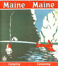
192941238N.P.: Maine Development Commission 1929. 1929. 18" x 16" sheet folded to 16 panels. 2 color cover panels showing a canoeing scene with a campsite in the background. 1-panel of information on camping and 1-panel of information on canoeing. 4 panels offering black and white photographs of scenery wildlife and individuals participating in various activities. Opposite panels offer 11 1/4" x 9" map of the state printed in black blue and red. Along the sides of the map is information on various cruises to include the Allagash trip; the St. John trip; the Fish River trip; the Rangeley Lakes trip; the Grand Lake - Machias trip; and the East and West Branch trips of the Penobscot River. 1/2" split to one fold and with light foxing and with light wear to the extremities. Very good. Maine Development Commission, 1929. unknown
192841239Augusta: Kennebec Journal Co. 1928. 1928. First edition. 9" x 8" with vertical fold at center and with bright colorful cover showing a coastal scene on 1/2 and a cabin scene on the other. 72 pp. including wrappers. Illustrations. Foreword. Maps. Map Index. General Index. Information and black and white photographs of the Maine seacoast to include the Yorks the Scarboro Beaches Porland and Casco Bay Bowdoin College Boothbay Harbor Bar Harbor Bangor Camden and Prescott Bay Narraguagus Bay Passamaquoddy Bay Eastport etc.; Inland Maine to include Sebago country Bridgton Harrison the Saco Valley the Oxford County Hills the Poland County etc.; Northwestern Maine to include the Rangeley region the Kennebago country the Dead River region etc.; Central Maine to include Moosehead Lake and Mount Kineo Kennebec Belgrade Lake Parlin etc.; and Eastern and Northern Maine to include the Grand Lakes country in Washington County Northern Aroostook County Patten Norcross Mount Katahdin etc. Information on various camping opportunities winter sports Maine's industry and agriculture as well as a history of Maine and its colonization. At center is a two-page map of the state of Maine showing the location of all cities towns and seacoast and inland resorts. Much valuable information. Light soiling to wrappers and light wear to the extremities. Very good. Kennebec Journal Co., 1928. unknown
190433991Bethel Maine: Printed by E. C. Bowder 1904. First Edition. Hardcover. Good. Thick octavo. 3 169 pages 2. Ex-institutional copy from the Long Island Historical Society with blind stamp on he title page page 169 written numbers on the copyright page and rear paste down. Later blue cloth with title on the spine. Blue linen inner hinges. Contents are clean. Printed by E. C. Bowder hardcover
190833992Bethel Maine: Printed by E. C. Bowder 1908. First Edition. Hardcover. Good. Thick octavo. 3 148 pages 5. Ex-institutional copy from the Long Island Historical Society with blind stamps on he title page page 148 written numbers on the copyright page and rear paste down. Later blue cloth with title on the spine.Blue linen inner hinges. Contents are clean. Printed by E. C. Bowder hardcover
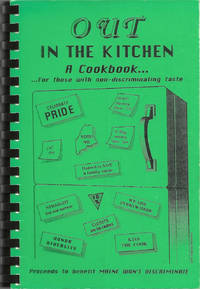
199510214Lenexa Kan.: Cookbook Publishers Inc. 1995. Comb-bound octavo 23 x 16 cm. viii 105 viii pages. Introduction; illustrated with a cover design by Cheryl Green. Title from Cover. FIRST EDITION. An important civil rights fundraising cookbook raising awareness and money to help defeat a state referendum question which would have overturned the Portland Human Rights Ordinance which extended protected classifications to "gays and lesbians" the nomenclature of the era. The cookbook itself was issued just as the referendum was defeated and the civil rights of gays and lesbians were upheld. In 2009 Maine was the first state to legalize same-sex marriage though the law was overturned in 2012. The text includes "A brief history of gay rights legislation in Maine". Lightest rubbing to black-printed green card stock covers otherwise fine with black comb-binding. Scarce. OCLC locates six copies. [Cookbook Publishers, Inc.] unknown
1922IAIe[MAI58Edinburgh & London: T.N.Foulis Ltd. 1922. 1922. 4to. ff. 24. printed in red & black. 10 full-page illus. decorative headpieces initials & title vignette. unopened in original cloth-backed gilt bds. First Edition. F. Hardcover. Edinburgh & London: T.N.Foulis, Ltd., [1922]. Hardcover
192041293Washington D.C.: Published by the United States Coast and Geodetic Survey 1920. Large folding nautical chart printed on heavy paper stock. Colored. A rare original coastal survey of the approach to Penobscot Bay including Matinicus Island and an inset map of Matinicus Harbor in the bottom right corner.<br/> <br/> Established by President Thomas Jefferson in 1807 as the Survey of the Coast the U.S. Coast and Geodetic Survey was the United States' first civilian scientific agency. This agency has followed its mission to survey the U.S. coastline create nautical charts of the coast and help increase maritime safety since its founding and has often played fascinating roles in significant chapters of U.S. history. It served in all theaters of the Civil War in the service of the Union Army and Navy pioneered acoustic exploration in the wake of the sinking of the Titanic and during WWI it worked to detect enemy submarines. In addition this agency worked to survey and produce detailed maps and renderings of the U.S. coast. These nautical survey maps commonly referred to as "T-sheets" provide fascinating insights into the history of the United States coastline which has and will continue to shift. These maps are the most important data source for understanding the physical and ecological characteristics of the U.S. shoreline. The present map is a highly detailed and accurate sea chart of Penobscot Bay and an important historical view of developing Maine. Published by the United States Coast and Geodetic Survey unknown
192041278Washington D.C.: Published by the United States Coast and Geodetic Survey 1920. Large folding nautical chart printed on heavy paper stock. Colored. A rare original coastal survey of Blue Hill Bay including Swans Island Deer Isle Mt Desert and Tremont.<br/> <br/> Established by President Thomas Jefferson in 1807 as the Survey of the Coast the U.S. Coast and Geodetic Survey was the United States' first civilian scientific agency. This agency has followed its mission to survey the U.S. coastline create nautical charts of the coast and help increase maritime safety since its founding and has often played fascinating roles in significant chapters of U.S. history. It served in all theaters of the Civil War in the service of the Union Army and Navy pioneered acoustic exploration in the wake of the sinking of the Titanic and during WWI it worked to detect enemy submarines. In addition this agency worked to survey and produce detailed maps and renderings of the U.S. coast. These nautical survey maps commonly referred to as "T-sheets" provide fascinating insights into the history of the United States coastline which has and will continue to shift. These maps are the most important data source for understanding the physical and ecological characteristics of the U.S. shoreline. The present map is a highly detailed and accurate sea chart of Blue Hill Bay and an important historical view of developing Maine. Published by the United States Coast and Geodetic Survey unknown
191941297Washington D.C.: Published by the United States Coast and Geodetic Survey 1919. Large folding nautical chart printed on heavy paper stock. Uncolored. A rare original coastal survey of Bath and Boothbay Harbor including Bath Georgetown Boothbay and Westport and Southport Islands.<br/> <br/> Established by President Thomas Jefferson in 1807 as the Survey of the Coast the U.S. Coast and Geodetic Survey was the United States' first civilian scientific agency. This agency has followed its mission to survey the U.S. coastline create nautical charts of the coast and help increase maritime safety since its founding and has often played fascinating roles in significant chapters of U.S. history. It served in all theaters of the Civil War in the service of the Union Army and Navy pioneered acoustic exploration in the wake of the sinking of the Titanic and during WWI it worked to detect enemy submarines. In addition this agency worked to survey and produce detailed maps and renderings of the U.S. coast. These nautical survey maps commonly referred to as "T-sheets" provide fascinating insights into the history of the United States coastline which has and will continue to shift. These maps are the most important data source for understanding the physical and ecological characteristics of the U.S. shoreline. The present map is a highly detailed and accurate sea chart of Bath and Boothbay Harbor and an important historical view of developing Maine. Published by the United States Coast and Geodetic Survey unknown
192041267Washington D.C.: Published by the United States Coast and Geodetic Survey 1920. Large folding nautical chart printed on heavy paper stock. Uncolored. A rare original coastal survey of Blue Hills Bay in Maine including Ellsworth Surry Tremont Southwest Harbor Swans Island Blue Hill and Acadia National Park.<br/> <br/> Established by President Thomas Jefferson in 1807 as the Survey of the Coast the U.S. Coast and Geodetic Survey was the United States' first civilian scientific agency. This agency has followed its mission to survey the U.S. coastline create nautical charts of the coast and help increase maritime safety since its founding and has often played fascinating roles in significant chapters of U.S. history. It served in all theaters of the Civil War in the service of the Union Army and Navy pioneered acoustic exploration in the wake of the sinking of the Titanic and during WWI it worked to detect enemy submarines. In addition this agency worked to survey and produce detailed maps and renderings of the U.S. coast. These nautical survey maps commonly referred to as "T-sheets" provide fascinating insights into the history of the United States coastline which has and will continue to shift. These maps are the most important data source for understanding the physical and ecological characteristics of the U.S. shoreline. The present map is a highly detailed and accurate sea chart of Blue Hills Bay and an important historical view of developing Maine. Published by the United States Coast and Geodetic Survey unknown
192241276Washington D.C.: Published by the United States Coast and Geodetic Survey 1922. Large folding nautical chart printed on heavy paper stock. Colored. Bisected into two maps. A rare original coastal survey of Maine including Boothbay Harbor Bath and Georgetown.<br/> <br/> Established by President Thomas Jefferson in 1807 as the Survey of the Coast the U.S. Coast and Geodetic Survey was the United States' first civilian scientific agency. This agency has followed its mission to survey the U.S. coastline create nautical charts of the coast and help increase maritime safety since its founding and has often played fascinating roles in significant chapters of U.S. history. It served in all theaters of the Civil War in the service of the Union Army and Navy pioneered acoustic exploration in the wake of the sinking of the Titanic and during WWI it worked to detect enemy submarines. In addition this agency worked to survey and produce detailed maps and renderings of the U.S. coast. These nautical survey maps commonly referred to as "T-sheets" provide fascinating insights into the history of the United States coastline which has and will continue to shift. These maps are the most important data source for understanding the physical and ecological characteristics of the U.S. shoreline. The present map is a highly detailed and accurate sea chart of coastal Maine from Boothbay Harbor to Bath and an important historical view of the developing state. Published by the United States Coast and Geodetic Survey unknown
192141274Washington D.C.: Published by the United States Coast and Geodetic Survey 1921. Large folding nautical chart printed on heavy paper stock. Colored. A rare original coastal survey of Maine around Casco Bay including Cape Elizabeth Portland Yarmouth Freeport and Harpswell.<br/> <br/> Established by President Thomas Jefferson in 1807 as the Survey of the Coast the U.S. Coast and Geodetic Survey was the United States' first civilian scientific agency. This agency has followed its mission to survey the U.S. coastline create nautical charts of the coast and help increase maritime safety since its founding and has often played fascinating roles in significant chapters of U.S. history. It served in all theaters of the Civil War in the service of the Union Army and Navy pioneered acoustic exploration in the wake of the sinking of the Titanic and during WWI it worked to detect enemy submarines. In addition this agency worked to survey and produce detailed maps and renderings of the U.S. coast. These nautical survey maps commonly referred to as "T-sheets" provide fascinating insights into the history of the United States coastline which has and will continue to shift. These maps are the most important data source for understanding the physical and ecological characteristics of the U.S. shoreline. The present map is a highly detailed and accurate sea chart of Casco Bay and an important historical view of developing Maine. Published by the United States Coast and Geodetic Survey unknown
192041281Washington D.C.: Published by the United States Coast and Geodetic Survey 1920. Large folding nautical chart printed on heavy paper stock. Uncolored. A rare original coastal survey of Maine from Nash Island to Cross Island including Jonesport Jonesboro Great Wass Island Preserve and Bucks Harbor.<br/> <br/> Established by President Thomas Jefferson in 1807 as the Survey of the Coast the U.S. Coast and Geodetic Survey was the United States' first civilian scientific agency. This agency has followed its mission to survey the U.S. coastline create nautical charts of the coast and help increase maritime safety since its founding and has often played fascinating roles in significant chapters of U.S. history. It served in all theaters of the Civil War in the service of the Union Army and Navy pioneered acoustic exploration in the wake of the sinking of the Titanic and during WWI it worked to detect enemy submarines. In addition this agency worked to survey and produce detailed maps and renderings of the U.S. coast. These nautical survey maps commonly referred to as "T-sheets" provide fascinating insights into the history of the United States coastline which has and will continue to shift. These maps are the most important data source for understanding the physical and ecological characteristics of the U.S. shoreline. The present map is a highly detailed and accurate sea chart of coastal Maine from Cross Island to Nash Island and an important historical view of the developing state. Published by the United States Coast and Geodetic Survey unknown
192041286Washington D.C.: Published by the United States Coast and Geodetic Survey 1920. Large folding nautical chart printed on heavy paper stock. Colored. A rare original coastal survey of the Damariscotta and Medomak rivers including Bristol Waldoboro and Damariscotta.<br/> <br/> Established by President Thomas Jefferson in 1807 as the Survey of the Coast the U.S. Coast and Geodetic Survey was the United States' first civilian scientific agency. This agency has followed its mission to survey the U.S. coastline create nautical charts of the coast and help increase maritime safety since its founding and has often played fascinating roles in significant chapters of U.S. history. It served in all theaters of the Civil War in the service of the Union Army and Navy pioneered acoustic exploration in the wake of the sinking of the Titanic and during WWI it worked to detect enemy submarines. In addition this agency worked to survey and produce detailed maps and renderings of the U.S. coast. These nautical survey maps commonly referred to as "T-sheets" provide fascinating insights into the history of the United States coastline which has and will continue to shift. These maps are the most important data source for understanding the physical and ecological characteristics of the U.S. shoreline. The present map is a highly detailed and accurate sea chart of the Damariscotta and Medomak rivers and an important historical view of developing Maine. Published by the United States Coast and Geodetic Survey unknown
192041287Washington D.C.: Published by the United States Coast and Geodetic Survey 1920. Large folding nautical chart printed on heavy paper stock. Colored. A rare original coastal survey of Maine at East Penobscot Bay including the Fox Islands Deer Isle Stonington and Isle Au Hunt.<br/> <br/> Established by President Thomas Jefferson in 1807 as the Survey of the Coast the U.S. Coast and Geodetic Survey was the United States' first civilian scientific agency. This agency has followed its mission to survey the U.S. coastline create nautical charts of the coast and help increase maritime safety since its founding and has often played fascinating roles in significant chapters of U.S. history. It served in all theaters of the Civil War in the service of the Union Army and Navy pioneered acoustic exploration in the wake of the sinking of the Titanic and during WWI it worked to detect enemy submarines. In addition this agency worked to survey and produce detailed maps and renderings of the U.S. coast. These nautical survey maps commonly referred to as "T-sheets" provide fascinating insights into the history of the United States coastline which has and will continue to shift. These maps are the most important data source for understanding the physical and ecological characteristics of the U.S. shoreline. The present map is a highly detailed and accurate sea chart of East Penobscot Bay and an important historical view of developing Maine. Published by the United States Coast and Geodetic Survey unknown