2 671 résultats
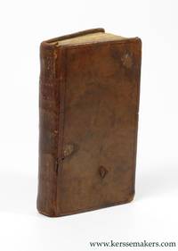
176338819Amsterdam: Chez Marc-Michel Rey 1763. 2 parts in 1 vol. Small 8vo 14x8 cmContemporary leather spine gilt faded with morocco title-label covers with loss of small pieces of leather marbled endpapers. xl128;ii189iii pp. First title soiled otherwise good copy. Barbier I171 mentions 2 editions: This first edition and Londres 1789 Chez Marc-Michel Rey hardcover
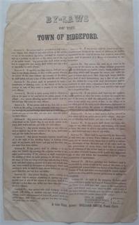
1850299Biddeford: N.p. 1850. <p>Broadside 14" x 8" double column signed in type by three selectmen with attestation by town clerk at end. Folded in quarters with several tiny holes no loss a number of creases minor stains one short marginal tear etc. but overall quite sound.</p> <br /> <p>Comprised of 19 Articles proscribing certain types of behavior the unique broadside specifies fines or other punishments for lawbreakers. Most interesting is Article 4: "No boy or other person shall be allowed to play at the game of bat and ball in the public streets of the village. Any person offending against this article shall forfeit and pay fifty cents for each offence."</p> <br /> <p>In addition to the obvious like public drunkenness these include: riding horses at a gallop in town or more than a walk on the covered bridge; "any boy or other person" who hangs onto a sleigh or carriage; anyone "causing dogs or any other animals to fight" in the streets; "Any person wantonly exposing himself sic naked in sight of any dwelling house"; a person injuring an ornamental tree on any street; anyone mutilating or pulling down signs or public notices or throwing dirt or setting off firecrackers or sliding down hills in the public streets &c. &c. According to internet resources Biddeford Maine passed a city charter and adopted a mayoral form of government in 1855.</p> <br /> <p>Not recorded in OCLC. 299</p> . N.p. unknown
1969stela1096Burnswick: 1969. 1969. oblong 8vo. unpaginated. 60 b/w illus. text by Rockwell Kent Carl Zigrosser & Richard V. West. chronology. wrs. couple stains to front cover spine sunned with wear bit scuffed half title had a Bowdoin College Museum of Art label addressed to Mr. & Mrs. Eris Wesselow. Soft cover. Very Good. [Burnswick]: 1969. Paperback
1764312885Kittery ME 1764. 1 p. pen and ink on paper. Oblong 12mo. Very Good. 1 p. pen and ink on paper. Oblong 12mo. A receipt from Caleb Emery to his brother Daniel Emery Jr. 1697-1778 reading: "Received of Daniel Emery junr. Five Shillings Lawfull sic money in Full of all accounts Debts Dues & Demand of any sort whatsoever to the Date hereof - By me" Caleb Emery 1710-1793 son of Daniel Emery Sr. and Margaret Gowen Emery married Jane Frost of Berwick where he was a lawyer farmer and tanner. "He read law with his brother Noah and was admitted to the Court of Common Pleas in 1750. He was a man of plain manners of strict integrity of peaceful character discouraging litigation among his neighbors even after he had entered the legal profession. He had the confidence of all with whom he came in contact and was highly esteemed by his relatives and clients." Genealogical records of descendants of John and Anthony Emery of Newbury Mass. 1590-1890 Emery Rufus 1827-1913. A Brother's Debt Paid. <br/><br/> unknown
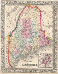
186047006New York: S. Augustus Mitchell Jr. 1860. Folio 12¼" X 15¼" image area 10½" X 15½". Hand colored. Very good. Light age toning and mild soiling mainly about edges. Sweet map of the "Pine Tree State" nicely hand-colored from the 1864 edition of "Mitchell's New General Atlas Containing Maps of the Various Countries of the World Plans of Cities Etc." Inset at lower right features "Portland Har. and Vicinity." Attractive example with sharp colors and handsome decorative border. S. Augustus Mitchell, Jr. unknown
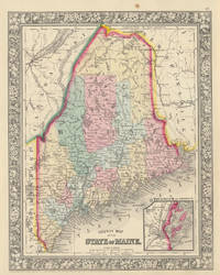
186045834New York: S. Augustus Mitchell Jr. 1860. Folio 12¼" X 15¼" image area 10½" X 15½". Hand colored. Very good. Mild age toning only. Charming hand-colored map of Maine from the 1864 edition of "Mitchell's New General Atlas Containing Maps of the Various Countries of the World Plans of Cities Etc." Inset at lower right features "Portland Har. and Vicinity." A lovely example well colored and with handsome decorative border. S. Augustus Mitchell, Jr. unknown
1851ZB375657NP: n.d. ca. 1851. small octavo 6 pp light extraction roughness at spine now in self wrappers later printing of the act Approved June 2d 1851. - If you are reading this this item is actually physically in our stock and ready for shipment once ordered. We are not bookjackers. Buyer is responsible for any additional duties taxes or fees required by recipient's country. Photos available upon request. NP: unknown
a76692Augusta 1848 William T. Johnson. 12mo. 16pp. original stringbound light pink wraps. Owner signed on cover Olilver Hanscomb Esq Lebanon. Good folded in half vertically. . paperback
a66638Bangor 1847 Samuel S. Smith. Octavo 16pp. later wraps. Good. paperback
a735891849. Octavo 7pp. 7pp. stringbound wraps. First 7 pages list Members by seat number residence and boarding place given after name. Second seven pages has same information but listed alphabetically. First section also has handwritten ink notation next to each Member's name giving his age and occupation farmer trader etc although some occupations are not written in. There is no ink notation in second portion. A small bit of arithmetic notes on top and rear cover blank margins. Good some wear. . paperback
1919307722Boston 1919. 291 photographs usually four to a page on 75 black album leaves captioned throughout in white ink. 1 vols. Oblong folio. Post bound album in black leather over limp boards edges rubbed front joint tender. A few photographs loosened but all present and complete one photo folded at left edge long ago. Black cloth folding box red morocco spine label. 291 photographs usually four to a page on 75 black album leaves captioned throughout in white ink. 1 vols. Oblong folio. An excellent and fully captioned photograph album of summer trout fishing and camping in the Rangeley district at Loon Lake Maine and other places of interest. The photographer is unnamed but evidently from Boston or the north shore with some connections further south on Long Island.<br /> <br /> The album records two trips to Maine: the first to Loon Lake in 1915 and the J. Lewis York family fishing camp including several fine images of York often with a bear cub on a lead 66 photographs on 17 leaves ; and the second undated to Green Lake Mike Marr's camp at Indian Pond to Squaw Mountain Pond with Fred Lessor guide and to Moosehead Lake and the Kennebec 36 photographs on 9 leaves. <br /> <br /> Three trips to Nova Scotia in 1914 1919 and 1923 to the Kedgemakoogee Rod and Gun Club on Kedgemakoogee Lake the Shelburne River and other trout fishing excursions 139 photographs on 37 leaves. In the June 1923 trip Irving Lake Dam on the Shelburne is described as the best fishing water of the trip. A few participants are identified: E.L. Matlack O.H. Muir and Wilson Forrest and the unidentified grinning angler with a large string of trout may well be the compiler. <br /> <br /> As well as scenes from the Piping Rock Horse Show Long Island noting Miss Lansdale up in several snapshots 22 photographs on 5 leaves; and a trip to Atlantic City at the end with the Shriners parade and seaside scenes 27 photographs on 7 leaves. Cf. Bibliotheca Salmo Salar 186 for a similar album unknown
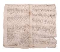
1680353098Likely Boston 1680. 4pp. Clerically signed Robert Warwick and Edward Gorges above an additional reaffirmation of grant dated June 1631 clerically countersigned by Thomas Wiggin James Parker James Watts and George Donglan. Docketed "Patent Saco: east of the river". Bifolium. Usual folds minor separations two repaired. 4pp. Clerically signed Robert Warwick and Edward Gorges above an additional reaffirmation of grant dated June 1631 clerically countersigned by Thomas Wiggin James Parker James Watts and George Donglan. Docketed "Patent Saco: east of the river". Bifolium. In 1629 less than a decade after the Pilgrims landed at Plymouth Rock the Council of New England an English joint stock company founded to establish colonial settlements in America issued a series of grants subdividing their royal charter that had ceded to them all land between "degrees 34 and 44" from sea to sea. These grants were important being among the earliest grants independently issued within the colonies. <br /> <br /> The present grant is of particular note for the history of Maine being the grant made to Thomas Lewis and Captain Richard Bonython for the land north of the Swanckadocke River i.e. the Saco River. The text of the grant reads in part:<br /> ".Whereas King James of famous memory late King of England Scotland France and Ireland by his Highness' letters patent and royal grant under the great seal of England bearing date the third day of November in the eighteenth year of his reign of England France and Ireland etc. for the causes therein expressed did absolutely give grant and confirm to the said Council for the affairs of New England in America and their successors forever all the land of New England lying and being from forty to forty-eight degrees of northerly latitude and in length by all that breadth aforesaid from sea to sea throughout the main land . that the said council for the affairs of New England in America as well for and in consideration that Thomas Lewis Gentleman has already been at the charge to transport himself and others to take a view of New England in America aforesaid for the bettering of his experience in advancing of a plantation and does now wholly intend by God's assistance with his associates to plant there both for the good of his Majesty's realms and dominions and for the propagation of Christian religion among those infidels and in consideration also that the said Thomas Lewis together with Captain Richard Bonighton and also with their associates and company have undertaken at their own proper costs and charges to transport fifty persons there within seven years next ensuing to plant and inhabit there to the advancement of the general plantation of that country and the strength and safety thereof among the natives or any other invaders also for the encouragement of the said Thomas Lewis and Captain Richard Bonighton and other considerations the said council thereunto moving have given granted enfeoffed and confirmed and by this present writing do fully clearly and absolutely give grant enfeof and confirm to the said Thomas Lewis and Captain Richard Bonighton their heirs and assigns for ever all that part of the main land in New England in America aforesaid commonly called or known by the name of Swanckadocke or by whatsoever other name or names the same is or shall be hereafter called or known by situated lying and being between the cape or bay commonly called Cape Elizabeth and the cape or bay commonly called Cape Porpoise containing in breadth from northeast to southwest along by the sea four miles in a straight line or accounting seventeen hundred and three score yards according to the standard of England to every mile and eight English miles upon the main land on the north side of the river Swanckadock after the same rate from the sea through all the breadth aforesaid ."<br /> <br /> The original vellum grant with seals is located in the archives of the Maine Historical Society. The present example is one of several extant early manuscript copies made during the subsequent conflicts and competing claims between the crown Massachusetts and Maine. In 1652 commissioners were appointed to determine the correct boundary between Massachusetts and several of the early patents with the former gradually extending their claim northward. In 1653 the settlers of Saco and other parts of Maine yielded to Massachusetts and the region was renamed Yorkshire or County of York. In 1664 after the Restoration the region was restored as an independent province but much of the region sold back to Massachusetts in 1678. After the charter of Massachusetts was annulled in 1684 and James II ascended to the crown in 1685 the region was once again assigned as part of the Province of Massachusetts Bay. Maine would remain part of Massachusetts until the final separation in 1820. <br /> <br /> The present undated copy likely dates from the period circa 1664 when a royal commission consisting of Richard Nicolls Sir Robert Carre George Cartwright and Samuel Maverick was sent to oversee the government of the colonies in New England. However it could also date as late as the period from the 1680s when Sir Edmund Andros became the Commissioner for the Dominion of New England. Documentary History of the State of Maine vol. 7 p. 117 unknown
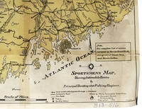
1916339615Portland Maine: maine Automobile Association 12 Monument Square 1916. Printed in yellow and black. Sporting camps marked with black dot. 22 x 16-1/2 inches. Tape repairs omn back else Very Good. Printed in yellow and black. Sporting camps marked with black dot. 22 x 16-1/2 inches. <br/><br/> maine Automobile Association, 12 Monument Square unknown
187310250Boston: J.R. Osgood & Co 1873. First edition. Frontispiece and 12 plates. 1 vols. Oblong folio. Original tan pictorial boards black calf spine. Bottom half of spine perished some cover wear internally fine. 1873 Christmas gift inscription on title. First edition. Frontispiece and 12 plates. 1 vols. Oblong folio. An account of the adventures of a group of friends vacationing at Mt. Desert Maine recounted in humorous verse and equally humorous drawings evidently by two members of the party. Summer romances the hazards of the communal dining table days of genteel ennui and other activities with the first names of the participants indicated as a partial aid to social historians a few of them are named in pencil on the title page are described in double columns of rollicking verse narrative and accompanying plates. A charming period piece and a not insignificant bit of amusing Americana. J.R. Osgood & Co unknown
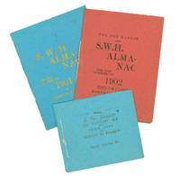
190263105Byerly Printing Co 1902. First and only edition. Illustrated by F. P. Byerly. 3 vols. 32mo. Blue red and green printed sewn wrappers. Fine. First and only edition. Illustrated by F. P. Byerly. 3 vols. 32mo. Amateur printing. Byerly Printing Co unknown
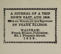
1981316097Dallas: The Somesuch Press 1981. Limited edition no. 56 of 200 copies signed by the printer and the publisher. vii 10 33 9 pp. 1 vols. Miniature 2-5/8 x 3 inches. Printed wrappers. As new. Limited edition no. 56 of 200 copies signed by the printer and the publisher. vii 10 33 9 pp. 1 vols. Miniature 2-5/8 x 3 inches. Facsimile of a rare and curious miniature book printed in 1858 reporting on a hunting trip to Maine. The Somesuch Press unknown
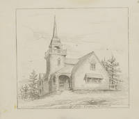
188517873New York: Century Magazine 1885. 1 vols. 4 3/4 x 4 1/8 inches. On stiff paper. Light wear. 1 vols. 4 3/4 x 4 1/8 inches. An early illustration of this island resort in Maine. From the well-known collection of American Artists' letters manuscripts and rare printed items formed by Professor E. Maurice Bloch. Century Magazine unknown
189173231London: John Murray 1891. Hardcover. Fair Condition. Fourteenth Edition. Brown cloth. Cloth split over the front hinge at the top but book feels in no danger. Boards boards bumped at the corners. Interior bright and clean. Size: Octavo. Quantity Available: 1. Shipped Weight: Under 1 kilo. Category: Law & Criminal Studies; Inventory No: 73231. . John Murray hardcover
1396265325.Ghardcover. Good. Access codes and supplements are not guaranteed with used items. May be an ex-library book. hardcover
1391638751.Gpaperback. Good. Access codes and supplements are not guaranteed with used items. May be an ex-library book. paperback
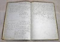
186223052301021st Maine Light Artillery; Union Army 1862. First Edition. Hardcover. Good. Union Army Order Book Large folio. 75 pages. Written by a fine hand 1862-1864. Also includes original typed orders from General Butler etc. Includes orders received by the unit from January 16 1862 through July 14 1864. Much of this period the battery was assigned to Louisiana Mississippi the Gulf of Mexico. <br> The battery was attached to 3rd Brigade Department of the Gulf until September 1862. It was attached to Weitzel's Reserve Brigade Department of the Gulf until January 1863. It was attached to Artillery 1st Division XIX Corps Department of the Gulf until January 1864 and the 2nd Division until April 1864. It then served at Camp Barry Defenses of Washington XXII Corps until July 1864. <br> The Battery notably served in the following engagements: Siege of Port Hudson; Battle of Fort Stevens; Third Battle of Winchester; Battle of Fisher's Hill; Battle of Cedar Creek. 1st Maine Light Artillery; Union Army hardcover
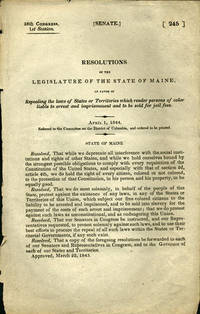
184436140Washington D.C.: n.p. 1844. First edition. Removed. A very good copy. 1 pp. 8vo. The Maine resolution was an attack on the heinous process of re-enslaving freed blacks: "Resolved. That we do most solemnly in behalf of the people of this State protest against the existence of any laws in any of the States of Territories of this Union which subject our free colored citizens to the liability to be arrested and imprisoned and to be sold into slavery for the payment of the costs of such arrest and imprisonment; that we do protest against such laws as unconstitutional and as endangering the Union." Maine approved this on March 22 1843 sent a copy to all members of the House and Senate and to all the governors of States and Territories. OCLC locates no copies. Not in Sabin Blockson Dumont Work LCP. Afro-Americana Clark: New England in U.S. Government Publications 1789-1849: 1145. n.p. unknown
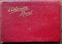
192036670Maine: n.p. 1920. Leather bound. Good. Oblong soft red leather ledger. Approximately 6.5" x 4.5." 64 leaves. Printed title page and explanation page. 60 pages used for writing down records. Several blank pages. Front cover shows light scratches a small stain and light creases. Small ink stain on a couple of blank pages towards the back else contents are clean. <br /> <br /> Records are written in columns for the first 56 pages. Column heading include date start time cyclo arrival time cyclo distance delays net running time average miles per hour roads party and remarks. Several empty pages until 4 pages of manuscript written in the memoranda section. The last note in this section is dated 1927. Alphabetical thumb index for expense records towards the back was not used. Title page does not have the name of the driver. However written at the bottom of the page is "1917 Ford #1750755 1921 Reg # 49290 Maine."Early trips recorded to Plymouth New Bedford Concord Boston Harvard Boothbay Harbor etc. Last driving record recorded August 1926. Although a date of 1927 recorded in the Memoranda section. A presentation card to "Uncle Charlie" enclosed with the inscription "may the roads be good the pleasure great and the blowouts few. n.p. unknown
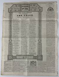
184613085Saco ME: January 7 1846. 4pp. on a single large folio sheet of newsprint. Old folds minor foxing disbound from larger volume with tell-tale chips along binding edge. Still very good condition. An unusual appearance of a carrier's address printed on most of the back page of the January 7 1846 issue of The Union newspaper published in Saco Maine. The address itself is printed in three columns and contains typical news of the day particularly the imminent statehood of Texas and Oregon the election of Polk and Liberty Party presidential candidate James Birney former slave owner turned abolitionist and with several lines decrying the issue of slavery. An example of the latter from the middle column reads: "But change we now a while our verse Disunion threatens with its curse The land the great and good have blest With pure example wise behest And slavery rears her hideous head Among the sons of Freedom's dead. Was it t'enslave dark Afric's race Our country braved a tyrant base Unloosed our chains from England's Throne To rivet them on those at home How false the cry for Freedom dear From those who've strove from year to year T'extend to lands which should be free The blight of endless slavery!"<br /> <br /> There is also a passage concerning both Texas AND slavery also involving Birney: "As on the banks of Rio Grande The future slave of Texas stands And sees his children from him torn To bear the wrongs which he has borne Hie eyes suffused with bitter tears Glance up the long vista of years Among the sufferings of his race In hopes their author's name to trace; How does he start and heave a groan Birney he sees stands out alone!" The address is also interesting for the elaborate ornamental border composed of printer's ornaments including floral elements and patriotic symbols. This is the first time we have seen a carriers address integrated into the newspaper itself. January 7 unknown
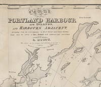
18283754<p><b>Important Early Chart of Portland Maine Harbor</b></p><p>Lemuel Moody 1767-1846 was an enterprising sea captain and nautical entrepreneur in Portland Maine. Realizing "the great necessity of a correct Chart of Portland Harbour and the dangerous Rocks near Cape Elizabeth also of Winter Harbour and the numerous islands in Casco Bay" Moody decided to produce such a chart. By 1825 the <i>Atlantic Neptune</i> charts that included this area were more than 50 years old and in need of updating. Moody took advantage of the opportunity and produced this chart using the <i>Atlantic Neptune</i> charts as the foundation. In a notation on the original agreement for producing the chart Moody states that "I did the whole of the survey." This impressive chart of Casco Bay was his sole cartographic undertaking. </p><p>The chart covers the area from Saco Bay to Seguin Island. A large inset at the upper left focuses on the immediate area around Portland harbor including a detailed layout of streets and wharves. Small drawings of several sailing ships decorate the chart. Of particular interest is one sailing vessel being towed by a steam-belching vessel southeast of Small Point an early record of steam-powered ships in Maine waters.</p><p>One of the prominent landmarks that Moody included on the chart is the Portland Observatory an 86' high tower that still stands atop Portland's Munjoy Hill. The Observatory one of Moody's entrepreneurial undertakings was built in 1807 and served as a marine signaling tower. Using a telescope from the tower and a flag-based signaling system Moody would – for an annual fee – alert ship owners of the arrival of their vessels well in advance of their arrival in the harbor.</p><p>The chart went through at least five states of which this is the second. The fortuitous survival of Moody's business records and the known construction dates of certain marine landmarks make it possible to identify the dates and production run of the various states of the chart with a fair degree of specificity. While all the charts produced include the initial publication date of 1825 in the title later states were known to have been printed in 1828 1832 1838 and 1857. The initial 1825/6 printing was 191 charts. For this second state only 49 charts were struck from the plates.</p><p>The second state is distinguished by the addition of two light towers that were constructed in Cape Elizabeth in 1828. Known now appropriately enough as "Two Lights" the two structures still stand though one has been decommissioned as a navigation aid. The updates to the copperplate and printing of this state were by Andrew Allen of Boston.</p><p>Moody's chart is very uncommon in any of its states. OCLC identifies three institutional holders as of September 2021: State Library of Massachusetts Osher Map Library and Boston Public Library. Additional examples are held at the Maine Historical Society Library of Congress Yale and at least one private collector. No examples of the chart were identified in the <i>Antique Map Price Record</i> during its run from 1983 to 2011.</p><p>A very attractive example of an important and scarce early Maine chart.</p><p><b>Reference</b>: Phillips <i>A List of Maps of the United States</i>: p. 717 Mistakenly titled as Map of Portland Harbour and Islands…</p><p><b>Acknowledgment:</b> I am indebted to Ms. Frances Pollitt formerly of the Maine Historical Society for sharing her research on the dating and production of Moody's chart.</p><b>Condition: </b>Lined on reverse mending several tears. Very minor recreation of image loss and restoration of blank margin areas.<p>ICN 7690.3.</p> [Lemuel Moody.] .] Engd by D. G. Johnson. Entered According to Act of Congress July 13th, 1825. [but 1828.]