184 résultats
2008321910The Folio Society 2008. Hard Cover Full Leather in original folding box. FINE/FINE -- SHIPPING ONLY IN U.S. AND BY MEDIA MAIL ONLY -- Limited Edition 670 / 1750 -- Includes booklet "The Divine Stenographer -- Dark blue leather with giltred and white embossing. 1101 pages with illustrations -- Hugo VIctor / Translated and with an Introduction by Norman Denny / Illustrations and designs by De Neuville Bayard Morin Valnay and other prominent French Artists. Limited Edition. Hard Cover. Fine/Slipcase. The Folio Society Hardcover
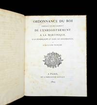
18292146<p><br /><b><i>A judicial turning point in the West Indies</i></b></p><p><br /></p><p>Jean-Guillaume baron Hyde de Neuville 1776-1857.</p><p><b>Ordonnance du Roi portant établissement de l'enregistrement à la Martinique à la Guadeloupe et dans ses dépendances et à la Guyane française.</b></p><p>Paris Imprimerie Royale 1829.</p><p><br /></p><p>4°. 122 pp. With the woodcut coat of arms of France on title-page.</p><p>Contemporary coloured marbled calf with gold-tooled borders smooth gold-tooled spine with title label in red morocco gilt edges. </p><p>First and only edition of an ordonnance of significant governmental administration reform in the colonial French Antilles and Guyana. This copy beautifully bound and from the library of Proser de Barante 1782-1866. The rare ordinance declares that the registration of anything official will have to be centrally administered and paid for meaning a farewell to the colonial ways of administration that was largely conducted by plantations. It was modelled after the successful administrative reform in the French East Indies in 1804. The fees for registering several specific matters such as the transfer of deeds are introduced in this book. The responsible official for this reform program was Jean-Guillaume baron Hyde de Neuville Minister of Colonies. In the foreword he declares that the proposed reform was controversial and met much resistance in the West Indies particularly because it would cost the citizens much more to do their business while the plantations would lose income and authority. However Hyde de Neuville counters that the fees for registration in the French Antilles will be significantly lower than those on the mainland.</p><p><br /><b>Condition:</b> Minor wear to joints and corners of binding. Slight foxing. Otherwise in very good condition.</p><p><b>Reference: </b><i>Ephémerides orientalistes</i> 168-172 1957: nr. 227 "rare".</p><p><b>Provenance:</b> Exlibris "Bibliotheque de Mr. de Barante" and library mark on front paste-down from Amable-Guillaume-Prosper Brugière de Barante Proser de Barante 1782-1866.</p> Imprimerie Royale
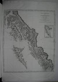
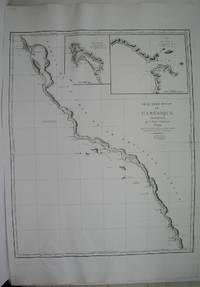
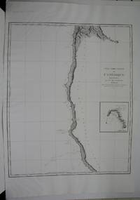
1800M5624Paris: Dépôt de la Marine 1800. Excellent. Notes: An inset map of Fort Stewert appears on the right hand side of the map.<br><br>George Vancouver 1758-1798 served as an officer in the second and third voyages of James Cook 1772-4 1776-80 and as a seasoned sailor and established surveyor was placed in command of an expedition to the Northwest Coast to determine England’s rights under the Nootka Sound convention of 1790. He left the British Isles in 1791 and sailed via Cape of Good Hope to Australia where he made a survey of the southwest coast and New Zealand to Tahiti and Hawaii. In April 1792 Vancouver left Hawaii and sailed to the Californian coast. He reached the Northwest Coast in 1792 and spent two years surveying the coastline resulting in the most correct maps of the Northwest made up to that time. Vancouver’s explorations on the northwest coast included the Port of San Francisco New Albio Nootka Sound and the Straits of Juan de Fuca. Size : 745x610 mm 29.25x24 Inches Coloring: Black & White Category: Maps Canada West British Columbia; Maps Polar Arctic Regions Alaska Greenland Iceland; Dépôt de la Marine unknown
1800M5678Paris: Dépôt de la Marine 1800. Excellent. Notes: George Vancouver 1758-1798 served as an officer in the second and third voyages of James Cook 1772-4 1776-80 and as a seasoned sailor and established surveyor was placed in command of an expedition to the Northwest Coast to determine England’s rights under the Nootka Sound convention of 1790. He left the British Isles in 1791 and sailed via Cape of Good Hope to Australia where he made a survey of the southwest coast and New Zealand to Tahiti and Hawaii. In April 1792 Vancouver left Hawaii and sailed to the Californian coast. He reached the Northwest Coast in 1792 and spent two years surveying the coastline resulting in the most correct maps of the Northwest made up to that time. Vancouver’s explorations on the northwest coast included the Port of San Francisco New Albio Nootka Sound and the Straits of Juan de Fuca. Size : 810x605 mm 31.875x23.75 Inches Coloring: Black & White Category: Maps United States West California; Maps United States West Washington & Oregon; Dépôt de la Marine unknown
198460670Museum. As New. 1984. Paperback. FREE UPGRADE to Courier/Priority Shipping Upon Request IN STOCK AND IMMEDIATELY AVAILABLE FOR SHIPMENT - AS NEW THE TEXT BLOCK IS PRISTINE CLEAN UNMARKED AND IN EXCELLENT CONDITION - - 40 pp. With 27 ills. 22 x 28 cm. -- with a bonus offer-- . Museum paperback
50734Paris France: Boussod Valadon Et Cie. As New. N.D. Hardcover. FREE UPGRADE to Courier/Priority Shipping Upon Request IN STOCK AND IMMEDIATELY AVAILABLE FOR SHIPMENT - Text block clean pages tight to spine - Text in French. 102 pages 86 black and white illustrations. ND Circa 1890 -- with a bonus offer-- . Boussod, Valadon Et Cie. hardcover
1894102635Galerie Georges Petit. As New. 1894. Paperback. FREE UPGRADE to Courier/Priority Shipping Upon Request - IN STOCK AND IMMEDIATELY AVAILABLE FOR SHIPMENT - AS NEW THE TEXT BLOCK IS PRISTINE CLEAN UNMARKED AND IN EXCELLENT CONDITION - - Text in French. 14 pages; both paintings illustrated. -- with a bonus offer-- . Galerie Georges Petit paperback
1800M5622Paris: Dépôt de la Marine 1800. Excellent. Notes: A small inset map appears along the right margin<br><br>George Vancouver 1758-1798 served as an officer in the second and third voyages of James Cook 1772-4 1776-80 and as a seasoned sailor and established surveyor was placed in command of an expedition to the Northwest Coast to determine England’s rights under the Nootka Sound convention of 1790. He left the British Isles in 1791 and sailed via Cape of Good Hope to Australia where he made a survey of the southwest coast and New Zealand to Tahiti and Hawaii. In April 1792 Vancouver left Hawaii and sailed to the Californian coast. He reached the Northwest Coast in 1792 and spent two years surveying the coastline resulting in the most correct maps of the Northwest made up to that time. Vancouver’s explorations on the northwest coast included the Port of San Francisco New Albio Nootka Sound and the Straits of Juan de Fuca. Size : 750x610 mm 29.5x24 Inches Coloring: Black & White Category: Maps United States West Washington & Oregon; Dépôt de la Marine unknown
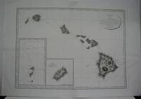
1800M5617Paris: Dépôt de la Marine 1800. Excellent. Notes: Two inset maps one of the Gallapagos Islands and the other of Cocos Island.<br><br>George Vancouver 1758-1798 served as an officer in the second and third voyages of James Cook 1772-4 1776-80 and as a seasoned sailor and established surveyor was placed in command of an expedition to the Northwest Coast to determine England’s rights under the Nootka Sound convention of 1790. He left the British Isles in 1791 and sailed via Cape of Good Hope to Australia where he made a survey of the southwest coast and New Zealand to Tahiti and Hawaii. In April 1792 Vancouver left Hawaii and sailed to the Californian coast. Size : 595x805 mm 23.375x31.625 Inches Coloring: Black & White Category: Maps United States West Hawaii; Dépôt de la Marine unknown