777 résultats
179135165[Paris] Imprimerie de Valleyre jeune s.d. [1791] in-4 en feuille
1740CCC-769169. edition Prault Paris 1740 In-24 (12,5 cm X 6,5 cm), relié, 323 pages. Plein veau marbré, dos à 4 nerfs , Tranches rouges, conis rapes, interieur bon, photos possibles.... Notaire au Châtelet, il a publié entre 1740 et 1746 ces Principes de la Coutume de Paris où les solutions coutumières sont présentées sous une forme succincte et méthodique suivant un plan qui préfigure celui du Code civil.... photos possible
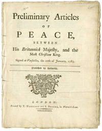
1783WRCAM20840London 1783. 14pp. Quarto. Antique half calf and marbled boards. Some minimal old ink underscoring else a near fine copy untrimmed. The first British publication of the terms of peace agreed upon between France and England after the American Revolution. The French had hoped to obtain more from England in the final peace settlement but De Grasse's catastrophic naval loss to Rodney in the Caribbean in 1782 weakened their position and the American commissioners forced their hand by coming to their own accord with the British on Nov. 30 1782. By this treaty the British cede Newfoundland fishing rights return St. Lucia and Tobago to France and France gives back Nevis Grenada St. Kitts Montserrat and St. Vincent to the British as well as territorial exchanges in India. This treaty was vital to the final resolution of the American Revolution since the United States was pledged to move with France as an ally and was not in a position to settle without her. The final treaties of all the warring powers were signed on Nov. 3 1783. DAVENPORT 169. AMERICAN CONTROVERSY 83-45. hardcover books
1783WRCAM20839London 1783. 10pp. printed in double-column format in parallel French and English. Small quarto. Dbd. Some old minor ink underscoring. Else very good. Untrimmed. In a half morocco box. The official English publication of the preliminary articles of peace between Spain and England. By this treaty an armistice was concluded Britain gave back the Floridas to Spain and Spain restored the Bahamas to England. AMERICAN CONTROVERSY 83-44. DAVENPORT 170. unknown books
1783WRCAM21253London 1783. 10pp. printed in double columns in parallel English and French. Small quarto. Modern half morocco and marbled boards. A very good crisp copy. This preliminary settlement had been a stumbling block to the general settlement of the other parties in the American Revolution. All other treaties were concluded the day after this one. It revolves mainly around questions of trade with various colonies. England's final treaty with Holland was not concluded until the following year. This is the official English edition of the preliminary articles. SABIN 65045. hardcover books
1737146921(1737). Format: 28,5 x 19 cm (bis zum Bildrand beschnitten).
1750902452AGParis, [um 1750]. Kupferstich Bildgröße 33,5 x 21 cm (hoch), Blattgröße 45 x 31,5 cm.
178727075Paris chez Lamy 1787 1 estampe : eau-forte en noir ; 22,2 x 27,8cm, PORTA S. MARTINI. / Poort van St. MARTYN (Paris - la Porte Saint-Martin) , 1673 gravure par Peter SCHENK l'ancien
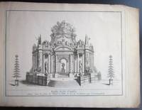
1749D4444Paris c. 1749. Hardcover. Very Good. Oblong 2o 325 x 440 mm. Engraved title-page engraved explanation of plates with pasted overslip adding a description of plate 6 and 6 engraved plates some staining to title-page and margins of plates. Contemporary marbled paper wrappers worn; cloth folding case. The plans and drawings illustrating the public festivities held in Paris to celebrate the TREATY OF AIX-LA-CHAPELLE on 12 February 1749. The treaty signed on 18 October 1748 was mainly a diplomatic agreement between Britain and France but it also marked the end of the War of Austrian Succession. Although the celebration called for fireworks at the Place de l'Hotel de Ville with numerous orchestras playing and buffets set up around the city the affair was rather gloomy due to French resentment over the terms of the treaty. Berlin 3019; Vinet 524. <br/><br/> hardcover books
1750902438AGParis:, Mariette, [um 1750]. Kupferstich 33,5 x 22,5 cm (hoch) Bildgröße, 45 x 31 cm Blattgröße.
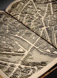
1739ABAA25-22<p>S.l. 1739.</p><p>Folio 558 x 443 mm bound in red morocco covers decorated with fleur-de-lys borders fleurs-de-lys in the corners coat of arms in the center spine ribbed and decorated with fleur-de-lys of various sizes stars and gilt fillets inner border decorated with fleurs-de-lys gilt edges. <em>Contemporary binding.</em></p><p>First issue of the most famous antique map of Paris called " plan de Turgot ".</p><p>James de Rothschild. 2312; Cohen 807.</p><p>It is composed of one plan of combination and of 20 engraved plates on double-page 800 x 515 mm representing the capital house by house in a panoramic view. " <em>We propose by making this engraved map to show at a glance all the buildings and all the streets of Paris</em> " informed the editor.</p><p>"This bird's eye map the widest of this sort ever tackled is known under the improper designation of 'Plan de Turgot'. It is composed besides the map of combination of twenty leaves that altogether form five ranks. Each leave as a surround of 79 centim. large on 50 high. The twenty assembled leaves thus form a square of about 316 centim. on 245 excluding the margin. This surface would bother more than one Parisian amateur whose allocation is way too narrow to have it in its cabinet.</p><p>The engraved title is at the bottom of the leaves 18 and 19 in the middle of a cartouche with a very circumvented shape surrounded with volutes and topped with the allegorical figure of the city of Paris resting on her shield.</p><p>This map takes usually the form of a large folio atlas; each leaf printed on thick paper is folded in two and glued on guard. It is said that most copies were bound at the time with more or less luxury to be distributed for free with no doubt to distinguished figures; all sheepskin or Levant morocco bindings are decorated in their center with the arms of Paris. Some copies were printed with wide margins.</p><p>This map ends the series of bird's eye maps and if after this period we still see some of those published it would be older maps copied or refreshed. Louis Bretez who drew it around 1734 derogated the generally admitted custom of positioning maps according to the noon mark because willing to give of Paris an image in front view he had to prefer with the model of previous geographers a system that would allow to see in front view the gates of our ancient churches so numerous still churches that for the most part had their facades directed westward. It is deplorable that the map as it was conceived wasn't created on an earlier date at least from a century. It would have been because of its dimensions of a much higher interest for the archaeologists of today.</p><p>The drawing ordered by Turgot was achieved in 1734; it represents thus the state of Paris at this time. Claude Lucas who engraved it is probably the one who worked on the maps of the districts of La Caille 1714 or perhaps his son.</p><p>The choice that was made of a bird's eye map must have led to huge costs…</p><p>The image of Paris represented here still offers I say it again a big appeal and documentation for archaeology. The few number of ancient buildings that have survived is so quickly diminishing day by day or is suffering from strange metamorphoses with the hideous mask of replastering so much that the Paris of Turgot threatened by our thousands of projects of alignment and expansion will soon have to be called in turn the 'old Paris' …. A. Bonnardot <em>Etudes archéologiques sur les anciens plans de Paris</em> pp. 199-203.</p><p>These plates remarkably engraved show in a vivid way the former layout in perspective of the Parisian sites residences and monuments.</p><p>Copy printed on thick paper illustrated with brilliant proofs preserved in a binding by Padeloup with the arms of Paris.</p><p>The title is engraved in the center of a blending of two plates. 1600 x 540 mm.</p><p><strong>FR</strong></p><p>S.l. 1739.</p><p>In-folio relié en maroquin rouge plats ornés d'une roulette fleurdelisée fleurs-de-lys aux angles armoiries au centre dos à nerfs orné de fleurs de lys de différentes tailles d'étoiles et de filets dorés coupes décorées roulette intérieure fleurdelisée tranches dorées. <em>Reliure de l'époque.</em></p><p>558 x 443 mm.</p><p><strong>Premier tirage du plus célèbre plan ancien de Paris dit Plan de Turgot.</strong></p><p>James de Rothschild. 2312 ; Cohen 807.</p><p>Il se compose d'un plan d'assemblage et de 20 planches gravées à double page 800 x 515 mm représentant la Capitale maison par maison en vue panoramique. " <em>On s'est proposé en faisant graver ce plan de faire voir d'un seul coup d'œil tous les édifices et toutes les rues qu'elle renferme</em> " avertit l'éditeur.</p><p>" Ce plan à vol d'oiseau le plus vaste en ce genre qu'on ait entrepris est connu sous la désignation impropre de 'Plan de Turgot'. Il se compose outre le plan d'assemblage de vingt feuilles qui réunies forment cinq rangs. Chaque feuille a d'encadrement 79 centim. De largeur sur 50 de hauteur. Les vingt feuilles réunies forment donc un carré d'environ 316 centim. Sur 245 non compris la marge. Cette surface embarrasserait plus d'un amateur parisien trop étroitement logé pour en garnir son cabinet.</p><p>Le titre gravé se trouve au bas des feuilles 18 et 19 au milieu d'un cartouche de forme très contournée entouré de volutes et surmonté de la figure allégorique de la ville de Paris appuyée sur son blason.</p><p>Ce plan forme le plus souvent un atlas grand in-folio ; chaque feuille tirée sur un papier fort est pliée en deux et collée sur onglet. Il paraitrait que la plupart des exemplaires furent reliés dans le temps avec plus ou moins de luxe pour être distribués gratuitement sans doute à tous les personnages éminents ; toutes les reliures en mouton ou en maroquin du Levant sont ornées au centre des armes de Paris. Il y a des exemplaires tirés sur grandes marges.</p><p>Ce plan termine la série des plans à vol d'oiseau et si passé cette époque on en voit paraitre encore quelques-uns de ce genre ce sont des plans plus anciens copiés ou rajeunis. Louis Bretez qui le dessina vers 1734 dérogea à l'usage généralement admis d'orienter les cartes selon la méridienne parce que voulant donner de Paris une image en élévation il dut à l'exemple des anciens géographes préférer un système qui permît de voir de face les portails de nos anciennes églises si nombreuses ncore églises qui pour la plupart avaient leur façade tournée vers l'occident. Il est à regretter que le plan tel qu'il a été conçu n'ait pas une date antérieure d'au moins un siècle. Il eût été à raison de sa dimension d'un bien haut intérêt pour les archéologues d'aujourd'hui.</p><p>Le dessin ordonné par Turgot était achevé en 1734 ; il représente donc l'état de Paris à cette époque. Claude Lucas qui le grava est le même sans doute qui travailla aux plans des quartiers de La Caille 1714 ou peut-être son fils.</p><p>Le choix qu'on fit du genre à vol d'oiseau dut entrainer des frais immenses…</p><p>L'image de Paris qu'il représente offre encore je le répète beaucoup d'attraits et de documents à l'archéologie. Le petit nombre de vieux édifices qui ont survécu disaparaît de nos jours si rapidement ou subit de si étranges métamorphoses sous le hideux masque du replâtrage que la Paris de Turgot en proie à nos mille projets d'alignements et d'agrandissements devra bientôt s'appeler à son tour le 'vieux Paris' …. A. Bonnardot <em>Etudes archéologiques sur les anciens plans de Paris</em> pp. 199-203.</p><p><strong>Ces planches d'une gravure remarquable montrent d'une façon très vivante la disposition ancienne en perspective des sites des demeures et des monuments parisiens.</strong></p><p><strong>Exemplaire imprimé sur papier fort orné de brillantes épreuves revêtu d'une reliure de Padeloup aux armes de la ville de Paris. </strong></p><p>Le titre est gravé au centre d'un assemblage de deux planches 1600 x 540 mm.</p> hardcover
179411811794 1794, Lavis original contrecollé sur papier fort.42,5 x 45,5 cm.
176651834P., Desnos & chez l'Auteur 1766 In-4, demi-basane brune, dos à nerfs, titre gravé, grand plan général dépliant et 34 planches sur double page, 28 ff.n.ch. de tables d. Petits frottements. Infimes rousseurs. Très bon exemplaire.
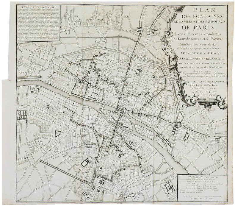
1720LBW-3471Paris, Monsieur de Beaurain, [circa 1720]. 299 x 296 mm.
1705279621705 Paris, 1705 - Blatt-Maße: ca. 27 x 38 cm. -- gut erhalten. || Original copper engraved map from 1714.
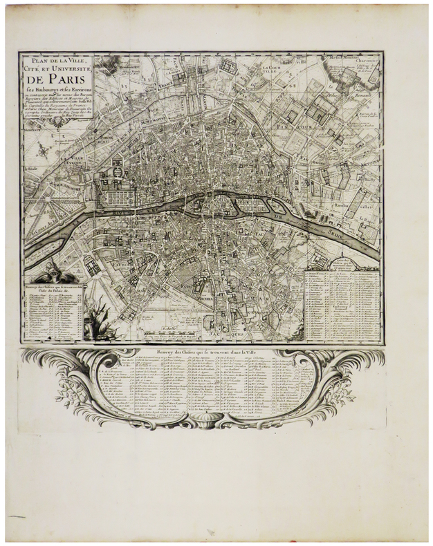
1735LBW-3700Paris, 1735. 547 x 584 mm.
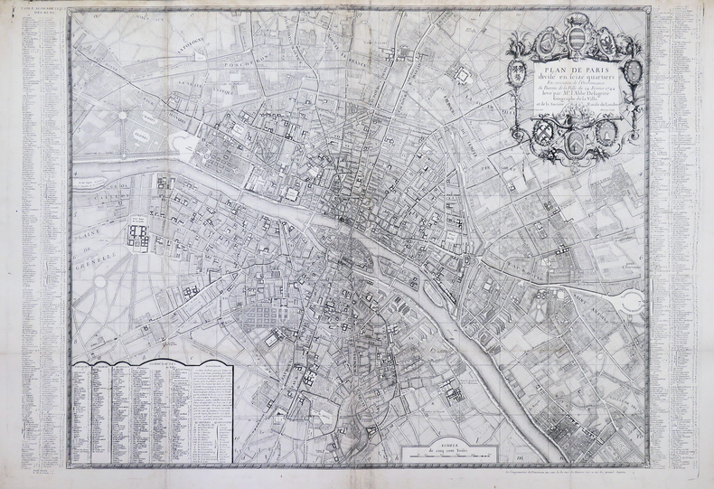
1744LBW-4456Paris, Fourneau, [1744]. 599 x 885 mm.
173770216Chez C. C. Thiboust | à Paris 1737 | 20.50 x 27 cm | relié
1726LBW-3558Paris, G. Desprez et J. Desessartz, 1726. En 40 sections jointes de 630 x 860 mm, monté sur toile.
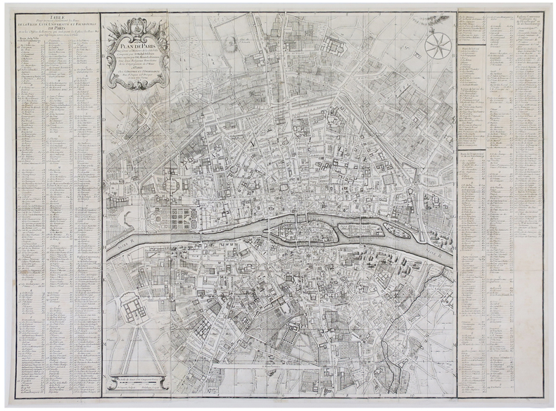
1735LBW-848Paris, Sr. Jaillot, [circa 1735]. En trois feuilles jointes de 470 x 1030 mm.
1780LBW-529[circa 1780]. 430 x 615 mm.
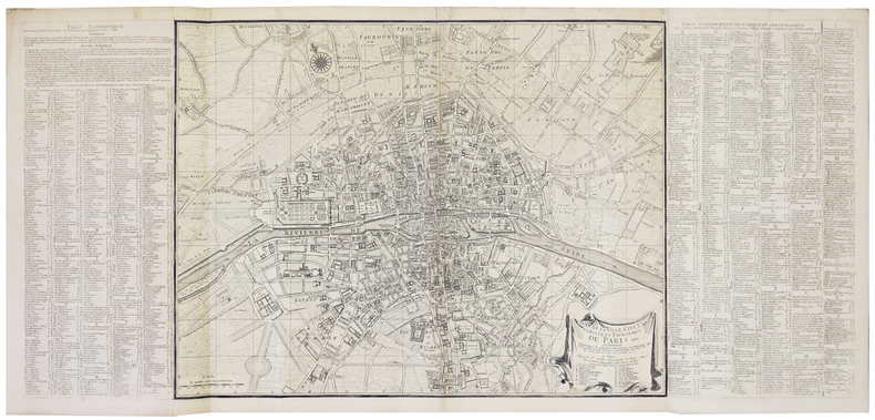
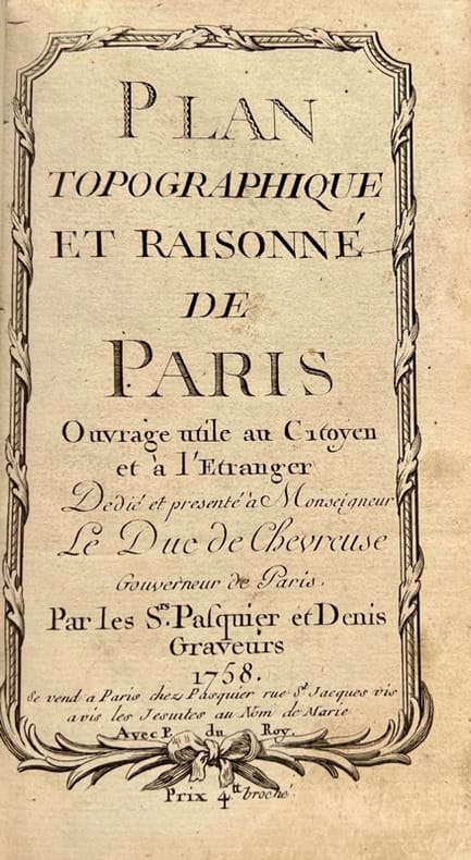
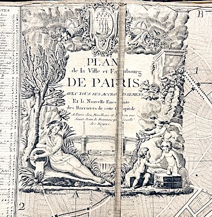
175842372Se vend à Paris, chez Pasquier et Denis, 1758. Petit in-8 de 3 ff.n.ch., 149 pp., 1 f.n.ch., veau lisse brun, dos orné, pièce de titre en maroquin rouge (reliure de l'époque).
179015849Mondhare et Jean Paris 1790 1 vol. Feuille de 98 x 63 cm, entoilée et repliée, étiquette.
1797LBW-5683Paris, Delamarche, 1797. 646 x 949 mm.