9 102 résultats
0672516705.Ghardcover. Good. Access codes and supplements are not guaranteed with used items. May be an ex-library book. hardcover
Q-0672516705Bobbs-Merrill Co. Library Binding. New. New. In shrink wrap. Looks like an interesting title! Bobbs-Merrill Co unknown
19631769172136ADAGeorge Allen & Unwin Ltd 1963. Hardcover. Good/Good. 1963. First Edition. 118 pages. Red pictorial dust jacket over red cloth. Pages are lightly tanned at the edges with light foxing. Occasional thumb marks to pages edges. Binding has remained firm. Inscription to front endpaper. Boards have slight shelf wear with bumping to corners. Spine ends are a little crushed. Light wear to clipped dust jacket with tears nicks and creases to spine edge and corners. Light tanning to spine and edges. George Allen & Unwin Ltd hardcover

1998583112.Gpaperback. Good. Access codes and supplements are not guaranteed with used items. May be an ex-library book. paperback
ria9781998583119_inpPaperback. New. New Book; Fast Shipping from UK; Not signed; Not First Edition; In the vibrant heart of Tokyo two worlds collide as cultures blend and hearts entwine in a romantic tale that transcends boundaries.Seventeen-year-old Kai Amara a passionate boy of Caribbean and Japanese descent navigates the complex paperback
20061-0870710893Oregon State Univ Pr 2006. Paperback. New. 432 pages. 9.00x5.75x1.00 inches. Oregon State Univ Pr paperback
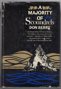
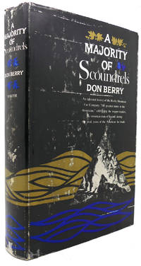
1961000011961New York: Harper & Brothers 1961 1961. First edition. Hardcover. Near Fine/Very Good. Large 8vo. 8 ix-xiv 2 3-432 pp. Blue cloth with gold lettering on the spine. Jacket designed by Anita Walker. Illustrated with several black and white photographs and two large maps. With an appendix an index. Cazedessus 10. An important work on the fur trade. Jacket is price-clipped with a few hints of edge wear. Harper & Brothers [1961] hardcover
000485New York Harper & Brothers 1961. A fine copy bound in turquoise cloth chipped dust wrapper. A spirited account of men and events that reflected the power greed and ruin of the RMF "the greatest name in the mountains". Folding maps in rear pocket. First edition. New York Harper & Brothers (1961). hardcover
1961000221New York: Harper & Brothers. Hardcover. 1961. 1st Edition. 8vo 432pp . Very Good in Good DJ. B&W Illustrations DJ chipped at lower right front corner 2 maps in rear pocket as issued . Harper & Brothers hardcover
196113724INDNew York: Harper & Brothers 1961. 432 pp. Original blue cloth covers w/ gilt title on spine. Includes two 2 folding maps in rear pocket. Light wear to spine ends. Light wear and tear to edges and spine ends of DJ. Small piece missing from top of front panel. Lightly rubbed and soiled. Illst. w/ b/w plates. First Edition. Hard Cover. Very Good/Very Good-. Harper & Brothers Hardcover
1961166532New York: Harper 1961. hardcover. very good/good. Illustrated. 432pp. 8vo cloth d.w.; ex-lib dust wrapper torn. New York: Harper & Brothers 1961. A very good copy in a good dust wrapper.<br/> <br/> Harper unknown
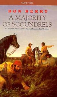
1989Q-0891740287Comstock Book Distributors 1989. Paperback. New. In shrink wrap. Looks like an interesting title! Comstock Book Distributors paperback
1961122469New York: Harper & Brothers 1961. First Edition; First Printing. Hardcover. Very Good in a Very Good dust jacket. All 4 corners clipped but not price clipped. Shelf wear on front/rear panels and spine. Bumping at spine crown/heel. 1/4 inch open tear at top of rear gutter. Stated First Edition. Harper & Brothers hardcover
1334529876.Gpaperback. Good. Access codes and supplements are not guaranteed with used items. May be an ex-library book. paperback
0484786296.Ghardcover. Good. Access codes and supplements are not guaranteed with used items. May be an ex-library book. hardcover
2004Q-0736422684RH/Disney 2004-09-28. Paperback. New. New. In shrink wrap. Looks like an interesting title! RH/Disney paperback
1961712838PN. New. 1961. Soft Cover. Date is original print. This is a reprint edition. . PN paperback
1932058941London: Constable & Company 1932. First Edition 1st Printing. Hardcover. Fine/Very Good. Ix 104 Pp. Red Cloth Spine Gilt Red Topstain. First Printing 1932 Date On Title Page Clean No Marks Gilt Brilliant.Dust Jacket Priced 3/6 Sligjht Usage A Little Dust 1/8" Chipping Across Top Edge Of Spine. <br/> <br/> Constable & Company hardcover
122903London Constable & Company Ltd 1932. . First edition; 8vo 19 x 13 cm; light spotting to edges with and some pages foxing on pp22-23 pp34 pp42-43 pp70-73 pp102-103 not affecting legibility of text otherwise good internal condition; publisher's red cloth boards gilt lettering to spine slight signs of wear to corners and spine small mark on upper spine otherwise very good condition; x 104pp.<br /> This first edition by wine expert Charles Berry is an exploration of his stories of wine and vineyards across Europe.<br /> London, Constable & Company Ltd, 1932. hardcover
19841212514PN. New. 1984. Reprint Edition. Soft Cover. Date is copyright date; this is a later reprint edition . PN paperback
2004Q-0060527471Greenwillow Books 2004-03-02. Hardcover. New. New. In shrink wrap. Looks like an interesting title! Greenwillow Books hardcover
1016634773.Ghardcover. Good. Access codes and supplements are not guaranteed with used items. May be an ex-library book. hardcover
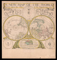
168018434London: Sold by Will Berry at the Signe of the Globe between Chearing-Cross and White-Hall c1680. 425 by 480mm 16.75 by 19 inches. The first polar projection world map published by an Englishman Engraved map fine original hand-colour Ptolemaic Tychonic and Copernican diagrams of the solar system around map map of the ancient world below. The first world map on polar projection to be published by an Englishman. Polar Projection Polar projection is a type of azimuthal projection based on a plane perpendicular to the Earth's axis through the poles. On polar-centered azimuthal projections longitude is represented by radial straight lines and latitude by concentric circles or parallels. One of the earliest examples of a polar map of this kind is Mercator's 1569 world map on which the Arctic is shown in an inset map on a polar projection rather than included as part of the main image on the eponymous cartographer's projection. Other early double hemisphere world maps on north and south polar projections include Gerard De Jode's Hemispheriu ab Aequinoctiali Linea 1593; Isaac Habrecht's map of 1628; Janssonius' Typus Orbis Terrarum from the same year; Jean Boisseau's Nouvelle Description de toute la terre universelle of 1640; and Novus Planiglobe Terrestris Per Utrumque Polum Conspectus engraved by Joan Blaeu before 1672 the only extant example of which bears the later imprint of Gerard Valck published around 1695. The present map by Berry is an example of the first map on polar projection to be published by an Englishman. The Map Published around 1680 Berry's map shows both the north and south hemispheres on a polar projection at a scale of approximately 1:100000000 with both extending to the equator which is scaled. The coast of Australia is incomplete and California is shown as an island. Other cartographic myths include the massive single Great Lake and the Straits of Anian. The sizes of the Philippines and Japan are exaggerated and the southern tip of South America has been truncated due to the projection. At first glance the work would appear to be a copy of Blaeu/Valck Novus Planiglobe Terrestris Per Utrumque Polum Conspectus; and although Berry's English title is an almost direct translation of Blaeu's work it is no merely slavish copy. Berry has reversed the hemispheres and significant cartographic differences are evident especially in the depiction of South America. Surrounding the hemispheres are cosmological diagrams showing the Ptolemaic Copernican and Tychonic solar systems as well as a smaller map of the ancient world. This shows only Europe Asia and Africa and is divided into layers of "temperate zone" "frozen zone" "unhabitable" and "habitable by the Antients" regions. Ribbons ornament the upper left- and right-hand corners streaming from the ends of the simple title banner along the upper edge. The map was engraved by John Rich who also executed his road map of Great Britain the year before. William Berry 1639-1718 In his Printed Maps in the Atlases of Great Britain and Ireland 15791870 Thomas Chubb describes Berry as a bookseller geographer and engraver who was active between about 1670 and 1703. Berry was the son of a Warwickshire baker probably apprenticed alongside his future partner Robert Morden c1650-1703 to Joseph Moxon 16271691 an engraver mapmaker globe-maker and instrument-maker. His most enduring partnership was later with Morden and together they sold topographical works prints maps charts and globes. Among their shared works were A New Map of the English Plantations in America 1673 William Leybourn's An introduction to astronomy and geography: being a plain and easie treatise of the globes 1675 and Playing cards depicting the Counties 1676. In 1677 they petitioned the Attorney General for "a licence to do all general and particular maps of the several parts of the world according to an alphabetical manner and method first projected by them against any other undertakers". Although there are individual maps and globes prepared by the pair the larger project never came to fruition although Berry is best remembered as the "English Sanson" for the set of maps of the world that he corrected and amended after Nicolas Sanson which were issued separately between 1680 and 1689. Rare we are only able to trace one institutional example held at The Library of Congress and a smaller facsimile at the British Library. Not in Shirley; LC G3200 1675 .B4. Sold by Will Berry at the Signe of the Globe between Chearing-Cross and White-Hall,
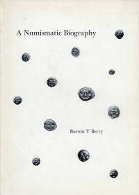
197182391BB1971 . Beirut: Burton Y. Berry; Luzern: Bucher 1971. 4°. 89 1 S. 527 Abbildungen broschiert Einband leicht berieben; gut erhalten Vorliegend eins von 600 Exemplaren dieses Privatdruckes. unknown