Arabian American Oil Company [Aramco].Biblio.com

347 résultats
65872Saudi Arabia 1955 - 1960. 43 silver gelatin press photographs of Saudi Arabia particularly of the workers and possessions of the Arab American Oil Company. 40 measure 25.5 x 20.5 cm 2 measure 21.5 x 16.5 cm and 1 measures 23 x 18 cm; 32 prints stamped by Aramco with 8 evidently also produced by the company 2 by Keystone Pictures Inc. and one by Wide World Photo; 18 photographs are accompanied by descriptions. Some creasing to corners one print with small tears to the top and left edge. In excellent condition overall. The Arabian American Oil Company also known as Aramco emerged from US efforts to extract and refine crude oil in the Arabian Peninsula. The California-Arabian Standard Oil Company discovered oil at Dhahran in 1937 which was extracted at a rate of 115 barrels a day. This became the first commercial well in Saudi Arabia and was a breakthrough for American Oilmen looking for reservoirs of 'black gold' overseas. In 1944 the company changed its name to the Arabian American Oil Company. These photographs were almost all taken by Aramco to showcase the company's logistical and mechanical achievements as well as the care it took of its workforce. Many of the photos were circulated in the Aramco World Magazine and Sun and Flare internal company magazines that were generally intended to boost the company's corporate identity as well as improve relations with the Saudi world around them. Contents include: Aramco hardware drill; pipes and coating machine for the trans-Arabian pipeline; stabilising plant at Dhahran; Aramco employees at work Saudi employees filling tank car; Saudi employee operating temperature gauge; Aramco employee towns and living quarters senior staff housing in Abqaiq; Aramco houses at Rahimah near Ras Tanura; various aerial views probably of Dhahran; Saudi townscapes and vernacular buildings school in Hofuf; market at Hofuf; Riyadh old town; etc.; American and Saudi employee recreations boat trip to Tarout Island; American wives shopping; swimming pool at Dhahran etc.; portraits and posed photographs 'Qidaith ibn Mubarak … Starting as a laborer he advances to the position of assistant driller'. In addition the collection includes two portraits of King Saud bin Abdulaziz. This is a fascinating set of photographs documenting the early days of US-Saudi relations and a key moment in modern oil production. Saudi Arabia, [1955 - 1960]. unknown
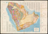
58310Washington D.C.: The US Geological Survey 1963. 129.5 x 185.5 cm. Original chromolithographed folding map laid onto new linen. Excellent condition. Large and detailed map depicting the geology of the Arabian Peninsula. The search for oil on the Peninsula started in 1933 when the Saudi Arabian government granted an oil concession to Standard Oil Co. of California which was later joined by Texaco buying a 50% stake in the concession. Geologists soon followed to start the surface mapping of the area and beyond achieving by 1937 a broad understanding of the region's geological strata. The first test to yield oil was in Dhahran on 4 March 1938. After a hiatus during WWII the activity of surveying and test-drilling resumed with reinvigorated effort. Aerial photography was introduced in 1949 and proved an invaluable tool for the surveying. In 1954 the US Geological Survey and Aramco the Arabian American Oil Company began work on a series of geological and geographic maps which would incorporate the data collected over the years. The project was sponsored by the US Department of State and the Kingdom of Saudi Arabia. The effort resulted in 1:500000-scale geologic sheets and a 1:200000-scale geological map of the Arabian Peninsula and the base topographical map — the present maps. The geological map delineates the strata of the peninsula with colour codes in two tables on either sides and text within the blank regions of Eastern Africa and Iran. A paper to accompany the map and further explain the geology was published in 1966 by the US Geological Survey. Powers Ramirez Redmond Elberg Geology of the Arabian Peninsula Sedimentary Geology of Saudi Arabia U.S. Geological Survey Professional Paper 1966. Washington, D.C.: The US Geological Survey, 1963. unknown
1183754Arabian American Oil Company. Paperback. Good - Cash. General reader wear to the corners edges and cover. Previous owner's name and address stamped on cover. The covers/corners have some creasing. Some pages are wrinkled. The pages show some general reader wear as well. The book is in good condition with some normal reader wear. Stock photos may not look exactly like the book. Arabian American Oil Company paperback
1983456460Oklahoma City: Interstate Oil Compact Commission January 1983. Hardcover . Used - Good/No Jacket. Light edge and cover wear with unmarked pages. Domestic orders shipped with USPS tracking numbers. Oklahoma City: Interstate Oil Compact Commission hardcover
0935315861.Ghardcover. Good. Access codes and supplements are not guaranteed with used items. May be an ex-library book. hardcover
1977ZB644063American Oil Chemists' Society 1977. Volumes 12-35 lacking volume 28 else all complete volumes partly bound minor library markings else text clean & bindings tight. - If you are reading this this item is actually physically in our stock and ready for shipment once ordered. We are not bookjackers. Buyer is responsible for any additional duties taxes or fees required by recipient's country. Photos available upon request. American Oil Chemists' Society unknown
026556235X.Ghardcover. Good. Access codes and supplements are not guaranteed with used items. May be an ex-library book. hardcover
0282824146.Gpaperback. Good. Access codes and supplements are not guaranteed with used items. May be an ex-library book. paperback
0365693618.Gpaperback. Good. Access codes and supplements are not guaranteed with used items. May be an ex-library book. paperback
ANAIS-0935315721Amer Oil Chemists Society. hardcover. Good. 1.8x6.5x9.5. Buy with confidence. Excellent Customer Service & Return policy. Amer Oil Chemists Society hardcover
1396205225.Ghardcover. Good. Access codes and supplements are not guaranteed with used items. May be an ex-library book. hardcover
1396212809.Ghardcover. Good. Access codes and supplements are not guaranteed with used items. May be an ex-library book. hardcover
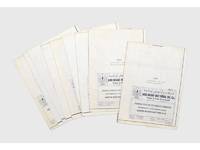
187383Abu Dhabi: 1987. Geology and oil fields A rare set of large blueprints produced by the Abu Dhabi National Oil Co. ADNOC with stratigraphic cross-sections of the Habshan formation in the Thamama Group in western and central Abu Dhabi. We have traced no other similar blueprints institutionally or on the market. Issued by the ADNOC geologists Abdullah al-Habshi and Mohammed M. Abd al-Sattar in May 1987 the blueprints provided the results of experiments in the gamma ray porosity correlation of the Habshan formation in order to clarify the rock type and composition of onshore and offshore oil fields including Umm Salsal West Mubarras Zakum Abu al-Bukoosh Bab and Sahil. While Abu Dhabi's oil production had slowed down markedly during the 1980s the reorganization of ADNOC in 1988 and the start of the Gulf War in 1990 prompted a sharp increase in output particularly in the areas covered by these blueprints. Nine blueprints from 130 x 40 mm to 233 x 40 mm folding into 285 x 200 mm numbered 1-9 sequentially. Small inset maps to folded verso c.10 vertical charts per map. Text in English occasional Arabic. Preserved in archival box. Inset map highlighted in ink. Occasional slight marginal soiling or small tears at folds: very good copies. unknown
1982178908Abu Dhabi: Abu Dhabi Company for Onshore Oil Operations 1982. First and only edition of this specially produced work published to commemorate the 20th anniversary of ADCO's first crude oil shipment from Jebel Dhanna. It is scarce with one copy at Exeter University and one at United Arab Emirates University. This work introduces key locations in Abu Dhabi such as the Liwa Oasis Al Ain Oasis and the mountainous regions. It shows how the agriculture and economy of the region has changed in recent years and is richly illustrated with pictures of farmers fisherman camels and palm trees "the prince of the plant kingdom" p. 5. Quarto. Colour photographic illustrations throughout; text in English and Arabic. Original green boards front board stamped with ADCO emblem in gilt green endpapers. With pictorial dust jacket. Jacket without price as issued a little creased at head minor soiling to rear flap verso: a fine copy in very good jacket. hardcover
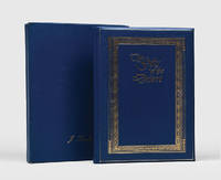
159397Abu Dhabi: Abu Dhabi Oil Company for Onshore Oil Operations 1982. Celebrating the first oil shipments from a key port First and sole edition of this specially produced work published to commemorate the 20th anniversary of ADCO's first crude oil shipment from Jebel Dhanna. An online institutional search showing one copy only at Exeter University. Provenance: lid of box lettered in gilt J. Turnbull and loosely inserted compliments slip with typed name of the same; this is almost certainly John Turnbull BP's General Manager Production Overseas and later chief executive of BP Indonesia. Quarto. With colour illustrations throughout. Original presentation binding of moderate blue padded leatherette gilt-lettered on covers within gilt and blind ornamental borders bright blue watered silk endpapers. Housed in the original matching box. Box showing just light signs of handling light scratch to front cover of book. A very good copy bright and sharp. hardcover
1334139717.Gpaperback. Good. Access codes and supplements are not guaranteed with used items. May be an ex-library book. paperback
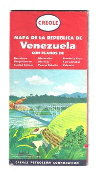
195680035General Drafting Company cartographer for the Creole Petroleum Corporation 1956. Text in Spanish. Full color one sheet map measures 65 x 108 cm folding to 22 x 11 cm. Light wear. Includes various indexes distance chart explanation of signs and index to points of interest in Caracas. Also includes highlighted zones of oil exploration.<br /> <br /> Venezuela became an oil economy after the discovery of crude oil around 1913. During the 1920s oil production was mostly done through concessions to foreign companies. The largest of those was the Creole Petroleum Corporation an American oil company and a division of Standard Oil of New Jersey. Once the second largest oil producer in the world the company was dissolved when Venezuelan nationalized its assets along with those of other foreign oil firms on January 1 1976.<br /> <br /> At the time this map was published the U.S. introduced oil import restrictions starting with voluntary controls in 1957 and escalating to President Eisenhower's Mandatory Oil Import Program MOIP in 1959 driven by concerns that cheap foreign oil threatened U.S. national security and domestic producers. From 1962 the maximum level of imports was set at 12.2% of domestic production. The import quota was lifted in 1973 by President Richard Nixon. General Drafting Company, cartographer, for the Creole Petroleum Corporation unknown
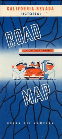
194853865Chicago: Rand McNally & Co. n.d ca 1948. ca 1948. First edition thus. 19 1/2" x 32 1/4" sheet folded to 9 3/4" x 4 1/2." Double-sided color lithograph maps. Nicely produced Pictorial Map of California & Nevada featuring pictographs of places of interest and tourist spots throughout the west including Las Vegas as only mine & mill cotton fields in the San Joaquin Valley and views around Yosemite as well as California Missions. Also featured are inset maps for San Francisco and Los Angeles as well as large highway map on verso inset tables for Western mileage and radio stations. Light rubbing to creases. Very good plus. Rand McNally & Co., n.d [ca 1948]. unknown
1924149012New York: Tidewater Oil Company 1924. 7th edition. Nice copy. quarto. card covers 75pp. colour & b/w plates text ills. diags. Fine catalogue illustrated with many nice engine diagrams & exploded views. Uncommon Tidewater Oil Company unknown
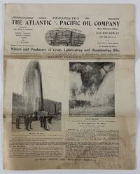
190212944New York 1902. 8pp. Illustrated. Folio. Original self wrappers stapled. Moderate staining and soiling old folds minor edge wear. Good condition. Illustrated with black & white photos and two maps one of holdings in Knox County Kentucky the other in the East Texas Oil Belt centered on Beaumont. The company -- miners and producers of crude lubricating and illuminating oils -- was incorporated in April 1901 under the state laws of Delaware. This prospectus solicited investors and presented its balance sheet and current activities listed officers and presented the "expert opinions" of geologist Major J.W. Otley the original surveyor of the Beaumont and other fields as to the worthiness of the company's properties at nearby Sour Lake Texas. No listings found on OCLC. A unique and early oil company prospectus with notable content on Kentucky and Texas oil. unknown
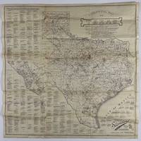
192012758Fort Worth: Standard Blue Print Map & Eng. Co 1920. Very good. Folding map 25.75 x 25.75 inches on thin paper. Old folds minor edge wear several short closed edge tears a couple of small areas of loss at crossfolds. Overall good condition and a wonderful display item. A rare and detailed Texas oil map produced by a Fort Worth firm just after World War I and here present in the larger 25-x-25-inch issue advertised in the promotional text on the map itself. The map shows the distribution of oil wells and derricks across the Lone Star State in 1920 prints the names of the most prominent oil fields and lists the names of Texas counties along with the oil companies active in each county. The map also shows the types of soil and rock deposits encountered throughout Texas counties with a legend of abbreviations for each at bottom right. The area of the map is crowded in places but still quite attractive and legible and is a good encapsulation of the rapidly developing oil industry in Texas at the time. Contemporary advertisements for the publisher of this map Standard Blue Print Map and Engineering promote the availability of over 200 oil maps of Texas Oklahoma New Mexico Louisiana and Arkansas from the firm. A rare map rarer still in this larger size; we locate just two copies at SMU one issued with a slightly later "May 1920" copyright notice with a larger "photocopy" reported at Denver Public Library and the Colorado School of Mines. Standard Blue Print Map & Eng. Co unknown
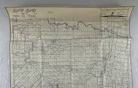
19765965Wichita Falls Tx: Heydrick Mapping Company 1976. About very good. Blue line map 45.5 x 42 inches. On paper. Folded. Toning across top and bottom portions light edge wear. A late but nonetheless instructive oil map of Knox County Texas printed by the Heydrick Mapping Company which was known for its oil maps. Indeed their slogan on the map indicates "Oil men have used Heydrick maps since 1870." The legend shows various kinds of oil and gas wells -- producing dry drilled etc. Most of the oil activity is along the southern part of the county with a deep concentration of wells and oil companies noted across the D.G. Burnett lands. Dozens of oil companies are represented here many of which would be gone when the Texas oil boom busted in the early-1980s though production in Knox County was relatively steady through the lean times. Knox County is located between the DFW metroplex and Lubbock and oil was discovered there in 1945. <br /> <br /> "Oil was discovered in Knox County in 1945. By 1946 the county's first successful oil well had been spudded on the Beavers Ranch north of Benjamin; in subsequent years other wells were drilled in the southern part of the county. In 1948 oil production was only thirty-seven barrels but in 1956 it reached 978715 and in 1960 almost 2415000. County oil wells produced 2065000 barrels in 1965 771089 barrels in 1974 and 1421964 barrels in 1982. Production totaled about 888000 barrels in 1990 and by January 1 1991 almost 55881000 barrels had been taken from Knox County lands since discovery in 1945" - Handbook of Texas online. <br /> <br /> All Heydrick maps of Texas are scarce regardless of when they were produced with the vast majority being located in only one or two copies. OCLC shows one copy each of editions printed in 1930 and 1957 but not this 1976 version. Heydrick Mapping Company unknown
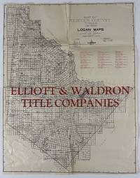
193013064Fort Worth: Logan Map Company 1930. Folded map 23 x 17.75 inches. Old folds minor wear a few closed tears along folds repaired with tape on verso bottom left marginal section a bit munched up. Good condition. A scarce and detailed plat map for Reeves County Texas in the crook of West Texas between Fort Stockton and New Mexico. This gridded county map provides numerous details on land ownership oil leases railroad lands and other claims; a number of the major oil companies including Humble Texas California Marland and Atlantic were active in the county at this time. A key is printed in the margin locating various types of oil and gas wells. The middle portion of the map is overprinted in large red letters "Elliot & Waldron Title Companies" who provided information to prospective land buyers in Reeves and several surrounding West Texas counties at this time. <br /> <br /> "In the early 1920s Pecos became the focus of Delaware Basin oil exploration and received substantial publicity though little oil and gas were found in paying quantities. By 1930 however oil excitement had brought a larger and more diversified population to the county" -- Handbook of Texas online. We find records for about twenty Logan Map Company maps all recorded in single copies. Logan Map Company unknown
1902106482<p>Rectangular 8vo 9½x5¼" pamphlet 1 11 leaves printed on rectos only original brown paper wrappers red ribbon tie at top. A little normal aging but otherwise near fine. This is an early Standard Oil piece that appears to be designed to promote the stock which according to this brochure consisted of only 2500000 shares. At the time of publication the par value was only $1 per share. The brochure discusses various oil field potential and on the inside back cover is a "no wild cat" illustration hyping the stock. This was printed well before the 1911 breakup of the company for violating the "Sherman Antitrust Act." A wonderful piece of corporate memorabilia. OCLC locates only a single copy at the University of Wyoming.</p>
193644218N.P.: 1936. 1936. 28" x 24" sheet folded to 24 panels. 2 bright colorful cover panels showing a woman at the wheel of a car the wind blowing through her hair. 8" x 5 3/4" map of Yosemite National Park 4" x 5 1/4" map of Boulder Dam and Vicinity and 4" x 5 1/4" map of Reno all Copyrighted by the H.M. Gousha Company;mileage chart. 6-panel 1936 map of the United States showing routes national parks and monuments cities etc. Opposite 12 panels offers a 1936 Road Map of Nevada showing roads cities roads under construction lakes etc. along with part of California. Down side edges is a listing of cities and their locations on the map. Wear to folds and with tiny hole to one fold. Very good. 1936. unknown