Mid Penn Oil CompanyBiblio.com
347 résultats
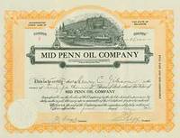
18-1455Delaware: Mid Penn Oil Company 1930. Single page. 12 x 8 inches. Printed both sides. Very Good. Issued to Henry C. Gibson. Dated 1 May 1930. Signed by treasurer and president. Delaware: Mid Penn Oil Company, 1930. unknown
1947004434Standard Oil Corp. 1947. First Edition. . Hardcover. Good. Gasoline Advertisement Chevron Standard Oil Collectibles Travel Western Scenic Views Retro Americana Advertisement Gasoline Memorabilia 34 prints These prints are from the late 1940's. Standard Oil Company of California offered a promotion where you received a print reproduction of original photos when you filled your tank at one of their stations. This promotion started in 1947. The complete set of 60 meant that you traveled around the United States by car gathering and collecting these beautiful prints. This set in redwood binder with leather hinges contains 34 prints. Most print are in excellent condition but do have some slight tanning due to paper used and being kept in redwood book. These are lovely prints with full history of sites on back of each. "See Your West with us . let us personally guide you to the glories of the West which no picture however lovely can quite match. We will without charge make up special trip routings supply exclusive Log Books describing your route and give you full travel information based on expert integrated knowledge of all the West." was Standards promotion. Prints are in full color. Pictures are appx 15' long overall with border appx 17.5" height is 12". Due to size of redwood binder additional postage may be necessary and this item is NOT suiteable for international shipping due to its over size and weight. <br/> <br/> Standard Oil Corp. hardcover
1333031297.Gpaperback. Good. Access codes and supplements are not guaranteed with used items. May be an ex-library book. paperback
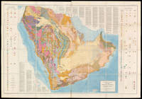
58310Washington D.C.: The US Geological Survey 1963. 129.5 x 185.5 cm. Original chromolithographed folding map laid onto new linen. Excellent condition. Large and detailed map depicting the geology of the Arabian Peninsula. The search for oil on the Peninsula started in 1933 when the Saudi Arabian government granted an oil concession to Standard Oil Co. of California which was later joined by Texaco buying a 50% stake in the concession. Geologists soon followed to start the surface mapping of the area and beyond achieving by 1937 a broad understanding of the region's geological strata. The first test to yield oil was in Dhahran on 4 March 1938. After a hiatus during WWII the activity of surveying and test-drilling resumed with reinvigorated effort. Aerial photography was introduced in 1949 and proved an invaluable tool for the surveying. In 1954 the US Geological Survey and Aramco the Arabian American Oil Company began work on a series of geological and geographic maps which would incorporate the data collected over the years. The project was sponsored by the US Department of State and the Kingdom of Saudi Arabia. The effort resulted in 1:500000-scale geologic sheets and a 1:200000-scale geological map of the Arabian Peninsula and the base topographical map — the present maps. The geological map delineates the strata of the peninsula with colour codes in two tables on either sides and text within the blank regions of Eastern Africa and Iran. A paper to accompany the map and further explain the geology was published in 1966 by the US Geological Survey. Powers Ramirez Redmond Elberg Geology of the Arabian Peninsula Sedimentary Geology of Saudi Arabia U.S. Geological Survey Professional Paper 1966. Washington, D.C.: The US Geological Survey, 1963. unknown
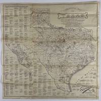
192012758Fort Worth: Standard Blue Print Map & Eng. Co 1920. Very good. Folding map 25.75 x 25.75 inches on thin paper. Old folds minor edge wear several short closed edge tears a couple of small areas of loss at crossfolds. Overall good condition and a wonderful display item. A rare and detailed Texas oil map produced by a Fort Worth firm just after World War I and here present in the larger 25-x-25-inch issue advertised in the promotional text on the map itself. The map shows the distribution of oil wells and derricks across the Lone Star State in 1920 prints the names of the most prominent oil fields and lists the names of Texas counties along with the oil companies active in each county. The map also shows the types of soil and rock deposits encountered throughout Texas counties with a legend of abbreviations for each at bottom right. The area of the map is crowded in places but still quite attractive and legible and is a good encapsulation of the rapidly developing oil industry in Texas at the time. Contemporary advertisements for the publisher of this map Standard Blue Print Map and Engineering promote the availability of over 200 oil maps of Texas Oklahoma New Mexico Louisiana and Arkansas from the firm. A rare map rarer still in this larger size; we locate just two copies at SMU one issued with a slightly later "May 1920" copyright notice with a larger "photocopy" reported at Denver Public Library and the Colorado School of Mines. Standard Blue Print Map & Eng. Co unknown
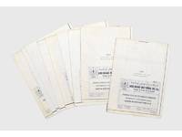
187383Abu Dhabi: 1987. Geology and oil fields A rare set of large blueprints produced by the Abu Dhabi National Oil Co. ADNOC with stratigraphic cross-sections of the Habshan formation in the Thamama Group in western and central Abu Dhabi. We have traced no other similar blueprints institutionally or on the market. Issued by the ADNOC geologists Abdullah al-Habshi and Mohammed M. Abd al-Sattar in May 1987 the blueprints provided the results of experiments in the gamma ray porosity correlation of the Habshan formation in order to clarify the rock type and composition of onshore and offshore oil fields including Umm Salsal West Mubarras Zakum Abu al-Bukoosh Bab and Sahil. While Abu Dhabi's oil production had slowed down markedly during the 1980s the reorganization of ADNOC in 1988 and the start of the Gulf War in 1990 prompted a sharp increase in output particularly in the areas covered by these blueprints. Nine blueprints from 130 x 40 mm to 233 x 40 mm folding into 285 x 200 mm numbered 1-9 sequentially. Small inset maps to folded verso c.10 vertical charts per map. Text in English occasional Arabic. Preserved in archival box. Inset map highlighted in ink. Occasional slight marginal soiling or small tears at folds: very good copies. unknown
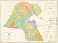
654341981. Original large colour-printed map 76 x 103.5 cm with detailed key and legend. Compilation and cartography by Hunting Geology and Geophysics Limited. Generally in excellent condition. Kuwait becomes a Major Player in the Global Oil Industry This is a scarce large-format bilingual geological map of Kuwait prepared in 1981 by Hunting Geology and Geophysics for the Kuwait Oil Company. It was produced at a time when Kuwait's oil production was undergoing rapid changes including the creation of the Kuwait Petroleum Corporation KPC of which the Kuwait Oil Company became a subsidiary and expansion into international markets and the securing of vertical integration. The map covers the mainland of Kuwait along with the Bubyan and Failaka Islands using colour-shading to indicate a variety of sands gravels clay and stone as explained in the bilingual legends present at right which also indicate geological era. Lines and other notation are used to indicate geological and international boundaries fault lines wadis elevation contour lines roads depressions and intertidal and shoaling sand. Developed areas namely Kuwait City and some nearby coastal settlements are shaded grey. Additional supplementary information appears at right including a diagram and explanation of the local grid employed. Historical Context Upon gaining independence from the United Kingdom in June 1961 Kuwait inherited an oil industry dominated by the Kuwait Oil Company KOC a joint venture between British Petroleum and Gulf Oil. However like other emerging postcolonial states in the region Kuwait was determined to assert control over its primary resources. This effort began with the formation of the Kuwait National Petroleum Company KNPC in 1960 and the Petrochemical Industries Company PIC in 1963 which allowed the government to build domestic technical expertise. A major milestone of this era was the 1962 relinquishment agreement which forced foreign concessionaires to return 60 percent of their unexplored territories to the state paving the way for independent national exploration and the 1968 opening of the Shuaiba Refinery the world's first all-hydrogen refinery. The 1970s saw a shift from foreign partnership to total nationalization following the 1973 oil crisis and the subsequent surge in global prices. After an initial 'participation' agreement in 1972 that gave the state a 25 percent stake in KOC Kuwait moved for a full takeover by December 1975. By 1976 the state held 100 percent ownership of its oil assets allowing it to cap production to conserve reserves for future generations a policy that stood in contrast to the high-extraction strategies of foreign firms who further increased production as they sensed nationalization was in the offing. Thus the vast revenues generated by the oil industry were funneled directly into the Reserve Fund for Future Generations established in 1976 to provide long-term fiscal stability. They also financed a comprehensive welfare state providing citizens with free education healthcare and subsidized housing while transforming the capital of Kuwait City simply 'Kuwait' here into a modern metropolis. By the early 1980s Kuwait shifted its focus toward global integration and organizational efficiency. In January 1980 the government established the Kuwait Petroleum Corporation KPC as a centralized holding company to manage all aspects of the industry from upstream exploration to downstream retail. Kuwait became a pioneer among OPEC nations by aggressively expanding into international markets acquiring the American drilling and engineering giant Santa Fe International in 1981. This strategy continued with the acquisition of refining and retail networks in Europe laying the groundwork for the 1983 launch of the 'Q8' brand. Thus by the mid-1980s Kuwait had successfully established one of the most vertically integrated and professionally managed state oil industries in the world. Publication History and Census This map was compiled and drawn by Hunting Geology and Geophysics for the Kuwait Oil Company. It is quite scarce noted only in the holdings of the Colorado School of Mines the U.S. Geological Survey Library and the Library of Congress with no known market history. Cartographer Hunting Geology and Geophysics Ltd. 1952 - 1987 was a British surveying firm that specialized in cutting-edge methods of mapping especially aeromagnetic surveys and focused on discovering potential reserves of natural resources especially fossil fuels. It was part of the larger Hunting group originally founded in 1874 as a shipping company by Charles Hunting and later moving into aircraft surveying and petroleum. Companies within the Hunting group frequently merged with each other and with outside acquisitions leading to frequent name changes; in this case Hunting Aerosurveys founded 1944 merged with Hunting Geophysics founded 1952 to form Hunting Surveys in 1960. In 1965 a public company was formed called Hunting Associated Industries Ltd. which included Hunting Surveys Holdings Ltd. but not a new entity Hunting Geology and Geophysics Ltd. which remained part of the privately-owned Hunting Group. In 1987 Hunting Geology and Geophysics Ltd. was closed down in a consolidation process that saw the public company now Hunting plc buy out the Hunting Group though the Hunting family retains a significant share of the company's stock and one of its members remains Chairman of the Board. Hunting Geophysics and later Hunting Geology and Geophysics Ltd. made pioneering surveys of Great Britain itself along with several countries in Central Africa seeking uranium and other minerals the Philippines Ethiopia and especially countries in the Middle East where the company conducted critically important surveys that helped to develop the lucrative oil industries of the United Arab Emirates Qatar and Kuwait among others. OCLC 9971094 1981. unknown
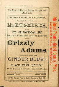
188250838N.P.: Privately printed n.d. ca 1882. 1882. 9" x 12" sheet folded to 4 panels. A 4-page promotional flyer for the theatrical performance of Grizzly Adams. Grizzly Adams came West in 1849 and forsook the gold mines for life in the Western and California wilderness where he acquired a legendary reputation for hunting grizzly bears and fending off Indians. Cover panel offers title actors manager etc. as well as printed in red ink on the right side front carries the notice "8th Street Theatre - - Grand Opening Week Commencing Monday September 4th" which would most likely have been 1882. The second panel offers a full-page advertisement for Merchant's Gargling Oil the company sponsoring the show. Merchant's Gargling Oil is “a Liniment for Man and Beast" a catch-all salve first produced by George W. Merchant a druggist in 1833. The salve was made up of petroleum soap ammonia water oil of amber iodine tincture benzine and water and supposedly would cure anything . burns scalds scratches foot rot on sheep roup in poultry hemorrhoids toothaches etc. Panel 3 offers general information about the play followed by a synopsis for all three acts. The rear panel offers a full-page woodcut illustration showing Adams on horseback rescuing innocent settlers in the wilderness from Indians. 1 1/2" closed tear to fold and with a 1" closed tear to side panels. Very good. Privately printed, n.d. [ca 1882]. unknown
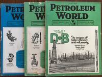
192558106Los Angeles CA: Petroleum World Publishing Co. 626 So. Spring St. June-July Sept. 1925. Three vols. 4to. 124; 120; 124 pp. With 100’s of photo illustrations text illustrations diagrams illustrated ads some in colour w/ 1 large folding map of Baldwin Hills Oil Field sized 17.5 x 19.5 in. Photo-illustrated colour and black & white softcovers photo cover art of oil derricks and McDonald equipment Hughes Tool Co. ads on back covers some edgewear minor chipping head & foot of spine minor wear to fore-edges still VG set. First editions of these very scarce issues of this noted California oil industry trade magazine filled with articles and advertisements for oil derricks oil drilling equipment addressing oil drill and oil rigger safety issues oil fires and more. Ads for truck companies such as White International Harvester & Herbert Chandler along with oil pumps gasoline service station pumps and more fill the pages. Of additional interest are the several articles directed towards the fallout from the Teapot Dome Scanda the Panamerican Oil Co. Doheny Fall & Sinclair and court decision analyses. The large folding map of the Baldwin Hills Oil Field by Walker Clute and Samuel Perry is quite scarce not only offering a plat map of oil leases and lease holders in the record breaking oil field but coupled with an article touting the Inglewood Oil Field. At the time Southern California was producing one-quarter of the World’s oil supply. Petroleum World Publishing Co., 626 So. Spring St., paperback
19442091502135301220Izumi shobo 1944. Soft Cover. Fine. Volume: 1 Izumi shobo paperback
1995275936PN. New. 1995. Soft Cover. Date is original print. This is a reprint edition . PN paperback
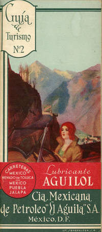
53032n.p.: privately printed n.d. n.d. 8 3/4" x 4" in pictorial wrappers. 34 pp . 17 pages written in Spanish and 17 pages written in English. An itinerary of a trip from the National Palace to Toluca and the Toluca Volcano followed by information on points of interest. Itinerary of a trip from Mexico to Jalapa via Puebla to Perote and Jalapa followed by information on points of interest. Two fold-out maps printed in green and burgundy . one showing route to Toluca and the other showing the route to Jalapa with points of interest noted on each map. Inset are basic street maps of Jalapa Puebla and Toluca. Light soiling to wrappers and with light rubbing to spine. Also includes 9" x 13 1/2" sheet folded to 8 panels titled "Driving to Mexico Helpful Hints for the Motorist." 2 cover panels and 2 panels showing a distance chart and locations of "Aguila" Gasoline & "Aguilol" Lubricants. Opposite 4 panels offer a map printed in red and green and showing various points of interest along the "Laredo-Mexico City" Road. Soiling throughout panels. privately printed, n.d. unknown
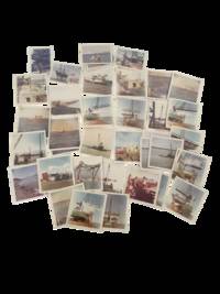
1965233141965. Offshore oil construction photographs documenting platform fabrication barge work marine transport and field logistics tied to the Gulf Coast petroleum industry in 1965-66 with direct evidence of how offshore drilling depended on a broad labor system before a rig ever reached a producing field. Taken at Farmers Marine Copper Works in Galveston Texas the archive records the building and handling of steel jackets deck sections cranes work barges service vessels and crew activity that made offshore extraction possible. The Gulf of Mexico was the proving ground of the modern offshore petroleum industry as the region became the incubator for an industry later exported worldwide.<br /> <br /> Photo archive of 53 color photographs 3.5" x 3.5" Galveston Texas 1965-66. The photographs show offshore structures in multiple stages of assembly and movement rather than a single completed drilling scene. Repeated views include steel platform legs and jacket sections standing in the water beside cranes and barges; large deck modules being hoisted or aligned over pilings; work decks with hoses railings and moored service boats; crewmen gathered onshore and aboard vessels; and small aircraft and automobiles used in project access and inspection. Several images show major marine lifts in progress with cranes extending over partially assembled structures and barges positioned tight against the work. Others widen out to open water towing scenes or partially completed platforms against distant mountainous terrain indicating that some photographs may record project deployment or field work beyond Galveston even if no specific destination is identified on the objects themselves. Handwriting on one verso of a group of men identifies "McClure / Chas. Young / Smithy."<br /> <br /> By the mid 1960s offshore oil had become central to both the U.S. energy economy and Texas coastal industry. Gulf Coast yards built and serviced the jackets pipe vessels and equipment that allowed companies to move farther offshore and later federal studies described fabrication yards as a core part of the offshore system that linked land based labor to offshore production. Texas held a special place in that expansion because its ports yards engineering firms and petroleum capital helped turn the Gulf into a permanent industrial frontier. Light handling wear and most exhibit curling; images generally clean and well preserved. Overall good condition. A strong documentary record of offshore construction labor at the moment when Texas Gulf Coast yards were helping scale the offshore oil industry from regional enterprise to national system. unknown
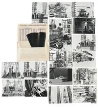
1970233351970. Offshore oil rig construction photographs of marine industrial labor and heavy equipment operations at the Port of Galveston Texas undated showing how Gulf Coast petroleum infrastructure was assembled through coordinated crane work deck staging and vessel support. Made by an unidentified worker contractor or site observer with direct access to the platform and adjoining work areas the group records the operational system behind offshore petroleum expansion rather than only the finished structure: derrick components rising between lattice boom cranes machinery positioned on crowded deck surfaces workers monitoring equipment from railings and platforms and service craft moving below the job site. Within the history of Gulf Coast oil and gas development these images preserve the waterfront and offshore construction process through which drilling and extraction infrastructure entered service in one of the chief locations which allowed Texas entry into national and international trade.<br /> <br /> <br /> Photo archive of 17 silver gelatin snapshot photographs each about 3.5" x 5" also includes 18 negative images 35 mm Port of Galveston Texas circa 1960s-1970s. The prints concentrate on a single marine construction environment with repeated views of tall lattice cranes a derrick or drilling tower under assembly steel framework catwalks railings deck mounted machinery and industrial piping. Several photographs move between wide and close vantage points: one looks down onto a work deck strewn with cables drums tools and structural members; another isolates a crane boom overhead; others frame the rig against open water with a small service boat alongside. Two views show a worker in coveralls standing at the railing and looking across the site; in one image the patch on his back reads "Farmers Marine Copper Works Inc. Petro Chemical Marine Galveston Texas" directly tying the group to a named Galveston industrial contractor. Another figure in light clothing appears deeper in the structure. Interior or semi enclosed machinery views include a hopper shaped component rollers and processing equipment. The accompanying negative strips are marked and the original photo processing envelope survives with printed instructions preserving the group's original commercial processing context.<br /> <br /> <br /> Galveston's port facilities formed part of the larger Gulf Coast industrial network that supported offshore petroleum construction marine transport and heavy fabrication across the twentieth century and this group fixes that system at deck level through workers machinery staging practices and support traffic in the water below. Light wear curling and handling to prints and negatives; processing envelope creased and worn. A concise visual record of offshore oil infrastructure under construction with strong research value for petroleum history labor history and Gulf Coast industrial development showing Galveston as a site where harbor industry and offshore oil support work converged making the port a key setting for mid twentieth century energy expansion.<br /> l. unknown
1971026475Houston TX: Gulf Oil 1971. Hardcover. Very Good/Very Good . 4to - over 9¾" - 12" tall. 10catalogssupplements&bulletins; SC gray 3-ring binder; slight rub w/cleantight pgs. lubrication; grease; hydralulics; oils. from 1967-1971 <br/> <br/> Gulf Oil hardcover
1930005898St. Louis MO: Blackwell Wienlandy Co. 1930 Blackwell Wienlandy Co. St. Louis MO. 1930. Hardcover. First Edition. Book is tight square and unmarked but for former owner names on front pastedown. Book Condition: Very Good; wear to spine sides tail head tips and bottom boards from shelving; interior toning. Internally Fine condition. No DJ. Black grained boards and spine with tarnished gilt lettering on the spine and front board with tilt blocking. 141 pp 8vo. The unitization movement is the child of necessity for economical development and operation of American oil pools in light of competition from foreign sources and contributes ot lower costs of production. A clean very presentable copy. Blackwell Wienlandy Co. hardcover
1948183725London: Compiled in the Companies' Head Office 1948. An informative survey of the Middle East and its oil industry First edition of this excellent handbook for IPC employees outlining the operations and expanding importance of the petroleum industry and surveying the history and current condition of states in Arabia the Gulf and the Levant. Chapter 1 describes the IPC's formation the mechanisms for opening a new concession the history of its prospecting and extraction projects and the Mediterranean pipeline. A chapter on the culture of the Arab world is followed by regional breakdowns that draw on company and government reports. Concerning the Gulf the handbook emphasizes the potential of oil exploration to transform the region. In Qatar where an oil field was discovered in the late 1930s "the population is scanty and wretchedly poor. The Company's present operations supply almost the sole source of wealth. The building of necessary roads jetties dwellings offices workshops stores and the like has advanced simultaneously with drilling" pp. 15 & 69. Accompanying the text are valuable plates showing IPC operations in Kirkuk and near Tripoli views of Qatar and Bahrain from the air and a well with head fittings and flow lines. The folding regional map details oil fields refineries and pipelines both built and projected. A useful tabular appendix summarizes the present state of the IPC's concessions including the area they cover and the rights granted as well as current exploration licenses. Octavo. Half-tone portrait frontispiece of King Faisal and 26 plates folding area map at rear maps in text. Original grey cloth spine lettered in red company logo in red on front board. Ownership inscription "L. B. Griffiths Tripoli 21.11.1948" on front free endpaper. Light sunning marking at head of front board top edge foxed: very good. hardcover
2012N5167Tel Aviv: Archaeological Center 2012. Original Decorative Cloth. Very Good. Folio. 287pp. Text English and French. A VERY GOOD CLEAN AND FRESH COPY. RICHLY ILLUSTRATED. <br/> <br/> Archaeological Center hardcover
2080202103702048Taishukanshoten N.A. Soft Cover. Fine. Page number: 149p Size: 21cm A5 Taishukanshoten paperback
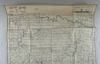
19765965Wichita Falls Tx: Heydrick Mapping Company 1976. About very good. Blue line map 45.5 x 42 inches. On paper. Folded. Toning across top and bottom portions light edge wear. A late but nonetheless instructive oil map of Knox County Texas printed by the Heydrick Mapping Company which was known for its oil maps. Indeed their slogan on the map indicates "Oil men have used Heydrick maps since 1870." The legend shows various kinds of oil and gas wells -- producing dry drilled etc. Most of the oil activity is along the southern part of the county with a deep concentration of wells and oil companies noted across the D.G. Burnett lands. Dozens of oil companies are represented here many of which would be gone when the Texas oil boom busted in the early-1980s though production in Knox County was relatively steady through the lean times. Knox County is located between the DFW metroplex and Lubbock and oil was discovered there in 1945. <br /> <br /> "Oil was discovered in Knox County in 1945. By 1946 the county's first successful oil well had been spudded on the Beavers Ranch north of Benjamin; in subsequent years other wells were drilled in the southern part of the county. In 1948 oil production was only thirty-seven barrels but in 1956 it reached 978715 and in 1960 almost 2415000. County oil wells produced 2065000 barrels in 1965 771089 barrels in 1974 and 1421964 barrels in 1982. Production totaled about 888000 barrels in 1990 and by January 1 1991 almost 55881000 barrels had been taken from Knox County lands since discovery in 1945" - Handbook of Texas online. <br /> <br /> All Heydrick maps of Texas are scarce regardless of when they were produced with the vast majority being located in only one or two copies. OCLC shows one copy each of editions printed in 1930 and 1957 but not this 1976 version. Heydrick Mapping Company unknown
1982178908Abu Dhabi: Abu Dhabi Company for Onshore Oil Operations 1982. First and only edition of this specially produced work published to commemorate the 20th anniversary of ADCO's first crude oil shipment from Jebel Dhanna. It is scarce with one copy at Exeter University and one at United Arab Emirates University. This work introduces key locations in Abu Dhabi such as the Liwa Oasis Al Ain Oasis and the mountainous regions. It shows how the agriculture and economy of the region has changed in recent years and is richly illustrated with pictures of farmers fisherman camels and palm trees "the prince of the plant kingdom" p. 5. Quarto. Colour photographic illustrations throughout; text in English and Arabic. Original green boards front board stamped with ADCO emblem in gilt green endpapers. With pictorial dust jacket. Jacket without price as issued a little creased at head minor soiling to rear flap verso: a fine copy in very good jacket. hardcover
1023339269.Ghardcover. Good. Access codes and supplements are not guaranteed with used items. May be an ex-library book. hardcover
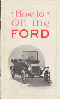
34097N.p. The Company. N.d. c.1912. 24mo. 14cm 16p. 1 figure cover adverts illustratedwraps fine. n12 With advertisements by Imperial Oil recommending theuse of their "Polarine" brand of oil and grease specifically on the FordMotor card. A photograph on the front cover illustrates the Ford ModelTouring Car the famous Model T that was produced in Canada from 1909to 1926 at Walkerville Ontario. Imperial Oil is a subsidiary of theUS-based ExxonMobil. It was established in London Ontario in 1880. N.p. The Company. N.d. c.[1912] unknown
am7-3-22-24-Paperback. Fair. Rare stapeled booklet some edge wear and mosture staine on edge. Some other stain on back. paperback
mon0000932450Halliburton Oil Well Cementing C. Spiral Bound. Good. in x in x in. Tape over the spiral bound. Chipping on cover. Halliburton Oil Well Cementing C unknown