Fischer, Katrina SigsbeeBiblio.com

347 résultats
19845643Nantucket MA: Mill Hill Press 1984. First American edition. Hardcover. Fine/fine. 4to. cloth <br/><br/> Mill Hill Press hardcover
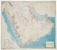
56801Washington D.C.: Department of the Interior United States Geological Survey and the Kingdom of Saudi Arabia Ministry of Finance 1963. SECOND EDITION ENGLISH ISSUE. Large chromolithohraphed map 122 x 139 cm of the Arabian peninsula shown with topographic relief and marked with water pipelines oases oil fields oil pipelines ports and harbours oil wells natural gas fields quarries and mines. Key lower left. The map includes the territories of modern day Kuwait Qatar Bahrain United Arab Emirates Oman and Yemen and was the work of a team lead by the distinguished geologist Glen F. Brown whose pioneering work on surface geology with its emphasis on water resources minerals and oil pertains to this day. Minor light spotting lower right generally in excellent condition. Issued simultaneously in an English and Arabic versions. Originally conceived in 1953 this second edition shows significant additional topographical detail and noticeably showing the growth in oil fields and accompanying infrastructure. Brown 1911-2001 began his career conducting coal investigations in South China and the Philippines and ground water investigations in Mississippi and Colorado the latter mostly concerned with supplying water to military installations. In response to a request from Ibn Sa'ud for assistance from the United States Geological Survey USGS Brown was selected in 1944 to investigate water supplies in the Saudi Arabian desert. Brown "arrived in Saudi Arabia early in 1945 and joined a mission sponsored by the US Foreign Economic Administration to study possibilities for agricultural development in central Arabia. As part of the mission he carried out a detailed investigation of the geologic formations in the Al Kharj district and identified substantial ground-water resources in buried aquifers. His report on the results of that investigation was very enthusiastically received by Saudi officials. Brown returned to Saudi Arabia at the request of Ibn Saud to conduct reconnaissance geologic mapping mineral evaluation and water-resource studies in the western and central parts of the kingdom. The mapping was carried forward from 1950 to 1958 by Brown with USGS and Saudi associates and extended to the entire Arabian Peninsula in cooperation with the Arabian American Oil Company Aramco as well as to organizations and companies of other countries in the peninsula. This resulted in a remarkable series of bilingual geologic and geographic maps of Saudi Arabia at a scale of 1:500000 and a geologic and geographic map of the entire Arabian Peninsula at a scale of 1:2000000 all of which were published by the USGS. These maps together with reports on the geology mineral deposits and water resources prepared by Brown and his associates providing the basis for Saudi Arabia to undertake a major national resource exploration and development program" obituary Geological Society of America. The map includes the territories of modern day Kuwait Qatar Bahrain United Arab Emirates Oman and Yemen. Although the hunt for oil gas and minerals ultimately drove geological survey work across the region in its early years it was the need for continual water sources which was the catalyst for Saudi Arabia's resource exploration. In 1944 King 'Abd al-'Aziz approached the United States for a technical expert who could assist with the identification and plotting of the kingdom's natural resources particularly its groundwater reserves. Glen F. Brown who undertook the task and is responsible for this map was one of the pioneers of a partnership between the United States Geological Survey USGS and the government of Saudi Arabia. This collaboration was one of international importance spanning the next five decades and influencing the development of the kingdom significantly. By 1954 the Saudi Ministry of Finance United States Geological Survey USGS and Aramco were working together to produce the first full series of geographic and geologic maps of the country. The first of their type in the Peninsula were published between the late 1950s and early 1960s in both Arabic and English copies. The information these maps contained formed the basis of subsequent Saudi national development plans. To this day all modern maps of the kingdom trace their roots back to these publications. Washington D.C.: Department of the Interior, United States Geological Survey and the Kingdom of Saudi Arabia Ministry of Finance unknown
19442092902137302721Japanese art publication 1944. Soft Cover. Fine. Size: 26cm Japanese art publication paperback
1987BN332847Mobil Oil de Mexico 1987. 1987. Hardcover. Arte popular mexicano: Multiplicaciones <br/><br/>Arte popular mexicano: Multiplicaciones Mobil Oil de Mexico Mobil Oil de Mexico hardcover
19752092902137302634atelier publisher 1975. Soft Cover. Fine. Size: 29cm atelier publisher paperback
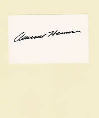
100995<p>Fine. - Armand Hammer's autograph penned on 3 inch high by 5 inch wide card stock. Fine.</p><p>The American oil tycoon entrepreneur and philanthropist Armand Hammer 1898-1990 was the son of a Russian-born American communist and activist. He studied medicine and made his first fortune in pharmaceuticals and whiskey before taking over the failing Occidental Petroleum company in 1956. Known for his "citizen diplomacy" his close ties to the Soviet Union helped him cultivate friends and associates the world over. Hammer was also known for his art collection and support of artistic institutions.</p>
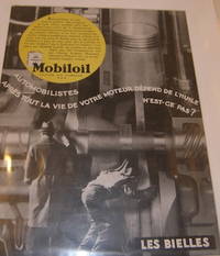
68-0379New York NY: Mobiloil ca. 1930. Matted Poster 17" x 13" Very Good. Text En Francais. Poster features the Ford Torpedo a version of the Model T Ford. [New York, NY: Mobiloil, ca. 1930]. unknown
1856091759.Gpaperback. Good. Access codes and supplements are not guaranteed with used items. May be an ex-library book. paperback
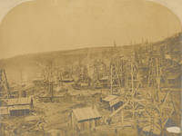
1865250221Benninghoff Run Pennsylvania 1865. Vintage albumen print rounded at top corners mounted on card captioned in pen beneath image. Image: 10 x 13 3/8 in. Image lightly faded some surface abrasion mount soiled. Vintage albumen print rounded at top corners mounted on card captioned in pen beneath image. Image: 10 x 13 3/8 in. Vintage albumen print showing the oil derricks and pump house of Benninghoff Run an important early oil field in Pennsylvania's Oil Creek Valley. The site's Ocean Well dug in 1865 was the first to prove that oil could be extracted from hilly terrain. Benninghoff Run was the scene of violence when teamsters angered over loss of work attempted to destroy the pipeline that comission dealer Henry Harvey built from Benninghoff Run to tanks at the Shaffer railroad two miles away. The right-of-way of the Benninghoff-Shaffer pipeline can be seen in this image as a white streak extending vertically from the fields to the hill in the distance cf. www.petroleumhistory.org. unknown
19421302150014Standard Oil Co 1/1/1942. First Edition. Paperback. Good. 0x0x0. Original comic 1942. Good binding. Minor shelf wear and small tear at spine cover. Discoloration along the edge of back cover. Fully illustrated. Interior pages are clean and unmarked with average age toning. From the library of noted military historian and community leader Sheldon Goldberg. An avid scholar of military and aviation history Sheldon served as a declassification specialist and Chief of the Reference Branch for the US Air Forceresponding to such critical inquiries as OPERATION TAILWIND and the No Gun Ri controversy. Standard Oil Co paperback
31954254-nnew. unknown
31954254like new. unknown
DADAX0128140011Academic Press 2018-10-10. 1. paperback. New. 5.98x1.13x9.02. Buy with confidence. Excellent Customer Service & Return policy. Academic Press paperback
A9780128140017Paperback / softback. New. paperback
0267850506.Ghardcover. Good. Access codes and supplements are not guaranteed with used items. May be an ex-library book. hardcover
1332107710.Gpaperback. Good. Access codes and supplements are not guaranteed with used items. May be an ex-library book. paperback
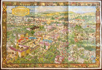
193561830San Diego CA: Shell Building San Diego Exposition 1935. One oblong atlas folio map. 32 x 22 in. Double-sided colour lithograph pictorial map with inset colour illustrations on verso of History of San Diego fold creases as issued light age toning at fore-edges very minor edgewear w/ original mailing envelope from the “Shell Building†at the CPIE toning to envelope NF/VG- copy mailed to Miss Gladys Buckman 1920-2011 in Long Beach CA from her brother Loren M. Buckman 1913-1995 who at the time was stationed on the USS Northampton CL/CA 26 US Navy Cruiser sunk later in 1942 at the Battle of Tassafaronga repelling Japanese from reinforcing troops on Guadalcanal. First edition of this scarce and beautifully rendered pictorial map celebrating the very successful California Pacific International Exposition held in San Diego over two years at the depths of the Great Depression to revive the Southern California economy which featured a number of unusual concessions and exhibits such as the Gold Gulch Lost Continent of Mu the Zoro Garden Nudist Colony and the “One Ton Mechanical Man.†Several of the exhibits used at the recently closed Century of Progress Exposition in Chicago 1933-1934 were re-used for the CPIE. This map reminiscent of the work of Jo Mora looks Eastward from a high point above the Pacific Ocean depicting San Diego from La Jolla to Oneonta and inland up to Cuyamaca Dam. Many of the buildings developed the architect Requa’s 1881-1941 “Southern California Architecture†style drawing upon the historical architecture of the Colonial Mexico the Pueblos of the Southwest and the Moorish features from Spain and North Africa and preserved the popular buildings which are still evident in Balboa Park. Bloodgood 1896-1989 was an illustrator cartoonist and map maper who produced a substantial body of pictorial maps from 1935-1968 for Shell Oil and the Pic-Tour Guide Series with this one being distributed from the Shell Building exhibit at the CPIE. Worldcat locates 6 copies SFPL U of FL Osher Map Lib. Bancroft UC San Diego Harvard. Shell Building, San Diego Exposition, unknown
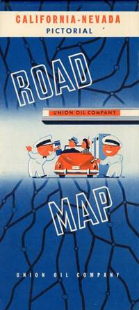
194853865Chicago: Rand McNally & Co. n.d ca 1948. ca 1948. First edition thus. 19 1/2" x 32 1/4" sheet folded to 9 3/4" x 4 1/2." Double-sided color lithograph maps. Nicely produced Pictorial Map of California & Nevada featuring pictographs of places of interest and tourist spots throughout the west including Las Vegas as only mine & mill cotton fields in the San Joaquin Valley and views around Yosemite as well as California Missions. Also featured are inset maps for San Francisco and Los Angeles as well as large highway map on verso inset tables for Western mileage and radio stations. Light rubbing to creases. Very good plus. Rand McNally & Co., n.d [ca 1948]. unknown
1527878449.Gpaperback. Good. Access codes and supplements are not guaranteed with used items. May be an ex-library book. paperback
0265868890.Ghardcover. Good. Access codes and supplements are not guaranteed with used items. May be an ex-library book. hardcover
116177162X.Ghardcover. Good. Access codes and supplements are not guaranteed with used items. May be an ex-library book. hardcover
1527877167.Gpaperback. Good. Access codes and supplements are not guaranteed with used items. May be an ex-library book. paperback
0265774659.Gpaperback. Good. Access codes and supplements are not guaranteed with used items. May be an ex-library book. paperback
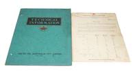
19494369Texas: Caltex Oil Company 1949. Original card folding binder; with four sections separately paginated between 14-16 pages respectively. Loosely inserted is a price list from the Vacuum Oil Company of Adelaide dated 1948. Well preserved clean and unmarked. The card binder bears the details of the Australian branch of Caltex but the sectional contents are published by the parent company in Texas.</p> <p>From the preface: 'this aircraft lubrication guide contains complete instructions covering the periodic lubrication of this model of aircraft. This guide does not cover lubrication of various items such as accessories which is performed at the time of major overhaul of each component. The arrangement of this guide is divided into various section of the aircraft such as landing gear power plant etc in order that the work may be subdivided among various groups of mechanics and to facilitate tying in with normal inspection and line maintenance procedures.'. Caltex Oil Company unknown
0331325799.Gpaperback. Good. Access codes and supplements are not guaranteed with used items. May be an ex-library book. paperback