No AuthorBiblio.com

132 résultats
18705388<p>Gall & Inglis' 1870's-1880's. Paperback. Very good. VGC.Gall & Inglis'.No date given but probably 1870's to 1880's prior to London Tower Bridge build which is not included on the map.Green hardbacksmall dentsnicks and light shelf wear on the cover with folded map in VGC.The map is in VGC but with small stain marks and foxing marks on the edgessmall tear on the edge of the map.The map is hand coloured and includes:RailwaysRailway StationsSteamer RoutesOmnibus and Tramway RoutesParks.The size of the map is: 30x20 inch.The scale of the map is: 3 3/4 to 1 mile.The map covers: From Hyde Parkincluding parts of Kensington Palace to Blackwall and from Mildmay Park to South Lambeth.The map is in VGC for its age. A collectable and scarce map.</p> Gall & Inglis' paperback
1873697671873. Hardcover. Good. Circa 175 pages of holograph text; remainder of book blank. Scuffed leather minute book. 34cm. Ruled pages. This railroad seems to been relatively short running from the Connecticut border south of Longmeadow Massachusetts to East Hartford. At the final 1887 meetings of the stockholders and directors recorded in this minute book the Company appeared to be facing a foreclosure suit by the Connecticut State Treasurer. The railroad appears to have ceased in 1887. hardcover
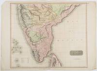
1816185242London.: Thomson. 1816. Engraved map with full handcolour 50.5 x 59.7 cms ; 53.9 x 73.8 cms sheet central fold a few minor edge tears one intruding into the top border the map unscathed marginal edgewear two corners with some loss but the map in very good crisp condition. An elegant map with great detail prepared for John Thomson's influential "New General Atlas" 1814-1821. Showing India from 20 degrees to 7 degrees north of the equator and includes the northern half of Ceylon with territorial interests attractively coloured. . Thomson. unknown
184050119George Corser Caracas 1840. Early Edition. Hardcover. Good Condition/No Dust Jacket. FLORES ESTRADA ALVARO. Curso de economia politica 4th edition corrected octavo Caracas: George Corser 1840 pp. 2 iv 593 1 2 index the last leaf of the index is lacking contemporary sheep binding with gilt decoration and gilt lettering on spine. Text in Spanish. Occasional worm holes along the spine hinges cracked boards rubbed and chipped moderate to heavy foxing begins at page 347 and continues through the end; still a good copy of a scarce text. The author 1766-1853 wrote on political economy as well as Spain and its relations with the Western Hemisphere nations and colonies. The present book is the only New World edition although at least seven editions were printed in Europe starting in 1828. OCLC locates 3 copies. Size: Octavo standard book size. 2 iv 593 1 2. Text is in Spanish. . . All edges clean neat and free of foxing. Quantity Available: 1. Shipped Weight: Under 1 kilo. Category: Antiquarian & Rare; Spain; 19th century; Spanish Language; Politics & Government. Pictures of this item not already displayed here available upon request. Inventory No: 50119. . George Corser hardcover
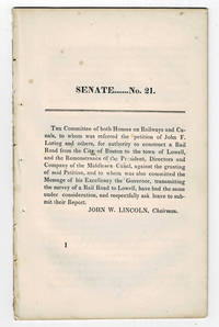
183099804<p>Boston MA: Printed by Dutton and Wentworth 1830. 1830. Very good. - Octavo 8-1/2 inches high by 5-1/4 inches wide. Softcover bound in printed self-wrappers. Once bound in with other similar pamphlets these three related items are unbound and removed with stab marks along the left edges. The pagination is a follows: pages 1-11 1 & 13-21 1-8; and 1-12. There is some scattered foxing throughout all three items. The cover page of the Senate No. 10 report dated December 15 1829 is darkened & stained with minor chipping to the bottom corners of that page and of the last page. Very good.</p><p>First edition Massachusetts Senate No. 21. The report is signed on page 11 by John W. Lincoln Chairman. The report is followed by the text of a bill entitled "An act to establish the Boston and Lowell Rail Road Corporation."</p><p>The Boston and Lowell Railroad was the first major railroad in the state of Massachusetts. The Boston and Lowell Railroad was preceded by the Middlesex Canal. Converting the canal to a railroad would eliminate the issue of transportation being unavailable during the winter when the canal froze. Patrick Tracy Jackson led the task of convincing the state legislature to fund the project. This proved difficult as the investors of the Middlesex Canal were against building a new form of transportation designed to replace their canal. The report at hand details the protest of the directors of the Middlesex Canal against granting the petition of John F. Loring and others to construct a railroad in its place. Loring and the other investors received their charter on June 5 1830 and the railroad began operations on June 24 1835.</p><p>The pamphlet is accompanied by an earlier February 12 1830 pamphlet titled:"To the Honorable the Senate and House of Representatives in General Court assembled. : The president directors and company of the Middlesex Canal having seen the publication of the petition of John F. Loring and others for a rail road from Boston to Lowell and the order of notice thereon beg leave to present the following remonstrance to granting the prayer thereof." 12 pages. Signed page 12: Wm. Sullivan Josh. Coolidge Geo. Hallet committee of directors of Middlesex Canal to this purpose duly authorized. House No. 40 printed by Dutton and Wentworth 1830.</p><p>In addition an earlier pamphlet from 1829 is included: "Boston December 15 1829. To His Excellency Levi Lincoln Governor of the Commonwealth of Massachusetts : Sir On the behalf of the Commissioners of Internal Improvements I have the honor to transmit herewith a report of a survey made in conformity to a resolve of the legislature passed on the 12th day of June 1829 directing the Board to survey a route for a rail road from the town of Taunton to some point in the route previously surveyed between Boston and Providence : with great consideration and respect I am your humble and most obe't. serv't. Josiah J. Fiske chairman." 8 pages. Signed on page 8: Josiah J. Fiske Willard Phillips James Hayward Commissioners of the Board of Internal Improvements. Senate No. 10. Printed by Dutton and Wentworth.</p> [Boston, MA: Printed by Dutton and Wentworth], [1830]. paperback
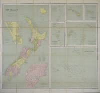
1865154409London.: George Philip & Son. 1865. 9 coloured maps by William Hughes segmented and mounted on linen 55.3 x 65.2cm. Folds into cloth covered case 17.2 x 12cm. Spine of case little faded and ribbon tie missing. Relief shown by hachures and spot heights. Philips' series of travelling maps series. Very good copy. Features a dominant map of New Zealand with 3 maps as insets to this map and 6 other maps separately shown within their own borders. The 3 inset maps are: Norfolk Island and Philip Island; Enlarged map of Auckland and the adjacent country; Enlarged plan of the country around Dunedin and the eastern portion of the Otago Gold Fields from Thomson's map. <br> <br>The 6 maps in addition to the New Zealand map are The Ladrones or Mariana Islands; The Sandwhich Islands; The Galapagos Islands; The New Hebrides and Santa Cruz Islands; The Feejee Friendly and Samoan Islands; The Marquesas Society and Low Archipelago. <br> <br>The New Zealand maps includes a list of native tribes and their locations. . George Philip & Son. hardcover
186985507h<p>London: Illustrated London News 1869. Book. Near Fine. Hardcover. Folio - over 12 - 15" tall. Half-year run bound in early half-leather over pebbled cloth boards. Some edge-wear and bumping to covers; small paper label painted over to upper spine. Edges toned and old library bookplate and marks to front and rear endpapers. Front hinge nearly exposed internally at endpaper but still firm. Otherwise clean tight and unmarked. Very neat -- a sound and handsome volume and internally unusually bright and clean. Superb illustrations.</p> Illustrated London News hardcover
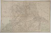
1859189711Calcutta.: Surveyor Generals Office. 1870. Reissue of 1859 edition. Lithographed map 57.2 x 93 cms; 61.1 x 96 cms sheet original folds old paper repairs to the verso and a sealed marginal tear central folds archivally strengthened some toning to the folds and creasing but the map in remarkably good clean condition. Impressive large Calcutta printing from the Survey of India showing Rajasthan Uttar Pradesh and surrounding states with extremely detailed delineation of settlements roads railways rivers and major points of interest the Taj Mahal is highlighted. . Surveyor Generals Office. unknown
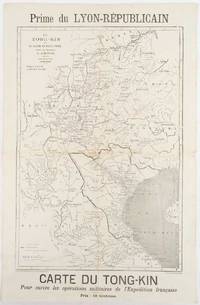
1883180621Lyon.: Lyon-Républicain. circa1883. Engraved map 40.5 x 27.5; 48.9 x 31.8 cm sheet original folds some browning to the fold and margins two small holes at the central fold without significant loss in good condition. Map issued as a supplement to "Le Lyon-Republicain" one of the great radical daily newspapers in Lyon. The map is after documents by French explorer and trader Jean Dupuis 1829-1912 who had explored regions along the Red River in the hopes of establishing trade routes within Vietnam and China and variously published. This supplement was issued on the eve of the Tonkin War in 1883 so that readers could follow the military movements of the French Expeditionary Force. It shows northern Vietnam and into south-western China with provinces marked and river systems in detail. . Lyon-Républicain. unknown
1840354279Mexico: Impresso Por Igancio Cumplido 1840. 964pp. plus one plate. Contemporary pictorial wrappers. Spine reinforced with archival tape minor dust soiling. Very good. 964pp. plus one plate. Variant issue without priority also printed in New Orleans in the same year. The text of a letter sent to Mexican president Anastasio Bustamente calling for a convention to address various ills affecting the newly independent state of Mexico. Estrada is heavy on political theory and with good reason. At the time of publication Mexican democracy was in a crisis. In July Gen. Urrea acting on behalf of Valentine Farias actually stormed the National Palace and took Bustamente prisoner. Bustamente soon escaped but the ensuing conflict between Farias and Bustamente for legitimacy had a devastating effect on hopes for a true democracy of the kind Estrada extols here. An excellent sample of Mexican political history and thought. SUTRO COLLECTION p.739 OCLC 7320339 Impresso Por Igancio Cumplido unknown
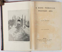
1897176109London.: Macmillan and Co. Limited. 1897. Photographic frontispiece of 'The Shah returning to Teheran' and numerous full page photographic illustrations four folding printed colour maps marginal spotting xii 275 pages 23 x 15 cm original red glazed red cloth boards occasional spotting the cloth a little marked and flecked the spine sunned but in very good condition.<P> An extensive and intrepid modern Grand Tour account through Constantinople and Turkey to Persia and Central Asia with 34 striking photographic plates. Clive Bigham was an Honorary Attaché to the British Embassy at St. Petersburg and war correspondent in the Near East travelled at the very height of the Armenian troubles when the strict orders had been issued by Turkey that Asia Minor was to be closed to Europeans. Burrell 94. <br> <br>This item is held off-site. Please note there may be a few days delay while it is brought into our shop for viewing or mailing to you. Thank you for your understanding.<P> <b>When referring to this item please quote stockid 176109</b> . Macmillan and Co. Limited. hardcover
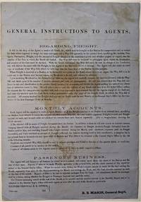
1855466Chicago: ICRR 1855. Broadside sheet. 280 x 195 mm. 11 x 8 /12 inches. Printed on blue paper folded brown stain in center portion of the sheet otherwise quite a good sound copy. Rare ICRR broadside containing instructions to their agents regarding freight accounts and passenger business with emphasis on recording and submitting Monthly Reports on all activities at their stations. It is signed by R. B. Mason General Sup't and though undated is from the early 1850's. Col. Roswell B. Mason was associated with the Illinois Central Rail Road from its inception overseeing construction of the line from 1852 to 1856 until he resigned in 1869 to become Mayor of Chicago. He was mayor during the fire of 1871 and used his power to declare martial law in its immediate aftermath. It is known that Abraham Lincoln served as counsel for Illinois Central in the early 1850s earning a fee of $5000 that occasion a law suit for nonpayment. Rare: this broadside in not among the Illinois Central Rail Road publications of the 1850s listed in OCLC. Not in Checklist of Ante-Fire Imprints 1851-1871. Not in Byrd Cecil B. Bibliography of Illinois Imprints 1814-1858 although three similar broadsides issued by Roswell Mason as General Superintendent are cited published in 1852 2 and 1855 1 all of which are in single copies at the Chicago Historical Society. (ICRR unknown
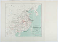
1898214719Paris.: Erhard Frères. 1898. Lithographed folding colour map 44.5 x 49.5 cms; 54.6 x 76.3 cms sheet towns and cities items of production and trade routes highlighted in red original folds in very good clean condition. Detailed map prepared for the Lyon Chamber of Commerce Mission to China under the direction of a young Henri Brenier 1867-1962 with the purpose of advancing French colonial expansion and shoring up the interests of the dominant Lyon silk trade. <br> <br>The map shows the principal centres of population production waterways roads telegraph lines and railroads togther with the centres of production and distribution for coal iron tin gold and silver opium tea rice sugar peanuts cinnamon wool medicinal plants and leather. The trade mission was organized following the Treaty of Shimonoseki and the end of the Sino-Japanese War: the Chamber of Commerce of Lyon understood that end of this war would signal a profound economic development and change. . Erhard Frères hardcover
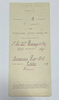
1875320963Standing Rock 1875. unbound. Partly printed military document signed 6th Infantry seven months before Little Big Horn 16.75 x 10.75 inches Standing Rock Nov. 1 1875 "A Statement Of Forage and Straw Issued to and Consumed by the Public Animals under my direction at Standing Rock Dakota Territory during the month of October 1875" for transient animals from Fort Rice signed by Captain and Commander of Post James S. Poland an officer who served under Major Reno at the Little Big Horn and was erroneously reported as "Killed In Action" when severely wounded in the back. At the time this document was signed Poland was ordered to cease his sale of rifles and ammunition to Indians at the Standing Rock Reservation as the recipients were closely connected with Sitting Bull's band. One month later the Commissioner of Indian Affairs called for the use of troops against those Indians. Also signed by Lieutenant William Badger a close friend of Custer who survived the Black Hills Campaign. His son Tom who filled out the body of this document became General Custer's personal secretary in 1876 and was killed at Little Big Horn. Also included: a Xerox of a rare photograph of the 7th cavalry 6th infantry in uniform with accoutrements all identified including Custer Badger and Poland. Partial tearing along one of the folds; otherwise near fine condition.<br/> <br/> unknown
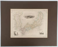
1850177528London.: The London Printing and Publishing Company. circa1850s. Lithographed map with original outline hand colour 25.8 x 33.5 cm three vignette illustrations decorative border central fold in very good condition presented in a window mount. Attractive decorative map with three vignettes by Rapkin: Yedo; a State barge in sail with penants flying--the paired oarsmen depicted through 10 small windows below deck; and Koreans in traditional costume; the map after the great mapmaker and publisher John Tallis. <br> <br>From the estate of the late collector and scholar Arthur Hacker with his pencilled catalogue mark on the verso. . The London Printing and Publishing Company. unknown
18282111902160201307Itamoto's seal is also unknown 1828. Soft Cover. Fine. Volume: 1 Itamoto's seal is also unknown paperback
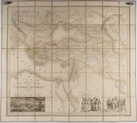
1853176118Paris.: Ministère d'Etampes et de Géographies. 1853. Engraved map with outline hand colour 67.2 x 75.1 cm sectioned and linen-backed two large vignettes: a view of Constantinople; and costumed Turks and European soldiers facing off across a stream the linen browned with some loss but not affecting the map with the fine nineteenth century label of Charles Delarue & Hivert on the verso. Fine map with beautiful vignettes by Adrien Toussaint Lallemand 1793 - c.1856 geographer and engraver at the Depôt de la Guerre. Lallemand was appointed at a precociously young age and later set up in business on his own the quality of his work assuring him of the continued business of the Depôt. <br> <br>Highly attractive map of the Ottoman Empire published at the outset time of the Crimean War 1853-1856. <br> <br>This item is held off-site. Please note there may be a few days delay while it is brought into our shop for viewing or mailing to you. Thank you for your understanding. . Ministère d'Etampes et de Géographies unknown
1883178272Paris.: Service hydrographique et océanographique de la marine. 1883 but1894. Engraved hydrographical chart on watermarked double sheet 99 x 63 cm soundings in metres lighthouses picked out in yellow and red inset map of the port and town of Tenedos central fold a few very slight edge tears to the generous margins light spotting and surface soiling but in very good condition. Fine and impressive large naval chart of this strategically important strait then still under the control of the Ottoman Empire. <br> <br>From a private collection; "Lord John Fitzroy Royal Yacht Squadron" in manuscript on the verso. . Service hydrographique et océanographique de la marine unknown
189840873N.P.: Sentinel and Gazette Steam Press 1851. 1898. 8 1/2" x 5 1/2" in light peach wrappers though missing the front wrapper. 15 pp. Illustrations. Map. Although it eventually became a transcontinental railroad the railroad that became the Milwaukee Road began as the Milwaukee and Waukesha Railroad whose goal was to link the developing Lake Michigan port city of Milwaukee Wisconsin with the Mississippi River. The company incorporated in 1847 but changed its name to the Milwaukee and Mississippi Railroad in 1850 before construction began. A report to the Board of Directors explaining that the railroad is not completed to Waukesha as was expected and offering reasons for the delay in its completion. "Considering our small beginning only a little over one year ago - that we have relied solely on the resources of the people of Wisconsin for the means of prosecuting this enterprise - without seeking foreign aid - with only the small contributions of each of our thousand Stockholders and the credits based on the securities of our city and citizens we have in that time completed the grade of our Road for twenty and a half miles laid the Track and brought into actual use the half of that distance - and will have the whole completed and in successful operation by the middle of February next." Information on estimated and actual costs of the First Division extending the road from Milwaukee to Waukesha. It appears that actual costs far exceeded estimates "but that has been the result of peculiar circumstances under which the work has been performed and by the adoption of a rail of greater weight than that estimated." It was determined that the contractors to whom jobs had been given at lower costs were inexperienced and inefficient resulting in their work having to be re-done. Furthermore the delay was caused by some stockholders not promptly paying the small installment of only 5% every three months thus leaving a deficit. Also a bank in a marsh sunk and had to be built back up. Th cost of constructing the first twenty and 1/2 miles is only $9495 per mile. Report ends with the reassurance that the Road will be complete by February and if weather permits perhaps even earlier. 8 1/4" x 21 1/2" map of the Milwaukee and Mississippi Rail-Road. Map is neatly torn in half at one fold and has 1 1/2 - 2" closed tears to tops of a couple folds. Front wrapper missing along with 3" split to toe of spine and with light wear to the extremities. Sentinel and Gazette Steam Press, 1851]. unknown
1806009589London: Printed for Richard Phillips Sold By Souter No. 1 Pater-noster-row. 1806. Book. Very Good. Hardcover. First Edition. Large 4to. A very good "large paper" copy with uncut edges leaf size approximately 285mm x 225mm with a few additional items bound in. Pp. xiv 2 530 ii ii. 16 hand-tinted aquatints of which several folding map plus an additional contemporary hand-coloured map of Ireland as frontispiece. Contents: frontispiece quarto format map - engraved for the Poem of Erin. The folding plate of Dublin shown as the frontispiece in the "Directions for Placing the Plates" has been bound in opposite the first page of text title page dedication prefacecontents errata directions for placing the engravings main body of the text additional page on St. Patrick from "Guide to Knowledge" bound in at rear before the Publisher's adverts cutting from the Times 1842 entitled "Robert Emmet and the Gaoler of Kilmainham" pasted to rear paste-down. Original paper-covered boards with recent pebbled cloth spine to match original with the original paper title-label applied to the spine binding in very good condition. Contents very good the uncut edges are a little worn in places and a couple of a small near-contemporary oval stamps of the "Baptist College Bristol" to the front end paper no other marks. Paper in very good condition without any obvious staining minimal foxing almost completly confined to the tissue guards maps and plates all very good clean and crisp short repaired tear to the edge of page 318 not nearly affecting the text. A very good to fine copy. Printed for Richard Phillips, Sold By Souter, No. 1, Pater-noster-row. Hardcover
1823ST20595London: Longman Hurst Rees Orme and Brown 1823. Seventh Edition. 237 x 145. 9 3/8 x 5 3/4". 3 p.l. vii 1 viii 1 6-236 pp. <br/> Publisher's blue paper boards and brown paper backstrip original printed paper label EDGES UNTRIMMED AND MOSTLY UNOPENED. A Large Paper Copy. Just the faintest evidence of foxing at very beginning and very end corners with slight wear as always superficial chafing to covers but AN EXCEPTIONALLY FINE COPY the binding remarkably clean and with no significant signs of use and the wide-margined text unusually fresh and nearly as white as snow.<br/> <br/> In its original boards untrimmed and partly unopened this is a wonderful contemporary copy of an important later edition of the magnum opus of a man whose name came to be synonymous with road improvement. DNB tells us that Scottish-born John Loudon McAdam 1756-1836 was "the first systematic builder and administrator of roads in Britain since Roman times" and his impact was so great that his name lives on to the present day in connection with paved surfaces. The use of "macadam" or "macadamized" to mean a good road surface began in the 1820s and continued through the invention of the automobile when dusty roads began to be improved with tar. At first "tar" was combined with "macadam" producing the term "tarmacadam" when referring to these improved roads; eventually this became shortened to "tarmac" which still is broadly understood to refer to road surfaces and more specifically to airport runways. Our author first published "Remarks on the Present System of Road Making" in 1816 to deliver his suggestions for an improved paving method following his extensive survey of the roads of Britain. His system--in which roads were built with a cambered surface for drainage using layers of consistent sizes of stones and gravel--soon caught on both within Britain and abroad. The present seventh edition features a variety of new material much of which deals with McAdam's efforts to encourage legislation for improving roads; this includes a new preface and advertisement as well as the "Minutes of Evidence" given by witnesses regarding turnpike improvement from March to May 1819 and the report of the Select Committee of the House of Commons on McAdam's system from June 1823. As evidenced by its appearance in multiple printings McAdam's "Remarks" was a widely used book but our remarkably well-preserved copy in its publisher's boards--obviously and decidedly--was not. Longman, Hurst, Rees, Orme, and Brown unknown
1844GD012817okBC1S5Manchester: Wetmore & Wallace 1844. Manchester: Wetmore & Wallace Rare Americana 1844 First Printing. 8vo. 16 pages with folding map at rear of wrappers. The folding map titled :Plan and Profile of the Route Surveyed for the Northern Railroad from Concord to Lebanon N.H." measuring approxinately 28" long and 9" wide. The map is in extremely nice condition. The spine shows some wear but remains a very nice copy. A signature of S.Chase" appears on the front wrapper. There is an institional rubber stamp on the margin of page 3. Vermont Historical Society Montpelier Vermont. This report printed by Wetmore & Wallace Printers in Manchester New Hampshire presents the findings of an engineer's survey for the Northern Railroad route. It covers the planned railroad connections between Concord Franklin and complete with Lebanon along the Connecticut River. Published in 1844 this document provides historical insight into the development of New Hampshire early railroad infrastructure and the engineering challenges faced in the region at that time. Scarce copy last auction records 1930. First Printing. Paperback. Good/No Jacket. 8vo - over 7¾" - 9¾" tall. Manchester: Wetmore & Wallace
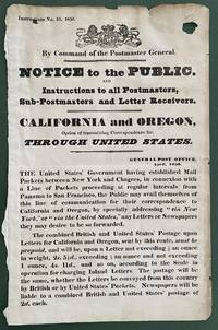
1850List2416Great Britain 1850. Broadside measuring 9 ⅞ x 15 ⅜ inches. Some chipping and wear to edge ink number written in corner two small section of loss due to improper mounting very good overall. Coat of arms of the United Kingdom above printed text. Very Good. A scarce broadside relating to British postal rates across the Panama Route through the Chagres River which supplied mail to California and Oregon beginning in 1848 before eventually being replaced by the Overland route in 1860. The service was characterized by long delay times as steamships on either side of the isthmus were often not coordinated causing major delays in the delivery. Several different steamship companies operated privately some carrying express mail. The letters were transported by canoe or pack animal across the isthmus. Postmaster General Cave Johnson began establishing post offices in California in 1848. Johnson also oversaw the transition to the prepaid delivery system. The broadside here of which we find no other records does state that postage must be prepaid and that the route can be accessed by writing “via New York†on the letters. A scarce postal history item relating to the expansion of mail services to California. We find no other records of this institutionally or in the trade. unknown
18462090502128300687Not Available 1846. Soft Cover. Fine. The book is in fine condition. Not Available paperback
1840018232London: Printed and Published By J. Barfield 1840. Book. Very Good. Hardcover. Fourth Edition. Folio 30 x 46cm. "Revised Collated and Considerably Enlarged by John Satchell Esq." Seventy-four double-page engraved genealogical tables and geographical maps all with original hand colouring contemporary . half black morocco gilt with green cloth boards. Binding good with some general wear and rubbing leather chipped with loss to the base of the spine joints rubbed but still strong corners worn. All edges gilt./ Contents clean and tight contemporary ink stain effecting the fore-edges of the first few pages but not affecting text or maps most noticeable to the front end papers with also have a pencil inscription dated 30 November 1935. All maps and charts in very good condition. Notwitstanding wear to the binding a very good copy. Printed and Published By J. Barfield Hardcover