[AFRICA - PRE-COLONIAL ERA MAP]Biblio.com
132 résultats
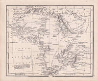
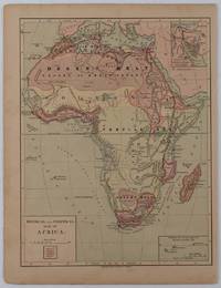
1877176015New York.: Harper & Brothers. circa1877. Chromolithographed map with outlne handcolour 27.1 x 21 cm major towns marked with a red cross relief by hachures ocean currents marked two inset maps of the Suez canal and Mascarene Island two very small marginal edge tears not affecting the map slight toning unrelated text on the verso prepared for "Harper's School Geography" in very good condition Interesting map of Africa before the escalation of the European race for colonial possessions from 1880. The map shows: the European possessions of the Cape Colony Transvaal Republic Orange River Republic and Natal; regions of the continent as fertile belts and desert belts; and indicates agricultural and other production such as palm oil ivory skins and cattle. Major cities are shown with important trade centers highlighted with a red cross. Prepared for US students in "Harper's School Geography" longitude is shown from the Greenwich prime meridian at the head of the map and from the Washington prime meridian at the foot. A small outline map of Ohio is included for relative scale. . Harper & Brothers. unknown
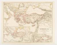
1874174914Gotha: Justus Perthes. 1874. Map with original colour and outline hand-colour 32.2 x 40 cm three inset maps text in German central fold slight marginal toning in very good condition. A most handsome map detailing the Eastern Roman Empire from the immigration of Hungarians in Ponnonia around 895 to the subjugation of the Bulgarian Empire by Emperor Basilius in 1019. The inset maps depict Divisions of the Empire Palestine and the Themata around Propontis present day Sea of Marmara issued for the "Hand-Atlas für die Geschichte des Mittelatters und die Neueren Zeit". . Justus Perthes unknown
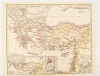
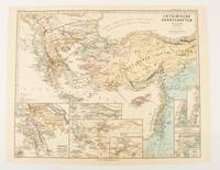
1876174911Gotha: Justus Perthes. 1876. Map with original colour and outline hand-colour 32.2 x 40 cm text in German four inset maps central fold slight marginal toning and spotting on the verso but in very good condition. A most handsome and highly detailed map detailing the Eastern provinces of the Byzantine/Roman Empire before the Fourth Crusade. The inset maps depict Constantinople Divisions of the Empire and Antioch issued for the "Hand-Atlas für die Geschichte des Mittelatters und die Neueren Zeit" . Justus Perthes unknown
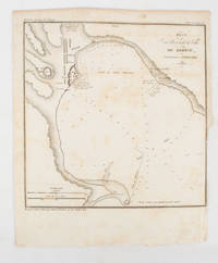
1839175248Paris.: Librairie de Gide. 1839. Engraved map 21.1 x 20.8 cm 27 x 22 cm sheet original folds trimmed to the inner margin with slight loss to the border only map spotted but otherwise in sound condition. Map of the Port of Kerch in Crimea prepared for the 1839 edition of the French Journal "Nouvelles Annales des Voyages." the editors for this edition amongst others the translator and geographer Jean-Baptiste Benoît Eyriès and Alexander von Humboldt founding members of the world's first geographical society the Société de Géographie. . (Librairie de Gide). unknown
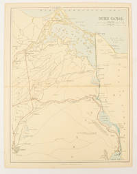
1880174937London Edinburgh & Glasgow.: William Mackenzie. 1880. Map printed in colour with original outline hand colour 29.8 x 22.7 cm central fold edge toning but in very good condition. Published for inclusion in "The National Encyclopaedia: A Dictionary of Useful Knowledge". . William Mackenzie. unknown
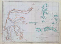
1860184035London.: Weekly Dispatch Atlas. circa1860. Map with outline handcolour 31.3 x 43.3; 33.3 x 48.7 cms sheet 12 x 17 inches small marginal bloom not affecting the map in very good condition. Detailed mapping of these two island groups by Edward Weller 1819–1884 from the ‘Weekly Dispatch Atlas’ an atlas published in monthly instalments from 1855 for subscribers to the long running newspaper. Weller was a pioneer in lithography and was sought after for his skill in producing detailed and accurate maps. . Weekly Dispatch Atlas. unknown
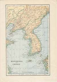
1900174813London. Circa1900. Map printed in colour showing submarine and overland telegraphs Manchuria Chosen Liao-Ting Kirin and Chili 21.5 x 13.3 cm 25.7 x 17.1 cm sheet size margins a little scuffed in very good condition. . unknown
1830176607London.: Robert Jennings. 1830. Engraved map 11.5 x 14.3 cm showing route of European explorers faint added outline colour in an early hand and manuscript note to the verso in the same ink edges age-toned but in very good condition. Detailed pre-colonial map of Africa "Regions Unexplored" marked and "no fresh water to be found" on the west coast. An early manuscript inscription on the verso refers to Lander's ."wanderings of Clapperton" the Scottish naval officer and explorer. Richard Lander had returned with Hugh Clapperton's journal following his death and the account was published in the same year as Fenner's "Pocket Atlas of Modern & Ancient Geography" for which this map was prepared. . (Robert Jennings) unknown
1893174920New York.: Hunt & Eaton. Circa1893. Printed map in colour elevation shown with hachures 29 x 23.5 cm text on the verso relating to entries for Afghanistan Beluchistan and Turkey prepared for Hunt & Eaton's "New York Recorder's Atlas" small tears to the top edge but in very good condition. . Hunt & Eaton. unknown
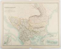
1893177055Edinburgh & London.: W. & A. K. Johnston. 1893. Engraved map with original outline hand-colour 44 x 57.4 cm map two inset maps of the Bosphorus and Crete; central fold corners chipped with loss lower edge with several small marginal tears neatly repaired head and foot clipped at the fold with loss to the margin but the map in very good condition. Detailed and finely engraved map also showing submarine telegraph lines and relief by hachures. Re-issue of the map first published in 1863 for "Keith Johnston's Royal Atlas of Modern Geography". . W. & A. K. Johnston unknown
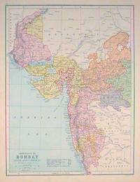
1880187528Edinburgh.: J. Bartholomew. circa1880s. Map 40.2 x 30.4 cms with printed colour and outline hand colour in very good condition. Handsome map with colonial interests attractively coloured. . J. Bartholomew unknown
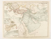
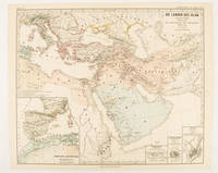
1877174917Gotha: Justus Perthes. 1877. Map with original colour and outline hand-colour 32.7 x 40.7 cm four inset maps text in German central fold slight marginal edge wear and spotting to the verso but in very good condition. A handsome map detailing the lands of Islam at the time of the Bujids 945-1055. The inset maps depict a western extension to the main map southern Arabia the lands of the Ghaznavid sultanate in Central Asia and lands of the Eastern Roman/Byzantine Empire issued for the "Hand-Atlas für die Geschichte des Mittelatters und die Neueren Zeit". . Justus Perthes unknown
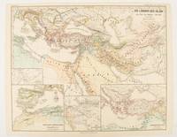
1877174913Gotha: Justus Perthes. 1877. Map with original colour and outline hand-colour 32.2 x 40 cm three inset maps text in German central fold slight marginal toning in very good condition. A most handsome map detailing the lands of Islam under the Abbasids up to the capture of Baghdâd by the Bûjids from 750 to 945 AD. The inset maps depict Northern Iraq Baghdad and a western continuation of the main map issued for the "Hand-Atlas für die Geschichte des Mittelatters und die Neueren Zeit". . Justus Perthes unknown
1877174916Gotha: Justus Perthes. 1877. Map with original colour and outline hand-colour 33.1 x 40.2 cm four inset maps text in German central fold slight marginal edge wear and spotting to the verso but in very good condition. A handsome map detailing the lands of Islam from Hegra in AD 622 to the fall of the Umayyads in AD 750. The inset maps depict a western extension to the main map and city plans for Damascus Jathrib & Medina and Mecca issued for the "Hand-Atlas für die Geschichte des Mittelatters und die Neueren Zeit". . Justus Perthes unknown
1876174910Gotha: Justus Perthes. 1876. Map with original colour and outline hand-colour 32.2 x 40 cm seven inset maps text in German central fold slight marginal toning in very good condition. A most handsome and highly detailed map detailing provinces of the Latin Empire in the wake of the Crusades. The inset maps depict Achaia in Greece Divisions of the Empire and a city plan of Constantinople issued for the "Hand-Atlas für die Geschichte des Mittelatters und die Neueren Zeit" . Justus Perthes unknown
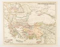
1877174915Gotha: Justus Perthes. 1877. Map with original colour and outline hand-colour 32.2 x 40 cm two inset maps text in German central fold in very good condition. A most handsome map detailing countries on the Aegean and Black Seas 1311 to 1390. The inset maps depict the kingdom of Stephan Duschan Serbia and the land of the Crimean Goths issued for the "Hand-Atlas für die Geschichte des Mittelatters und die Neueren Zeit". . Justus Perthes unknown
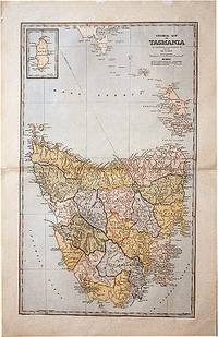
188861874Sydney.: The Picturesque Atlas Publishing Company. 1888. A large and detailed map of Tasmania from The Picturesque Atlas Publishing Company showing railroads existing as well as under construction and coloured regions dividing the island into districts. Hachures depict landforms detailed index to place names on verso small inset upper left corner showing Kind Island printed colour 70 x 45.5 cm. . The Picturesque Atlas Publishing Company. unknown
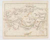
1830175250London.: Society for the Diffusion of Useful Knowledge. Baldwin & Cradock. 1830. Engraved map wth outline hand colour 29.7 x 42 cm relief shown in hachures key to abbreviations including "Ancient Ruins" the west and east extremities attactively engraved to burst through the border original folds map with occasional spotting more pronounced at the lower corner edges a little ragged small chip to the inner margin no loss to the map manuscript pagination in the lower corner but in good condition. . Society for the Diffusion of Useful Knowledge. Baldwin & Cradock. unknown
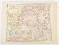
1893175715New York.: Hunt & Eaton. Circa1893. Printed colour map 24 x 28 cm four thumbnail inset maps: Banana; Boma; Matadi & Environs; Stanley Pool named for the explorer; and below a lozenge inset of the road from Matadi to Leopoldville marginal toning and small edge tears one corner creased but in very good condition and on the verso explanatory text and line engravings in two columns for this map and partial description for the previous entry for the Suez Canal from Hunt & Eaton's school atlas published in 1893. . (Hunt & Eaton). unknown
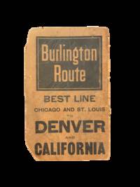
19005708Chicago: Rand Mcnally & Co 1900. Two color map 28x21" folding to 6x3.5." Few small marginal tears at folds some toning else very good. Attached to original Burlington Route folder lacking front cover. <br /> <br /> Uncommon Indiana pocket map from the Burlington Route showing roads counties cities etc. with an emphasis on railways which are listed in red at the bottom right corner. List of chief cities with populations along left margin. <br /> <br /> <br /> . Rand, Mcnally & Co unknown
18952092902141300007Main Hall Reconstruction Office Headquarters 1895. Soft Cover. Fine. Number of books: 1 Main Hall Reconstruction Office Headquarters paperback
18892877821Barcelona.: Henrich y compañía. 1889. Hardcover. Cubierta deslucida. contiene pegatina en portada . Good. 22 cm. 88 p. Encuadernación en tapa dura artesanal con lomo en piel. Cubierta deslucida. contiene pegatina en portada . Literatura.82 82 Henrich y compañía. hardcover
1818ZB353063Washington: Printed by E. de Krafft 1818. 6 pp. 2 folding tables; issued as 15th Congress 1st Session H 201; extraction roughness at spine general age toning lower outside corner crumpled disbound in self wrappers; things are progressing well with average cost per mile $9744.21. - If you are reading this this item is actually physically in our stock and ready for shipment once ordered. We are not bookjackers. Buyer is responsible for any additional duties taxes or fees required by recipient's country. Photos available upon request. Washington: Printed by E. de Krafft, unknown
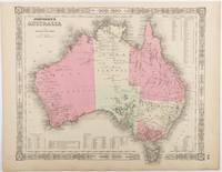
1865214355Johnson and Ward. Circa1865. Hand coloured map 32.3 x 39.7 x cms including the decorative border; 35.6 x 45.8 cms sheet key to major centres unrelated text on verso sheet age toned in very good condition. Detailed map from the leading mid 19th Century American firm of Johnson and Ward. Although Tasmania was known as such from 1856 the map refers to "Van Diemen Land". . Johnson and Ward. unknown
1852180552London.: Longman Brown Green & Longmans. Second Edition. 1852. 5 folding mathematical projections at the rear. v 143pp plus 5 pages of publisher's adverts. Original cloth lettered in gilt on the spine and ruled in blind title page slightly browned head & tail of spine slightly chipped else a lovely clean copy. A presentation copy "With the Author's Cordial Regards' dated July 6th" 1854. 17.5x 10.5cm Born in Westminster London in 1818 William Hughes was a prolific mapmaker geographer engraver printer and publisher. . Longman, Brown, Green, & Longmans. hardcover