SCALLY, ALEX JBiblio.com
132 résultats
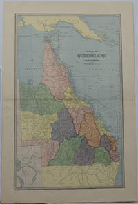
1886175917Sydney & Melbourne.: The Picturesque Atlas Publishing Company Limited Sydney & Melbourne. 1886-1888. Large printed colour map 60.9 x 37 cm 69.9 x 45.3 cm sheet central fold slight browning at the fold and to the generous margins in very good condition. Detailed map prepared for Andrew Garran's monumental "Picturesque Atlas of Australasia" 1886-1888 with the counties attractively coloured. New Guinea is shown to the North and borders with Northern Territory South Australia and New South Wales. The extent of the Great Barrier Reef is delineated along with the ocean "Border of Colony". Proposed and current railways are shown with an extensive place index printed on the verso of the map. . The Picturesque Atlas Publishing Company, Limited, Sydney & Melbourne. unknown
1885064721Madrid: Sucesores de Rivadeneyra 1885. No consta edición. Tapa dura. Good. XXXI 767 227 Láminas plegadas. 20 x 26 cm. LECCIONES DE NAVEGACIÓN - Precedidas de unas ligeras nociones de astronomía y seguidas de unas tablas para facilitar los cálculos náuticos. Buen estado. Sucesores de Rivadeneyra hardcover
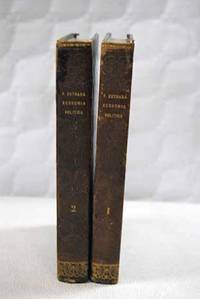
18351101351Madrid.: Imprenta de D. Miguel de Burgos. 1835. Hardcover. Cubierta deslucida. Good. 22 cm. 2 vols. Encuadernación en tapa dura artesanal. Pequeñas notas manuscritas a lápiz en la primera página del tomo I . Cubierta deslucida. Economía.33 33 Imprenta de D. Miguel de Burgos. hardcover
1834ZB285685Washington 1834. 23rd Cong. 1st Sess. HD 456 34 pp. extracted from larger bound volume slight age toning but in all very good. - If you are reading this this item is actually physically in our stock and ready for shipment once ordered. We are not bookjackers. Buyer is responsible for any additional duties taxes or fees required by recipient's country. Photos available upon request. Washington unknown
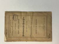
186340799Cleveland: Fairbanks Benedict & Co. 1863. Stitched in original printed wrappers. 33 1 blank pp folding table. Wrappers with extremity chipping and old rubberstamp. Rear wrap detached but present. Title page with rubberstamp. Old bookplate. Good plus.<br /> <br /> This is a joint report of the Bellefontaine & Indiana Rail Road and the Indianapolis Pittsburgh & Cleveland Rail Road. <br /> Wikipedia says: "The Indianapolis and Bellefontaine Railroad I&B was an American railroad founded in 1848. It changed its name to the Indianapolis Pittsburgh and Cleveland Railroad IP&C in 1854. Its counterpart in Ohio was named the Bellefontaine and Indiana Railroad B&I. The B&I ceased to exist as an independent company when it merged into the Bellefontaine Railway in September 1864. The Bellefontaine Railway merged with the Cleveland Columbus and Cincinnati Railroad to form the Cleveland Columbus Cincinnati and Indianapolis Railway in December 1864."<br /> OCLC 12696870 11 as of March 2025. Fairbanks, Benedict & Co. unknown
185316365Philadelphia: John C. Clark 1853. Original printed wrappers stitched 20pp. A bit of edge chipping to the wraps else Very Good. Statutes beginning with the Act of Incorporation under Pennsylvania law in 1850 relating to this railroad with the Act of the Virginia legislature authorizing a right of way through that State. FIRST EDITION. Haynes 13907. Not in Sabin Eberstadt Decker BRE BEAL. John C. Clark unknown
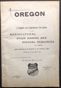
1890H22859Battle Creek MI: Wm. C. Gage & Son 1890. Paperback. Very Good. Stated Third Edition Revised. 8.25 x 5.5 inches gray printed wraps very good contents tanning. 108 pp full page map on inside front cover no other illustrations. A more substantial 264 pp. version seems also to have been issued interspersed with many ads. This promotional pamphlet is rarer. Wm. C. Gage & Son paperback
18972110502150406878Edited and sculpted by Omuro Otokichi 1897. Soft Cover. Fine. Number of books: 7 Edited and sculpted by Omuro Otokichi paperback
189635319New York: America. Poor with no dust jacket. 1896. paperback. A reading copy only. pp brittle; a number loose. Spanish text. ; 46 pages . America paperback
1816175252Philadelphia.: Carey Mathew and Warner Benjamin. 1816. Engraved map 19 x 22.3 cm original folds some offsetting to the map marginal browning and staining small archival repairs to the outer margin but in good condition. Fine map Plate 19 prepared for Carey and Benjamin's "General Atlas.". . (Carey, Mathew and Warner, Benjamin). unknown
1851174952London & New York.: Tallis J & F. 1851. Lithographed map 24.5 x 32.3 cm borders picked out in original hand colour four inset vignette illustrations decorative Greek key border edge worn and discoloured paper toned but the attractive map in good condition. Attractive decorative map prepared for "Tallis's illustrated atlas and modern history of the world." one of the last great illustrated series of world maps. The fine vignettes are of Mt. Olympus Rhodes a ketch in the Mediterranean Sea and two costumed Ottomans. . Tallis, J & F. unknown
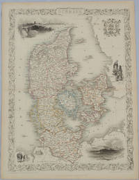
1850175779London & New York.: John Tallis & Company. Circa1850s. Lithographed map with original outline hand colour 34.5 x 24.7 cm including border and captionsfive fine vignette illustrations decorative border central fold edges with light toning in very good condition. Attractive decorative map with fine vignettes of Copenhagen Sleswig and Elsinore figures in costume the coat of arms of Denmark and an amiable equine pair by the great mapmaker and publisher John Tallis. . John Tallis & Company. unknown
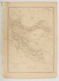
1863177017London.: Cassell Petter and Galpin. circa1863. Engraved map 43.1 x 30.3 cm 50.7 x 34.5 cm sheet central fold small edge tears one neatly repaired lower corner chipped slight age toning but in very good condition. Impressive large map of Persia Iran by noted map maker Edward Weller in original uncoloured state re-issued by the publisher for inclusion as map 26 in Cassell's Atlas. . Cassell, Petter and Galpin. unknown
183536.274Madrid: Imp. de Miguel Burgos 1835. Rústica editorial. 16x22. Imp. de Miguel Burgos paperback
189457598San Francisco CA: Standard Asphalt Company of California Printed by Bosqui Printing & Engraving Co. 1894. 8vo. 8 pp unpaginated. printed in red & black. Black printed softcovers white lettering front cover company logo illust. on back cover minor shelfwear slight rubbing very slight chip to upper right corner still VG copy. First edition of this scarce promotional brochure by this pioneering California oil and mining company initially drawing upon petroleum and asphalt mines near Bakersfield California by the late 1880’s. They had originally drawn upon deposits in Asphalto and Hazleton but later these were played out due to high production costs to refine out the clay but later the company made a large discovery in 1893 just prior to the publication of this promotional piece touting 79% level of bitumen and production of asphalt vital for use in lacquers paints and road construction. Worldcat locates 1 copy UC Berkeley; See: Asphaltum Mineral Resources of the United States 1893-1894 1895 pp. 633-634; Asphaltum Standard Asphalt Company of California Los Angeles Herald April 5 1891 p. 6. Standard Asphalt Company of California, Printed by Bosqui Printing & Engraving Co., paperback
190060562Buffalo NY: Kellogg Iron Works ca. 1900. Oblong 8vo. 9.5 x 6 in. 16 pp unpaginated. printed photo plate followed by plates of elevations and bridge plans. Original gray printed softcovers black lettering front cover minor corner chip to first page couple closed tears w/ minor repairs dustsoiling to fore-edges still a VG- copy. First edition of this exceedingly scarce catalogue of touting “Kelloggâ€truss bridges which consisted of Pratt inner bracing with additional diagonals and were popular in the Northeast at the end of the 1800’s until about 1901-1905 spanning between 75 to 150 feet. These types of bridges played a crucial role in road building driven by the Good Roads Movement during the opening decades of the 20th century. At the end of the 19th century less than 50% of roads within American cities were paved and the very few highways and turnpikes connecting cities and towns were little more than crushed rock macadam dirt roads or even paths. Although founded in the 1880s by bicycling enthusiasts the Good Roads Movement at the beginning of the 20th century began to be driven largely by advocates of the automobile who favored sturdy durable bridges which could be easily maintained. These Kellogg truss bridges featured riveted steel trusses and were often anchored in stone foundations. Charles H. Kellogg the elder was an active bridge engineer and builder whose firm wen through several different configurations and owners between 1870-1915 while his son Charles H. Kellogg the younger operated his own company from 1891-1901 and should not be confused with the short-lived Kellogg Iron Bridge Works Co. which was using the Union Bridge Company’s shop. No copies in Worldcat; See: Mead & Hunt Contextual Study of New York State’s Pre-1961 Bridges pp. 23 & 93 1999. Kellogg Iron Works, paperback
184010777New York: Bryant and Boggs. 1840. Original printed wrappers with wrapper title as issued. pp 157-217 as issued. Several rubberstamps spine reinforced. Disbound. Good. With the first annual report of the directors of the Housatonic Rail Road Company its engineer's report and the report of the engineer of the Berkshire Rail Road Company. The Joint Special Committee's Report examines the feasibility of links between the Housatonic Road-- via Bridgeport CT and Stockbridge MA-- and New York City and its system of railroads. FIRST EDITION. Thomson 2535 7. AI 40-4958 no locs. or collation. Not in Sabin. Bryant and Boggs. unknown
185130464Portland ME: Printed by Order of the Directors 1851. 64pp stitched. Wrappers absent else Very Good. <br /> <br /> A.P. Robinson was removed from the office of Chief Engineer of the York and Cumberland Rail Road Company in May 1851; F.O.J. Smith was removed as President in August. Each was removed after discovery of financial discrepancies. Smith retaliated with a pamphlet assailing the Board's conduct. This Statement by the Board thoroughly explains the reasons for his dismissal with detailed lists of costs and estimates and reports from Board meetings. Page 29 begins the thirty-page "Reply" to Smith's pamphlet by Daniel Emery of the Company's Treasury Office. He elaborates on the facts which led to Robinson's and Smith's dismissals. <br /> Sabin 82569. BRE 280. OCLC 13636503 9 as of August 2013. Printed by Order of the Directors unknown
1866829B27Victoria: Imprenta del Siglo 1866. First edition. Leather. Good. 10" by 7". none . A scarce first edition copy of Santiago Estrada's short story that celebrates nature in the original Spanish. A scarce first edition copy of this work in the original Spanish. This is a short story by Santiago Estrada meaning The Home in the Pampas. The story aims to present a picture of the charms that can be found in the solitude of the fields and the beauty of nature. In quarter morocco with marbled covered boards. Externally generally smart with some fading to the boards and some marks to the spine. A library stamp and previous owner inscription to the page after the half title page. Internally firmly bound with generally clean pages which are a little age toned. Good Imprenta del Siglo hardcover
183539444México: Impreso por Ignacio Cumplido 1835. Paperback. Good. 44p wrps. Gutiérrez Estrada 1800-1867 was Secretary of Interior and Exterior Relations under Santa-Anna and Barragán in 1834 and 1835. Here he explains and documents that his resignation was not an attempt to discredit the government but to respond to his federalist convictions. Later he was forced into exile served as ambassador in several posts and was named head of the commission to offer the throne of Mexico to Maximillian. Impreso por Ignacio Cumplido paperback
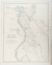
1861177021Edinburgh & London.: William Blackwood & Sons. 1861. Engraved map with original outline hand-colour 57 x 43.8 cm 61.1 x 49 cm sheet central fold very slight edge toning but the map in very good bright condition. First edition. Fine large folding map: the Nile delta and river with attractive original outline colour railways and canals marked and name references to biblical and classical geography. Published for inclusion as map 39 in "Keith Johnston's royal atlas of modern geography" . William Blackwood & Sons. unknown
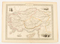
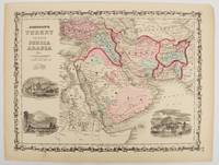
1860177019New York.: Johnson & Browning. circa1860. Engraved map 30.2 x 40.5 cm 34.5 x 45.5 cm sheet original hand-colour elaborate strapwork border three fine vignettes of Muscat Trebisond small marginal edge tears top corner chipped the map in very good condition. Most attractive decorative map of Arabia the Ottoman Empire Persia Afghanistan Beloochistan and surrounds by one of the most popular and successful 19th Century American atlas publishers. . Johnson & Browning. unknown
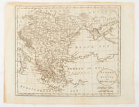
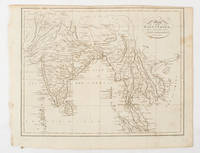
1805175148London & Glasgow.: W. and D. Brownlie. 1805. Engraved map 18.7 x 23.9 cm original folds age toned and spotted inner margin a trifle ragged paper thinning in a few spots in good condition. Attractive map engraved for "A System of Geography; or A Descriptive Historical and Philosophical View of the Several Quarters of the World" published in 1805. . (W. and D. Brownlie) unknown
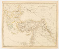
1840174957London.: Charles Knight & Co. circa1840s. Lithographed map with original outline hand-colour 31.9 x 39.1 cm small marginal tears neatly repaired with archival material but no loss small surface abrasion affecting the border at the foot edgewear and browning inked pagination in an early hand but in very good condition. A handsome map with fine topographical engraving also showing the borders with Hungary Russia and Persia. . Charles Knight & Co. unknown
1862111032294Printed by R. & R. CLARK Edinburgh: PRINTED FOR PRIVATE CIRCULATION 1862. Book. Fair. Hardcover. First Edition. 12mo - over 6¾ - 7¾" tall. Age-toned cover with black border and chocolate endpapers gilt spine title and gilt - In Memoriam. 1862 at front cover center. Fair condition with partially re-glued inner spine to text block and old tape at the inside front. Some page sections have been moved slightly forward from the binding and there is a separation at the contents gutter. The cover is spotted and sunned with frays at the corners and the pages are lightly foxed. Whole page 1863 associated related inscription at the half-title page with a 1971 inscription below from another relative. Pasted picture of his wife opposite the title page. Civil War era book. 7 x 4 1/2 with 133 pages. Rare. PRINTED FOR PRIVATE CIRCULATION Hardcover