ESTRADA, SantiagoBiblio.com
132 résultats
18891933PRIMERA EDICION.- Barcelona: Imp. Henrich y Cia. 1889.- XIII276 p.; en 4º. 23 cm.- Interesantes biografÃas americanas: Santiago Liniers; Félix FrÃas amplio estudio biográfico; Mi padre; El Tte. General Pedernera; Domingo Sarmiento.- CONTINUA EN EL MISMO VOLUMEN: ESTRADA Santiago.- Discursos / Precedidos de una introducción de D. Santiago Liniers.- Barcelona: Imp. Henrich y Cia. 1889.- XV327 p. 1 h.; 4º 23 cm.; Las 2 obras encuadernadas en un solo volumen en Media Piel de la época.- RARO. El lomo restaurado de un desgarro en la cabeza y algunas pequeñas rozaduras. En la portadilla lleva estampado un pequeño sello tampón del anterior propietario. Las portadas con mÃnimas y tenues motas de óxido. Dicho esto que es preceptivo el libro se encuentra por lo demás en muy buen estado. HISTORIA POLÃTICA Y DERECHO POLÃTICO-INTERNACIONAL AMERICANOS DESDE LA INDEPENDENCIA Libro en español Imp. Henrich y Cia. hardcover
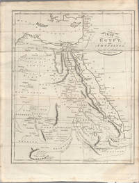
1803174955London. circa1803. Engraved map 23 x 18.5 cm original folds small split to one fold affecting the margin only paper age- toned lower corner darkened and on the verso inked circles to the lower half in an early hand but in good condition. Finely engraved early 19th Century map also showing to the north Syria Palestine and Cyprus and Darfur and Mountains of the Moon Sources of the Nile to the South. . unknown
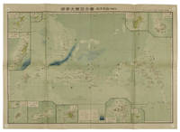
1819162103Tokyo.: Tōseisha. Showa 18 1943. Folding colour map of Australia 54.2 x 76.4cm. Some foxing particularly along folds and upper right margins a few repaired tears and small holes at folds.With original sleeve. The 15th map in the Standard Maps of Greater East Asia series of 20 maps. Shows the natural resources such as sheep gold pearl diary regions opals etc. Tasmania appears as an inset in the bottom right corner. Text in Japanese. . Tōseisha. unknown
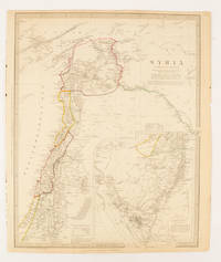
1843174934London.: Chapman & Hall. 1843. Engraved map with outline hand colour 39.4 x 31.4 cm inset map "Continuation from the Dead Sea to Mount Sinai" with finely engraved notes and a key to the Divisions under control of the Turkish Government manuscript pagination in an early hand to the top right edge tear nicks and browning but in very good condition. A most attractive map with detailed notes published when Syria was still under control of the Ottoman Empire. . Chapman & Hall. unknown
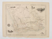
1851174666London.: Tallis John. 1851. Lithographed map 24.2 x 32 cm districts picked out in original hand colour inset vignette illustrations decorative border lower margin ragged but the attractive map in very good condition. Attractive decorative map from "Tallis's illustrated atlas and modern history of the world." one of the last great illustrated series of world maps. The fine vignettes are of Cape Town Graham Town and entrance to the Knysha Heads. . (Tallis, John). unknown
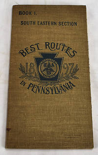
18972605120102Philadelphia: Armstrong & Fears 1897. 10. Maps. Very Good. Double sided foldout colored map 43 x 39 cm labelled "L.A.W. Local cycling Map" and colored corresponding to the road type. 79 p. Includes: an official list of consuls hotels and repair services in the area that acts as a very early example of a travel coupon. Pages include routes from Adamsville to Zionsville with route maps and information about the views road conditions and recommendations from riders. <br>Published to capitalize on the bike boom of the period where recent innovations in safety components and reduction of manufacturing costs made bicycles more commercially available and bike clubs sprung up across the country. Philadelphia was one of the centers of this Bike Boom due to it's relatively flat cityscape and was home to some of the most prominent cycling clubs. The League of American Wheelman was one of the most prominent with 103000 members in 1898 the year after this map was published. The league of American Wheelman still exists to this day. <br> Catalogued by Anastasia Rittenhousesmith. Armstrong & Fears unknown
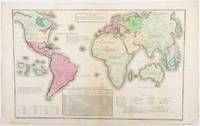
1835203763Philadelphia.: W. Marshall. Circa1835. Handcoloured engraved map 26.5 x 41.3 cms; 29.6 x 48.3 cms sheet central fold insets of "Oceanica" and "New Holland" central table some light staining in the image and margins in good condition. Eurocentrism laid bare. This 19th Century map includes a "State of Society" for each part of the world declared with a symbol to represent "Barbarous Half Civilized Civilized and Enlightened Societies" as well as noting religion and ethnicity. It includes a table of distances between chief towns or capitals and between these towns and Washington DC. Australia "New Holland" is styled principally as pagan barbarous unexplored and African a thin sliver of what is now New South Wales and Victoria is labelled civilized European and Protestant. Scarce. . (W. Marshall). unknown
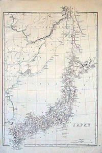
1852185246London.: Cassell Petter & Galpin. circa1852. Map with outline handcolour 42.5 x 30.1 cms; 49.2 x 34.3 cms sheet margins a little toned small corner crase but in very good condition. Very detailed map of the Japanese islands with Sakhalin above and the coast of Manchuria and Korea. . Cassell, Petter & Galpin. unknown
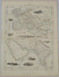
1850177525London.: The London Printing and Publishing Company. circa1850s. Lithographed map with original outline hand colour 33 x 24.5 cm including border and captions seven vignette illustrations two reference keys decorative border central fold light toning mainly at the central fold and to the verso of the sheet in very good condition preserved in a window mount. Attractive decorative map with fine vignettes of the London Post Office Suez Bombay Madras. Aden Malta Gibraltar and a wonderful camel train led by a carriage and horses crossing North Africa originally by the great mapmaker and publisher John Tallis. The two reference keys note steam packet routes railways electric telegraph and the Suez Canal. . The London Printing and Publishing Company. unknown
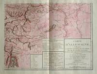
1805570721805. Copper engraving with handcolouring map shows the border of the Austrian Empire and Hungary Vienne sic and the Danube can be seen at the top of the map Two keys and scale inset. Few closed tears and some browning edges otherwise a clean and bright image. Map measures approximately 34 x 44cm. Map of Germany <br>indicating the present division of this empire as well as the new possessions of the princes who make up the Germanic body and including Batavia and Helvetia Switzerland with their divisions. by E. Mentelle a member of the institute and P. G. Chanlaire one of the authors of the National Atlas. An xiii 1805. Paris. There is a key to the explanation of the signs and an explanation of the colours used for the district of the various states contained in this map. . unknown
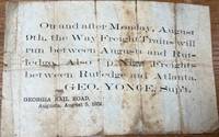
185836085Augusta: Georgia Rail Road 1858. Broadside. Fair. Broadside. Approximately 5" x 7.5". Paper is folded creased toned with two small holes. Tears at the splits. Tape repair on the blank reverse side. Fair condition only. Obscure. No other copies of this advertisement were found during a recent search. Georgia Rail Road unknown
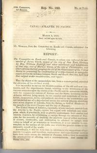
183928837Washington 1839. 25th Cong. 3d Sess. H.Rep.322. 167pp disbound. Six folding maps and chart. Several text leaves browned Very Good plus. <br /> <br /> Reviewing proposals and data for a canal route including a memorial from Matthew Carey. <br /> Morrison 5 noting only 3 maps. unknown
185830039New York: Benjamin Corlies 1858. Original printed glossy wrappers light fading to lettering. Stitched. 10 2 blanks pp. Near Fine.<br /> <br /> Founded in 1847 as the Rock Island and LaSalle Rail Road Company the Chicago and Rock Island reincorporated in 1851 and adopted these bylaws in 1858. In 1880 the Company was reorganized as the Chicago Rock Island and Pacific Railway. <br /> 131 Eberstadt 354. Benjamin Corlies unknown
1837228771837. 4.75" x 7.5" folded. 1 3 blank pp gilt edges. Old wax seal remnants with small blank edge tear caused by opening the seal. 'Hazzard Esq. New Port' in script on back. Very Good. A rare ephemeron of this railroad and early American railroad travel. The printed invitation is on the first page. The ticket is loosely affixed to blank page 3. It is printed 'Excursion Over the New York Providence and Boston Rail Road. November 10th 1837. 'Mr. Hazzard' is written in script on its verso. unknown
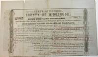
185438904Quincy IL: Patriot Office. Gibson & Warren Printers 1854. Folio broadsheet bond oblong 16-1/4" x 9-1/2." Old folds with a couple of short marginal fold splits no text affected. Printed in a variety of type fonts and styles. Very Good. Signed in ink by Thompson Chandler County Judge of McDonough County; Isaac Grantham County Clerk; N. Bushnell President of the Rail Road; and C.E. Lippincott State Auditor.<br /> <br /> The County is in West Central Illinois. The Rail Road one of the earliest Illinois Roads was operated by the State of Illinois until the late 1840s. It later merged with the Wabash Railroad. Patriot Office. Gibson & Warren, Printers unknown
185275654Buffalo:: Jewett Thomas & Co. 1852. First edition. original gilt-lettered cloth. Tear to the folding map neatly repaired on verso with Japanese tissue; slight use and fading to the cloth; very attractive. 12mo. Illustrated with maps and numerous engravings from original sketches including a folding map of the "Northern Route U. S. Mail Line.Steamers.New York and Rochester.and Routes from Albany to Niagara Falls Buffalo and Montreal" with inset view of Niagara Falls. Jewett, Thomas & Co., hardcover
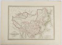
1837177519Paris. circa1837. Engraved map with original outline hand-colour 22 x 30 cm; 28.8 x 38.6 cm sheet marginal repair to the lower corner not affecting the map sheet lightly age-toned in very good condition preserved in a window mount. Fine map of China Japan and Central Asia noting Manchuria "Mandchourie" bordering Northern India and Turkestan in the West and Russia "Russie d'Asie" in the North. <br> <br>From the estate of the late collector and scholar Arthur Hacker with his pencilled catalogue mark on the verso. . unknown
1819155215統正社 Tōseisha . Showa 18 1943. Colour folded map 54. x 76.5cm. Pinholes at corners light even browning good copy. This Japanese map of Micronesia shows the Mariana Islands Eastern and Western Caroline Islands Marshall Islands and Gilbert Islands. The separate maps around the edge are clockwise from the upper right corner: Jaluit Atoll Guam Island Rota Island Saipan Island Palau Islands Yap Island Hall Islands Pohnpei Island Truk Islands and Kusaie Island. . 統正社 [Tōseisha ]. unknown
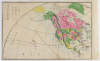
1877159812Kyoto.: 村上勘兵衛 文部省刊行. Murakami Kanbē; Monbushō kankō. Meiji 10 1877. Colour woodblock map of North and Central America. From the Journal of World Geography 萬國地誌略 published in 1877. Printed area measures 33.5 x 21cm a good copy with occasional soiling. . 村上勘兵衛, 文部省刊行. [Murakami Kanbē; Monbushō kanko& unknown
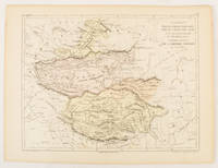
1856175109Paris.: Gustave Barba Editeur. 1856. Lithographed map with original hand colour central fold 24.2 x 31.5 cm marginal toning plate number in manuscript in very good condition. Finely engraved Dufour map of Central Asia prepared for his "Atlas Populaire" showing East Turkestan Petite Boukharie and Kalmykia Dzoungarie Mongolia and Tibet. . Gustave Barba Editeur. unknown
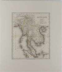
1866175919Hildburghausen: Bibliographischen Instituts. 1866. Engraved map with outline hand colour central fold 37 x 30 cm 47.4 x 36.2 cm sheet colour key to territorial control and administrative boundaries major cites towns roads rivers and mountains relief shown by hachures light toning in very good condition preserved in modern window mount. Detailed 19th Century regional map of the Malay Peninsula Vietnam Cambodia etc. extending from the Straits of Malaca and Singapore north to Hainan and the Gulf of Tonquin. Text in German prepared for Meyer's Hand Atlas noted in the marginal caption top-left . Bibliographischen Instituts unknown
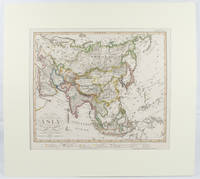
1855173439Gotha.: Perthes Justus. Circa1855. Engraved map 44.1 x 36.3 cm sheet size 35.8 x 29.7cm map size plate mark map with original hand colouring and hand coloured key noting Islamic "Mohammedanische" Buddhist "Buddhaistische" and European territories by country. Unusual map in an early issue. It was included as map 39 in Stieler's "Hand-Atlas uber alle Theile der Erde und uber das Weltgebaude by Frederic von Stulpnagel" revised by Hermann Berghaus in 1855. The issue is noted to the top right: Ausg. in 63BI. no XIV. Fine outline hand colouring denotes territories by religion and Chinese ports open to European trade and Japanese ports open to American trade. . Perthes, Justus. unknown
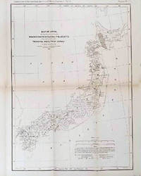
1878210211Philadelphia.: American Institute of Mining Engineers. Sherman & Co. printers. 1878. Large folding map of Japan showing "some of the more important Mining Districts Coal Fields etc." small fold split without loss tables 67pp. Covers a little scuffed and discoloured overall in very good condition. Scarce offprint separately paginated of a paper included in Volume V of the Transactions of the American Institute of Mining Engineers. The author Henry S. Munroe had been retained by the Japanese Government as Assistant Geologist and Mining Engineer with the Geological Survey of Yesso for the Hokkaidō Colonization Agency. His work laid the foundations for the future coal mining industry in Hokkaido. The report contains two lengthy tables relating to coal production and quality. . American Institute of Mining Engineers. Sherman & Co., printers. unknown
185821955MADRID: Imprenta de M. Rivadeneyra 1858. Primera edición.- 4º.- Media piel de época lomera con filetes y florones dorados.- 311 páginas.- 4 láminas fuera de texto más un mapa plegado todos en litografía. . Palau 84432 Imprenta de M. Rivadeneyra unknown
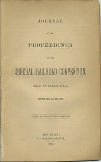
185240966New Haven: T.J. Stafford Printer 1852. First edition. Disbound. Removed from a larger volume else a very good copy chips to last three leaves of which two are blanks without loss of text. 24 pp. Sm. 8vo. To avoid ruinous rate wars railroads began to collude in earnest in the 1850s the first recorded meeting being that of the New England railroad companies in the winter of 1850-1851 followed then by this general railroad convention at Springfield Mass. called for by the principals of the New York and New Haven railroad to consider uniform train rules exchange of reports timetables and abuses in the issuance of free passes. The Ohio Railroad Convention thereafter met annually in the fifties. OCLC shows only eight locations: Lib. of Congress Amer. Antiquarian Soc. Harvard 2 Univ. Missouri Linda Hall Lib. Dartmouth and Univ. Denver. T.J. Stafford, Printer unknown