[ASIA-PACIFIC - MAP].Biblio.com
609 résultats
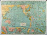
1945180206Sydney.: H.E.C. Robinson. Circa1945. Full colour inset maps principal cities and towns marked shipping routes international boundaries and railways. 99 x 73cm. Some small insect damage has been repaired on the verso visible on map as a few small lighter areas in the western Pacific. Pinpoint holes at folds paper repair along cover but a very good clean copy. From the Sydney publisher H.E.C. Robinson the firm founded in 1895 by Herbert Robinson 1857-1933 a founder of the Royal Geographical Society of Australasia. <br> <br>Although the map is undated North and South Korea are shown as divided which occurred in late 1945 and Manchuria is marked as still under Soviet occupation which only lasted until 1946 at which point it was handed over to Communist China. <br> <br>As well as what now would be considered Southeast Asia the main map shows the eastern half of India Tibet and parts of Mongolia the USSR and East Asia. Inset maps include: Caroline Islands Marshall Islands Federation of Malaya Singapore Hong Kong Taiwan Japan Hawaiian Islands Philippine Islands Midway Gaum and Wake Islands Fiji Islands Eastern & Western Samoa Santa Cruz and Solomon Islands New Caledonia Rabaul Tahiti Lord Howe etc. . H.E.C. Robinson. unknown
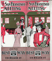
190151617N.P.: Privately printed 1901. 1901. 9 1/4" x 8" in clorful pictorial wrapper folded at center. 12 pp. Illustrations. Schedule. Overview of San Francisco along with information on its climate Chinatown The Cliff House Golden Gate Park Sutro Baths and Museum Nob Hill and side trips from San Francisco to include brief information on Monterey San Jose Paciic Grove Lake Tahoe Los Angeles etc. Information on the Burlington Route train and its railroad cars. Finally a schedule for the trip from Omaha .by way of Denver and Salt Lake City and onto San Francisco. Light soiling and light wear to the extremities. Very good. Privately printed, 1901. unknown
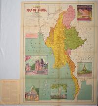
1951214601Delhi.: S.B. Makhija & Brothers. circa1951. Printed colour map 98.6 x 69 cms folding into pictorial wrappers 25.3 x 19.5 cms five pictorial colour inserts of pagodas and the Shwethalyaung reclining Buddha wrappers a little chipped marginal wear and three small fold splits in the map but overall in very good condition. Attractive large map of Burma with the provinces coloured steamship routes shown in red and printed in the booklet a range of information printed based on the 1951 census including climate agriculture and form of government "Burma became an independent nation completely outside the British Empire on January 4 1948 and is now a sovereign independent republic known as the Union of Burma". . S.B. Makhija & Brothers. unknown
192544354Chicago IL: Engineering and Contracting Publishing Co. 1925. 4to. 320 pp. 100s of photo illusts. diagrams text illusts. Embossed & decorated gray cloth lettering & decorated border red & black lettering on spine minor shelfwear light rubbing to corners VG copy w/ former ownership markings on ffep. First edition numbered on verso of title of this fascinating work illustrating the equipment and materials needed to build the roads and highways in the early automobile era. Included are asphalt companies oil burning equipment for road building and repairs expansion joint steel fencing companies steam rollers graders cranes excavators and much more. Engineering and Contracting Publishing Co., hardcover
193358148Chicago: Chicago Burlington & Quincy Railroad Printed by Poole Bros. Inc. 1933. Tall 8vo. 4 x 9 in. which folds out into 8 x 9 in. 4to. 20 pp unpaginated illustrated & printed in red & black throughout numerous photo illustrations text illustrations 1 double-page maps 1 double-page. Colour-illustrated softcovers cover art on front of the Hall of Sciences back cover w/ pictorial map of Burlington Routes slight shelfwear NF copy. First edition of this very scarce promotional brochure advertising the low round trip rates being offered by the Burlington Route for tourists to the 1933 Chicago World’s Fair. Detailed descriptions are included of the Exposition exhibits a birds-eye view of the Century of Progress grounds amenities in Chicago and the Travel & Transport Building which held a special Burlington Route exhibit. Kaufmann & Fabry was an active commercial photographic firm specializing in architectural photography in Chicago from before 1910 and are still in existence. No copies located in Worldcat. Chicago, Burlington & Quincy Railroad, [Printed by Poole Bros., Inc.,] paperback
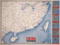
1945194660New York.: Army Information Branch. Volume III No. 51F. 9 April1945. Folding colour map and six inset maps in a vertical panel 88 x 119 cms sheet and on the recto circular map of Europe smaller inset map of Asia and of the Ryukyu Islands descriptive text original folds in very good bright condition. Scarce Newsmap of "China Southeast Coast" from Shanghai to French Indochina with the islands of Formosa and Hainan. At the right edge are inset maps of the vicinities of Shanghai Wenchow Foochow Swatow Canton and Hong Kong. On the verso is a large map of the European theatre of operations centred on Berlin a map of the Pacific area noting the American occupation of Okinawa with a detailed map of this island. In unusually fine bright condition. . Army Information Branch. unknown
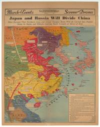
1940209821Los Angeles.: Los Angeles Examiner. 1940. Printed colour pictorial map on a single newspaper leaf 42.3 x 39.9 cms; 54.3 x 42.5 cms sheet archivally laid down on linen slight discoloration to lower centrefold and sheet slightly age-toned but in very good condition. A striking geopolitical map by Los Angeles Examiner artist Howard Burke covering China Japan Southern Russia and the northern part of French Indochina and Siam showing how the "Aggressors Divide China." Areas under Japanese occupation are shown in red and their naval blockade shown by an arc of naval vessels with vivid arrows indicating lines of supply. Text labels including sources of agricultural and raw materials provide a dynamic overview of the geopolitical situation and show the influence of American scientific illustrator and cartographer Richard Edes Harrison who argued for examining geographic issues from multiple perspectives and Los Angeles Times artist Charles Owens. . Los Angeles Examiner. unknown
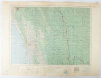
1955173072Washington D.C.: Army Map Service U.S. Army. 1955. Large colour map. 1:250000 scale. Transverse mercator projection. 23°00'N 91°30'E-22°00'N 93°00'E. Series U502 Sheet NF 46-6 Edition 1-AMS. Map measures 57.3 x 75.8cm. Slight wear creasing even light browning small closed tears on edges upper-right corner little foxed. Shows signs of use but map is clean and complete. Corps of Engineers Army Map Service map of Chittagong and surrounds compiled in 1955. Based on the British Indian one-inch and half-inch map series from 1938-43 and 1936-43 respectively. . Army Map Service, U.S. Army. unknown
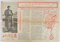
1967169746Beijing.: 地图戰報.Di tu zhan bao. September1967. Maps printed in red and black single sheet printed on both sides folded scale not given photographic image of Mao Zedong. Some light browning at edges with tears and losses on left edge still good. Text in Chinese. Sheet measures 26.5 x 38.4cm. Includes a map of Autumn Harvest Uprising and also shows the routes of the military advancing towards Jinggangshan between September and October 1927. On reverse left section a map shows the route along which Chairman Mao led the Fourth Army of the Chinese Red Army marching towards south of Anhui and Jiangxi Provinces in 1929. On reverse right section a map titled "The Long March of The Chinese Workers' and Peasants' Red Army October 1934-October 1935". Quotations of Chairman Mao about the Long March insert on corners of the map. <br> <br>Issue no. 6 of a series of maps with text issued by the Red Guards organisations in the form of Cultural Revolution tabloid-sized newspaper. This issue is designed to celebrate the 40th anniversary of the Autumn Harvest Uprising which was one of the earliest armed uprisings organised by the Chinese Communist Party. . 地图戰報.[Di tu zhan bao]. unknown
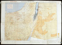
1942207841London.: Royal Engineers. July1942. Printed colour topographical map mounted on linen 56.7 x 79.2 cms; 64.6 x 89. 5 cms sheet original folds edgewear small marginal chips a little dusty but in good condition. Detailed World War II operational map of Egypt and the Middle East issued by 512 Army Field Survey Company of the Royal Engineers. The map is marked "Not to be Published" in the upper right margin. Railways roads camel tracks telegraph lines boundaries altitudes towns and villages are marked. . Royal Engineers. unknown
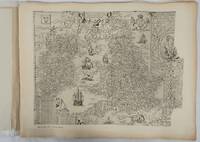
1932176499London.: Royal Geographical Society. 1932. Twenty one loose maps with tissue guards printed on sheets 49.5 x 63.5 cm in the original folio title-wrappers the maps with some edge wear and toning but on the whole in very good condition the wrappers browned and stained torn with minor loss at the foot of the title wrapper small closed edge tears now re-enforced with archival material and sound. Lacking the introductory notes by Edward Heawood. The complete suite of maps: an impressive production. The first map is a general map of England and Ireland by an unknown author 1594; nineteen county maps; and a final sheet of miniature county maps printed as a deck of playing-cards. The county maps proper vary in date from Saxton's “Southamtonia” of 1575 to John Speed's version of Norden's map of Sussex dated 1610. A contemporary reviewer dubbed it " a rich cartographical feast" allowing easy access to rare and valuable maps and comparison of maps by different cartographers for the same county. <br>The county maps reproduced include five by Christopher Saxton three by John Norden Philip Symonson's map of Eastern Kent published in 1596 a series of seven maps dating from the early years of the seventeenth century two maps prepared for Camden and two published by John Speed. . Royal Geographical Society unknown
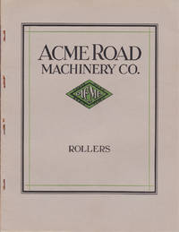
1927014098NY: Acme Road Machinery Company 1927. Quarto. 48 pp; illustrated throughout in b/w. Stapled wraps. Very good with some rusting to staples and a small split to top of spine. Internally clean and bright. Early examples of heavy road working equipment. Soft Cover. Near Fine. Acme Road Machinery Company Paperback
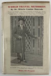
193212800Washington DC: Claude T. Clements Press 1932. 14362pp. Profusely illustrated. Publisher's tan cloth with titles stamped in brown on spine and front board. In original unclipped pictorial dust jacket. Minor edge wear light insect damage to boards. Dust jacket either trimmed a bit short or originally produced a half-inch shorter than boards. Minor dust-soiling to jacket with minor insect damage to rear flap. Internally clean. Overall very good. The rare autobiographical travel narrative by one of the most important Filipino-American political leaders in history especially notable for retaining the original pictorial dust jacket. Hilario Camino Moncado established the Filipino Federation of America in 1925 in Los Angeles California. It was also known at various times as the Filipino World Federation and the Filipino Crusaders World Army. As one of the fraternal organizations appealing to the small but growing Filipino immigrant community the FFA distinguished itself from competitors by accentuating "clean living" and rules of moral conduct. Moncado earned a law degree and also edited and published Filipino Nation. Through his work Moncado sought to portray the immigrant community as responsible and healthy in contrast to the then-prevalent depictions of them as uneducated gamblers. Much less publicly the FFA developed a set of religious teachings that held Moncado to be the reincarnation of Jesus Christ by way of José Rizal the Filipino patriot executed in the waning days of Spanish rule. Moncado's birthday was changed to make him appear to have been born after Rizal's death so that his identity as Rizal's reincarnation would be more plausible.<br /> <br /> In the present travel memoir Moncado focuses on political and social issues encountered on a trip around the world conveying an impression of worldliness which burnished his reputation within the Filipino-American community. He visits England Holland Germany France Italy Egypt India China Japan and "Home Sweet Home Philippines." A sampling of chapters focus on London his visit to Oxford University the refusal of Germany to pay reparations from the First World War mentioning the German people's and particularly Hitler's stance against paying them any further his visit to the League of Nations "Mussolini - Benevolent Despot or Tyrant" Gandhi and "India's Revolution" China "The Awakening Giant" "Americanized Japan" and the betrayal of the Filipino independence movement by the American Congress.<br /> <br /> OCLC records just eight institutional copies including one in the Philippines one in Singapore and six in the United States at NYPL UC-Davis the University of Hawaii Michigan Washington and Wisconsin. Claude T. Clements Press unknown
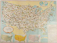
1955172003Washington D.C.: 国務省. Kokumishō. No date. circa1955. Large folding Japanese coloured map of the United States with 3 inset maps at foot of map showing main railways air and highway routes and hemispheres at the top right. Some browning mainly visible on reverse still a good copy. 66 x 81cm. An intricate and detailed pictorial map of the United States published in Japanese by the US State Department. The same type of map had been published since 1945 in English and subsequently in other languages. The Japanese language map is hard to find. The map is undated but was probably produced in the 1950's. The images include depictions of women board riders in two piece swimsuits of the sort popular in the 1950s but the inset text lists Alaska and Hawaii as external territories of the US indicating that the map was produced before they attained statehood in 1959. <br> <br>An inset panel provides information on the area and population of the US the population of major American cities mineral and other resources climate and topography. A note at the bottom right hand corner of the map states that copies of the map can be obtained free of charge from your nearest US Information Office. <br> <br>Every region of the country is decorated with an illustration of the natural resources industries or cultural or historical resources associated with that particular place. These include images of early colonial settlers the birthplaces of Mark Twain and Woodrow Wilson Booker T. Washington's house and Abraham Lincoln's grave; images of major dams oil fields coal mines cotton plantations etc. various animals and crops and images of ships cars and public buildings including the Statue of Liberty located rather oddly far out at sea. . 国務省. [Kokumishō]. unknown
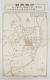
19671632381967. Vintage transportation black and white map of Hangzhou folded no scale a legend lower right corner shows bus/trolleybus routes and terminals. The map covers the old city of Hangzhou from the north side of the city 杭三中"Hangzhou No.3 High School" to the south side 钱江大桥 "Qiantang River Bridge". The West Lake is featured in the centre with its famous tourist spot 三潭映月 "Three Pools Mirroring the Moon" indicated. Bus/trolleybus routes connects schools hospitals municipal government departments cinemas department stores tourist spots around the West Lake etc are all shown on this map. <br> <br>Stained in the central section light wear along folds and edges otherwise good. Text in Chinese. Sheet measures 39.1 x 24.8cm The headline Chinese text in the box along the top of the map reproduces one of the highest directives from Mao's Quotations: "You must pay attention to state affairs and carry the great proletarian cultural revolution through to the end!" . unknown
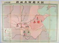
1958171563Beijing.: 地图出版社. Di tu chu ban she. 1st Edition 2nd Printing. 1958. Large Chinese coloured educational map folded. Scale 1:2000000 legend lower left corner showing the military advance of two peasant insurgent groups Lulin and Chimei's march towards the capital city Chang'an now Xi'an in 17 AD. In original worn paper wrapper map in very good condition. Text in traditional Chinese. Map measures 77 x 105.2cm. 王匡 Wang Kuang and 王凤 Wang Feng founded the Lulin Army in the region of modern Hubei Province. 樊崇 Fan Chong lead the Chimei also known as Red Eyebrows Army in the northern parts of modern Shandong Province. . 地图出版社. [Di tu chu ban she]. unknown
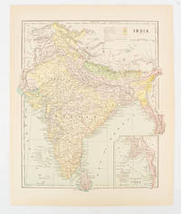
1910174839New York. circa1910. Printed colour map 29 x 25 cm with inset map of the Eastern Part of India colour key reference key to the ruling divisions current and projected railways and telegraphs also shown central fold slight toning; in very good condition. Interesting map shaded by Divisions: the Presidencies of Bengal Madras Bombay Ceylon "Native States under British Protection" and "Independent States" Nepal and Bhutan. . unknown
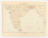
1910174841London. circa1910. Printed colour map on conjoined pages 22.3 x 33.7 railways submarine cables and heights above sea level marked faded but in very good condition. Map showing the ruling divisions by shading borders with Burma and the Andaman and Nicobar Islands also shown. . unknown
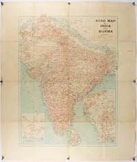
1940211089Bombay.: Joshi & Co. circa1940. Colour lithographic map 66 x 50 cms; 81.x 68.5 cms sheet two inset maps and on the verso a full sheet "Relief Map of India" original folds with fold splits archivally strengthened several city names have been neatly underlined “Agartala” inked in the margin overall in good condition. Scarce Bombay-published map of the pre-Partition Indian sub-continent with two small inset maps one showing roads around Karachi and the other Burma. Through Routes Other Main Roads and Motorable Roads Subject to Weather are marked. The "Relief Map of India" on the verso includes Railway Lines Canals Steamer Routes Rivers Air Routes Navigable Canals and Broadcasting Stations. . Joshi & Co. unknown
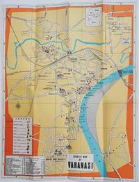
1960178269Circa1960. Folding colour tourist map of Varanasi in Uttar Pradesh province two inset maps of India and a gude map of Sarnath legend and key select Ghats shown railways "western style" and "Indian style" hotels marked in very good condition. 42.9 x 33.1 cm. . unknown
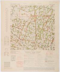
1945200411Washington D.C.: Army Map Service. First edition - revised AMS4. 1945. Army survey map printed in colour 36.7 x 36.7 cm; 58 x 48 cm sheet conversion graph glossary and administrative index to the inner margin; scale three column legend index to adjoining sheets and notes re grid references and mean declination to the foot; sheet toned a very few edge tears the map in very good condition. Wartime map produced by the US Army Map Service AMS who formed in 1942 and were at the forefront of military mapping campaigns during WWII and the post-war years. The very detailed map shows residency and administrative boundaries transportation ground and water features vegetation cultivation ruins religious sites "Graves; Chinese native" and "Cemetery; heathen Christian" walls hedges populated places built-up areas and buildings with those of iron stone wood and bamboo differentiated by colour; fishponds plantations and much more. . Army Map Service. unknown
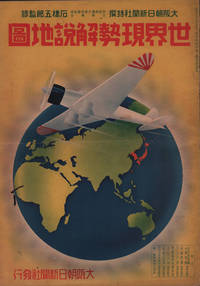
1937208633大阪朝日新聞社. Osaka Asahi Shinbunsha. Showa 12 1937. 10 colour maps not including insets or sketch maps in text on 12 pages. Handsome world map features as the centre fold colour pictorial paper wrappers. A little light soiling and horizontal crease wrappers. An attractive atlas. 38 x 26.7cm. A large format atlas with six pages of coloured maps showing the nations of the world and five pages of Japanese text. The publication seems to have been produced to celebrate the 1937 world record flight from Tokyo to London by Iinuma Masaaki and Tsugayoshi Kenji in their plane 'Kamikaze' which was sponsored by the Asahi Newspaper. The front cover depicts the plane soaring over a map of the world while the back cover also had a colour image of the 'Kamikaze' with an advertisement for the Oji Paper Company which we are told donated a hundred million yen to support the flight. The name 'Kamikaze" had at that stage not yet taken on the connotations which it acquired during the Pacific War. <br> <br>The maps inside the volume show political boundaries major cities and transport routes. The opening pages show the Japanese Empire including Japan proper Korea Karufuto and Manchukuo with small insets covering Taiwan the Chishima Archipelago and Japan's South Sea mandate. The accompanying text focuses on Japan's newly acquired client state of Manchukuo detailing its area population principle products etc while the map includes graphs illustrating Japan's trade with the world and with Manchukuo. China receives an entry of its own with a map of the Chinese Republic and information on the political situation population trade and infrastructure. The central pages of the volume are taken up with a double-spread map of the world including depictions of the flags of a selection of the world's nations. Other sections of the work cover Asia Europe America Africa and Oceania grouped together. The discussion of Oceania includes a section on Hawaii and some small and improbable depictions of Maori and Indigenous Australians. . 大阪朝日新聞社. [Osaka Asahi Shinbunsha]. unknown
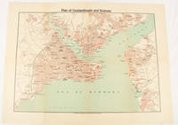
1925174961Constantinople.: The Anglo-American Book & Newsagency. 1925. Printed folding colour map 36 x 49.2 cm street grids for Stambul Pera Galata and Skutari railways and landing places marked small fold splits affecting the margins only now repaired with archival material two small holes at central folds pin-holes to the four corner some age-toning but in very good condition. A scarce map of the historic peninsula soon after the Republic of Turkey was founded and the capital moved to Ankara. Printed for the tourist market this map is a rare survival. . The Anglo-American Book & Newsagency. unknown
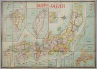
1906197908Kobe Japan.: Fuku-In-Kwan. 1906. Printed colour folding map on two conjoined sheets laid down 73.8 x 10⁵ cms foxing on verso not affecting map single pinhole in each corner scant spotting small fold splits no loss a few soft fold creases but in good condition. Very rare striking map of Japan published for the Western market. <br> <br>Created under the direction of Takachika Okishio featuring 10 inset maps: Chishima Kurile Islands Hokushu Hokkaido Ogasawara-Jima Bonin Islands Hachijo-Shima Ioshima Okinawa Saki-Shima Kyushu Saikaido Taiwan Formosa and Eastern Asia. The insets of Taiwan and Kyushu are the largest and centrally positioned. A Glossary and Explanation of Signs is printed at the foot of the map which list Towns Railway Stations Boundaries of Prefectures Notable Places Hot Springs Water-falls rapids Volcanoes Light-Houses Gold Silver and Coal-Oil fields. The Japanese Government Railway series of Travellers' Maps of Japan appear to have been modelled after this design. . Fuku-In-Kwan. unknown
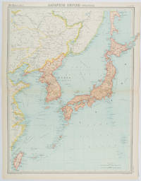
1922215880Edinburgh.: John Bartholomew & Son Ltd. 1922. Large double page map 54.2 x 43 cms map original fold some edge toning and to the fold but in very good condition. Large map prepared as plate 65 for “The Times Survey Atlas of the World” in 1922 and was prepared at the Edinburgh Geographical Institute under the direction of J G Bartholomew. The map shows Japan's territory inclusive of Korea southern Sakhalin and Taiwan. . John Bartholomew & Son Ltd. unknown