609 résultats
1968Q-0803815298Hastings House 1968-01-01. Hardcover. New. New. In shrink wrap. Looks like an interesting title! Hastings House hardcover
197645337Zürich, Diogenes Verlag AG, 1976. 166 Seiten , 18 cm, kartoniert
19572090502113710821Not Available 1957. Soft Cover. Fine. The book is in fine condition. Not Available paperback
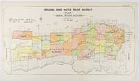
1912177249Sydney.: W.A. Gullick Govt. Printer. 1912. Large lithographed folding county map 78.8 x 45.4 cm the parishes highlighted in colour two small fold splits slight toning in very good bright condition. Attractive map from the Report on the first Interstate Conference on Artesian Water Sydney 1912 showing boundaries of water trust districts proposed boundaries with position and length of drains for the counties of Denham and Jamison in northern New South Wales boundaried by the Namoi River to the South. . [W.A. Gullick, Govt. Printer] unknown
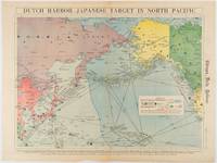
1942180751Chicago.: Chicago Daily Tribune. Friday June 51942. Printed colour map on a single newspaper leaf 37.5 x 53.2 cm; 44.7 x 59.8 cm sheet inset legend marginal browning and at the folds some undulation of paper and tide mark along lower section but in remarkably bright very good condition. Strategic map published in the Chicago Daily Tribune "The World's Greatest Newspaper" on June 5th 1942 two days after the Japanese attack on Dutch Harbor the site of the US army and navy bases in the Aleutians and as it transpired at the outset of the Battle of MIdway. The owner and proprietor of the Tribune Robert McCormick was staunchly against the United States entering the war and had firm views once it had occurred that American resources should not be used defending the British Empire. Famously the Tribune published the "Victory Program" Roosevelt’s military plan to prepare the United States for possible entry into World War II and was subject to prosecution for an alleged violation of the Espionage Act relating to the newspaper’s front-page account of the Battle of Midway 4-7 June 1942. It became an important test case for the limits of free speech and censorship during war-time. <br> <br>The Legend shows territorial Control of Ocean Areas marking Japanese Naval and Air bases as of 1941 and "according to latest reports" those established in the first six months of 1942. Also shown are pre-war sovereignties as at the bombing of Pearl Harbour on December 7th 1941. The Anson Archipelago is shown but a question mark "indicates islands etc. whose existence or give position is doubtful…". . Chicago Daily Tribune. unknown
1965359284City of Washington: Smithsonian Institution Press 1965. Hardcover. Near Fine. First edition. Quarto. 234pp. Blue cloth with gilt stamping on front board and spine. Spine ends and corners bumped owner's name penned on front pastedown else near fine. Smithsonian Contributions to Anthropology: Volume 1 Whole Number. Smithsonian Institution Press hardcover
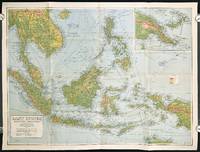
1940211106Sydney.: H.E.C. Robinson Pty. Ltd. circa1940. Full colour folding map 71 x 97 cms; 76.2 x 10² cms sheet blank on verso save for a neat inked stamp "East Indies" inset map of New Guinea and Papua heights shown by colour very good clean condition. Large scale World War II era map by Sydney publisher H. E. C. Robinson. Extremely detailed map it is coloured according to height above sea level and showing naval bases railways shipping routes air routes. Includes smaller inset map of "New Guinea & Papua" showing the eastern part of the island. . H.E.C. Robinson Pty. Ltd. unknown
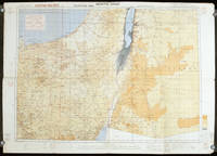
1942207841London.: Royal Engineers. July1942. Printed colour topographical map mounted on linen 56.7 x 79.2 cms; 64.6 x 89. 5 cms sheet original folds edgewear small marginal chips a little dusty but in good condition. Detailed World War II operational map of Egypt and the Middle East issued by 512 Army Field Survey Company of the Royal Engineers. The map is marked "Not to be Published" in the upper right margin. Railways roads camel tracks telegraph lines boundaries altitudes towns and villages are marked. . Royal Engineers. unknown
19962092902143902049Shunju-sha 1996. Soft Cover. Fine. Number of books: 1 book Shunju-sha paperback
19962092902143802085Shunju-sha 1996. Soft Cover. Fine. Number of books: 1 book Shunju-sha paperback
19951145250Universidad Nacional Autonoma de Mexico 1995. Softcover. Fine/No jacket. In Spanish. Limited to 500cc. Universidad Nacional Autonoma de Mexico unknown
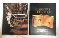
199259701Madrid: Museo Naval 1992. 2 Vols. 31x24 307p.- 308p ilustraciones. Tapa dura editorial con sobrecubiertas. Buen estado. De esta primera edición se hizo una tirada de 750 ejemplares numerados siendo el presente el número 70. Museo Naval hardcover
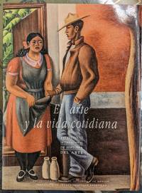
1990AY-GRMX-HZ7TInstituto de Investigaciones Esteticas-Universidad Nacional Autonoma de Mexico 1990. Rústica. Very Good. Hard to find first edition of this foundational work of sound studies in Mexico published by UNAM in 1990. Publisher's illustrated wraps. Minor creases to cover and first few pages else a very good copy. Shipped from Mexico City Used book in good to very good condition unless otherwise noted. All our books are thoroughly checked for issues such as missing dust jackets markings library stamps and so on. If we notice a book was misdescribed we will always let you know before shipping. We're a brick and mortar store and handle every single book with respect and care. Instituto de Investigaciones Esteticas-Universidad Nacional Autonoma de Mexico paperback
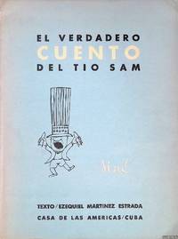
1963311144-KL4La Habana Cuba : Casa de las Américas 1963. Softcover. Good. Original wrappers softcover illustrated with b/w drawings 4to. From the colection of Kees Broos name in pencil on half title.; Dedication on half title; partly slightly discoloured. La Habana, Cuba : Casa de las Américas paperback
1991AD-LUWJ-9YDTSan Luis PotosiÌ MeÌxico: Archivo HistoÌrico del Estado de San Luis PotosiÌ 1991. Fine. Used book in good to very good condition unless otherwise noted. All our books are thoroughly checked for issues such as missing dust jackets markings library stamps and so on. If we notice a book was misdescribed we will always let you know before shipping. We're a brick and mortar store and handle every single book with respect and care. Archivo HistoÌrico del Estado de San Luis PotosiÌ unknown
190395773New York New Haven & Hartford Rail Road Company 1903. Pamphlet. Used - Very Good. L.S. Punderson New Haven later William H. Clark New York Printers 1883 to 1903. 12 to 44 pages each. Some have map. 9 x 6" printed wrappers. Bowdoin College rubberstamps lightly creased VG. New York, New Haven & Hartford Rail Road Company unknown
19731003065<p>Photographic facsimile of the Fray Francisco Ximenez manuscript of K'iche Quiche and Spanish-language versions of the Maya _Popol Vuh_ side by side with transcription on the facing page. 301pp. 16 illus. some color. 32 x 21.5cm. Inscribed by Agustin Estrada Monroy on front end paper. This book belonged to U.S. Anthropologist Dennis Tedlock and has some pencil notations especially comparisons to Brasseur's version. Spine taped and covers are worn. In stock. Recommended to a scholar! Usually ships within three days. </p> EDITORIAL "JOSE DE PINEDA IBARRA". MINISTERIO DE EDUCACION paperback
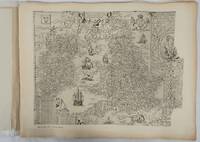
1932176499London.: Royal Geographical Society. 1932. Twenty one loose maps with tissue guards printed on sheets 49.5 x 63.5 cm in the original folio title-wrappers the maps with some edge wear and toning but on the whole in very good condition the wrappers browned and stained torn with minor loss at the foot of the title wrapper small closed edge tears now re-enforced with archival material and sound. Lacking the introductory notes by Edward Heawood. The complete suite of maps: an impressive production. The first map is a general map of England and Ireland by an unknown author 1594; nineteen county maps; and a final sheet of miniature county maps printed as a deck of playing-cards. The county maps proper vary in date from Saxton's “Southamtonia” of 1575 to John Speed's version of Norden's map of Sussex dated 1610. A contemporary reviewer dubbed it " a rich cartographical feast" allowing easy access to rare and valuable maps and comparison of maps by different cartographers for the same county. <br>The county maps reproduced include five by Christopher Saxton three by John Norden Philip Symonson's map of Eastern Kent published in 1596 a series of seven maps dating from the early years of the seventeenth century two maps prepared for Camden and two published by John Speed. . Royal Geographical Society unknown
1998SONG0471977136Wiley 1998-06-29. 1. hardcover. Used: Good. 6.22x0.63x9.25. Buy with confidence. Excellent Customer Service & Return policy. Wiley hardcover
1998DADAX0471977136Wiley 1998-06-29. 1. hardcover. New. 6.22x0.63x9.25. Buy with confidence. Excellent Customer Service & Return policy. Wiley hardcover
1998x-0471977136John Wiley & Sons Inc 1998. Hardcover. New. 194 pages. 9.00x6.00x0.75 inches. John Wiley & Sons Inc hardcover
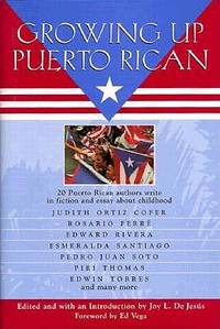
1997Q-0688142931William Morrow & Co 1997-05-01. Hardcover. New. In shrink wrap. Looks like an interesting title! William Morrow & Co hardcover
1997mon0000106688New York : Morrow 1997-01-01. Hardcover. New. in x in x in. New York : Morrow hardcover
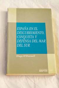
19923707293Madrid.: MAPFRE. 1992. Paperback. Good. 23 cm. 291 p. il. Encuadernación en tapa blanda de editorial ilustrada. O'Donnell y Duque de Estrada Hugo 1948-. Colección Mar y América. volumen coleccion 6. Ãndices. PiraterÃa. PacÃfico Región. Historia. Españoles . ISBN: 847100335X rúst Viajes de descubrimientos. Expediciones 910.4265"15/19" Arte militar en general 355.49265"15/18" MAPFRE. paperback