[Western Americana] [Road Trips]Biblio.com
609 résultats
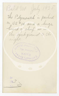
1935152267N.p.: N.p. 1935. Archive of 24 vernacular photographs documenting a 1935 summer road trip through the badlands of South Dakota Idaho and Wyoming. Each photograph with manuscript ink annotations identifying location to the margins and manuscript pencil annotations to the verso noting locations and dates along with the stamp of Rays photography studio in LaCrosse WI. <br /> <br /> Captured in the archive are various natural landmarks including Shoshone Canyon IXL Ranch and Bighorn Mountains in Wyoming Bald Mountain in Idaho and the Black Hills Badlands and Missouri River in South Dakota. Also included are a few photographs taken along US Route 14 one of the original US highways of 1926 an east-west route running 1398 miles. An alternately charming and chilling collection of Depression-era travel photography in the Midwest and Mountain West. <br /> <br /> 23 photographs 4.5 x 2.17 inches 1 photograph 3.5 x 2.75 inches. Generally Very Good plus some with light fading and age toning. N.p. unknown
19732090502113717581Not Available 1973. Soft Cover. Fine. The book is in fine condition. Not Available paperback
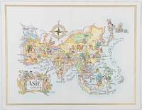
1964195995Pan American World Airways. 1964. Colour pictographic/pictorial map of Asia 23.2 x 30.1 cms gilt double-rule border printed on a folding decorative menu card 32 x 50 cms open highlighted in gilt text in English French and Japanese central fold and later central vertical crease in very good condition. Pan Am menu card for First Class passengers dubbed "The President Special" the deluxe cuisine by fabled Maxim's of Paris "Good food is the basis for true happiness". Passengers were feted with gourmet meals on bone china with silver cutlery. The witty pictorial cover-map of Asia was by French artist and commercial illustrator Jacques Liozu 1910-1974 also known for his larger scale maps. . Pan American World Airways. unknown
1993CBS-9780817637163Sp Springer 1993. New. Sp Springer unknown
1993CBS-9780817637163Sp Springer 1993. New. Sp Springer unknown
1993Q-0817637168Birkhauser 1993-12-01. Hardcover. New. New. In shrink wrap. Looks like an interesting title! Birkhauser hardcover
1993DADAX0817637168Brand: Birkhauser 1993-01-01. 1. hardcover. New. 6.50x0.75x9.75. Buy with confidence. Excellent Customer Service & Return policy. Brand: Birkhauser hardcover
19492092902137305003Arusu 1949. Soft Cover. Fine. The book is in fine condition. Arusu paperback
19492092902137303867Arusu 1949. Soft Cover. Fine. The book is in fine condition. Arusu paperback
1949TECH1162Wels, O.Ö. Landesvlg. (1949). 238 S., mit 10 Abb. auf Taf. u. im Text, 1 Landkarte u. einem Verzeichn. d. Strassenmeistereien, OHLn., Besitzerstemp. auf Vorderdeckel, flieg. Vors., Innentit. u. Index, Reste eines Papierschildch. am Rü., Einbd. abgegriff., leicht angestaubt, Ecken u. Kanten berieb., schwach fingerfl.
196423280ABo.O., o.V., o.J, (1964). 8°. Plasitfizierte Mappe mit Druckknopfverschluss. + Wichtig: Für unsere Kunden in der EU erfolgt der Versand alle 14 Tage verzollt ab Deutschland / Postbank-Konto in Deutschland vorhanden +
191921882Los Angeles: Automobile Club of Southern California 1919. First Edition. Large folding map 22" x 28". Three tears at fold lines two small spots on front; a very good copy. The left portion of the map lays out the main cities of Dinuba Oros Visalia Exeter Tulare Lindsay Tipton and Porterville. The right portion depics the Sierra Forest Reservation Sequoia National Park Tule River Indian Reservation California Hot Springs various camps and more. Automobile Club of Southern California unknown
1915015456Antwerpen: Willem Seghers Litho-Grav. 1915. Map. Good. Unframed. First Edition. 120x86cm. A substantial map 120 x 86cm colour printed in two halves and joined on the back. A few edge tears and a few splits to the central folds a couple of splits repaired to the verso with paper tape several light creases. A good copy. Seemingly scarce. Willem Seghers, Litho-Grav. unknown
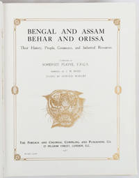
1917214418London and New York.: The Foreign and Colonial Compiling and Publishing Co. 1917. Numerous black and white photographic illustrations. 768pp. Full red morocco binding spine lettered and ruled in gilt in compartments 'Tiger head' emblematical device stamped in gilt on the upper board repeated in gilt on the title page corner ornaments blocked in gilt. All edges gilt marbled endpapers light rubbing to corners but a lavishly produced edition in exceptional condition. 30 x 23.5cm One of a series of publications published with the object of supplying the British public with a picture - complete as far as literary and pictorial effort could make it - of the several different parts of the Empire. in this instance Northern India. . The Foreign and Colonial Compiling and Publishing Co. unknown
1943TECH1133(Wien 1943). 4°, 68 Bl. Manuskriptdruck + 30 gef. Abb. in Kart.-Umschl. m. Leinenbindung, zus. in Leinenband m. ms. geschrieb. Rückenschildch., die Abb. sind sep. in Umschlaglasche am inn. Vorderdeckel, Rü. stärker ausgebleicht, Ecken etw. bestoß., abgegriff., papierbed. gebr., Bibl.-Expl. mehrf. gestemp.
2000mon0004112882Bloomsbury Academic 7/9/2026 12:00:01 AM. paperback. Like New. 0.5500 8.9500 6.0500. Bloomsbury Academic paperback
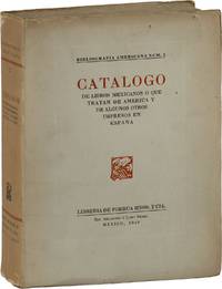
194987925Mexico: Libreria de Porrua Hnos. y CIA 1949. Limited Edition. One of 400 copies of which this is No.154 softcover. Octavo 24.5cm; white paper wrappers; xxiv12-8897pp; fore- and bottom- edges untrimmed; black-and-white illustrations throughout. Some pages of text unopened. Text in Spanish. Tanned with modest shelf-wear and trace shelf-soil; Very Good. Catalogue on literature of Mexico and the Americas. 87925. Libreria de Porrua Hnos. y CIA unknown
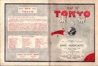
1954194113Tokyo.: Charles E. Tuttle Company. 1954. Printed four colour map 92 x 71cm; 102.5 x 74.5cm sheet folding into pictorial wrappers 25.6 x 19 cms inset map of the Marounouchi District and on the verso an extensive grid reference in English and Japanese and over four panels a map of the streetcar railway and subway system scant spotting to cover two small fold splits without loss and toning most evident at the folds in very good condition. Comprehensive 1950s map of Tokyo by US publisher Charles E. Tuttle "Here at last is the map that makes order out of chaos.extending as far as Haneda Airport Grant Hights Harbor Area and Nakano Ward" blurb. . Charles E. Tuttle Company. unknown
1999Q-1555662471Johnson Books 1999-11-01. Paperback. New. In shrink wrap. Looks like an interesting title! Johnson Books paperback
19722090502124600020Kanae Document Bureau 1972. Soft Cover. Fine. Number of pages: 456P Kanae Document Bureau paperback
19522090502113716000Not Available 1952. Soft Cover. Fine. The book is in fine condition. Not Available paperback
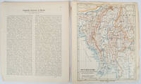
1903173709Gotha: Justus Perthes. 1903. Map printed in colour 24.7 x19.4cm and leaf of descriptive text in German 26.5 x 22.5cm slight toning and edges of the map worn with two small tears no loss. Geopolitical map of Burma with railways and railways under construction highlighted. The accompanying text is by the German Tibetologist linguist and orientalist Dr Emil Schlagintweit. . Justus Perthes unknown