609 résultats
19992090502113709596Not Available 1999. Soft Cover. Fine. The book is in fine condition. Not Available paperback
19702092902141102542Fuji Etsu shobo 1970. Soft Cover. Fine. Volume: 1 Fuji Etsu shobo paperback
191046197New Orleans: Privately printed 1910. 1910. First edition. 6" x 4 1/2" in colorful pictorial wrappers. 40pp. Illustrations. Map. Overview of New Orleans in the winter. Information on various streets houses and buildings important people cemeteries and with much on Mardis Gras. Also discusses "New" New Orleans with information on cemeteries the Jackson Barracks Canal Street City Park the West End Audubon Park Riverfront etc. Listing of theaters hotels restaurants railroad depots etc. Opposite each page of text is a full-page green-tinted photograph of the various buildings streets areas etc. in New Orleans. Appears that someone unstuck the tops of the first few pages leaving page residue at tops as well as some closed tearing to those pages. Wrappers lightly soiled. Very good. Nicely produced. Privately printed, 1910. unknown
19612090202118205088Heibonsha 1961. Soft Cover. Fine. The book is in fine condition. Heibonsha paperback
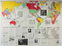
1942202620Army Orientation Course. / News Map of the Week Inc. Volume 4 No. 32. 13 April1942. Folding colour pictorial map on sheet 88 x 119 cms blank on verso inset maps two photographic diagrams and black and white photographic illustrations descriptive text top edge chipped a few short edge tears and lower corner torn no loss pinholes at the corners inoffensive tidemark at a lower corner in good condition. Colour world map showing political boundaries and military events of World War II from April 3 to 9 1942. with descriptive text beneath including: the loss of two British Cruisers off Ceylon; the occupation of Bataan by the Japanese and their landing on Manus; Japanese war tactics revealed by Malay prisoners and the increasing importance of Central Africa to the Allied war effort. The. Map is indexed according to these notes. Two inset maps of Europe chart Hitler's gains in 1941 and activity on the Russian Front. Additional diagrams on the main world map show war spending and the civilian and war output of US industries. . Army Orientation Course. / News Map of the Week, Inc. unknown
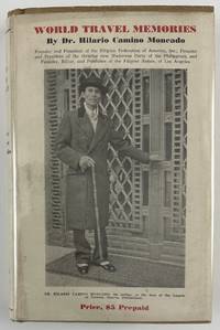
193212800Washington DC: Claude T. Clements Press 1932. 14362pp. Profusely illustrated. Publisher's tan cloth with titles stamped in brown on spine and front board. In original unclipped pictorial dust jacket. Minor edge wear light insect damage to boards. Dust jacket either trimmed a bit short or originally produced a half-inch shorter than boards. Minor dust-soiling to jacket with minor insect damage to rear flap. Internally clean. Overall very good. The rare autobiographical travel narrative by one of the most important Filipino-American political leaders in history especially notable for retaining the original pictorial dust jacket. Hilario Camino Moncado established the Filipino Federation of America in 1925 in Los Angeles California. It was also known at various times as the Filipino World Federation and the Filipino Crusaders World Army. As one of the fraternal organizations appealing to the small but growing Filipino immigrant community the FFA distinguished itself from competitors by accentuating "clean living" and rules of moral conduct. Moncado earned a law degree and also edited and published Filipino Nation. Through his work Moncado sought to portray the immigrant community as responsible and healthy in contrast to the then-prevalent depictions of them as uneducated gamblers. Much less publicly the FFA developed a set of religious teachings that held Moncado to be the reincarnation of Jesus Christ by way of José Rizal the Filipino patriot executed in the waning days of Spanish rule. Moncado's birthday was changed to make him appear to have been born after Rizal's death so that his identity as Rizal's reincarnation would be more plausible.<br /> <br /> In the present travel memoir Moncado focuses on political and social issues encountered on a trip around the world conveying an impression of worldliness which burnished his reputation within the Filipino-American community. He visits England Holland Germany France Italy Egypt India China Japan and "Home Sweet Home Philippines." A sampling of chapters focus on London his visit to Oxford University the refusal of Germany to pay reparations from the First World War mentioning the German people's and particularly Hitler's stance against paying them any further his visit to the League of Nations "Mussolini - Benevolent Despot or Tyrant" Gandhi and "India's Revolution" China "The Awakening Giant" "Americanized Japan" and the betrayal of the Filipino independence movement by the American Congress.<br /> <br /> OCLC records just eight institutional copies including one in the Philippines one in Singapore and six in the United States at NYPL UC-Davis the University of Hawaii Michigan Washington and Wisconsin. Claude T. Clements Press unknown
1997Q-089879756XWriters Digest Books 1997-03-01. Hardcover. New. In shrink wrap. Looks like an interesting title! Writers Digest Books hardcover
1993125403(Hong Kong 1993). 125 pages. With a lot of illustrations, mostly in colour. Original hardcover and an illustrated dustjacket. (A littel used). 30x22 cm
1971Q-0292701403University of Texas Press 1971-01-01. Hardcover. New. New. In shrink wrap. Looks like an interesting title! University of Texas Press hardcover
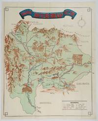
1930206841Kofu.: Onkodo Printing Co. circa1930s. Colour pictorial map 70.2 x 56 cms; 75.5 x 59.5 cms sheet light wear along the inner margin some soft creases from folding short split at center fold; in very good clean condition. An appealing and decorative map of Yamanashi Prefecture which while a process print has the attractive soft look of a lithograph adorned with vignettes of key attractions landmarks such as Mt. Fuji and industry such as silk and wine. The legend lists Railways 'Footing' Roads Hot Springs Hotels and National Parks. A scarce and attractive English language map for the tourist market. . Onkodo Printing Co., unknown
19922090202118106232Shueisha 1992. Soft Cover. Fine. The book is in fine condition. Shueisha paperback
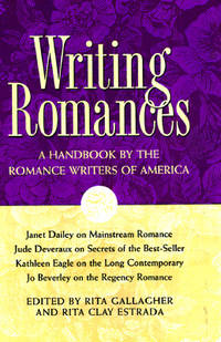
19991-0898798620Writers Digest Books 1999. Paperback. New. 128 pages. 8.75x6.00x0.25 inches. Writers Digest Books paperback
1999Q-0898798620Writer's Digest Books 1999-07-15. Paperback. New. In shrink wrap. Looks like an interesting title! Writer's Digest Books paperback
19692111902152908847Nigensha 1969. Soft Cover. Fine. Size: New book size Nigensha paperback
19782080202104500849Nigensha 1978. Soft Cover. Fine. Number of pages: 315p Index 51p Size: 19cm Number of books: 1 volume Nigensha paperback
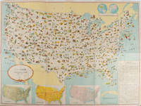
1955172003Washington D.C.: 国務省. Kokumishō. No date. circa1955. Large folding Japanese coloured map of the United States with 3 inset maps at foot of map showing main railways air and highway routes and hemispheres at the top right. Some browning mainly visible on reverse still a good copy. 66 x 81cm. An intricate and detailed pictorial map of the United States published in Japanese by the US State Department. The same type of map had been published since 1945 in English and subsequently in other languages. The Japanese language map is hard to find. The map is undated but was probably produced in the 1950's. The images include depictions of women board riders in two piece swimsuits of the sort popular in the 1950s but the inset text lists Alaska and Hawaii as external territories of the US indicating that the map was produced before they attained statehood in 1959. <br> <br>An inset panel provides information on the area and population of the US the population of major American cities mineral and other resources climate and topography. A note at the bottom right hand corner of the map states that copies of the map can be obtained free of charge from your nearest US Information Office. <br> <br>Every region of the country is decorated with an illustration of the natural resources industries or cultural or historical resources associated with that particular place. These include images of early colonial settlers the birthplaces of Mark Twain and Woodrow Wilson Booker T. Washington's house and Abraham Lincoln's grave; images of major dams oil fields coal mines cotton plantations etc. various animals and crops and images of ships cars and public buildings including the Statue of Liberty located rather oddly far out at sea. . 国務省. [Kokumishō]. unknown
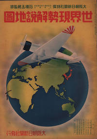
1937208633大阪朝日新聞社. Osaka Asahi Shinbunsha. Showa 12 1937. 10 colour maps not including insets or sketch maps in text on 12 pages. Handsome world map features as the centre fold colour pictorial paper wrappers. A little light soiling and horizontal crease wrappers. An attractive atlas. 38 x 26.7cm. A large format atlas with six pages of coloured maps showing the nations of the world and five pages of Japanese text. The publication seems to have been produced to celebrate the 1937 world record flight from Tokyo to London by Iinuma Masaaki and Tsugayoshi Kenji in their plane 'Kamikaze' which was sponsored by the Asahi Newspaper. The front cover depicts the plane soaring over a map of the world while the back cover also had a colour image of the 'Kamikaze' with an advertisement for the Oji Paper Company which we are told donated a hundred million yen to support the flight. The name 'Kamikaze" had at that stage not yet taken on the connotations which it acquired during the Pacific War. <br> <br>The maps inside the volume show political boundaries major cities and transport routes. The opening pages show the Japanese Empire including Japan proper Korea Karufuto and Manchukuo with small insets covering Taiwan the Chishima Archipelago and Japan's South Sea mandate. The accompanying text focuses on Japan's newly acquired client state of Manchukuo detailing its area population principle products etc while the map includes graphs illustrating Japan's trade with the world and with Manchukuo. China receives an entry of its own with a map of the Chinese Republic and information on the political situation population trade and infrastructure. The central pages of the volume are taken up with a double-spread map of the world including depictions of the flags of a selection of the world's nations. Other sections of the work cover Asia Europe America Africa and Oceania grouped together. The discussion of Oceania includes a section on Hawaii and some small and improbable depictions of Maori and Indigenous Australians. . 大阪朝日新聞社. [Osaka Asahi Shinbunsha]. unknown
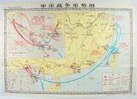
1978171343北京. Beijing.: 地图出版社.Di tu chu ban she. 1978. Large Chinese map in colour showing southern part of China and northern Vietnam folded in original envelope scale 1: 150000 inset map upper left corner scale 1:800000. Both maps show the battles between Qing court and French army between 23 Aug 1884 and 25 Mar 1885. Original paper envelope repaired with acidic free tape map in very good condition. Text in Chinese. Sheet measures 76.8 x 107.1cm. . 地图出版社.[Di tu chu ban she]. unknown
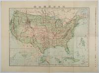
1911179415Tokyo.: 楠山正雄. Kusuyama Masao. Meiji 44 1911. Colour folding map 40 x 55cm inset maps showing the Philippines Alaska and Hawaii very good copy. This map was a supplement of October 1911 issue of a monthly magazine Shin Nippon 新日本 which was published between 1911 and 1918. The main map covers the contiguous United States with inset maps of the world showing the American territories of Alaska Hawaii and the Philippines. Curiously Cuba has been marked as an American territory having been directly occupied from 1906 to 1909 though at the time still beholden to the 1903 Cuban-American Treaty of Relations. . 楠山正雄. [Kusuyama Masao]. unknown
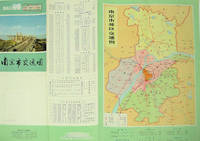
1977137003No place of publication.: 江苏人民出版社.Jiangsu ren min chu ban she. 1st Edition 2nd Printing. 1977. Colour Chinese transportation map featuring the city of Nanjing capital city of Jiangsu Province and its surrounding regions. Upper side: A transpiration map of Nanjing and neighbouring counties right section with a list of names of stations buses trains coaches ferries and their addresses lower right edge tourist guide including the addresses and phone numbers of major travel agents hospitals cinemas and more left section accompanied by two tables of bus routes. On reverse: a "Map of Nanjing Municipal Transpiration Map" scale not given a chart of terminus for bus and trolley bus lower right section. Some soiling on reverse stamp of a prior dealer in Guangzhou a handwritten date of "September 17th 1977" upper side light creases good copy. Text in Chinese. Sheet measures 37.8 x 52.3cm. . 江苏人民出版社.[Jiangsu ren min chu ban she]. unknown
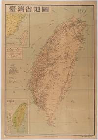
1954215869地圖出版社. Reprint. 1954. Colour folding map of Taiwan showing all major cities towns and villages railways highways roads rivers and sea routes. Topographical inset map at lower left Taiwan Straits with mainland coast inset map at top left. Each map has its own scale. Text in traditional Chinese characters. Washi repairs along some folds on reverse pin marks at corners evenly browned and a little faded. A nice map of Taiwan in fair condition. 77 x 53.8cm. . 地圖出版社. unknown
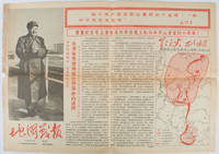
1967169746Beijing.: 地图戰報.Di tu zhan bao. September1967. Maps printed in red and black single sheet printed on both sides folded scale not given photographic image of Mao Zedong. Some light browning at edges with tears and losses on left edge still good. Text in Chinese. Sheet measures 26.5 x 38.4cm. Includes a map of Autumn Harvest Uprising and also shows the routes of the military advancing towards Jinggangshan between September and October 1927. On reverse left section a map shows the route along which Chairman Mao led the Fourth Army of the Chinese Red Army marching towards south of Anhui and Jiangxi Provinces in 1929. On reverse right section a map titled "The Long March of The Chinese Workers' and Peasants' Red Army October 1934-October 1935". Quotations of Chairman Mao about the Long March insert on corners of the map. <br> <br>Issue no. 6 of a series of maps with text issued by the Red Guards organisations in the form of Cultural Revolution tabloid-sized newspaper. This issue is designed to celebrate the 40th anniversary of the Autumn Harvest Uprising which was one of the earliest armed uprisings organised by the Chinese Communist Party. . 地图戰報.[Di tu zhan bao]. unknown
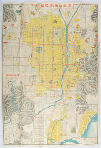
1922171899京都. Kyoto.: 山中書房. Yamanaka Shobō. 大正 11 1922. Attractive colour folding map of Kyoto with a quite detailed illustrated tourist guide printed in blue and white on the reverse some light browning holes at some folds good copy. 78.5 x 54cm This 1922 colour folding tourist map of Kyoto offers sightseeing information each panel showing a photographic monochrome image of the site discussed. <br> <br>The two inset maps on the Kyoto map show Otsu city on the shore of Lake Biwa and the Arashiyama area north of Kyoto. The main map highlights the major temples and famous sights in red geographic features such as rivers and hills are shown and an inset chart shows distances of sights from the nearby stations. The information on the reverse gives more detail on the famous sights a calendar of events seasonal highlights and details of the Imperial graves around Kyoto. . 山中書房. [Yamanaka Shobō]. unknown