[SERIZAWA KEIGO]. 芹澤馨吾Biblio.com
132 résultats
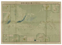
1819155215統正社 Tōseisha . Showa 18 1943. Colour folded map 54. x 76.5cm. Pinholes at corners light even browning good copy. This Japanese map of Micronesia shows the Mariana Islands Eastern and Western Caroline Islands Marshall Islands and Gilbert Islands. The separate maps around the edge are clockwise from the upper right corner: Jaluit Atoll Guam Island Rota Island Saipan Island Palau Islands Yap Island Hall Islands Pohnpei Island Truk Islands and Kusaie Island. . 統正社 [Tōseisha ]. unknown
1819162103Tokyo.: Tōseisha. Showa 18 1943. Folding colour map of Australia 54.2 x 76.4cm. Some foxing particularly along folds and upper right margins a few repaired tears and small holes at folds.With original sleeve. The 15th map in the Standard Maps of Greater East Asia series of 20 maps. Shows the natural resources such as sheep gold pearl diary regions opals etc. Tasmania appears as an inset in the bottom right corner. Text in Japanese. . Tōseisha. unknown
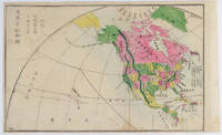
1877159812Kyoto.: 村上勘兵衛 文部省刊行. Murakami Kanbē; Monbushō kankō. Meiji 10 1877. Colour woodblock map of North and Central America. From the Journal of World Geography 萬國地誌略 published in 1877. Printed area measures 33.5 x 21cm a good copy with occasional soiling. . 村上勘兵衛, 文部省刊行. [Murakami Kanbē; Monbushō kanko& unknown
1816175252Philadelphia.: Carey Mathew and Warner Benjamin. 1816. Engraved map 19 x 22.3 cm original folds some offsetting to the map marginal browning and staining small archival repairs to the outer margin but in good condition. Fine map Plate 19 prepared for Carey and Benjamin's "General Atlas.". . (Carey, Mathew and Warner, Benjamin). unknown
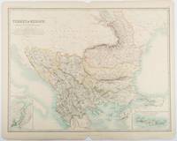
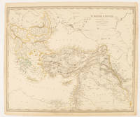
1893177055Edinburgh & London.: W. & A. K. Johnston. 1893. Engraved map with original outline hand-colour 44 x 57.4 cm map two inset maps of the Bosphorus and Crete; central fold corners chipped with loss lower edge with several small marginal tears neatly repaired head and foot clipped at the fold with loss to the margin but the map in very good condition. Detailed and finely engraved map also showing submarine telegraph lines and relief by hachures. Re-issue of the map first published in 1863 for "Keith Johnston's Royal Atlas of Modern Geography". . W. & A. K. Johnston unknown
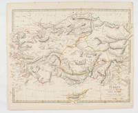
1830175250London.: Society for the Diffusion of Useful Knowledge. Baldwin & Cradock. 1830. Engraved map wth outline hand colour 29.7 x 42 cm relief shown in hachures key to abbreviations including "Ancient Ruins" the west and east extremities attactively engraved to burst through the border original folds map with occasional spotting more pronounced at the lower corner edges a little ragged small chip to the inner margin no loss to the map manuscript pagination in the lower corner but in good condition. . Society for the Diffusion of Useful Knowledge. Baldwin & Cradock. unknown
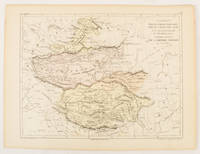
1856175109Paris.: Gustave Barba Editeur. 1856. Lithographed map with original hand colour central fold 24.2 x 31.5 cm marginal toning plate number in manuscript in very good condition. Finely engraved Dufour map of Central Asia prepared for his "Atlas Populaire" showing East Turkestan Petite Boukharie and Kalmykia Dzoungarie Mongolia and Tibet. . Gustave Barba Editeur. unknown
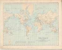
1874174897London.: Virtue & Co. circa1874. Printed colour map 18.4 x 24.1 cm edge wear marginal spotting and on the verso but the map in very good condition. Unusual map showing time differences east and west of Greenwich before the atomic clock and well before satellites! The explanatory text notes aso that: "The space comprehended between the meridiens of 120 & 160 E. is repeated in order to show the relative position of England to Australia both eastward and westward." . Virtue & Co. unknown
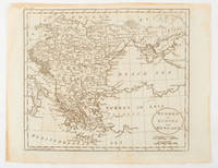
1840174957London.: Charles Knight & Co. circa1840s. Lithographed map with original outline hand-colour 31.9 x 39.1 cm small marginal tears neatly repaired with archival material but no loss small surface abrasion affecting the border at the foot edgewear and browning inked pagination in an early hand but in very good condition. A handsome map with fine topographical engraving also showing the borders with Hungary Russia and Persia. . Charles Knight & Co. unknown
185275654Buffalo:: Jewett Thomas & Co. 1852. First edition. original gilt-lettered cloth. Tear to the folding map neatly repaired on verso with Japanese tissue; slight use and fading to the cloth; very attractive. 12mo. Illustrated with maps and numerous engravings from original sketches including a folding map of the "Northern Route U. S. Mail Line.Steamers.New York and Rochester.and Routes from Albany to Niagara Falls Buffalo and Montreal" with inset view of Niagara Falls. Jewett, Thomas & Co., hardcover
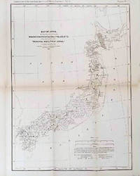
1878210211Philadelphia.: American Institute of Mining Engineers. Sherman & Co. printers. 1878. Large folding map of Japan showing "some of the more important Mining Districts Coal Fields etc." small fold split without loss tables 67pp. Covers a little scuffed and discoloured overall in very good condition. Scarce offprint separately paginated of a paper included in Volume V of the Transactions of the American Institute of Mining Engineers. The author Henry S. Munroe had been retained by the Japanese Government as Assistant Geologist and Mining Engineer with the Geological Survey of Yesso for the Hokkaidō Colonization Agency. His work laid the foundations for the future coal mining industry in Hokkaido. The report contains two lengthy tables relating to coal production and quality. . American Institute of Mining Engineers. Sherman & Co., printers. unknown
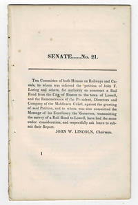
183099804<p>Boston MA: Printed by Dutton and Wentworth 1830. 1830. Very good. - Octavo 8-1/2 inches high by 5-1/4 inches wide. Softcover bound in printed self-wrappers. Once bound in with other similar pamphlets these three related items are unbound and removed with stab marks along the left edges. The pagination is a follows: pages 1-11 1 & 13-21 1-8; and 1-12. There is some scattered foxing throughout all three items. The cover page of the Senate No. 10 report dated December 15 1829 is darkened & stained with minor chipping to the bottom corners of that page and of the last page. Very good.</p><p>First edition Massachusetts Senate No. 21. The report is signed on page 11 by John W. Lincoln Chairman. The report is followed by the text of a bill entitled "An act to establish the Boston and Lowell Rail Road Corporation."</p><p>The Boston and Lowell Railroad was the first major railroad in the state of Massachusetts. The Boston and Lowell Railroad was preceded by the Middlesex Canal. Converting the canal to a railroad would eliminate the issue of transportation being unavailable during the winter when the canal froze. Patrick Tracy Jackson led the task of convincing the state legislature to fund the project. This proved difficult as the investors of the Middlesex Canal were against building a new form of transportation designed to replace their canal. The report at hand details the protest of the directors of the Middlesex Canal against granting the petition of John F. Loring and others to construct a railroad in its place. Loring and the other investors received their charter on June 5 1830 and the railroad began operations on June 24 1835.</p><p>The pamphlet is accompanied by an earlier February 12 1830 pamphlet titled:"To the Honorable the Senate and House of Representatives in General Court assembled. : The president directors and company of the Middlesex Canal having seen the publication of the petition of John F. Loring and others for a rail road from Boston to Lowell and the order of notice thereon beg leave to present the following remonstrance to granting the prayer thereof." 12 pages. Signed page 12: Wm. Sullivan Josh. Coolidge Geo. Hallet committee of directors of Middlesex Canal to this purpose duly authorized. House No. 40 printed by Dutton and Wentworth 1830.</p><p>In addition an earlier pamphlet from 1829 is included: "Boston December 15 1829. To His Excellency Levi Lincoln Governor of the Commonwealth of Massachusetts : Sir On the behalf of the Commissioners of Internal Improvements I have the honor to transmit herewith a report of a survey made in conformity to a resolve of the legislature passed on the 12th day of June 1829 directing the Board to survey a route for a rail road from the town of Taunton to some point in the route previously surveyed between Boston and Providence : with great consideration and respect I am your humble and most obe't. serv't. Josiah J. Fiske chairman." 8 pages. Signed on page 8: Josiah J. Fiske Willard Phillips James Hayward Commissioners of the Board of Internal Improvements. Senate No. 10. Printed by Dutton and Wentworth.</p> [Boston, MA: Printed by Dutton and Wentworth], [1830]. paperback
18860011204Chicago: Percival Lowell General Passenger Agent C. B. & Q. R.R. 1886. Revised and Enlarged Edition. Sewn wrappers. Good. 16mo 88 pages dedication page chipped lacks 99% of its flexible covers <br/><br/>The prior 1885 edition had only 80 pages. This has its frontispiece and numerous small maps other illustratios throughout. This includes travel to Mexico. Percival Lowell, General Passenger Agent, C. B. & Q. R.R. unknown
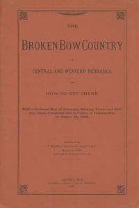
188647038Lincoln: Journal Company State Printers 1886. 1886. NEBRASKA RAILROAD. First edition. 8vo. Original orange printed wrappers 16 pp. folding map: Map of Nebraska 1886. 59 x 99 cm. 23 1/4" x 41" 12 miles to one inch. The map was the project of the Burlington Route for selling land. Very detailed and routes outlined in bright red. Broken Bow was to be the new center of life in Nebraska. The map is in fine condition some splitting at the bottom two inches of the spine due to the folded size of the map and a tiny closed tear and a few minor nicks to the rear cover fore-edge overall a near fine copy. Journal Company, State Printers, 1886. unknown
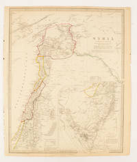
1843174934London.: Chapman & Hall. 1843. Engraved map with outline hand colour 39.4 x 31.4 cm inset map "Continuation from the Dead Sea to Mount Sinai" with finely engraved notes and a key to the Divisions under control of the Turkish Government manuscript pagination in an early hand to the top right edge tear nicks and browning but in very good condition. A most attractive map with detailed notes published when Syria was still under control of the Ottoman Empire. . Chapman & Hall. unknown
1880174937London Edinburgh & Glasgow.: William Mackenzie. 1880. Map printed in colour with original outline hand colour 29.8 x 22.7 cm central fold edge toning but in very good condition. Published for inclusion in "The National Encyclopaedia: A Dictionary of Useful Knowledge". . William Mackenzie. unknown
185130464Portland ME: Printed by Order of the Directors 1851. 64pp stitched. Wrappers absent else Very Good. <br /> <br /> A.P. Robinson was removed from the office of Chief Engineer of the York and Cumberland Rail Road Company in May 1851; F.O.J. Smith was removed as President in August. Each was removed after discovery of financial discrepancies. Smith retaliated with a pamphlet assailing the Board's conduct. This Statement by the Board thoroughly explains the reasons for his dismissal with detailed lists of costs and estimates and reports from Board meetings. Page 29 begins the thirty-page "Reply" to Smith's pamphlet by Daniel Emery of the Company's Treasury Office. He elaborates on the facts which led to Robinson's and Smith's dismissals. <br /> Sabin 82569. BRE 280. OCLC 13636503 9 as of August 2013. Printed by Order of the Directors unknown
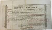
185438904Quincy IL: Patriot Office. Gibson & Warren Printers 1854. Folio broadsheet bond oblong 16-1/4" x 9-1/2." Old folds with a couple of short marginal fold splits no text affected. Printed in a variety of type fonts and styles. Very Good. Signed in ink by Thompson Chandler County Judge of McDonough County; Isaac Grantham County Clerk; N. Bushnell President of the Rail Road; and C.E. Lippincott State Auditor.<br /> <br /> The County is in West Central Illinois. The Rail Road one of the earliest Illinois Roads was operated by the State of Illinois until the late 1840s. It later merged with the Wabash Railroad. Patriot Office. Gibson & Warren, Printers unknown
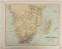
1877177228Edinburgh & London.: W. & A. K. Johnston. circa1877. Printed colour map 25 x 32.5 cm edge tears one affecting the lower border only two small chips from the upper margin corner repaired the map in very good condition. Map of North America with a small inset of the British Isles on the verso. Map of Southern Africa before the Scramble for Africa in the late 19th Century. . W. & A. K. Johnston. unknown
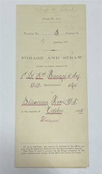
1875320963Standing Rock 1875. unbound. Partly printed military document signed 6th Infantry seven months before Little Big Horn 16.75 x 10.75 inches Standing Rock Nov. 1 1875 "A Statement Of Forage and Straw Issued to and Consumed by the Public Animals under my direction at Standing Rock Dakota Territory during the month of October 1875" for transient animals from Fort Rice signed by Captain and Commander of Post James S. Poland an officer who served under Major Reno at the Little Big Horn and was erroneously reported as "Killed In Action" when severely wounded in the back. At the time this document was signed Poland was ordered to cease his sale of rifles and ammunition to Indians at the Standing Rock Reservation as the recipients were closely connected with Sitting Bull's band. One month later the Commissioner of Indian Affairs called for the use of troops against those Indians. Also signed by Lieutenant William Badger a close friend of Custer who survived the Black Hills Campaign. His son Tom who filled out the body of this document became General Custer's personal secretary in 1876 and was killed at Little Big Horn. Also included: a Xerox of a rare photograph of the 7th cavalry 6th infantry in uniform with accoutrements all identified including Custer Badger and Poland. Partial tearing along one of the folds; otherwise near fine condition.<br/> <br/> unknown
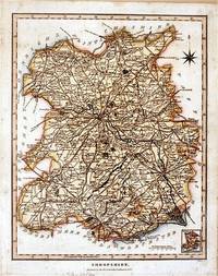
182761872London.: J. Wilkes. 1827. Attractive hand coloured map of Shropshire 27.5 x 21.5 cm. very occasional light foxing on reverse but not visible on the image itself. A most attractive map. . [J. Wilkes.] unknown
186340799Cleveland: Fairbanks Benedict & Co. 1863. Stitched in original printed wrappers. 33 1 blank pp folding table. Wrappers with extremity chipping and old rubberstamp. Rear wrap detached but present. Title page with rubberstamp. Old bookplate. Good plus.<br /> <br /> This is a joint report of the Bellefontaine & Indiana Rail Road and the Indianapolis Pittsburgh & Cleveland Rail Road. <br /> Wikipedia says: "The Indianapolis and Bellefontaine Railroad I&B was an American railroad founded in 1848. It changed its name to the Indianapolis Pittsburgh and Cleveland Railroad IP&C in 1854. Its counterpart in Ohio was named the Bellefontaine and Indiana Railroad B&I. The B&I ceased to exist as an independent company when it merged into the Bellefontaine Railway in September 1864. The Bellefontaine Railway merged with the Cleveland Columbus and Cincinnati Railroad to form the Cleveland Columbus Cincinnati and Indianapolis Railway in December 1864."<br /> OCLC 12696870 11 as of March 2025. Fairbanks, Benedict & Co. unknown
1820705531820. unknown
184010777New York: Bryant and Boggs. 1840. Original printed wrappers with wrapper title as issued. pp 157-217 as issued. Several rubberstamps spine reinforced. Disbound. Good. With the first annual report of the directors of the Housatonic Rail Road Company its engineer's report and the report of the engineer of the Berkshire Rail Road Company. The Joint Special Committee's Report examines the feasibility of links between the Housatonic Road-- via Bridgeport CT and Stockbridge MA-- and New York City and its system of railroads. FIRST EDITION. Thomson 2535 7. AI 40-4958 no locs. or collation. Not in Sabin. Bryant and Boggs. unknown
186496045Mine Hill and Schuylkill Haven Rail Road Company 1864. Pamphlet. Used - Very Good. 13-31 pages each. Large folding map. 9 x 6" printed wrappers. Lacking 1 lower wrap 1 creased few edge chips soiling tear else VG. Mine Hill and Schuylkill Haven Rail Road Company unknown