132 résultats
18462090502128300687Not Available 1846. Soft Cover. Fine. The book is in fine condition. Not Available paperback
18705388<p>Gall & Inglis' 1870's-1880's. Paperback. Very good. VGC.Gall & Inglis'.No date given but probably 1870's to 1880's prior to London Tower Bridge build which is not included on the map.Green hardbacksmall dentsnicks and light shelf wear on the cover with folded map in VGC.The map is in VGC but with small stain marks and foxing marks on the edgessmall tear on the edge of the map.The map is hand coloured and includes:RailwaysRailway StationsSteamer RoutesOmnibus and Tramway RoutesParks.The size of the map is: 30x20 inch.The scale of the map is: 3 3/4 to 1 mile.The map covers: From Hyde Parkincluding parts of Kensington Palace to Blackwall and from Mildmay Park to South Lambeth.The map is in VGC for its age. A collectable and scarce map.</p> Gall & Inglis' paperback
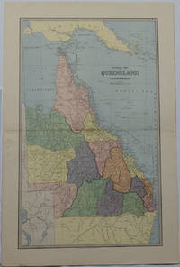
1886175917Sydney & Melbourne.: The Picturesque Atlas Publishing Company Limited Sydney & Melbourne. 1886-1888. Large printed colour map 60.9 x 37 cm 69.9 x 45.3 cm sheet central fold slight browning at the fold and to the generous margins in very good condition. Detailed map prepared for Andrew Garran's monumental "Picturesque Atlas of Australasia" 1886-1888 with the counties attractively coloured. New Guinea is shown to the North and borders with Northern Territory South Australia and New South Wales. The extent of the Great Barrier Reef is delineated along with the ocean "Border of Colony". Proposed and current railways are shown with an extensive place index printed on the verso of the map. . The Picturesque Atlas Publishing Company, Limited, Sydney & Melbourne. unknown
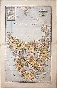
188861874Sydney.: The Picturesque Atlas Publishing Company. 1888. A large and detailed map of Tasmania from The Picturesque Atlas Publishing Company showing railroads existing as well as under construction and coloured regions dividing the island into districts. Hachures depict landforms detailed index to place names on verso small inset upper left corner showing Kind Island printed colour 70 x 45.5 cm. . The Picturesque Atlas Publishing Company. unknown
18972110502150406878Edited and sculpted by Omuro Otokichi 1897. Soft Cover. Fine. Number of books: 7 Edited and sculpted by Omuro Otokichi paperback
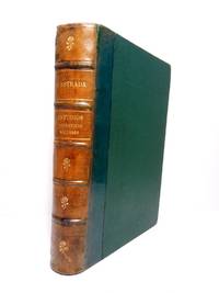
18891933PRIMERA EDICION.- Barcelona: Imp. Henrich y Cia. 1889.- XIII276 p.; en 4º. 23 cm.- Interesantes biografÃas americanas: Santiago Liniers; Félix FrÃas amplio estudio biográfico; Mi padre; El Tte. General Pedernera; Domingo Sarmiento.- CONTINUA EN EL MISMO VOLUMEN: ESTRADA Santiago.- Discursos / Precedidos de una introducción de D. Santiago Liniers.- Barcelona: Imp. Henrich y Cia. 1889.- XV327 p. 1 h.; 4º 23 cm.; Las 2 obras encuadernadas en un solo volumen en Media Piel de la época.- RARO. El lomo restaurado de un desgarro en la cabeza y algunas pequeñas rozaduras. En la portadilla lleva estampado un pequeño sello tampón del anterior propietario. Las portadas con mÃnimas y tenues motas de óxido. Dicho esto que es preceptivo el libro se encuentra por lo demás en muy buen estado. HISTORIA POLÃTICA Y DERECHO POLÃTICO-INTERNACIONAL AMERICANOS DESDE LA INDEPENDENCIA Libro en español Imp. Henrich y Cia. hardcover
189840873N.P.: Sentinel and Gazette Steam Press 1851. 1898. 8 1/2" x 5 1/2" in light peach wrappers though missing the front wrapper. 15 pp. Illustrations. Map. Although it eventually became a transcontinental railroad the railroad that became the Milwaukee Road began as the Milwaukee and Waukesha Railroad whose goal was to link the developing Lake Michigan port city of Milwaukee Wisconsin with the Mississippi River. The company incorporated in 1847 but changed its name to the Milwaukee and Mississippi Railroad in 1850 before construction began. A report to the Board of Directors explaining that the railroad is not completed to Waukesha as was expected and offering reasons for the delay in its completion. "Considering our small beginning only a little over one year ago - that we have relied solely on the resources of the people of Wisconsin for the means of prosecuting this enterprise - without seeking foreign aid - with only the small contributions of each of our thousand Stockholders and the credits based on the securities of our city and citizens we have in that time completed the grade of our Road for twenty and a half miles laid the Track and brought into actual use the half of that distance - and will have the whole completed and in successful operation by the middle of February next." Information on estimated and actual costs of the First Division extending the road from Milwaukee to Waukesha. It appears that actual costs far exceeded estimates "but that has been the result of peculiar circumstances under which the work has been performed and by the adoption of a rail of greater weight than that estimated." It was determined that the contractors to whom jobs had been given at lower costs were inexperienced and inefficient resulting in their work having to be re-done. Furthermore the delay was caused by some stockholders not promptly paying the small installment of only 5% every three months thus leaving a deficit. Also a bank in a marsh sunk and had to be built back up. Th cost of constructing the first twenty and 1/2 miles is only $9495 per mile. Report ends with the reassurance that the Road will be complete by February and if weather permits perhaps even earlier. 8 1/4" x 21 1/2" map of the Milwaukee and Mississippi Rail-Road. Map is neatly torn in half at one fold and has 1 1/2 - 2" closed tears to tops of a couple folds. Front wrapper missing along with 3" split to toe of spine and with light wear to the extremities. Sentinel and Gazette Steam Press, 1851]. unknown
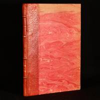
1866829B27Victoria: Imprenta del Siglo 1866. First edition. Leather. Good. 10" by 7". none . A scarce first edition copy of Santiago Estrada's short story that celebrates nature in the original Spanish. A scarce first edition copy of this work in the original Spanish. This is a short story by Santiago Estrada meaning The Home in the Pampas. The story aims to present a picture of the charms that can be found in the solitude of the fields and the beauty of nature. In quarter morocco with marbled covered boards. Externally generally smart with some fading to the boards and some marks to the spine. A library stamp and previous owner inscription to the page after the half title page. Internally firmly bound with generally clean pages which are a little age toned. Good Imprenta del Siglo hardcover
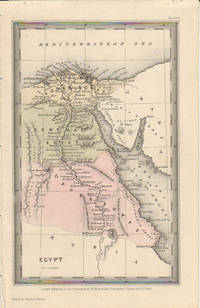
1833174939London.: Published for the Proprietors by Mr. Bull. 1833. Engraved map 14.1 x 8.8 cm original hand colour in very good condition. Fine miniature map with appealing hand colour denoting Lower Central and Upper Egypt. . Published for the Proprietors by Mr. Bull. unknown
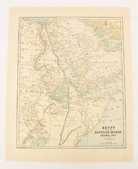
1893174920New York.: Hunt & Eaton. Circa1893. Printed map in colour elevation shown with hachures 29 x 23.5 cm text on the verso relating to entries for Afghanistan Beluchistan and Turkey prepared for Hunt & Eaton's "New York Recorder's Atlas" small tears to the top edge but in very good condition. . Hunt & Eaton. unknown
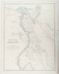
1861177021Edinburgh & London.: William Blackwood & Sons. 1861. Engraved map with original outline hand-colour 57 x 43.8 cm 61.1 x 49 cm sheet central fold very slight edge toning but the map in very good bright condition. First edition. Fine large folding map: the Nile delta and river with attractive original outline colour railways and canals marked and name references to biblical and classical geography. Published for inclusion as map 39 in "Keith Johnston's royal atlas of modern geography" . William Blackwood & Sons. unknown
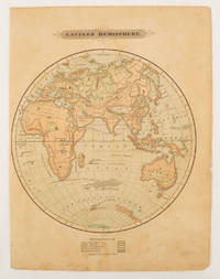
1875175128Harper & Brothers. 1875. Spherical map printed in colour 21.3 x 21.2 cm with shaded key to elevation and ocean currents unrelated text on the verso paper toned and margins soiled bottom edge ragged small sealed to to the inner margin but in sound condition. Map showing the five continents of Asia Africa Antarctica Europe and Australia. Published by Harper & Brothers for inclusion in their "School Geography". Plateau of Tibet very prominently marked. Gobi Desert and Plateau of Mongolia also marked India described as Hindostan Indo-China includes Thailand. . Harper & Brothers. unknown
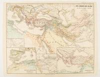
1877174917Gotha: Justus Perthes. 1877. Map with original colour and outline hand-colour 32.7 x 40.7 cm four inset maps text in German central fold slight marginal edge wear and spotting to the verso but in very good condition. A handsome map detailing the lands of Islam at the time of the Bujids 945-1055. The inset maps depict a western extension to the main map southern Arabia the lands of the Ghaznavid sultanate in Central Asia and lands of the Eastern Roman/Byzantine Empire issued for the "Hand-Atlas für die Geschichte des Mittelatters und die Neueren Zeit". . Justus Perthes unknown
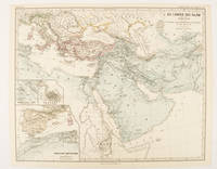
1877174913Gotha: Justus Perthes. 1877. Map with original colour and outline hand-colour 32.2 x 40 cm three inset maps text in German central fold slight marginal toning in very good condition. A most handsome map detailing the lands of Islam under the Abbasids up to the capture of Baghdâd by the Bûjids from 750 to 945 AD. The inset maps depict Northern Iraq Baghdad and a western continuation of the main map issued for the "Hand-Atlas für die Geschichte des Mittelatters und die Neueren Zeit". . Justus Perthes unknown
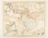
1877174916Gotha: Justus Perthes. 1877. Map with original colour and outline hand-colour 33.1 x 40.2 cm four inset maps text in German central fold slight marginal edge wear and spotting to the verso but in very good condition. A handsome map detailing the lands of Islam from Hegra in AD 622 to the fall of the Umayyads in AD 750. The inset maps depict a western extension to the main map and city plans for Damascus Jathrib & Medina and Mecca issued for the "Hand-Atlas für die Geschichte des Mittelatters und die Neueren Zeit". . Justus Perthes unknown
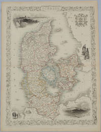
1850175779London & New York.: John Tallis & Company. Circa1850s. Lithographed map with original outline hand colour 34.5 x 24.7 cm including border and captionsfive fine vignette illustrations decorative border central fold edges with light toning in very good condition. Attractive decorative map with fine vignettes of Copenhagen Sleswig and Elsinore figures in costume the coat of arms of Denmark and an amiable equine pair by the great mapmaker and publisher John Tallis. . John Tallis & Company. unknown
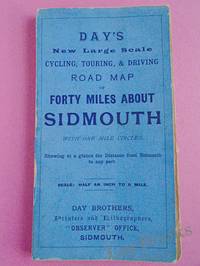
1900033970Sidmouth: Day Brothers 1900. Map. Very Good. Unframed. New Edition. Undated but circa 1900 Engraved map main roads coloured orange 445 x 575 mm folding down to 150 x 85 mm with printed blue covers published by Day Brothers "Printers Stationers & Booksellers Observer Office Sidmouth". Generally in very good condition with light general wear and some rubbing to edges of covers. An attractive map. Scarce. Day Brothers unknown
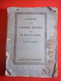
184050119George Corser Caracas 1840. Early Edition. Hardcover. Good Condition/No Dust Jacket. FLORES ESTRADA ALVARO. Curso de economia politica 4th edition corrected octavo Caracas: George Corser 1840 pp. 2 iv 593 1 2 index the last leaf of the index is lacking contemporary sheep binding with gilt decoration and gilt lettering on spine. Text in Spanish. Occasional worm holes along the spine hinges cracked boards rubbed and chipped moderate to heavy foxing begins at page 347 and continues through the end; still a good copy of a scarce text. The author 1766-1853 wrote on political economy as well as Spain and its relations with the Western Hemisphere nations and colonies. The present book is the only New World edition although at least seven editions were printed in Europe starting in 1828. OCLC locates 3 copies. Size: Octavo standard book size. 2 iv 593 1 2. Text is in Spanish. . . All edges clean neat and free of foxing. Quantity Available: 1. Shipped Weight: Under 1 kilo. Category: Antiquarian & Rare; Spain; 19th century; Spanish Language; Politics & Government. Pictures of this item not already displayed here available upon request. Inventory No: 50119. . George Corser hardcover
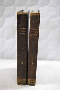
18351101351Madrid.: Imprenta de D. Miguel de Burgos. 1835. Hardcover. Cubierta deslucida. Good. 22 cm. 2 vols. Encuadernación en tapa dura artesanal. Pequeñas notas manuscritas a lápiz en la primera página del tomo I . Cubierta deslucida. Economía.33 33 Imprenta de D. Miguel de Burgos. hardcover
183536.274Madrid: Imp. de Miguel Burgos 1835. Rústica editorial. 16x22. Imp. de Miguel Burgos paperback
18892877821Barcelona.: Henrich y compañía. 1889. Hardcover. Cubierta deslucida. contiene pegatina en portada . Good. 22 cm. 88 p. Encuadernación en tapa dura artesanal con lomo en piel. Cubierta deslucida. contiene pegatina en portada . Literatura.82 82 Henrich y compañía. hardcover
183728840Washington 1837. 24th Cong. 2d Sess. H. Rep. 135. 38pp disbound folding sketch of wire suspension bridge across the Ohio River at Wheeling. Some leaves browned else Very Good. unknown
1834ZB285685Washington 1834. 23rd Cong. 1st Sess. HD 456 34 pp. extracted from larger bound volume slight age toning but in all very good. - If you are reading this this item is actually physically in our stock and ready for shipment once ordered. We are not bookjackers. Buyer is responsible for any additional duties taxes or fees required by recipient's country. Photos available upon request. Washington unknown
185821955MADRID: Imprenta de M. Rivadeneyra 1858. Primera edición.- 4º.- Media piel de época lomera con filetes y florones dorados.- 311 páginas.- 4 láminas fuera de texto más un mapa plegado todos en litografía. . Palau 84432 Imprenta de M. Rivadeneyra unknown
1873697671873. Hardcover. Good. Circa 175 pages of holograph text; remainder of book blank. Scuffed leather minute book. 34cm. Ruled pages. This railroad seems to been relatively short running from the Connecticut border south of Longmeadow Massachusetts to East Hartford. At the final 1887 meetings of the stockholders and directors recorded in this minute book the Company appeared to be facing a foreclosure suit by the Connecticut State Treasurer. The railroad appears to have ceased in 1887. hardcover