WILLIAMS, Charles Alfred SpeedBiblio.com
1 009 résultats
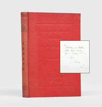
1933175841Beijing: Kwang Yuen Press 1933. First edition first printing presentation copy inscribed by the author on the front free endpaper "To Cobbles and Dulcie with best wishes for a Happy Xmas from Charles. 1933 Peking" opposite a gelatin silver photograph of the author. The recipients were Charles and Dulcie Hope Danby 1879-1958; 1889-1981. Hope Danby was a prolific writer on Chinese history and archaeology. She was a friend of the controversial scholar-collector Edmund Backhouse and wrote his entry for the Dictionary of National Biography. Her husband worked as an insurance agent. Based like the Danbys in Beijing the author 1884-1972 was the city's most senior customs service official. He entered the service in 1903 at the junior level of Fourth Assistant. On his retirement in 1935 he had served for 13 years at the senior grades of deputy commissioner and then acting commissioner. In 1969 he published his autobiographical Chinese Tribute which recounts his colourful experiences of working for the service. Alongside his professional work Williams had a scholarly interest in Chinese history and culture. He is most well-known for Outlines of Chinese Symbolism and Art Motives: An Alphabetical Compendium of Antique Legends and Beliefs as Reflected in the Manners and Customs of the Chinese 1931. This manual describes the country's animal agricultural textile and mineral exports and is also intended to assist scholarly research of flora and fauna. Octavo. Half-tone frontispiece showing Shanghai customs house. Original red cloth spine lettered in gilt in English and Chinese front cover panelled and lettered in English and Chinese in blind. Spine sunned staining on rear board a few leaves dog-eared: a very good copy. hardcover
164623409London: William Humble 1646. Other. In excellent condition. 383 by 507mm 15 by 20 inches. Copper engraving uncolored as published. William Humble unknown
164623430London: William Humble 1646. Other. In excellent condition. 384 by 512mm 15 by 20¼ inches. 384 by 512mm 15 by 20¼ inches. Copper engraving hand colored in outline and wash. William Humble unknown
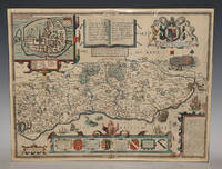
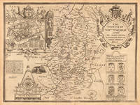
86954<p>Described by Iohn Norden. Augmented by I. Speede And are to be solde by G. Humble. Cum Privilegio 1627. Nice later hand-colouring. An attractive and decorative map with inset town plan of Chichester crests and elaborate coat of arms vignettes of galleons and sea-monsters there is a Civil War battle probably a skirmish at Haywards Heath and a representation of William the Conqueror's fleet arriving at Pevensey. In very good condition. Some slight darkening around edges and centre fold. Professional repair lower margin. Unframed. Large double sided map engraved surface 20.5 x 16 inches. The maps by John Speed are "the best known and most popular of all English county maps" Tooley. This is a very famous map engraved by Jodocus Hondius in 1610 and first published the following year in Speed's atlas 'The Theatre of the Empire of Great Britain'.</p> Described by Iohn Norden. Augmented by I. Speede, And are to be solde by G. Humble. Cum Privilegio 1627
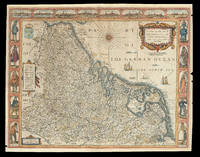
167621920<p>London: Are to be sold by Thomas Bassett in Fleet Street and Richard Chiswell in St. Pauls Churchyard 1676. 420 by 540mm. 16.5 by 21.25 inches. Speed's map of 'Low Germanie' Double-page engraved map with hand-colour. A map of 'Low Germanie' the modern-day Netherlands from the 1676 edition of the first atlas compiled and published by an Englishman Speed's 'Prospect'. A decorative border along the top of the map depicts views of major cities among them Amsterdam and Utrecht. Along each side of the map are illustrated figures in regional costume. Accompanying text in English 'The Description of Belgia' is printed on the reverse. John Speed 1552-1629 was the outstanding cartographer of his age. By trade a merchant tailor but by proclivity a historian it was the patronage of Sir Fulke Greville poet and statesman that allowed him to pursue this interest in earnest. His 'Theatre of Great Britain' first published in 1611 or 1612 was the first large-scale printed atlas of the British Isles. The 'Prospect of the Most Famous Parts of the World' from which the present work is drawn appeared in 1627 bound with the 'Theatre' and is the first world atlas compiled by an Englishman to be published in England. Engraved in Amsterdam many of the maps are anglicized versions of works by Dutch makers in distinctive carte-à-figure style featuring borders with figures in local costume and city views. This map is from the 1676 edition of the 'Prospect' published by Thomas Bassett and Richard Chiswell. While not as rare as the earlier publications this edition is perhaps the most important given that it is the first to include the nine new maps: among them Virginia and Maryland Barbados and Russia. It is also the last time that the 'Prospect' was printed as an atlas. Shirley Atlases T.SPE-2f.</p> Are to be sold by Thomas Bassett in Fleet Street and Richard Chiswell in St. Pauls Churchyard,
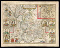
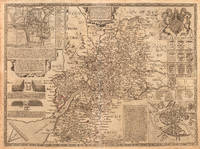
167621977<p>London: And are to be solde by Thomas Bassett in Fleet Street and Ric: Chiswell in St. Pauls Churchyard 1676. 390 by 510mm. 15.25 by 20 inches. Speed's map of Lancashire Double-page engraved map with hand-colour minor wear to edges. A map of Lancashire from the 1676 edition of the first large-scale atlas of the British Isles Speed's 'Theatre'. In the top right-hand corner is an inset town-plan of Lancaster probably the first printed plan of Lancaster. On the left-hand side are portraits of monarchs from the house of Lancaster including Henry IV and on the right of monarchs from the house of York including Richard III. On the verso of the map is printed 'Hundreds in Cheshire' and a description of 'The County Palatine of Chester'. John Speed 1552-1629 was the outstanding cartographer of his age. By trade a merchant tailor but by proclivity a historian it was the patronage of Sir Fulke Greville poet and statesman that allowed him to pursue this interest in earnest. His 'Theatre of Great Britain' from which the present work is drawn was first published in 1611 or 1612 and is 'the earliest English attempt at atlas-production on a grand scale' Skelton. Drawing heavily on the work of Saxton and Norden little of Speed's cartography is original he acknowledges 'I have put my sickle into other mens corne' instead it is his blend of cartography and history incorporating town-plans vignettes and genealogy that makes Speed an innovator. This map is from the 1676 edition of the 'Theatre' published by Thomas Bassett and Richard Chiswell. Chubb CIV; Shirley Atlases T.Spe-1j; Skelton 92; Whitaker 123.</p> And are to be solde by Thomas Bassett in Fleet Street, and Ric: Chiswell in St. Pauls Churchyard,
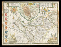
167621981<p>London: And are to be sold by Thomas Bassett in Fleet Street and Richard Chiswell in St. Pauls Churchyard 1676. 385 by 510mm. 15.25 by 20 inches. Speed's Map of Cheshire Double-page engraved map with hand-colour some discolouration to margins and to left and right of image. A map of Cheshire from the 1676 edition of the first large-scale atlas of the British Isles Speed's 'Theatre'. In the top-centre of the map is an inset town-plan of Chester with four coin medallions possibly showing: Julius Caesar the emperor Vespasian the emperor Domitian and the 20th Legion which was among those to invade Britain with Claudius in 43CE. Along the left-hand side of the map are depicted the arms of the Earls of Chester since the Norman Conquest among them 'Ranulph Blundeuill' and 'Ranulph Gernones'. John Speed 1552-1629 was the outstanding cartographer of his age. By trade a merchant tailor but by proclivity a historian it was the patronage of Sir Fulke Greville poet and statesman that allowed him to pursue this interest in earnest. His 'Theatre of Great Britain' from which the present work is drawn was first published in 1611 or 1612 and is 'the earliest English attempt at atlas-production on a grand scale' Skelton. Drawing heavily on the work of Saxton and Norden little of Speed's cartography is original he acknowledges 'I have put my sickle into other mens corne' instead it is his blend of cartography and history incorporating town-plans vignettes and genealogy that makes Speed an innovator. This map is from the 1676 edition of the 'Theatre' published by Thomas Bassett and Richard Chiswell. Interestingly this map lacks the text in English that is usually printed on the verso. Chubb CIV; Shirley Atlases T.Spe-1j; Skelton 92.</p> And are to be sold by Thomas Bassett in Fleet Street, and Richard Chiswell in St. Pauls Churchyard,
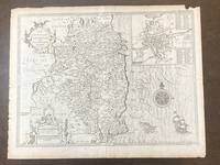
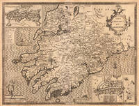
1676100280To be sold by Robert Chiswell in St. Paul's Churchyard and Thomas Basset in Fleetstreet 1676. Map. Very Good. Uncolored map of County Leinster 15 in. x 20.25 in. sheet is 17 in. x 22 in. with inset map 6 in. x 7 in. of Dublin with a 69-point key. The map is backed by pages 141/142 of an atlas presentation. Title and legend are decorated with two ornate cartouches a decorative compass rose and a full-masted sailing ship and sea-monster that cruise the Irish Sea. <br /> <br /> Map is dated 1610. The English text on the verso and the 3-line imprint Chiswell and Bassett below the distance scale indicate it is from the 1676 publication of Speed's "Theatre of the Empire of Great Britaine." On the map's backside page 141 describes the geography people and history of the County. Page 142 provides an alphabetized list all the towns and villages included on the map. <br /> <br /> Light tanning; rubbing and short closed tears along right and edges. Faint vertical fold line at center and faint horizontal fold line eight inches above bottom. One inch chip in margin at upper right corner. John Speed 1552-1629 began his career as a tailor with deep interests in history theology and cartography. The patronage of Sir Fulke Greville Lord Brooke 1554-1628 allowed him to give up his trade and dedicate himself to these interests. In terms of cartography he is especially known for an ambitious project to publish a series of maps of English counties called Theatre of the Empire of Great Britaine first published in 1611. Designed along the lines of Ortelius' Theatrum orbis terrarum Speed's Theatre was groundbreaking: it provided some of the first detailed maps of the Irish provinces as well as town plans for seventy-three English towns. Univ of Missouri Special Collections. To be sold by Robert Chiswell in St. Paul's Churchyard and Thomas Basset in Fleetstreet unknown
164623399London: William Humble 1646. Other. In excellent condition. 393 by 520mm 15½ by 20½ inches. 393 by 520mm 15½ by 20½ inches. Copper engraving uncolored as published. William Humble unknown
16651788London: to be sold by Roger Rea the Elder ad younger at the Golden Crosse in Cornhill against the Exchange. 1665. 410 by 550mm. 16.25 by 21.75 inches. Double-page engraved map fine contemporary outline hand colour upper left and right margins skilfully repaired margins reinforced with japan paper. The map bears the imprint of Roger Rea the Elder and Younger. The Reas had purchased the rights to Speed's work form William Garrett in 1659 who had previously purchased them from the widow of William Humble in the same year. Skelton suggests that the father and son intended a new edition of the atlas for the Restoration of 1660. However the atlas would appear not to have been published until 1665. This is borne out by an advertisement in the Term Catalogue by the subsequent owners of the plates Thomas Bassett and Richard Chiswell in 1675: "Mr John Speed's. Geography of the Kingdoms of England Scotland and Ireland. together with his Prospect. all in one entire Volume hath been for seven Years past out of Print the greatest part of an Impression then newly Printed being destroyed by the late dreadful Fire 1666". This is borne out by the rarity of the Rea edition of the atlas. There is evidence that they planned an edition of 1666 as there are impressions of Sussex Buckingham and Derby with Rea's imprint which bear that date. Rea would later sell the plates to Bassett and Chiswell who would publish a new edition in 1676. to be sold by Roger Rea the Elder ad younger at the Golden Crosse in Cornhill against the Exchange. unknown
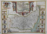
1625M8563London: John Speed c. 1625. Backed on acid free tissue paper for long term preservation central fold reinforced otherwise very good. Notes: A beautifully decorated and coloured map of Suffolk by historian and cartographer John Speed. This map of Suffolk is taken from “Theatre of the Empire of Great Britain†and shows the town plan of Ipswich in an inset at the top of the map. The Inset has the images of the Roman general Petillius Cerealis on the left and Boadicea on the right. The arms of the noble families of the county are also depicted on either side of this artistic map. <br><br>A description of the county of Suffolk is written on verso. Size : 400x545 mm 15.75x21.46 Inches Coloring: Hand Colored Category: Maps Europe United Kingdom England Counties; John Speed unknown
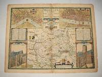
87964Published by Bassett and Chiswell -The Theatre of the Empire of Great Britaine described by John Norden. 1676. Nice later hand-colouring. Considered to be the most decorative map of the county it includes views of St. Peter’s Westminster Abbey and St. Paul’s cathedrals In good condition. Some slight darkening around edges and centre fold. Professional repair ends of folds. Unframed. Large double sided map engraved surface 20.5 x 16 inches. Published by Bassett and Chiswell -The Theatre of the Empire of Great Britaine, described by John Norden. 1676 unknown
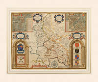
166254995Theatre of the Empire of Great Britain. Roger Rea. 1662-65. A beautiful map of Buckinghamshire from Speed's Theatre. Inset plans of the market towns of Buckingham and Redding the latter being a strange choice given that it lies in the county of Berkshire - an indication that the other market towns in Buckinghamshire were not large or prosperous. Embellished with cartouches cherubs and coats of arms belonging to the titled families of the county. Decorated scale at bottom with dividers above and compass rose to the right. Copper engraving. Good condition. Cut close at left and right hand sides but enough added margin for mounting and framing. Top margin strengthened. A closed tear 3 inches runs from the bottom up to the shield of Thomas of Wodstoke on the right. This has an old repair and is scarcely noticeable. Later colour. Size: 50 x 38 cm. 19½ x 15 inches unknown
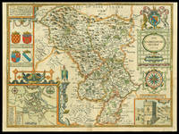
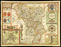
162711763London: Performed by John Speede and are to be sold in popes head Alley by Iohn Sudbury and G. Humble 1627. 380 by 510mm. 15 by 20 inches. Engraved map with hand colouring. A beautifully coloured map of Derbyshire with insets of the city of Derby and the springs at Buxton. John Speed 1552-1629 was the outstanding cartographer of his age. His 'Theatre of Great Britain' was the first atlas of the British Isles: Speed prepared the maps himself about two years before they were published. His maps and books dominated the seventeenth-century English market. The present map is taken from the 1627 English edition published by George Humble. Chubb XXV. Performed by John Speede, and are to be sold in popes head Alley by Iohn Sudbury and G. Humble, unknown
16651781London: to be sold by Roger Rea the Elder and younger at ye Golden Crosse in Cornhill against ye Exchange 1665. 410 by 550mm. 16.25 by 21.75 inches. Hand-coloured double-page engraved map upper left and right margins skilfully repaired margins reinforced with japanned paper. The map bears the imprint of Roger Rea the Elder and Younger. The Reas had purchased the rights to Speed's work form William Garrett in 1659 who had previously purchased them from the widow of William Humble in the same year. Skelton suggests that the father and son intended a new edition of the atlas for the Restoration of 1660. However the atlas would appear not to have been published until 1665. This is borne out by an advertisement in the Term Catalogue by the subsequent owners of the plates Thomas Bassett and Richard Chiswell in 1675: "Mr John Speed's. Geography of the Kingdoms of England Scotland and Ireland. together with his Prospect. all in one entire Volume hath been for seven Years past out of Print the greatest part of an Impression then newly Printed being destroyed by the late dreadful Fire 1666". This is borne out by the rarity of the Rea edition of the atlas. There is evidence that they planned an edition of 1666 as there are impressions of Sussex Buckingham and Derby with Rea's imprint which bear that date. Rea would later sell the plates to Bassett and Chiswell who would publish a new edition in 1676. to be sold by Roger Rea the Elder and younger at ye Golden Crosse in Cornhill against ye Exchange, unknown
167621984<p>London: are to be sold by Thomas Basset in Fleet Street and Richard Chiswell in St Pauls Churchyard 1676. 390 by 515mm. 15.25 by 20.25 inches. Speed's map of Hertfordshire Double-page engraved map with hand colour slight discolouration to centre fold. A map of Hertfordshire from the 1676 edition of the first large-scale atlas of the British Isles Speed's 'Theatre'. In the top left-hand corner is an inset town-plan of Hertford with points of interest including 'Hony lane' and 'Back stret' marked using an alphabetical key. In the top right-hand corner is an inset showing 'Verolanium' presumably a mis-spelling of 'Verulamium' modern-day St. Albans one of the most significant cities in Roman Britain. In the bottom right-hand corner is a cartouche in which are described the 'three mortall and bloody Battells of Englands civill disections' fought in Hertfordshire: the first battle of St. Albans 1451 the second battle of St. Albans 1461 and the battle of Barnet 1471. Accompanying text in English 'Hundreds in Hertford-shire' and 'Hertford-shire' is printed on the verso. John Speed 1552-1629 was the outstanding cartographer of his age. By trade a merchant tailor but by proclivity a historian it was the patronage of Sir Fulke Greville poet and statesman that allowed him to pursue this interest in earnest. His 'Theatre of Great Britain' from which the present work is drawn was first published in 1611 or 1612 and is 'the earliest English attempt at atlas-production on a grand scale' Skelton. Drawing heavily on the work of Saxton and Norden little of Speed's cartography is original he acknowledges 'I have put my sickle into other mens corne' instead it is his blend of cartography and history incorporating town-plans vignettes and genealogy that makes Speed an innovator. This map is from the 1676 edition of the 'Theatre' published by Thomas Bassett and Richard Chiswell. Chubb CIV; Shirley Atlases T.Spe-1j; Skelton 92.</p> are to be sold by Thomas Basset in Fleet Street, and Richard Chiswell in St Pauls Churchyard,
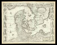
167621924<p>London: are to be sold by Tho: Bassett in Fleet Street and Ric: Chiswell in St. Pauls Churchyard 1676. 400 by 520mm. 15.75 by 20.5 inches. Speed's map of Denmark Double-page engraved map. A map of 'the Kingdome of Denmarke' comprising modern-day Denmark and parts of Sweden and Germany from the 1676 edition of the first atlas compiled and published by an Englishman Speed's 'Prospect'. The upper border contains views of major cities including Copenhagen and Hamburg with the arms of Christian King of Denmark at the centre and portrait medallions of Christian IV and of his son and heir Frederick on either side. Along each side are illustrated figures wearing regional costumes. Accompanying text in English 'The Description of the Kingdom of Denmark' is printed on the reverse. John Speed 1552-1629 was the outstanding cartographer of his age. By trade a merchant tailor but by proclivity a historian it was the patronage of Sir Fulke Greville poet and statesman that allowed him to pursue this interest in earnest. His 'Theatre of Great Britain' first published in 1611 or 1612 was the first large-scale printed atlas of the British Isles. The 'Prospect of the Most Famous Parts of the World' from which the present work is drawn appeared in 1627 bound with the 'Theatre' and is the first world atlas compiled by an Englishman to be published in England. Engraved in Amsterdam many of the maps are anglicized versions of works by Dutch makers in distinctive carte-à-figure style featuring borders with figures in local costume and city views. This map is from the 1676 edition of the 'Prospect' published by Thomas Bassett and Richard Chiswell. While not as rare as the earlier publications this edition is perhaps the most important given that it is the first to include the nine new maps: among them Virginia and Maryland Barbados and Russia. It is also the last time that the 'Prospect' was printed as an atlas. Shirley Atlases T.SPE-2f.</p> are to be sold by Tho: Bassett in Fleet Street and Ric: Chiswell in St. Pauls Churchyard,
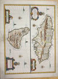
1676M7404London c.1676. Very good the lower part of the central fold reinforced and backed with acid free tissue paper for long term preservation. Notes: From Speed's A Prospect of the Most Famous Parts of the World. Size : 389x510 mm 15.31x20.08 Inches Coloring: Hand Colored Reference: Kapp: Printed Maps Of Jamaica 22<br>Campbell: Printed Maps Of Barbados MCS 21 no.5 pl. III Category: Maps West Indies Other Islands; unknown
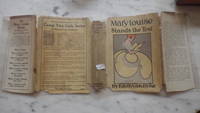
192124650Reilly and Lee Company 1921. no other plates. Front Inner Flap DJ Taped Detached Pricecliped Blank Endpaper Small Stickers HBDJ 1921. Early Reprint Hardcover. Book Condition: Very Good -. Dust Jacket Condition: FAIR AS-IS FADED. Small 8vo 223 pgs NO ADS in Back. This title was written by Emma Speed Samson under the name Edith Van Dyne a pseudonym of L. Frank Baum. with the DJ listing six titles on the rear flap ends with Mary Louise & Josie OGorman. Full bound blue Decorated cloth with navy titles on front board and spine Cvr Light Wear. Some sunning to cloth at head and tail of spine light dust soil to block edges booksellers' stickers on front and rear pastedowns. DJ Shows significant wear with Small Chips Extremities Edges Yet Titles in Black & Illustration INTACT Both flaps are detached but present with Tape Mending chipping along all edges 1/2" chipped from head and tail of Darkened Spine DJ affects Titles & Publ somewhat some sunning and dust soil. Back DJ Soil Fox & Edge Chipping Yet Titles INTACT End with Camp Fire Girls at Hurricane Island Interior tight crisp and relatively clean FOX & WEAR. .Roses of the honeymoon had Hardly Faded before Sorrow Came to the Little Bride & Her Soldier-Boy Husband. When Danny Was Practically Driven From Home of his Beloved Girl-Wife by reason of the Colonels Vagaries She Refused to Give Up & Fought Fate Bravely. Her Friend Josie OGorman was Cheery Friend & Real Inspiration when Trouble Came & The Higgledy Piggledy Shop was There to Fall Back On. Mary Becomes a Milliner when the Colonel Died & His Fortune Vanished & Danny was Reported Lost At Sea. There Followed MYSTERY & Excitement. Hard Cover. Reilly and Lee Company hardcover
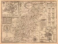
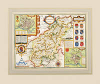
162757317Theatre of the Empire of Great Britain published by Bassett and Chiswell. c.1627. A highly decorative Speed's map with coats of arms of all the families that were made earls of Northampton following the Norman conquest. Insets showing a townplan of Northampton with related text and plan of Peterborough and a vignette of the Battle of Egdecot in 1469 together with a section of text First published in 1611 today the work of John Speed is regarded highly by map collectors historians and artists due to the intricate nature and artistic beauty of the maps. Copper engraving. Fine condition; wide margins. Mounted size: 71.5 x 60 cm Hand coloured. Size: 51 x 38.5 cm. 20 x 15 inches unknown
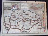
1627006728London: George Humble 1627. Map. Very Good. Are to be sold in popes head Alley by J. S. & G. H." "R. Elstrack sculpsit." 1 hand-colored copperplate engraving 41 x 55 cm. from Book One of John Speed's Theatre of the Empire of Great Britaine London: George Humble 1627. See: STC 2nd ed. 23042. A detailed map of Norfolk County with inset illustrations of a battle in the Peasant's Revolt in 1381 and of the town of Norwich. The town plan of Norwich includes a guide to 24 locations in the town. Above the map is the royal coat of arms of the United Kingdom; along one side are seven coats of arms of Norfolk families. text on the reverse describes Norfolk and lists the hundreds. In Very Good Condition: minor loss along upper edge not impacting image; just starting to separate at lower end of center fold; colors are bright; a clean and crisp map. George Humble unknown
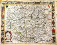
1676M11228London: Are to be sold in popshead Alley by G. Humble. 1676. Very Good . Notes: Highly decorative and detailed map of Bohemia the present-day Czech Republic.<br><br>English text on verso.<br><br>John Speed 1552 –1629 was an English cartographer and historian. He is known as England's most famous Stuart period mapmaker. His maps of English counties are often found framed in homes throughout the United Kingdom. For a series of maps Speed partnered with Dutch engraver Jodocus Hondius. <br><br> Size : 415x519 mm 16.34x20.43 Inches Coloring: Original Hand Coloring Category: Maps Europe Czech Republic Slovakia; Are to be sold in popshead Alley by G. Humble. unknown
164623423London: William Humble 1646. Other. In excellent condition. 383 by 514mm 15 by 20¼ inches. 383 by 514mm 15 by 20¼ inches. Copper engraving uncolored as published. William Humble unknown
164623401London: William Humble 1646. Other. In excellent condition. 385 by 510mm 15¼ by 20 inches. 385 by 510mm 15¼ by 20 inches. Copper engraving uncolored as published. William Humble unknown
164623402London: William Humble 1646. Other. In excellent condition. 387 by 512mm 15¼ by 20¼ inches. 387 by 512mm 15¼ by 20¼ inches. Copper engraving uncolored as published. William Humble unknown