John Keats; Jno Gilmer Speed [ed]Biblio.com
1 203 résultats
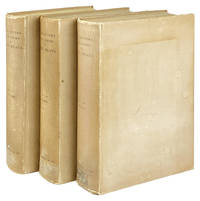
188328255New-York: Dodd Mead & Company 1883. Very Good. New-York: Dodd Mead & Company 1883. First Thus Limited to 279 sets printed on Holland paper of which this is no. 160. Three volumes; octavos; publisher's buff paper-covered boards black spine titling; frontispieces at head of each volume that of Vol. I printed in color. Ex-Darrow Gibbs School Library with their early 20th-century ex libris to front free endpapers and usual internal markings to Vols. II & III faint evidence of previously-removed spine labels boards a bit scuffed and spines toned Vol. III upper cover unevenly discolored and faintly damp-stained with brief ink numeral to front free endpaper else a Very Good still quite attractive set. Dodd, Mead & Company unknown
20101420066560Chapman and Hall/CRC 2010. New/New. <p><strong>Author:</strong> John P. Buonaccorsi Byron J.T. Morgan Niels Keiding Peter Van der Heijden Terry Speed</p><p><strong>Publisher:</strong> Chapman and Hall/CRC</p><p><strong>ISBN:</strong> 9781420066562</p><p><strong>Release Date:</strong> 2010</p><p><strong>Languages:</strong> English</p><p><strong>Binding:</strong> Hardcover</p><p><strong>Number Of Pages:</strong> 464</p> Chapman and Hall/CRC hardcover
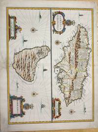
1676M7404London c.1676. Very good the lower part of the central fold reinforced and backed with acid free tissue paper for long term preservation. Notes: From Speed's A Prospect of the Most Famous Parts of the World. Size : 389x510 mm 15.31x20.08 Inches Coloring: Hand Colored Reference: Kapp: Printed Maps Of Jamaica 22<br>Campbell: Printed Maps Of Barbados MCS 21 no.5 pl. III Category: Maps West Indies Other Islands; unknown
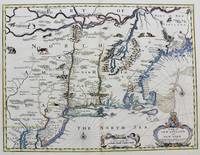
1676M8290London. : Tho: Basset; Richard Chiswell c. 1676. Very Good. Notes: A significant map of the British colonies in North America covering the east coast from Maryland and New Jersey northward through New York and New England to the French possessions in Canada. It depicts the territories acquired by the British with the capture of New Amsterdam in 1664 which changed European influence in the colonies from the Dutch to the English. It is the first appearance of name Boston and the first map to use the term New York for both Manhattan and the colony. It is also one of the first maps to show New Jersey. The map is decorated with various animals in the interior of the map two compass roses two cartouches and a coat of arms. With English text on verso that provides interesting information on the colonies. Size : 381x497 mm 15.00x19.55 Inches Coloring: Hand Colored Category: Maps United States East; Tho: Basset; Richard Chiswell unknown
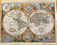
1659M9858London 1659. Very Good backed on acid free tissue paper for long term preservation. Notes: Scarce third state of Robert Walton's decorative map of the World based upon the earlier edition of John Speed's World map.<br>Double hemisphere map of the World with portraits of the four great explorers of the era Sir Francis Drake Thomas Candish Oliver Van Noort and Ferdinand Magellan.<br>California is depicted as an Island with an unusual Northwest Coast of America. The map is surrounded by smaller celestial hemispheres and the four elements with notes on the South Pole & Straits of Magellan. <br>Walton's map is rarer than John Speed's map and is of equal artistic and cartographic importance.<br> Size : 398x530 mm 15.67x20.87 Inches Coloring: Hand Colored Reference: Shirley #397. Category: Maps World; unknown
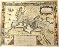
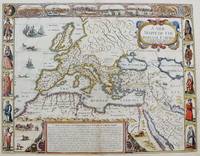
1676M10992London 1676. Very Good. Notes: English text on verso.<br>Map of the Roman Empire it is surrounded by views of the cities of Geneva Rome Jerusalem Venice and Constantinople and Alexandria and figures displaying the customary dress of Italians Egyptians Turks and Spaniards with their wives. <br><br>John Speed 1552 –1629 was an English cartographer and historian. He is known as England's most famous Stuart period mapmaker. His maps of English counties are often found framed in homes throughout the United Kingdom. For a series of maps Speed partnered with Dutch engraver Jodocus Hondius. <br><br> Size : 393x509 mm 15.47x20.04 Inches Coloring: Original Hand Coloring Category: Maps Europe Continent; Maps Asia Continent; unknown
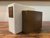
16466182London: M. F. for William Humble/George Humble 1646. First Thus. Very Good. An original travel atlas containing an early map of the world maps of the continents several countries and detailed maps of Ireland Wales Scotland and the counties in England. Bound in modern full grain leather over boards with new endpapers. Housed in a custom clamshell box using archival cloth and with a leather and gilded label on the spine. A few names on first blank in 19th century/early 20th century ink dated. Pages are toned some trimmed very close to the plate. Some infrequent soiling all text and maps are legible. With 1 folding map; a short tear to the folded part of the map. General wear to page edges. Complete with an engraved double-hemisphere map of the world 4 maps of the continents 15 other global maps and 63 maps of England Scotland Wales and Ireland. A 64th map is called out in the table of maps but Midia seems to be missing from all examples. This a miniaturized version of John Speed's folio edition.<br /> <br /> Pages: 4 206; 2; 378 Dimensions: 65/16 x 43/16 x 2. M. F. for William Humble/George Humble unknown
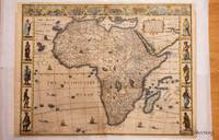
1626320851626. John Speed was a notable cartographer and historian of Britain. This decorative map is sought after by collectors because it is the first map of Africa prepared by a notable English cartographer. His Theatre of the Empire of Great Britaine was widely influential later editions of which included this map of Africa. The map first was published in A prospect of the most famous parts of the world which was a supplement to Speed's Theatre. Somewhat paradoxically this first English map of Africa was engraved by the famous Abraham Goos from Amsterdam - he was a relative of the Hondius family and therefore knew well the Dutch maps from which this map is derived. The map has a long publication history see Betz: published first by William Humble then his son George first state with date of 1626; then Roger Rea most of whose atlases were destroyed in the Great Fire of London 2nd state. Basset & Chiswell acquired Speed's plates after 1668 and published this 3rd state of the map together with maps of the other continents and the world map. Some time before 1690 Christopher Browne acquired the plates but a map of Africa from him is not known. The map is based maps of Jodocus Hondius whose Latin annotations are translated into English and Willem Blaeu his geography. The geography is typically early seventeenth century with its legendary Ptolemaic mountains rivers and lakes; typically the Nile arises from two lakes. The Europeans knew little about the interior of Africa and therefore there are numerous illustrations of terrestrial animals 'elephants for want of towns' according to Jonathan Swift; the oceans have ships and sea serpents. The English text on verso provides a fascinating view of the European concept concerning the wildlife customs and manners of the African people. There is a description of Anthropophagi cannibals who kill their own babies to avoid the trouble of raising them; but in order to preserve their race steal children from their neighbors. The side borders of this carte-a-figure map comprise sets of 5 decorative costumes of African peoples and the top border displays prospects of eight African Cities. Some of the border illustrations are copied from Willem Blaeu. At top is a panel of panoramas and plans illustrating Tanger Ceuta Alger Tunis Alexandria Cairo Alca Mozambique and the Canary Islands. This example of the map is in attractive colour and in very good condition. a few minor chips along the edges and an old repair on the bottom joint. Acid free mounting tape on the back. unknown
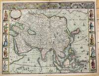
1626M10939London c.1626. Very Good. Notes: English text on verso.<br>First British map of Asia the map has 8 town plans in upper border and costumes of inhabitants of Asia in side borders. Size : 395x514 mm 15.55x20.24 Inches Coloring: Original Hand Coloring Category: Maps Asia Continent; unknown
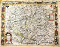
1676M11228London: Are to be sold in popshead Alley by G. Humble. 1676. Very Good . Notes: Highly decorative and detailed map of Bohemia the present-day Czech Republic.<br><br>English text on verso.<br><br>John Speed 1552 –1629 was an English cartographer and historian. He is known as England's most famous Stuart period mapmaker. His maps of English counties are often found framed in homes throughout the United Kingdom. For a series of maps Speed partnered with Dutch engraver Jodocus Hondius. <br><br> Size : 415x519 mm 16.34x20.43 Inches Coloring: Original Hand Coloring Category: Maps Europe Czech Republic Slovakia; Are to be sold in popshead Alley by G. Humble. unknown
2017lib9019282726BC19Batsford 2017. Hardcover. Like New. large colorful oblong book in Fine shape Batsford hardcover
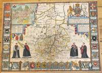
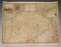
1676M9963London: Thomas Bassett & Richard Chiswell c.1676. Very Good. Notes: Map shows 25 university armorials four scholars the Royal Crest and a plan of Cambridge. English text on verso. Size : 385x525 mm 15.16x20.67 Inches Coloring: Original Hand Coloring Category: Maps Europe United Kingdom England Counties; Thomas Bassett & Richard Chiswell, unknown
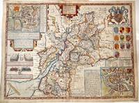
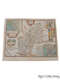
1627M11352London 1627. Very Good central fold reinforced. Notes: Detailed and decorative county map of Gloucestershire with inset plans of Bristol and Gloucester also with two battle vignettes and 10 Royal coat of arms.<br>English text on verso. Size : 388x510 mm 15.28x20.08 Inches Coloring: Hand Colored Category: Maps Europe United Kingdom England Counties; unknown
167633174Bassett and Chiswell 1676. This map is from John Speed's The Theater of the Empire of Great Britaine with the english text on the back. Presenting well uniform toning later hand-coloring. Border strengthened at the back with acid free tape. 545 by 435mm 21½ by 17¼ inches. Bassett and Chiswell unknown
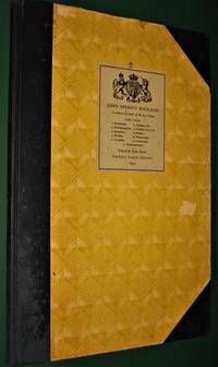
19544777<p>London- UK: Phoenix House Limited 1954. John Speed's England. Part 4- A Coloured Facsimile of the First Edition- John Arlott Ed.- Illustrated- Phoenix House Limited- London-UK- 1954 1st Edition Thus- Hardcover:- Elephant Folio - over 15" - 23" tall- 1/2 Cloth & Boards- G-VG/ no jacket as issued- still tight and square rubs and light chips unpaginated 58 pages only minor faint spotting no tears or writing- SEE PHOTOS- Non-fiction-atlas-travel guide-England-illustrated 4777 Not very heavy but very large book which may require extra shipping. Please inquire. 1st Thus. 1/2 Cloth & Boards. G-VG/No Jacket as Issued. Illus. by Illustrated. Elephant Folio - over 15" - 23" Tall.</p> Phoenix House Limited hardcover
75869<p>London John Sudbury & George Humble nd. Large Map. Approx 20 x 16 inches engraved area. Hand coloured. Mounted. Double-sided with list of hundreds and Description of the County on reverse. Framed. In very good condition. Lovely colouring. Centre crease. Double glazed Frame. Some masking tape reinforcement to bottom of map. Glass may need to be removed for transit/posting if sent abroad.</p> London, John Sudbury & George Humble nd
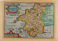
1627M9234London: George Humble c.1627. Very Good. Notes: A charming map of Pembrokeshire county in Wales during the early 17th century. English text on verso. Size : 85x121 mm 3.35x4.76 Inches Coloring: Hand Colored Category: Maps Europe United Kingdom Wales; George Humble unknown
B9781621966784Paperback / softback. New. paperback
A9781621966777Hardback. New. hardcover
47141101-nnew. unknown
47141101like new. unknown
ria9781621966777_inpHardcover. New. New Book; Fast Shipping from UK; Not signed; Not First Edition; This book is in the Rapid Communications in Conflict and Security RCCS Series General Editor: Thomas G. Mahnken; Founding Editor: Geoffrey R.H. BurnBeginning in 2010 a public debate emerged about the role of so-called ma hardcover
ria9781621966784_inpPaperback. New. New Book; Fast Shipping from UK; Not signed; Not First Edition; This book is in the Rapid Communications in Conflict and Security RCCS Series General Editor: Thomas G. Mahnken; Founding Editor: Geoffrey R.H. BurnBeginning in 2010 a public debate emerged about the role of so-called ma paperback
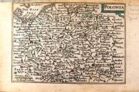
1646M11174London c.1646. Very Good. Notes: Miniature map of Poland with English text on verso.<br>Pieter van den Keere Latin: Petrus Kaerius 1571 – c.1646 was a Flemish engraver publisher and globe maker who worked for the most part of his career in England and the Dutch Republic. Size : 86x122 mm 3.39x4.80 Inches Coloring: Original Hand Coloring Category: Maps Europe Poland Lithuania; unknown
1651M8291London: Tho: Basset; Richard Chiswell c. 1651. Very Good. Notes: StolenHighly decorative map of the Roman Empire. Includes illustrations of ships and sea monsters as well as various animals placed in their native lands. <br>Includes a decorative cartouche on the upper right side and a brief historical description of the history of the Roman Empire at the bottom of the map. Illustrations of Rome Geneva Jerusalem Venice Constantinople and Alexandria as well as various native people in costumes are placed around the map. Size : 391x509 mm 15.40x20.05 Inches Coloring: Original Hand Coloring Category: Maps Mediterranean Sea; Maps Asia Near East Turkey; Maps Europe Continent; Maps Africa Continent; Tho: Basset; Richard Chiswell unknown