Speed, JohnBiblio.com

1 204 résultats
16231701800Published by George Humble 1623. Hardback. Very Good. Very good condition with no wrapper. Their Originals Manners Habits Warres Coines and Seales: with the Successions lives acts etc. of the English Monarchs. Second Edition. Revised and enlarged. Contents lists 10 books; this binding contains the following: Contents plus 8 page proeme; Books 5 - 10 plus Summary of the whole and 78 page index table. Very large format. Leather binding with raised bands to spine and black title labels and gilt titles. Contains woodcuts. Leather binding is a modern binding which is faded to spine. NO frontis. Book reads complete with in itself - but starts at book 5. A rare survivor of this historical book! Published by George Humble hardcover
1623LD8073London: Printed by John Beale for George Humble 1623. Second edition. Hardcover. Very Good. Folio 340 x 220mm. xx 1258pp. 74 numerous error in paging and register. Signatures: par.6 1st leaf blank A8; B-2H6; I4; 2K-4S6; 4T4; 4V-4Y6; 4Z8 4Z8 sic 4Z4; 5A-5T6; 5V1 of 4. Printers device of Humble on title head- and tail- pieces and initials throughout. Many in text engravings including 8 full page genealogies and numerous woodcuts throughout of coins and seals. Text in double column. Period full English calf rebacked and restored at corners in modern leather and stamped in gilt Historie of Great Britain Speed; lacking frontis. title somewhat browned and remargined text block lightly browned around edges lacking final 3 leaves of Table otherwise good. Sold as is. Large white on black bookplate of Dr. Otto Orren Fisher of Detroit Michigan to front pastedown. <br/><br/>Second Edition of Speeds Historie of Great Britain. Second Edition revised and enlarged and reissued in 1625 and again in 1627; Speeds Historie of Great Britain was originally published in 1612 with The Theatre of the Empire of Great Britaine as a companion volume though continuously paginated The Historie being the second work and the contents listing refers to the first four books which were part of the Theatre although this work books 5 - 10 is complete in itself. His account of the reign of Henry VIII p. 998 is followed by an appendix described in the running head as A Catalogue of the Religious Houses Colledges and Hospitals sometimes in England and Wales. These sections hold a wealth of information on early successors and founders of English Institutions. It was likely Speed an apt historian himself borrowed many of his materials from William Camden and was supplied by many Sir Robert Cotton Sir Henry Spelman and other antiquaries with whom he was acquainted. Although he probably had access to historical sources that are now lost to us he certainly used the work of Saxton and Norden his work as a historian is considered mediocre and secondary in importance to his map-making and the town plans he drew. Despite its many defects the Historie was very frequently cited by later writers. An important rich historical and artifactual book on Early English history. STC 2nd ed. 23046.3 Printed by John Beale for George Humble hardcover
1632129648At London : Printed By Iohn Dauuson For George Humble And Are To Be Sold In Popes-Head Pallace At The Signe Of The White Horse 1632. Third Edition. Hardback. Finely and period sympathetically bound in modern aniline calf over marble boards. Raised bands with a dark morocco gilt-blocked label. An uncommonly good example - scans and additional bibliographic detail on request. ; 1237 pages; With sundry descents of the Saxons kings their marriages and armes. Signatures: par. 6 -par. 1 A8 B-2H6 2I4 2K-4S6 4T4 4V-4Z6 5A8 5B-5Y6 5Z4. Physical desc. : 20 1237 i. E. 1281 85 p. : ill. geneal. Tables. This third edition has been reissued enlarged and newly corrected. Subject: Great Britain - History - To 1485. Referenced by: STC 2nd ed. 23049. At London : Printed By Iohn Dauuson, For George Humble, And Are To Be Sold In Popes-Head Pallace, At The Signe Of The White Hors hardcover
163230290London: John Dawson for George Humble 1632. Folio pp. 22 1237 i.e. 1281 - page numbers 1043-1086 assigned to recto only 85; includes the preliminary blank leaf; engraved frontispiece portrait of Speed by S. Savery numerous woodcut illustrations and genealogical tables throughout; numerous woodcut initials and ornaments; contemporary full calf perfunctorily rebacked in brown calf maroon morocco label on spine; several clean tears entering text no loss leaf 5a with small piece missing from fore-edge causing minor loss to a few words and numbers light occasional dampstains; a good sound complete copy. A continuation of his Theatre of Great Britaine whose contents are described in this volume as "The Chorographicall Part" accounting for the first 4 books. This volume "The Historicall Part" therefore begins with "the fifth booke" but is complete in itself. STC 23049; Graesse V 462-63; Lowndes 2471-72. John Dawson, for George Humble unknown
1019614331.Ghardcover. Good. Access codes and supplements are not guaranteed with used items. May be an ex-library book. hardcover
0548477876.Gpaperback. Good. Access codes and supplements are not guaranteed with used items. May be an ex-library book. paperback
1163788031.Gpaperback. Good. Access codes and supplements are not guaranteed with used items. May be an ex-library book. paperback
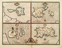
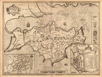
164663961London. c.1646. An excellent map by John Speed of the English Islands of: Farne and Holy Island off the Northumbrian coast; and the Channel Islands of Jersey and Guernsey. Each quatered map has a compass rose dividers and a mileage scale. Size: 430 x 550 mm. Copperplate engraving. Hand coloured. Good condition. Some minor staining to the centrefold and surrounding area. unknown
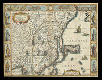
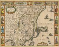
162621928<p>London: Are to be sold in pops-head Alley by G. Humble 1626 but 1627-1632. 405 by 515mm. 16 by 20.25 inches. Speed's map of China Double-page engraved map with hand-colour. A map of China also encompassing Korea and some of the islands of Japan from the first atlas compiled and published by an Englishman Speed's 'Prospect'. Along the top of the map is a decorative border with bird's-eye views of the islands of Macao after de Bry and Quinzay modern-day Hangzhou as well as dubiously accurate vignettes showing 'ye Manner of their Travelling by land' and 'the Manner of their Execution'. Along the sides of the map are depicted figures including one of the earliest European depictions of a Japanese soldier. Korea is shown as a long island and Japan is drawn after Ortelius and Teixeira. The Great Wall of China "built by ye King of China against ye breaking in of ye Tartars" separates China from the 'Desert Lop' which divides it from Russia. Here small diabolical figures are illustrated accompanied by the warning that "men are thought to be seduced by wonderfull illusions and divilish spitting". Accompanying text in English 'The Description of the Kingdome of China' is printed on the reverse. John Speed 1552-1629 was the outstanding cartographer of his age. By trade a merchant tailor but by proclivity a historian it was the patronage of Sir Fulke Greville poet and statesman that allowed him to pursue this interest in earnest. His 'Theatre of Great Britain' first published in 1611 or 1612 was the first large-scale printed atlas of the British Isles. The 'Prospect of the Most Famous Parts of the World' from which the present work is drawn appeared in 1627 bound with the 'Theatre' and is the first world atlas compiled by an Englishman to be published in England. Engraved in Amsterdam many of the maps are anglicized versions of works by Dutch makers in distinctive carte-à-figure style featuring borders with figures in local costume and city views. Chubb XXV; Shirley Atlases T.SPE-2a.</p> Are to be sold in pops-head Alley by G. Humble,
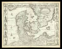
167621924<p>London: are to be sold by Tho: Bassett in Fleet Street and Ric: Chiswell in St. Pauls Churchyard 1676. 400 by 520mm. 15.75 by 20.5 inches. Speed's map of Denmark Double-page engraved map. A map of 'the Kingdome of Denmarke' comprising modern-day Denmark and parts of Sweden and Germany from the 1676 edition of the first atlas compiled and published by an Englishman Speed's 'Prospect'. The upper border contains views of major cities including Copenhagen and Hamburg with the arms of Christian King of Denmark at the centre and portrait medallions of Christian IV and of his son and heir Frederick on either side. Along each side are illustrated figures wearing regional costumes. Accompanying text in English 'The Description of the Kingdom of Denmark' is printed on the reverse. John Speed 1552-1629 was the outstanding cartographer of his age. By trade a merchant tailor but by proclivity a historian it was the patronage of Sir Fulke Greville poet and statesman that allowed him to pursue this interest in earnest. His 'Theatre of Great Britain' first published in 1611 or 1612 was the first large-scale printed atlas of the British Isles. The 'Prospect of the Most Famous Parts of the World' from which the present work is drawn appeared in 1627 bound with the 'Theatre' and is the first world atlas compiled by an Englishman to be published in England. Engraved in Amsterdam many of the maps are anglicized versions of works by Dutch makers in distinctive carte-à-figure style featuring borders with figures in local costume and city views. This map is from the 1676 edition of the 'Prospect' published by Thomas Bassett and Richard Chiswell. While not as rare as the earlier publications this edition is perhaps the most important given that it is the first to include the nine new maps: among them Virginia and Maryland Barbados and Russia. It is also the last time that the 'Prospect' was printed as an atlas. Shirley Atlases T.SPE-2f.</p> are to be sold by Tho: Bassett in Fleet Street and Ric: Chiswell in St. Pauls Churchyard,
64286London: Are to be sold in pops-head Ally by G. humble 1627-32. Original copper engraved map sheet 40.5 x 52 cm; plate: 39.5 x 51 cm with later hand-colouring of China also showing Korea and Japan. Vignette views of Macao and Quinzay and scenes showing the Chinese manner of 'Travelling by Land' and 'Execution' in the upper border. Eight illustrations showing different types of oriental costume four in the left border and four in the right. English text 'Description of the Kingdome of China' to verso. Watermark to western side. Excellent condition. [London: Are to be sold in pops-head Ally by G. humble 1627-32]. unknown
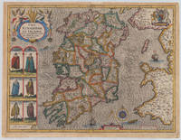
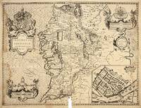
161038006London: John Sudbury and George Humble 1610-27. In very good to excellent condition. 38.5 x 51 cm 15.25 x 20 inches. Original antique copper engraving hand colored in outline and wash very likely old colored. Engraved by Jodocus Hondius. Published 1627 English text edition. Very decorative map of the County of the kingdom of Ireland. At the top left is the title cartouche on which two putti are sitting holding a harp. Below are six engraved costume prints depicting three couples: Gentleman / Gentlewoman of Ireland Civil Irish woman / Civil Irish Man Wild Irish man / Wild Irish woman. In the top right corner we the coat of arms with the inscription 'God and my right' in French language. In the Irish Sea next to the compass rose and mileage scale a sailing ship and a sea monsters are engraved. Below the imprint with the publisher John Sudbury and George Humble and the privileg dated 1610. An early edition of this rare map of Ireland with strong engraved waves in the sea. John Speed 1551 oder 1552 – 28. Juli 1629 war ein englischer Kartograf Chronologe und Historiker mit Wurzeln in Cheshire. Als Sohn eines Bürgers und Schneiders in London verließ er den Beruf seiner Familie um die Aufgabe anzunehmen die Geschichte Topografie und Karten der Königreiche Großbritanniens zusammenzustellen und zu überarbeiten um die Vereinigung ihrer Monarchien in der Person von König James I. und VI. darzustellen. Er erreichte dies mit bemerkenswertem Erfolg mit der Unterstützung und Hilfe der führenden Altertumsforscher seiner Generation. Er stützte sich auf die Shire-Karten von Christopher Saxton John Norden und anderen und verbesserte sie indem er als Erster die Hundertgrenzen in sie einfügte und er war der Landvermesser und Urheber vieler der darin enthaltenen Stadtpläne. Seine Arbeit trug dazu bei frühneuzeitliche Konzepte der britischen Nationalidentität zu definieren. Seine biblischen Genealogien wurden auch offiziell mit der Erstausgabe der King-James-Bibel in Verbindung gebracht. Er gehört zu den berühmtesten englischen Kartografen. Wikipedia.A minor marginal light staining in very good to excellent condition. 2nd English edition 1616 P. 255 John Sudbury and George Humble unknown
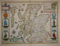
16767572London: Basset & Chiswell 1676. Copper engraving 38.5 x 51.5 cms recent hand-colour light crease in the lower right hand corner but generally a very good example; English text on verso. Cartographically Speed follows Mercator but his is one of the most distinctive and decorative early maps of Scotland. The portraits in the borders originally represented James VI and I and his family including a young Prince Charles. The royal family was burnished from the copper plate during the Interregnum and replaced with the commoners seen here: a Scotch man and woman and a Highland man and woman notable as early depictions of tartan. John Speed 1552-1629 is unquestionably the most significant British map-maker of the seventeenth-century. A brief note from Granger's Bibliographical History of England 1779 contains most of the information we have about Speed's life: "John Speed who was bred a Tailor was by the generosity of Sir Fulk Grevil his patron set free from a manual employment and enabled to pursue his studies to which he was strongly inclined by the bent of his genius. The fruits of them were his Theatre of Great Britain containing an entire set of maps of the counties drawn by himself his History of Great Britain richly adorned with seals coins & medals from the Cotton collection; and his Genealogies of Scripture first bound up with the Bible in 1611 which was the first edition of the present English translation. His maps were very justly esteemed & his History of Great Britain was in its kind incomparably more complete than all the histories of his predecessors put together ." The first edition of Speed's "Theatre" was published in 1612. It was the first atlas of the British Isles and the first attempt made by an Englishman to match the achievements of the great continental publishing houses - although much of the engraving of the copper plates was performed in Amsterdam by Jodocus Hondius. Speed was an antiquary and intended that his atlas should be read in conjunction with his history of Britain. He managed to include a great deal of historical detail on his 'modern' county maps and the inset town plans some surveyed by himself together comprise the first collection of town plans of the British Isles all in all making the Theatre a highly decorative as well as a useful volume. It was a great success and there were editions printed throughout the seventeenth-century. Map Basset & Chiswell unknown
164623399London: William Humble 1646. Other. In excellent condition. 393 by 520mm 15½ by 20½ inches. 393 by 520mm 15½ by 20½ inches. Copper engraving uncolored as published. William Humble unknown
164623402London: William Humble 1646. Other. In excellent condition. 387 by 512mm 15¼ by 20¼ inches. 387 by 512mm 15¼ by 20¼ inches. Copper engraving uncolored as published. William Humble unknown
49670London: John Sudbury & George Humble William Humble 1610 1646. Original engraved map 39x 51 cm. Uncoloured. Insets of Galway. Good dark impression on thick paper torn at centre-fold with loss some staining to outer edges. London: John Sudbury & George Humble [William Humble] 1610 [1646] unknown
2006Q-0312325487St. Martin's Press 2006-08-22. Hardcover. New. In shrink wrap. Looks like an interesting title! St. Martin's Press hardcover
2007Q-0312325495St. Martin's Griffin 2007-07-24. Mass Market Paperback. New. New. In shrink wrap. Looks like an interesting title! St. Martin's Griffin paperback
2007Q-0312325517St. Martin's Press 2007-09-04. Hardcover. New. New. In shrink wrap. Looks like an interesting title! St. Martin's Press hardcover
164623417London: William Humble 1646. Other. In excellent condition. 382 by 506mm 15 by 20 inches. 382 by 506mm 15 by 20 inches. Copper engraving uncolored as published. William Humble unknown
164623414London: William Humble 1646. Other. In excellent condition. 383 by 509mm 15 by 20 inches. 383 by 509mm 15 by 20 inches. Copper engraving uncolored as published. William Humble unknown
1997032510Collector Grade Publications 1997. Hardcover. Fine. Fine clean hard cover first edition with near fine dust jacket. Size: 8vo - over 7¾" - 9¾" Tall; Oblong Collector Grade Publications hardcover
1998032509Collector Grade Publications 1998. Hardcover. Fine. Fine clean hard cover first edition with fine dust jacket. Size: 8vo - over 7¾" - 9¾" Tall; Oblong Collector Grade Publications hardcover
1982263490.Ghardcover. Good. Access codes and supplements are not guaranteed with used items. May be an ex-library book. hardcover
1019398590.Ghardcover. Good. Access codes and supplements are not guaranteed with used items. May be an ex-library book. hardcover