John Speed (1552-1629)Biblio.com
1 203 résultats
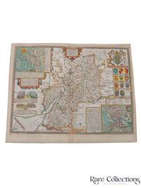
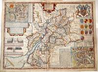
1627M11352London 1627. Very Good central fold reinforced. Notes: Detailed and decorative county map of Gloucestershire with inset plans of Bristol and Gloucester also with two battle vignettes and 10 Royal coat of arms.<br>English text on verso. Size : 388x510 mm 15.28x20.08 Inches Coloring: Hand Colored Category: Maps Europe United Kingdom England Counties; unknown
167633174Bassett and Chiswell 1676. This map is from John Speed's The Theater of the Empire of Great Britaine with the english text on the back. Presenting well uniform toning later hand-coloring. Border strengthened at the back with acid free tape. 545 by 435mm 21½ by 17¼ inches. Bassett and Chiswell unknown
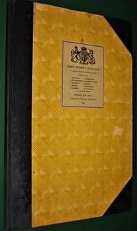
19544777<p>London- UK: Phoenix House Limited 1954. John Speed's England. Part 4- A Coloured Facsimile of the First Edition- John Arlott Ed.- Illustrated- Phoenix House Limited- London-UK- 1954 1st Edition Thus- Hardcover:- Elephant Folio - over 15" - 23" tall- 1/2 Cloth & Boards- G-VG/ no jacket as issued- still tight and square rubs and light chips unpaginated 58 pages only minor faint spotting no tears or writing- SEE PHOTOS- Non-fiction-atlas-travel guide-England-illustrated 4777 Not very heavy but very large book which may require extra shipping. Please inquire. 1st Thus. 1/2 Cloth & Boards. G-VG/No Jacket as Issued. Illus. by Illustrated. Elephant Folio - over 15" - 23" Tall.</p> Phoenix House Limited hardcover
500256708France loisirs Sans date.
500278348Sans date.
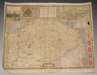
75869<p>London John Sudbury & George Humble nd. Large Map. Approx 20 x 16 inches engraved area. Hand coloured. Mounted. Double-sided with list of hundreds and Description of the County on reverse. Framed. In very good condition. Lovely colouring. Centre crease. Double glazed Frame. Some masking tape reinforcement to bottom of map. Glass may need to be removed for transit/posting if sent abroad.</p> London, John Sudbury & George Humble nd
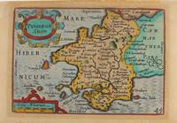
1627M9234London: George Humble c.1627. Very Good. Notes: A charming map of Pembrokeshire county in Wales during the early 17th century. English text on verso. Size : 85x121 mm 3.35x4.76 Inches Coloring: Hand Colored Category: Maps Europe United Kingdom Wales; George Humble unknown
B9781621966784Paperback / softback. New. paperback
A9781621966777Hardback. New. hardcover
47141101-nnew. unknown
47141101like new. unknown
ria9781621966777_inpHardcover. New. New Book; Fast Shipping from UK; Not signed; Not First Edition; This book is in the Rapid Communications in Conflict and Security RCCS Series General Editor: Thomas G. Mahnken; Founding Editor: Geoffrey R.H. BurnBeginning in 2010 a public debate emerged about the role of so-called ma hardcover
ria9781621966784_inpPaperback. New. New Book; Fast Shipping from UK; Not signed; Not First Edition; This book is in the Rapid Communications in Conflict and Security RCCS Series General Editor: Thomas G. Mahnken; Founding Editor: Geoffrey R.H. BurnBeginning in 2010 a public debate emerged about the role of so-called ma paperback
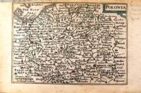
1646M11174London c.1646. Very Good. Notes: Miniature map of Poland with English text on verso.<br>Pieter van den Keere Latin: Petrus Kaerius 1571 – c.1646 was a Flemish engraver publisher and globe maker who worked for the most part of his career in England and the Dutch Republic. Size : 86x122 mm 3.39x4.80 Inches Coloring: Original Hand Coloring Category: Maps Europe Poland Lithuania; unknown
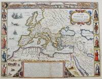
1651M8291London: Tho: Basset; Richard Chiswell c. 1651. Very Good. Notes: StolenHighly decorative map of the Roman Empire. Includes illustrations of ships and sea monsters as well as various animals placed in their native lands. <br>Includes a decorative cartouche on the upper right side and a brief historical description of the history of the Roman Empire at the bottom of the map. Illustrations of Rome Geneva Jerusalem Venice Constantinople and Alexandria as well as various native people in costumes are placed around the map. Size : 391x509 mm 15.40x20.05 Inches Coloring: Original Hand Coloring Category: Maps Mediterranean Sea; Maps Asia Near East Turkey; Maps Europe Continent; Maps Africa Continent; Tho: Basset; Richard Chiswell unknown
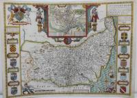
1625M8563London: John Speed c. 1625. Backed on acid free tissue paper for long term preservation central fold reinforced otherwise very good. Notes: A beautifully decorated and coloured map of Suffolk by historian and cartographer John Speed. This map of Suffolk is taken from “Theatre of the Empire of Great Britain†and shows the town plan of Ipswich in an inset at the top of the map. The Inset has the images of the Roman general Petillius Cerealis on the left and Boadicea on the right. The arms of the noble families of the county are also depicted on either side of this artistic map. <br><br>A description of the county of Suffolk is written on verso. Size : 400x545 mm 15.75x21.46 Inches Coloring: Hand Colored Category: Maps Europe United Kingdom England Counties; John Speed unknown
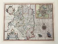
1610M9855London c.1610. Very Good. Notes: John Speed's map of Leinster county; also with an <br>early plan of Dublin. Size : 382x511 mm 15.04x20.12 Inches Coloring: Original Hand Coloring Category: Maps Europe Ireland; unknown
1995Q-1857936124Pavilion Books Ltd 1995-04-01. Paperback. New. New. In shrink wrap. Looks like an interesting title! Pavilion Books Ltd paperback
1851451315.Ghardcover. Good. Access codes and supplements are not guaranteed with used items. May be an ex-library book. hardcover
DADAX1857936124Brand: Trafalgar Square Publishing 0000-00-00. Reprint. paperback. New. 8.25x1.00x12.25. Buy with confidence. Excellent Customer Service & Return policy. Brand: Trafalgar Square Publishing paperback
1331463963.Gpaperback. Good. Access codes and supplements are not guaranteed with used items. May be an ex-library book. paperback
0267666942.Ghardcover. Good. Access codes and supplements are not guaranteed with used items. May be an ex-library book. hardcover
1614655K5London: William Hall and John Beale 1614. Leather. Very Good. 16.5" by 11". Christoph Schweitzer. A very scarce edition of this highly historically significant work of British history written by an extremely influential historian and cartographer and offering a thorough exegesis of early British history from Julius Caesar to King James. A reissue of the 1611 first edition with imprint date altered as called for. ESTC Citation No. S122020. Folio. The work is very scarce with the 1614 reissue being a particularly scarce edition. Collated lacking errata leaf to the rear of the work and front and rear blank. Leaf 802 is misnumbered as leaf 801 as called for. Pagination is continuous from 'The Theatre of The Empire of Great Britaine' but the work is considered complete as a single volume. Contains the exceptionally scarce three leaves between pi 1 and Mm2 containing the author's preface. This is not present in the ESTC copy. Engraved title page has been trimmed and mounted with slight loss to fore edge. With an engraved title page and vignette engravings throughout by Christoph Schweitzer. John Speed is renowned for his work as both a leading English cartographer and historian and is considered one of the best known English mapmakers of the early modern period. Following encouragement from English antiquarian and historian William Camden Speed began this work published first in 1611 as the 'Historie of Great Britaine'. Many of the historical sources utilised for the work remain unknown although they do include the work of cartographers Christopher Saxton and John Norden. The work is considered a continuation of The Theatre of the Empire of Great Britaine first published between 1611 and 1612 within which is contained the first set of individual county maps of England and Wales. Speed himself considered his History of Great Britaine his major work the majority of which was funded by Sir Fulke Grevillean the Elizabethan poet dramatist and statesman. The work offers a highly detailed summary of Early English history and whilst the work has been criticised for a number of inaccuracies the subsequent frequent citations of the work in later historical pieces reflect its historical significance. Among others the work offers detailed information regarding the early successors and founders of English institutions including The Saxons Henry VIII and Edward IV. Written by one of the most influential historians and cartographers of the early modern period this extremely scarce 1614 edition of The History of Great Britaine is a sought after piece of significant historical and literary non fiction. Rebacked with the original contemporary calf boards preserved. Externally very smart with professional repair to the extremities. Slight rubbing and marking to the boards. Hinges slightly strained but firm. Evidence of bookplate removal to rear pastedown. Internally firmly bound. Engraved title page has been trimmed and mounted with slight loss to fore edge. Lacking front and rear blank and errata leaf to the rear of the work. The occasional light tidemark to the extremity of the occasional leaf. Handling marks and the occasional spot. The occasional contemporary ink annotations heavier to the final leaf. The occasional closed tear. Professional repair to leaf 5A2. Very Good William Hall and John Beale hardcover
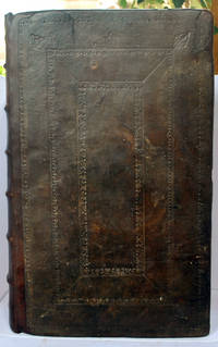
1611031042Popes-head alley at y signe of y White Horse: Imprinted by William Hall and John Beale. Sold by John Sudbury and Georg Humble. 1611 A good copy of the extremely rare 1st edition of Speed's comprehensive work. In full leather binding which has been rebacked retaining the original boards which have blind tooled decoration and replacing the spine which has raised bands and gilt title label. This work continued Speed's 'Theatre of Great Britaine' - and the page numbering is continuous with it - the text starting at p155 and finishing at p 894 although the book is complete on its own. With engraved decorative title page; 4 page preface and text completing at p 894; Summary conclusion of the whole - 4 pp; The Second Index - 46 pp; and a one page 'Faults etc Sped'. The work has numerous engravings of coins seals and coats of arms; and is embellished throughout with decorative head and tailpieces and decorated initial capitals. The binding has been expertly repaired with some building up to one of the corners which had been lost. With new endpapers. The title page has been relaid on tissue. There is light nibbling to page edges up to the end of the preface but overall the paper is extremely thick and well-preserved. There is loss to the Faults page bottom corner and p 755 has a corner missing without loss of text. The pages vary from being completely clean to having spotting to having browning. There are occasional water stains to page margins - most usually the bottom margin - occasionally with a pinkish tinge at the page edge. A few pages have small repaired tears without loss. Imprinted by William Hall and John Beale. Sold by John Sudbury and Georg Humble. hardcover
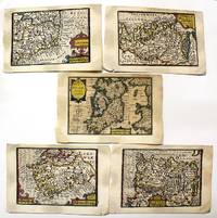
1632M11092London: Petrus Kaerius caelavit George Humble c.1632 . Very Good. Notes: A set of 5 miniature maps of Ireland and its counties.<br>Pieter van den Keere Latin: Petrus Kaerius 1571 – c. 1646 was a Flemish engraver publisher and globe maker who worked for the most part of his career in England and the Dutch Republic.<br><br>Miniature Speeds<br>A series of 44 plates for the British Isles from about 1599 took a long time to publish. They were based on Christopher Saxton Ortelius and Giovanni Battista Boazio respectively for England and Wales Scotland and Ireland. They appeared in 1617 in a Latin edition of the Britannia of William Camden by Willem Blaeu. Later these plates came to William Humble or George Humble according to Royal Geographical Society fellow Carl Moreland and David Bannister—map dealer—in "Antique Maps" who issued them with some modification and expansion in 1627 as a miniature version of the atlas of John Speed. Thereby van den Keere's works came by the name "Miniature Speeds".<br> Size : 85x123 mm 3.35x4.84 Inches Coloring: Original Hand Coloring Category: Maps Europe Ireland; Petrus Kaerius caelavit [George Humble] unknown