SPEED, JOHN:Biblio.com
1 009 résultats
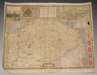
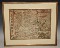
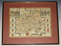
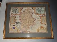
76833Speed / George Humble ca1610-1614. Original Engraved Hand Coloured Double-Sided Map. Mounted and framed in double glazed gold frame glass front and back. Map size 20 x 15 inches. Total size 26 x 21 inches. In very good condition. Vertical crease to centre. A very clean and bright example. Beautifully hand coloured with description and list of Towns to verso. Speed / George Humble ca1610-1614 unknown
75869<p>London John Sudbury & George Humble nd. Large Map. Approx 20 x 16 inches engraved area. Hand coloured. Mounted. Double-sided with list of hundreds and Description of the County on reverse. Framed. In very good condition. Lovely colouring. Centre crease. Double glazed Frame. Some masking tape reinforcement to bottom of map. Glass may need to be removed for transit/posting if sent abroad.</p> London, John Sudbury & George Humble nd
89165Described by Iohn Norden. Augmented by I. Speede And are to be solde by G. Humble. Cum Privilegio. 1610/1625. Large double sided map engraved surface 20 x 15 inches. Framed with mount. Frame Size 26 x 22 inches. In very good condition. Some darkening around the top and corners the darkening has left some lighter stripes. Two rubbed holes at bottom corners with missing text neatly re-written at left corner. One small minor tear to right hand edge on borner and bottom edge by scale at inset of Colchester. With vertical centre fold. Nice later hand-colouring. An attractive and decorative map with inset town plan of Colchester crests and elaborate coat of arms. The maps by John Speed are "the best known and most popular of all English county maps" Tooley. Described by Iohn Norden. Augmented by I. Speede, And are to be solde by G. Humble. Cum Privilegio. 1610/1625 unknown
93175John Sudbury & George Humble 1627. Nice later hand-colouring. An attractive and decorative map with inset views of the palaces of Richmond and Nonsuch both royal Tudor residences which were demolished by the end of the seventeenth century. Nonsuch was given by Charles II to Barbara Countess of Castlemaine who then tore it apart to pay gambling debts; Richmond was sold by Parliament after the execution of Charles I. In very good condition. Some slight on centre fold. Map a little darkened. Wooden fame has a few little nicks. Large double sided map engraved surface 20.5 x 15.5 inches. Gold tinted black hardwood Frame with glass front with a light maroon mount. Frame Size 24.5 x 22.5 inches. The maps by John Speed are "the best known and most popular of all English county maps" Tooley. John Sudbury & George Humble 1627 unknown
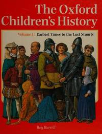
0656079436.Ghardcover. Good. Access codes and supplements are not guaranteed with used items. May be an ex-library book. hardcover
1931mon0003676787Peiping: Customs College Press 1931. Hardcover. Very Good. . A beautiful copy with 200 illustrations many in color SIGNED by the author on the title page. Williams was a British scholar who lived much of his life in China. A comprehensive book on Chinese culture it is alphabetically arranged and covers symbolism legends manners and customs. Blue cloth cover shows minor wear and rubbing pages are lightly tanned and clean. Peiping: Customs College Press hardcover
019918187X.Ghardcover. Good. Access codes and supplements are not guaranteed with used items. May be an ex-library book. hardcover
0199181187New. Brand new and still unused unknown
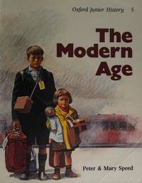
1979Q-0199181225Oxford University Press 1979-12-13. Paperback. New. New. In shrink wrap. Looks like an interesting title! Oxford University Press paperback
162764885London. 1627. A handsome early Sudbury and Humble edition of John Speed's map of Oxfordshire in colour. Towns and cities are highlighted in red decorative college arms and the supposed years of their foundation are found on either side of the map. A detailed inset map of the city of Oxford is in the upper right corner with a separate key with 28 listed city landmarks. The arms of the earl of Oxford to the right. Two academic university figures are seen standing with a pair of compass dividers either side of a striking globe representing the scale of miles. A strapwork border design and the royal coat of arms complete this map wonderfully well. Size: 395 x 535 mm. Copperplate engraving with later hand colouring. Fair condition. Some old repairs to lower central fold. Slight discolouration to the central fold. unknown
16275154London George Humble 1627. Copper engraving 8.7 x 12.3 cms recent hand-colour. Trivial soiling. English text on verso. From the first edition of the so-called minature Speed which used maps by van den Keere to illustrate a pocket edition of Speeds text and which Humble appears to have printed to coincide with editions of the larger atlas. Map unknown
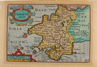
1627M9234London: George Humble c.1627. Very Good. Notes: A charming map of Pembrokeshire county in Wales during the early 17th century. English text on verso. Size : 85x121 mm 3.35x4.76 Inches Coloring: Hand Colored Category: Maps Europe United Kingdom Wales; George Humble unknown
2001Star-9780126565614Elsevier 2001. Paperback. New. Elsevier paperback
2001Star-9780126565614Elsevier 2001. Paperback. New. Elsevier paperback
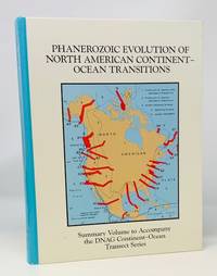
1994500201The Geological Society of America 1994 x 504 pp with B&W charts and maps throughout. Text is clean tight and unmarked. Glazed paper boards are bright and undamaged. 1st Edition. Hardcover. Very Good/No Jacket as Published. Quarto. The Geological Society of America hardcover
B9781621966784Paperback / softback. New. paperback
A9781621966777Hardback. New. hardcover
47141101-nnew. unknown
47141101like new. unknown
ria9781621966777_inpHardcover. New. New Book; Fast Shipping from UK; Not signed; Not First Edition; This book is in the Rapid Communications in Conflict and Security RCCS Series General Editor: Thomas G. Mahnken; Founding Editor: Geoffrey R.H. BurnBeginning in 2010 a public debate emerged about the role of so-called ma hardcover
ria9781621966784_inpPaperback. New. New Book; Fast Shipping from UK; Not signed; Not First Edition; This book is in the Rapid Communications in Conflict and Security RCCS Series General Editor: Thomas G. Mahnken; Founding Editor: Geoffrey R.H. BurnBeginning in 2010 a public debate emerged about the role of so-called ma paperback
162196678X.Gpaperback. Good. Access codes and supplements are not guaranteed with used items. May be an ex-library book. paperback
1621966771.Ghardcover. Good. Access codes and supplements are not guaranteed with used items. May be an ex-library book. hardcover
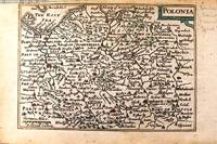
1646M11174London c.1646. Very Good. Notes: Miniature map of Poland with English text on verso.<br>Pieter van den Keere Latin: Petrus Kaerius 1571 – c.1646 was a Flemish engraver publisher and globe maker who worked for the most part of his career in England and the Dutch Republic. Size : 86x122 mm 3.39x4.80 Inches Coloring: Original Hand Coloring Category: Maps Europe Poland Lithuania; unknown
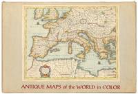
1960558694New York: Sterling Publishing House Co. Inc 1960. Unbound. Very Good. Portfolio. Color facsimiles of 36 historical maps. Each map measures approximately 12" x 9" printed on 17" x 11½" paper with descriptive text in the left margin. Housed with a title page sheet and unprinted top sheet in a four-fold chemise. Unprinted topsheet sunned at the edges first two leaves with some very light toning and a couple of tiny corner creases; the maps are otherwise bright and fine. The chemise is good only with toning wear and soil and a 1" creased tear on the cover panel. A nice production and the chemise has done its job keeping the maps bright and fresh. Sterling Publishing House, Co., Inc unknown