1 009 résultats
1693JC11390London: T. Basset R. Chiswell M. Wotton G. Conyers and J. Walford 1693. Paperback. Good. Disbound; 12mo; pp. 27 1 blank with large copperplate engraving on title-page. Title-page backed along the fore-edge and extending beyond the body of the text which is trimmed close frequently eliminating marginal notes. A scarce edition of this enormously popular and oft-reprinted verse attack on the Puritans first published in 1647. Wing S4898. <br/><br/> T. Basset, R. Chiswell, M. Wotton, G. Conyers, and J. Walford paperback
1710931F22London: printed and sold by the booksellers of London and Westminster 1710 . Paperback. Very Good Indeed. 7" by 4.5". None. A scarce early eighteenth century piracy of Robert Speed's scarce poem about a fight in a debtors prison. First published in 1621 and scarce in all contemporary editions.This is a pirate edition produced by Henry Hills but without his name appearing to the title page.A mock-heroic satire from Robert Speed detailing a brawl in the Wood Street Compter or debtors' prison between two tradesmen. ESTC T58812. With the label of J. O. Edwards to the front pastedown.An attractive example of this work. Rebound in paper wraps with a title label to the front wrap. Small ink mark towards tail of front wrap. Endpapers renewed. Name label to front pastedown. Internally firmly bound. Pages age toned due to the paper type but generally clean. Very Good Indeed printed, and sold by the booksellers of London and Westminster paperback
1680mon0000023721London: for R. Scot T. Baffet 1680. LATER EDITION. Small 4to. 54pp.i disbound recto of title-page repaired illustrated with two engravings one of which is a title-page vignette foredge of title-page chipped not affecting image or text. The poem celebrates a brawl in the Wood Street Compter or debtors' prison. The title-page vignette a copperplate illustrates a brawl; the other plate a full-page woodcut shows a scene at the gate of the prison. The date of the first edition of this work is uncertain but circa 1628 is guessed.rnWing S4896; Lowndes 2164; Grolier Whither to Prior 771. London: for R. Scot, T. Baffet, unknown
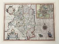
1610M9855London c.1610. Very Good. Notes: John Speed's map of Leinster county; also with an <br>early plan of Dublin. Size : 382x511 mm 15.04x20.12 Inches Coloring: Original Hand Coloring Category: Maps Europe Ireland; unknown
1995Q-1857936124Pavilion Books Ltd 1995-04-01. Paperback. New. New. In shrink wrap. Looks like an interesting title! Pavilion Books Ltd paperback
1851451315.Ghardcover. Good. Access codes and supplements are not guaranteed with used items. May be an ex-library book. hardcover
DADAX1857936124Brand: Trafalgar Square Publishing 0000-00-00. Reprint. paperback. New. 8.25x1.00x12.25. Buy with confidence. Excellent Customer Service & Return policy. Brand: Trafalgar Square Publishing paperback
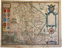
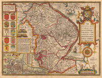
16764988LONDON: Thomas Basset and Richard Chiswell 1676. Attractive full colour example of Speed's map of Lincoln from an early 1676 edition of Speed's Theatre of Great Britain. Includes multiple coats of arms and a large inset plan of the town of Lincoln. The hand colouring is attractive and bright but there are marks and stains to the edges of the map and a little darkening. There are old pin holes to the corners where one pinned to the wall! To the rear are pages 63 and 64 with the description of Lincolnshire and list of the Hundreds in the county. The decoration of the text title identifies the edition as that of 1676. Centre fold. There are a few tape remnants to the verso and some small repairs with archival tape. 42cm x 54cm. British historian John Speed is perhaps the most famous English mapmaker of the seventeenth century. His reputation rests on two great books: The Theatre of the Empire of Great Britaine produced initially in 1611-1612 and A Prospect of the Most Famous Parts of the World published in 1627 the first general atlas of the world to be created in England. . Attrayant exemple en couleur de la carte de Lincoln de Speed tirée d'une édition ancienne 1676 du Speed's Theatre of Great Britain. Elle comprend plusieurs armoiries et un grand plan en médaillon de la ville de Lincoln. La coloration à la main est attrayante et brillante mais il y a des marques et des taches sur les bords de la carte ainsi qu'un léger assombrissement. Il y a de vieux trous d'épingle dans les coins où l'on a épinglé la carte au mur ! Au verso les pages 63 et 64 contiennent la description du Lincolnshire et la liste des centaines du comté. La décoration du titre du texte identifie l'édition comme étant celle de 1676. Pli central. Il y a quelques restes de ruban adhésif au verso et quelques petites réparations avec du ruban adhésif d'archivage. 42cm x 54cm. L'historien britannique John Speed est peut-être le cartographe anglais le plus célèbre du XVIIe siècle. Sa réputation repose sur deux grands livres : The Theatre of the Empire of Great Britaine produit initialement en 1611-1612 et A Prospect of the Most Famous Parts of the World publié en 1627 le premier atlas général du monde créé en Angleterre. Thomas Basset and Richard Chiswell unknown
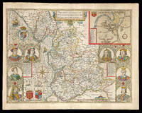
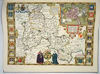
167621977<p>London: And are to be solde by Thomas Bassett in Fleet Street and Ric: Chiswell in St. Pauls Churchyard 1676. 390 by 510mm. 15.25 by 20 inches. Speed's map of Lancashire Double-page engraved map with hand-colour minor wear to edges. A map of Lancashire from the 1676 edition of the first large-scale atlas of the British Isles Speed's 'Theatre'. In the top right-hand corner is an inset town-plan of Lancaster probably the first printed plan of Lancaster. On the left-hand side are portraits of monarchs from the house of Lancaster including Henry IV and on the right of monarchs from the house of York including Richard III. On the verso of the map is printed 'Hundreds in Cheshire' and a description of 'The County Palatine of Chester'. John Speed 1552-1629 was the outstanding cartographer of his age. By trade a merchant tailor but by proclivity a historian it was the patronage of Sir Fulke Greville poet and statesman that allowed him to pursue this interest in earnest. His 'Theatre of Great Britain' from which the present work is drawn was first published in 1611 or 1612 and is 'the earliest English attempt at atlas-production on a grand scale' Skelton. Drawing heavily on the work of Saxton and Norden little of Speed's cartography is original he acknowledges 'I have put my sickle into other mens corne' instead it is his blend of cartography and history incorporating town-plans vignettes and genealogy that makes Speed an innovator. This map is from the 1676 edition of the 'Theatre' published by Thomas Bassett and Richard Chiswell. Chubb CIV; Shirley Atlases T.Spe-1j; Skelton 92; Whitaker 123.</p> And are to be solde by Thomas Bassett in Fleet Street, and Ric: Chiswell in St. Pauls Churchyard,
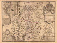
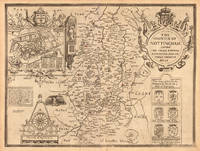
164623430London: William Humble 1646. Other. In excellent condition. 384 by 512mm 15 by 20¼ inches. 384 by 512mm 15 by 20¼ inches. Copper engraving hand colored in outline and wash. William Humble unknown
164623411London: William Humble 1646. Other. In excellent condition. 380 by 507mm 15 by 20 inches. 380 by 507mm 15 by 20 inches. Copper engraving uncolored as published. William Humble unknown
164623401London: William Humble 1646. Other. In excellent condition. 385 by 510mm 15¼ by 20 inches. 385 by 510mm 15¼ by 20 inches. Copper engraving uncolored as published. William Humble unknown
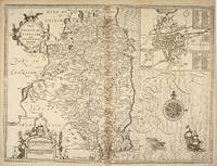
49671London: Tho. Bassett and Richard Chiswell. 1676. Original engraved map 38 x 51 cm. Uncoloured. Inset of Dubline. Good impression very light tanning to centre-fold minor crease at margin of lower right corner. London: Tho. Bassett and Richard Chiswell. [1676] unknown
1992109244Pavilion Books 1992-01-01. Hardcover. New. 11x9x0. Brand new gift quality hardcover in jacket oversized and overweight. B75 Please email for photos. Pavilion Books hardcover
1989Q-0500251045Thames & Hudson 1989. hardcover. New. In shrink wrap. Looks like an interesting title! Thames & Hudson hardcover
16651780London: to be sold by Roger Rea the Elder and younger at the Golden Crosse in Cornhill against the Exchange 1665. 410 by 550mm. 16.25 by 21.75 inches. Double-page engraved map upper left and right margins skilfully repaired margins reinforced with japan paper. The map bears the imprint of Roger Rea the Elder and Younger. The Reas had purchased the rights to Speed's work from William Garrett in 1659 who had previously purchased them from the widow of William Humble in the same year. Skelton suggests that the father and son intended a new edition of the atlas for the Restoration of 1660. However the atlas would appear not to have been published until 1665. This is borne out by an advertisement in the Term Catalogue by the subsequent owners of the plates Thomas Bassett and Richard Chiswell in 1675: "Mr John Speed's. Geography of the Kingdoms of England Scotland and Ireland. together with his Prospect. all in one entire Volume hath been for seven Years past out of Print the greatest part of an Impression then newly Printed being destroyed by the late dreadful Fire 1666". This is borne out by the rarity of the Rea edition of the atlas. There is evidence that they planned an edition of 1666 as there are impressions of Sussex Buckingham and Derby with Rea's imprint which bear that date. Rea would later sell the plates to Bassett and Chiswell who would publish a new edition in 1676. to be sold by Roger Rea the Elder and younger at the Golden Crosse in Cornhill against the Exchange, unknown
16651788London: to be sold by Roger Rea the Elder ad younger at the Golden Crosse in Cornhill against the Exchange. 1665. 410 by 550mm. 16.25 by 21.75 inches. Double-page engraved map fine contemporary outline hand colour upper left and right margins skilfully repaired margins reinforced with japan paper. The map bears the imprint of Roger Rea the Elder and Younger. The Reas had purchased the rights to Speed's work form William Garrett in 1659 who had previously purchased them from the widow of William Humble in the same year. Skelton suggests that the father and son intended a new edition of the atlas for the Restoration of 1660. However the atlas would appear not to have been published until 1665. This is borne out by an advertisement in the Term Catalogue by the subsequent owners of the plates Thomas Bassett and Richard Chiswell in 1675: "Mr John Speed's. Geography of the Kingdoms of England Scotland and Ireland. together with his Prospect. all in one entire Volume hath been for seven Years past out of Print the greatest part of an Impression then newly Printed being destroyed by the late dreadful Fire 1666". This is borne out by the rarity of the Rea edition of the atlas. There is evidence that they planned an edition of 1666 as there are impressions of Sussex Buckingham and Derby with Rea's imprint which bear that date. Rea would later sell the plates to Bassett and Chiswell who would publish a new edition in 1676. to be sold by Roger Rea the Elder ad younger at the Golden Crosse in Cornhill against the Exchange. unknown
161221264London: Sudbury & Humble 1612. Insets of the Plan of Radnor Wales with a coat of arms compass rose/scale of miles and title in decorative cartouche. From the atlas "The Theatre of the Empire of Great Britaine". Skelton R. A. County 7. Restoration in margins otherwise very good. Copper engraving with original color re-touched. 20 x 15" plus ample margins. Sudbury & Humble unknown
1989132425England: Thames And Hudson 1989. Hardcover. Fine/Fine. First American edition. Fine in fine dustwrapper. A beautiful copy clean like new many detailed maps. Thames And Hudson hardcover
DADAX0500251045Thames & Hudson 0000-00-00. hardcover. New. 0.00x0.00x0.00. Buy with confidence. Excellent Customer Service & Return policy. Thames & Hudson hardcover
16765494London Thomas Bassett &: Richard Chiswell 1676. Copper engraving 38.5 x 51.2 cms recent hand colour English text to verso. John Speed 1552-1629 is unquestionably the most significant English map-maker of the seventeenth-century. A brief note from Granger's Bibliographical History of England 1779 contains most of the information we have about Speed's life: "John Speed who was bred a Tailor was by the generosity of Sir Fulk Grevil his patron set free from a manual employment and enabled to pursue his studies to which he was strongly inclined by the bent of his genius. The fruits of them were his Theatre of Great Britain containing an entire set of maps of the counties drawn by himself his History of Great Britain richly adorned with seals coins & medals from the Cotton collection; and his Genealogies of Scripture first bound up with the Bible in 1611 which was the first edition of the present English translation. His maps were very justly esteemed & his History of Great Britain was in its kind incomparably more complete than all the histories of his predecessors put together ." The first edition of Speed's "Theatre" was published in 1612. It was the first atlas of the British Isles and the first attempt made by an Englishman to match the achievements of the great continental publishing houses - although much of the engraving of the copper plates was performed in Amsterdam by Jodocus Hondius. Speed was an antiquary and intended that his atlas should be read in conjunction with his history of Britain. He managed to include a great deal of historical detail on his 'modern' county maps and the inset town plans some surveyed by himself together comprise the first collection of town plans of the British Isles all in all making the Theatre a highly decorative as well as a useful volume. It was a great success and there were editions printed throughout the seventeenth-century. Map Richard Chiswell unknown
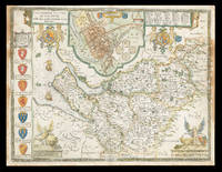
167621981<p>London: And are to be sold by Thomas Bassett in Fleet Street and Richard Chiswell in St. Pauls Churchyard 1676. 385 by 510mm. 15.25 by 20 inches. Speed's Map of Cheshire Double-page engraved map with hand-colour some discolouration to margins and to left and right of image. A map of Cheshire from the 1676 edition of the first large-scale atlas of the British Isles Speed's 'Theatre'. In the top-centre of the map is an inset town-plan of Chester with four coin medallions possibly showing: Julius Caesar the emperor Vespasian the emperor Domitian and the 20th Legion which was among those to invade Britain with Claudius in 43CE. Along the left-hand side of the map are depicted the arms of the Earls of Chester since the Norman Conquest among them 'Ranulph Blundeuill' and 'Ranulph Gernones'. John Speed 1552-1629 was the outstanding cartographer of his age. By trade a merchant tailor but by proclivity a historian it was the patronage of Sir Fulke Greville poet and statesman that allowed him to pursue this interest in earnest. His 'Theatre of Great Britain' from which the present work is drawn was first published in 1611 or 1612 and is 'the earliest English attempt at atlas-production on a grand scale' Skelton. Drawing heavily on the work of Saxton and Norden little of Speed's cartography is original he acknowledges 'I have put my sickle into other mens corne' instead it is his blend of cartography and history incorporating town-plans vignettes and genealogy that makes Speed an innovator. This map is from the 1676 edition of the 'Theatre' published by Thomas Bassett and Richard Chiswell. Interestingly this map lacks the text in English that is usually printed on the verso. Chubb CIV; Shirley Atlases T.Spe-1j; Skelton 92.</p> And are to be sold by Thomas Bassett in Fleet Street, and Richard Chiswell in St. Pauls Churchyard,
1258331071.Ghardcover. Good. Access codes and supplements are not guaranteed with used items. May be an ex-library book. hardcover
197528530Hull: N.T. Leslie 1975. First edition thus. Hardcover. Very good condition. Beautiful color reproductions of the English county maps from the London edition of 1611. <br /> <br /> Elephant Folio 59 cm unpaginated 43pp 1/4 black and blue cloth boards title label on front with gilt title no title on spine. Spine rubbed top front corner bumped otherwise good. OCLC: 57296131<br /> <br /> Speed John 1552–1629 historian and cartographer was born in 1552 in Farndon Cheshire. His father was also called John and was a member of the Merchant Taylors’ Company; his mother was Elizabeth Cheynye. He was brought up in his father's trade and in 1580 was himself admitted into the Merchant Taylors’ Company. At this time he also speculated in property and acquired a number of sites through the patronage of the Taylors’ Company and through Sir Fulke Greville first Lord Brooke.<br /> <br /> However although Speed is regarded as the first English historian as opposed to chronicler or annalist it is through his hobby that he is best known; he made maps of English counties in his spare time. In 1598 he presented a number to Queen Elizabeth and in 1600 others to the Merchant Taylors’ Company. Speed became a recognised and skilled cartographer – his insertion of town plans into his maps in particular was a distinctive feature. In 1607 he copied John Norden's map of Surrey for William Camden's Britannia and in 1608–10 published a series of fifty-four maps of England and Wales. These were issued in 1611 as his famous Theatre of the empire of Great Britain. In 1608 the publisher George Humble was granted the twenty-nine-year privilege to print this book ‘compiled by John Speed’ CSPD 1603–10 425. It was reprinted in 1614 and 1627 and brought out in a Latin version in 1616 and 1646. Dictionary of Irish Biography. N.T. Leslie hardcover
191219949Chicago: The Reilly and Britton Co. Near Fine with no dust jacket. 1912. First Edition; First Printing. Hardcover. Just perhaps the faintest hint of fading to the spine and 3 small light spots at the bottom of the front cover. Owner's name in pencil on the fep. Not chipped bumped or rubbed. It doesn't get much better. ; Small 8vo 7½" - 8" tall; 313ads pages . The Reilly and Britton Co. hardcover