Leas, Speed BBiblio.com

1 009 résultats
1998Q-1566991846Rowman & Littlefield Publishers 1998-11-01. Paperback. New. In shrink wrap. Looks like an interesting title! Rowman & Littlefield Publishers paperback
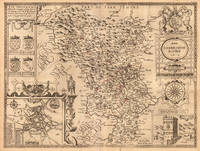
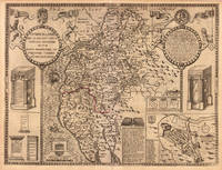
164623403London: William Humble 1646. Other. In excellent condition. 384 by 514mm 15 by 20¼ inches. 384 by 514mm 15 by 20¼ inches. Copper engraving uncolored as published. William Humble unknown
3837050718.Gpaperback. Good. Access codes and supplements are not guaranteed with used items. May be an ex-library book. paperback
AD 9780727765765USA Edition . New. Brand New! Fast Delivery US Edition and ship within 24-48 hours. Deliver by FedEx and Dhl & Aramex UPS & USPS and we do accept APO and PO BOX Addresses. Order can be delivered worldwide within 7-12 days and we do have flat rate for up to 2LB. Extra shipping charges will be requested if the Book weight is more than 5 LB. This Item May be shipped from India United states & United Kingdom. Depending on your location and availability. unknown
A9780727766892Hardback. New. <p>This volume includes high-quality papers on best practice in planning design construction and management for large-scale railway infrastructure projects. It is divided into two sections: ground engineering geotechnics groundworks and earthworks and structural engineering bridges viaducts tunnels and underground structures.</p> hardcover
45722555like new. unknown
45722555-nnew. unknown
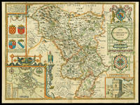
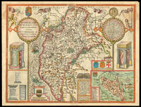
162711763London: Performed by John Speede and are to be sold in popes head Alley by Iohn Sudbury and G. Humble 1627. 380 by 510mm. 15 by 20 inches. Engraved map with hand colouring. A beautifully coloured map of Derbyshire with insets of the city of Derby and the springs at Buxton. John Speed 1552-1629 was the outstanding cartographer of his age. His 'Theatre of Great Britain' was the first atlas of the British Isles: Speed prepared the maps himself about two years before they were published. His maps and books dominated the seventeenth-century English market. The present map is taken from the 1627 English edition published by George Humble. Chubb XXV. Performed by John Speede, and are to be sold in popes head Alley by Iohn Sudbury and G. Humble, unknown
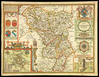
16651781London: to be sold by Roger Rea the Elder and younger at ye Golden Crosse in Cornhill against ye Exchange 1665. 410 by 550mm. 16.25 by 21.75 inches. Hand-coloured double-page engraved map upper left and right margins skilfully repaired margins reinforced with japanned paper. The map bears the imprint of Roger Rea the Elder and Younger. The Reas had purchased the rights to Speed's work form William Garrett in 1659 who had previously purchased them from the widow of William Humble in the same year. Skelton suggests that the father and son intended a new edition of the atlas for the Restoration of 1660. However the atlas would appear not to have been published until 1665. This is borne out by an advertisement in the Term Catalogue by the subsequent owners of the plates Thomas Bassett and Richard Chiswell in 1675: "Mr John Speed's. Geography of the Kingdoms of England Scotland and Ireland. together with his Prospect. all in one entire Volume hath been for seven Years past out of Print the greatest part of an Impression then newly Printed being destroyed by the late dreadful Fire 1666". This is borne out by the rarity of the Rea edition of the atlas. There is evidence that they planned an edition of 1666 as there are impressions of Sussex Buckingham and Derby with Rea's imprint which bear that date. Rea would later sell the plates to Bassett and Chiswell who would publish a new edition in 1676. to be sold by Roger Rea the Elder and younger at ye Golden Crosse in Cornhill against ye Exchange, unknown
171312789London: Henry Overton Bassett & Chiswell 1713. Copper-engraved map with full modern colour very large marings in very good condition except for a stain at the bottom edge well away from the image. A highly decorative map of Denbighshire by one of the greatest English cartographers<br/> <br/> Denbighshire in Wales clearly a mountainous region was surveyed by Christopher Saxton which was Speed's source for this map. William Smith Pursuivant at the College of Arms was the apparent source for the coats of arms: one of which is that of Robert Dudley Earl of Leicester Queen Elizabeth's favorite. In the town plan of Denbigh in the upper right corner is a circular inset displaying what appears to be a castle. It is actually an unfinished and indeed never finished church that Leicester had tried to have built in Denbigh. Apparently his unpopularity was part of the reason the church was never completed. The map is decorated with a sea monster a classical god on horseback and a ship. Henry Overton's edition of this map includes the few roads that snaked their way through the county.<br/> <br/> cf. Hawkyard and Nicolson The Counties of Britain A Tudor Atlas by John Speed p. 73-76; Skelton The County Atlases of the British Isles 1579-1850 Map Collector's Circle part 1 #7 Speed and part 4 #92 & 121. Henry Overton, Bassett & Chiswell unknown
0448128071.Ghardcover. Good. Access codes and supplements are not guaranteed with used items. May be an ex-library book. hardcover
21060452-nnew. unknown
21060452like new. unknown
2014x-1137304650Palgrave Macmillan 2014. Paperback. New. 283 pages. 8.50x5.50x1.00 inches. Palgrave Macmillan paperback
SONG1137304650MACMILLAN 2014-09-12. 2014. paperback. Used: Good. 5.51x0.71x8.50. Buy with confidence. Excellent Customer Service & Return policy. MACMILLAN paperback
DADAX1137304650MACMILLAN 2014-09-12. 2014. paperback. New. 5.51x0.71x8.50. Buy with confidence. Excellent Customer Service & Return policy. MACMILLAN paperback
2024x-1032431504Routledge 2024. Hardcover. New. 288 pages. 9.19x6.13x9.21 inches. Routledge hardcover
2024x-1032431512Routledge 2024. Paperback. New. 288 pages. 9.19x6.13x9.21 inches. Routledge paperback
1837891044.Gpaperback. Good. Access codes and supplements are not guaranteed with used items. May be an ex-library book. paperback
1644058197.Gpaperback. Good. Access codes and supplements are not guaranteed with used items. May be an ex-library book. paperback
164623396London: William Humble 1646. Other. In excellent condition. 384 by 508mm 15 by 20 inches. 384 by 508mm 15 by 20 inches. Copper engraving uncolored as published. William Humble unknown
16651789London: to be sould by Roger Rea the Elder and younger at the Golden Cross in Cornhill against the Exchange 1665. 410 by 550mm. 16.25 by 21.75 inches. Double-page engraved map fine contemporary outline hand colour upper left and right margins skilfully repaired margins reinforced with japan paper. The map bears the imprint of Roger Rea the Elder and Younger. The Reas had purchased the rights to Speed's work form William Garrett in 1659 who had previously purchased them from the widow of William Humble in the same year. Skelton suggests that the father and son intended a new edition of the atlas for the Restoration of 1660. However the atlas would appear not to have been published until 1665. This is borne out by an advertisement in the Term Catalogue by the subsequent owners of the plates Thomas Bassett and Richard Chiswell in 1675: "Mr John Speed's. Geography of the Kingdoms of England Scotland and Ireland. together with his Prospect. all in one entire Volume hath been for seven Years past out of Print the greatest part of an Impression then newly Printed being destroyed by the late dreadful Fire 1666". This is borne out by the rarity of the Rea edition of the atlas. There is evidence that they planned an edition of 1666 as there are impressions of Sussex Buckingham and Derby with Rea's imprint which bear that date. Rea would later sell the plates to Bassett and Chiswell who would publish a new edition in 1676. to be sould by Roger Rea the Elder and younger at the Golden Cross in Cornhill against the Exchange, unknown
0259472581.Gpaperback. Good. Access codes and supplements are not guaranteed with used items. May be an ex-library book. paperback
B9783385344914Paperback / softback. New. paperback