2 241 résultats
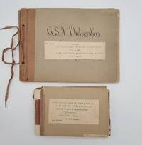
1898693921898. Two odd volumes of Geological Society of America photo books. Small oblong quarto 20 cm x 27 cm; Oblong duodecimo 13 cm x 18 cm. <br /> <br /> First book: Cover title and seven photographs on 1/4 brown cloth with gray card boards held together with a string tie binding. In calligraphy on the front board: "G. S. A. Photographs." The photographs measure 16.5 cm wide x 11.5 cm tall. Caption titles on paper strips mounted below the photographs. Numbers on small strips mounted in top fore-edge corners. With the following photographs present: 495- "28. Terraces of Tertiary Lake Beds near Salmon City Idaho on the Lemhi River."; 496- "29. Terraces of Tertiary Lake Beds on Lemhi River near Salmon City Idaho."; 497- "30. Old Gold diggings - work 1859-65. Leesburg Idaho on Napias Creek."; 498- "32. Rocky cut for sluice California Bar Idaho."; 499- "33. Discharge sluice California Bar Idaho."; 500- "31. Hydraulic Mining at California Bar Idaho."; 501- "No. Basal Cambrian sandstones of section at mouth of Two-mile Canyon 2 miles south of Malad City Idaho 562 C.D.W. 1898." Condition: Very good. Light wear and waviness to boards. Numerical notations crossed out in top fore-edge corners.<br /> <br /> Second book: Thirty-seven linen-backed photographs mounted between gray card boards with 1/4 brown cloth. Front board completely detached but present. The photographs measure 16.5 cm wide x 11.5 cm tall. With typed titles and some notations in pencil/pen on the reverse. Numbers mounted in the top fore-edge corners of the photographs. With the following photographs present: 747- "Shore of lake Ontario Niagara county New York. Illustrated mode of origin of beach shingle by showing rock in place and rocks recently detached."; 748- "Beach of flat shingle. Shore of lake Ontario at Golden Hill Creek New York." 749- "Beach of well rounded shingle. Shore of lake Ontario at Golden Hill Creek New York."; 750- "Cemented shingle in spit of glacial lake Iroquois at Lewiston New York."; 751- "Section of spit of glacial lake Iroquois at Lewiston N.Y. The dip is landward indicating growth on the inside of the spit."; 752- "Section of spit of glacial lake Iroquois at Lewiston. The dip is landward indicating growth on inside of spit." 753- "Cut terrace of the Iroquois shore line 2 miles west of Dickensonville N.Y. Lacustrine plain bed of lake Iroquois near Jeddo N.Y. The water edge was at base of cliff. The cliff is carved from Medina shale."; 754- "Till plain 1/2 mile south of Jedoo Niagara county N.Y."; 755- "Cross bedding and unconformity in sand kame 3 miles east of Lockport N.Y."; 756- "Till Shore of lake Ontario Wilson N.Y."; 757- "Deposit by torrent of Erian water on the withdrawal of the ice sheet from the escarpment at Lewiston N.Y. Unassorted and unworn alluvi."; 758- "Section of talus Niagara gorge."; 759- "Angular gravel in kame south of Royalton Niagara county N. Y."; 760- "Solitary gravel kame 3 miles south of Middleport N. Y."; 761- Escarpment of the Niagara limestone; looking west from a point on the talus near Lewiston N.Y."; 762- "Niagara escarpment capped by niagara limestone; looking east from a point 5 miles west of Lockport N.Y."; 763- "Niagara escerpment sic without capping of Niagara limestone; looking west from a point near Middleport New York."; 764- "Drowned valley of Twelve-mile creek Niagara county N.Y. near Wilson. Water lilies grow on submerged alluvial plain."; 765- "Head of estuary of Twelve-mile creek Niagara county N.Y. Submerged alluvial plain supports rushes."; 766- "Estuary of Eighteen-mile creek near Olcott Niagara county N.Y. Channel deep current slow. Submerged alluvial plain supports rushes."; 767- "Valley of Eighteen-mile creek Niagara county N.Y. above head of estuary. Channel shallow current rapid; alluvial plain supports rushes."; 768- "Post-Glacial anticline Hopkins creek Niagara county N.Y. The displacement of the rocks is accompanied by a superficial ridge traversing an alluvial terrace." 769- "Section of Niagara limestone Cooks quarry near La Salle Niagara county N.Y. Shows structure described by James Hall Geology of 4th district N.Y. pages 93 and 94."; 770- "Section in cut of Erie Railroad Niagara falls N.Y. Shows structure described by James Hall Geology of the 4th district N.Y. pages 93 and 94."; 771- "Weathering of Niagara limestone by solution. A joint face exposed in quarrying southwest of Middleport N.Y."; 772- "Weathering of Niagara limestone by solution; old quarry southwest of Middleport N.Y."; 773- "Unconformity by erosion. Sandstones and shales of the Medina format Niagara gorge."; 774- "Isolated limestone mass at base of Niagara shale containing 'transition fauna' of Ringueberg."; 775- Section of ripplemark on Medina sandstone Lockport N.Y. From crest to crest 23 feet; depth of trough 29 inches.";776- "Flagstone in court-house yard Elyria Ohio. Shows reticulated ripplemarks."; 777- "Trough of large ripplemark in Medina sandstone Niagara gorge N.Y."; 778- "Crest of large ripplemark in Medina sandstone quarry near Lewiston N.Y."; 779- "Crest of large ripple-mark in Medina sandstone. Quarry in Lockport N.Y."; 780- "Diverse cross-bedding associated with large ripplemarks in Medina sandstone. Quarry near Lewiston N.Y."; 781- "Quarry dace in Medina sandstone Lockport N.Y."; 782- "Quarry face in Niagara limestone Lockport N.Y. The joint face shows weather fracture."; 783- Shore of lake Ontario at Wilson N.Y. Train of shore drift from right being arrested by bew-pin begins to accumulate and partly protects bluff from wave attack. Dearth of shore drift under lee of pier fevors wave attack; bluff eaten back 45 feet. Bluff contains two tills and cover of laminated clay a deposit from lake Iroquois. Boulder pavement at top of lower till indicated by arrow." Condition: Good only due to the detached cover. The photographs are in very good condition. Two photo books with forty-four photographs extremely well identified with detailed captions containing the geological characteristics of the wide variety of locations and with the numbers of Gilbert's negatives clearly listed. It could be that these images appeared or were intended to appear in USGS publications.<br /> <br /> The Geological Society of America GSA was founded in 1888. It is a global scientific society with members from academia government and industry in over one hundred countries. The aim of the GSA is to support the professional growth of geoscientists and encourage cooperative research among earth life planetary and social scientists foster public dialogue on geoscience issues and promote the geosciences in the service of humankind.<br /> <br /> James Furman Kemp 1859-1926 was mostly known for his work in igneous petrology and on the origin of ore deposits. He served as the President of the Geological Society of America in 1921. Charles Doolittle Walcott 1850-1927 was the third director of the U.S. Geological Survey the fourth Secretary of the Smithsonian Institution and a contributor to the "Bulletin of the Geological Society of America."<br /> <br /> The lion's share of the photographs are reproduced from the negatives of U.S. explorer geographer and geologist Grove Karl Gilbert 1843-1918 whose life spanned an age of heroic geology and who was one of the founders of modern geomorphology the study of landforms. He helped launch the U.S. Geological Survey USGS and was its chief geologist under the famed explorer and second USGS director John Wesley Powell. In addition Gilbert was a founding member of the National Geographic Society as well as president twice of the Geological Society of America. Gilbert was first exposed to the American West when he participated in the Wheeler Survey one of the four great surveys of the American West headed by George Wheeler Clarence King Ferdinand Vandeveer Hayden and Powell. Gilbert's monumental works were "Report on the Geology of the Henry Mountains" 1877 and "Lake Bonneville - Department of the Interior Monographs of the United States Geological Survey Volume 1" 1890. He is credited with naming ancient Lake Bonneville whose raised shorelines he used to demonstrate crustal isostasy.<br /> <br /> "Gilbert had a knack for harnessing the geography of the land in the cause of something greater: extraction of knowledge about the processes at work." - R. S. Anderson https://eos.org/features/reflections-on-the-legacy-of-grove-karl-gilbert-1843-1918.<br /> <br /> A collection featuring the investigative research of three prominent U.S. geologists who were the top field geologists of their time. A spectacular portrait of late nineteenth century / early twentieth century field geology. unknown
1822179692Bonn, Eduard Weber, 1822. 1. Aufl., 4 Bde. Mit allen insgesamt 21 größtenteils kolorierte Steintafeln, 1 Kupferstich, XII, 370, X, 387, VIII, 291, VIII, 390 S. 8°, Halblederbände der Zeit mit Ledertitelbezug auf Buchrücken in rot. 1826.
187832689Les Héritiers Loosjes, Harlem + Gauthiers-Villars, Paris + G.E. Schulze, Leipzig 1868-1878. 200 - 500 S. je Band mit sehr zahlreichen meist gefalteten lith. Tafeln, 4°, marmoriertes Halbleinen mit Rückentitel, Papier stellenweise etwas braun- oder stockfleckig, insgesamt gute und innen saubere Exemplare,
18591293943London: John Murray 1859. Third Edition. Hardcover. Octavo; G; Green spine with gilt lettering; 429 pages with two fold outs and pages of advertisements.;<br /> <br><br /> <br><br /> Darwin's contribution present and corrected on page 268. NOTES: The first edition of 1849 had a transposition error in Darwin's essay some later states included a corrected text in a rear pocket. The second edition was issued in 1851 with no offprint of Darwin's article. This is the third edition complete. Fold out maps are present with some slight tears to the rear map.;<br /> <br><br /> <br><br /> Book has been repaired with original green cloth still present; Some cloth missing from the spine lettering still present but worn; Former library book with bookplate from the Royal Navy on front paste down and faded ink stamp on title page; Boards show wear along the edges corners bumped and beginning to fray. Pages are age toned as is typical with some minor spotting mostly at the beginning and on the fold outs; Interior otherwise clean and free of marking.;<br /> <br><br /> <br><br /> shelved case 10. 1293943. Shelved Dupont Bookstore. John Murray hardcover books
18591293943London: John Murray 1859. Third Edition. Hardcover. Octavo 429 pages with two fold outs and pages of advertisements. In Good plus condition. Rebacked in green cloth with gilt lettering to spine with original boards and preserved and parts of original spine laid on. Boards show wear along the edges; corners bumped and beginning to fray. Pages are age toned as is typical with some minor spotting mostly at the beginning and on the fold outs. Interior otherwise clean and free of marking. An ex-library copy with usual markings including a bookplate from the Royal Navy on front paste down and faded ink stamp on title page. <br /> <br> <br /> <br> <br /> Darwin's contribution present and corrected on page 268. The first edition of 1849 had a transposition error in Darwin's essay some later states included a corrected text in a rear pocket. The second edition was issued in 1851 with no offprint of Darwin's article. This is the third edition complete. Fold out maps are present with some slight tears to the rear map. Shelved in Case 10. 1293943. Shelved Dupont Bookstore. John Murray hardcover
1895ALPI0161Wien, Ed. Hölzel 1895. 34 x 26,5 cm. Textband : IV, [8] Bl., 152 S., [24] Bl., 90 Textbilder; Atlasband : 132 Atlastafeln (38 Lichtdrucke, 10 Photolithogr., 84 Autotypien). Orig.-Halblederbände mit Einbandgoldprägung, umlaufender Rotschnitt. Leder an den Kanten etw. berieben, Tafelband im Bund etwas gelockert. Im Text sauber u. fleckenfrei. - Differenzbesteuert Dem Geographen Friedrich Simony (1813-1896) ist die Erschließung des Dachsteingebietes zu verdanken. Die vorliegende Publikation stellt die Krönung seiner Lebensarbeit dar. Die Abbildungen (insbesondere) des Atlasbandes sind von bestechender Detailtreue und Unmittelbarkeit; derartiges kann durch die heute gebräuchlichen Reproduktionsverfahren nicht mehr erreicht werden (Kollateralschaden der Digitalisierung).-
181858946ABGöttingen, Röwer, 1811 - 1818. Mit 5 gest. Titelblättern jeweils mit Vignette, 18 (12 gefalt.) Kupfertafeln, 4 (3 gefalt.) kolor. Kupferkarten und 13 (12 gefalt.) Tabellen. Spätere marmorierte Pappbände mit Lederrückenschild.
18839696Staunton VA: Printed by S. M. Yost & Son for Jed Hotchkiss 1883. Hard Cover. Good binding. Quarto. xi 1 196 192; 6 196; 1 iii 196 pp. maps illus. First edition. Volume 1 & 2 bound together in library buckram; Volume 3 in marbled boards with modern bonded leather spine and corners; Volume 4 in library buckram. Volume II is lacking volume title page and index. All volumes trimmed some closer than others. Ex-library with typical markings; bindings are a trifle worn but sturdy; contents are a bit brittle with some closed tears to the folds of the maps a couple of maps have cleanly separated along those tears; occasional early tape repairs to a few leaves and a few maps. Rogers’s geological map is quite crisp and bright. Relatively well-preserved volumes from this landmark publication. <br /> <br /> An important periodical that ran from 1880 through Volume VI 1885 before being merged into the Industrial South. Jedediah Hotchkiss the editor and publisher is perhaps most remembered as the staff officer of Stonewall Jackson and employed his topographical and cartographical skills to the great benefit of Jackson during the Civil War. After the war Hotchkiss established himself in Staunton VA as a consulting engineer and geologist among other endeavors eventually editing and publishing this present periodical. Given the wealth of information related to natural resources it's easy to imagine that these efforts brought significant funding into the commonwealth at a time it was greatly needed. <br /> <br /> While there are contributions by most significant geologists of the day as well as maps and sections by Hotchkiss J. Peter Lesley James P. Kimball R. O. Currey John L. Campell and others. But certainly the most notable inclusions is William Barton Rogers’s 1841 geological map of Virginia. This first systematic geological survey of Virginia began in 1835 when Rogers a recognized expert was engaged by the Virginia General Assembly to undertake the task. The manuscript of the map was largely complete when funding for the project was cut off in 1841. This map languished for decades until a version of it Marcou 592 was published in Virginia: A Geographical and Political Summary. Hotchkiss a friend and colleague of Rogers further added to the map and issued it in Vol. I No. 6 of The Virginias 1880. Of this map E. M. Sanchez-Saavedra writes: "The geological map of Virginia is modest in appearance but it contains more information than first meets the eye. Its topography was based on the 1827 Boye nine-sheet map altered to emphasize natural drainage and erosion patterns. The large patches of color representing different formations were the result of Rogers's years in the field—digging climbing and analyzing rock strata." Finally noting that this color coding seems to have been of Roger's invention it would be employed to some degree in subsequent years by John Wesley Powell as he embarked on his ambitious undertaking to map the entirety of the country. This map remains an important piece of Virginia geologic and cartographic history. Sanchez-Saavedra A Description of the Country: Virginia's Cartographers and Their Maps 1607-1881. pp. 103-118. Marcou 612. Printed by S. M. Yost & Son for Jed Hotchkiss unknown
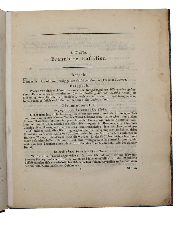
180160663Kopenhagen, Friedrich Brummer, 1801. 4to. Bound uncut in a nice recent half calf binding with gilt lettering to spine. With a few occassional brownspots but otherwise a nice copy. VIII, 172 pp.
187543223Sans lieu, , (1875). Tableau géologique compartimenté finement dessiné et aquarellé sous verre (cadre noir : 89 x 120 cm, verre : 68 x 99 cm).
182458947ABLeipzig, Wienbrack, 1824. XX, 243 S.; XVI, 406 S., 1 Bl. Mit 9 (4 kolor.) lithogr. Falttafeln. Grüne Pappbände der Zeit (Band 1: Interims-Pappband, Band 2: Pappband mit geprägtem Rückentitel und -vergoldung).
18879135ABMontreal, Dawson Brothers, 1887. 176 S. OBrosch., Einband
180719842Freyberg, Craz und Gerlach, 1806 u.1807. XXXII, 424 SS, 1 kolorierte Faltkarte, 8 ausfaltbare Tafeln mit 18 Tabellen im Anhang, weitere 4 faltbare Tafeln mit Tabellen im Text. / XXXVI, 260 SS. 8°, späteres Halbleder, Rückenvergoldung, marmorierter Schnitt
1848RO80102182IMPRIMERIE ROBERTINE. 1841 - 1848. In-4. Relié demi-cuir. Etat d'usage, Couv. légèrement passée, Dos satisfaisant, Rousseurs. XXII + 825 + XII + 813 pages. Nombreuses gravures en noir et blanc, dans le texte. Titre, filets et fleurons dorés sur demi-chagrin marron. Etiquette de code sur la coiffe en-tête et tampons de bibliothèque sur la page de titre. Quelques épidermures sur le cuir.. . . . Classification Dewey : 551-Géologie
184162293Rédigée sous la direction de M. Brochant de Villiers, Inspecteur général des Mines, par MM. Dufrénoy et Elie de Beaumont, ingénieurs en chef des Mines et publiée en 1841 par ordre de M. Teste, Ministre des Travaux Publics, 3 vol. in-4 reliure postérieure demi-basane marron, couv. conservées pour les tomes II et III, Imprimerie Royale, Paris, 1841, Imprimerie Nationale, Paris, 1848 et 1873, XXII-825 pp., XII-813 pp. ; VIII-231 pp.
18297368Carlsruhe, 1829-32. 2 cont. hcalf. Backs somewhat worn a. l hinge weakening on vol.2. XIV,11o4,XVI,632 pp. and 11 + 4 engr.plates (15), 3 handcoloured. Slightly brownspotted. - First edition.
1841108556Stuttgart, Schweizerbart 1841 (und) 1844. 1841. quer-4° (ca. 19 x 27,5 cm) 33 S. mit 11 lithographierten und kolorierten Tafeln. (und) 15 (davon 4 kolorierte) Tafeln, neuer Halbleinenband im Stil der Zeit mit montiertem Titel auf Vorderdeckel.
1806192042Weimar, "im Verlage des Geograph. Instituts", 1806. 4to. (36 : 25 cm). 7 doppelblattgroße Kupferstichkarten, alt flächen- und grenzkoloriert. Kartenbild ca. 42 : 30 cm. Schlichter Halblederband d. Zt. mit marmorierten Deckelbezügen. Deckelecken beschabt u. bestoßen, Rücken mit Fehlstelle am oberen Kapital. [5 Warenabbildungen]
181914314Kbhvn., 1819. Orig. marmoreret papbd. 97 pp., 1 stort håndkoloreret kobberstukket kort samt kobberstukket kort over Kulegnene. Med svag gennemgående skjold.
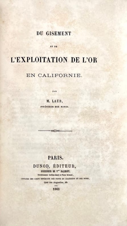
188643203Paris, Librairie polytechnique Baudry et Cie, 1886. In-8 de (4)-147 pp., figures dans le texte.LAUR (P.). Du gisement et de l'exploitation de l'or en Californie. Paris, Dunod, 1863. In-8 de (4)-89 pp., 6 planches repliées hors texte.Les deux pièces reliées en 1 vol. in-8, demi-chagrin vert, dos orné à nerfs (reliure de l'époque).
1829RO30081412AUDIN. 1829. In-12. Relié demi-cuir. Etat d'usage, Couv. convenable, Dos abîmé, Intérieur frais. 568 pages + 20 planches dépliantes illustrées en noir et blanc et en couleurs gravées par Bonnet. Tranches marbrées. Tranches marbées en couleus; Titre, ornement dorés sur le dos cuir marron. Des manques sur le dos.. . . . Classification Dewey : 551-Géologie
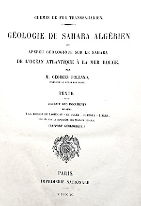
189014846Imprimerie Nationale Paris 1890-94 3 vol. 3 volumes in-4 (2 de texte et un atlas) de 2 ff.n.ch. 276 pp., 2 ff.n.ch. 425 pp. et 2 ff.n.ch. 5 pp. 1 f.n.ch. 30 feuillets chiffrés, demi-chagrin de l'époque, dos à 5 nerfs, titres dorés.
1836200685E. Schweizerbart, Stuttgart 1836-41. 456 S. - 481 S. - 628 S. - 490 S. - 712 S. mit einigen Textabbildungen und zusammen 97 Tafeln in Stahlstich oder Lithographie (davon 9 koloriert), 8°, Original-Pappbände (Hardcover), Rundumrotschnitt, Einbände leicht berieben, Ecken und Kanten bestoßen, Rücken teilweise mit Lesefältchen, Papier innen vereinzeltt stock- oder braunfleckig, Vorsätze stärker stockfleckig, insgesamt gute Exemplare mit festem Buchblock und weitgehend sauberen Tafeln,
18442178Couverture souple 1ère Édition Carilian-Goeury et V. Dalmont 1844 Paris 23x14 cm
180119966Berlin, Himburg, 1801. Frontispiz (Aquatinta-Ansicht von Schloß Rotenhaus im Saatzer Kreiße, Stecher F.K. Wolf, Prag), XII, 804 SS. Dedikation an Innenminister Graf Heinrich von Rottenhan, der sich maßgeblich um die Förderung des Bergbaus der Region verdient gemacht hat. 8°, Halbleder der Zeit, etw. Rückenvergoldung, zwei goldgepr. Rückenschildchen, Rotschnitt, Vorsätze aus hübschem Marmorpapier. Einband berieben und an Ecken und Kanten bestoßen.