Fundamentals of Human GeographyAntiquariat.de

23 950 résultats
1978179953Edited by John Blunden a.o. London, Harper & Row, 1978. Mit Kartenskizzen u. einigen Illustrationen. X, 382 S. Or.-Kart.; gering angestaubt.
1904802683Washington, 1904. 4°. M. 16 (teils farb.) Ktn. u. Taf. u. 4 Abb. 139 S. (Prof. paper of the U.S. Geol. Survey 20).
Washington, 1904. 4to. Unbound as issued. Tear in lower part of titlepage, a little loss of paper, no loss of text. 139 pp., 13 plates, fold. maps.
1910160417Washington, 1910. M. 17 Taf. u. zahlr. Abb. 88 S. OBr. Umschl. gelöst. (U.S. Geological Survey, Bulletin 435)
1910EC10-042Washington, Government Printing Office, 1910. original Broschur, 8?, 88 pages with illustrations, Bibliothekstempel / bibliotheekstempel / cachet de biblioth?que / librarystamp, a good copy
1912615738Washington, 1912. M. 26 (teils farb.) Ktn. u. Taf. u. 3 Abb. 162 S. (U.S. Geol. Survey Bull. 497).
193370975The National Geological Survey of China, Peiping 1933. 224 S. mit 52 Bildtafeln und mit 1 mehrfach gefalteten Karten, 4°, Original-Karton (Softcover), Bibliotheks-Exemplar (ordnungsgemäß entwidmet), Stempel auf Vorsatz, Deckel und Titel, Kapitale bestoßen, Einband randstaubig und knitterig, ansonsten gutes und innen sauberes Exemplar,
193570926The National Geological Survey of China, Peiping 1935. 134 S. mit Abbildungen und Tabellen, 1 mehrfach gefalteten Karte und 10 Bildtafeln, 4°, Original-Karton (Softcover), Bibliotheks-Exemplar (ordnungsgemäß entwidmet), Stempel auf Vorsatz, Deckel und Titel, Einband leicht knitterig, Rücken defekt, insgesamt noch ordentliches und innen sauberes Exemplar,
1936172753Dublin, Hodges, Figgis & Co. 1936. 4°. S. 89-94. OBr. Umschl. angestaubt u. m. St. (Proceeding of the Royal Irish Academy 43 B 8).
1961132761Sydney, 1961. M. 2 Taf. S. 115-120. OBr. (Records of The Australian Museum XXV/7).
1973241121Grahamstown, 1973. M. 16 Abb. 35 S. (Annals of the Cape Provincial Museums / Nat. hist. 9/8).
1876160783Washington, 1876. 4°. M. 45 Taf. 629 S. OLwd. Einbd. berieben u. fleckig. Tafels. braunfl. Report of the United States Geological Survey of the Territories 9)
1988122027Edited by Eugen Wirth. Bonn, Dt. Forschungsgemeinschaft u. Tübingen, Institute for Scientific Co-operation, 1988. 172 S. Or.-Kart. (Applied Geography and Development, Supplementary Volume).
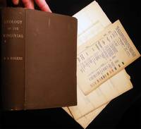
188427089New York N.Y.: D. Appleton and Company 1884. xv 832 4 pages of publisher's announcements; a useful index at back. With illustrations in the text as well as plates in pockets at front and back; all collated complete; also included in the pocket contents and not on the printed list is a color-coded "Table of the Geological Formations found in Virginia and West Virginia.with Explanation of Colors as used on the Virginia Sections" - there are 14 different colors used in printing the maps and sections and this 'Table' acts as a color key to all. The text posthumously gathers the reports of William Barton Rogers 1804 - 1882 American geologist and educator whose ".research findings to farming attracted the interests of the Virginia legislature prompting Rogers to lobby for the establishment in 1835 of a Virginian Geological Survey. For this he secured resources and funding by promising economic returns from properly mapping the terrain for future railroad construction locating more fertilizer sources and revealing the existence of valuable mineral deposits. The same year he left Baltimore to become the state geologist and director of the Virginian Geological Survey; he was also appointed professor of natural philosophy and geology at the University of Virginia. His efforts with the Geological Survey from 1835 until 1842 provided the data for his most important geological publicationsDespite his exhaustive efforts after 1837 the Virginia legislature responded to a drop in public revenues by cutting funding and more closely scrutinizing the survey finally terminating support for the project altogether in 1841. Rogers was unable to persuade them to continue funding beyond 1842. As a result few copies of Rogers's six annual reports were printed and a final report was never published. The reports were not even combined into a single publication until Jed Hotchkiss compiled and published them with a map in 1884. .an illustrious career during which he received many honors and awards." including founding and becoming the first president of M.I.T. Trent A. Mitchell in the ANB The map of Virginia and other plates credited to cartographer & engineer Jedidiah Hotchkiss 1828 - 1899 "Mapmaker of the Confederacy." Volume approx. 5 1/2" x 8" size; bound in the original brown cloth gilt spine titles; patterned-paper endpapers. Some edge tips wear to the cover; couple of small foxing-spots on the title; the text plates within the volume darkened stained; plates in the pockets & the map with a little darkening; few clean splits along folds and in very good condition. . First Edition. Hard Cover. Very Good. D. Appleton and Company hardcover books
1921173293Boston, 1921. (S.A.a.: Proceedings of the Boston Society of Natural History 36/3). S. 135-163. OBr. Umschl. leicht angestaub. St. a. 1. S. Klammerbind. leicht oxydiert. Unaufgeschn.
1979240816Urbana, 1979. M. 6 Abb. 18 S. (Circular of the Illinois State Geolog. Survey 507).
Volume numero 1330 della serie Geological Survey Professional Paper. Brossura in cartoncino, in buono stato, con strappetto alla cerniera e con traccia di inchiostro nero in copertina. Pagine con testo a due colonne, con ampio margine e corredate da figure e tabelle nel testo; alla controguardia posteriore tasca contenente 1 grande carta ripiegata. Numero pagine 99. USATO
1967222683Leiden, 1967. 4°. M. 60 Abb. u. 3 farb. Ktn.-Anl. X, 75 S.
193570923The National Geological Survey of China, Peiping 1935. 76 S. mit Abbildungen und Tabellen, 1 mehrfach gefalteten Karte und 9 teils gefalteten Tafeln, 4°, Original-Karton (Softcover), Bibliotheks-Exemplar (ordnungsgemäß entwidmet), Stempel auf Vorsatz, Deckel und Titel, Einband leicht knitterig, insgesamt gutes und innen sauberes Exemplar,
1969240852Urbana, 1969. M. 3 Abb. 12 S. (Circular of the Illinois State Geolog. Survey 444).
19705560Budapest: Akademiai Kiado, Publishing House of the Hungarian Academy of Sciences. 1970. 1. Auflage, in english, S. 417-420, 1 Faltkarte, OBroschur, Widmung auf Vorsatz, gutes Ex., (= Acta Geologica Academiae Scientiarum Hungaricae Tomus 14),
1921240245Washington, 1921. 4°. M. 11 (teils farb.) Taf. u. 61 Abb. 261 S. OBr. Rücken etwas angerissen. Umschl. angeschmutzt u. m. St. (Prof. paper of the Geological Survey 123).
Volume numero 123 della serie Geological Survey Professional Paper. Brossura in cartoncino, leggermente brunita, con strappi al dorso, qualche leggera fioritura e con traccia di inchiostro in copertina. Pagine ingiallite, con testo a due colonne, ampio margine e corredate da numerose figure e tabelle nel testo e da alcune tavole ripiegate; alla controguardia posteriore tasca contenente 1 carta ripiegata. Numero pagine 260. USATO
First edition, 8vo (220 x 130 mm), [2], xi, [3], 50pp., with half-title, lithographed frontispiece, neat stamp to title page, rebacked quarter blue calf, orig. marbled boards, spine lettered in gilt, a nice copy. Provenance: From the Norfolk library of Ron Fiske with his bookplate.
1980230176Washington, Gov. Print Off. 1980. M. 7 Taf. III, 25 S. (Geological Survey prof. paper 1128).