29 résultats
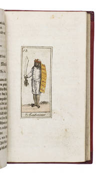
181118884Köln 1811. 12mo. Later gold-tooled half red morocco red paper over boards with the title in gold on the spine. With 24 numbered engravings 7 x 3 cm showing the peoples discussed in their traditional costumes each mounted on a blank leaf. With the engravings coloured as published as indicated on the title page. 170 4 pp. Extremely rare copy of the second edition of an already very rare work presenting the geography and anthropology of the foreign world in the form of a story told in 24 winter evenings by a father to his children. It is divided into 24 chapters each describing the inhabitants of a specific region in Africa the Americas Australia Asia and Europe each with a hand-coloured illustration. The equally rare first edition published by Bieling in Nürnberg in 1810 contains the plates from Johann Sigmund Stoy Bilder-Akademie für die Jugend 1784 while the illustrations in present anonymous edition are printed from new plates implying a possible pirated edition.It treats the Khoikhoi the inhabitants of Guinea the Caribbean Florida and Mexico the Eskimos the inhabitants of Greenland and Patagonia the "Pescherans" from Tierra del Fuego the inhabitants of New Zealand the Australian aboriginies called "New Hollanders" the inhabitants of Java and Amboina & Makassar the Moguls in India the inhabitants of Bukhara and China the Kalmyks Mongols and Buryatians the inhabitants of Tunguska and Kamchatka the Ostyaks the Samoyedic peoples and the Laplanders. Although published as a complete work by itself it was so successful that Bieling published a companion volume covering different regions in 1811: Schilderung der Vornehmsten Völker.The title-page mentions the work is written by the author of Unterhaltende Erzählungen für das erste Kindesalter 1809 apparently the same anonymous author who also wrote Julius merkwürdige Abentheuer 1813-1817 and Das goldene Buch für Kinder 1811 all published by Bieling in Nürnberg.The boards show very minor signs of wear the title-page shows traces of earlier endleaves some very minor occasional spotting. Otherwise in very good condition. An extremely rare copy of an early 19th-century German children's book teaching geography and anthropology.l WorldCat 1082152367 1 copy Universität Frankfurt; cf. GVK 2 copies of the first edition; Wegehaupt 1154 first edition lacking title-page; not in Lipperheide; Sabin etc. ABE CAT Anthropology & Ethnography ABE CAT Costumes & Uniforms hardcover
18852092902141600621Osakafu 1885. Soft Cover. Fine. Size: 109 cm x 134 cm number of books: 1 Osakafu paperback
18832110502150906360Masaaki Yuki Ironworks 1883. Soft Cover. Fine. Number of books: 1 Masaaki Yuki Ironworks paperback
185459626Edinburgh & London: William Blackwood & Sons 1854. Folio. 12 x 15 in. 122 pp. all text w/in engraved ruled borders. Double-page hand-coloured steel-engraved frontisp. map 24 steel-engraved hand-coloured maps 1 text map. Contemporary half-maroon-coloured sheep over plum-coloured cloth gilt lettering on front cover & spine pale yellow clay-sized endpapers a.e.g. very slight occasional interior thumb soiling or dustsoiling minor scuffing to fore-edges wear to corners rear hinge starting still VG copy from library of Edwin Corbold 1827-1921 Independent Minister later Congregational Reverend and temperance supporter at Purley in Surrey. First “Reduced†edition of the first physical atlas ever published in England. Johnston 1804-1871 explains in his preface the four sections of Geology Hydrology Meteorology and Natural History originally Phytology & Zoology which were subsequently reduced in order to serve as a very popular educational atlas. Each section includes beautifully engraved maps and explanatory sections and the large Palaeontological map of the British Islands with extensive colouring and added notes by Edward Forbes. Johnston’s work reflected not only the increased interest in mapping geological zoological and biological distributions but also focused on the measurement of climate and environmental factors. William Blackwood & Sons, hardcover
1850019528London and New York: The London Printing and Publishing Company - Limited 1850. First Edition Thus . Half Leather. Good. 11 1/8" Tall. 3 Colored Maps 22 Colored Plates 30 Uncolored Plates. Two Volumes Three Quarter Leather. Volume 1: 944 Pp With 30 Uncolored Plates And One Colored Map "Mexico California And Texas: The Newly Discovered Gold Districts". Volume Ii: 784 Pp With Two Colored Maps Of Canada And 22 Colored Plates All With Yellow Borders And Nice Original Color Throughout. The Map Of Mexico And California Tipped In But Neatly Loosened And Detached Without Intention And Usually Not Present Has Nicely Detailed Illustrations Of The Ruins At Uxmal Yucatan Mexican Peasantry And Gold Washing And Outlines The Gold Districts Of The U S And Mexico In Yellow. No Date Of Publication Indicated But Presumably 1850. Bindings Poor Three Of Four Boards Detached Spines Perished Boards Very Worn And Frayed Deserving Of An Expensive Rebind. Contents Near Fine Clean Maps Perfectly Preserved. Volume I With Additional Illustrated Title Page Showing Penn's Treaty Painted By Benjamin West And Here Engraved By J. Rogers. This Greatly Enlarged Fourth Edition With The Colored California Gold Map Is Uncommon About 7 Holdings Shown In Worldcat; It Is Not Listed In Carl Wheat's "The Maps Of The California Gold Region 1848 - 1857" Nor In The Addendum To The 1997 Martino Reprint Of That Book. <br/> <br/> The London Printing and Publishing Company - Limited hardcover
18107540Edinburgh: William Anderson of Stirling 1810. Revised edition. Leatherbound. Good. J. Menzies; T. Clerk engraved maps. 8vo. Pp. xii 952; 830. Frontis. fold-out map each volume. Illustrated with 30 additional engraved fold-out maps. Volumes uniformly bound in contemporary full polished calf gilt titles stamped in black morocco lettering pieces on the spine with gilt rules decorations and volume numbers. Previous owner ink signature "D. B. McNab" on each front free endpaper and ink manuscript index to plates tipped in. T. Kitchin engraving of armillary sphere mounted to front pastedown of vol. 1 and 1841 data table of Scotland's railways and canals to Vol. 2 FFEP. Corners bumped spines with crackling light scuffs and scars to covers leaf edges toned and light foxing throughout top edges soiled all maps intact albeit some with small chips and creases bindings tight. "A compilation where those who read the Newspapers might at once find some account of any particular town or fortress." The casual armchair traveler is also well-served with vivid descriptions. This revision of the 1807 edition has better maps. The Chronological Table leaves off in November 1809 with events of the Napoleonic Wars. <p>Sample of a brief entry: "Oregan or River of the West a river of North America which falls into the ocean in lon. 122.30.W and lat. 43.17.30.N." Though the mythical river had yet to be supplanted by the real Columbia in the listings it appears on the updated map of North America. William Anderson of Stirling unknown
18611012614to leather spine and corners with speckled boards maps colored in outline 23 pp. index. Top board almost separated joint split spine and edges are rather worn small piece missing at the top of spine preliminary page loose large folding map has split at the center; maps generally bright and clean. This atlas contains 22 maps that are colored in outline. Includes a nice map of Palestine and a folding map of some of the exploits of Alexander the Great. The atlas also contains an index that provides the latitude and longitude of the places named on the maps. H.G. Bohn,
1861005672Liverpool New York: Charles Magnus & Co. 1861. First Edition Thus . No Binding. Very Good . 28" x 24. Early Civil War Era Display Map Hand Colored Title "Union Military Map" At Top In Red White And Blue And Incorporating The 19" X 14.5" Complete Map Of The Rail Roads At Center Hand Colored With Other Three Maps Below Along With Hand Colored Figures Of Columbia And Justice And A Very Detailed Engraving Of The Capitol With The City Of Washington In The Background. Mounted On Board. The Map Of Rail Roads Has A Copyright Date Hand Corrected In The Printing Plate To 1859; The Map As A Whole Has A Copyright Date At Bottom Hand Corrected In The Plate To 1861. Another Version Probably Later Includes Additional Figures Of Uniformed Soldiers At Both Sides Of The Rail Road Map. In A Simple Yet Solid Black Frame With Uv-Resistant Glass. No Folds Or Tears. Scarce. <br/> <br/> Charles Magnus & Co. unknown
1806300804Glasgow: Niven Napier and Khull 1806. hardcover. very good-. Illustrated with some engraved portrait plates and 4 folding maps. 3 volumes. iv 480; iv 476; iv 479 pages. 8vo contemporary full brown calf with red labels; well-rubbed but sound. Glasgow: Niven Napier and Khull 1806. Some crude repairs to folding plates and significant foxing throughout still a very good- copy of this uncommon title.<br/> <br/> Niven, Napier and Khull unknown
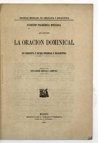
18886942México: E. Dublan y CompañÃa 1888. Second edition. 223x154mm. 8¾x6". México E. Dublan y CompañÃa 1888. En 8º marquilla 223 x 154mm. 31 pp. Cubiertas papel originales. Segunda edición rara. "La presente Colección se ha formado con la impresa por la Sociedad en 1860 a la que se han agregado algunas otras oraciones en diferentes idiomas y dialectos que se encuentran en la obra del señor pimental intitulada: Cuadro descriptivo y comparativo de las lenguas indÃgenas de México o Tratado de FilologÃa Mexicana y otros varios que hemos debido a la cooperación de los Sres. Altamirano y MartÃnez Gracida formándose asà una obra más completa y que da una idea más aproximada del número de idiomas y dialectos que se hablan en el paÃs" nota del editor. A pesar de ser un breve folleto es de mucho aprecio. E. Dublan y Compañía unknown
182416651Paris 1824. 44pp bound in modern plain wrappers. Very Good plus. <br /> <br /> The Society of Geography published this book for travellers. Pages 37-39 are devoted to North America with discussion of non-European ethnicities that colonized areas of America. There is some discussion of the relationship between the United States and Texas noting that despite Texas's geographical strengths of climate and fertility it is still underutilized; that Texas is inhabited by an "infinity of Indian nations" and that the white population has declined from 7000 in 1812 to 4000 today. Another section discusses the efforts of English emigrants to form an evidently utopian Greek colony in Florida in 1767 their travails at the hands of neighboring occupants and the eventual demise of the colony in 1769. unknown
18555468AB1855. München Kaiser 1855. 15 : 10 cm. XI 276 Seiten mit einer mehrfach gefalteten lithographierten Karte. Moderner Halblederband mit Rückenvergoldung und Rückenschild. Erste Ausgabe. - Titel verso gestempelt. - Engelmann S. 278 f; nicht bei Lentner u. Pfister. unknown
187139866Mexico: Tipografia Mexicana Calle de cadena núm. 3 1871. 82 1 pp. 1 vols. 8vo. Contemporary quarter red calf and marbled boards. 82 1 pp. 1 vols. 8vo. Tipografia Mexicana, Calle de cadena núm. 3 unknown
1817AB8386Glasgow: Longman Hurst Rees Orme and Brown 1817. Revised Edition. . Hardcover. Poor. 24mo Disbound no front cover text block split into 2 no title page. Does not appear to be in British Library. 166pp. Sections on various countries and areas of the world fold-out maps of the world Asia Africa South America British Isles loose maps of Europe missing. Long list of geographical questions vocabulary of proper names. Book appears to be aimed at tutors/teachers. <br/> <br/> Longman, Hurst, Rees, Orme and Brown hardcover
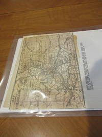
18760343801876. No Binding. Very Good. Map 8 1/2" X 6" Printed On One Side Only Probably 1876 Colorado A State No Continental Railroad Route And Denver Pacific Railroad Indicated As Such Before It Became Part Of The Union Pacific In 1880. Some Browning Traces Of Glue On Reverse. <br/> <br/> unknown
1896DEMO012892IChicago: The Caxton Club 1896. First American Edition. Hardcover. Good plus. Facsimile map supplied for rear pocket. Tall octavo 229pp. half vellum -with some splits gray boards bumped at corners untrimmed. <br/><br/>A reprint of the first English translation London 1714; with the Map of the original French edition Paris 1713 in facsimile. A reprint of the first English translation London 1714; with the Map of the original French edition Paris 1713 in facsimile. Joutel was second-in-command of this expedition which failed to find the mouth of the Mississippi. Finley Collection 42. "Most reliable eye-witness account of La Salle's two-years wanderings in Texas. The map based on La Salle's Mississippi explorations was the first accurate delineation of that river --Howes J266." Limited to only 206 copies. The first book published by The Caxton Club CCI. Facsimile map supplied for rear pocket The Caxton Club hardcover
189981576Helsingfors:: Societe Anonyme F. Tilgmann 1899. First edition. publisher's gilt-decorated and lettered cloth; quarter leather spine which is all be perished. As noted above the leather spine is very damaged and the covers are barely attached. The interior is in fine clean and undamaged condition. Oversized folio. Complete with 32 double-page maps and plates. Societe Anonyme F. Tilgmann, hardcover
18460005141London: R. Spencer 1846. First edition. Hardcover. Fine. Uncut and unopened in modern quarter green leather marbled boards 57 pages original wrappers bound in place. <br/><br/>Dr. Oliver Vicar of Scopwick was a member of the Topographical Society as well as a prominent freemason. Spencer specialized in publications on freemasonry. R. Spencer hardcover
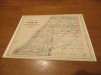
1880032799Philadelphia: D. W. Ensign & Co. 1880. 1st Edition . No Binding. Very Good. Single Sheet Printed Area 9" X 7 3/8" Hand Colored Apparently Extracted From A Copy Of The 1880 Book Then Nicely Mounted On A Beveled Card. A 3/16" And Another 1/2" Light Foxing Spot At Left Neat Margin Outside The Printed Map; One Thin Abrasion 1 5/8" Long Up To 1/16: Wide Extending From Lake Michigan Into Part Of Lincoln County. Scarce; Apparently Lacking From Many Copies Of This Book. <br/> <br/> D. W. Ensign & Co. unknown
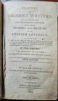
1802086840Edinburgh: Printed for Peter Hill by Alex Smellie Anchor Close 1802. 5th Edition . Hardcover. Good/No Jacket. 7" x 4. Leather bound. Boards are rubbed and scuffed. Text block is tight but a bit dusty. There is a dedication written on free endpaper. Books 1 & 2 in 1 volume. <br/> <br/> Printed for Peter Hill by Alex Smellie, Anchor Close hardcover
19002092902140311683Rokumeikan 1900. Soft Cover. Fine. Number of books: 1 Rokumeikan paperback
19002082702114900190Rokumeikan 1900. Soft Cover. Fine. Number of pages: 308 pages Size: Bunko size Rokumeikan paperback
180793858Glasgow: Niven Napier and Khull for W.D. and A. Brownlie. 1807. Original full leather binding octavo folding map Colony of the Cape of Good Hope very little remains of damaged wrinkled folding plate opp. pp.278 pp ii 479 missing frontis plate and one other plate staining to portrait plate of Mungo Park opposite page six. Binding very rubbed. Fair. "Travels in the Interior of Africa" by Mungo Park and "Travels in Southern Africa" by John Barrow. Boards. Niven, Napier and Khull for W.D. and A. Brownlie hardcover
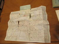
1890030017New York / Boston: Metropolis Map Co / Damrell & Upham / The Old Corner Bookstore 1890. 1st Edition . Soft cover. Good. Folding Map Printed In Red And Black 14" X 17" In Green Folding Card Covers With Damrell & Upham Name/Address On Front Cover. Covers Worn But Intact Very Short Tears/Frays At Corners. Map Complete A Few Short Tears To Folds Extensive Notes On Places Visited On Otherwise Blank Reverse Some Further Notes In The River Part Of The Map Itself. Worldcat Shows Six Institutional Holdings. <br/> <br/> Metropolis Map Co / Damrell & Upham / The Old Corner Bookstore paperback
1875014455London: Hamilton Adams & Co. And J.Y.Knight & Co. 1875. Thirty-eighth edition. This is a history of the world from a Fundamentalist Christian perspective. From the intro: "History ought to be studied with uniform submission to the authority of revelation.Revelation is the standard by which all history is to be judged as well as the rule by which all history is to be improved. History is to be studied as confirming scriptural facts." Full purple cloth with paper label on spine. Spine lightly sunned to a brown. Corners lightly bumped. Overall a VERY GOOD copy. Full Cloth. Very Good. 12mo - over 6¾" - 7¾" tall. Hardcover. Hamilton, Adams, & Co. And J.Y.Knight & Co. Hardcover