11 020 résultats
Rarissima carta dell’isola, datata il lastra 1570. Rappresentata circondata dalla flotta di navi della Repubblica di Venezia la carta è orientata con il Sud in alto. Carta anonima e priva di dati editoriali, che segue nella morfologia la carta del monogrammista PS e tutte le sue derivazioni. L’aspetto interessante che mostra questa carta, è dovuto al contesto storico; l’isola è rappresentata con la flotta veneziana chierata a difesa contro gli assalti dei turchi. L’opera, datata al 1570, viene attribuita a Nicolò Nelli per evidenti ragioni stilistiche e per le analoghe carte su Cipro e Creta, che recano la sua firma. La mappa si trova inserita in alcune raccolte cinquecentesche, e viene di seguito pubblicata nel Isole che son da Venetia nella Dalmatia et per tutto l’arcipelago fino a Costantinopoli, edito da Simone Pinargenti a Venezia nel 1573. L’opera fu realizzata in stretta concorrenza con l’analoga raccolta del Camocio Isole Famose, e raccoglie carte incise da Nicolò Nelli, Natale Bonifacio e dal Pinargenti stesso. I pochi esemplari noti della raccolta sono spesso diversi tra loro, e contengono un numero variabile di carte. Magnifico esemplare, in straordinario stato conservativo. This very-rare loose-sheet map of Corfu carries at the lower right hand corner the date of the publication, 1570. Like the larger maps of The IATO these smaller ones were first issued for a loose sheet circulation, and then assembled in booklet form for interested customer. The island is shown surrounded by an armada of Venetian war ships. The map is oriented with south at the top and its shape is based on the Ferrando Bertelli map of Kerkyra (1564). Sometimes the map appear in the rare collection by Simone Pinargenti “Isole che son da Venetia nella Dalmatia et per tutto l’arcipelago fino a Costantinopoli” (1573). Nicolò Nelli (1530 ca – 1573) was venetian engraver of maps, portraits, religious subject and prints. He also traded in prints and published the works of Giovanni Battista Fontana and Giorgio Ghisi and had a business relationship with Bertelli en Zaltieri. Copperplate, with full margins, very good condition. Very rare. Tavernari (2014): n. 65; Zacharakis (1992): n. 1756; Zacharakis (2009): n. 2692.
Carta della Morea a firma di Orazio Bertelli. Sebbene priva di data l’opera può essere ricondotta a prima del 1568, in quanto compare occasionalmente in alcune copie della raccolta di carte di piccolo formato della famiglia Bertelli, il Civitatum aliquot insignorum et locorum magis monitorum exacta delineation cum additione aliquot Insularum principalium. Disegni di alcune più illustri città et fortezze del mondo con aggionta di alcune Isole principali edito da Ferrando Bertelli nel 1568. Ma la carta circolava già prima, come dimostra la sua presenza in alcune raccolte cinquecentesche di grande formato. Dal punto di vista cartografico la carta deriva dall’opera di Giacomo Gastaldi del 1560.La carta conosce una seconda stesura, anonima, profondamente modificata dalla scomparsa del cartiglio con il titolo. Esaminando bene gli esemplari di secondo stato si intravedon le scritte che compaiono nel primo. Tali prove, più comuni, sono inserite nella ristampa Civitatum aliquot insignorum et locorum curata da Donato Bertelli nel 1574.Stati & edizioni: 1°: come descritto.2°: abraso il cartiglio in basso a sinistra e la nave più grande; sono ancora visibili le tracce delle iscrizioni. Nel posto del cartiglio si legge ora MARE MEDITERRANEO. SECOND STATE, WITHOUT THE IMPRINTMap of Morea from the very rare Civitatum Aliquot insignorum et locorum… of Bertelli. The book, which describes the main cities, isles and remarkable places of the world, followed after only one year the analogous work published by Forlani (1567). It bears also the plates engraved by Forlani himself, by Zenoi and Bertelli. The first state of the map is with a cartouche ta the lower left, with the title "OREA peninsula anticame[n]nte detta poloponesso, apia, e pelagia. oratio berteli.". This second state have the cartouche (and some of the ships) erased where is now the inscription "Mare Mediterraneo".Copper engraving, with margins, in excellent condition. Meurer (2002): n. 65; Tavernari (2014): n. 116; Gallo (1950): p. 99, n. 25; Nordenskiöld (1981): n. 12 (62); Zacharakis (1992): nn. 197 & 2558; Zacharakis (2009): nn. 325-326
274 p., 197 planches photographiques n/b, hors-texte. Série Kunst und Altertum am Rhein, n 48. Inv. 19215.
242 p., qq. ill. n/b. Demi toile à coins, reliure récente. Inv. 21766
274 p.PACT 18, 1987. Revue du groupe européen d'érudes pour les techniques physiques, chimiques, biologiques et mathématiques appliquées à l'archéologie. Articles en français, anglais, italien. Inv. 19296.
477 + (1) p., (600) fig. in et hors-texte. Bel ex. bien relié. Demi percaline rouge, titre et filets dorés (reliure récente). Inv. 19025.
127 p., très nbr. ill. coul. Inv. 41389
112 p., 52 fig. n/b. Inv. 25414
44 p., 159 lots illustrés en coul. Couverture légèrement tachée. Inv. 24839 0
55 p., ill. n/b. et coul. Inv. 24926
51502Paris ,1937, in-4 de 264 pages ,illustrations in-texte ,broché ,Bon état , .Isbn : 1937.(6 photos du livre sur mon site https://www.vieuxlivre.fr) .Les frais de port pour la France sont offerts à partir de 25 euros d'achat (Mondial relay ). (colissimo suivi +6,90 ).
200817209Alan Sutton (Mémoire en image), 2008. In-8 broché, 128 pages, richement orné de photographies et vues anciennes, très bon état
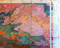
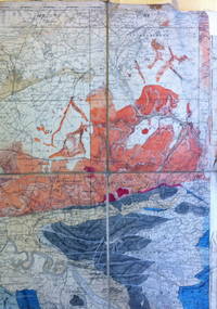
19288956Geological Survey of Scotland 1928. Revised edition. Good. Folded map mounted on linen Covers an area mainly in Ayrshire from Ardrossan to Darvel comprising mostly Carboniferous and Triassic strata with many igneous intrusions. Geological Survey of Scotland unknown
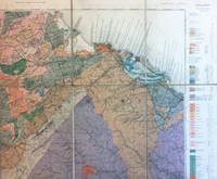
19109032Ordnance Survey 1910. Good. Folded map mounted on linen Map in 15 segments linen-backed. Covers an area from Prestonpans to Oldhamstocks. The area consists predominantly of Silurian Devonian and Carboniferous strata with some igneous intrusions. Ordnance Survey unknown
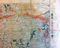
19249031Ordnance Survey 1924. Fair. Folded map mounted on linen Map in 18 segments linen-backed separating at two of the folds. Covers an area from Cambuslang to Grangemouth. The area consists predominantly of Carboniferous strata with some igneous intrusions. Ordnance Survey unknown
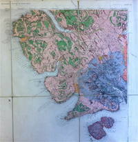
18969033Ordnance Survey 1896. Good. Folded map mounted on linen Map in 8 segments linen-backed. Covers the south-western part of the Island of Skye including much of the Cuillin range and also Soay. The area consists predominantly of Tertiary igneous rocks. Ordnance Survey unknown
9035Ordnance Survey n.d. Fair. Folded map mounted on linen Map in 8 segments linen-backed. Covers parts of Stirlingshire and Perthshire. The area consists predominantly of metamorphic rocks with coal measures of the Carboniferous period near Alloa. This copy has evidently been used in the field as it shows considerable signs of wear and has been neatly annotated in various places with names of coal seams and in a few places other sedimentary strata. Ordnance Survey unknown
2005134388Couverture rigide. 20 x 27 cm. Cartonnage de l'éditeur. 358 pages.
2006R260180371PICCOLIA. 2006. In-8. Broché. Bon état, Couv. convenable, Dos satisfaisant, Intérieur frais. 48 pages - nombreuses illustrations en couleurs dans le texte et hors texte. . . . Classification Dewey : 550-Sciences de la Terre et des autres mondes
2009R260180432TERRES EDITIONS. 2009. In-8. Broché. Bon état, Couv. convenable, Dos satisfaisant, Intérieur frais. 224 pages - nombreuses illustrations monochromes hors texte. . . . Classification Dewey : 550-Sciences de la Terre et des autres mondes
2007R200131516Guy Trédaniel. 2007. In-12. Broché. Etat d'usage, Couv. légèrement pliée, Dos plié, Pliures. 384 pages, nombreuses illustrations en couleur dans et hors texte - coins frottés, coiffes abimées, tranches tachées.. . . . Classification Dewey : 550-Sciences de la Terre et des autres mondes
19762082702114607798Heibonsha 1976. Soft Cover. Fine. Number of books: 1 Heibonsha paperback
192630434AB1926. Chur Schuler 1926 8° 387 S. mit zahlr. s/w-Abb. und Illustr. im Text und auf Tafelseiten sowie Ausklapp-Karten und 2 farbige Tafelseiten mit wunderbaren Schmetterings-Abbildungen original Kartonage Paperback altersgemäß gutes sauberes Exemplar Ho1 Eine Auflistung der enthaltenden Fachbeiträge mailen wir auf Bedarf gerne zu. Abholung im Ladengeschäft in Frankfurt am Main Nordend ggü. Musterschule möglich. Das spart die Portokosten. Pickup at the store in Frankfurt am Main Nordend close to Musterschule is possible. It saves the shipping costs. paperback
ill., br. Per migliorare la vita sul pianeta, non è necessario rinunciare al tempo libero e spendere denaro. Non bisogna essere supererei o utilizzare polveri magiche. Ogni nostra azione ha un impatto sul delicato sistema-mondo ed è per questo che piccoli cambiamenti nella vita quotidiana possono essere davvero benefici per il pianeta senza gravare sulla lista delle cose da fare. E sono tanti i vantaggi collaterali: si risparmia, si perde peso, ci si sente più in forma, i figli si divertono, ci si comporta meglio dei vicini.
2011VOY4433MBroché, 96 pages, paru en 2011 chez Chandeigne, livre en très bon état général. Nous avons d'autres exemplaires des éditions Chandeigne, retrouvez les dans notre catalogue grâce au mot-clé "Chandeigne".