[Garnmann-Horodisch, Alice:]Antiquariat.de

4 134 résultats
1967900306AG1967. Blattmaß: 16,5 x 24 cm,
1967900304AG1967. Aquarell, Blattmaß: 16,5 x 24 cm (quer),
Engraved map of the Indian Ocean, Indian subcontinent and most of the Gulf region (28 x 39 cm; margins extended to 50 x 66.5 cm), at a scale of about 1:13,500,000 with north at the foot, with the equator reticulated with longitudes based on a prime meridian through Cape Verde, reticulated scales of latitude in the left and right borders, the Tropic of Cancer not reticulated; 3 sea monsters, a spouting whale and 3 ships in the ocean; and on the land elephants, lions and 2 people on horseback carrying spears. Rare very early engraved map showing the Indian subcontinent, the Strait of Hormuz, the eastern half of the Gulf, and the Indian Ocean, including the islands of Ceylon (Sri Lanka), the Maldives, Seychelles, the western tip of Sumatra and what must be the eastern tip of Somalia. The island Diego Garcia (7° S), labelled "Isole de Don Garzia", touches the southern edge of the map image. The map's own scales indicate that it covers 35°N to 9°S and 60 to 120°E (labelled 85 to 145°E following the Cape Verde prime meridian), but in fact it covers about 60 to 96°E. It is double trapezoidal projection, but tapers only slightly from its widest point at the equator. Many topographic names appear in forms used in early Portuguese accounts of voyages, but most can be identified. In India and Ceylon we find Goa, Mangalor (Mangalore), Cochin (Kochi), Calinapata (Calcutta?), Besinagar (Bangalore), Colmucho (Colombo) and many others; in the Gulf region Cor. Dulfar (Dhofar), the island Macira (Masirah), C. Resalgate (Ras el Had?), Galatia (the ancient site Qalhat), Mazcate (Muscat), the island Quexumo (Qeshm) and Ormus (Hormuz). There is even an unlabelled city close to present-day Abu Dhabi. Two of the ships are labelled with their destinations: Calicut (Kozhikode) on the Malabar Coast and Molucche (the Moluccas) in the East Indies. - Gastaldi first published a similar map as one of a set of three woodcut maps in the first volume of the second edition of Giovanni Battista Ramusio,Navagationi et viaggi, Venice, 1554: the "Prima tavola" shows Africa, the "Seconda tavola" shows the regions in the present map and the "Terza tavola" shows Southeast Asia and the East Indies. These were a great advance on earlier maps, including even Gastaldi's own, taking account of new information from Portuguese explorers. - The woodblocks and whatever copies of the printed edition had not yet been sold were destroyed by a fire in 1557, so for the 1563 edition the publisher had the three maps engraved on copperplates by Niccolo Nelli. Bertelli published the three maps without Ramusio's text, and his maps are usually supposed to have been printed from the 1563 plates, but Karrow describes them as close copies, with his name and the date 1565 added in each map, and Bertelli was an engraver as well as a publisher. Although the first map also has a longer note referring to all three maps, they were probably issued separately as well. Although printed from a single copper plate, the present map image is divided into two parts, with a 7 mm gap between the right and left halves, so that nothing would be lost if the map were bound as a double-page plate. No later state is noted in the literature, so there may have been multiple printings with the unrevised plate. - The present copy is printed on a whole sheet of paper, watermarked: coat of arms (77 x 44 mm) bearing a tree on the central and highest of three hills = --, with about 38.5 mm between chainlines except that the mark is centred on a chainline only 25 mm from the adjacent ones. The tree clearly matches the style of the oak tree in the arms of the family Delle Rovère, including the Popes Sixtus IV and Julius II (who served 1471-1484 and 1503-1513), but their arms does not include the hills. The present mark is very close to Briquet 969 (Lucca 1573-1582) and Zonghi 1737 (Fabriano 1571). Likhachev 3636 (an Italian manuscript f ca. 1570) is not as close. All similar marks noted in the literature date from the period 1569 to 1582, so the present map seems unlikely to have been printed in 1565, but very likely to have been printed ca. 1570 (Bertelli remained active to ca. 1580 or perhaps even later). Bifolco & Ronca lists copies of the 1563 (84a) and the present 1565 (84b) state or edition together, but their separate lists of references suggest the present 1565 version is much rarer. - The margins have been cut down close to the plate edge and in places to the outer edge of the border, and the margins then greatly extended (10-14 cm) with blank paper, but this paper is also contemporary, watermarked: coat of arms bearing a ladder and topped with a 6-point star (90 x 27 mm) = --, similar to Likachev 3524 (Loreto 1564). The map is very slightly browned at the edges (where the pieces of paper used to extend the margins were pasted together) and in the gap between the right and left halves (where the old fold has been reinforced on the back), but the map is otherwise in fine condition. A milestone in the cartography of India and the Gulf States, remarkably well preserved. Bifolco & Ronca, Cartografia topografia Italiana, 84b. Gole, Early printed maps of India, 2. Karrow 30/74.2.
12mo. 134, (6) pp. Contemporary red morocco, triple gilt filet on covers, central royal coat of arms, gilt edges. First edition. The priest Gaudereau (1663-1743) had gone to Persia in 1689 in the company of Bégnine Vachet, a director of the Seminary of Foreign Missions. Having arrived at Isfahan in late 1690, they joined François Sanson, another member of the Society of Foreign Missions sent by Louis XIV to the court of Shah Suleiman. After Sanson's departure in 1692, Gaudereau continued negotiations with Suleiman, after 1694 with Husayn. Having negotiated a military and commercial alliance between Persia and the French East India Company, he returned to Isfahan, which he quit for Europe in 1703. It was during this journey from Constantinople and Trabzon that in September 1704 he contracted the illness he describes in his book, which he based on his own experience, having miraculously survived. - Fine copy, bound for Philippe d'Orléans. From the library of Hyacinthe Théodore Baron (18th century engraved book plate). Blake 169. OCLC 495355672. Not in Waller or Wellcome.
Folio (210 x 330 mm). (2), 65, (1) pp. Original printed boards, spine reinforced with cloth. Annotated tables of the tribes making up "Al-Muntafiq", a large Arab tribal league in southern and central Iraq then in struggle against British occupation. Edited from the Basrah Arab Bureau's confidential British government handbook "The Muntafik" published that same year. - Corners chipped; erased stamps; stamp and handwritten ownership of "Harry J. Almond, Arabian Mission" (American Mission School). Extremely rare; no copies in OCLC or the British Library.
8vo. (38), 97-144, (8) pp. Title-page printed in red and black. With engraved frontispiece and folding letterpress table. - Bound after this is a 10-page German manuscript by a contemporary hand in red and black ink, entitled "Continuatio curiosorum experimentorum collocatio". Modern half vellum with marbled covers and spine title. Edges sprinkled in red. Later edition of this oft-reprinted but rare manual of geomancy, a divination system with Arabian origins. The term is derived from the ancient Greek "geômanteía", a translation of the Arabic "'ilm al-raml" - the "science of the sand", or the art of foretelling from dots or lines randomly marked upon the ground or on paper. The method, probably developed in the Near and Middle East, arrived in mediaeval Europe via North Africa. In the European context it was seen as an ancillary science to astrology and was attributed to Hermes Trismegistus. It was especially Robert Fludd's "Utriusque cosmi maioris scilicet et minoris metaphysica, physica atque technica historia" (1618) that made geomancy popular in the late Renaissance. "Pointing, or geomancy, was among the most popular of the divinatory entertainments of the 17th and 18th century" (cf. Daxelmüller, Zauberpraktiken, p. 200, with fig. 35). Purportedly translated from Arabic, this manual cites Cornelius Agrippa, Henry de Pisis, Trithemius, and Fludd as its authorities. - The manuscript bound at the end of the volume treats of "Onomantia", or the so-called science of divining a person's future from their names - a method explicitly said to work not only with Christian names given at baptism, but also with any name bestowed by a similar process upon a Jew or Muslim. - Slightly browned, but well preserved. 1744 handwritten and stamped ownership of the Lieutenant Christoph Carl König on title page, with his initials and date at the head of the instructions to the reader. Graesse (Bibl. Mag. et Pneum.) 105. Not in Ackermann, Caillet, Dorbon-Aine, Rosenthal, etc.
8vo. 37, (1) pp. Giltstamped purple cloth with white moirée endpapers. Extremely rare anonymous pamphlet by the political writer Georges Giacometti about the political position of Turkey during the crisis of December 1876, after the outbreak of the Serbian-Ottoman War that would soon develop into the Russo-Turkish War of 1877-78. OCLC lists a single copy in public collections (British Library, not identifying the author). - Extremeties a little rubbed. Removed from the library of Sultan Abdul Hamid II, with traces of requisite marks and the author's handwritten inscription to front flyleaf: "A Sa Majesté Impériale / Hommage Respectueux de l'auteur. G. Giacometti". - Abdul Hamid II (1842-1918) was the last Sultan of the Ottoman Empire to exert effective contol over the fracturing state and also remembered as a poet, translator and one of the dynasty's greatest bibliophiles. While his passion for books is memorialized by the many precious donations he gave to libraries all over the world and which mostly have remained intact to this day (including the 400-volume "Abdul-Hamid II Collection of Books and Serials" gifted to the Library of Congress), his own library was dispersed in the years following his deposition in 1909: books were removed to other palaces and even sold to Western collectors, the greatest part of his collection is today preserved in the Chester Beatty Library in Dublin. OCLC 504499620.
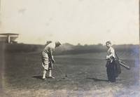
192658065Youngstown OH: n.p. 1926. Oblong folio. 17 x 9.5 in. 13 leaves unnumbered. on thick gray-green textured boards all mounted on linen hinges at gutter margin with 35 tipped-in silver gelatin photographs sized from 4.5 x 9.5 in. up to 6.75 x 14 in. Full green morocco gilt lettering stamped on front cover decorative Italian patterned endpapers minor scuffing & wear to fore-edges very light sunning to front cover still a VG exemplar. This excellent souvenir photo album depicts the golf tourney hosted by the Youngstown Country Club in honor of Campbell’s 1854-1933 72nd birthday in 1926. The opening photo depicts all the participants and dignitaries at the Country Club followed by images of players on the greens. The 18-hole course was built on the 131-acre Holland Farm and designed by Walter Travis featuring a $ 60000 Clubhouse which was noted for elegance and model comfort. These images depict the quintessential 1920’s golfing excursion including those of players the greens the roughs caddies and even an image of what appears to be Walter Travis himself taking a turn on the links. The year before in 1925 the Youngstown Country Club had hosted the 25th Open Championship of the Western Golf Assoc. and legends of the game including Walter Hagen Gene Sarazen and Tommy Armour III all played the course. Campbell was an enthusiastic golfer until his death holding a similar tourney in 1929 on his 75th birthday. He had begun his business career by forming the Youngstown Ice Co. in the summer of 1884 and by 1890 was hired as manager of the Trumbull Iron Co. later consolidated into Union Iron & Steel Co. In 1901 he founded Youngstown Steel and Tube Co. but after a failed merger at the beginning of the Great Depression his health declined. See: Ted Heineman James A. Campbell Riverside Cemetery Journal 2009; History & Golf Outings Youngstown Country Club 2021; James A. Campbell’s 75th Birthday Celebration Youngstown Sheet & Tube Audiovisual Archives YHC MSS 0140 Box 10 Folder 186 n.p., hardcover
194863234New York: A.S. Barnes & Co. 1948. 8vo. 125 1 pp. Photo frontisp. photo illustrations throughout. Light green publisher’s cloth green lettering front cover & spine slight shelfwear w/ d.j. cover art of Babe Didrikson golf swings minor chipping & small tear head of spine creasing & edgewear still VG/G- copy w/ former ownership markings of Pacific Northwest golfer Lena Hillsman on ffep. First edition of this compact and detailed work by the 1948 US Women’s Open champion in 1948 detailing the fundamentals of the game and her stroke-by-stroke techniques. Didrikson 1911-1956 was considered one of the best women athletes in the first half of the 20th-Century who excelled at a myriad of sports qualified for five Olympic events in Los Angeles even though women were allowed to compete in only three setting a world record and winning the first Olympic 80-meter hurdels broke the world record with Jean Smiley in the high jump and dominated Women’s golf during the 1940’s. A.S. Barnes & Co., hardcover
1990LFA-126731454Revue de 258 pages, format 210 x 295 mm, illustrée, brochée couverture couleurs, bon état
201502682Paris, Hachette pratique, 2011 ; in-4, 216 pp., br.
LFA014afUn ouvrage de 90 pages, format 155 x 155 mm, illustré, relié cartonnage couleurs, s.d., Editions Exley, bon état
201503816Paris, Larousse, 1988 ; in-8, 192 pp., cartonnage de l'éditeur.
1930WB17568USA: Palmer Products 1930. First Edition. Paperback. Very Good. Original brown wraps lettered in red. 143 pp. With numerous illustrations throughout. Light edgewear but a nice copy overall of a scarce golf book. Sold with no guarantees that you can or will break 80 after purchase. <br/><br/> Palmer Products paperback
63672Berkshire:: Eaton Crane & Pike Co. no date. enclosed in publisher's two-part box illustrated in color with printed wraparound bands around envelopes and notepaper. Contents fine. Minor repairs to the joints of the illustrated box top which is a little sunned and dust-soiled. The unprinted box bottom has had several voids neatly supplied in facsimile. Box size 5-1/2 x 8-1/2 x 1 inch. Four color scenes of pairs of children playing golf in Victorian attire are illustrated on the box top; present here are three of those four illustrating 12 folded sheets of notepaper initialed by the artist W. C. O. with envelopes. Eaton, Crane & Pike Co., unknown
1929136431929 P., Etablissements Loubok, 1929, 1 vol. in-folio (395 x 290 mm), cartonné sous jaquette illustrée en bleu, jaune et palladium, de (28) pp.Petite rayure sans gravité sur le plat supérieur de la jaquette, transfert des encadrements de photos sur les pages en regard, très bel exemplaire, très rare dans cet état (l'ouvrage est généralement couvert de rousseurs).
201703297Montreal, Les editions de l homme, 1982 ; in-8, 114 pp., br.
201600470Paris, France loisirs, 1989 ; in-4, 93 pp., cartonnage de l'éditeur.
200814809Paris, Denoel - connaissance et technique, 1987 ; petit in-4, 238 pp., cartonnage de l'éditeur (ptes usures).
200704060Paris, Denoel - connaissance et technique, 1987 ; petit in-4, 238 pp., cartonnage de l'éditeur.
201708950Paris, Solar, 1989 ; in-8, cartonnage de l'éditeur. Les 4 volumes. En 4 volumes.
201200100Paris, Amphora, 1984 ; in-8, 165 pp., cartonnage de l'éditeur. Broché bon état (un peu écorné)66 figures dans le texte 1ere édition Contents, Chapitres : Découvrir le golf - Les fondamentaux de la technique - Un matériel adapté - Le golf et sa psychologie - Golf et condition physique - Analyser sa performance - Apprendre et se perfectionner - Le golf, sport athlétique - L"entrainement - Glossaire - Lexique de Massy (1911) - Description des tests.
200907275Paris, Nathan, 1990 ; in-4, 168 pp., cartonnage d'éditeur avec jaquette.
200907274Paris, Nathan, 1990 ; in-4, 168 pp., cartonnage d'éditeur avec jaquette.
202302229Paris, Nathan, 1984 ; in-4, 230 pp., cartonnage de l'éditeur. Avec jaquette.