421 résultats
198435433Atlanta: Atlanta Athletic Club 1984. Wraps. Very good. Stapled wraps. 10" x 7". 16 pages. One photograph inside. Yellow covers with title printed in black on the front. Included with the story is a fund raising card for the "Bobby Jones Room Fund" and a explanatory fund raising copied typed letter from John P. Imlay President of the Atlanta Athletic Club. Atlanta Athletic Club unknown
193421248New York: Conde Nast 1934. First edition. Very good overall. September 1934 issue of the magazine with article by Robert T. Jones. Robert Tyre "Bobby" Jones 1902 - 1971 was an American amateur golfer who founded the Augusta National Golf Club and co-founded the Masters Tournament. He was the most successful amateur golfer to compete at the national and international level. Other articles by Grantland Rice Frank Condon Bob Davis O. B. Keeler George Low Sr. Bernard Darwin and Tracy Hammond Lewis. The cover photographic illustration of George Dunlap; many b&w photographic illustrations throughout. Folio 48pp. A few small marks at front wrapper. Conde Nast unknown
193854228New York: Hillman-Curl Inc. 1938. 8vo. 188 pp. Tan cloth red lettering on front cover & spine minor chipping foot of spine former date stamps on rear endpaper minor soiling still G copy. Second edition of this scarce golf mystery included as part of the Clue Club Mystery series which was published between 1936 and 1939. Hillman-Curl, Inc., hardcover
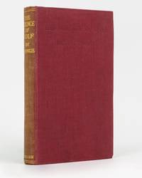
192274414London: Methuen 1922. First Edition. Hardcover. Very Good. London Methuen 1922. Octavo xii 128 8 publisher's catalogue pages plus a frontispiece and 7 pages of plates. Cloth lightly bumped on the front bottom edge; spine sunned and a little rubbed; endpapers lightly offset; inner margin of the title leaf and the adjacent leaf a little glue discoloured with trifling adhesion blemishes to the inner margin of the frontispiece and title page; a very good copy. Methuen hardcover
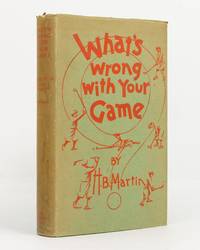
1930142034London: John Lane The Bodley Head Limited 1930. First Edition. Hardcover. Near fine/Good. London John Lane The Bodley Head Limited 1930. Octavo viii 240 8 publisher's list pages with numerous line illustrations by the author. Green cloth lettered and decorated in red; top edge dyed green; endpapers unevenly tanned; a near-fine copy with the very good dustwrapper the spine sunned marked and a little chipped. The 'main feature of the book is its constructive advice to golfers on their personal faults in playing the game' dustwrapper blurb. John Lane The Bodley Head Limited hardcover
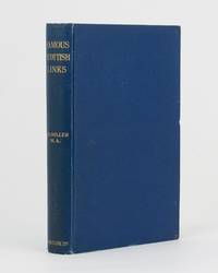
191175830Edinburgh: R. and R. Clark 1911. First Edition. Hardcover. Very Good. Edinburgh R. and R. Clark 1911. Octavo viii 150 pages plus 2 plates. Original blue cloth slightly rubbed at the extremities and lightly marked; tiny bump to the leading edge of the front cover; bottom corner of the rear board cracked creating a ripple in the cloth along the fracture and cracking the pastedown but the corner is firm and stable; edges endpapers and first and last pages foxed; a very good copy. Inscribed and dated 26 December 1913 by the author. R. and R. Clark hardcover
194344692New York: Charles Scribner’s Sons 1943. 4to. 4 131 1 pp. Illust. title numerous illusts. & plates some double-page. Illust. green cloth w/ d.j. cover art by John Fulton vry mnr shlfwr slght rubbng NF/VG copy. First edition of this golf title in the Renick Sports Stories series. Charles Scribner’s Sons, hardcover
192549705Pittsburgh PA & Port Arthur TX: Gulf Refining Co. ca. 1925. Folio. 11.5 x 14.25 in. 5 large oversize folding leaves of typed descriptions measurements specifications; mounted 7 linen-backed photo leaves 2 folding -- w/ 39 images printed on 34 silver gelatin photos. Original split-pin post-binder blue silk red cloth corners brass split pins minor edgewear rubbing minor fraying to corners first typed leaf w/ creasing minor closed tears still a VG exemplar from the library of John W. Jackson former Marketing & Sales executive with Gulf Oil Corporation Tulsa OK. This spectacular packaging catalogue for Gulf Oil Company petroleum products in the 1920s provides an incomparable photographic reference for all of the available products their dimensions sizes specific directions about tin lithograph colours as well as the cardboard and wooden shipping crates. Gulf Oil Corporation was initially organized in May 1901 by J.M. Guffy Andrew W. Mellon and others. By 1907 they had built a 400-mile pipeline from Port Arthur to the Glenn Pool Field in Oklahoma and started refining Oklahoma crude by 1907. By the 1920s this integrated Oil Company had built service stations across the country sold Good Gulf Gasoline and actively promoted automobile travel with Gulf Maps marketing promotions and more. This catalogue begins with photos of 1 5 10 and 25 lb. tins of Gulf Supreme Grease Transmission Grease Red Top Axle Grease Gulf Petrol-atum Gulf High Pressure Grease and Gulf Lubricant with all of the product tins carefully sized by stack showing their side graphics sizes lids and lid configurations. The oil cans include Tractor Oil Auto Oil Harvester Oil Gulf Motorcycle Oil small illustration of 1920s era motorcycle with Gulf Logo and even the blank tin soldered cans of assorted sizes. Of particular interest are the images of all the specialty products Gulf Oil was marketing during the Flapper Era including Venom pesticide & bug killer in glass bottles with screw-top tin lids & corks; Gulf Gas-o-Clenz cans in 1/2 pint 1 pint 1 quart and 1 gallon sizes; Gulf Gleam Cans Gulf Jelly Clens tubes Gulf Grease tubes and more. The last group of photos show all of the varieties of Gulf Venom Jelly-Clenz Gulf Pressure Grease Gulf Gleam cardboard and wooden packaging complete with printed labels lithograph labels Venom hand-sprayers and packaging and crates in assorted sizes and amounts. These types of photographic sales catalogues for the Petroleum industry are quite scarce and often unique items. Gulf Refining Co., hardcover
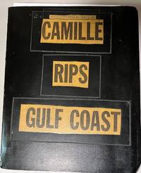
196934699Unknown: n/a 1969. Album. Good. Scrapbook. Approx. 9.5" x 11.5" three ring black binder with title pasted down on the front cover. Back cover of the album has some scuff marks. Contents clean.<br /> <br /> Contents include 43 photographs mounted on black paper magazine and newspaper clippings a Gulf Coast map by Shell Gas Company and a written essay on the hurricane. Original photographs depict scenes of devastated buildings properties etc. A unique collection of visual and printed material regarding one of the most powerful and destructive hurricanes to hit the Gulf coast. n/a unknown
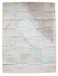
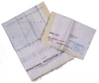
1967L6CEZZVCL8UFSt Louis: Aeronautical chart and information center United States Air Force 1967. Two maps colour printed on both sides of a sheet of silk 103 x 78.5 cm on a scale of ca. 1:1000000. The two maps ONC-H-6 & ONC-H-7 show one continuous area. Rayon pilot's map of the Arabian Gulf region focusing on the Trucial States modern UAE Qatar Bahrain Oman Iran and Saudi Arabia including main oil installations. Items of specific interest to aircraft such as airfields and even seaplane bases are particularly listed. Warnings to stay within the specific flying routes while in Iran are placed on multiple locations. While the map depicts a continuous area on both side on of one sheets it actually consist of two maps originally published separately. Slightly frayed at the edges. In very good condition. Aeronautical chart and information center, United States Air Force, unknown
1969L95DV18L9VQZSt Louis: Aeronautical chart and information center United States Air Force 1969. Two copies of two folding maps colour printed on both sides of a sheet of silk 103 x 78.5 cm on a scale of ca. 1:1000000. The two maps ONC-H-6 & ONC-H-7 show one continuous area. Rayon pilot's map of the Arabian Gulf region focusing on the Trucial States modern UAE Qatar Bahrain Oman Iran and Saudi Arabia including main oil installations. Items of specific interest to aircraft such as airfields and even seaplane bases are particularly listed. Warnings to stay within the specific flying routes while in Iran are placed on multiple locations. While the map depicts a continuous area on both side on of one sheets it actually consist of two maps originally published separately. We here include two copies so the whole area can be displayed. The maps are reproduced after the third and fourth edition.In very good condition. Aeronautical chart and information center, United States Air Force, unknown
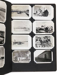
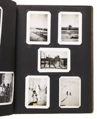
1943ABC_484281943. Contemporary embossed brown cloth with the title embossed in silver on the front board and the green shoulder sleeve insignia of the Persian Gulf Command embedded in the front board. Ca. 32.5 x 26 cm. With 150 gelatin silver photographs various sizes. Unusual military photo album with 150 photographs of the activities of the Persian Gulf Command PGC at the base in Andimeshk Iran. The PGC was a branch of the United States Army established to facilitate the supply of material from the U.S. Lend-Lease programme through the Persian Corridor. This material was sent to the Soviet Union to strengthen it so it could help defeat Nazi Germany. The photographs in this album which cannot be found anywhere else offer a visual documentation of this time. However they show the simple soldiers; the men tasked with driving trucks maintaining oil supply lines or working alongside Iranians at the two factories producing trucks for the war effort. The work therefore offers a fascinating insight into daily life of PCG members in Persia in the Second World War.This album was compiled by John Stefano dates unknown a technician fourth grade in the PGC. It includes photographs of the Tehran conference in 1943 the first World War II conference between the Soviet Union the United States and the United Kingdom where it was decided to open a second front against Germany. Other than this there are photographs of the barracks the men lived in the military vehicles they used the marches and excercises they partook in but also the surrounding landscape and the local people.Inserted in the album is a booklet with images and information about Persia with a letter by PCG commander Donald Prentice Booth 1902-1993 which was sent to PCG members after the war to congratulate them on a job well done. He hoped the booklet would serve as a memento. Together with the album it continues to do so until this day.With the shoulder sleeve insignia of the Persian Gulf command mounted on the inside of the frfont board some of the photographs are captioned on the back. The eyelets for the string on the front board have come loose. The corners of the leaves are slightly creased. Overall in very good condition. hardcover
1943ABC_484291943. Contemporary embossed brown cloth with the title embossed in silver on the front board the name of the owner painted in silver and the green shoulder sleeve insignia of the Persian Gulf Command embedded in the front board. Ca. 32.5 x 26 cm. With 76 gelatin silver photographs various sizes. Remarkable military photo album with 76 photographs of the activities of the Persian Gulf Command PGC at various locations in Iran. The PGC was a branch of the United States Army established in 1941 to assure the supply of U.S. Lend-Lease war material to the Soviet Union through the Persian Corridor. After the war members of the PCG received an empty album to fill with personal memories of their time in Iran. These albums are now relatively rare. The present one was compiled by Colonel S. Morgan Thomas dates unknown a PGC member who carried out inspections of the railroads. It includes various photographs of him at work.This album also contains photographs of PCG commander Donald Prentice Booth 1902-1993 a visit by Soviet soldiers and a young child military activity in Teheran locals and soldiers sending telegrams. Loosely inserted in the album are maps of Iran the lands surrounding Hamadan and the Trans Iranian Railroad which would have been important to carry for someone who inspected the railroads. The work offers a rare insight into life of a PGC member stationed in Iran.The corners of the boards are somewhat scuffed. One of the inserted maps is somewhat foxed and another has a tear that has been repaired with tape in the lower margin not affecting the image some leaves are missing one of the corner mounts the photographs are mounted on possibly missing a photograph on the verso of leaf 4. Otherwise in very good condition. hardcover
1944015766Pittsburgh Pennsylvania: Gulf Research & Development Company 1944. Soft cover. Very Good. One of 65 copies this being copy 43 made and distributed by the Office of Scientific Research and Development. Covers lightly worn at edges; spot of soiling on rear cover. Interior unmarked and generally clean. Includes four pages of photographs of equipment on glossy paper six pages of mechanical diagrams and 35-pages of statistical graphs. 137 pages each printed on one side. 11 x 8.5 inches. No institutional copies located on OCLC. Rare. Confidential WWII-era technical report on the testing of anti-tank land mines including the German Tellermine. The report details the results of measuring of the dynamic characteristics of the mines when subjected to shock impulses including drop weight and blast tests essential to the comparison of various methods of clearing mine fields in which mines were detonated by means of the shock impulse from blast waves flails etc. The research was conducted by the contractor the Gulf Research & Development Company Pittsburgh Pennsylvania. ''It is the ultimate object of this investigation to obtain an indicator mine. Such an indicator mine is useful in comparing the relative effectiveness of various methods of clearing land mine fields. The German Teller mine TMi-43 is known to be the most difficult to explode by blast. Engineering data were provided the Engineering Board on the basis of which this German mine was substantially duplicated. This mine is known as the TMi-43 Indicator Mine'' - from the comments of the NDRC Project Supervisor Semi Joseph Begun 1905-1995. Begun was a German-American engineer and inventor who was at the time the Vice President of Research for the Brush Development Company Cleveland Ohio. The report was submitted by Thomas Bardeen and A. P. Palmer. Thomas Bardeen 1912-1980 was a Pittsburgh resident and engineer with Gulf. He received the President's Certificate of Merit on November 30 1948 for his contributions to the war effort. The mines tested were the M1B1 M1A2 M4 TMi-42 TMi-43 T6E1 C.I. Canadian Indicator and the T6-43. Gulf Research & Development Company paperback
1992106211Aberdovey Golf Club 1992. First Edition. Hardback. Fine. 0x0x0. 132 pages illustrated. A fine copy in green faux leather binding. No previous ownership markings Aberdovey Golf Club hardcover
1992110716Aberdovey Golf Club 1992. First Edition. Hardback. Very Good. 0x0x0. 132 pages illustrated. A VG copy in green faux leather binding. No previous ownership markings Aberdovey Golf Club hardcover
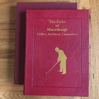
19913554907191371991. Hard Cover. Signed by Author. Droitwich Worcestershire: Grant Books 1991. AUTHOR'S PRESENTATION EDITION SIGNED BY THE AUTHOR JOHN ADAMS AND LIMITED TO 125 COPIES THIS BEING # 69. Publisher's full red morocco with gilt lettering to the front board and spine with vignette of a golfer in gold to the front board. Four raised bands to the spine. All edges gilt. Title to the spine in gilt on black leather label. Marbled end-papers. A very fine copy in like publisher's slip-case. Hand-written letter from the publisher dated 6.4.91 laid in about the forthcoming publication of this book. A stunning production. Note: This limited edition of 125 copies should not be confused with the separate limited edition of 750 copies which is signed by Shirley Grant the publisher which was NOT published with a slip-case. Photographs/scans available upon request. hardcover
1902e9632Edinburgh: Printed for Private Circulation by Morrison & Gibb Ltd. Cover rubbed. Original cloth rebacked. New fep affixed to half title page. Hinges along an initial and end leaf with tape repairs along gutter. Part of prelims misbound. Light scattered browning. Teg. 1902. First Edition. Blue hardback cloth cover. 260mm x 190mm 10" x 7". xl 126pp. Photographic frontispiece and vignette of old clubhouse. . Printed for Private Circulation by Morrison & Gibb Ltd hardcover
1905001215London: Horace Cox 1905. Book. Very Good. Cloth. First Edition. 1905 First edition. Horace Cox London. Very Good gray cloth. Mild bumping to extremities. Scarce early instructional. Donovan and Murdoch 28260. Horace Cox Hardcover
199710257München, Heyne, 1997. PP, 136S, gutes Exemplar
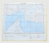
1963153757London: Geographical Section General Staff 1963. Scarce charts of Bahrain and the Straits of Hormuz A rare and historically interesting pair of adjacent maps of the Arabian Gulf covering six degrees of longitude each the geographical area encompassing the whole of Qatar Bahrain and part of what was to become the United Arab Emirates Al-Hofuf being the major city in the Al-Ahsa Oasis Eastern Province Saudi Arabia; sixth and fifth editions respectively. Maps of the period issued by the GSGS Geographical Section General Staff use a 7-colour tint scale to distinguish altitude and a glossary that highlights towns of significance and other standout features which provided steady references for army personnel to aid navigation in the challenging conditions of the region. The Bander Abbas map was compiled by the US Army Map Service Corps of Engineers from a number of sources including USAF Aeronautical Approach Charts of 1951-55 and the US Geological Survey of the Arabian Peninsula 1958. The Hofuf chart is based inter alia on 512 Field Survey Royal Engineers charts 1942-4. WorldCat lists just three individual copies for Hofuf NG39 SUNY at Buffalo University of Notre Dame and Eastern Illinois University alongside four copies of Bandar Abbas NG40 University of Exeter University of Notre Dame Eastern Illinois University and University of South Florida. It should be noted that major national institutions - BL for example - will have holdings of these maps within the complete GSGS series. Most copies would be discarded on supersession making these an important record of cartographic progress in the region. Two two-colour printed maps 1:1000000 scale 690 x 610 & 750 x 610 mm respectively. Ex- libris stamp of Arizona State Library both stamped "superseded" in blank margin and "withdrawn" on verso some pencilled marginalia; both in excellent condition. unknown
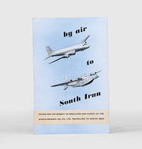
1955171428Malta: Trade Commissioner to the Malta Government 1955. A rare promotional guide to the air route from London to Basra produced for travellers destined for the Anglo-Iranian Oil Company's refinery at Abadan in Iran. A map shows the route passing through the eastern Mediterranean and Egypt before arriving in Iraq. The text attempts to give the impression of a well-organized journey: "At Basra you will be met by a representative of the Company who will help you with the Customs and other formalities. After a meal at the Airport Hotel you will find that arrangements have been made for your onward journey to your destination". The map to the verso shows critical infrastructure across the Middle East including oil pipelines and railways. Octavo. With 4 photographs and 2 colour maps. Folding colour printed pamphlet 140 x 215 mm when folded 420 x 215 mm when open. Minor scuffing creased at centre a touch foxed at front. A very good copy. unknown
1957182684London: War Office; Printed for D. Survey WO and AM by Balding and Mansell Ltd 1957. A bright example of this detailed Gulf map Classified "restricted" and issued for military use at the time of the Jebel Akhdar War this double-sided sheet shows much of the modern-day UAE extending northwards from the latitude of Abu Dhabi and the Buraimi Oasis as well as the eastern Arabian Peninsula from the Trucial Coast to Jubail. As with other contemporary GSGS maps the sheet covers six degrees of longitude and highlights towns of significance and other standout features for example oil pipelines and wells water systems and roads and railways. Rayon sheet 630 x 710 mm printed both sides in colour folded as issued. A fine example. unknown
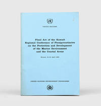
1978172055Perhaps Kuwait: United Nations Environment Programme 1978. First and sole edition untraced in Middle Eastern libraries of this plan enshrining environmental protection as a priority for future development along the Arabian coast. The regional conference highlighted the dangers posed by oil spills and committed to pollution-control measures for future projects. Participants included delegates from Bahrain Iran Iraq Kuwait Oman Qatar Saudi Arabia and the UAE. Attendees also agreed on a regional trust fund funded in different proportions by eight governments including the UAE and Saudi Arabia to finance initiatives. In the United Kingdom copies can be found at the universities of Oxford Durham and Southampton. We have also located three each in the US and Canada two in Germany two in Switzerland and one each in Austria and Sweden. Octavo. Original pale blue wrappers wire-stitched as issued front cover lettered in black. Light peripheral toning to covers small rust mark at top corner of front cover back cover slightly creased: a very good copy. unknown
1956153759London: Geographical Section General Staff 1956 & 1957. Scarce maps of Oman and south-east Arabia dating to the Jebel Akhdar War A pair of decidedly uncommon and impressively sized regional maps both second editions Muscat-Musira following the first of 1945 S. E. Arabia first published in 1956. The Muscat-Masira map drawn up by D Survey of the Ministry of Defence reaches as far north as Khaburah Oman on the coast south beyond Masirah Island and westward reaching beyond Lahus and Hadhi. It is based on several mappings including Bertram Thomas's map of Rub' al Khali the "Empty Quarter" 1931 the sand desert covering most of the southern third of the Arabian Peninsula Samuel Barrett Miles 1910 map of Oman and Captain F. F. Hunter's map of Arabia 1935 revision. The aeronautical chart goes into greater detail reaching beyond Sur in the North South to Masirah Island and Manadhif and West to Uruq ash Shaybah UAE; this was drawn up by No. 1 SPC.RE i.e. Survey Production Centre Royal Engineers and is based largely on the USAF Aeronautical Approach Charts 1956 and World Aeronautical Chart 563 1951. During the mid to late-1950s Britain was involved in a number of disputes in Oman perhaps the most serious involving the Imam Ghalib al-Hinai and his brother Talib bin Ali who led the Imamate's revolt against Sultan Said bin Taimur which resulted in the Jebel Akhdar or Oman War 1954-1959. In this the RAF played a leading role not least because aircraft could at the same time expedite oil exploration operations in the interior of Oman. Pembrokes light transport aircraft and heavier Avro Ansons from 1417 Communication Flight RAF carried out reconnaissance "and other tasks during this operation against the Imamate and were the first aircraft ever to land at Nizwa marked "Nazwa" on the chart on a roughly cleared strip which proved extremely hazardous for the pilots but which was later transformed into a passable airfield" Lee p. 22. The present chart has two pencilled lines radiating from Masira airfield one of which passes through Nizwa near which is marked the "approx. position" of an airstrip. The chart bear the proviso that they should "not be taken as an authority on names" and that "the alignment of all tracks is approximate". Users were also directed to update information and highlight errors which were to be directly sent to the Director of the Military Survey in the War Office. There are noticeable graphical variations between the chart and map as fitting their usage. Before the Second World War pilots flew using landmarks - such as train tracks or roads - as pointers which meant that they relied on perfect weather conditions. However technological advances in aviation alongside the use of radio for more accurate navigation meant that to a degree pilots could work in more challenging conditions. This meant that maps with their focus on terrain and details relevant from the perspective of ground troops would become irrelevant when observed from a plane's altitude. Therefore a number of countries started to produce charts highlighting key information by reducing the contour structure and focusing on key landmarks necessary for aviators. The Muscat-Masira map uses a five-colour tint scale to distinguish altitude includes a glossary and key the latter identifying towns given four categories of importance significant ruins geographical features such as mountains hills marshes saddles and passes rivers water holes and man-made features such as railways roads tracks telegraph lines pipelines and pumping stations mosques and temples; tribal and regional names are also given. However reflecting the simplification required by pilots the S. E. Arabia chart only uses fives tones to highlight land mountains paths and the sea. These maps intended for use in the field would have had a high rate of attrition; WorldCat locates just a handful of copies of the Muscat-Masira map whilst S.E. Arabia 4802 is well represented institutionally but decidedly uncommon on the market. Two colour printed maps the first 1: 1000000 scale 860 x 640 mm the second 1:500000 scale 1100 x 825 mm. Both with creases from old folds and some minor marginal splits and spots the second with pencil lines marking a flight route from Masira Island and a notation in the margin; both remain very good. Sir David Lee The RAF in the Mediterranean and Middle East 1945-71 1978. unknown