[La Haye, Jean de].MareMagnum

4 134 résultats
(2) [Harsdörffer, Georg Philipp]. Germania deplorata, sive relatio, qua pragmatica momenta belli pacisque expenduntur. (3) [Milag, Martin]. Aulaea Romana, contra Peristromata Turcica expansa: sive dissertatio emblematica, concordiae Christianae omen repraesentans. (4) [Anonymous French critic of Cardinal Richelieu]. Gallia deplorata, sive relatio, de luctuoso bello, quod rex Christianissimus contra vicinos populos molitur. 4 editions published together in 1 volume. 4to. With 2 engraved title-plates plus 12 full-page engraved emblematic illustrations, all on integral leaves, each with a small plate nested in a larger plate (7 in the Peristromata with a varying plate black and the same outer plate of a Persian carpet in orange). Gold-tooled light brown calf (ca. 1820?) by Charles Murton in London. Rare first and only Latin editions (probably the first and only early editions in any language) of four closely related polemical pamphlets on European policy toward the Ottoman Empire. The publication was instigated by the prominent Nuremberg poet and jurist Georg Philipp Harsdörffer (1607-58), who somehow found access to the French manuscripts of the pro-Richelieu "Peristromata Turcica" (Turkish carpets), and the anti-Richelieu "Gallia deplorata", translated them into Latin, edited them for publication and added what is believed to be his own anti-French Latin rebuttal of the former, "Germania deplorata". On 26 November 1641 he sent all three to the Calvinist Prince Ludwig of Anhalt-Köthen, founding president of the Fruchtbringende Gesellschaft in Weimar, who found the "Peristromata Turcica" shocking and dangerous, not only for its content but also because its remarkable and "seductive" graphic form. At a spring 1642 meeting of the society Ludwig initiated the writing and production of an emblematic rebuttal, the "Aulaea Romana" (Roman tapestries). Besides the political importance of these pamphlets as records of differing European attitudes toward the Ottoman Empire, they are remarkable graphic and typographic artefacts, early examples of colour printing and important emblemata. In 1536 Francois I had formed an alliance with the Ottoman Emperor Suleiman the Magnificent, and for a century Franco-Ottoman relations swung between extremes. Around 1626 Cardinal Richelieu began to encourage noblemen to strengthen France's economy by expanding its maritime trade in the Middle East, Near East and beyond. But with its great maritime power, the Ottoman Empire was not only a potentially valuable trading partner but also a fierce competitor and even a military threat to Europe's trade in those regions. Richelieu therefore attempted to form a Catholic union with the Holy Roman Empire and others to fight against the Ottomans. With owner's inscription of the lawyer and diplomat Georg Achatz Heher (1601-67) and bookplate of Robert Hoe (1839-1909), one of the greatest book collectors of all time. With the last quires (E-H) of the "Aulaea Romana" misbound following the last quire (G) of Gallia. A small marginal worm hole in the first work and the first leaves of the second, and an occasional small marginal chip or tear, but still in good condition. The binding with cracks in the hinges and some wear at the extremities, but otherwise good. Although these four editions were clearly designed to be published together, only about a dozen complete sets are known to survive, nearly all in Germany, Austria and Poland. Faber de Faur 497-500. Praz 448f. M. Reinhart, "Georg Philipp Harsdörffer and the Emblematic Pamphlets of 1641-42", in: Emblemata XX (2013), pp. 313-376 & XXI (2014), pp. 277-375. Stijnman & Savage, p. 46 (ad 1). Not in Atabey or Blackmer.
8vo mimeographed typescript. Approx. 122 pp. Original black wrappers. Together with: 3 colour stills on board (364 x 281 mm), 12 colour stills (241 x 185 mm) issued for the press, 10 silver gelatin print stills (278 x 210 mm), colour poster, and 14 behind the scenes and costume test silver gelatin prints (ranging from 158 x 105 mm to 290 x 290 mm), with further costume test photographs tucked into the script. Fascinating and significant collection of material relating to one of the most famous British films of all time, Sir David Lean's "Lawrence of Arabia" (1962). The collection includes a unique production-used script, the title-page annotated "2nd Unit, Abbey", with various test photographs inserted into the script at different points and annotations and added tabs towards the end of the script. Includes four large black and white behind-the-scenes photos of the film's then-unknown star, Peter O'Toole (1932-2013), on camelback taken by famous stills photographer Ken Danvers (1911-80). Various additional costume reference photographs are present, including three for 'Lawrence', one featuring Peter O'Toole, in costume, smoking next to a set trailer. Also present are a set of twelve front of house stills for the film, an American one-sheet poster from the 1971 re-release, and other photographic stills relating to the production including three large colour film stills on board, which round out an impressive collection. Also included are 11 photographic references of T. E. Lawrence used by the costume design team to style Peter O'Toole. - "Lawrence of Arabia" (1962) was O'Toole's film debut, for which he received international acclaim. The film itself was selected in 1999 as the third best British film of the 20th century, and won seven of an impressive ten Oscar nominations. It is generally considered one of the most important films to come out of the 1960s, and has been selected for preservation in America's National Film Registry in acknowledgment of its cultural significance. - Occasional light wear to photographs, generally in the form of subtle pinpricks to corners. In general, exceptionally well preserved. - Provenance: Acquired by an employee of the film's producer, Sam Spiegel (1901-85). Spiegel was financially responsible for some of the most critically acclaimed motion pictures of the 20th century, and was the first independent Hollywood producer to work on films that won the Academy Award for "Best Picture" three times. One of those films was, of course, "Lawrence of Arabia".
Small folio (227 x 294 mm). (6), 113, (1) pp. With Allenby's portrait frontispiece on cloth and 56 coloured maps (facing explanatory texts printed on versos). Original printed wrappers with printed cloth spine. First edition, edited by Harry Pirie-Gordon as a souvenir album: an account of the 1917-19 campaign in the Middle East. Contains two reports written by T. E. Lawrence, "Sherifian Co-Operation in September" and "Story of the Arab Movement", in which he details the Ashraf contribution to the War effort and narrates his own involvement in a third-person report. - Rubbed and stained, with occasional edge flaws. Endpapers have pencil ownership of O. A. Holstius, attached to Headquarters, 19th Brigade, Royal Field Artillery. Loosely inserted is a typed extract from "The Honourable Artillery Company in the Great War, 1914-1919" by George Goold Walker (1930), detailing living conditions in the Jordan Valley during the Great War (torn and frayed at edges). O'Brien A011.
2003LFA0183eRevue mensuelle de 50 pages, format 160 x 240 mm, brochée.
150 x 205 mm. AP press photo showing Sayid Idris al-Senussi in London shaking hands with Eric de Candole, British Administrator of Cyrenaica, and his wife. Captioned on the reverse: "Senussi leader arrives in London. The Emir Sayid Idris el Senussi, head of the state of Cyrenaica, photographed on arrival in London last night July 15. He is shaking hands with Mr. E. A. V. Candole, British Chief Administrator of Cyrenaica. At centre is Mrs. Candole. The Emir travelled from Derna to Marseilles in the battleship 'Vanguard' and thence across France. It is the Emir's first visit to England. While here he will have talks with Mr. Bevin on the future of Cyrenaica". Well preserved.
Varying sizes (ca. 60 x 55 mm to 20 x 14 mm). Engraved bronze. Set within a modern frame (36,4 x 30,4 cm). Rare document of the Roman presence on the Arabian Peninsula, comprising 15 fragments in good condition. The diploma was issued for an equestrian named Bithus of the ala praetoria singularium, an auxiliary cavalry unit stationed in Syria, under the command of Aulus Furius Saturninus during the reign of Emperor Domitian (81-96). It can be dated with a high degree of certainty, as Aulus Furius Saturninus is only traceable to military diplomas issued as part of an imperial military constitution for 5 alae and 2 cohorts in Syria from 8 November 88. The name Bithus is probably of Thracian origin. - The ala praetoria singularium was one of 14 alae and 33 cohorts stationed in the province of Syria between 88 and 157. These troops built and defended the almost 1500 kilometre Limes Arabicus, a system of streets, watchtowers, and forts that had its origin in the Roman conquest of Syria in 64 BCE and reached its greatest extent in the second century. Palmyra and Damascus were among the fortified cities along the Limes Arabicus. - From the German collection of Peter Weiß, acquired before 1980. Published: P. Holder, Roman Military Diplomas V (London: University of London, Institute of Classical Studies, 2006), p. 771 f., no. 330. P. Weiß, Neue Militärdiplome, in: Zeitschrift für Papyrologie und Epigraphik 117 (1997), pp. 229-231.
Ca. 72 x 83 mm. Engraved bronze. Rare and exceptionally well-preserved document of the Roman presence on the Arabian Peninsula. This diploma was issued for a member of the ala praetoria singularium, an auxiliary cavalry unit stationed in Syria, under the command of Aulus Furius Saturninus during the reign of Emperor Domitian (81-96). It can be dated with a high degree of certainty, as Aulus Furius Saturninus is only traceable to military diplomas issued as part of an imperial military constitution for 5 alae and 2 cohorts in Syria from 8 November 88. - The ala praetoria singularium was one of 14 alae and 33 cohorts stationed in the province of Syria between 88 and 157. These troops built and defended the almost 1500 kilometre Limes Arabicus, a system of streets, watchtowers, and forts that had its origin in the Roman conquest of Syria in 64 BCE and reached its greatest extent in the second century. Palmyra and Damascus were among the fortified cities along the Limes Arabicus. - From the German collection of Peter Weiß, acquired before 1980. Published: P. Holder, Roman Military Diplomas V (London: University of London, Institute of Classical Studies, 2006). P. Weiß, Neue Militärdiplome, in: Zeitschrift für Papyrologie und Epigraphik 117 (1997), pp. 227-268.
4to. (8) pp. With woodcut Papal arms and the Saints Peter and Paul on the title-page. Modern wrappers. Rare pamphlet of litanies and prayers invoking Divine assistance against the Ottoman threat during the Great Turkish War of 1683 to 1699. Previously issued in 1683, and again in 1716, during the Ottoman-Venetian War. OCLC lists a single copy at the Biblioteca Nazionale Centrale di Roma. - A waterstain throughout, else fine. OCLC 954866405.
4to. (2), 750 pp. French manuscript on paper. Contemporary gilt and blindstamped full green cloth with giltstamped title to spine and cover. Appealing, unpublished handwritten travelogue commemorating the French president Émile Loubet's tour of Algeria and Tunisia. Each page is enclosed within blue, white and red borders, with chapter titles and first initials also in tricolour. Apparently a presentation manuscript prepared for Michele Modica, vice-consul of Italy in Algeria, whose name is giltstamped on the front cover, it is signed - and probably written - by the prefecture's huissier Roche. In very neat handwriting, the account describes Loubet's two-week tour of French North Africa from Algiers to Oran, on to Tunisia and back to Marseille, mentioning visits to palaces, hospitals and race tracks, local delegations received by the president, as well as feasts and banquets held in his honour. - Extremities lightly scuffed. Ink corrosion along the left vertical blue border affecting the final 20 pages; slightly foxed in places. - An exceptional manuscript befitting the high rank of its recipient.
4to (198 x 247 mm). 8 pp. With armorial woodcut vignette on title, headpiece and initial. Unbound as issued. Rare official account of the French diplomatic expedition to Algiers undertaken in January 1666 by lieutenant general Damien Martel to re-establish the peace between Louis XIV and the Barbary Coast. - To protect the French merchant fleet from North African corsairs, but also inspired by the mercantilist theories of Jean-Baptiste Colbert, who strove to expand French commercial capacities abroad, the King had in 1664 sent an expedition under the Duke of Beaufort to Djidjelli in north-eastern Algeria. There, the French had sunk several corsair ships, seized the city and begun expanding the port into a permanent naval base. Algerian pirate commandos, however, soon retook the city, destroyed the French works and sold the surviving Frenchmen into slavery. Indeed, the Djidjelli expedition had achieved nothing for France but to serve as a convenient excuse for the Ottomans to charge Louis XIV with having breached the peace. While the Porte declared that they would not hinder the French in pursuing the corsairs, it was made clear that the Sultan would not permit Louis to take possession of the coastal cities and ports of Barbary. The French did not attempt to re-establish themselves in Africa; rather, they sent punitive expeditions throughout the Mediterranean to rout whatever corsair ships they could find, thus finally driving the Pasha of Algiers to accept a new peace treaty. In early 1666, Martel was dispatched with a fleet of 17 ships (including three "brûlots", or fireships); the pamphlet discusses his self-assured entrance to Algiers and the subsequent delicate negotiations that renewed the diplomatic accord between two nations. - An uncommon work; we have located copies only at the Bibliothèque Ste. Geneviève in Paris, the University of Oxford, British National Archives, and Bibliothèque Nationale, the latter two with title spelling 'Succincte'. Some duststaining, especially to the wide, untrimmed margins, but still a well-preserved copy. Playfair, Handbook for Travellers in Algeria and Tunis, pp. 44f. OCLC 57055024. Not in Playfair, Bibliography of Algeria: From the Expedition of Charles V in 1541 to 1887.
8vo. (26), 237 pp., final blank. Title within double-ruled border. 19th century half calf over marbled boards with giltstamped spine and spine label. Marbled endpapers. Very scarce English translation of this popular chronicle of the 8th-century Moorish invasion of Spain, purportedly translated from an Arabic manuscript that the Moorish apologist and interpreter Miguel de Luna claimed to have found in the Escorial library, but in fact a work of historical fiction of his own composition. Originally issued as "La verdadera hystoria del Rey Don Rodrigo" in two parts (in 1592 and 1600), the present edition, which encompasses only the first part (a second volume announced in the publisher's letter "To the reader" was never published), is the third one in English, following that of Robert Ashley in 1627 and the slightly more common edition published by Leach in 1687. Further translations appeared in French and Italian. It was not until almost a century after its publication that de Luna's book was discovered to be a literary forgery, and even today it remains important as a sympathetic account of the Moorish conquest of Spain. - Binding insignificantly rubbed. Occasional very light foxing; title-page slightly trimmed at foot affecting border. A tiny rust-hole to I5 and a larger tear to K8. Provenance: Handwritten ownership of the Revd. Thomas Watkins (1761-1829), F.R.S., of Pennoyre, Breconshire (dated 1806) to p. 1. Later in the library of the art collectors Howard and Linda Knohl at Fox Pointe Manor, California, with their bookplate to front pastedown. Rare; a single copy in auction records. Palau 144.080. Wing L3484C.
Oblong 4to (280 x 204 mm). 112 vintage black-and-white photographs (ca. 13 x 18 cm), frequently captioned in German in white ink, on 56 black paper leaves (plus two blank leaves at the end). Contemporary green card boards, block-bound with string. A fine album of excellent original travel photographs, assembled by a party of young men from Germany, Austria and Hungary travelling through Northern Africa in the late 1920s or very early 1930s. A total of 36 photos show scenes from Libya: the cave dwellings in the jebels, the Arab and especially Jewish population, a Bedouin tent, Italian officers in Aziziya, but also a group portrait of the travellers leaning on their motorcar. A few pictures show the European tourists laughingly taunting the local children with cigarettes for which they let the youngsters grapple. The strong focus on the fairly large Jewish community (then constituting nearly 4% of the Libyan population, as compared to less than 0.8% in Germany) is poignant before the background of the increasingly virulent antisemitism in the visitors' central European homeland, apparently revealing a particular fascination with the "otherness" of the Jews who are here shown and described as a people living as they supposedly did in Biblical times. - Via Malta (6 photos, some depicting warships in the harbour) the party sailed on to Tunis, where no fewer than 32 photographs cover the port, the Al-Zaytuna Mosque, Spahis and French officers on horseback, and a wealth of street scenes: the old town with its souks, Bab Souika square, gypsies, veiled women, water salesmen, men in coffee houses, and a Christian butchery. The remainder of the album shows scenes from the return journey through Italy: Cagliari and Sardinia (6), Civitavecchia (3), Livorno (5), Genoa (1), and Milan (23, including many from the Cimitero Monumentale and some showing off then-modern architecture). - A well-preserved ensemble of amateur travel photographs from a region more frequently captured in military photography but rarely visited at the time by affluent European tourists with high-quality cameras.
More than 400 glass slides depicting various motifs of coal mining, chemical processes, astronomy and topographical motifs from Asia, Africa, China, Europe and America. Housed in original wooden boxes. Includes 2 original projectors and 1 camera. Remarkable, encompassing collection of turn-of-the-century Magic Lantern slides. Several of the slides show cavalry horses: the "Krigen, 1848-1864" set includes (no. 45) an equestrian portrait of General Bülow, victor of the 1849 Battle of Fredericia, painted by Aug. Jerndorff; (no. 29) Friedrich von Schleppegrell riding at the battle of Isted; (no. 26) General Krogh on horseback (all V. Richter, Kopenhagen); no. 20. captioned "Pferdeablieferung" (horse delivery). A box labelled "København" includes: (no. 21) Brandmajoren rykker ud; (no. 20) a fire at the time of Frederik VI. Other slides show workhorses in Denmark and Sweden during haying-time or spreading manure, as well as works of the Danish painter Otto Bache: the Coronation of Christian IV in 1596; the conspirators escaping from Finderup on horseback after having murdered Eric V of Denmark. The collection also contains copies of paintings by various artists, such as Leonardo da Vinci, Raphael, and Rembrandt. Among the remaining slides, we find astronomic illustrations and pictures of observatories (Greenwich, Delhi, Potsdam, etc.); as well as numerous photographs and paintings of landscapes, people and architecture in Africa, Asia, Europe, China and America.
8vo. 163 ff. (without final leaf, blank except for anchor on verso). Aldine anchor device on title page. 18th-century English polished calf. Second edition (first published in 1543) of this collection of Venetian voyages to the Near and Middle East, edited by Antonio Manuzio, son of Aldus. "Tana was the name which the Genoese gave to their factory at Azov at the mouth of the river Don. This volume contains voyages by Giosafat Barbaro (Tana in 1436, Persia 1471), Ambrogio Contarini (Persia 1473-77), and Luigi Roncinotto (Ethiopia 1532, Persia and India in 1529). It also includes Benedetto Ramberti's account of the Turkish Sultan's campaign against the Portuguese settlement of Diu in northern India in 1538" (Atabey). "This appears to be one of the very few travel books from the Aldine press" (Blackmer). - Extremities rubbed and bumped, short cracks in joints. Light dampstain to first few leaves. Contemp. ink ownership to title page, further ownership trimmed away at lower edge (remargined without loss); further contemp. ownership "Gioseppe Custodi" under the colophon. Modern ownership inscription "J. W. S. M. / Caius. / Cambridge. / Jan. 1899" on front pastedown - very likely the Caius-educated English entomologist John William Scott Macfie (1879-1948). Later himself a traveller to the East, he served as director of the Medical Research Institute in Accra between 1914 and 1923, having undertaken the same responsibilities in an acting capacity at Lagos in 1913. Adams V 624. Blackmer 1071. Göllner 861. Renouard 134 (noting that of the two editions the present is "bien mieux imprimée"). Cf. Atabey 761 (first edition).
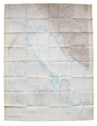
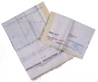
1967L6CEZZVCL8UFSt Louis: Aeronautical chart and information center United States Air Force 1967. Two maps colour printed on both sides of a sheet of silk 103 x 78.5 cm on a scale of ca. 1:1000000. The two maps ONC-H-6 & ONC-H-7 show one continuous area. Rayon pilot's map of the Arabian Gulf region focusing on the Trucial States modern UAE Qatar Bahrain Oman Iran and Saudi Arabia including main oil installations. Items of specific interest to aircraft such as airfields and even seaplane bases are particularly listed. Warnings to stay within the specific flying routes while in Iran are placed on multiple locations. While the map depicts a continuous area on both side on of one sheets it actually consist of two maps originally published separately. Slightly frayed at the edges. In very good condition. Aeronautical chart and information center, United States Air Force, unknown
1969L95DV18L9VQZSt Louis: Aeronautical chart and information center United States Air Force 1969. Two copies of two folding maps colour printed on both sides of a sheet of silk 103 x 78.5 cm on a scale of ca. 1:1000000. The two maps ONC-H-6 & ONC-H-7 show one continuous area. Rayon pilot's map of the Arabian Gulf region focusing on the Trucial States modern UAE Qatar Bahrain Oman Iran and Saudi Arabia including main oil installations. Items of specific interest to aircraft such as airfields and even seaplane bases are particularly listed. Warnings to stay within the specific flying routes while in Iran are placed on multiple locations. While the map depicts a continuous area on both side on of one sheets it actually consist of two maps originally published separately. We here include two copies so the whole area can be displayed. The maps are reproduced after the third and fourth edition.In very good condition. Aeronautical chart and information center, United States Air Force, unknown
Map (1030 x 785 mm), colour-printed on two sides. Scale 1:1,000,000. Rayon pilot's map of the Arabian Gulf region focusing on the Trucial States (modern UAE), Qatar, Bahrain, Oman, Iran and Saudi Arabia, including main oil installations. Items of specific interest to aircraft, such as airfields and even seaplane bases, are particularly listed. Warnings to stay within the specific flying routes while in Iran are placed on multiple locations. - Slightly frayed at the edges. In very good condition.
Two copies of two folding maps colour printed on both sides of a sheet of silk (103 x 78.5 cm) on a scale of ca. 1:1,000,000. The two maps (ONC-H-6 & ONC-H-7) show one continuous area. Rayon pilot's map of the Arabian Gulf region focusing on the Trucial States (modern United Arab Emirates), Qatar, Bahrain, Oman, Iran and Saudi Arabia, including the main oil installations. Items of specific interest to aircraft, such as airfields and even seaplane bases, are particularly listed. Warnings to stay within the specific flying routes while in Iran are placed on multiple locations. While the map depicts a continuous area on both sides of one sheet, it actually consists of two maps, originally published separately. We here include two copies so the whole area can be displayed at once. The maps are reproduced after the third and fourth edition. - In very good condition.
Colour printed map, 685 x 905 mm. Scale 1:7,500,000. With an inset map of "the Moslem World; percentage of Moslems in total population". Large map of Asia and the Middle East in 1952, published for the National Geographic Magazine. The map clearly shows the unresolved nature of several borders due to the waning colonial power of France and Great Britain. Notations mention that the "boundaries between India and Pakistan are not finally fixed", the borders between Saudi Arabia and Jordan are "undefined". Almost the complete Arabian Peninsula is without any border markings with only the single mention near Saudi Arabia and Trucial Oman (the future UAE) of "coastal sovereignty undefined". Showing the world before the oil boom in the Middle East, it is noteworthy that the only significant airport in Trucial Oman is that of Sharjah. - With two stamps of the University of Chicago library (including one withdrawal stamp) on the back. A few small repaired tears and some discolouring at the edges; in very good condition.
Colour printed map, 540 x 680 mm, with yellow covers (195 x 110 mm). Map of Iran, Iraq and parts of the surrounding countries, including modern Kuwait, Bahrain, Qatar and the UAE, in the 1930s, published in the series "Philips' authentic imperial maps for tourists & travellers". Published in the early years of the discovery of oil in the Middle East, the map shows roads and railways, but also caravan routes, submarine cables and oil pipelines. - Slightly soiled, in very good condition.
Colour printed map, 540 x 400 mm. Map of the Arabian Peninsula and parts of the USSR, Turkey, Iran and the British, French and Italian colonies in Africa, possibly coming form an edition of the "Commercial atlas of the world". Printed in yellow are oil fields and pipelines, including the legendary Kirkuk-Haifa/Tripoli oil pipeline. Detailed maps of Iran and of British controlled Palestine are printed on the other side. - With a few small holes near the inner margin.
Four maps (600 x 620 mm) printed in black and brown, kept folded in a grey cloth pocket. Map of modern Syria, Iraq, Jordan and Saudi Arabia in four parts, illustrating the travels of Alois Musil in 1908-1915 and published as part of a series of books and maps by Musil. Musil "mapped the topography, collected a large number of plants and in 1911 helped make observations that led to the first general sequence of the Phanerozoic geological succession of north-west Arabia". An inset in the map shows terrain elevations for several parts of the region. - Alois Musil (1868-1944) was a Czech orientalist and explorer and professor of Oriental Studies at the University of Prague. The collection of works which includes this map was published by the American Geographical Society with funding by the American industrialist and Arabist Charles R. Crane (1858-1939). - In very good condition. Vincent, Saudi Arabia: an environmental overview, p. 9. Cf. Wright, "Northern Arabia: the explorations of Alois Musil", in: Geographical review XVII, 2 (April 1927), pp. 177-206.
Colour-printed map, 560 x 735 mm, with a legend printed on the back. Scale 1:1,000,000. Pilot's map of Wadi Sirhan in the border region of Iraq, Saudi Arabia and Jordan. The map shows the concave and zigzagging border between Saudi Arabia and Jordan before its revision in 1965. The indefinite nature of the borders is clearly visible on the map in the changed and crossed-out borderlines and the notations "boundary approximate". Several areas are marked as "danger area" or "prohibited area". - Stamped "obsolete for use in aviation", otherwise in excellent condition.
Colour-printed map, 590 x 855 mm. Bilingual road map of the Arabian Peninsula for Aramco employees. Focused on Saudi Arabia, the map shows the main roads, as well as surfaced roads, trails, roads under constructions and even proposed roads. A list titled "hints for survival" mentions extremely logical traffic rules such as "come to a complete stop at stop signs and observe stop-and-go signals" and "observe speed laws in the community where you live as well as on the highway". Placing common traffic rules under the header "hints for survival" makes one fear the worst for Saudi Arabian traffic in this period. The Arabic side of the map contains the same "hints" as well as a list of road signs in Arabic and English. - In very good condition.
Scale 1:2,500,000. Equal-area conic projection (ravnougol'naia konicheskaia proektsiia). Relief shown by gradient tints, shading, and spot heights. Depths shown by soundings. 89 x 77.5 cm. In original printed sleeve. Third edition of the Soviet 1:2,500,000 reference map of Iran (Persia), edited by Z. P. Pekhova. Includes insets: "Karta narodov" and "Ekonomicheskaia karta" (1:7,500,000). Index printed on reverse. - Title repeated with ballpoint in Latvian on sleeve's spine. In excellent condition. OCLC 255529903.