Bishop, Ted (signed)Biblio.com

505 résultats
2016029682Stratford Connecticut: Classics of Golf 2016. INSCRIBED / SIGNED by the AUTHOR directly on the front free endpaper. The inscription reads: "Maryanne - Hope you make every putt at Spring Brook! Ted Bishop. PGA #38." Fine condition in a Very Good dust jacket. The jacket has light shelfwear but NO chips tears creases or fading. Square and tight. Sharp corners. NOT a library discard. NOT a remainder. Pages are fresh crisp clean and unmarked. No year of publication is indicated but 2016. First printing of the First Edition with complete number row 10 987654321 on the copyright page. The author was 38th President of the PGA of America. Photo illustrated including a full color frontispiece photos of the author seated next to Donald Trump at Trump Plaza. Bound in the original gilt-stamped black cloth. Complete with dust jacket with a rear panel color photo of the author with Tom Watson. Watson comments that Bishop's impeachment by the PGA was "steeped in political correctness" and "in no way fit the crime." From the publisher: "Ted Bishop the controversial 38th President of the PGA delivers a riveting gem with "Unfriended- Power Brokers Political Correctness and Hypocrisy in Golf." It is a powerful behind the scenes look at the Ryder Cup Masters and PGA and the myriad of meetings where the decisions of golf are made. Great theater and big personalities abound. "Unfriended" exposes many things about many people. Golfers will love "Unfriended" and will read it from cover to cover!". INSCRIBED / SIGNED by the AUTHOR. First Printing of the First Edition. Hardcover. Fine condition/Very Good dust jacket. Illus. by NOT a library discard. 8vo. 253pp. Great Packaging Fast Shipping. Classics of Golf Hardcover
19433554907250781943. First Edition. St. Andrews Scotland: W.C. Henderson and Son Ltd. University Press 1943. First UK Edition. A softback. Not issued with a dustwrapper. 75p. Blue illustrated wrappers lettered in white to the front cover. A VG copy. Minor creasing to the bottom right-hand corner of the front cover. No inscriptions. Clean interior. Spine firm. A nice bright and clean copy. Uncommon. Further photographs available upon request. unknown
199254906Boca Raton Florida: Lewis Publishers. Very Good. 1992. Hardback. 0873717422 . 951 pages . Lewis Publishers hardcover
0471690090New. Brand new and still unused unknown
0471690090.Ghardcover. Good. Access codes and supplements are not guaranteed with used items. May be an ex-library book. hardcover
0471745650New. Brand new and still unused unknown
0470223324.Ghardcover. Good. Access codes and supplements are not guaranteed with used items. May be an ex-library book. hardcover
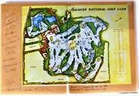
SB19B-02453Augusta National Golf Club. Used - Good. Good condition. Paperback edition. golf golfing golf tournament A copy that has been read but remains intact. May contain markings such as bookplates stamps limited notes and highlighting or a few light stains. Augusta National Golf Club paperback
197876031aozThe Augusta National Golf Club 1978. imitation_leather. Good/Missing. 0x0x0. Signed by Other. Signed and isncribed by golf course designer Fred Sparks. Oversized green hardbound without dust jacket. Apart from the inscription no text markings noted. The Augusta National Golf Club hardcover
19781591219832Augusta National Golf Club 1978. Hardcover. Good. Missing dust jacket; Pages can have notes/highlighting. Spine may show signs of wear. ~ ThriftBooks: Read More Spend Less.Dust jacket missing. Shelf and handling wear to cover and binding with general signs of previous use. Boards betray fading and nicks and other signs of wear and imperfection commensurate with age. Binding is tight and structurally sound. Pages unmarked. Sealed in plastic for shipping. Secure packaging for safe delivery.Dust jacket quality is not guaranteed. Augusta National Golf Club hardcover
1990016936Augusta Ga: Augusta National Golf Club 1990. Book. Fine. Hardcover. Inscribed and Dated in the Year of Publication. 1st Edition. A lovely copy in green leatherette inscribed & signed by Jay Hebert. Jay Herbert " Junius Joseph "Jay" Hebert February 14 1923 - May 25 1997 was an American professional golfer. He won seven times on the PGA Tour including the 1960 PGA Championship". Augusta National Golf Club Hardcover
1396758178.Ghardcover. Good. Access codes and supplements are not guaranteed with used items. May be an ex-library book. hardcover
19402092902137306519Shinkenchikusha 1940. Soft Cover. Fine. The book is in fine condition. Shinkenchikusha paperback
46890215-nnew. unknown
1997Q-1572431725Triumph Books 1997-09-01. Hardcover. New. In shrink wrap. Looks like an interesting title! Triumph Books hardcover
rja651716<p>UKslim 8vo HBdw/djillustrated1st edn. Preceded by the US1st edn issued a year earlier in 1959. Author's 2nd book/title following on from his first and best-seller 'How to Play Your Best Golf All the Time'. FINE/VG. Owner's neat ink namedate inscrptn to reverse of ffe and no price-clip to dw/dj. Bright crisp generally clean matt colour pictorial artwork non-credited illustrated front panelspine of dw/dj with red and black lettering; with negligible shelf-wear or creasing to edges and corners - no major nicks or tears present. Head of spine/backstrip of dw/dj bumpedcreased and minimally rubbed and rear inner flap with an accidental approx 1/2" internal vertical crease to it's entire length. Topfore-edges slightly aged/toned but still generally bright and clean; contents bright tight clean solid and sound - near pristine - no dog-ear reading creases to any pages' corners appears unread apart from my collation. Publisher's bright clean but slightly sunned sharp-cornered original plain green cloth boards with a black ink golf club 2 hand-grip vignette to front board's lower right-hand corner and bright crisp blocked gilt titlepublisher letters to printed gilt double-line edged dark green box/label on spine/backstrip and clean multi-green coloured golf links illustrated endpapers. Part of the dw/dj illustration/design has 'ghosted' or bled throughto the front board beneath. UKslim 8vo HBdw/djillustrated1st edn 1-143pp paginated includes 15 chapters4-colour block green pale green black and white illustrations by Merrit D. Cutler as chapter head pieces part-page and full-page illustrations and technique diagrams throughout the text and the book; plus unpaginated half-title page publisher advert for Armour first best-seller book with full page colour illustration to it's reverse by Cutler title page a dedication a Contents list/table title separator page a Note about author and 2pp blanks at the rear. Described hard but fairly and honestly - not as bad as it reads or would sound! See my book ID rja651616 for his 3rd book - 'Tommy Armour's ABC's OF GOLF'a UK8vo HBdw/dj1st edn. A BOOK FOR EVERY GOLFER by one of the acknowledged Masters of the Game. Nine holes of a friendly foursome described stroke by stroke with instruction and advice both technical and strategic given to the players who are of very different prowess the whole lit up by anecdotes from Tommy Armour's personal experience to illustrate his points. Instructive entertaining and splendidly illustrated by Merrit D. Cutler. Please contact seller @ rpaxtonden@blueyonder.co.uk because of the value of this item for correct insuredor uninsured at own risk shipping/Pp quotes - particularly ALL overseas buyers - BEFORE ordering through the order page! N.B. ALL buyers please note stocks' shipping quotes are adjusted for any refunds AFTER receipt of order and BEFORE the despatch of the order especially if the item is offered either Pp included/FREE. <br /> N.B. US/Canada customers please be aware: Standard US AIRMAIL to these destinations can now in some cases cost more than the price of the book! If speed is not of the essence then Economy rate is recommended - at approx. anything from a 1/3rd to 1/2 of the standard US AIR quote/rate - sometimes arriving sooner than the 42 days - but not always.</p> LONDON.HODDER & STOUGHTON.1960. hardcover
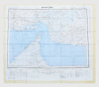
1963153757London: Geographical Section General Staff 1963. Scarce charts of Bahrain and the Straits of Hormuz A rare and historically interesting pair of adjacent maps of the Arabian Gulf covering six degrees of longitude each the geographical area encompassing the whole of Qatar Bahrain and part of what was to become the United Arab Emirates Al-Hofuf being the major city in the Al-Ahsa Oasis Eastern Province Saudi Arabia; sixth and fifth editions respectively. Maps of the period issued by the GSGS Geographical Section General Staff use a 7-colour tint scale to distinguish altitude and a glossary that highlights towns of significance and other standout features which provided steady references for army personnel to aid navigation in the challenging conditions of the region. The Bander Abbas map was compiled by the US Army Map Service Corps of Engineers from a number of sources including USAF Aeronautical Approach Charts of 1951-55 and the US Geological Survey of the Arabian Peninsula 1958. The Hofuf chart is based inter alia on 512 Field Survey Royal Engineers charts 1942-4. WorldCat lists just three individual copies for Hofuf NG39 SUNY at Buffalo University of Notre Dame and Eastern Illinois University alongside four copies of Bandar Abbas NG40 University of Exeter University of Notre Dame Eastern Illinois University and University of South Florida. It should be noted that major national institutions - BL for example - will have holdings of these maps within the complete GSGS series. Most copies would be discarded on supersession making these an important record of cartographic progress in the region. Two two-colour printed maps 1:1000000 scale 690 x 610 & 750 x 610 mm respectively. Ex- libris stamp of Arizona State Library both stamped "superseded" in blank margin and "withdrawn" on verso some pencilled marginalia; both in excellent condition. unknown
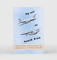
1955171428Malta: Trade Commissioner to the Malta Government 1955. A rare promotional guide to the air route from London to Basra produced for travellers destined for the Anglo-Iranian Oil Company's refinery at Abadan in Iran. A map shows the route passing through the eastern Mediterranean and Egypt before arriving in Iraq. The text attempts to give the impression of a well-organized journey: "At Basra you will be met by a representative of the Company who will help you with the Customs and other formalities. After a meal at the Airport Hotel you will find that arrangements have been made for your onward journey to your destination". The map to the verso shows critical infrastructure across the Middle East including oil pipelines and railways. Octavo. With 4 photographs and 2 colour maps. Folding colour printed pamphlet 140 x 215 mm when folded 420 x 215 mm when open. Minor scuffing creased at centre a touch foxed at front. A very good copy. unknown
1957182684London: War Office; Printed for D. Survey WO and AM by Balding and Mansell Ltd 1957. A bright example of this detailed Gulf map Classified "restricted" and issued for military use at the time of the Jebel Akhdar War this double-sided sheet shows much of the modern-day UAE extending northwards from the latitude of Abu Dhabi and the Buraimi Oasis as well as the eastern Arabian Peninsula from the Trucial Coast to Jubail. As with other contemporary GSGS maps the sheet covers six degrees of longitude and highlights towns of significance and other standout features for example oil pipelines and wells water systems and roads and railways. Rayon sheet 630 x 710 mm printed both sides in colour folded as issued. A fine example. unknown
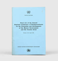
1978172055Perhaps Kuwait: United Nations Environment Programme 1978. First and sole edition untraced in Middle Eastern libraries of this plan enshrining environmental protection as a priority for future development along the Arabian coast. The regional conference highlighted the dangers posed by oil spills and committed to pollution-control measures for future projects. Participants included delegates from Bahrain Iran Iraq Kuwait Oman Qatar Saudi Arabia and the UAE. Attendees also agreed on a regional trust fund funded in different proportions by eight governments including the UAE and Saudi Arabia to finance initiatives. In the United Kingdom copies can be found at the universities of Oxford Durham and Southampton. We have also located three each in the US and Canada two in Germany two in Switzerland and one each in Austria and Sweden. Octavo. Original pale blue wrappers wire-stitched as issued front cover lettered in black. Light peripheral toning to covers small rust mark at top corner of front cover back cover slightly creased: a very good copy. unknown
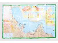
181557Saudi Arabia: Kruger for I.P.A. International Bookshops Dharan Airport 1977. Road construction faster than map production A folding road map of the Gulf and an interesting snapshot of its natural and human geography in the 1970s with 25 attractive photographs of Dubai. The map extends from Kuwait to Oman's Jabal al-Akhdar showing primary metalled roads roads under construction secondary roads towns wadis oil wells and pipelines oilfields and the morphology of the terrain. It also features 7 inset maps of the city centres of Manama Doha Abu Dhabi Kuwait Dubai Mutrah and Muscat. The small print in the reference section explains that "all roads under construction are being completed as the progress was faster than our production". The photos of Dubai include views of Dubai Creek dhows dromedaries and camels local inhabitants and the main heritage sites. Colour printed map folded 295 x 157 mm; unfolded 585 x 910 mm. Text in Arabic and English. Seven inset maps of Gulf capital cities verso with 25 colour photograph views of Dubai by Said Salah. Original colour self-wrappers printed in yellow black and white on a red and green ground. A few tiny chips or light wear to some folds couple of minor creases to outer corners: a very good exemplar. unknown
1956153759London: Geographical Section General Staff 1956 & 1957. Scarce maps of Oman and south-east Arabia dating to the Jebel Akhdar War A pair of decidedly uncommon and impressively sized regional maps both second editions Muscat-Musira following the first of 1945 S. E. Arabia first published in 1956. The Muscat-Masira map drawn up by D Survey of the Ministry of Defence reaches as far north as Khaburah Oman on the coast south beyond Masirah Island and westward reaching beyond Lahus and Hadhi. It is based on several mappings including Bertram Thomas's map of Rub' al Khali the "Empty Quarter" 1931 the sand desert covering most of the southern third of the Arabian Peninsula Samuel Barrett Miles 1910 map of Oman and Captain F. F. Hunter's map of Arabia 1935 revision. The aeronautical chart goes into greater detail reaching beyond Sur in the North South to Masirah Island and Manadhif and West to Uruq ash Shaybah UAE; this was drawn up by No. 1 SPC.RE i.e. Survey Production Centre Royal Engineers and is based largely on the USAF Aeronautical Approach Charts 1956 and World Aeronautical Chart 563 1951. During the mid to late-1950s Britain was involved in a number of disputes in Oman perhaps the most serious involving the Imam Ghalib al-Hinai and his brother Talib bin Ali who led the Imamate's revolt against Sultan Said bin Taimur which resulted in the Jebel Akhdar or Oman War 1954-1959. In this the RAF played a leading role not least because aircraft could at the same time expedite oil exploration operations in the interior of Oman. Pembrokes light transport aircraft and heavier Avro Ansons from 1417 Communication Flight RAF carried out reconnaissance "and other tasks during this operation against the Imamate and were the first aircraft ever to land at Nizwa marked "Nazwa" on the chart on a roughly cleared strip which proved extremely hazardous for the pilots but which was later transformed into a passable airfield" Lee p. 22. The present chart has two pencilled lines radiating from Masira airfield one of which passes through Nizwa near which is marked the "approx. position" of an airstrip. The chart bear the proviso that they should "not be taken as an authority on names" and that "the alignment of all tracks is approximate". Users were also directed to update information and highlight errors which were to be directly sent to the Director of the Military Survey in the War Office. There are noticeable graphical variations between the chart and map as fitting their usage. Before the Second World War pilots flew using landmarks - such as train tracks or roads - as pointers which meant that they relied on perfect weather conditions. However technological advances in aviation alongside the use of radio for more accurate navigation meant that to a degree pilots could work in more challenging conditions. This meant that maps with their focus on terrain and details relevant from the perspective of ground troops would become irrelevant when observed from a plane's altitude. Therefore a number of countries started to produce charts highlighting key information by reducing the contour structure and focusing on key landmarks necessary for aviators. The Muscat-Masira map uses a five-colour tint scale to distinguish altitude includes a glossary and key the latter identifying towns given four categories of importance significant ruins geographical features such as mountains hills marshes saddles and passes rivers water holes and man-made features such as railways roads tracks telegraph lines pipelines and pumping stations mosques and temples; tribal and regional names are also given. However reflecting the simplification required by pilots the S. E. Arabia chart only uses fives tones to highlight land mountains paths and the sea. These maps intended for use in the field would have had a high rate of attrition; WorldCat locates just a handful of copies of the Muscat-Masira map whilst S.E. Arabia 4802 is well represented institutionally but decidedly uncommon on the market. Two colour printed maps the first 1: 1000000 scale 860 x 640 mm the second 1:500000 scale 1100 x 825 mm. Both with creases from old folds and some minor marginal splits and spots the second with pencil lines marking a flight route from Masira Island and a notation in the margin; both remain very good. Sir David Lee The RAF in the Mediterranean and Middle East 1945-71 1978. unknown
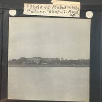
17118Vintage Optical Lantern images of the Persian Gulf circa late 19 cent Glass size is about 3.25" x 3.25" . Vintage Image of the Persian gulf and The Sheik of Mohammerah Palace at Shah-et-Arab. A boat is docked in calm water along the bridge while a spray of palm leaves waves at the edge of a palace. The handwritten label reads "Sheik of Mohammerah Palace. Shah-et-Arab." The Shatt al-Arab also known as Arvand Rud River is a river formed by the confluence of the Euphrates and the Tigris. Mohammerah is city and port presently known as Khorramshahr a city in southwestern Iran. It lies on the right bank of the KÄrÅ«n River where it enters the Shatt al-Arab. The city occupies the site of the old Ê¿AbbÄsid port of Mohammerah but it was already in existence at the time of Alexander the Great. Since In 1847 it was ruled by a sheik known as the Emir of Mohammerah who was chief of the local Banu Ka'b tribe and built a large Palace known as Qasr al-Failiyah in Mohammera with very large arches that can be seen on the image. Very few historical artifacts exist from the times of Shaikh Khaz'al bin JÄbir bin MirdÄw al-Ka'bÄ« 1861-1936. After oil was discovered by the Anglo-Iranian Oil Company BP today in Khuzestan in 1908 Britain at first strengthened its ties to Shaikh Khaz'al. But after WWI The British stopped supporting him and in 1924 Mohammerah came under the control of the central government of Iran and was renamed Khorramshahr by Rez Shah of Iran. The cheikh was taken to Tehran and stayed in house arrest until his death in 1936. Out of all the sheikdoms around the gulf Abu Dhabi Dubai Sharjah Ajman Umm Al Quwain and Fujairah he is the only Emir to have lost his sheikdom. The southern end of the river constitutes the border between Iraq and Iran and discharges into the Gulf and has been the cause of multiple wars due to its huge oil reserves including the Iran-Iraq war. Scarce and in very good condition. unknown
1905001215London: Horace Cox 1905. Book. Very Good. Cloth. First Edition. 1905 First edition. Horace Cox London. Very Good gray cloth. Mild bumping to extremities. Scarce early instructional. Donovan and Murdoch 28260. Horace Cox Hardcover
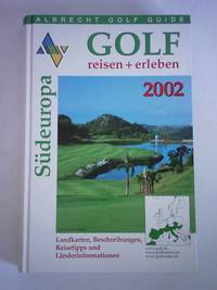
5d5818Albrecht Golf Verlag München 2001. 783 S. in getrennter Zählung mit zahlreichen Abbildungen Pappband quart. - gutes Exemplar / Landkarten Beschreibungen Reisetipps und Länderinformationen - unknown