[Golf]. GRIERSON, Dr JamesBiblio.com
505 résultats
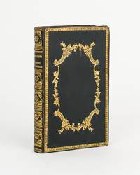
1838111804Cupar: G.S. Tullis and St Andrews Melville Fletcher Printed by G.S. Tullis Printer to the University of St Andrews 1838. 3rd Edition. Hardcover. Very Good. Cupar G.S. Tullis and St Andrews Melville Fletcher Printed by G.S. Tullis Printer to the University of St Andrews 1838 third edition/ 1807. Duodecimo xii last blank 264 pages with several tables plus 12 full-page engraved plates including an additional title page. Early gilt-decorated polished black calf all edges gilt endpapers marbled; top corners a little bumped with the extremities a little rubbed; light stain to the blank bottom corner of the last 40 leaves gradually reducing in extent from the rear and not affecting the printed surfaces; early ownership signature James Astle at the head of the engraved title page slightly cropped; a very good copy. Not least 'The Company of Golfers' pages 237-247. G.S. Tullis, and St Andrews, Melville Fletcher (Printed by G.S. Tullis, Printer to the University of St Andrews) hardcover
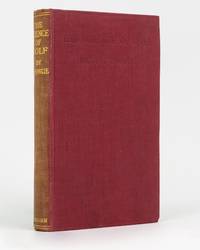
192274414London: Methuen 1922. First Edition. Hardcover. Very Good. London Methuen 1922. Octavo xii 128 8 publisher's catalogue pages plus a frontispiece and 7 pages of plates. Cloth lightly bumped on the front bottom edge; spine sunned and a little rubbed; endpapers lightly offset; inner margin of the title leaf and the adjacent leaf a little glue discoloured with trifling adhesion blemishes to the inner margin of the frontispiece and title page; a very good copy. Methuen hardcover
193854228New York: Hillman-Curl Inc. 1938. 8vo. 188 pp. Tan cloth red lettering on front cover & spine minor chipping foot of spine former date stamps on rear endpaper minor soiling still G copy. Second edition of this scarce golf mystery included as part of the Clue Club Mystery series which was published between 1936 and 1939. Hillman-Curl, Inc., hardcover
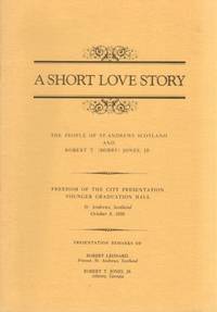
193421248New York: Conde Nast 1934. First edition. Very good overall. September 1934 issue of the magazine with article by Robert T. Jones. Robert Tyre "Bobby" Jones 1902 - 1971 was an American amateur golfer who founded the Augusta National Golf Club and co-founded the Masters Tournament. He was the most successful amateur golfer to compete at the national and international level. Other articles by Grantland Rice Frank Condon Bob Davis O. B. Keeler George Low Sr. Bernard Darwin and Tracy Hammond Lewis. The cover photographic illustration of George Dunlap; many b&w photographic illustrations throughout. Folio 48pp. A few small marks at front wrapper. Conde Nast unknown
198435433Atlanta: Atlanta Athletic Club 1984. Wraps. Very good. Stapled wraps. 10" x 7". 16 pages. One photograph inside. Yellow covers with title printed in black on the front. Included with the story is a fund raising card for the "Bobby Jones Room Fund" and a explanatory fund raising copied typed letter from John P. Imlay President of the Atlanta Athletic Club. Atlanta Athletic Club unknown
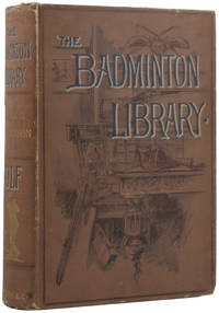
54413London: Longmans Green and Co. 1895. Sport NEW EDITION. Octavo 18 x 13cm pp.xiv; 480. Illustrated with 28 plates and many line drawings in the text by Thomas Hodge and Harry Furniss. Publisher's original decorated and titled brown cloth green swan-patterned endpapers. Armorial bookplate of MacFarlane Digby contents a little spotted old tape mark to flyleaf cloth a little rubbed and handled one small nick to spine. Very good. First published in 1890 this definitive guide to golf was 'thoroughly revised with additions' in 1895. This printing is entirely reset and the text considerably longer. London: Longmans, Green, and Co., 1895 unknown
63672Berkshire:: Eaton Crane & Pike Co. no date. enclosed in publisher's two-part box illustrated in color with printed wraparound bands around envelopes and notepaper. Contents fine. Minor repairs to the joints of the illustrated box top which is a little sunned and dust-soiled. The unprinted box bottom has had several voids neatly supplied in facsimile. Box size 5-1/2 x 8-1/2 x 1 inch. Four color scenes of pairs of children playing golf in Victorian attire are illustrated on the box top; present here are three of those four illustrating 12 folded sheets of notepaper initialed by the artist W. C. O. with envelopes. Eaton, Crane & Pike Co., unknown
1930WB17568USA: Palmer Products 1930. First Edition. Paperback. Very Good. Original brown wraps lettered in red. 143 pp. With numerous illustrations throughout. Light edgewear but a nice copy overall of a scarce golf book. Sold with no guarantees that you can or will break 80 after purchase. <br/><br/> Palmer Products paperback
194863234New York: A.S. Barnes & Co. 1948. 8vo. 125 1 pp. Photo frontisp. photo illustrations throughout. Light green publisher’s cloth green lettering front cover & spine slight shelfwear w/ d.j. cover art of Babe Didrikson golf swings minor chipping & small tear head of spine creasing & edgewear still VG/G- copy w/ former ownership markings of Pacific Northwest golfer Lena Hillsman on ffep. First edition of this compact and detailed work by the 1948 US Women’s Open champion in 1948 detailing the fundamentals of the game and her stroke-by-stroke techniques. Didrikson 1911-1956 was considered one of the best women athletes in the first half of the 20th-Century who excelled at a myriad of sports qualified for five Olympic events in Los Angeles even though women were allowed to compete in only three setting a world record and winning the first Olympic 80-meter hurdels broke the world record with Jean Smiley in the high jump and dominated Women’s golf during the 1940’s. A.S. Barnes & Co., hardcover
192658065Youngstown OH: n.p. 1926. Oblong folio. 17 x 9.5 in. 13 leaves unnumbered. on thick gray-green textured boards all mounted on linen hinges at gutter margin with 35 tipped-in silver gelatin photographs sized from 4.5 x 9.5 in. up to 6.75 x 14 in. Full green morocco gilt lettering stamped on front cover decorative Italian patterned endpapers minor scuffing & wear to fore-edges very light sunning to front cover still a VG exemplar. This excellent souvenir photo album depicts the golf tourney hosted by the Youngstown Country Club in honor of Campbell’s 1854-1933 72nd birthday in 1926. The opening photo depicts all the participants and dignitaries at the Country Club followed by images of players on the greens. The 18-hole course was built on the 131-acre Holland Farm and designed by Walter Travis featuring a $ 60000 Clubhouse which was noted for elegance and model comfort. These images depict the quintessential 1920’s golfing excursion including those of players the greens the roughs caddies and even an image of what appears to be Walter Travis himself taking a turn on the links. The year before in 1925 the Youngstown Country Club had hosted the 25th Open Championship of the Western Golf Assoc. and legends of the game including Walter Hagen Gene Sarazen and Tommy Armour III all played the course. Campbell was an enthusiastic golfer until his death holding a similar tourney in 1929 on his 75th birthday. He had begun his business career by forming the Youngstown Ice Co. in the summer of 1884 and by 1890 was hired as manager of the Trumbull Iron Co. later consolidated into Union Iron & Steel Co. In 1901 he founded Youngstown Steel and Tube Co. but after a failed merger at the beginning of the Great Depression his health declined. See: Ted Heineman James A. Campbell Riverside Cemetery Journal 2009; History & Golf Outings Youngstown Country Club 2021; James A. Campbell’s 75th Birthday Celebration Youngstown Sheet & Tube Audiovisual Archives YHC MSS 0140 Box 10 Folder 186 n.p., hardcover
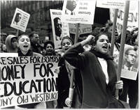
59227N.p.; photographer unknown ca 1990. Three large-format black-and-white photographic prints 11" x 14"; very mild creasing at edges still Near Fine. <br /> <br /> Three anonymous but excellent images of a Gulf War-era demonstration probably in Manhattan ca. 1990. The photographer is unidentified but the prints are of professional quality and capture close-up scenes of crowds carrying banners and placards opposing military involvement in the Middle East and directly attacking President George H.W. Bush. One placard calls for Bush's impeachment accusing him of ".creating the Gulf War to Cover Up His High Crimes and Misdemeanors;" another appears to read "Liar Liar We Will Set Your Ass on Fire." <br /> <br /> Several images suggest a New York likely Manhattan locale: one poster connects the marcher to SUNY Old Westbury on Long Island; several placards bear the imprint of the National Coalition to Stop U.S. Intervention in the Middle East including a New York City phone number. <br /> <br /> Though the precise date is obviously uncertain the event captured here is plausibly the October 20 1990 nationwide protest against Operation Desert Storm; rallies took place in several cities simultaneously but New York's was by far the largest as some 15000 protesters gathered at Columbus Circle and marched to Times Square. In general opposition to the first Gulf War was rather muted but significant demostrations did take place in October 1990 and January 1991 as well as a less well-attended counter-protest on the day of the Desert Storm victory parade June 8th 1991. unknown
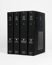
121943Cambridge Cambridge Archive Editions 2020. . 4 vols 8vo 25.5. x 16.5 cm; publisher's original black cloth lettered in silver a fine set.<br /> A valuable collection of records detailing the development and growth of the cities of Kuwait Manama Doha Abu Dhabi Dubai Sharjah Muscat and Mattrah from as early as 1818 right the way through until the mid-1960s before the Gulf War. Chapters are divided into: topography municipality water electricity health education communication lines urban development port development and social history with many royal decrees reproduced.<br /> Cambridge, Cambridge Archive Editions, 2020. hardcover
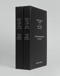
121999Minneapolis East View 2026. . 2 vols 8vo 25.5 x 16.5 cm; includes maps charts & tables; publisher's black cloth lettered white to boards and spines a fine copy.<br /> The complete collection of planning documents for Abu Dhabi from 1962 to 1979 the development plan review for Dubai of 1971 and the Federal Economic and Social Development Plan 1975 to 1980.<br /> Minneapolis, East View, 2026. hardcover
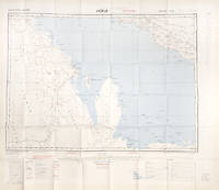
112628London War Office printed for D. Survey WO and AM by Balding and Mansell Ltd. 1957. . Coloured double-sided map of the Arabian Gulf on 1 sheet printed on silk; edition I-GSGS; sheet size: 64 x 72.5 cm; scale 1:1000000 text in English slight fading to creases otherwise near fine.<br /> An excellent example of a double-sided coloured escape map of the Arabian Gulf showing the UAE and Oman to recto and Qatar to verso. With a key to topographical features railways main roads and important settlements including the tribal and official names of provinces and a useful Arabic-English glossary translating key terms such as 'Bir' for 'Well' 'Ain' for Spring' 'Qasr' for 'Fort/Castle'.<br /><br />The recto extends from Kumzat in the North to Hafit in the South and Abu Dhabi in the West to al-Qasbiyat in the East showing the six remaining emirates of Dibai Dubai Sharja Ajman Umm al-Qaiwan Ras al-Khaima and Fujaira. The verso runs South from Ras es Safaniya to Ei Abd and from Awania in the West to Rudaim in the East including the principal settlements of Jubail Bahrein Hofuf showing Doha Wakra and Lusail on the Qatar Peninsular.Arabian Gulf Fabric Map of Hofuf and Bandar Abbas 1957<br /> [London], War Office, printed for D. Survey (WO and AM) by Balding and Mansell Ltd., 1957. unknown
112618London War Office printed for D. Survey WO and AM by Balding and Mansell Ltd. 1957. . Coloured double-sided map of the Arabian Gulf on 1 sheet printed on silk; edition I-GSGS; sheet size: 64 x 72.5 cm; scale 1:1000000 text in English very slight fading to outer margin otherwise near fine.<br /> An excellent example of a double-sided coloured escape map of the Arabian Gulf showing the UAE and Oman to recto and Qatar to verso. With a key to topographical features railways main roads and important settlements including the tribal and official names of provinces and a useful Arabic-English glossary translating key terms such as 'Bir' for 'Well' 'Ain' for Spring' 'Qasr' for 'Fort/Castle'.<br /><br />The recto extends from Kumzat in the North to Hafit in the South and Abu Dhabi in the West to al-Qasbiyat in the East showing the six remaining emirates of Dibai Dubai Sharja Ajman Umm al-Qaiwan Ras al-Khaima and Fujaira. The verso runs South from Ras es Safaniya to Ei Abd and from Awania in the West to Rudaim in the East including the principal settlements of Jubail Bahrein Hofuf showing Doha Wakra and Lusail on the Qatar Peninsular.<br /> [London], War Office, printed for D. Survey (WO and AM) by Balding and Mansell Ltd., 1957. unknown
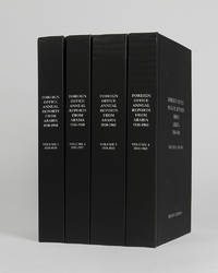
122002Minneapolis East View 2026. . 4 vols 8vo 25.5 x 16.5; publisher's black cloth lettered white to boards and spines a fine copy.<br /> A comprehensive collection of annual reports produced by the British Foreign Office concerning the major regions of Arabia often intended as internal circulars and never for direct publication.<br /> Minneapolis, East View, 2026. hardcover
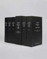
122010London Archive Editions 2003. . 6 vols 8vo 25.5 x 16.5 cm; includes maps & genealogical tables; publisher's original black cloth white lettering to upper board and spine a fine set.<br /> Lorimer's Gazetteer of the Persian Gulf was compiled by officials of the British Government in India during the decade after Lord Curzon's Vice-Regal tour of the Gulf in 1903. When first issued in 1915 it was classified as Secret and for Official Use Only and just a few dozen copies were printed for circulation to British Government departments and agencies.<br /><br />The work was planned in two parts; the first comprising a history of the Gulf region the second being a geographical dictionary but grew to encompass all aspects of Gulf life culture cities towns tribes and topography.<br /><br />Lorimer was an official of the India Civil Service who had spent most of his career on the North West Frontier. He was placed on 'special duty' to compile the Gulf handbook which was intended to be completed in six months but due to Lorimer's dedication and extensive field trips the work took some ten years to complete.<br /><br />The present edition printed from the India Office Records makes available one of the most important primary sources for the study of the Gulf region from the seventeenth to the early twentieth century.<br /> London, Archive Editions, 2003. hardcover
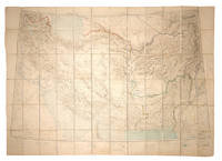
108381Calcutta Survey of India Office 1912-1923. . Heliozincographed colour map four sheets dissected and mounted on linen as one folding out to 108 x 152 cm in size scale 1:2000000 1.014 inches to 32 miles original paper covers with manuscript title label faint crayon lines confined to the area around Quetta a couple minor marginal tears repaired linen a little fragile in a few places but still a sturdy and attractive copy.<br /> Four sheets of the Survey of India Southern Asia Series 1912-1945 covering the Gulf Persia Afghanistan Boluchistan and western India stretching from Riyadh in the south-west to Bukhara in the north-east. The sheet covering the Arabian Gulf titled 'Southern Persia' is dated 1912 and shows the main travel routes along the Gulf and into the interior as far as Riyadh with none of the roads being depicted as suitable for wheeled vehicles and totally absent of railways or telegraph lines. Kuwait Bahrain Qatar Abu Dhabi and Dubai are all identified.<br /><br />Sir Sidney Gerald Burrard 1860-1943 initially served in the Survey offices at Dehra Dun before being made Surveyor General in 1908. In 1912 it was his decision to produce a new set of maps which would correct trigonometric errors in previous surveys and give a totally accurate mapping of Arabia and Central Asia centred on the oil reserves in Persia which Britain had a controlling interest in.<br /> Calcutta, Survey of India Office, 1912-1923. unknown
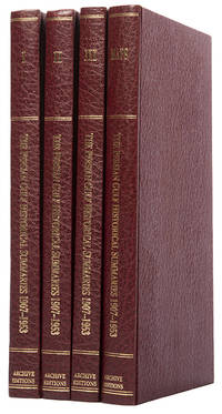
113476London Archive Editions 1987. . First edition; 4 vols 8vo includes a volume of maps and genealogical tables original brown cloth gilt a fine set.<br /> An historical summary of events in the Arabian Gulf concerning British interests from 1907. also includes oil agreements and concessions in the region particularly Muscat and Oman.<br /> London, Archive Editions, 1987. hardcover
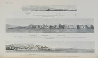
112658London Hydrographic Department Admiralty 1955. . Tenth edition with the second supplement dated 1959; 8vo 24.5 x 16 cm; supplement loosely inserted at rear 4 coloured plates of diagrams two maps acting as an index for admiralty charts 16 double-sided plates showing numerous coastal views further in-text weather diagrams notice of supplement tipped in to face title; publisher's blue cloth lettered in yellow spine a little sunned joints professionally restored very good copy; l 312 1 pp.<br /> A scarce pilot guide of the Persian gulf describing Bahrain Kuwait Qatar Dubai and Abu Dhabi and numerous other villages and towns along the Arabian coast. Includes coastal views of Ras Al Hadd Sur Qalhat As Suwaiq Sohar Fujairah Khasab the Tunb Islands Abu Musa Sirri Island Al Jazirah Al Hamra Al Shebeakah Rams Ajman Qasr Al Hosn in Abu Dhabi Sir Bani Yas the Doha Fort Bahrain Harbour and Tarut Island amongst others.<br /><br />The guide was published to give accurate sailing directions to the ports towns and safe anchorages along the Arabian coast from Ras al Hadd on the eastern peninsular of Oman to Shatt al Arab in the North and back along the coast of Iran to Bandar Abbas and beyond. With much early information on the principal settlements of the United Arab Emirates Qatar Bahrain Kuwait and Oman and an interesting glossary of Arabic-English key terms.<br /><br />By 1955 it was clear how the oil boom had changed the economy of the region. The first chapter gives an overview and includes the character of the sea and ports description of major towns and cities and their respective populations for example 18000 in Qatar the main economic imports and exports of each locale and considerable weather information.<br /><br />Dubai is described as well as Daira: 'Daira is a large suburb consisting of mat huts amongst which stand a number of well-built houses.' 'Dibai Dubai contains the residence of the Shaikh. There are several tall towers in Dibai; the fort is a conspicuous square building with a round tower. from which the Shaikh's flag is displayed. There is a hospital.'<br /><br />Abu Dhabi is similarly described: 'This town consists for the most part of huts and extends along the coast for nearly two miles. In the town there is a small fort partially surrounded by trees with five towers close together. The coast in the vicinity of Abu Dhabi is very low and the beach is of white sand'. The fort is given it's own view on one of the plates. The great pearl bank is also given attention: 'this extensive bank. fills the great bight in the southern part of the Persian Gulf.' 'Many islands both close to the coast and far offshore lie on the bank. With the exception of Dalma none has permanent inhabitants though they are frequented by the pearl boats during the summer and by fisherman from Abu Dhabi in the winter.' 'The best pilots for the coast are to be obtained at Abu Dhabi.'<br /><br />Much detail is also given to Qatar and Doha: 'This town situated on the southern side of the harbour is the capital of Al Qatar peninsula and had a population in 1947 of about 12000.' ' The Shaik's palace. is a large building with many colonnades and an open balustrade round its roof.' ' The chief exports are gutch fish and pearls; imports are food timber and manufactured goods.'<br /><br />Bahrain is also described with Manama being called the 'principal town and port' and as well as the trade being described there is also note of the health of the region: 'Manama is more liable to epidemics than the smaller ports; since 1920 however there have been no more epidemics in Bahrain than in any other of the larger Gulf ports.' It is interesting also that one of the major changes of the supplement is changing the name 'Bahrein' to 'Bahrain'.<br /><br />Kuwait is described as greatly altered by the oil wealth: ' Wealth derived from oil revenues is being spent on completely replanning and rebuilding the town. Government offices schools hospitals electric generating and water distillation stations private houses and blocks of flats are all being built in the most modern style'. 'Pearl fishing is now practically extinct. There are to all intents and purposes no exports. The chief imports are food of all kinds machinery motor vehicles and building materials.'<br /> London, Hydrographic Department, Admiralty, 1955. hardcover
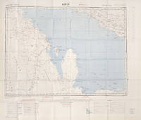
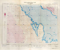
113506London War Office Geographical section 1951. . First edition GSGS 4622 Sheet 2547; Coloured printed map of Bahrain and Qatar on single sheet with extensive legend printed on reverse size: 62.5 x 77 cm; scale 1:1000000 text in English a little faded along folds a very good copy.<br /> First edition of the 1951 issue of the R.A.F. Aeronautical map of Bahrain and Qatar. The War office issued the R.A.F. series alongside a separate US Airforce Series: the R.A.F. series only covers Europe Africa Arabia and up to the end of 1951 had only covered Britain the east coast of Africa and this sheet of Arabia.<br /><br />The odd selection of this region aside from east Africa is made clearer by looking at the content of the map. The map does not show the 'delineation of international boundaries' or 'danger zones' but the topography largely the elevation and depression of the terrain with indications of marshy areas. The only indicated features other than towns and roads are of oil fields and pipelines. <br /><br />In 1941 Britain had gained control of much of Iraq's oil after the Anglo-Iraqi War and sought to expand its influence. The allies had seen the strategical benefits of Bahrain and after the discovery of oil in the region in 1932 it became even more pertinent to grow relations with the entire Middle Eastern command moving from Bushehr in Iran to Bahrain in 1935. But after the war relations had soured with the 1947 anti-Jewish riots in Manama Bahrain largely in reaction to Britain's disastrous orchestration of the Partition of Palestine. At the same time Iran had sought to break free of British control of their oil and in March 1951 voted to nationalise their oil production: in response Britain boycotted Iranian exports. It was in that same month that this map was finalised and published in July in the midst of the tense negotiations Iran was conducting with both Britain and the USA. In 1951 Britain was clearly searching for new regions to extract oil from and this map is captivating evidence of the fractious relationship Britain had fostered with the state of the Arabian Gulf.<br /> [London], War Office, Geographical section, 1951. unknown
121954London Archive Editions 1991. . 8 vols 8vo 25.5 x 16.5 cm; 7 vols text & map portfolio containing 12 large folding maps; publisher's original green cloth gilt arms of Qatar to upper boards gilt lettering to spines with red lettering pieces top edges gilt a fine set.<br /> An unrivalled collection of material revealing the history of Qatar from 1820 to 1960 focussing on primary documents charting the history of the peninsular from Qatar's first maritime treaty with Britain in 1820 up to the abdication of Ali bin Abdullah in 1960. Many of the documents within are published for the first time.<br /> London, Archive Editions, 1991. hardcover
121953Cambridge Cambridge Archive Editions 2021. . 4 vols 8vo 25.5 x 16.5 cm; 5 large folding maps loose in rear pocket; publisher's original black cloth silver gilt lettering a fine set.<br /> A comprehensive collection of documents recording the history of Qatar between the years 1966 and 1971 which saw the withdrawal of Britain from the region and the eventual establishment of Qatar as an independent nation rather than joining the Emirates in a confederation.<br /> Cambridge, Cambridge Archive Editions, 2021. hardcover
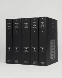
121951Cambridge Cambridge Archive Editions 2021. . 5 vols 25.5 x 16.5 cm; publisher's original black cloth silver gilt lettering a fine set.<br /> A very important collection of documents charting the the history of Qatar during the years 1961 to 1965 including the rise of the National Unity Front the growth of the Qatar Petroleum Company and the decline of British-Qatari relations. Chapters divide the documents into sections: the Royal Court Council of Ministers communications economy foreign affairs internal affairs judiciary labour and oil among others.<br /> Cambridge, Cambridge Archive Editions, 2021. hardcover
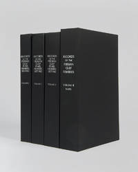
122017London Archive editions 2026. . 4 vols 8vo; includes a map portfolio with 7 maps original black cloth lettered in white a fine set.<br /> A very important work on the pearl fisheries of the Arabian Gulf bringing together in a single research collection all relevant documents from British government records relating to the pearl industry the most important economic activity in the Gulf before the oil era.<br /> London, Archive editions, 2026. hardcover