7 464 résultats
48906P., Club Alpin Français, 1928, in 8° relié demi percaline, dos lisse muet, XXIX-400 pages ; nombreuses illustrations hors-texte ; croquis et cartes dans le texte.
64677Lyon, Club Alpin, 1930-1931, 8 numéros reliés en 1 volume in 8°, demi percaline bordeaux, dos lisse, 144-156 pages et VIII (table) pages.
49507Lausanne, Margerat, Réunion en 1 volume in 4° relié pleine toile de l'éditeur des N°9, 10, 11 et 12 de 1955 et 1956, 84, 90, 90 et 84 pages.
190061672Hamilton MT: Hageman & Moore Photographers ca. 1900. One oblong boudoir-sized albumen photograph 8 x 5 in. mounted on beige-coloured studio board sized 11 x 6.75 in. w/ photographer’s imprint stamped on verso minor age toning & slight soiling to fore-edges minor wear & rubbing to corners still VG bright sharp image. Sheep raising was actually introduced into Montana’s Bitterroot Valley by Catholic Missionary Father De Smet and over the 19th-Century often grew in concert with cattle raising with many ranches maintaining both herds. Following the disastrous Winter of 1886-1887 in which thousands of cattle died off sheep ranching became the predominant stock shipped into and out of Montana as they not only handled the Montana Winters well they cost much less to raise and wool was a significant commodity. Hageman 1872-1944 had settled in Montana in 1896 and started operating as a photographer in the Bitterroot Valley by 1898 later partnering with Moore 1869-1955 for a short time in a photo studio in 1890 before both went out on their own by 1891 with Hageman operating as photographer until his death and Moore going first to Missoula and then Los Angeles. Hageman & Moore, Photographers, unknown
192759537Butte MT: Anaconda Copper Mining Co. 1927. 8vo. 12 pp unpaginated. with numerous photos by F. Ward Butte MT. Black softcovers lettering front & back cover in gilt minor shelfwear slight creasing still VG bright copy. First edition of this scarce promotional brochure for the Anaconda company which took its name from the giant copper mine The Anaconda on Butte Hill in Butte Montana. It offers illustrations a brief history of the company mines and its hoists compressor plants loading cars and miners as well as the electric locomotives hauling ore underground. Worldcat locates 2 copies Bancroft SMU. Anaconda Copper Mining Co., paperback
195957861New York: Arcadia House 1959. 8vo. 223 1 pp. Yellow cloth brown lettering logo on front cover minor dustsoiling shelfwear rubbing w/ d.j. minor chipping head & foot of spine couple closed tears edgewear minor creasing still VG/G- copy signed by author on ffep. First edition signed of this uncommon western set in Montana against the backdrop of rustlers outlaws and blackmail. Cummins was a longtime California Western pulp writer who continued writing prospected logged was a cow puncher fire fighter and even appeared in early Silent Movie Westerns. Arcadia House, hardcover
194157081Billings MT: Billings Advertising Co. 1941. 8vo. 4 24 4 pp. With photo illustrations centerfold double-page photo spread text illustrations maps 4 pp. sections at front & rear which open into 7 x 8.75 in. sized leaves w/ maps & photos. Gold-tinted illustrated softcovers lozenge photo cowgirl on front cover yapp edges some soiling edgewear couple minor closed tears at the fold creases for the folding leaves still VG- copy. First edition thus of this remarkably scarce installment in the Gail’s Golden Guide automobile reference books for tourists intended to welcome visitors to the “land of Purple Hills and Golden Sunsets - of historic landmarks -- scenic wonders . . . the ‘Crow Country’ of yesterday. . . .†Filled with maps photos of rodeos advertising for gasoline stops descriptions of Buffalo Bill Cody the Billings Boot Hill monument and more. The business directory and the “latest revised auto map†were of invaluable assistance to the traveler on the eve of World War II. Worldcat locates only 1 copy Yale all other references to runs of the popular Gail’s guides only refer to issues largely from 1924-1939. Billings Advertising Co., paperback
190056528Butte MT: n.p. ca. 1900. Oblong 8vo. 5 x 7 in. silver gelatin photo mounted on gray studio boards sized 7 x 9 in. w/ pencil annotations on verso. Nice crisp photograph of the Meaderville smelter near Butte MT which processed copper mined from the Leonard and the Colusa mines near Butte as well. By this time the B&M’s quick expansion required far more capacity so the company had already built a large updated smelter in Great Falls MT drawing upon the power generated by the Black Eagle hydroelectric dam. n.p., hardcover
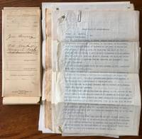
191256287Dillon & Monida MT: Zene Bucy Monroe Bucy Clair William Robison W.T. George 1912. Fourteen pieces. Folio. 8.5 x 13 in. 3 leaves on thin onion skin paper signed by Martin Fricks & Monroe W. Bucy; ALS from William Koch to Zene Bucy; 2 leaves ALS signed Monroe Bucy; 2 leaves Report of Commissioners; 2 leaves 1 typescript Summons on Robison letterhead; 1 typescript Summons on Robison letterhead; 1 leaf oath of Commissioners typescript copy; 1 manuscript colour map by W.G. George 9.5 x 13.5 in.; 3 leaves printed report & MS map from L.G. Price Real Estate Land Office; 2 leaves Petition of New Road filled in MS; 6 leaves Summons MS printed & typescript additional colour manuscript map by George; 4 leaves Petition for New Road including MS & printed map; 2 leaves Demurrer; 2 leaves judgement typescript signed all contained in the original legal file folder. This archive of legal documents chronicle the efforts of Montana rancher Zene Bucy to connect his ranch land cut off from the County Road from Monica to Lakeview MT in the years prior to World War I so that he could fulfill a logging and sawmill contract with Martin Fricks. Zene Bucy’s ranch was sandwiched between the T.C. Beattie and William & Margaret Koch ranches outside of Monida and his only option was to take over and build a road across Koch’s land. Initially Koch objected and insisted that Bucy buy the land for $ 150.00 as well as build a very expensive fence along the entire length of the road. Bucy refused hired Robison as his attorney and months later was able to have the County Road Commissioners rule that he could keep the road and only owed $ 30.00. At the time Beaverhead County MT was not only a bustling County Capital but also one of the major suppliers of wool cattle and lumber for Idaho and Montana mining companies. The Bucy’s were an influential Centennial Valley family in Beaverhead County first established by Andrew Bucy followed by his sons Monroe Zene Louis & Manley who all owned ranches in and around Monida MT and Dillon MT. Zene Bucy 1886-1928 operated as a rancher until after World War I and then sold out and moved to Denver CO where he owned and operated a cigar store until his death. The family is best remembered for the gunfight between Louis Bucy and brother Monroe Bucy which caused Monroe to buy and operate the Cowboy Bar in West Yellowstone in order to remove himself and his family from living near Louis. Koch 1869-1952 and wife Margeret 1883-1923 owned the ranch near Dillon MT until her death and then he relocated to Missoula MT. Monida MT still exists as a small unincorporated town with a population of 2 near the Montana - Idaho border. See: History of Beaverhead County 1800-1920 Vol. I pp. 46 48-49 388; Detail Assessment of Property Dillon Tribune August 23 1912. Zene Bucy, Monroe Bucy, Clair William Robison, W.T. George, unknown
196762782Boston: Houghton Mifflin Co. 1967. 8vo. xviii 446 pp. With numerous photo plates maps maps on endpapers. Biege-gray cloth black lettering front cover & spine slight dustsoiling shelfwear w/ d.j. cover art photo of Garcia front cover Garcia’s Native American wives on back cover In-who-lise Squis-squis and Mal-lit-tay-lay minor chipping head & foot of spine fore-edges closed tear to spine still NF/VG- copy. First edition 2nd printing of this famed posthumously published semi-autobiographical memoir prepared and edited by Stein from Garcia’s original writings famously kept secure in dynamite boxes. Garcia 1855-1943 famously was a Mountain Man who set up a trading company centered on the Musselshell River and spent nine years of that life living with the Pend d’Oreille Indigenous Peoples who married three different Native American women beginning with In-who-lise his Nez Perce wife who was surviving witness of the Battle of Big Hole. Later David Stein the son of Ben Stein had access to the tightly held original manuscript and Diane Smith also granted access both interpreted the treatment by Garcia of his Native American wives and his intent to preserve their memories. Controversy over the editing process just how much of the memoir actually took place and factual elements persist but the work is still a compelling read. See: Kathryn Kramer The Romantic Tale of “Tough Trip Through Paradise†Montana Historical Society April 6 2013. Houghton Mifflin Co., hardcover
1819106645Typed letter possibly a carbon. On 8" X 10 ½" sheet signed S.B. Robbins Project Engineer in type. On letterhead of the Department of the Interior United States Reclamation Service. With original mailing envelope and a pre-addressed postcard to respond to the letter. Some aging and browning crease at center fold; overall very good. Form letter writing to a possible homesteader noting that additional information on the massive irrigation project was available and that the recipient could request that information by using the enclosed postcard. The Sun River project was initiated to provide storage of Sun River water at Gibson Reservoir Willow Creek Reservoir and a few other reservoirs. On September 26 1906 the Department of the Interior authorized the USBR's Sun River Project under pressure from local residents namely those of Great Falls who wanted the irrigation of lands east of the Rocky Mountains along the Sun and Teton Rivers. Construction began on the Fort Shaw Division in May 1907 with the bulk of the work completed by July 1908. Water was first delivered to the lands in 1909. The main storage dam Gibson was constructed during 1926-1929 with the construction of lateral systems was finished in 1936.The author S.B. Robbins sometimes called the "father" of the Sun River project was project engineer when the Fort Shaw division opened in 1908. Joining the Reclamation Service soon after its establishment in 1902 Robbins took part in the early surveys of the Sun River project and by 1904 was the engineer in charge of the project. He held that position until 1910.Through the cooperative advertising efforts of the Reclamation Service the Great Falls Commercial Club and the Great Northern railroad people in other parts of the United States learned about the Sun River project. Notices in newspapers suggested that interested
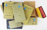
19594928Saltese Mt. and various places across the American West 1959. Very good to near fine. Approximately 2150 photo negatives each about 3x5 inches contained in 22 fully-annotated Kodak negative albums. A bit of exposure bleeding at edges hardly affecting image areas. Occasional light scratching visible in margins. Fine strong images overall. A comprehensive and meticulous collection of photo negatives comprising well over 2000 images of Saltese Montana its industry development and culture over the first six decades of the 20th century. The images present here were compiled across two generations of the Rogers family primarily by Herbert Rogers and his son Gale Rogers both influential citizens in the very small town of Saltese during its brief heyday. Herbert moved to Montana in the late-19th century and began this photo record soon after; and until his retirement in the late 1920s he was the chief owner and operator of the power and water services for the town. Gale attended a small business school in Butte and thereafter was involved in many of the Rogers' local business interests including the Woodburn Mining Company the aforementioned Saltese Electric Light and Water Company and the Rogers Tourist Cabins and Standard Service Station. The elder Rogers was perhaps the prime mover of this archive's generation as the photo series ends in 1959 following quickly upon his death the year prior.<br /> <br /> Today the town of Saltese in the northwest corner of Montana near the border with Idaho is a small collection of houses with a bar and a general store sandwiched between Interstate 90 and the St. Regis River. The 2020 census recorded a population of ten. In its former life Saltese was a gold and silver mining town established in the 1880s as Silver City and renamed after the Nez Perce chief in 1891; for a time in the early-20th century and during the period covered by the present archive it could boast over 2000 residents and a stop on the Northern Pacific Railroad. The twenty-two albums that house the negative collection each contains an index filled with manuscript dates and descriptions for each image.<br /> <br /> The core of this archive is an almost sixty-year visual record of life in Saltese with images of town architecture views industry business social activity and citizens. The preponderance of images date from the early 1920s to the late 1950s with one album covering the period before World War I. The negatives include classic mining images railroad views and town floods; floods of the St. Regis River winter storms and their effects and various weather mitigation efforts; social events town baseball games and family gatherings; group and individual portraits of town citizens friends and members of the Rogers family. In addition to the images of mining efforts there is ample documentation of other industry in the region such as lumbering and milling; the local water and power plants which the Rogers owned; and construction of various edifices and businesses. The negatives are also an excellent record of town life showing schoolhouse gatherings town sports teams fire lookouts and Rogers family activities.<br /> <br /> A substantial portion of the collection documents automobile journeys taken across the intermountain West by the Rogers who traveled extensively in Montana Idaho Wyoming Utah Colorado and elsewhere. A subset of these is an interesting group of major dam projects and construction such as Polson Dam on the Flathead River and the Grand Coulee Dam on the Columbia River. In all a fabulous and expansive visual archive of a small town northwestern Montana and life in the mountain West as it was lived by the Rogers family during the first half of the 20th century. unknown
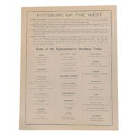
19135995Great Falls: Bateman-Switzer Co 1913. Single sheet printed in blue ink on both sides 8.5x11." Fine condition. <br /> <br /> Nicely preserved broadsheet from Great Falls Montana or the "Pittsburg of the West." The sheet states the current population as being 25000 with a prediction of 100000 residents in 1915. Advertised are banks architects breweries and malting plants merchants music houses and more. On the verso is the letterhead for the Bateman-Switzer Co. Wine Merchants. Bateman-Switzer Co unknown
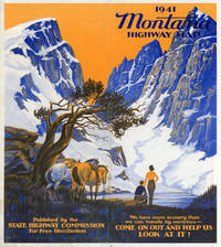
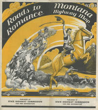
194149317Helena: Montana State Highway Commission 1941. 1941. First edition. 20 1/2" x 28" sheet folded to 30 panels. 15 panels offer a map of the Montana State Highway System printed in blue red and gray ink and showing paved improved graded roads and roads under construction. Opposite 15 panels offer a two cover panels printed in yellow and black and showing a young woman on a running horse with cowboys Indians and a covered wagon behind and with 5 cars on a highway shown below the illustration. 13" x 10" map of Waterton-Glacier Peace Park and a 13" x 10" map of Yellowstone National Park both printed in yellow and black and showing main secondary and connecting roads interstates and trails. Opposite panels also offer a mileage table and brief messages from the state governor and state highway department. Near fine. Montana State Highway Commission, 1941. unknown
194049314Helena: Montana State Highway Commission 1940. 1940. First edition. 20 1/2" x 28" sheet folded to 30 panels. 15 panels offer a map of the Montana State Highway System printed in blue red and gray ink and showing paved improved graded roads and roads under construction. Opposite 15 panels offer a two cover panels printed in yellow and black and showing a young woman on a running horse with cowboys Indians and a covered wagon behind and with 5 cars on a highway shown below the illustration. 13" x 10" map of Waterton-Glacier Peace Park and a 13" x 10" map of Yellowstone National Park both printed in yellow and black and showing main secondary and connecting roads interstates and trails. Opposite panels also offer a mileage table and brief messages from the state governor and state highway department. Minor soiling and folds as issued. Very good. Montana State Highway Commission, 1940. unknown
193558767Caldwell ID: The Caxton Printers Ltd. 1935. 8vo. 318 4 pp. Frontisp. numerous plates 1 large folding map maps on endpapers. Green textured publisher’s cloth silver lettering & decoration front cover & spine w/ d.j. cover art drawing of Yellowstone geyser slight shelfwear rubbing price-clipped NF/VG copy. First edition thus of this originally published in 1878 recounting conflict between Nez Perce Indians under Chief Joseph conflicting with two parties of Montana tourists in Yellowstone National Park during the Nez Perce War of 1877 while being pursued by Maj. Gen. O.O. Howard. The Caxton Printers, Ltd., hardcover
18891356094Helena: Independent Publishing Co 1889. First Edition. Softcover. Octavo 76 pages; VG-; Side-sewn pamphlet in original pink wrappers; Covers show light wear to edges and head/tail of spine with uneven age-toning along spine and edges; Textblock has moderate age-toning to edges and light plus age-toning to pages throughout interiorly; RWO. 1356094. Special Collections. Independent Publishing Co unknown
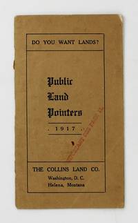
19176104Washington DC; Helena Mt: The Collins Land Co 1917. About very good. 20pp. Narrow 12mo. Original tan printed wrappers stapled. Light wear inner spine reinforced with tape. Contemporary ink stamp to cover and p.11. "The aim will be to set out in this little booklet the methods by which public land may be acquired and the services we can render in that connection." Herein Jeremiah Collins offers advice on how to acquire public land and move your claims through bureaucracy offering his services as a land attorney if needed. The Collins Land Company maintained offices in both Helena and D.C. indicating much of his work centered on Montana. We locate a single copy in OCLC at the Wisconsin Historical Society. The Collins Land Co unknown
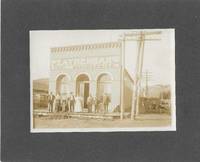
18999874Drummond MT 1899. Boudoir cabinet card. Albumen photograph 13 cm x 18 cm / 5" x 7" on a dark gray mount 20 cm x 25 cm / 8" x 10" Gently faded. Photograph of the Featherman Mercantile in Drummond Montana. Manuscript notation on the reverse identifying Featherman. John A. Featherman 1836-1924 arrived in New Chicago Montana a stage stop along the Mullan Military Road on July 4 1872. He opened a mercantile store in partnership with his nephew James B. Featherman. After the establishment of Drummond along the route of the Northern Pacific Railroad in 1883 the Feathermans moved their store to the new town. They operated the store until 1915 when they sold the business to H. J. Faust and C. N. Bassett. J. B. Featherman was also the postmaster both at New Chicago and at Drummond. unknown
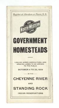
190976811Chicago: The North-Western Line 1909. Pamphlet. Very good. President William Howard Taft's August 19 1909 presidential proclamation directed that certain lands in the Cheyenne River and Standing Rock Reservations be opened to the public for settlement between October 4 and 23 1909. This brochure outlines the opportunity for any United States citizen over the age of 21 who does not already own 160 acres of U.S. land to apply and secure a homestead. Married women were not eligible to apply "unless she has been deserted or abandoned by her husband or unless her husband is incapacitated by disease or otherwise earning support for his family and she is the head and main support of the family."<br /> <br /> The brochure also provides a description of the lands open to settlement and detailed instructions on the process for registering and selecting the allotted 160-acre tracts. The North-Western Line a subsidiary of the Chicago and North Western Railway was a major economic force in South Dakota beginning in 1878.<br /> <br /> Federal Indian policy during the period from 1870 to 1910 marked a departure from earlier policies that were dominated by removal treaties reservations and war. The new policy known as the General Allotment Act of 1887 or Dawes Act focused specifically on breaking up reservations and tribal lands by granting land allotments to individual Native Americans. Amendments to the General Allotment Act also made it easier for Indian land to pass into non-Indian hands. The Burke Act 1906 contributed to the ongoing fractionation of lands within reservation boundaries by requiring the government to assess whether individuals were "competent and capable" to manage their land. Printed on both sides of a 32" x 9" sheet that folds to 4" x 9 ¼" 16 panels including a map on one panel by Poole Bros. Chicago. Light soiling; otherwise very good. The North-Western Line unknown
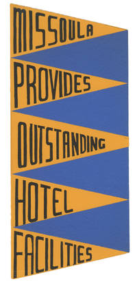
73804This unique travel brochure folds out into the shape of a pennant. Declaring Missoula the best equipped hotel city in Montana it pictures and describes the amenities and rates of seven facilities: Florence Palace Park Missoula Priess Shapard and Wilma. Several of these structures including the Palace and Wilma are now on the National Register of Historic Places. Also on the Register is the striking Art Moderne-styled Florence which has welcomed visitors to Missoula and the Big Sky Country for three decades.<br/> <br/> Undated this piece was likely issued by The Missoulian shortly after the completion of the Florence Hotel in 1941. It was union printed in black and yellow on the recto and solid blue on the verso. It measures 18 ½" x 8 ¾" and folds to 3 ¾" x 8 ¾". Especially crisp and bright with just a hint of edgewear. Scarce OCLC locates no holdings. unknown
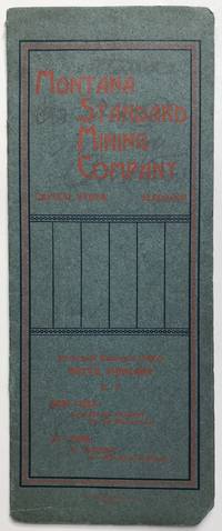
19021082Butte 1902. Good. 16pp. Narrow quarto. Original printed wrappers stapled. Light soiling corners and spine worn. Spine and text separating at lower margin. Minor soiling internally some contemporary annotations. Promotional prospectus for sale of stock belonging to the Montana Standard Mining Company a mining enterprise engaged in the extraction of gold -- a product that "sells itself." The company was incorporated with a capital of $2 million and herein are detailed its properties and their respective worths. The centerfold of the pamphlet is a map of "Properties of Montana Standard Mining Co. near Marysville Lewis & Clarke Co. Montana." The map outlines each claim; a contemporary hand has made pencil notations to the map. "It is now generally concluded that money judiciously invested in mining enterprises yields a much larger return with no more attendant possibilities of absolute loss." We find no record of the present item in OCLC. unknown
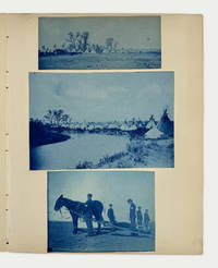
1890BB.001<p><em><strong>Cyanotypes and silver prints 48</strong></em> <em><strong>Most 5 x 7 inches a few smaller</strong></em> This intriguing collection of cyanotype and platinum print photographs shows Native American life in Montana at the end of the 19th / beginning of the 20th century. The photos were likely taken in the third Crow Agency its present location as there are three photographs showing Crow camps along the Little Bighorn River. There are also several photographs showing a festival or ceremony; images of travoises in use; thoughtfully-composed views of tipis; shots of US Army presence including one photo of a man with a bandaged arm; scenic views; and interior views of an unidentified home most likely the photographers. A captivating collection worthy of greater study.<br /><br />The original Crow Agency was established in 1868 and located in the western reaches of the Yellowstone River Valley north of the Absaroka Range of Mountains. In 1875 the Agency was relocated eastward to a new site north of modern-day Absarokee MT. In 1884 it was moved for a final time 60 miles south of Billings MT along the Little Bighorn River.</p>
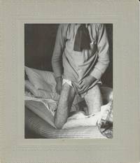
80030A series of photographs showing the treatment of a patient suffering from smallpox at a “pest house†in Livingston Montana. These isolation facilities often located near graveyards or at the edge of communities could be found in many towns at the turn of the last century to house people with communicable diseases.<br /> <br /> Over thousands of years smallpox killed hundreds of millions of people making it known as one of the deadliest diseases known to humans. It is also one of the only human diseases to have been eradicated declared so in 1980 a significant achievement realized through childhood immunization programs and targeted surveillance and containment strategies. Smallpox was deadly and gruesome. Symptoms included high fever vomiting and mouth sores followed by fluid-filled lesions on the whole body. Death would come suddenly often within two weeks and survivors could be left with permanent scars such as blindness and infertility.<br /> <br /> This series of four cabinet cards dating from the early 1900s show a patient covered in lesions. According to a caption written on the verso one image includes Dr. William F. Cogswell 1868-1956 who served with the Montana State Board of Health from 1912 to 1946 and was a strong advocate for mandatory smallpox vaccination. <br /> <br /> The images are in very good condition. unknown
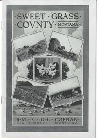
191176801Missoula Montana: Missoulian Publishing Company 1911. Pamphlet. Near fine. Promotional pamphlet by the real estate firm of R.M. & G.L. Cobban with agricultural facts and statistics for Sweet Grass County in southern Montana and advertisements by the firm for locating a homestead. Although a portion of Montana was acquired as part of the Louisiana Purchase in 1803 it was not admitted into the union until 1889 and grew slowly in the succeeding years. This brochure encourages Easterners to give up paying rents and move to Montana: "If not gifted with a fat purse he still has the opportunity of securing a piece of land from Uncle Sam - his birth right - and like thousands of others in Montana today make good while earning his title thereto living upon it."<br /> <br /> Pamphlet 28 p. printed in black and white. Includes photographic illustrations charts of comparative crop yields in various regions and a map of the state on the verso of the front panel. Original pictorial paper wrappers 6 1/2" x 9" bound with two staples. Near fine.<br /> <br /> Scarce no copies in the marketplace. OCLC locates five holdings: Columbia Montana Historical Society Washington State Yale and Southern Methodist. Missoulian Publishing Company unknown